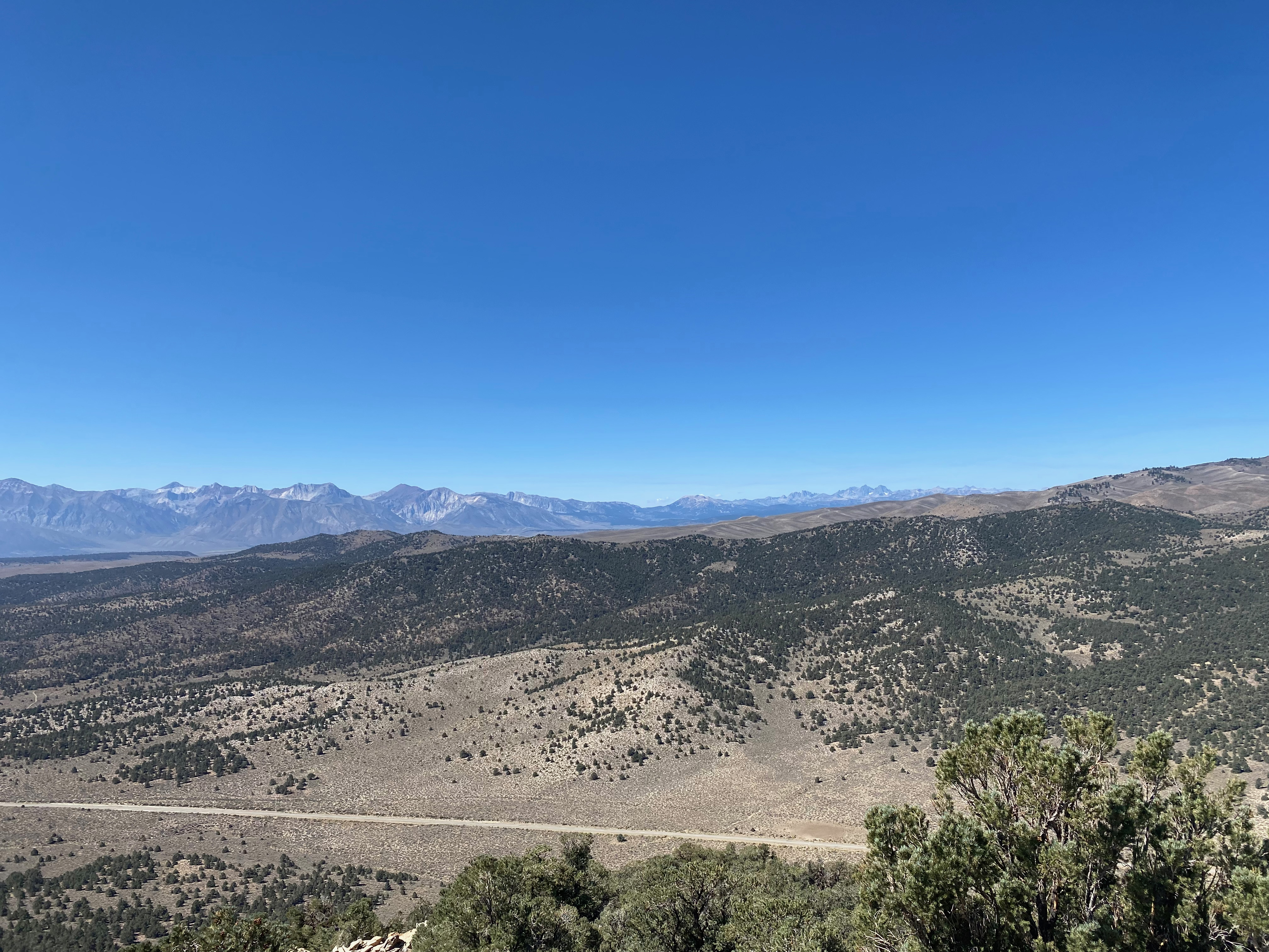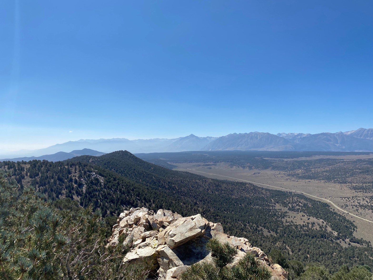
Looking south from this fine peak at the Mt Sill and the Palisades. Mt Tom is the prominent peak in the middle
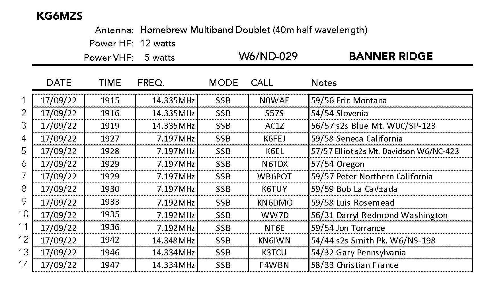
17 SEPTEMBER 2022 W6/ND-029

| Elevation: | 4,580′ |
| Route: | Cross country |
| Hike Distance: | 2.2 miles round trip |
| Elevation Gain: | 800′ |
| Navigation: | Tricky |
| Steepness: | Extremely steep |
| Vehicle: | Passenger car |
| Road: | Good dirt road |
| Cell Coverage: | n/a |
After completing 37 miles of the John Muir Trail with a 38 pound backpack, my good friends Bill Smith, Steve Tennant and I hung out in Lee Vining overnight. In the morning after we had said our farewells, I decided to head out to the Benton Range and activated the highest point – Banner Ridge.
This turned out to be a spectacular idea. I would rate this summit 3 stars for the view and the overall wilderness experience. It just missed getting 4 stars (a classic) as it is a easy hike but it is over some wonderful terrain.
I traveled along the south shore of Mono Lake on highway 120 east – a section of California I had never seen. Before you reach Benton Hot Springs, turn south on Benton Crossing Road. Then drive south to forest service road 3S50 and turn left.
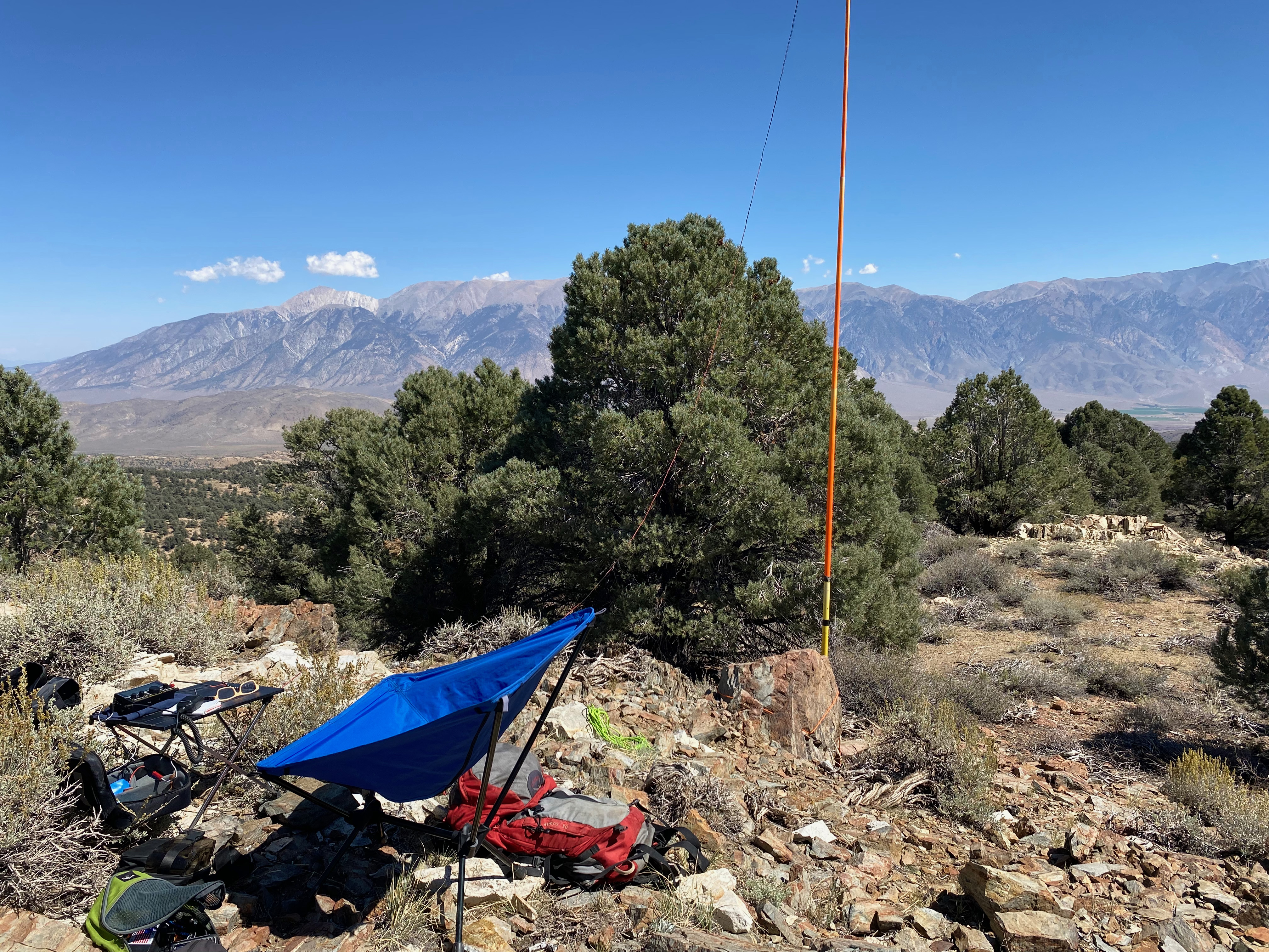
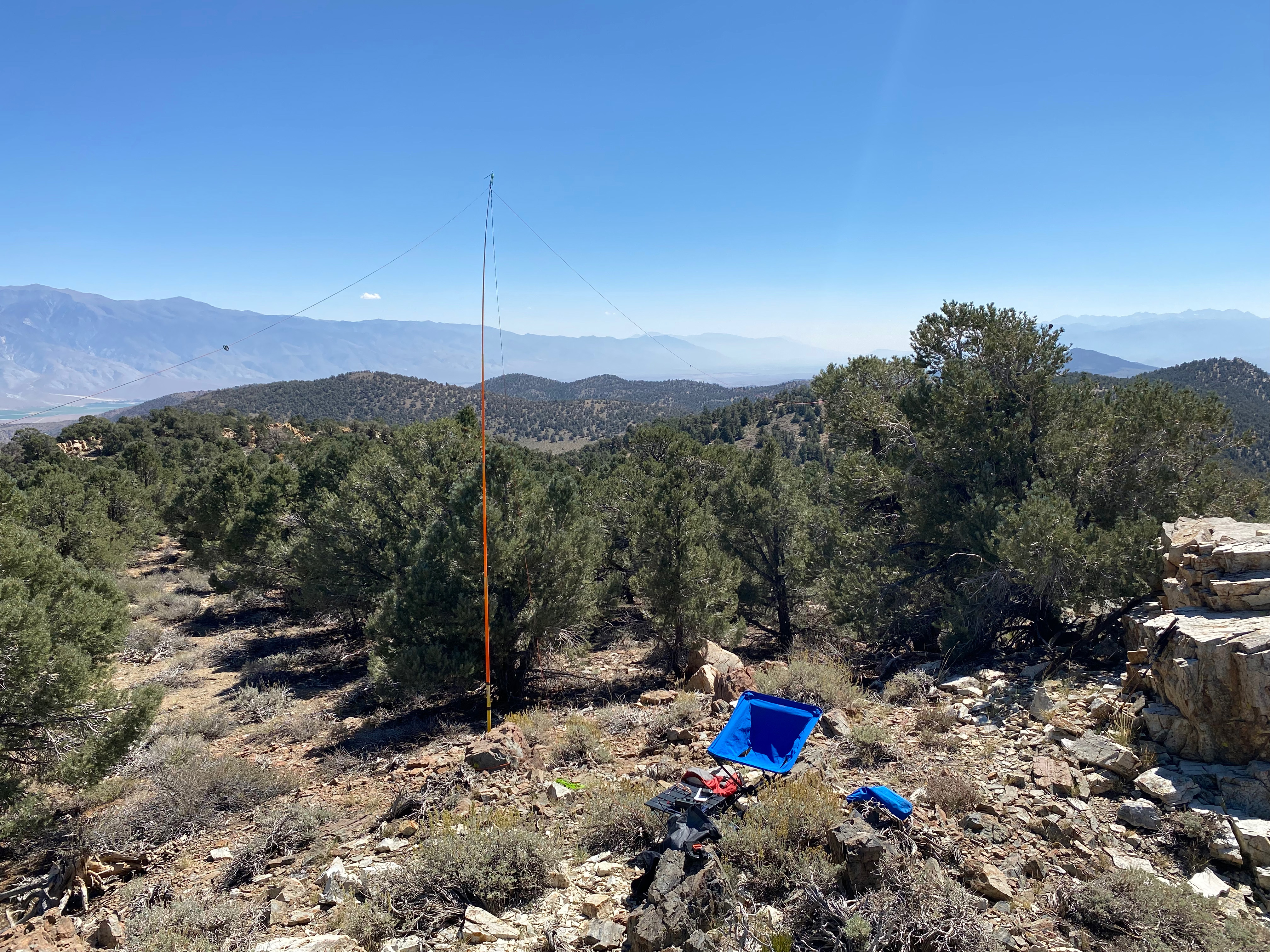
I parked here near the Gold Crown mine.
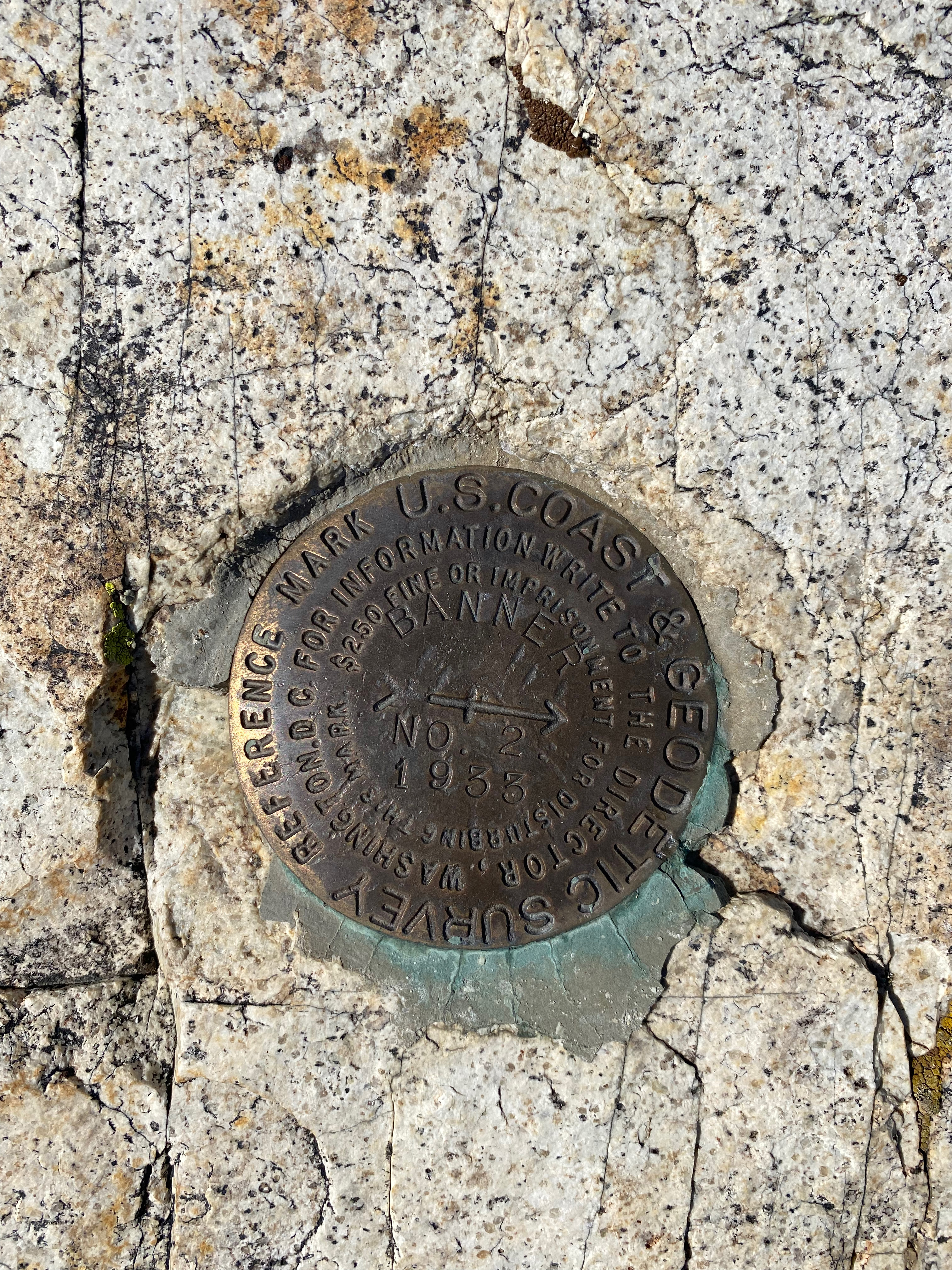
The hike is up a moderately steep hill that is pretty easy to navigate. I was rewarded with a terrific view of the Sierra Nevada from the Palisades to Yosemite. The register went back to 1967! I got very nostalgic recalling all my family’s pilgrimages to an isolated cabin on Twin Lakes out of Bridgeport back in the early sixties. What a different place 395 was back then.