
25 NOVEMBER 2020 W6/CC-002 I’ve skied to this summit far more often than I have hiked it. It is fun terrain for cross country skis and at 8,848′ it has snow much the winter, on average. My first trip to this summit was on June 9th, 1974 – just before graduating from Palisades High School.Continue reading “Mount Pinos”
Author Archives: wringmaster
Oat Mountain

13 NOVEMBER 2020 FRIDAY THE THIRTEENTH W6/CT-032 I can see Oat Mountain from the window of my radio shack window here in Topanga. It’s easy for me work repeaters on Oat with 500 mW and a rubber duck. My last hike up there was 24 years ago back when it was all private property. NowContinue reading “Oat Mountain”
Cahuenga Peak

8 NOVEMBER 2020 W6/CT-037 Cahuenga is one of the few surviving Tongva place names we have in southern California. My last trip to the summit was February 20th 1984. Once again, I left before dawn figuring it would be pretty crowded later on a nice clear Sunday after the rain. This was my third activationContinue reading “Cahuenga Peak”
4,020′

7 NOVEMBER 2020 W6/CT-158 There isn’t much to say about the “hike” up this summit. You can park in the activation zone. A short walk past the locked gate to the right brings you up to a large level area with some burnt wooden poles that make good mast anchors. I chose a day whenContinue reading “4,020′”
Hoyt Mountain
31 OCTOBER 2020 – HALLOWEEN MORNING W6/CT-146 I had one of the strangest experiences of my mountaineering career climbing Hoyt Mountain on Halloween 2020. The hike up was mostly in the dark before dawn to avoid the hiking crowds in these days of the Covid Pandemic, and to avoid the heat that was forecast. AContinue reading “Hoyt Mountain”
Sunset Peak
24 OCTOBER 2020 W6/CT-022 Last weekend my friend Brian (WA6JFK) hiked up this mountain while I did Timber Mountain. I decided to follow his activation with my own. My last trip up Sunset Peak was 26 years ago and it looked much the same. The old fire lookout was originally built in 1915 for aContinue reading “Sunset Peak”
2,450′ – Bodle Peak
22 OCTOBER 2020 W6/SC-237 A little history about this summit – in 1930 a fire lookout tower was moved from Blue Ridge in the San Gabriel Mountains to this location. County forester Spence D. Turner said the move was intended to protect “…a highly hazardous mountain area where there are many summer homes and valuableContinue reading “2,450′ – Bodle Peak”
1,470′ Calabasas
20 OCTOBER 2020 W6/SC-347 Early on Tuesday morning I made my way through a dense marine layer to Malibu Canyon. The drizzle was enough to need the windshield wipers. There was nobody at the Cistern/Phantom trail head a few miles west of Las Virigines/Malibu Canyon road on Mulholland Highway. The hike is short and easyContinue reading “1,470′ Calabasas”
Timber Mountain
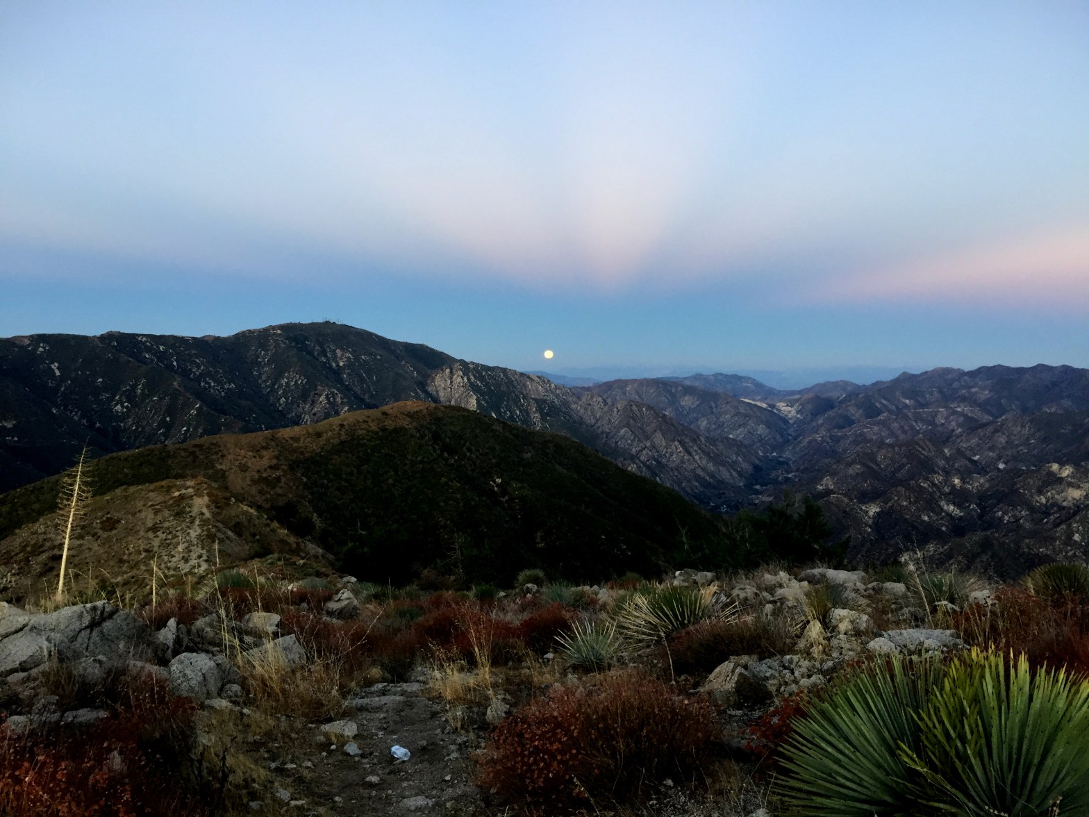
17 OCTOBER 2020 W6/CT-052 Brian (WA6JFK) and I were planning another pair of tandem activations. Sunset Peak was a good choice for a moderate hike, but what other juicy peak was nearby? I had climbed Timber Mountain twice before – once in 1981 and once in the winter of 1999. At 10 miles round tripContinue reading “Timber Mountain”
Simi Peak
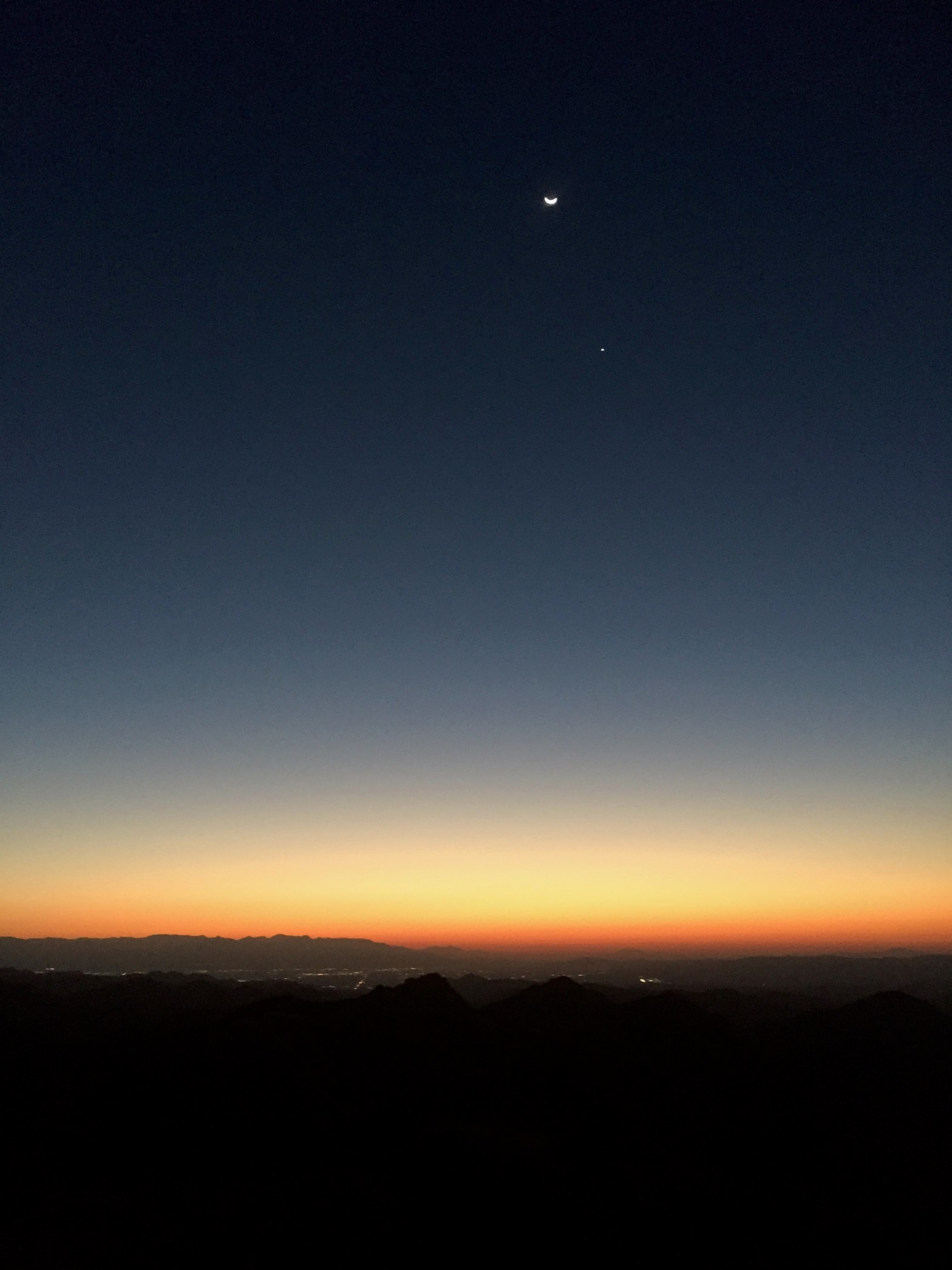
Venus and the waning crescent Moon before dawn on Simi Peak with the San Gabriel Mountains. 13 OCTOBER 2020 W6/CT-207 Elevation: 4,580′ Route: Good trail Hike Distance: 5.2 miles round trip Elevation Gain: 1,260′ Navigation: Easy Steepness: Gentle Vehicle: Passenger car Road: Paved roads Cell Coverage: Good Verizon Hike basics Once again my friend BrianContinue reading “Simi Peak”
