Looking west to Santa Ynez Peak 1 MARCH 2025 W6/SC-124 Elevation: 3,620′ Route: Paved Road Hike Distance: Drive-up Elevation Gain: n/a Navigation: n/a Steepness: n/a Vehicle: Passenger car Road: Good paved road Cell Coverage: Good Verizon Hike basics Nothing much to this one. The high point on Camino Cielo is within the activation zone. ThereContinue reading “Summit 3,620′”
Author Archives: wringmaster
La Cumbre Peak

The early morning marine layer to the south of this lovely summit. 1 MARCH 2025 W6/SC-086 Elevation: 3,986′ Route: Almost a drive up Hike Distance: .2 miles round trip Elevation Gain: 80′ Navigation: Easy Steepness: Gentle Vehicle: Passenger car Road: Good paved road Cell Coverage: Good verizon Hike basics Three stars for a virtual drive-upContinue reading “La Cumbre Peak”
Thomas Mountain
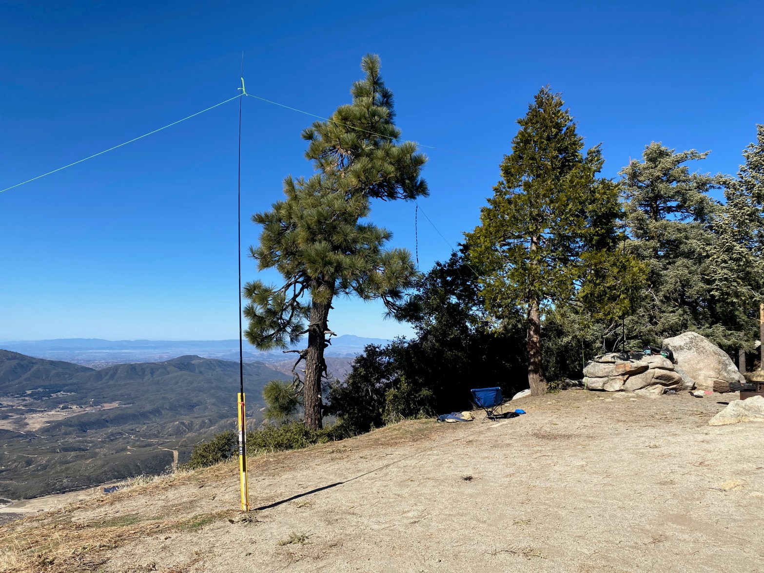
Here is one leg of the doublet and the roll-up slim jim antenna for 2m. 23 FEBRUARY 2025 W6/CT-016 Elevation: 6,825′ Route: Drive up Hike Distance: n/a Elevation Gain: n/a Navigation: n/a Steepness: n/a Vehicle: High clearance 4wd suggested Road: As of this trip pretty rutted Cell Coverage: Good Verizon Hike basics When I firstContinue reading “Thomas Mountain”
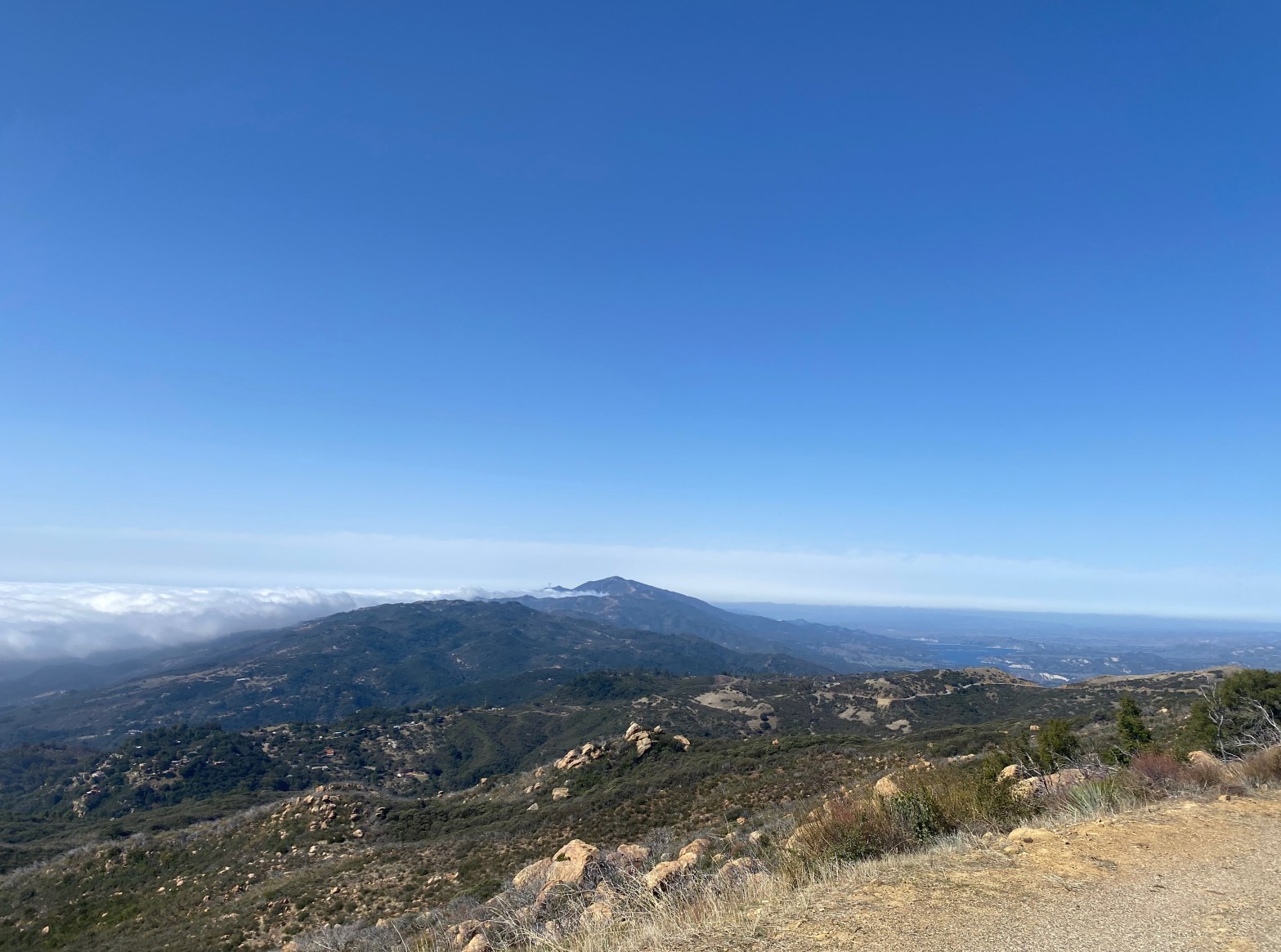
Lookout Mountain #1

Looking east from the summit toward Toro Peak. Elevation: 5,590′ Route: Pacific Crest Trail and use trail Hike Distance: 4 miles round trip Elevation Gain: 1,000′ plus 400′ on the return Navigation: Moderate Steepness: Steep use trail Vehicle: Passenger car Road: Paved highway Cell Coverage: Good Verizon Hike basics It’s always good to get whatContinue reading “Lookout Mountain #1”
Mount Lemmon
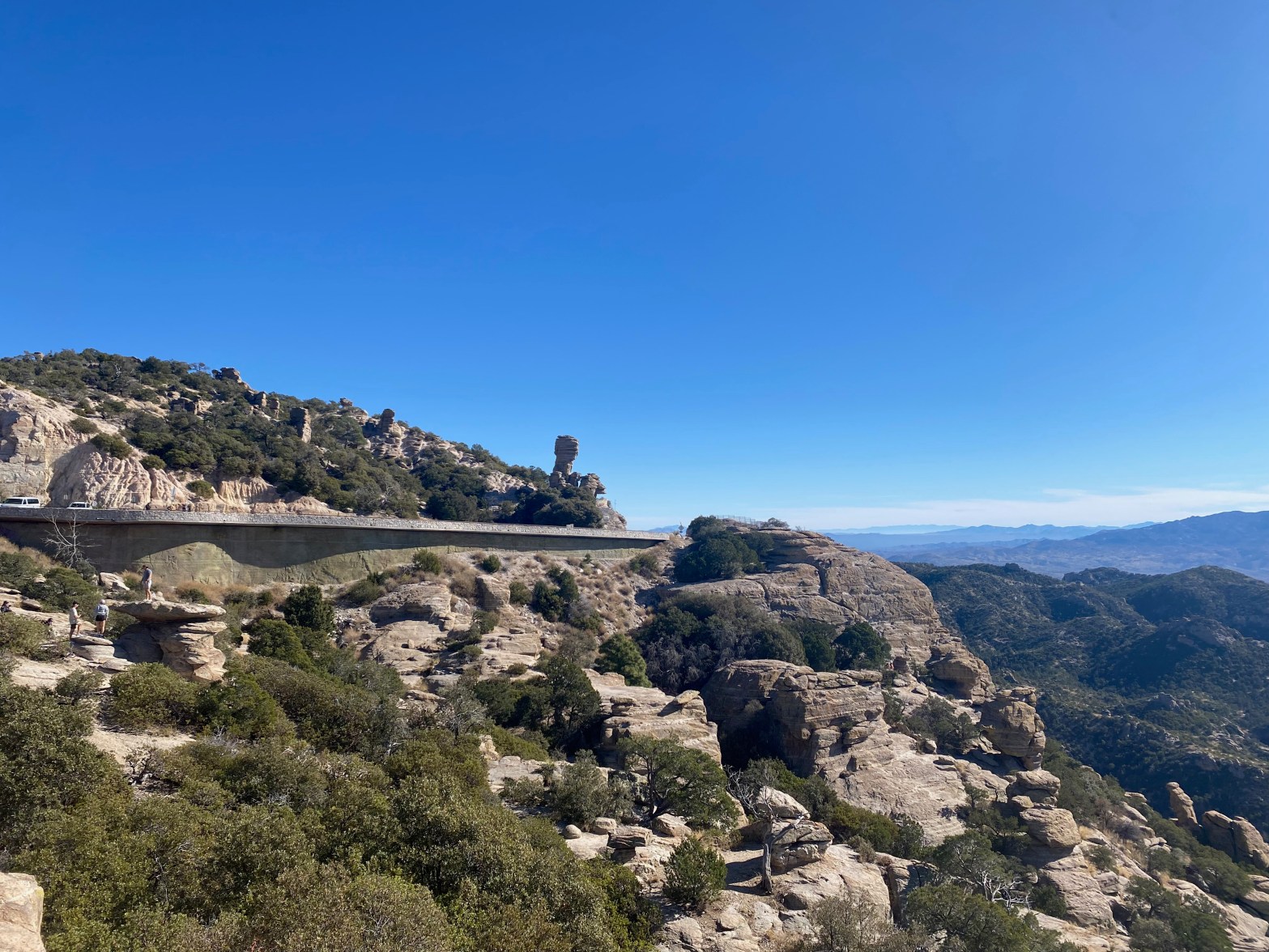
Highway 39 on the way up to Mount Lemmon. 15 DECEMBER 2024 W7A/AW-001 Elevation: 9,167′ Route: Drive up if the gate is open Hike Distance: 3.6 miles round trip if gate is closed Elevation Gain: 800′ if gate is closed (Dec 15 to Mar 1) Navigation: Easy Steepness: Gentle Vehicle: Passenger car Road: Good pavedContinue reading “Mount Lemmon”
Summit 3,853′

Looking north at the Agua Dulce Movie Ranch aka Firestone Ranch, Letteau Ranch or Annan Ranch with Mount McDill Behind 9 NOVEMBER 2024 W6/CT-165 Elevation: 3,853′ Route: 4×4 trail Hike Distance: 4.0 miles round trip Elevation Gain: 1000′ Navigation: Easy Steepness: Moderate Vehicle: High clearance suggest for the last bit Road: Good dirt road CellContinue reading “Summit 3,853′”
Summit 2,569′ “Teri’s Peak”
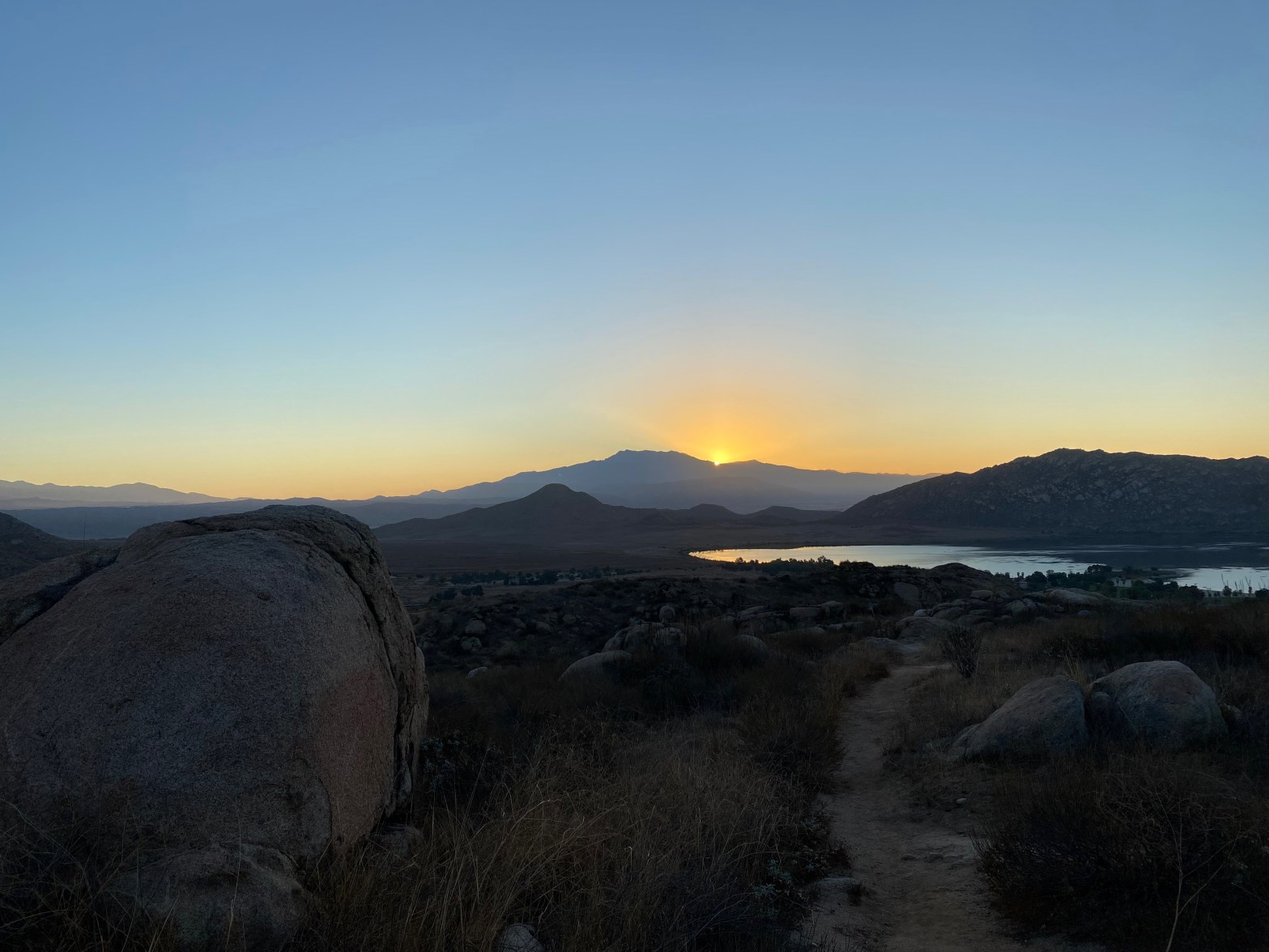
Sunrise over San Jacinto Peak from the trail up Teri’s Peak. 20 OCTOBER 2024 W6/CT-195 Elevation: 2,569′ Route: Good trail Hike Distance: 2.25 miles round trip Elevation Gain: 800′ Navigation: Easy Steepness: Moderate Vehicle: Passenger car Road: Good dirt road to Horse Camp Cell Coverage: Good Verizon Hike basics Another 5AM start from Topanga CanyonContinue reading “Summit 2,569′ “Teri’s Peak””
Mount Russell
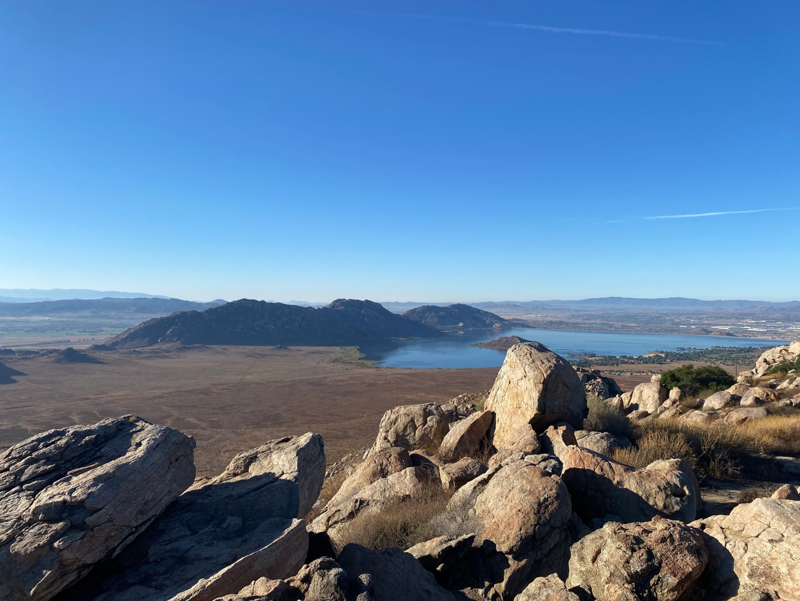
Perris Lake to the southwest of this fine summit 12 OCTOBER 2024 W6/CT-188 Elevation: 2,703′ Route: Good Trail Hike Distance: 4 miles round trip Elevation Gain: 950′ via route 2 Navigation: Easy Steepness: Moderate Vehicle: Passenger car Road: Paved Cell Coverage: Excellent Verizon Hike basics I left Topanga Canyon right at 5AM and got toContinue reading “Mount Russell”
San Guillermo Mountain

Here’s my comfy little station looking east toward Lockwood Valley and Frazier Mountain. 5 October 2024 W6/SC-012 Elevation: 6,585′ Route: Cross country Hike Distance: 3.8 miles round trip from gate Elevation Gain: 875′ Navigation: A bit tricky to start/end Steepness: Moderate Vehicle: Passenger car Road: Good dirt road Cell Coverage: Good Verizon Hike basics ThisContinue reading “San Guillermo Mountain”
Vollmer Peak

Looking northeast to Briones Reservoir. 20 SEPTEMBER 2024 W6/NC-298 Elevation: 1,906′ Route: Trail Hike Distance: 1.5 miles round trip Elevation Gain: 375′ Navigation: Easy Steepness: Gentle Vehicle: Passenger car Road: Paved Cell Coverage: Excellent Verizon Hike basics If Flint Peak in Southern California is owned by David N6AN, then Vollmer Peak should be renamed MountContinue reading “Vollmer Peak”
