
Valley View Benchmark is a lovely summit. Not sure what kind of bird that is – maybe a condor? (See below) 29 MARCH 2025 W6/SC-377 Elevation: 735′ Route: Trail Hike Distance: 2.5 miles round trip Elevation Gain: 550′ Navigation: Easy Steepness: Pretty steep in one place Vehicle: Passenger car Road: Paved Cell Coverage: Good fromContinue reading “Valley View Benchmark”
Category Archives: Uncategorized
Agua Dulce Benchmark

Looking west across the station to Hines Peak and Ventura and Santa Barbara Summits 25 MARCH 2025 W6/CT-273 Elevation: 2,844′ Route: Cross country Hike Distance: 1.5 miles round trip Elevation Gain: 800′ Navigation: Easy Steepness: Moderately steep Vehicle: Passenger car Road: Paved road Cell Coverage: Good Verizon Hike basics Looking for an easy new oneContinue reading “Agua Dulce Benchmark”
Summit 3,620′
Looking west to Santa Ynez Peak 1 MARCH 2025 W6/SC-124 Elevation: 3,620′ Route: Paved Road Hike Distance: Drive-up Elevation Gain: n/a Navigation: n/a Steepness: n/a Vehicle: Passenger car Road: Good paved road Cell Coverage: Good Verizon Hike basics Nothing much to this one. The high point on Camino Cielo is within the activation zone. ThereContinue reading “Summit 3,620′”
La Cumbre Peak

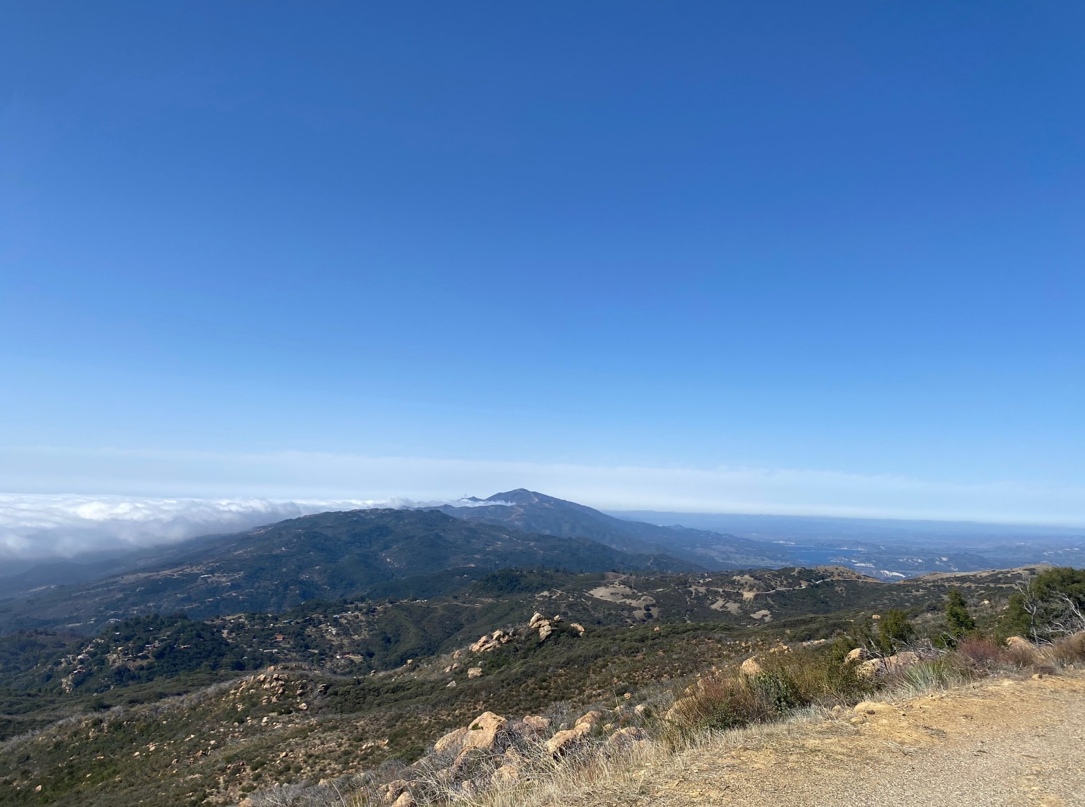
The early morning marine layer to the south of this lovely summit. 1 MARCH 2025 W6/SC-086 Elevation: 3,986′ Route: Almost a drive up Hike Distance: .2 miles round trip Elevation Gain: 80′ Navigation: Easy Steepness: Gentle Vehicle: Passenger car Road: Good paved road Cell Coverage: Good verizon Hike basics Three stars for a virtual drive-upContinue reading “La Cumbre Peak”
Thomas Mountain
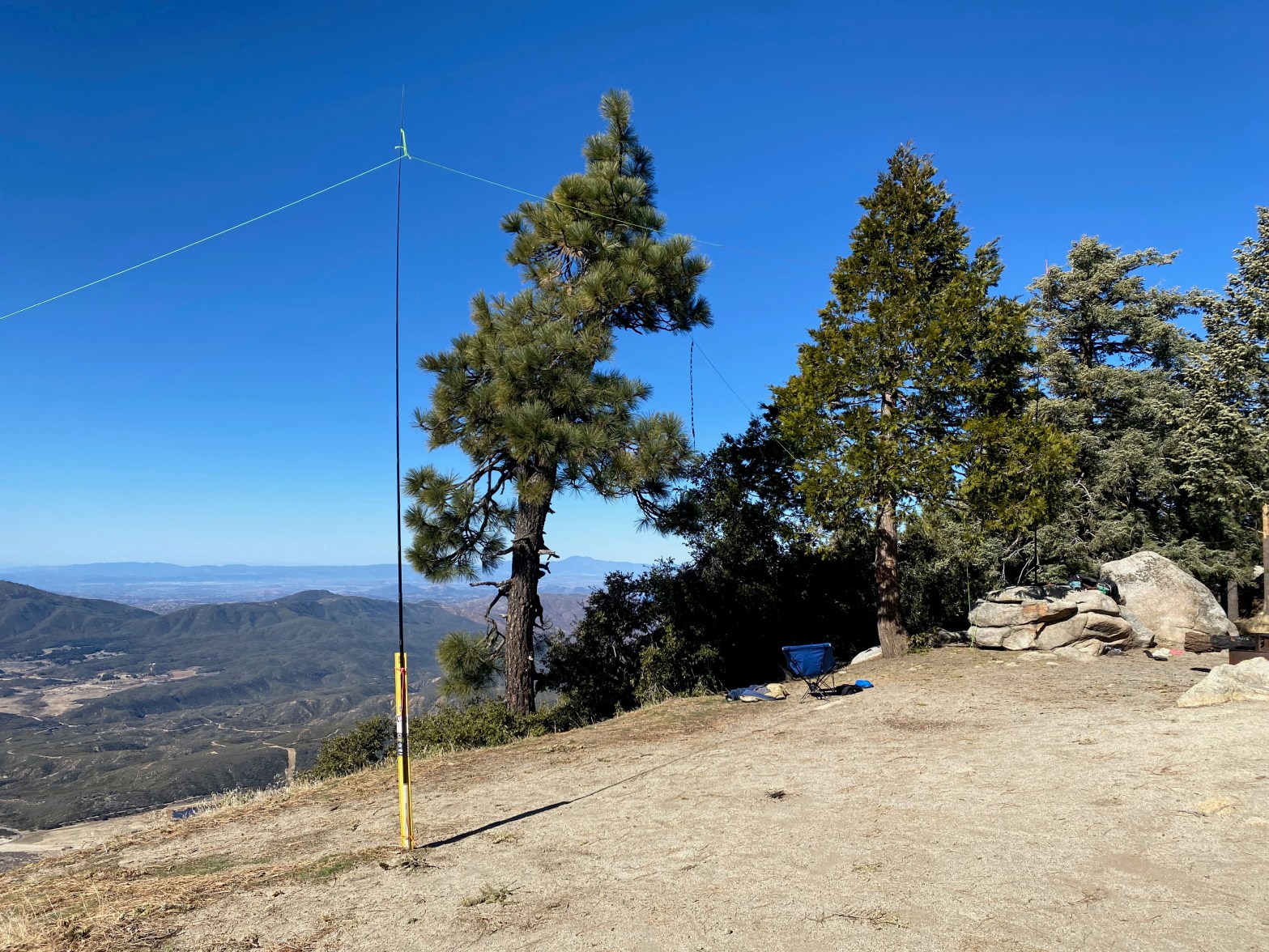
Here is one leg of the doublet and the roll-up slim jim antenna for 2m. 23 FEBRUARY 2025 W6/CT-016 Elevation: 6,825′ Route: Drive up Hike Distance: n/a Elevation Gain: n/a Navigation: n/a Steepness: n/a Vehicle: High clearance 4wd suggested Road: As of this trip pretty rutted Cell Coverage: Good Verizon Hike basics When I firstContinue reading “Thomas Mountain”
Lookout Mountain #1

Looking east from the summit toward Toro Peak. Elevation: 5,590′ Route: Pacific Crest Trail and use trail Hike Distance: 4 miles round trip Elevation Gain: 1,000′ plus 400′ on the return Navigation: Moderate Steepness: Steep use trail Vehicle: Passenger car Road: Paved highway Cell Coverage: Good Verizon Hike basics It’s always good to get whatContinue reading “Lookout Mountain #1”
Mount Lemmon
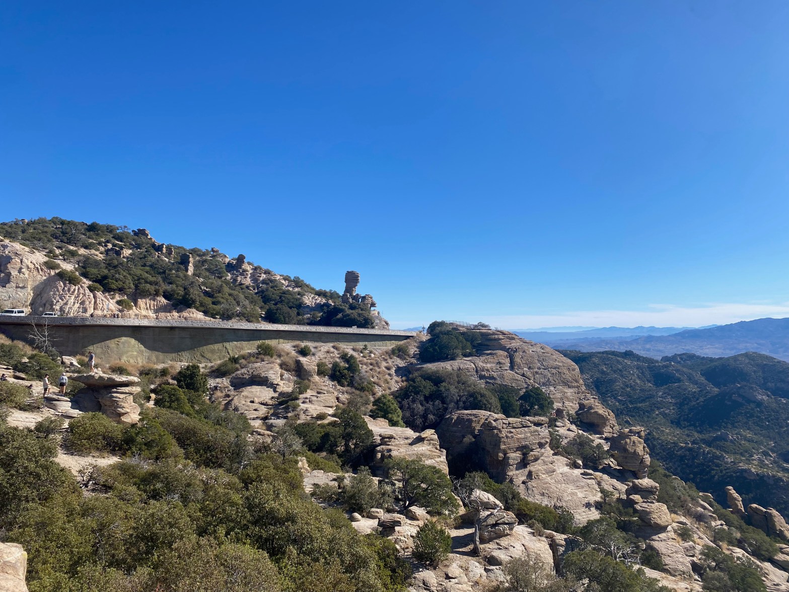
Highway 39 on the way up to Mount Lemmon. 15 DECEMBER 2024 W7A/AW-001 Elevation: 9,167′ Route: Drive up if the gate is open Hike Distance: 3.6 miles round trip if gate is closed Elevation Gain: 800′ if gate is closed (Dec 15 to Mar 1) Navigation: Easy Steepness: Gentle Vehicle: Passenger car Road: Good pavedContinue reading “Mount Lemmon”
Summit 3,853′

Looking north at the Agua Dulce Movie Ranch aka Firestone Ranch, Letteau Ranch or Annan Ranch with Mount McDill Behind 9 NOVEMBER 2024 W6/CT-165 Elevation: 3,853′ Route: 4×4 trail Hike Distance: 4.0 miles round trip Elevation Gain: 1000′ Navigation: Easy Steepness: Moderate Vehicle: High clearance suggest for the last bit Road: Good dirt road CellContinue reading “Summit 3,853′”
Summit 2,569′ “Teri’s Peak”
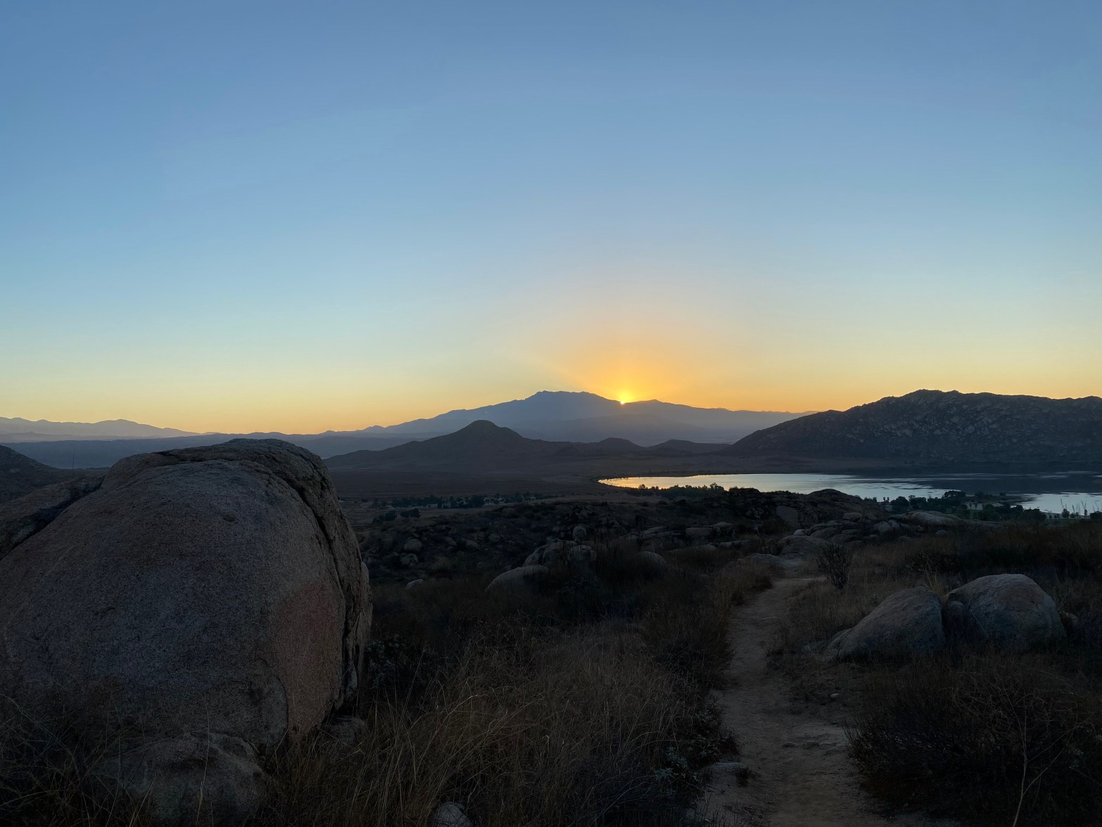
Sunrise over San Jacinto Peak from the trail up Teri’s Peak. 20 OCTOBER 2024 W6/CT-195 Elevation: 2,569′ Route: Good trail Hike Distance: 2.25 miles round trip Elevation Gain: 800′ Navigation: Easy Steepness: Moderate Vehicle: Passenger car Road: Good dirt road to Horse Camp Cell Coverage: Good Verizon Hike basics Another 5AM start from Topanga CanyonContinue reading “Summit 2,569′ “Teri’s Peak””
Mount Russell
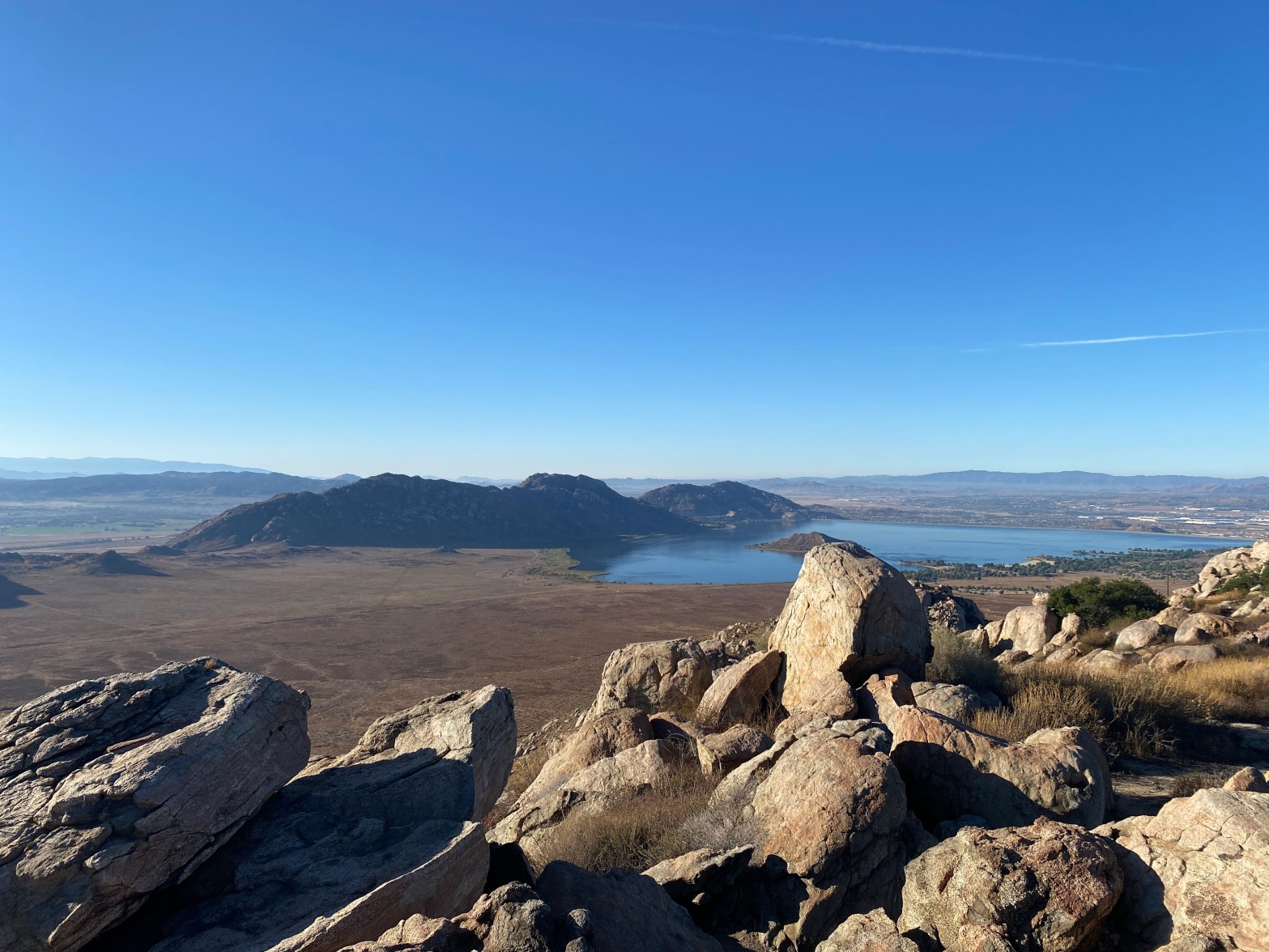
Perris Lake to the southwest of this fine summit 12 OCTOBER 2024 W6/CT-188 Elevation: 2,703′ Route: Good Trail Hike Distance: 4 miles round trip Elevation Gain: 950′ via route 2 Navigation: Easy Steepness: Moderate Vehicle: Passenger car Road: Paved Cell Coverage: Excellent Verizon Hike basics I left Topanga Canyon right at 5AM and got toContinue reading “Mount Russell”
