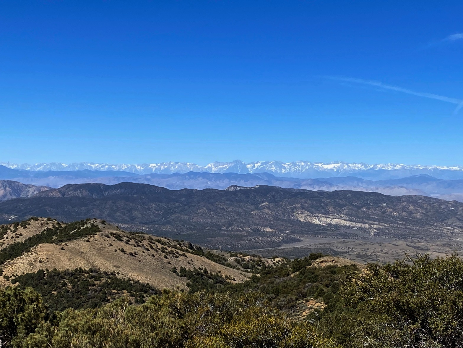
The Sierra Nevada crest from Palmetto Mountain. Split Mt. is the prominent peak in the center. The Palisades to the right.
21 MAY 2022 W7N/EM-031
This activation was the result of a long-standing idea I’ve had to activate the sparsely populated grid DM17. I’ve been thinking about this for years, studying maps and satellite images to find a good place to set up a 100 watts digital station.
Why digital?
The answer to that one can be found in the "Gridpedion" backstory told here
I left Topanga Canyon early Friday morning without my nephew. Originally R had hoped to come along as a videographer/photographer and all around good company. But the powers at the California State Colleges intervened and R was obligated to finish teaching duties beyond the end of the quarter. So it was just me heading off into some brutal headwinds up highway 395 and the Owens Valley. In all my years of Sierra Nevada trips I had never seen the wind blowing like this. There were whitecaps on Little Lake! The dust was so thick in the air that it looked foggy. I had heard that dust in the air had become a big problem due largely to Los Angeles sucking the Owens Valley dry and I had seen some dusty, hazy days up there, but nothing like this. Ever.
At this point I was starting to think that I would need to abandon my dream of so many years. As I was doing this alone, I was already prepared to turn back if anything rose above even a modest threat.
The headwinds knocked my gas mileage down from Whitedog’s usual 20 mpg on the highway to around 12 mpg.
But fortune smiled upon me because after I gassed up in Big Pine and made it over Westgard Pass in the White Mountains, the winds abated. This was all now new country for me… new dots on the map, as I sometimes say. Dropping down into the austere Deep Springs Valley the landscape became wildly ‘basin and range.”
Just before Lida Summit, I kicked Whitedog into 4WD and turned off highway 266 to an unmarked dirt road. Going by the maps I figured that I might actually be able to drive to the summit of Palmetto Mountain to the communications facility up there. The road was in excellent shape – recently scraped – and stayed on Bureau of Land Management land the entire way.
However at the apparently defunct Nevada Silver State Mine there was a locked gate and a private property sign. This is not private property, but this happens. The area is a maze of dirt roads so I looked for a way around the mine on another road that goes by Excelsior Springs and joins back up with the service road to Palmetto Mountain. However this road became very rough and I had already made the decision to let discretion be the better part of valor. I turned around.
Finding another road further to the north I found that while this road would not take me to the summit, it did get me up on a saddle and it looked like an easy hike from there. This ended up being a really good solution because camping on the summit as I had planned would’ve exposed, unbeautful and uncomfortable, whereas the camp I ended up in was excellent with a great eastern horizon for my grid activation.
I made camp and was on the air before 00:00 utc.
I often think of the digital modes as a dance. Being in a rare grid is like being the prettiest girl at that dance. I had so much fun working the pile-up. Remarkably everything went smoothly. I think the shakedown trip the week before to Frazier Mountain really helped with that. I worked 18 different stations on PSK. On FT8 I worked almost 100 all over the US, Australia, Indonesia, China, Japan, Italy, Germany, Panama, Chile, Venezuela, and the Republic of Korea. I worked the radio as long as I could keep my eyes open after such a long day.
That night was pretty cold. The water in my teapot froze overnight. The hike from my trailhead camp as a delightful 1.5 miles with about 850 feet of ascent. Surprisingly I had cell coverage from Verizon almost the entire trip. Also APRS coverage is great in the area due to a 2m repeater on Palmetto Mountain. From camp it was a cross country jaunt through pretty open and easy terrain for about a mile before joining the access road to the summit.
Fun activation with summit-to-summit contacts to South Dakota and Georgia along with a lot of regular chasers.
Thank you everybody for helping to make this trip an absolute BLAST!

Stay tuned for an upcoming video on this activation and gridpedition, Coming Soon


