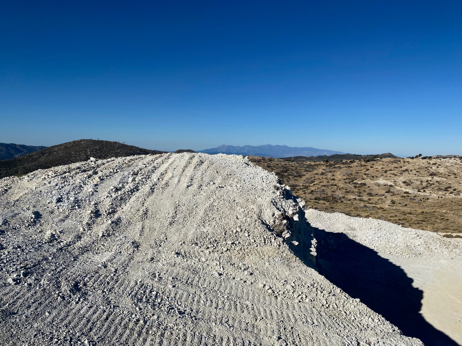
Looking west toward the San Gabriel Mountains over what is left of summit 7,940′ 21 OCTOBER 2023 W6/CT-060 Elevation: Something less than 7,940′ Route: Mining road Hike Distance: 2.2 miles round trip. Elevation Gain: 350′ Navigation: Tricky because of the changing topography Steepness: Gentle on the route below Vehicle: Passenger car Road: Good dirt roadContinue reading “7,940′ “Strip Mine” Summit”
Monthly Archives: October 2023
Burnt Peak

A partial eclipse of the sun is projected through a pinhole in my logbook’s cover. The spiral spine also creates a series of suns. 14 OCTOBER 2023 W6/CT-093 Elevation: 5,778′ Route: Drive-up if the gates are open Hike Distance: 5.5 miles round trip if the gates are closed Elevation Gain: 1,500′ – 1,000′ in andContinue reading “Burnt Peak”
Tahquitz Peak
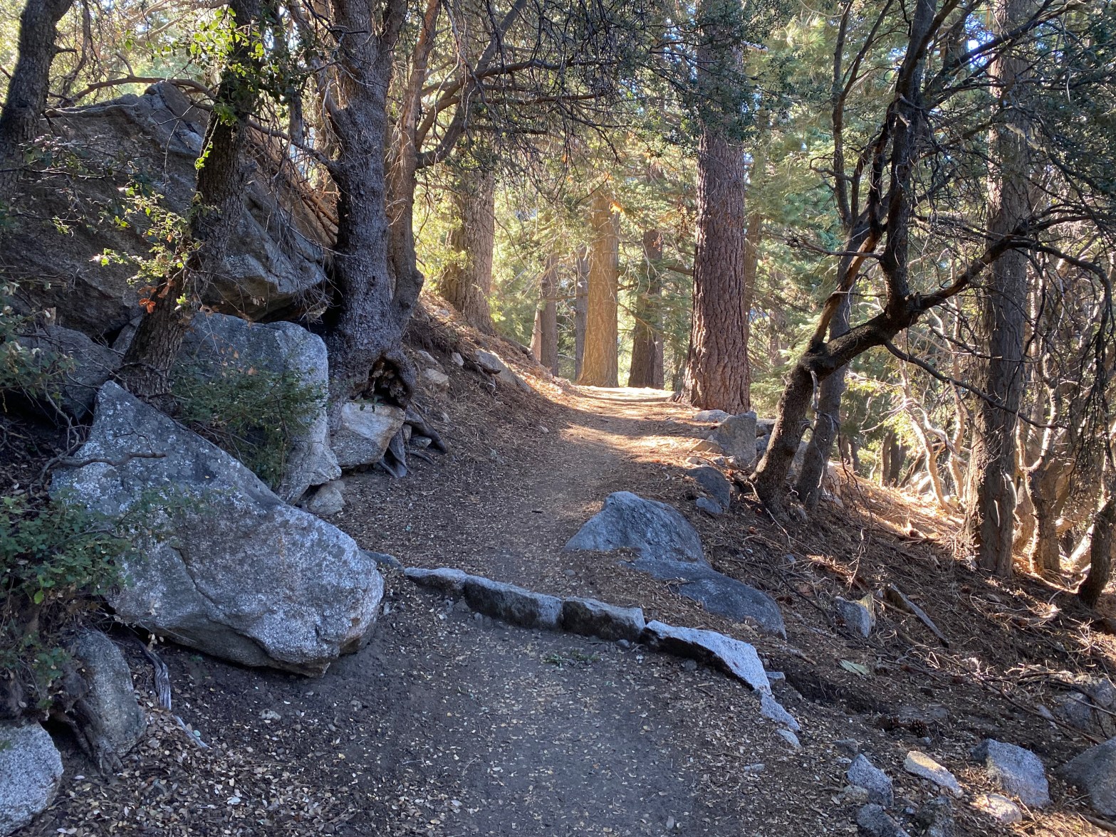
Devil’s Slide Trail up from Humber Park is a lot of up, but it is cool and mostly shaded in the early morning. 16 SEPTEMBER 2023 W6/CT-007 Elevation: 8,770′ Route: Trail Hike Distance: 9 miles round trip Elevation Gain: 2,350′ Navigation: Easy Steepness: Well graded trail Vehicle: Passenger car Road: Paved road Cell Coverage: InContinue reading “Tahquitz Peak”
Alabama Hills
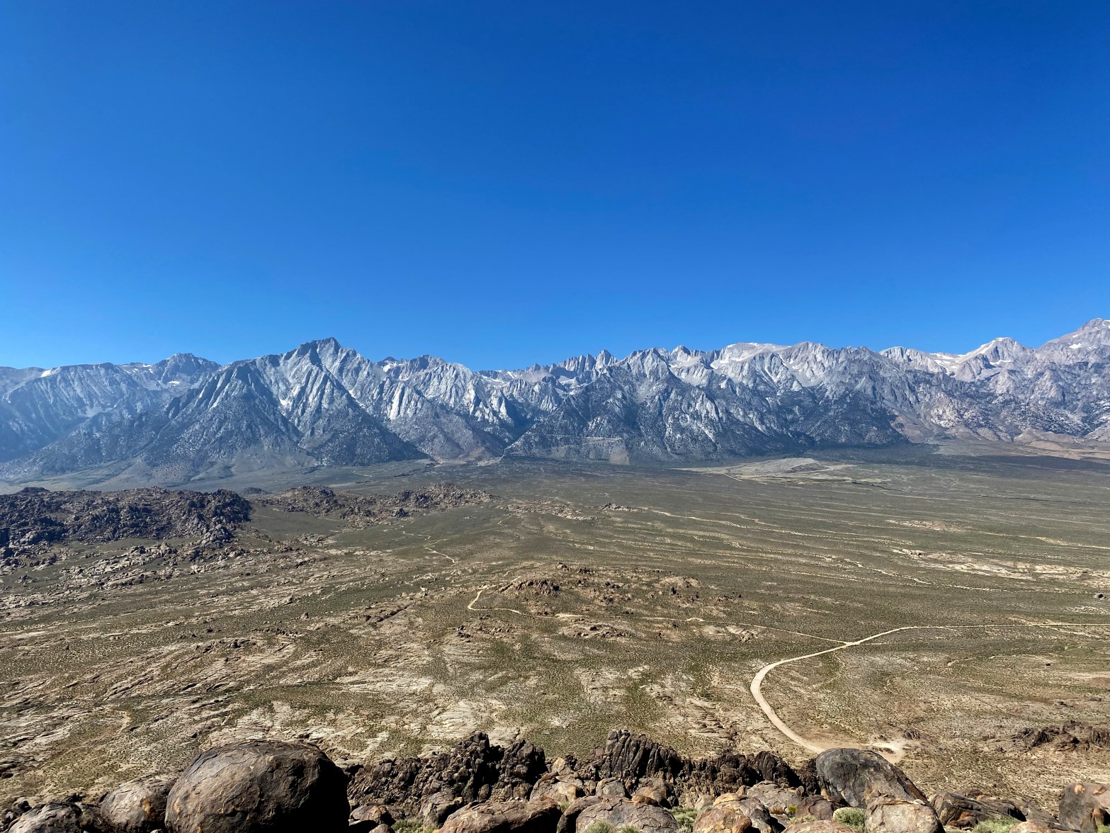
A spectacular view of the Whitney Crest from the high point of the Alabama Hills 22 SEPTEMBER 2023 W6/SS-636 Elevation: 5,413′ Route: Cross country Hike Distance: .8 miles round trip Elevation Gain: 500′ Navigation: A bit tricky Steepness: Moderate Vehicle: Passenger car Road: Good dirt road Cell Coverage: Spotty (Verizon) Didn’t check APRS Hike basicsContinue reading “Alabama Hills”
