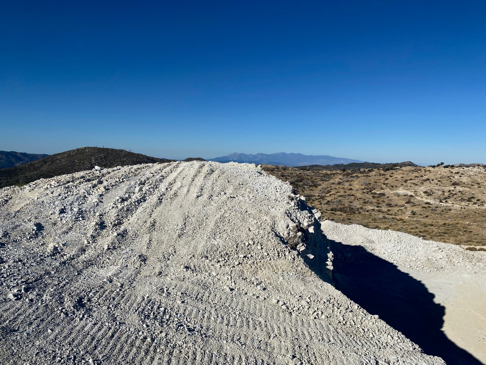
Looking west toward the San Gabriel Mountains over what is left of summit 7,940′
21 OCTOBER 2023 W6/CT-060

| Elevation: | Something less than 7,940′ |
| Route: | Mining road |
| Hike Distance: | 2.2 miles round trip. |
| Elevation Gain: | 350′ |
| Navigation: | Tricky because of the changing topography |
| Steepness: | Gentle on the route below |
| Vehicle: | Passenger car |
| Road: | Good dirt road |
| Cell Coverage: | Good (Verizon) APRS Excellent |
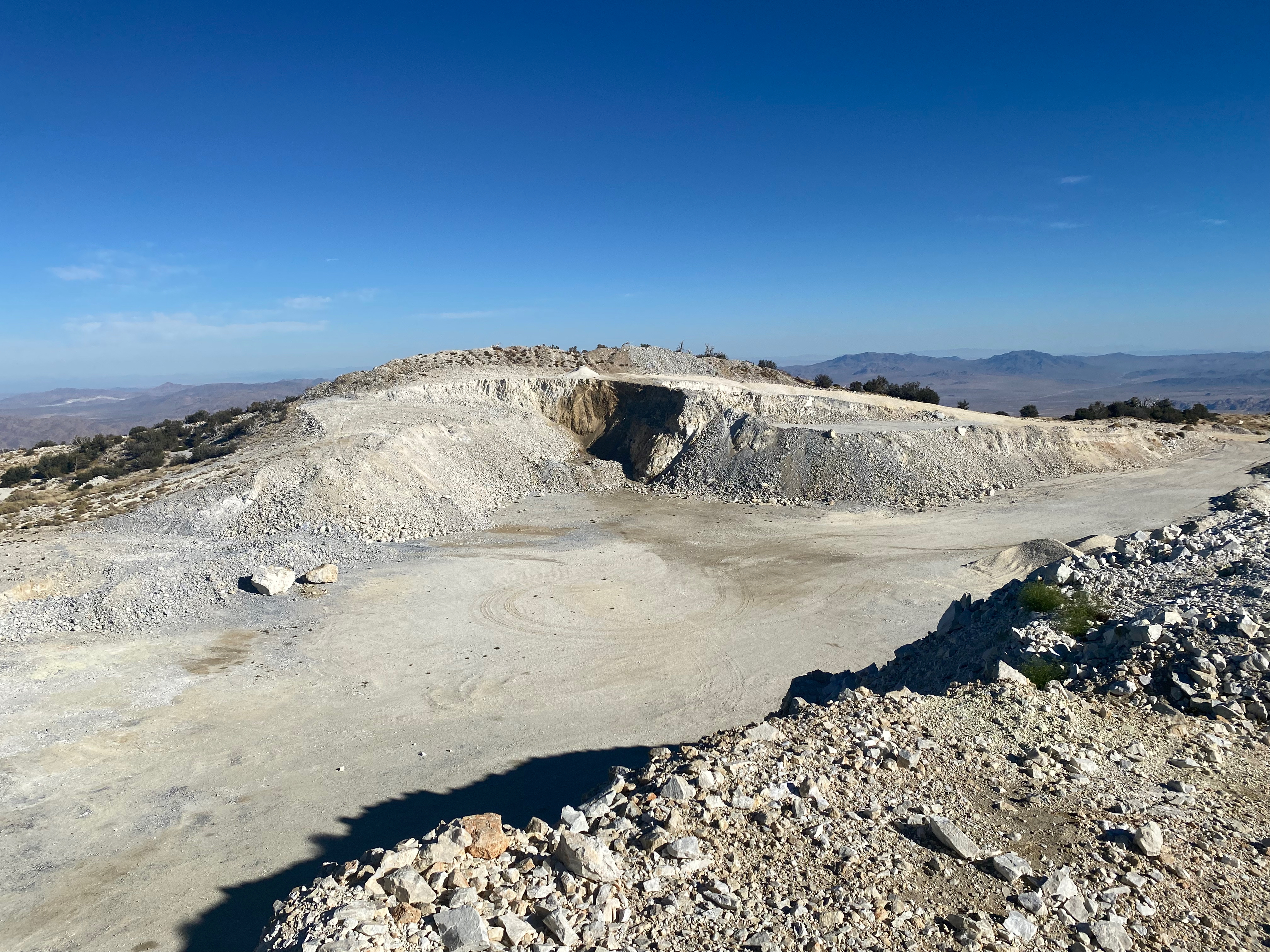
There is very little to recommend this summit in my opinion. The OMYA Sentinel Quarry has decimated the summit to the point that it probably no longer meets the SOTA criteria for prominence. It looks like the north side of the quarry is now higher. About the only thing I can say is get this one now in case it gets de-certified later.
I followed the track posted on SOTLas by KX6I and the “short climb up a rockpile” is now a treacherous scramble up very loose powdered quartz. I spent 15 minutes or so carving out semi-stable steps to make the ridge. I don’t recommend this.
My route down follows a road that is a much better route. Who knows how long this will last given all the earth-moving up there.
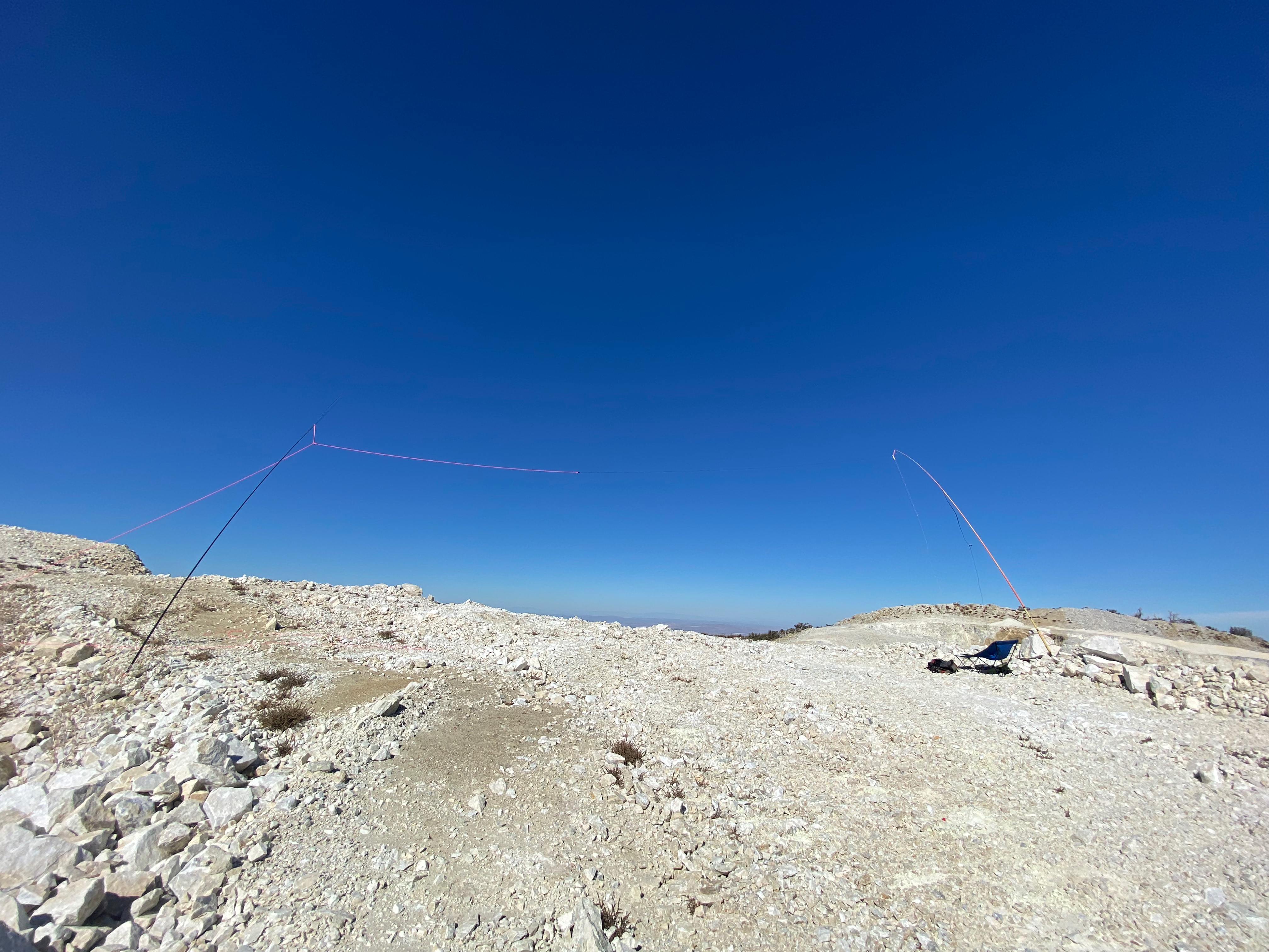
I did have an enjoyable time on the radio despite all this and had my first-ever chase from down under!


Leave a comment