
Looking northeast to Humphreys Mountain – the highest point in Arizona at 12,635′ – and Kendrick Peak 10,420.
22 MARCH 2024 W7A/CS-032

| Route: | Cross-country |
| Hike Distance: | 1 mile round trip |
| Elevation Gain: | 635′ |
| Navigation: | Easy |
| Steepness: | Moderate |
| Vehicle: | Passenger car |
| Road: | Good forest service dirt |
| Cell Coverage: | Good (Verizon) |
On a Friday morning I set out from our house in Topanga at 4:30am on my way to meet Cassie in Santa Fe. We are getting ready to set out for Arkansas and the total solar eclipse on April 8th. I got to William about 11am and decided that was about enough battling the big rigs on I-40 for one day.
I had my eye on Spitz Hill as an easy hike with a short approach drive. I was not disappointed. There are apparently several ways to walk through the forest to reach this summit and I chose the west slope. There is no particular route beyond the numerous elk trails the crisscross the deadfall. It’s pretty easy to find the summit through the trees – just go up!
Here is my track up Spitz Hill. I will say that it was a bit harder to find my way down than it was to find the summit going up. I didn’t worry about it too much because I knew I’d hit County Road 76 if I just went down.
The weather was pretty much perfect; mild and a light breeze now and again. I managed to get Chester the Drone in the air to shoot a little video:
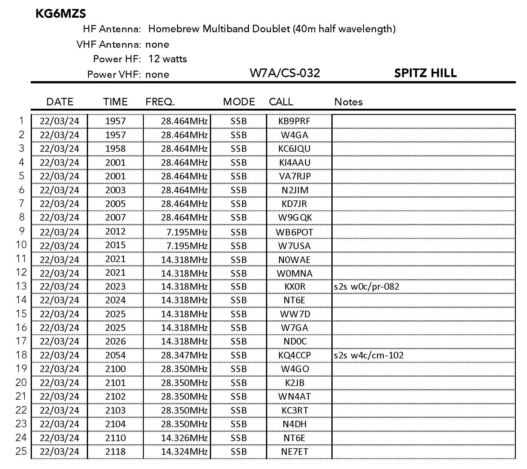
I made 25 contacts – no big DX but a lot of familiar callsigns. Thank you all for helping to make this a very enjoyable day. I was down and in Flagstaff by check-in time at my motel.


Leave a comment