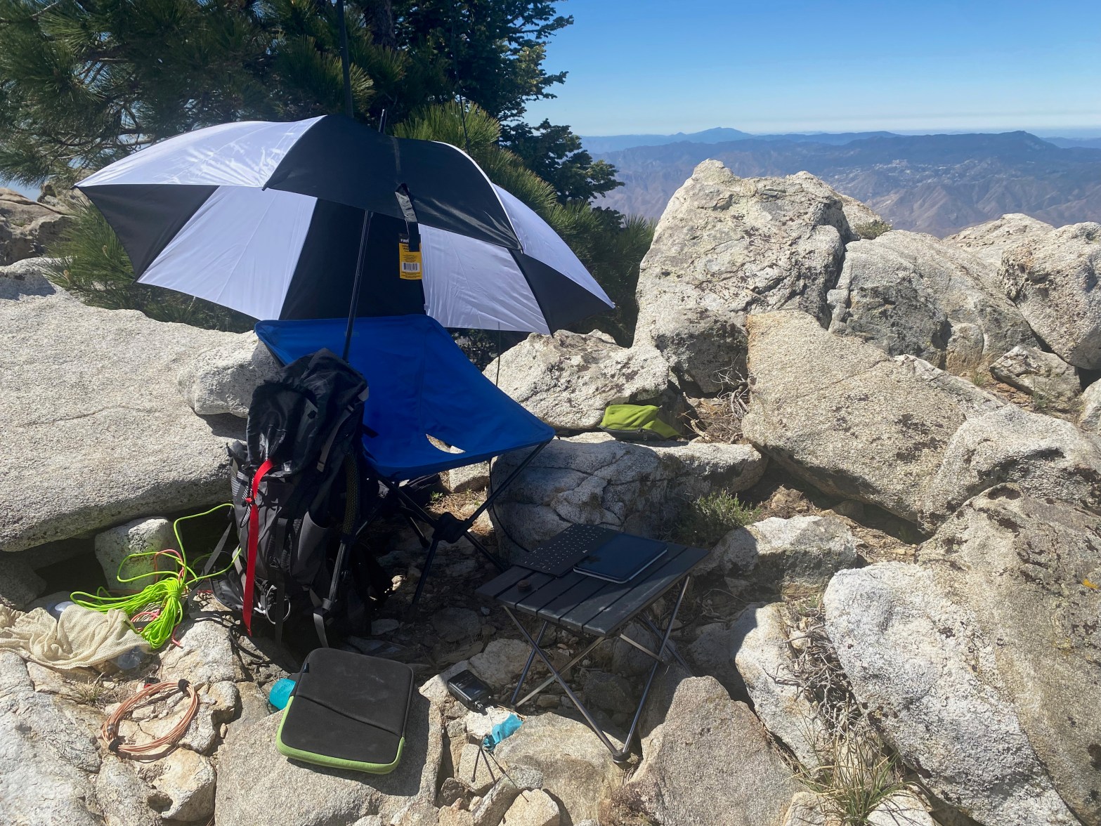
The station on the uneven ground of the summit. Looking south with Cuymaca Peak in the background.
SPECIAL ACCESS NOTE: This summit is on the Santa Rosa Band of Cahuilla Indians reservation. A day-use permit is required to visit this summit. Permits are $40 per person and must be obtained in advance. A liability waiver is also required.
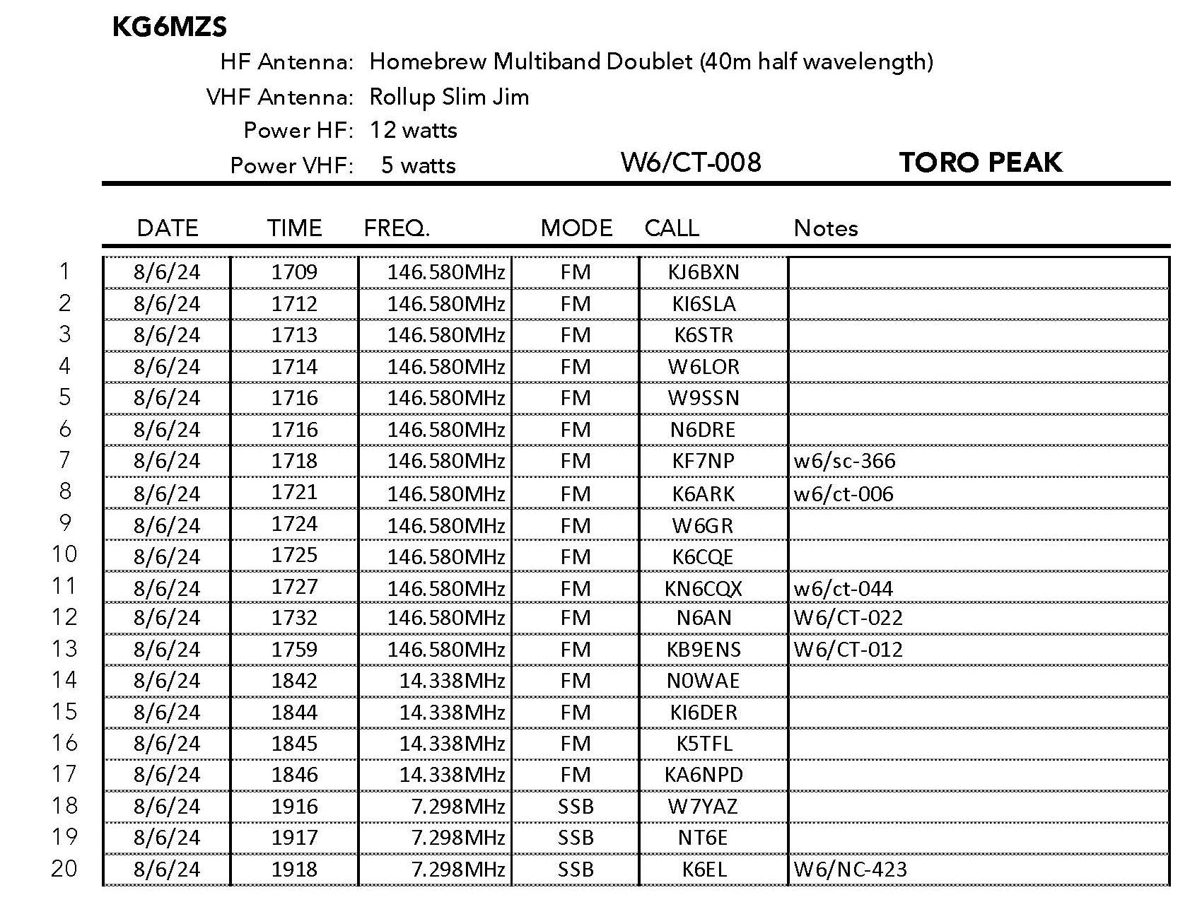
8 JUNE 2024 W6/CT-008

| Elevation: | 8,694′ |
| Route: | Dirt Road |
| Hike Distance: | 1 mile round trip |
| Elevation Gain: | 450′ |
| Navigation: | Easy |
| Steepness: | Moderate |
| Vehicle: | High clearance suggested |
| Road: | Long dirt road |
| Cell Coverage: | Spotty Verizon |
Toro Peak is a summit that has eluded me. It is the highest of the Santa Rosa Mountains one of the HPS summits that I have never done, so this was an extra special summit for me. I left Topanga about 5 AM and had a relatively fast trip to the Ramona Expressway. Once here however I was stopped by a seemingly endless procession of signals. Back in the days when I was rock climbing Suicide and Taquitz Rocks we often went this way. I was amazed to see the number of bedroom communities that have sprung up since that time.
Santa Rosa Road leaves Highway 74 — the so-called “Pines to Palms Highway” at
33° 34.0662′ N, 116° 30.7052′ W
From here is is 12.5 miles of pretty bad road. It’s the kind of road I have driven passenger cars on but I was glad to have Whitedog’s high clearance and 4 wheel drive. There was a Tesla and a Lexus parked about half way up before a rutted, muddy section.
The hike itself is short – about half a mile up 450′ – to a large communications facility. I continued past that to the west side where I found a place to set up away from the microwave dishes and repeaters. the ground here was pretty uneven and it took me much longer to set up than usual as my wires and ropes kept getting tangled and jammed in the rocks and buck brush.
It was pretty hot in the sun and I brought an umbrella. This was fortunate because my electronics rapidly overheated in the direct sun.


Leave a comment