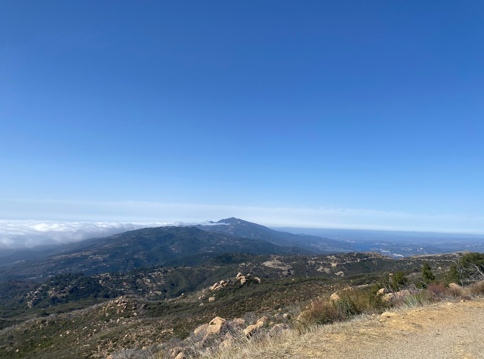
Looking west to Santa Ynez Peak
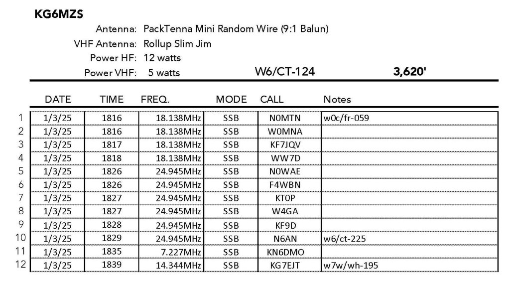
1 MARCH 2025 W6/SC-124

| Elevation: | 3,620′ |
| Route: | Paved Road |
| Hike Distance: | Drive-up |
| Elevation Gain: | n/a |
| Navigation: | n/a |
| Steepness: | n/a |
| Vehicle: | Passenger car |
| Road: | Good paved road |
| Cell Coverage: | Good Verizon |
Nothing much to this one. The high point on Camino Cielo is within the activation zone. There is a gated road to the summit but a fenced aviation radar facility blocks access to the actual summit. I look at a spot up that road but opted for a spot along Camino Cielo that was shielded from the radar.
I did manage to lose my Packtenna end fed random wire on the turnout on the road.

Leave a comment