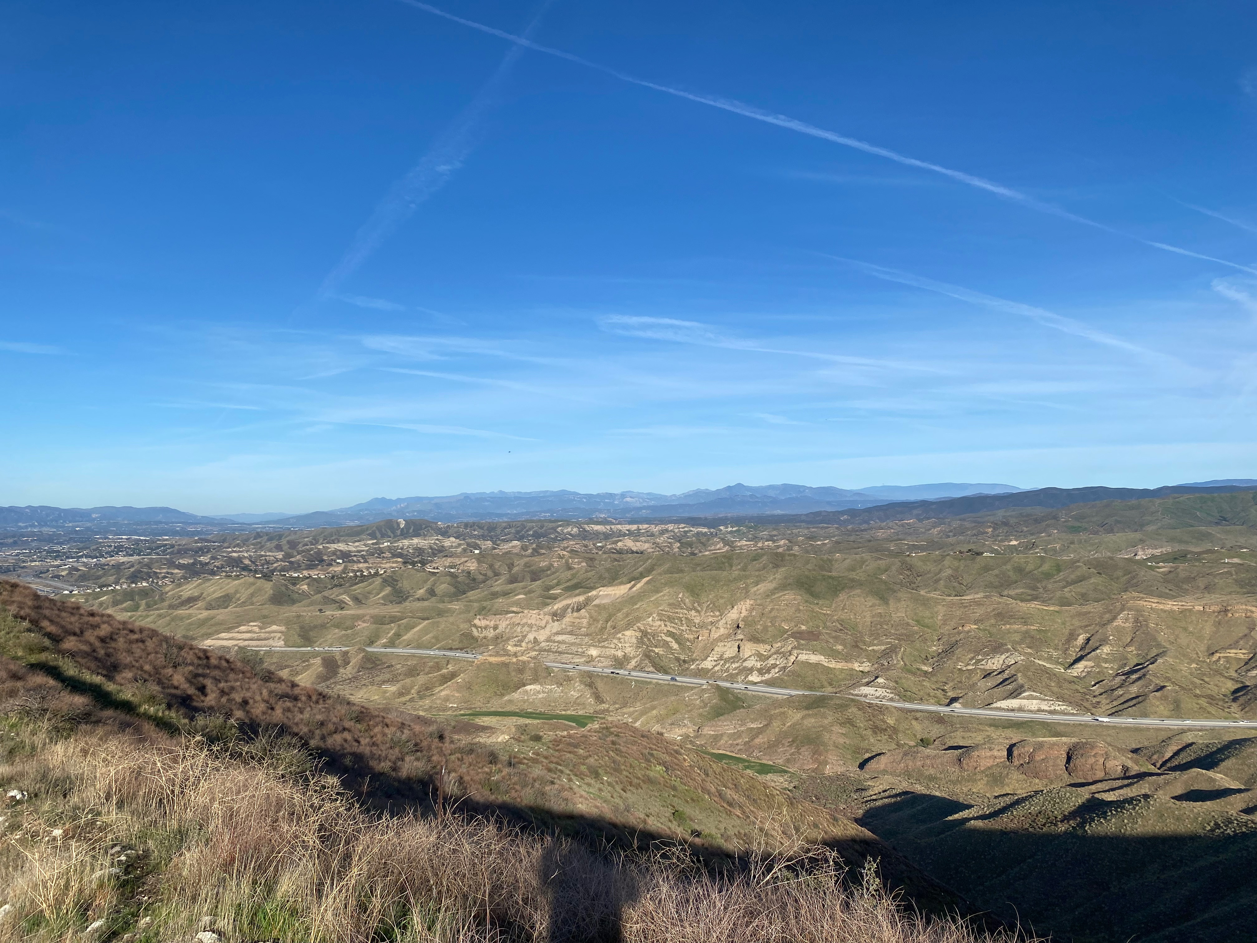
Looking west across the station to Hines Peak and Ventura and Santa Barbara Summits
25 MARCH 2025 W6/CT-273
One star – Nothing special but I’d do it again.
Elevation:
2,844′
Route:
Cross country
Hike Distance:
1.5 miles round trip
Elevation Gain:
800′
Navigation:
Easy
Steepness:
Moderately steep
Vehicle:
Passenger car
Road:
Paved road
Cell Coverage:
Good Verizon
Hike basics
Looking for an easy new one and this pleasant jaunt filled the bill. I wanted to get back and spend some time with KG6MZR before she left for New Mexico so I made this one a quickie. The hike is very straightforward. Just follow make the first ridge line and follow it up. A recent fire has made the going easy.
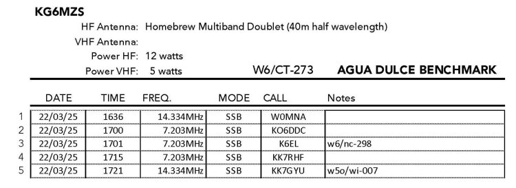
Radio conditions were poor due to recent solar storms, but I still managed a few contacts
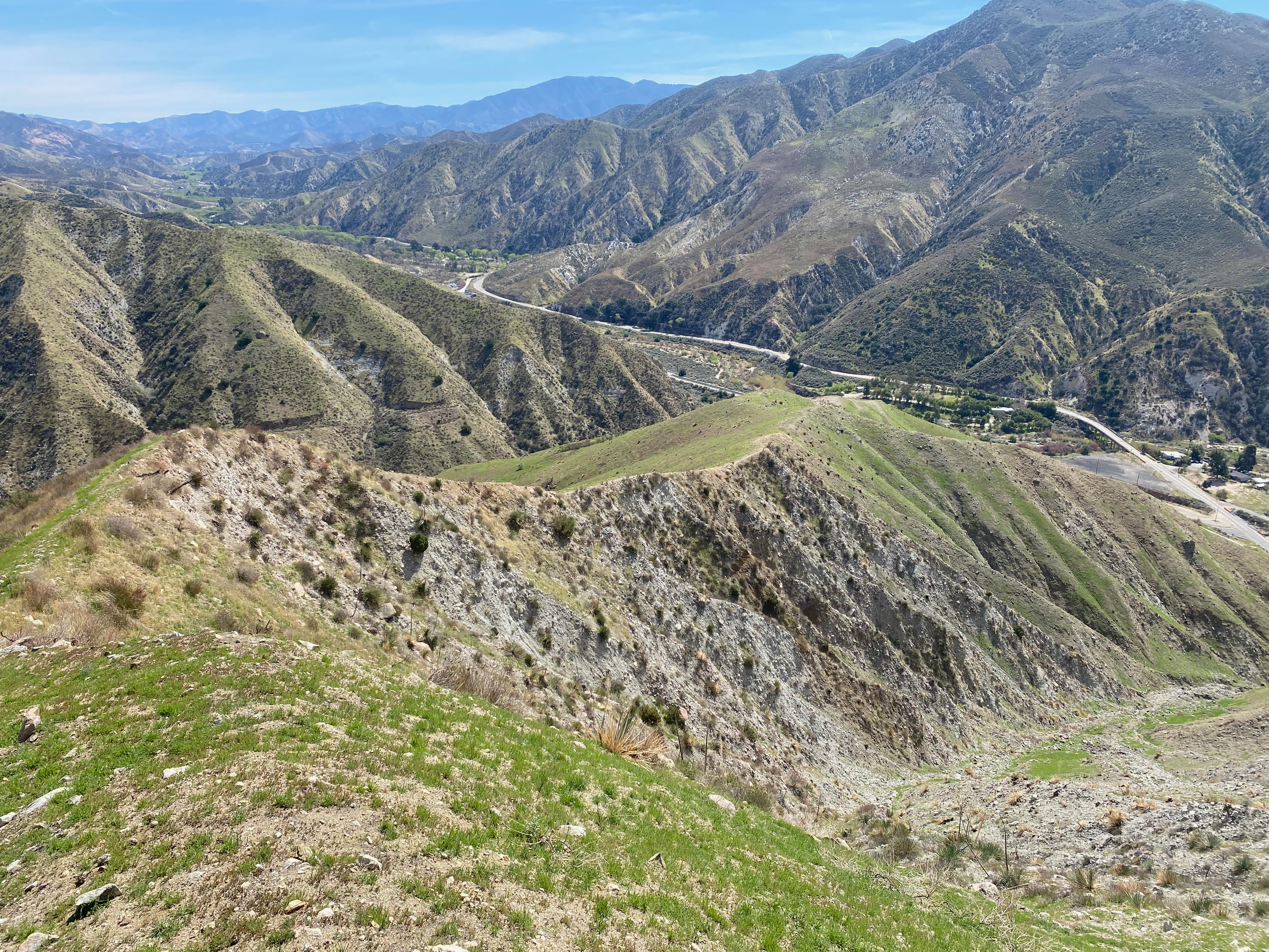
The route up follows a sometimes steep ridgeline up from Agua Dulce Canyon Road. That’s Soledad Canyon Road visible in this shot. The station looking west.Looking northwest to Highway 14 and Cobblestone Mountain.Recent fire made the route easy pickings. Looking east. You can actually see Whitedog below if you blow this shot up.
I'm a graphic artist in the movie business. When I was a kid I got interested in astronomy. When it would get too cloudy to observe the heavens, my buddy and I would sit at the VFO of his Hallicrafters S 38c like safe crackers trying to coax faraway signals out of that humble radio. My love of astronomy and radio survive to this day fifty+ years later.
View more posts


Leave a comment