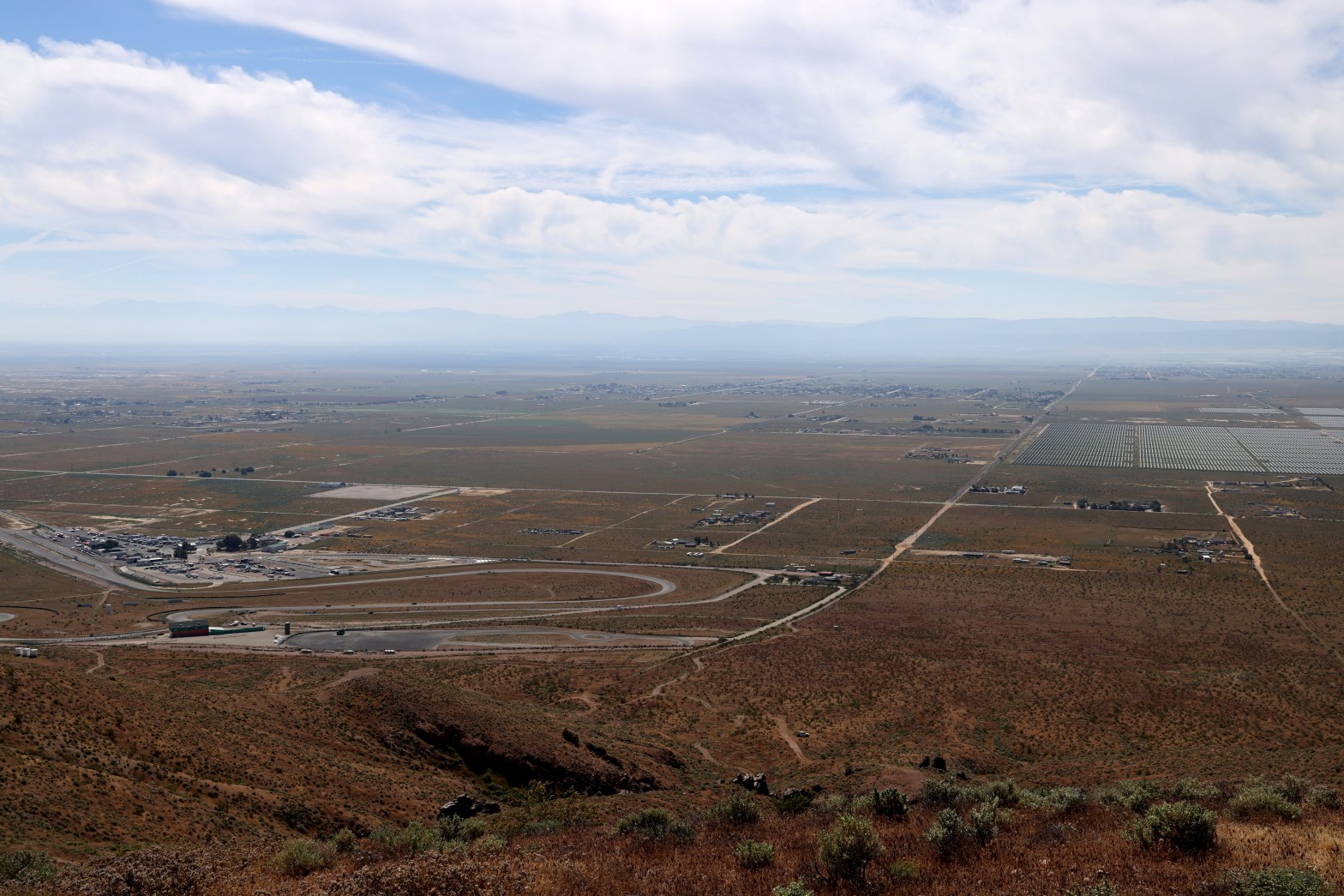
Looking south across the eponymous raceway to the hazy San Gabriel Mountains. Whitedog is visible below.
22 MARCH 2026 W6/ND-328

| Elevation: | 3,297′ |
| Route: | Cross country |
| Hike Distance: | .8 miles round trip |
| Elevation Gain: | 500′ |
| Navigation: | A slight twist* |
| Steepness: | Steep |
| Vehicle: | Passenger car |
| Road: | Good dirt road |
| Cell Coverage: | Excellent Verizon |
This entire activation was a punt. Plan C. I started my morning before dawn in Woodland Hills and headed for Tehachapi Pass looking to do a pair of summits out of Walker Basin. In all my years of exploring Southern Califonia, this was a corner of the Golden State I had somehow managed to overlook. This historic, out-of-the-way place was really showing off her charms as I wound up the narrow loop only to discover that the north and south access roads were gated, locked and posted with “Private Property, No Trespassing” signs.
Disappointed, I pointed Whitedog back toward the Antelope Valley and activated my “plan C” summit; Willow Springs Butte. My brother Mark and I had activated nearby Rosamond Hills on a recent Sunday and were dismayed by the plethora of careless target shooters. We repeatedly heard not only the report of the firearms, but the whooshing of projectiles whistling through the air.
Also it had been unseasonably hot for the vernal equinox and I knew it could be pretty toasty. I drove to the end of Truman Road and turned up toward the summit and 4-wheeled up a way. The cross country route was fairly steep and it was quite warm, as I had expected.
Once I gained the ridge, I mistakenly turned to the west and ascended the high point there. Interestingly SOTA Goat reported that I was in the activation zone on that summit when the dip between that point and what was certainly the actual summit was more than 82 feet. Once I returned to the dip, SOTA Goat did report that I was not in the AZ.
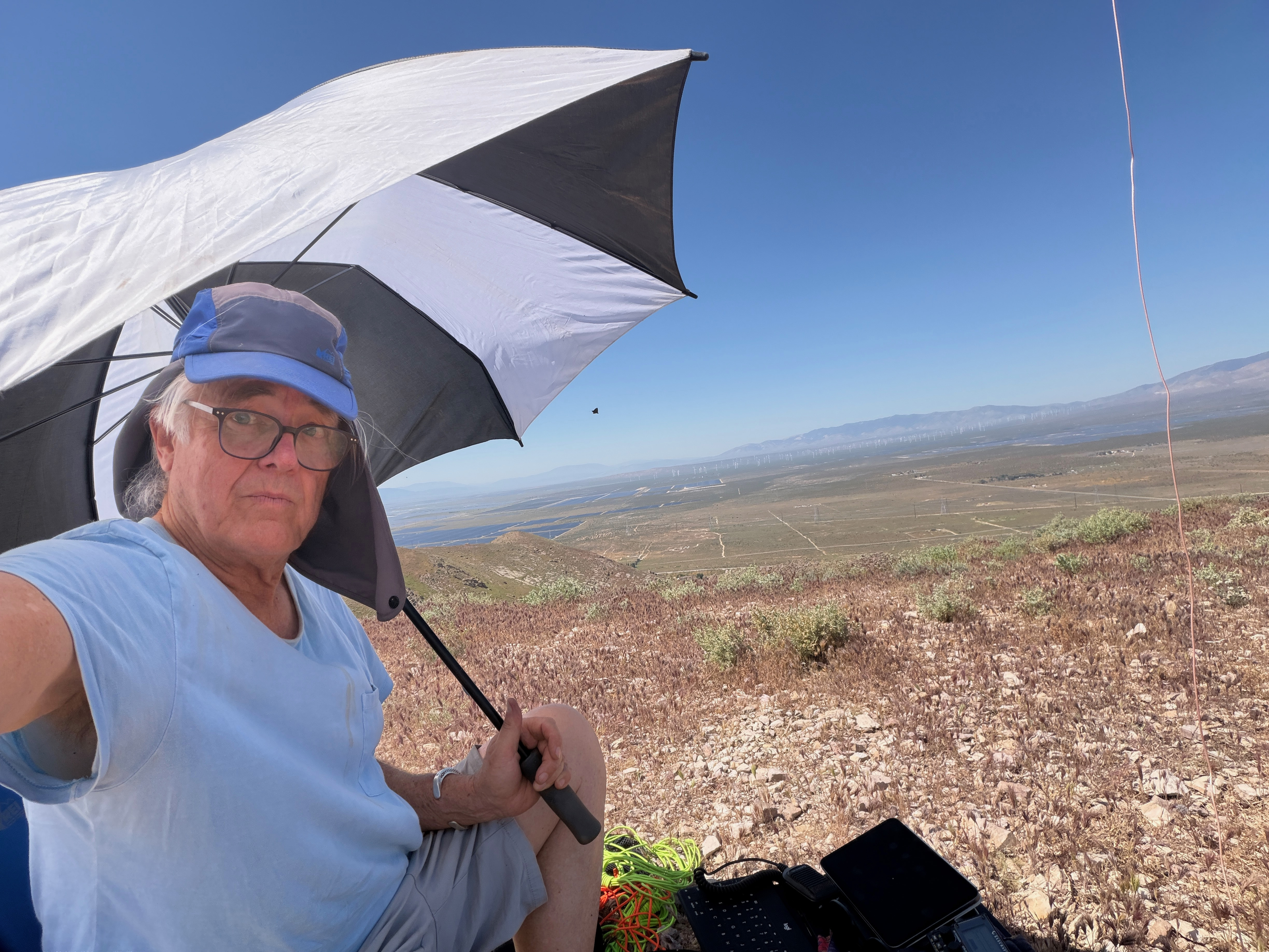
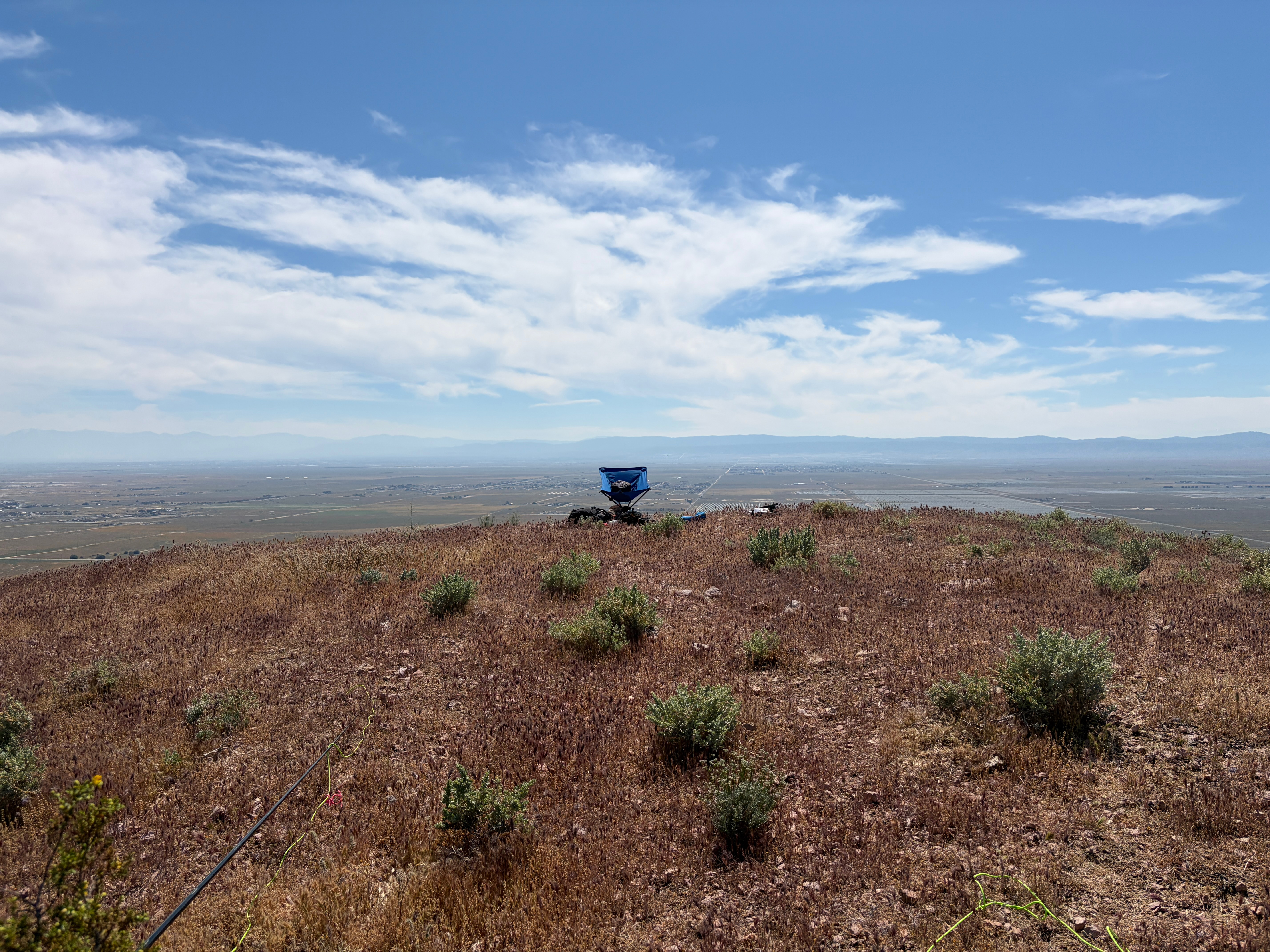
The summit only has a few low bushes to support masts. Fortunately I had an umbrella for shade as the gear certainly would have overheated without it.
The constant roar of Willow Springs Raceway and the ubiquitous Antelope Valley gunfire make this summit a one-off for me. Fortunately the shooters were more distant than they were on Rosamond Hills. I would suggest doing this one very early on a weekday. It’s probably pretty nice then.
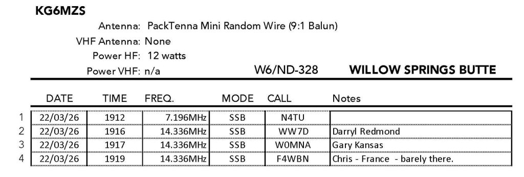
Radio conditions were horrible and I didn’t feel like hanging out.
The silver lining was that on the way back the floor of the Antelope Valley was carpeted in orange flowers. They weren’t California Poppies – I don’t know what species they were.

Leave a comment