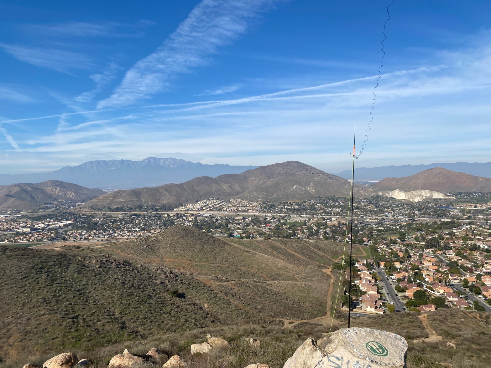
Looking north to the San Gabriel Mountains. 13 JANUARY 2024 W6/CT-241 Route: Trail/road Hike Distance: .5 miles round trip Elevation Gain: 150′ Navigation: Easy Steepness: Moderate Vehicle: Passenger car Road: Paved Cell Coverage: Good (Verizon) APRS Good Hike basics After doing Box Springs Mountain (W6/CT-180), I wanted to do another Complete, so I meandered throughContinue reading “Pedley Hills”
Author Archives: wringmaster
Box Springs Mountain
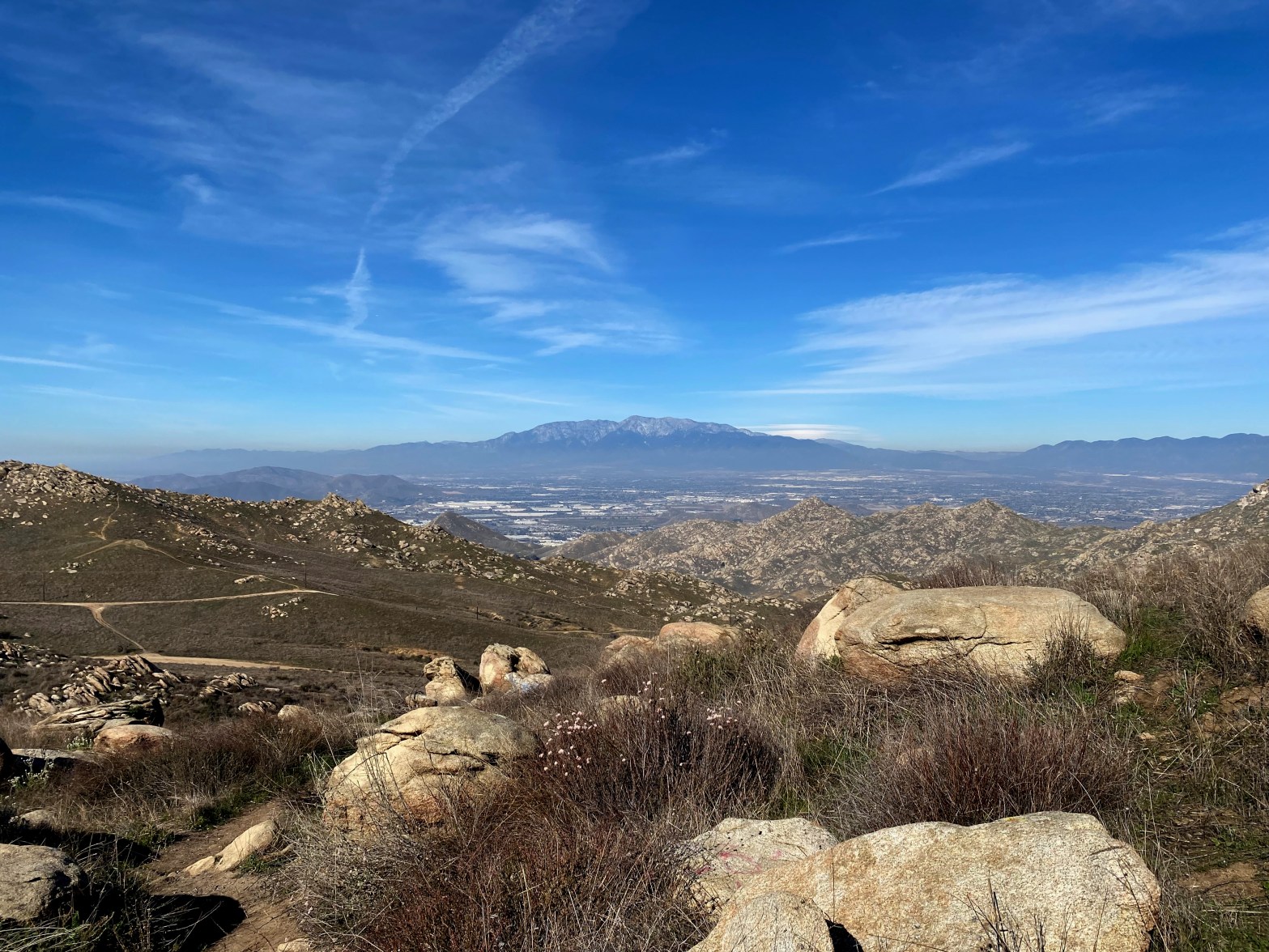
Terrific view of the big San Gabriel Mountains over their namesake valley. Baldy or Mount San Antonio is in the background. 13 JANUARY 2024 W6/CT-180 Elevation: 3,045′ Route: Good trail and access road Hike Distance: 4 miles round trip Elevation Gain: 700′ Navigation: Tricky Steepness: Extremely steep Vehicle: Passenger car Road: Paved Cell Coverage: Just belowContinue reading “Box Springs Mountain”
The Pinnacles

The tall skinny rock on the left is called The Bong (aka 2001) by rock climbers. 15 DECEMBER 2023 W6/CT-097 Elevation: 5,738′ Route: Trail Hike Distance: 3.7 miles round trip Elevation Gain: 875′ Navigation: Easy to lose the trail over rocks Steepness: Steep Vehicle: Passenger car Road: Paved road Cell Coverage: Good (Verizon) Hike basicsContinue reading “The Pinnacles”
Burn Benchmark #2
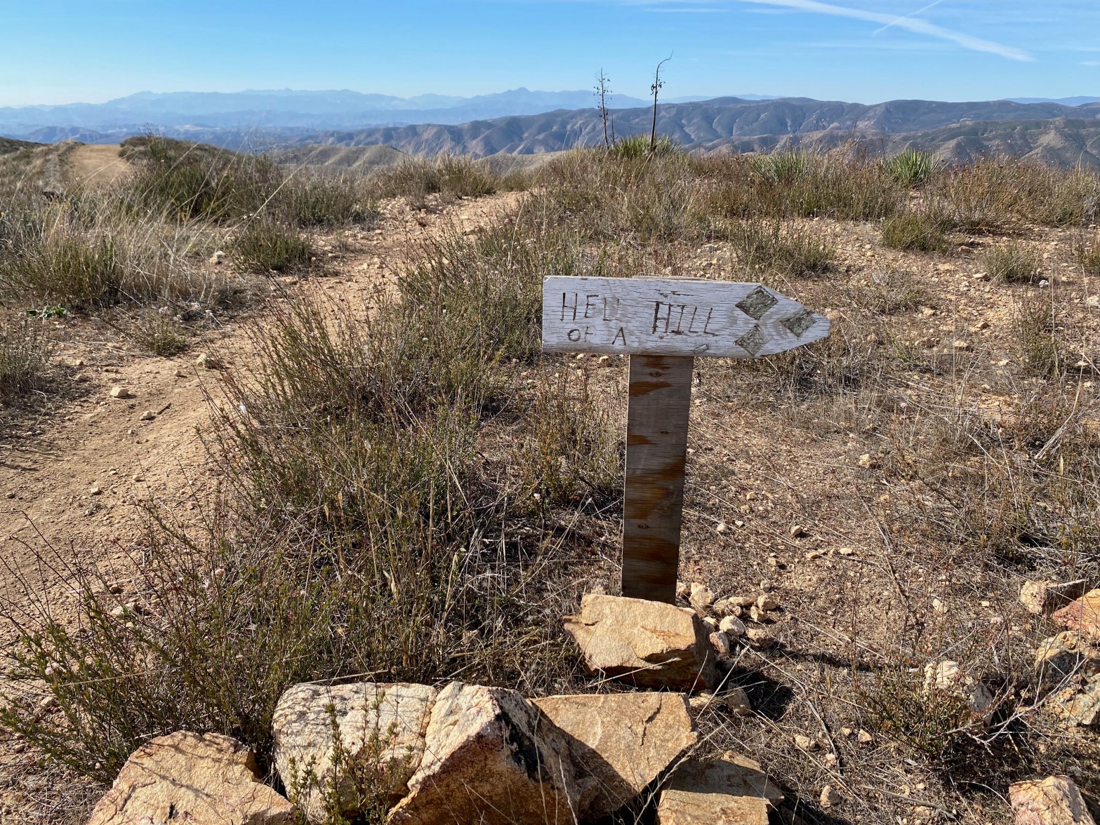
This sign isn’t kidding. The last half mile of this route is steep! 4 NOVEMBER 2023 W6/CT-271 Elevation: 3,094′ Route: Fire road and motorcycle track Hike Distance: 3.5 miles round trip Elevation Gain: 550′ in and 100′ on the return Navigation: Easy Steepness: Extremely steep at the end Vehicle: Passenger car Road: Good dirt roadContinue reading “Burn Benchmark #2”
7,940′ “Strip Mine” Summit
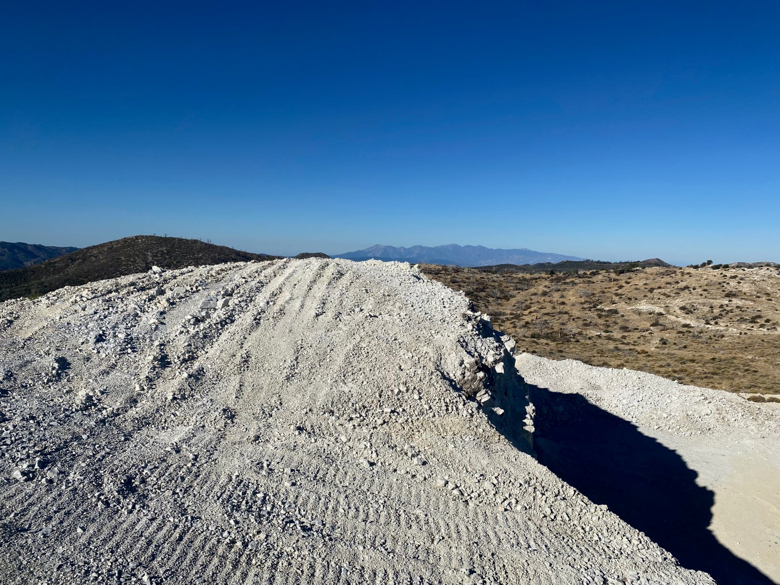
Looking west toward the San Gabriel Mountains over what is left of summit 7,940′ 21 OCTOBER 2023 W6/CT-060 Elevation: Something less than 7,940′ Route: Mining road Hike Distance: 2.2 miles round trip. Elevation Gain: 350′ Navigation: Tricky because of the changing topography Steepness: Gentle on the route below Vehicle: Passenger car Road: Good dirt roadContinue reading “7,940′ “Strip Mine” Summit”
Burnt Peak

A partial eclipse of the sun is projected through a pinhole in my logbook’s cover. The spiral spine also creates a series of suns. 14 OCTOBER 2023 W6/CT-093 Elevation: 5,778′ Route: Drive-up if the gates are open Hike Distance: 5.5 miles round trip if the gates are closed Elevation Gain: 1,500′ – 1,000′ in andContinue reading “Burnt Peak”
Tahquitz Peak
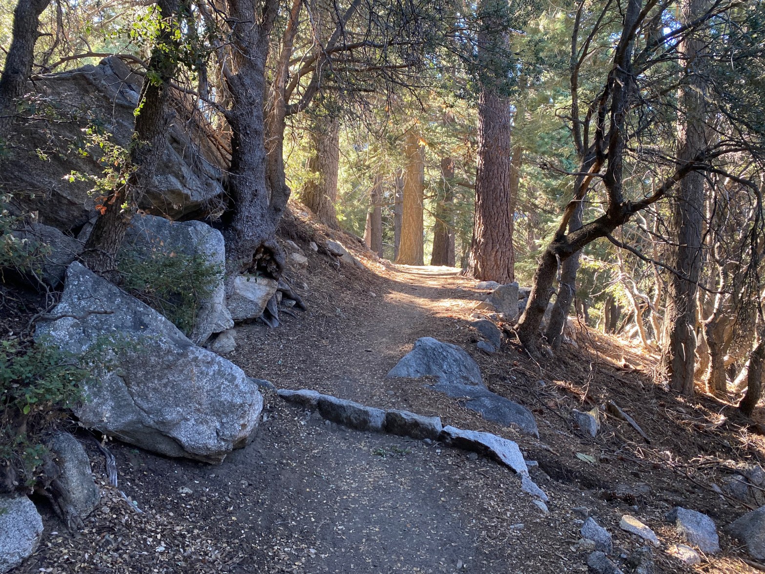
Devil’s Slide Trail up from Humber Park is a lot of up, but it is cool and mostly shaded in the early morning. 16 SEPTEMBER 2023 W6/CT-007 Elevation: 8,770′ Route: Trail Hike Distance: 9 miles round trip Elevation Gain: 2,350′ Navigation: Easy Steepness: Well graded trail Vehicle: Passenger car Road: Paved road Cell Coverage: InContinue reading “Tahquitz Peak”
Alabama Hills
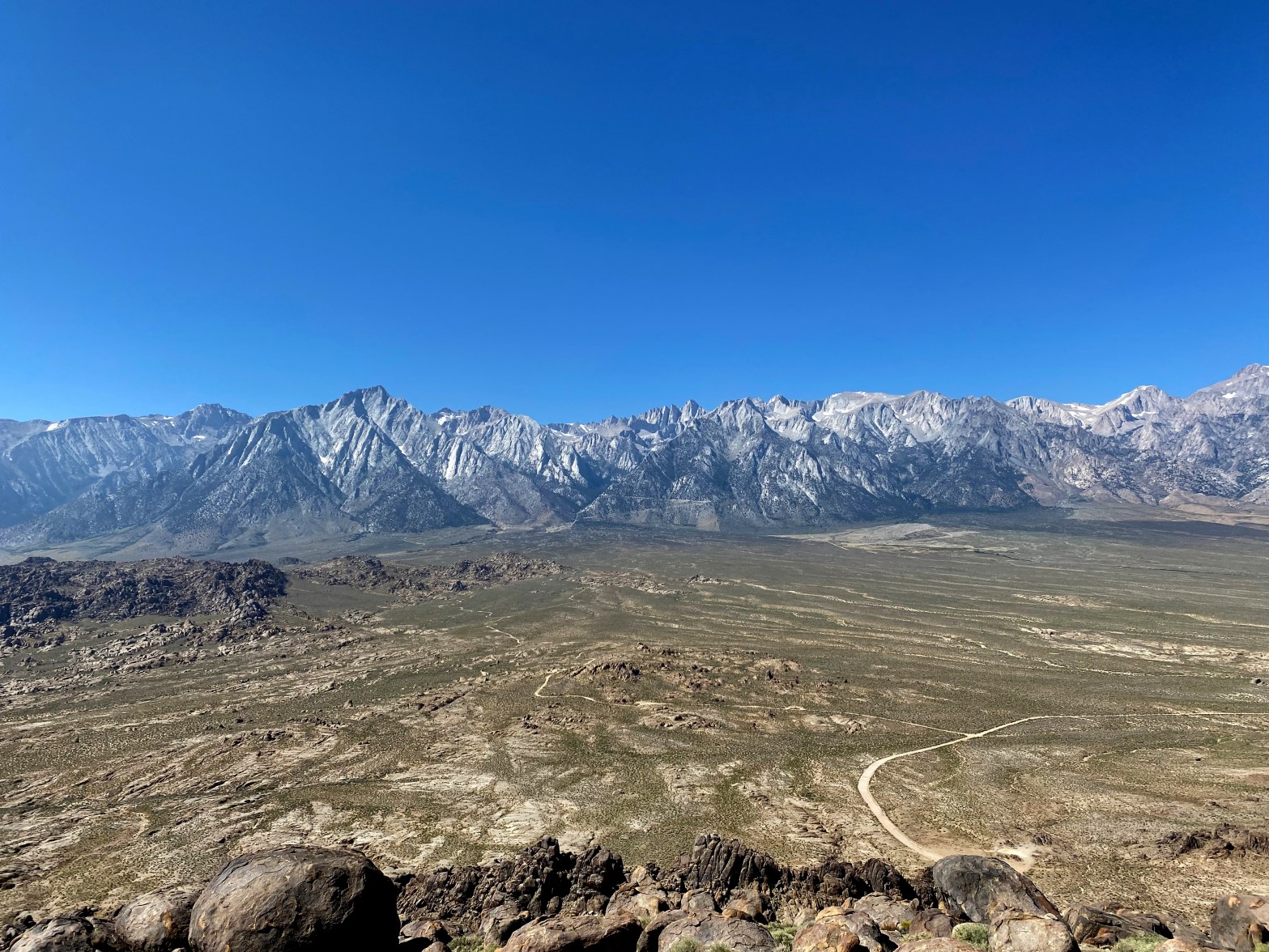
A spectacular view of the Whitney Crest from the high point of the Alabama Hills 22 SEPTEMBER 2023 W6/SS-636 Elevation: 5,413′ Route: Cross country Hike Distance: .8 miles round trip Elevation Gain: 500′ Navigation: A bit tricky Steepness: Moderate Vehicle: Passenger car Road: Good dirt road Cell Coverage: Spotty (Verizon) Didn’t check APRS Hike basicsContinue reading “Alabama Hills”
Cirque Peak – Mountain Goat!

Dab me up, Mr. Smith! Here is the latest W6 Mountain Goat to join the herd. Mt. Langley in the background. Photo by Bill Smith. 25 SEPTEMBER 2023 W6/SS-085 Elevation: 12,900′ Route: Trail and Cross country Hike Distance: 20 miles round trip Elevation Gain: 2,875′ Navigation: Easy Steepness: Moderate Vehicle: Passenger car Road: Paved roadContinue reading “Cirque Peak – Mountain Goat!”
Mountain Home Peak
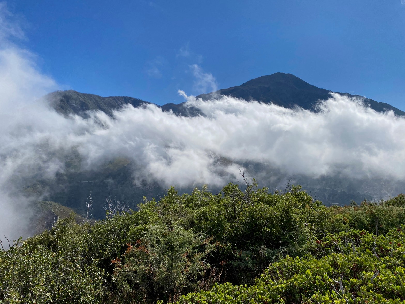
A cloud dance in front of San Bernardino Mt. morning after a very unusual winter-type storm in Southern California 3 SEPTEMBER 2023 W6/CT-090 Elevation: 7,470′ Route: Cross country Hike Distance: 1 mile round trip Elevation Gain: 500′ Navigation: Easy Steepness: Moderate to steep at the end Vehicle: Passenger car with decent clearance Road: Dirt roadContinue reading “Mountain Home Peak”
