
Alpine tableau on the summit of Agua Fria Peak 30 JULY 2022 W5N/CM-008 Route: A labyrinth of spec roads Hike Distance: 4 miles round trip Elevation Gain: 200′ Navigation: Difficult Steepness: Easy Vehicle: Passenger car Road: Good dirt road Cell Coverage: None on the summit (Verizon), Good APRS Hike basics Cassie (KG6MZR) and I triedContinue reading “Agua Fria Peak”
Monthly Archives: July 2022
Cerro Montoso

Chester the Drone shoots the summit looking south across the Taos Plateau. 19 JULY 2022 W5N/OT-022 Route: 4×4 track and cross-country Hike Distance: 4 miles round trip Elevation Gain: 728′ Navigation: Moderate to difficult on the way down Steepness: Gentle Vehicle: High clearance vehicle Road: Mostly good dirt. DRY WX only Cell Coverage: None (Verizon)Continue reading “Cerro Montoso”
Sierra de Don Fernando
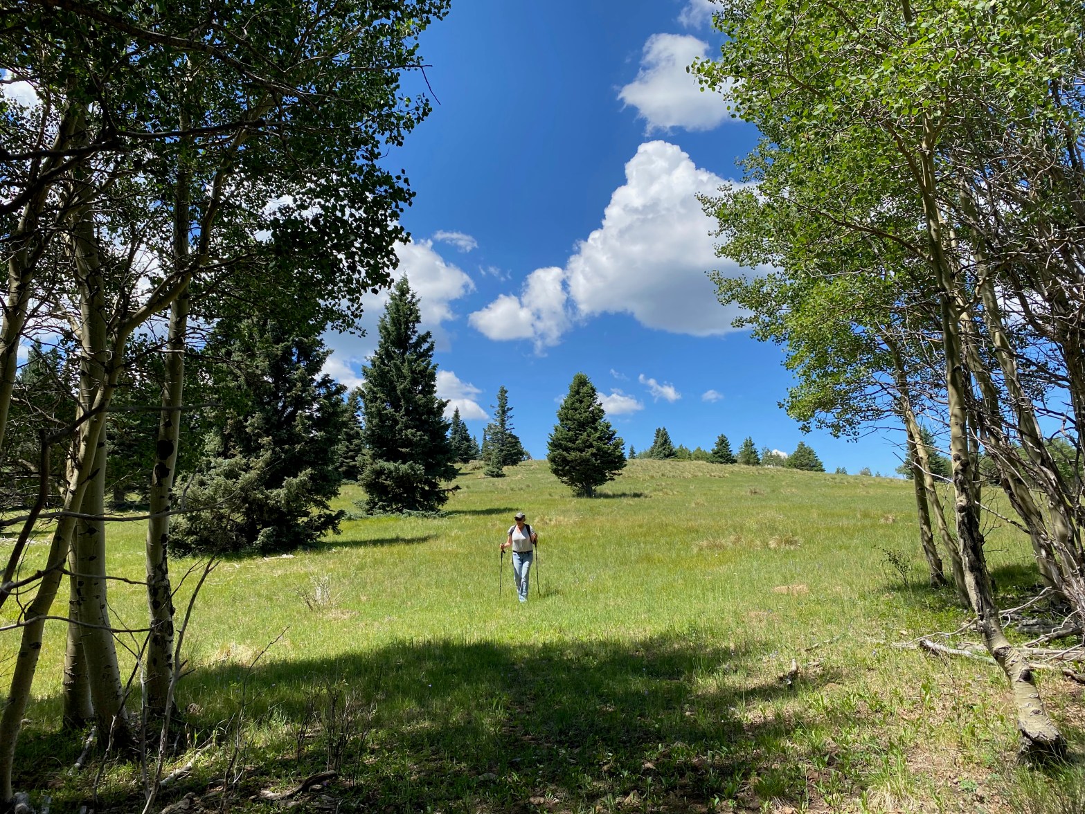
Cassie (KG6MZR) makes her way down through an alpine meadow near the top of Sierra de Don Fernando. 17 JULY 2022 W5N/SS-024 Route: Forest service road & cross country on use and game trails Hike Distance: 3 miles round trip Elevation Gain: 300′ Navigation: Moderate Steepness: Easy Vehicle: Passenger car Road: Rough dirt road Coverage:Continue reading “Sierra de Don Fernando”
Cerro de los Taoses

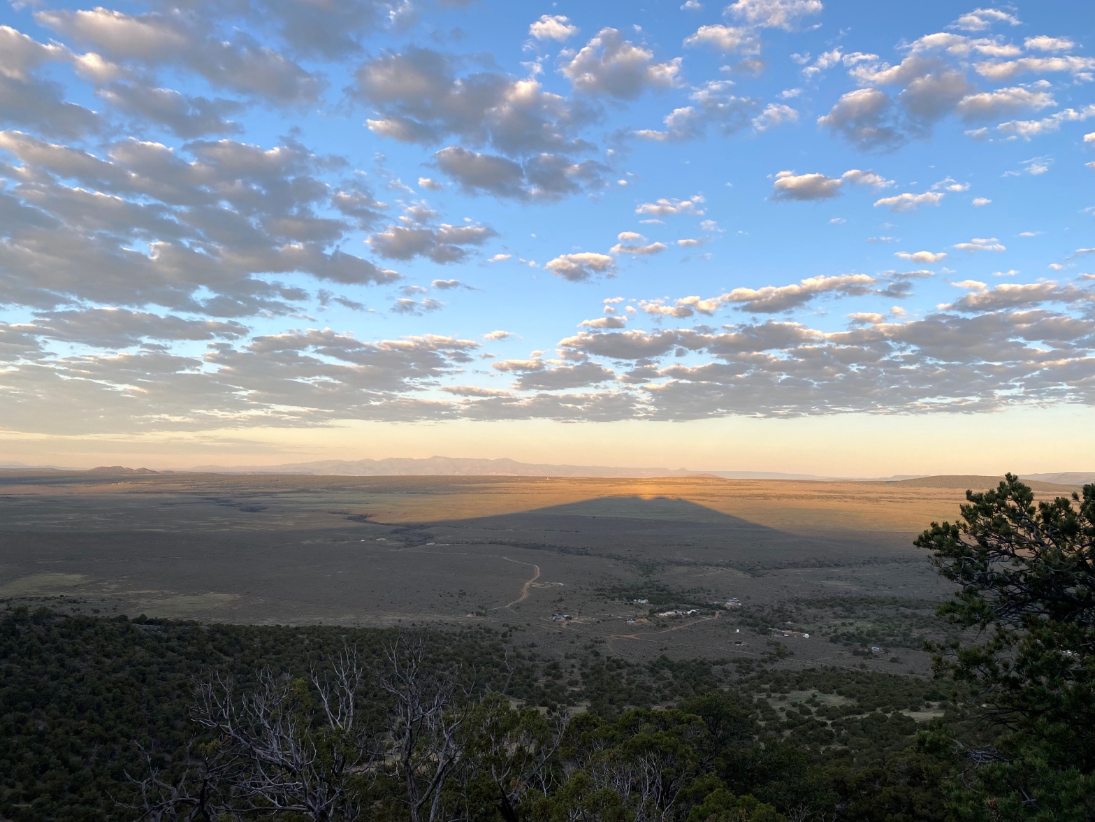
Looking south at dawn toward Tres Orejas (W5N/OT-026) and Santa Fe Baldy. 14 JULY 2022 W5N/OT-025 Route: Wide open cross country Hike Distance: 1.2 miles round trip Elevation Gain: 400′ Navigation: Easy Steepness: Easy Vehicle: High clearance passenger vehicle Road: Seasonal, very rocky at the end. Cell Coverage: Fair (Verizon) Hike basics For this reallyContinue reading “Cerro de los Taoses”
Tres Orejas
Sunrise on the way up 8 JULY 2022 W5N/OT-026 Route: Cross-country Hike Distance: .8 miles round trip Elevation Gain: 530′ Navigation: Easy Steepness: Steep Vehicle: Passenger car Road: 9 miles dirt (dry weather only!) Cell Coverage: Indeterminate. My phone had to be reset after this trip. Hike basics Last winter I attempted to do TresContinue reading “Tres Orejas”
Navajo Point

Sunrise on the Cedar Breaks the day before on the way to Brian Head. 2 JULY 2022 W7U/IR-002 Route: Jeep track and coss-country Hike Distance: .3 miles round trip Elevation Gain: 250′ Navigation: Easy Steepness: Moderate Vehicle: Passenger car Road: One mile good dirt road Cell Coverage: Unknown – forgot my cell! Hike basics PerhapsContinue reading “Navajo Point”
Brian Head

Brian Head, Utah 1 JULY 2022 W7U/SU-017 Full write-up to follow. Stay tuned… Route: Drive-up Hike Distance: 200′ Elevation Gain: 0′ Navigation: Easy Steepness: Easy Vehicle: Passenger car Road: 3 miles good dirt Cell Coverage: Good (Verizon) Hike basics
