Cleghorn Mountain

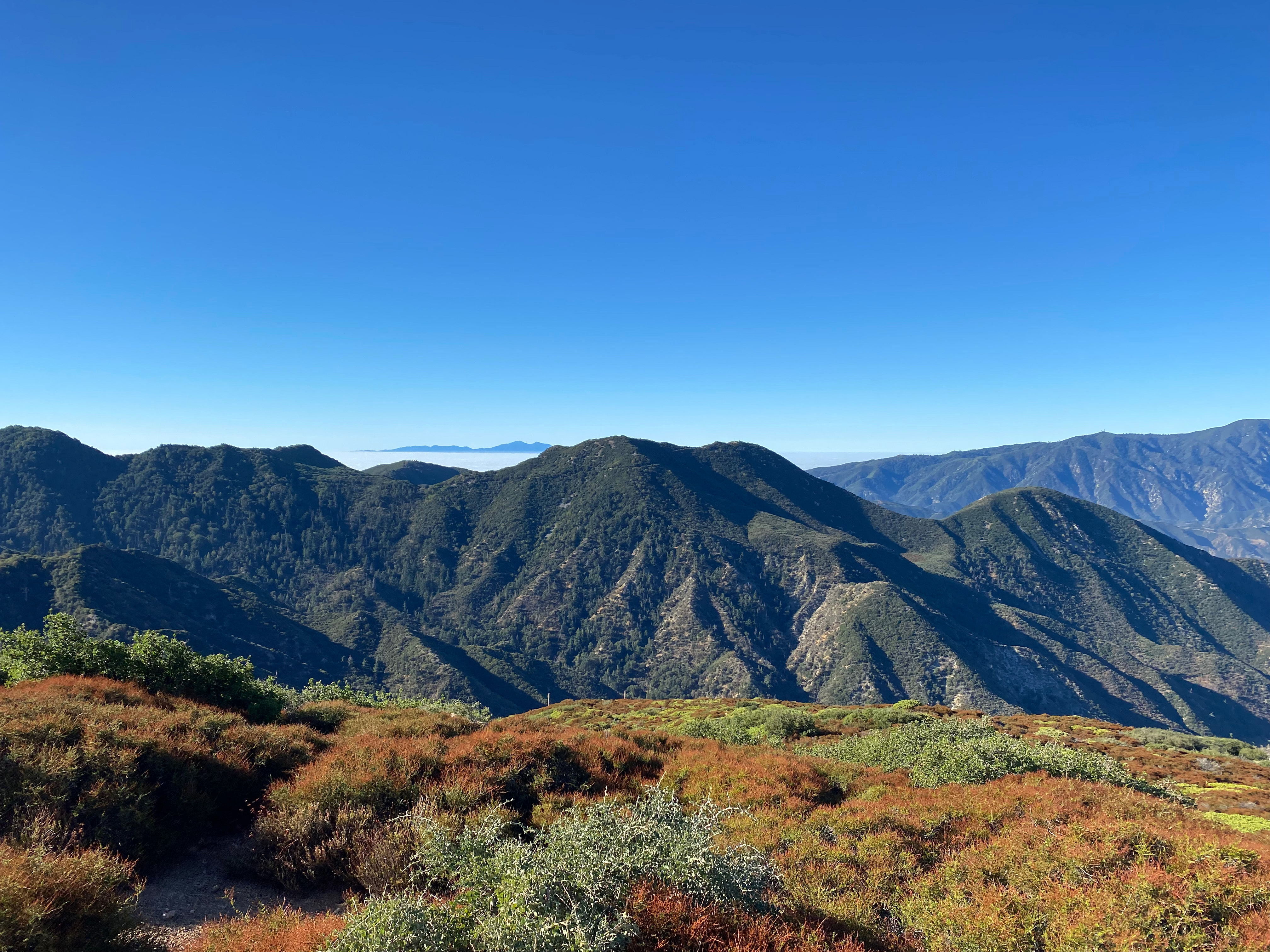
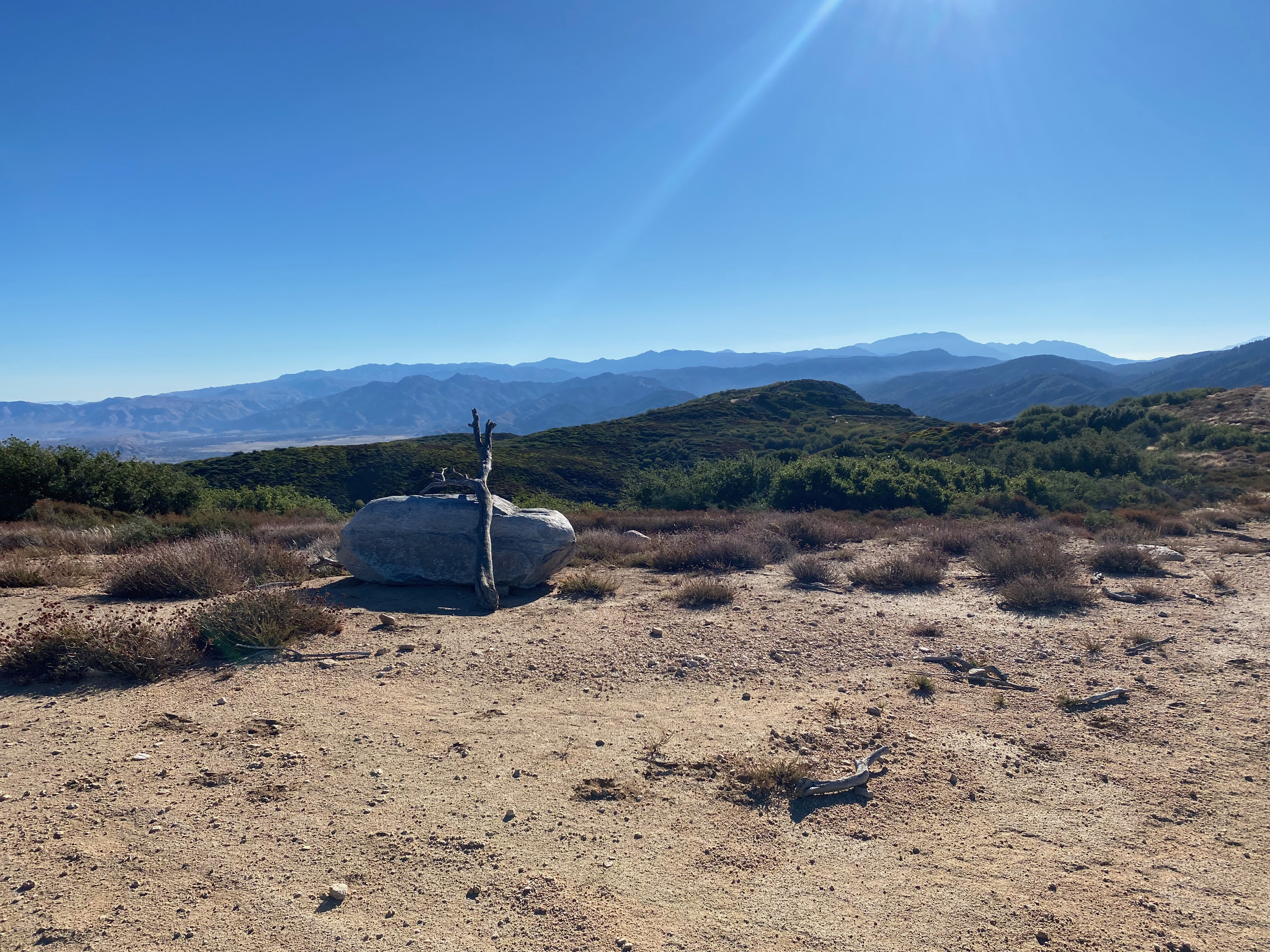
The San Andreas Fault Zone northwest of Cleghorn Mountain at sunrise.

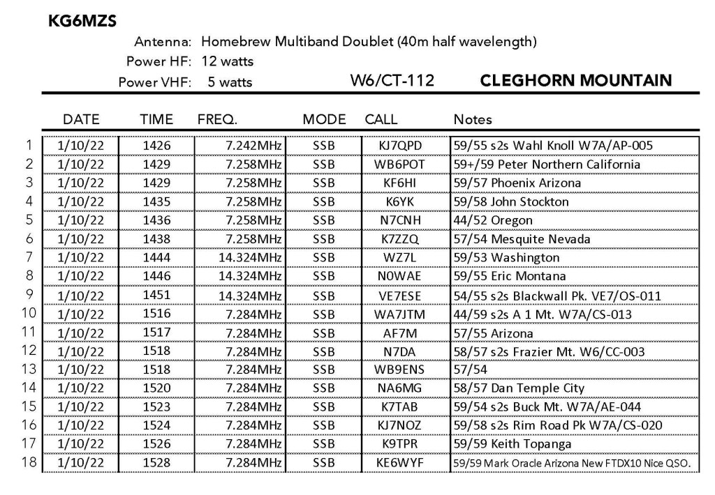
1 OCTOBER 2022 W6/CT-112

One star – Nothing special but I’d do it again.
Elevation:5,333′
Route: Firebreak
Hike Distance: .2 mile roundtrip
Elevation Gain: 80′
Navigation: Easy
Steepness: Gentle
Vehicle: High clearance SUV recommended
Road: Forest service dirt
Cell Coverage: Good (Verizon), APRS Excellent
Hike basics

Post to follow…. Stay tuned….

A nice large granite boulder on the summit made a nice table to operate from
The big San Gabriel Mountains looking west at sunrise
The station wide
Santiago Peak just over Cajon Mountain.
Looking east at the big San Bernardino Mountains – San Gorgonio on the right.

Leave a Reply

Fill in your details below or click an icon to log in:

WordPress.com Logo

You are commenting using your WordPress.com account. Log Out /  Change )

Twitter picture

You are commenting using your Twitter account. Log Out /  Change )

Facebook photo

You are commenting using your Facebook account. Log Out /  Change )

Connecting to %s

Published by wringmaster

I'm a graphic artist in the movie business. When I was a kid I got interested in astronomy. When it would get too cloudy to observe the heavens, my buddy and I would sit at the VFO of his Hallicrafters S 38c like safe crackers trying to coax faraway signals out of that humble radio. My love of astronomy and radio survive to this day fifty+ years later.

Leave a Reply

Fill in your details below or click an icon to log in:

WordPress.com Logo

You are commenting using your WordPress.com account. Log Out /  Change )

Twitter picture

You are commenting using your Twitter account. Log Out /  Change )

Facebook photo

You are commenting using your Facebook account. Log Out /  Change )

Connecting to %s

%d bloggers like this: