
Looking southwest at the station on the summit.
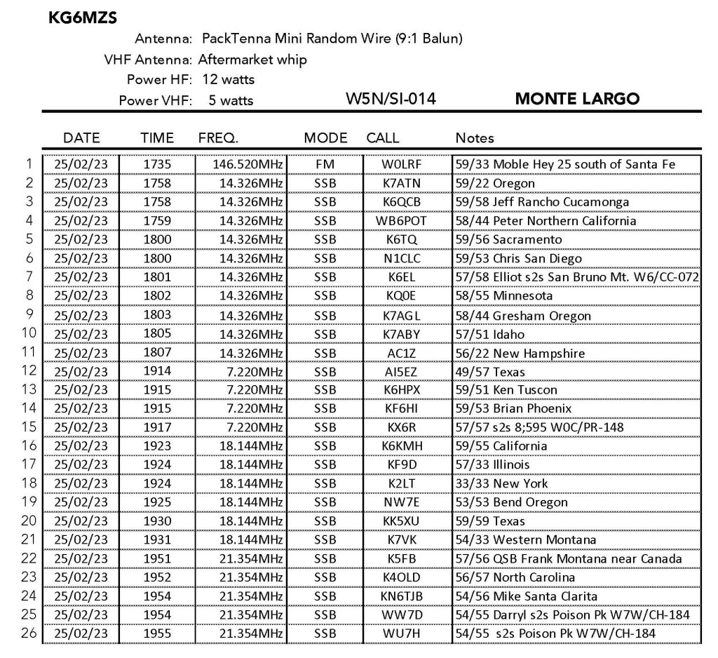
25 FEBRUARY 2023 W5N/SI-014

| Elevation: | 7,710′ |
| Route: | Use trail |
| Hike Distance: | 2.6 miles round trip |
| Elevation Gain: | 675′ |
| Navigation: | A bit tricky |
| Steepness: | Moderate |
| Vehicle: | Passenger car |
| Road: | Paved |
| Cell Coverage: | None (Verizon), APRS Excellent |
Due to heavy snowfall in New Mexico I limited my activations on this trip to some of the lower summits. Monte Largo was on my list to do as a complete and because of Fred KT5X’s glowing reports. As usual, there were a few flies in my SOTA ointment for this one. First, while I checked out the map the day before, I failed to load the detailed map into my Gaia GPS on my phone. This usually isn’t a problem if there is cell service but for some reason I had no cell service on this entire trip until I rebooted my phone in Albuquerque on the way back. I’m not sure if there actually was no cell service as reported above, or if it was just an iPhone glitch. So this meant that I had to negotiate the confusing approach through the neighbourhood from memory. This proved to be rather trying as this part of Sandia Park is a checker board maze of cul de sacs.
Then there was the matter of the hiking route itself. There is a pretty well established use trail to the summit, but I took a wrong turn (again due to not having the map downloaded) and ended up doing cross-country route.

On the way down I saw the actual use trail but didn’t take it just in case it led to some other completely different trailhead. The devil you know and all that. It was all good, however, it just made the whole thing a little more challenging. A good lesson in old-school route finding.
The activation was quite enjoyable and the wind eased enough for Chester the drone to fly. here is a short video of the summit:


Leave a comment