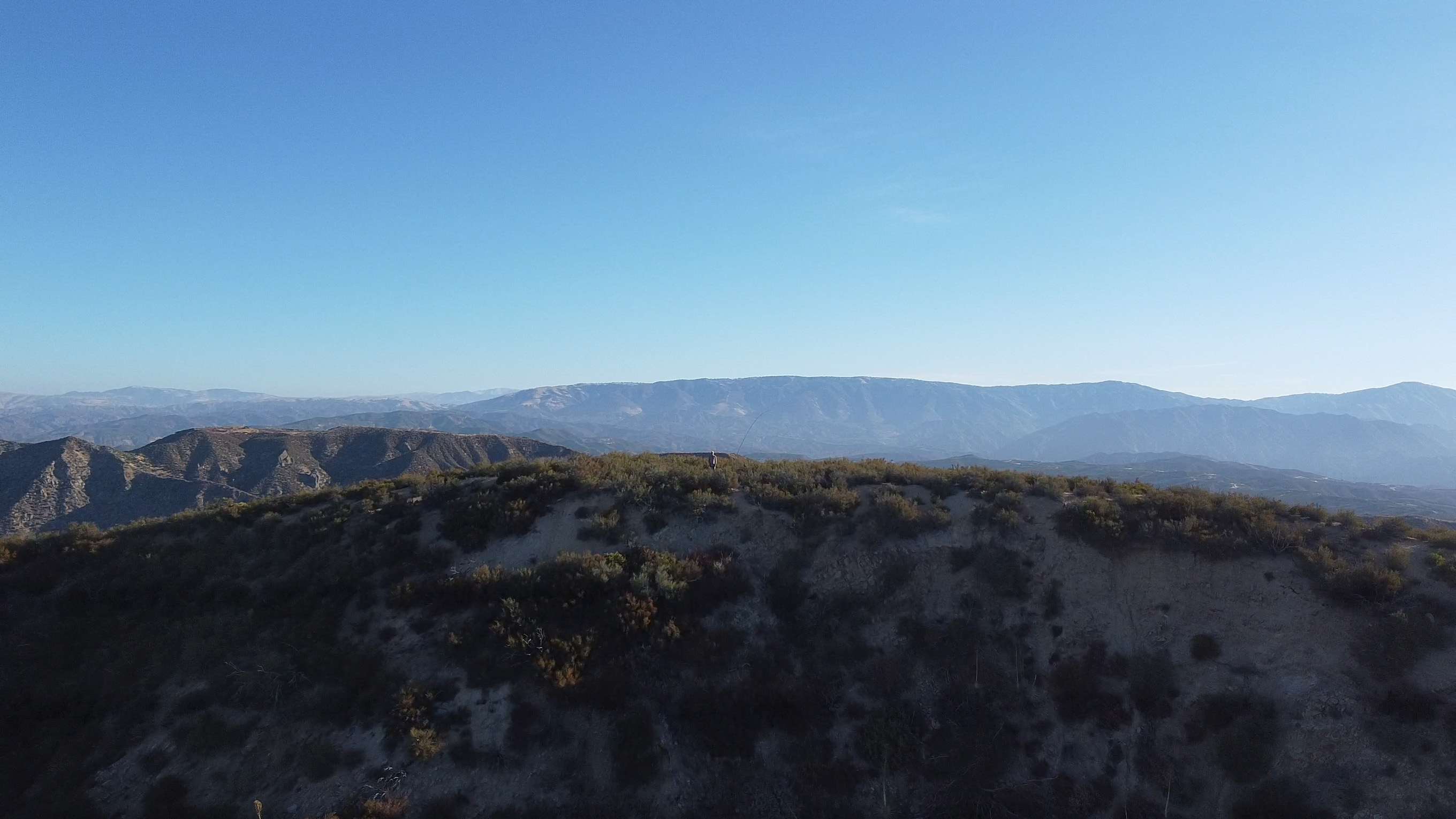
Looking south from this fine peak at the Mt Sill and the Palisades. Mt Tom is the prominent peak in the middle
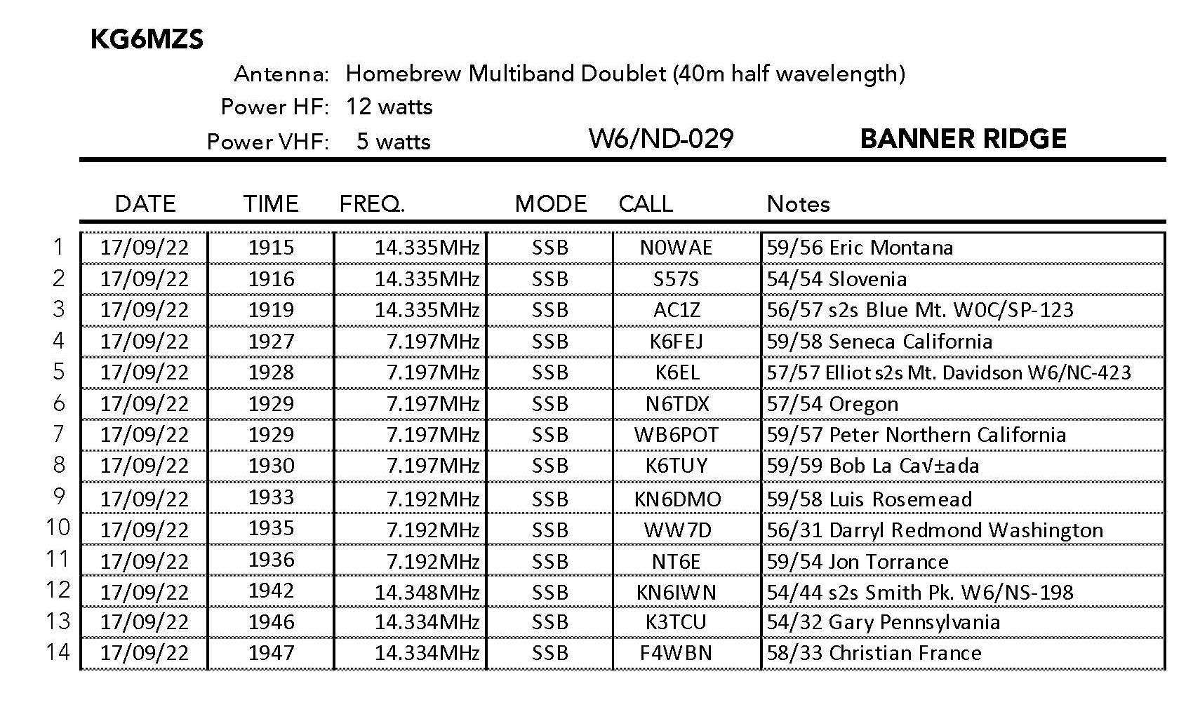
17 SEPTEMBER 2022 W6/ND-029
Three stars – Highly recommended.
Elevation:
4,580′
Route:
Cross country
Hike Distance:
2.2 miles round trip
Elevation Gain:
800′
Navigation:
Tricky
Steepness:
Extremely steep
Vehicle:
Passenger car
Road:
Good dirt road
Cell Coverage:
n/a
Hike basics
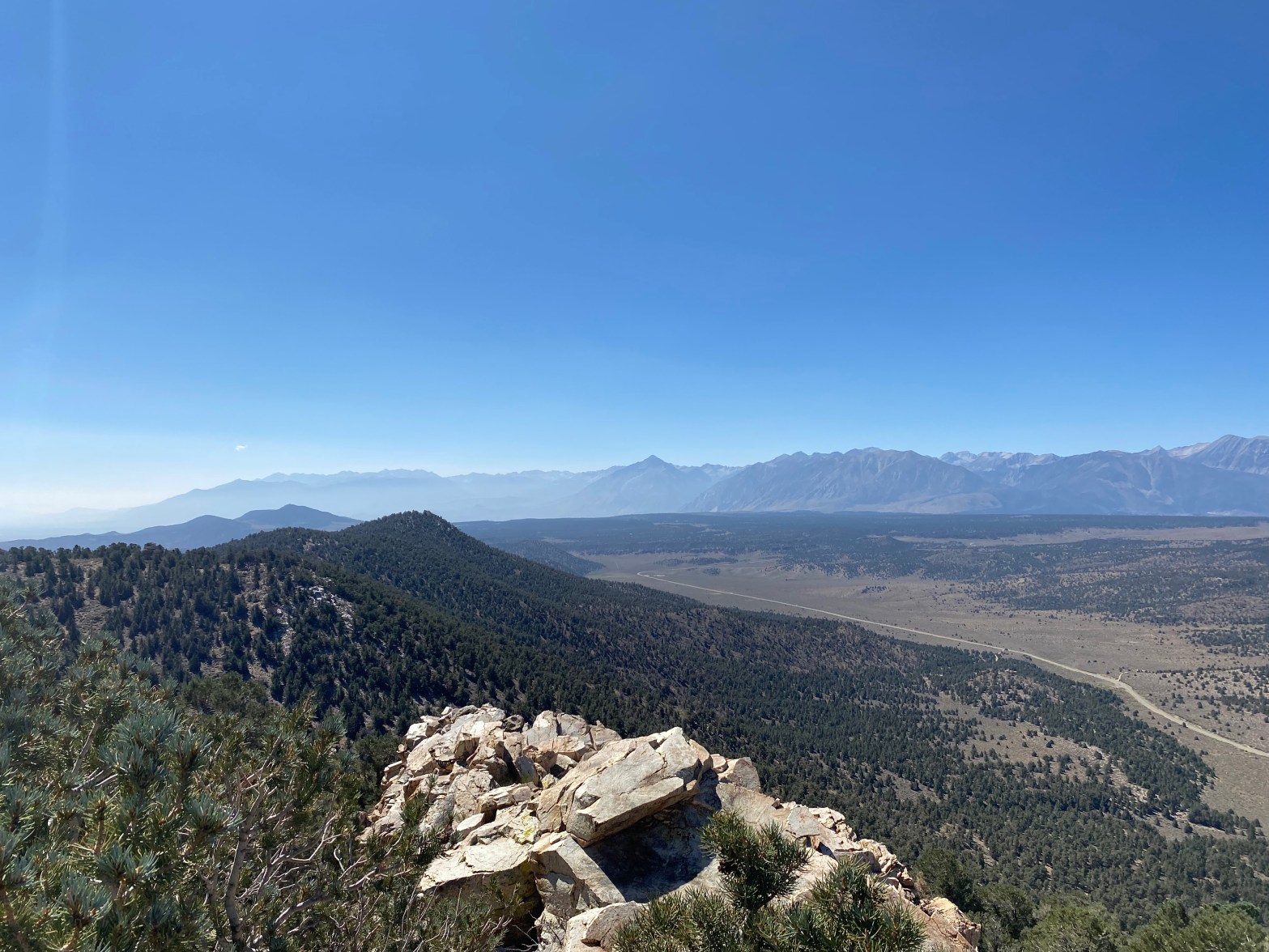
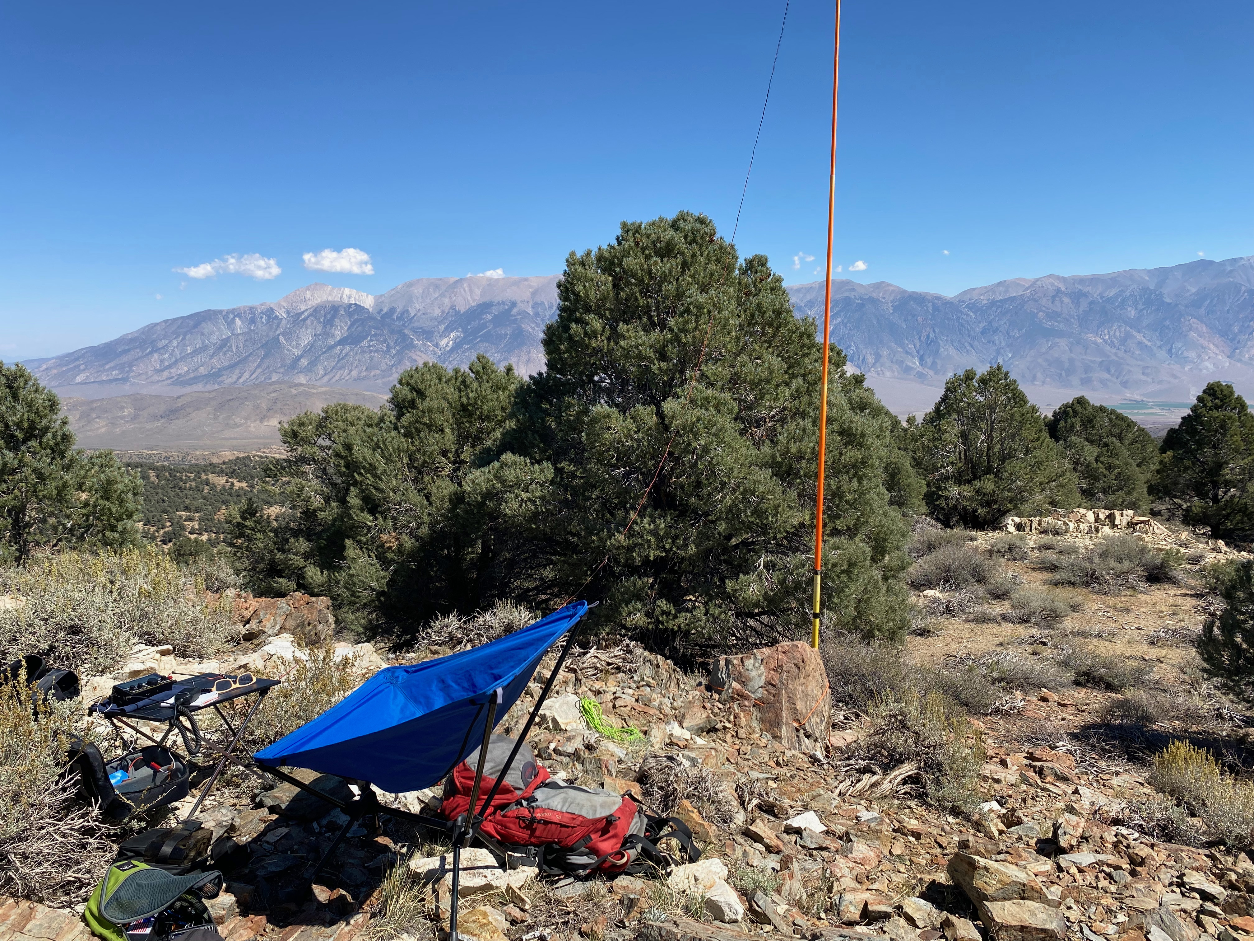
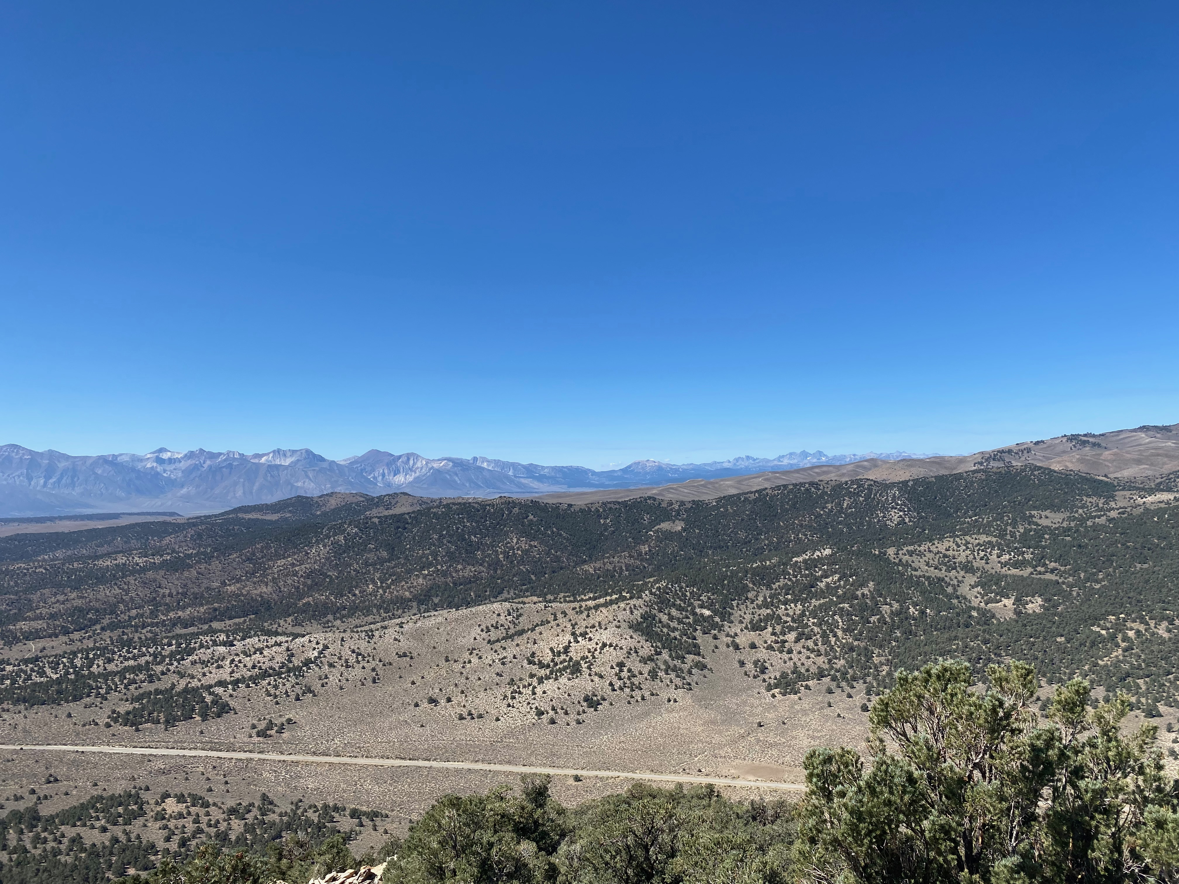
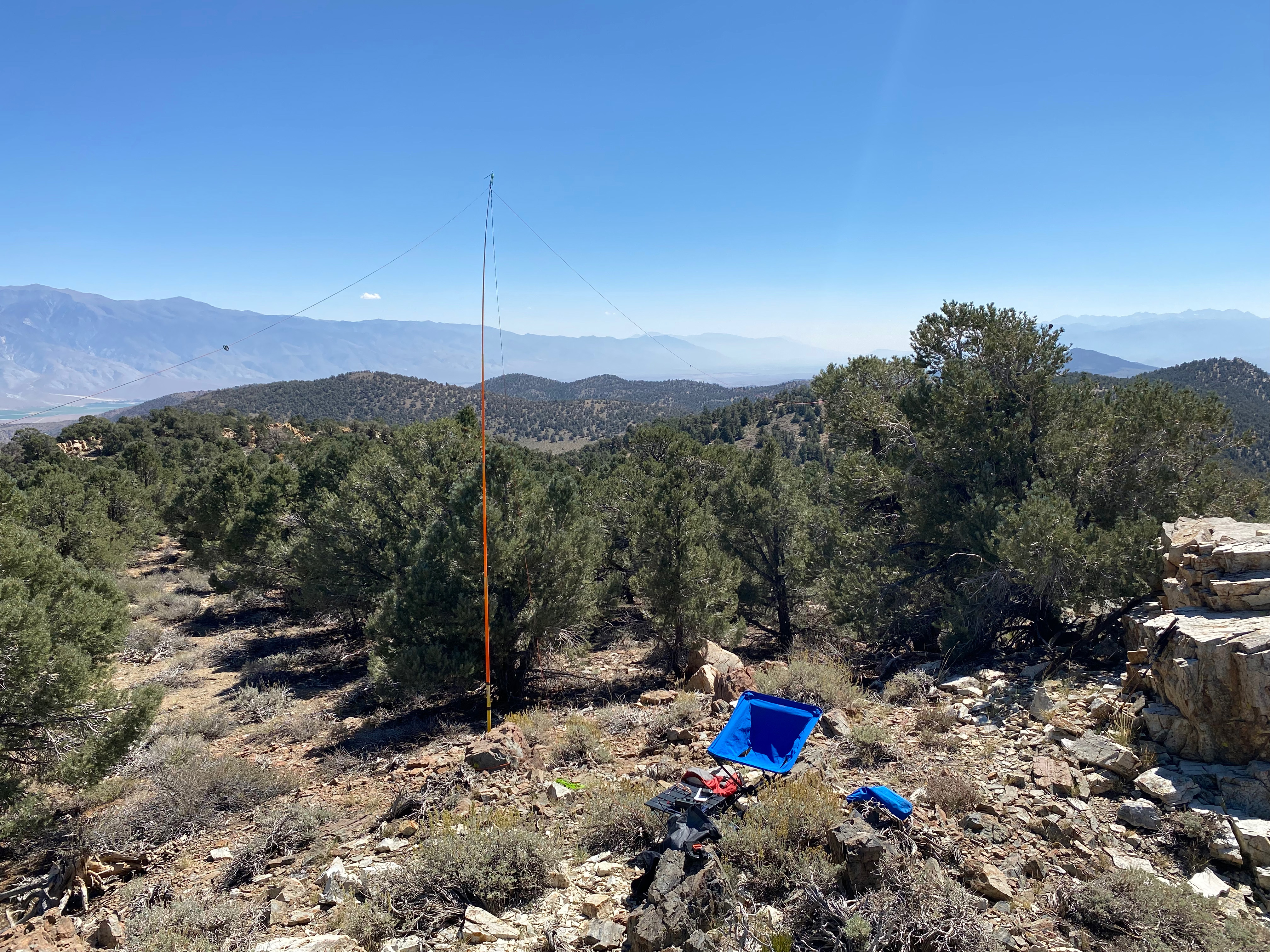
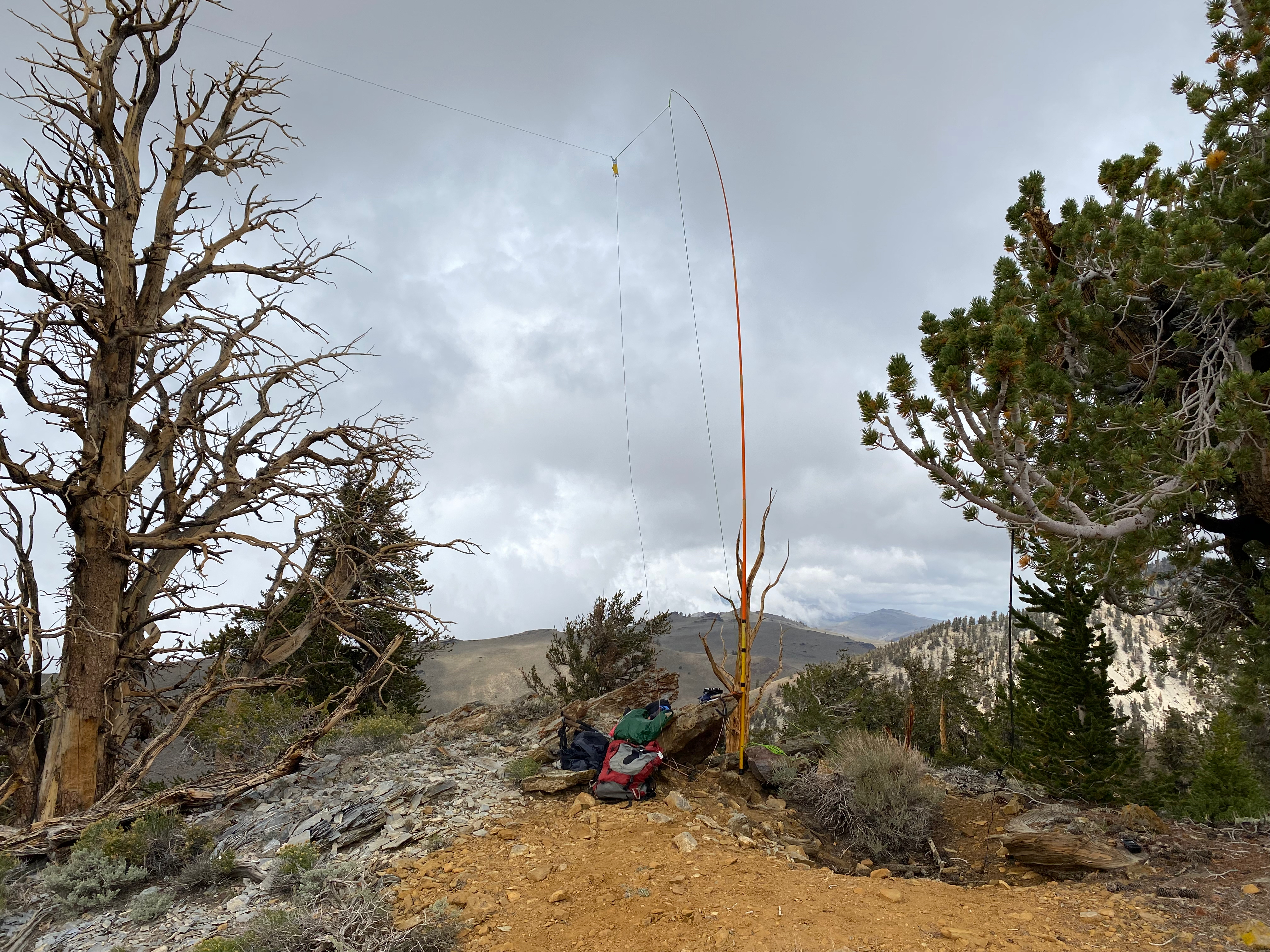
After completing 37 miles of the John Muir Trail with a 38 pound backpack, my good friends Bill Smith, Steve Tennant and I hung out in Lee Vining overnight. In the morning after we had said our farewells, I decided to head out to the Benton Range and activated the highest point – Banner Ridge.
This turned out to be a spectacular idea. I would rate this summit 3 stars for the view and the overall wilderness experience. It just missed getting 4 stars (a classic) as it is a easy hike but it is over some wonderful terrain.
I traveled along the south shore of Mono Lake on highway 120 east – a section of California I had never seen. Before you reach Benton Hot Springs, turn south on Benton Crossing Road. Then drive south to forest service road 3S50 and turn left.
The hike is up a moderately steep hill that is pretty easy to navigate. I was rewarded with a terrific view of the Sierra Nevada from the Palisades to Yosemite. The register went back to 1967! I got very nostalgic recalling all my family’s pilgrimages to an isolated cabin on Twin Lakes out of Bridgeport back in the early sixties. What a different place 395 was back then.
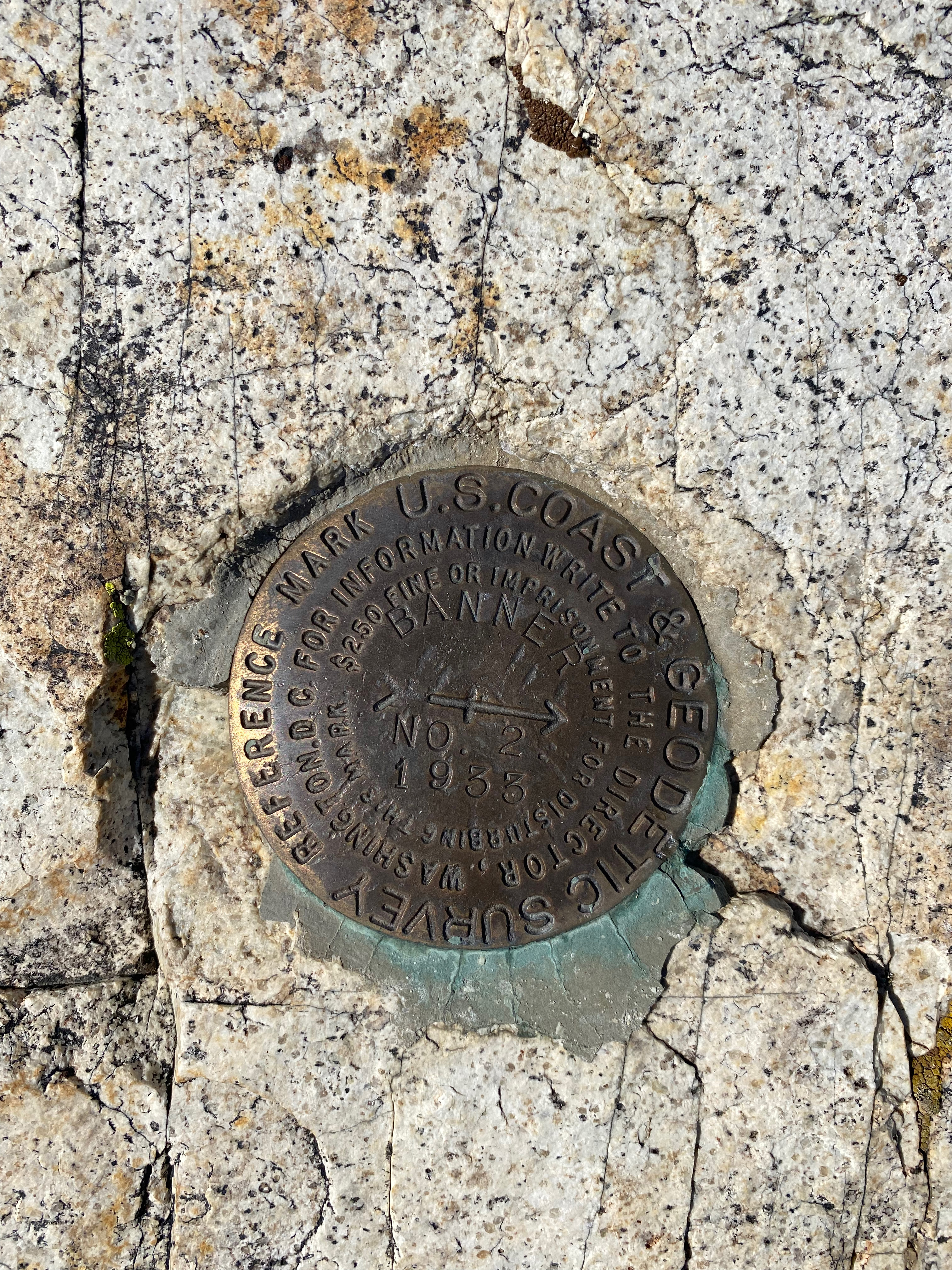
The station with Boundary Peak, Nevada in the background.Looking west across Benton Crossing Road to Mount Ritter and Banner.The station looking south donw the Owens valley with White Mountain Peak on the left.One of two bencjmarks on the summitGold Crown mine.
Mt. Ritter and Banner (Partially hidden in the clouds) and the Minarets off to the west with the San Joaquin Ridge in between.
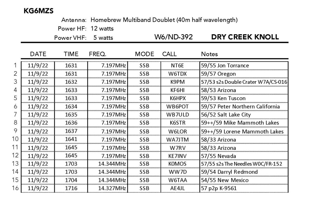
11 SEPTEMBER 2022 W6/ND-392
Three stars – Highly recommended.
Elevation:
8,851′
Route:
Forest service road & cross country
Hike Distance:
2.5 miles round trip
Elevation Gain:
500′
Navigation:
Easy
Steepness:
Gentle
Vehicle:
Passenger car
Road:
Paved
Cell Coverage:
Good (Verizon), APRS Excellent
Hike basics
Getting ready to do the next leg of our piecemeal John Muir Trail attempt, I arrived in Mammoth Lakes two nights before our permit to start from Tuolumme Meadows. I had been up in the White Mountains the day before activating two 10,000′ unnamed summits, so I looked around the Mammoth area for a nice stroll of a hike. Dry Creek had the attraction of being probably the easiest 3 bonus points I would ever earn as a ND (Northern Desert) summit just before the September 15 cutoff, plus it would be a complete as I had worked a few different SOTA activators from there.
After the downpour in the White Mountains the day before from Tropical Storm Kay, the day dawned sparklingly clear. The turnoff is a very short drive from the town of Mammoth Lakes on the Mammoth Scenic Loop. While Whitedog with 4 wheel drive probably could’ve made all most all the way to the summit, I parked just off the scenic loop just to get the exercise in preparation for the JMT.
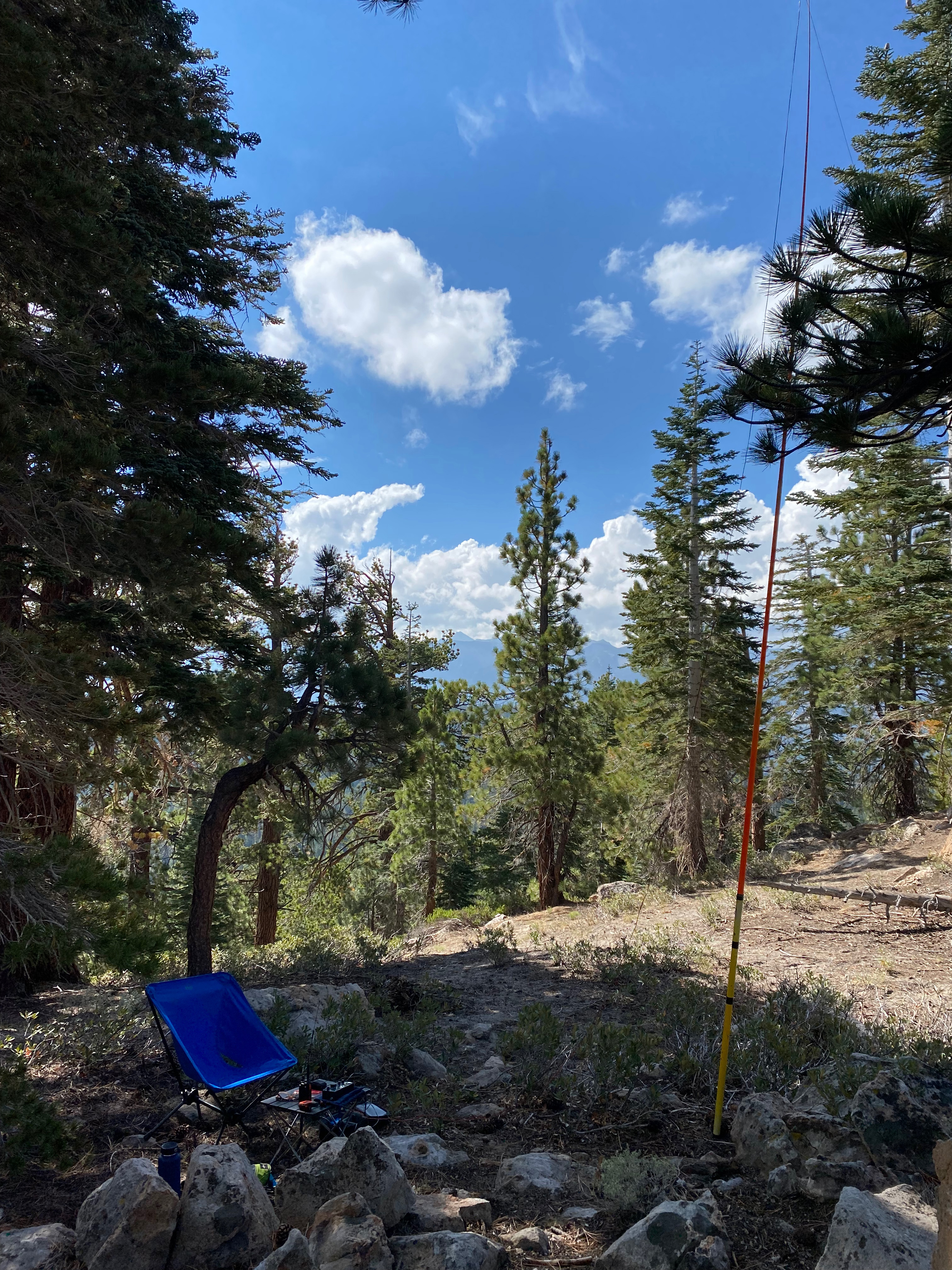
I give this hike three stars – a solid recommendation as it is a very nice walk through the woods with a great forested summit to hang antennas. If the view was a bit more open of the Minarets and Ritter and Banner it might’ve rated 4 stars in my book.
Radio conditions were okay with a surprise call from Lorene W6LOR and Mike K6STR just down the hill in Mammoth Lakes! They were on their way out and I was sorry to miss them. It would have been a perfect summit day to fly Chester, but I didn’t bring him along after the stormy weather had kept him grounded on the previous two summits the day before.
Looking north up the White Mountains with some serious weather moving in.
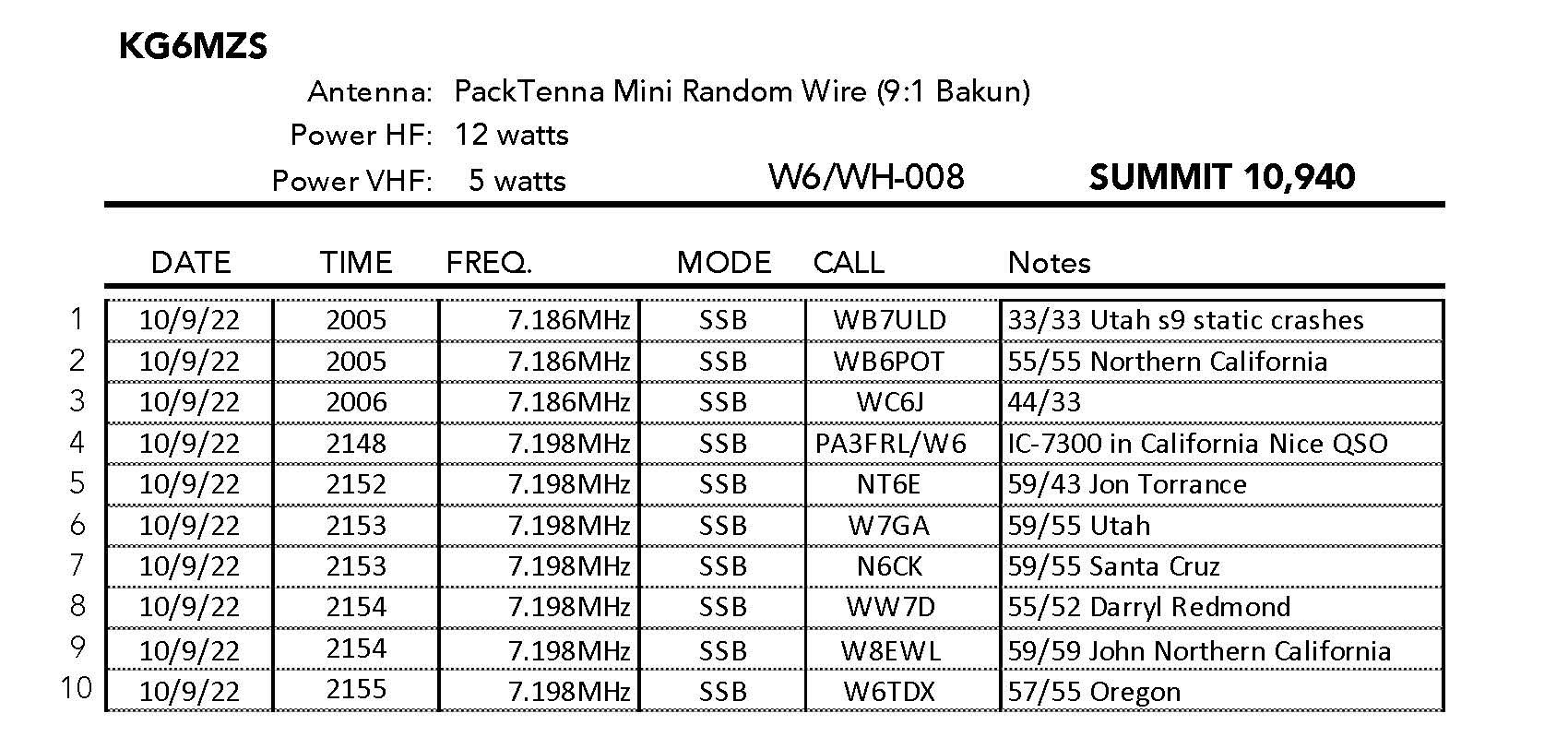
10 SEPTEMBER 2022 W6/WH-008
One star – Nothing special but I’d do it again.
Elevation:
10,940′
Route:
Use trail and cross country
Hike Distance:
.3 miles round trip
Elevation Gain:
150′
Navigation:
Easy
Steepness:
Moderate
Vehicle:
Passenger car
Road:
Good dirt road
Cell Coverage:
None (Verizon), APRS Excellent
Hike basics
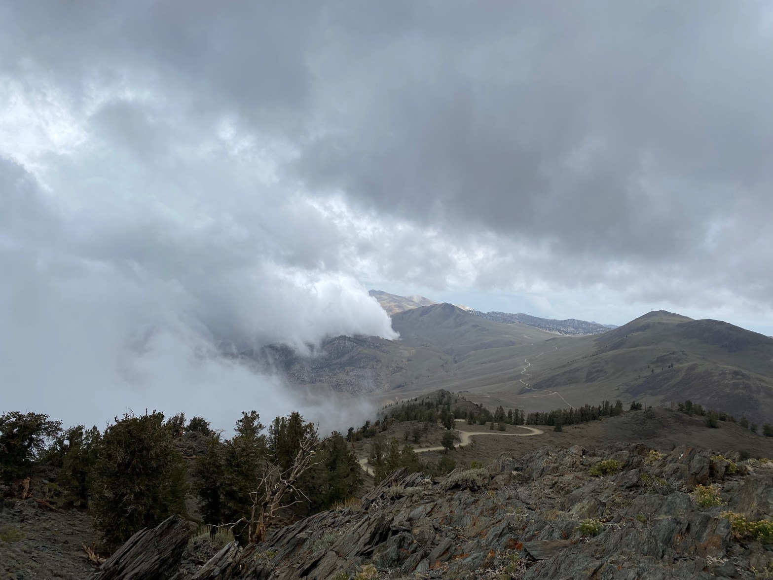
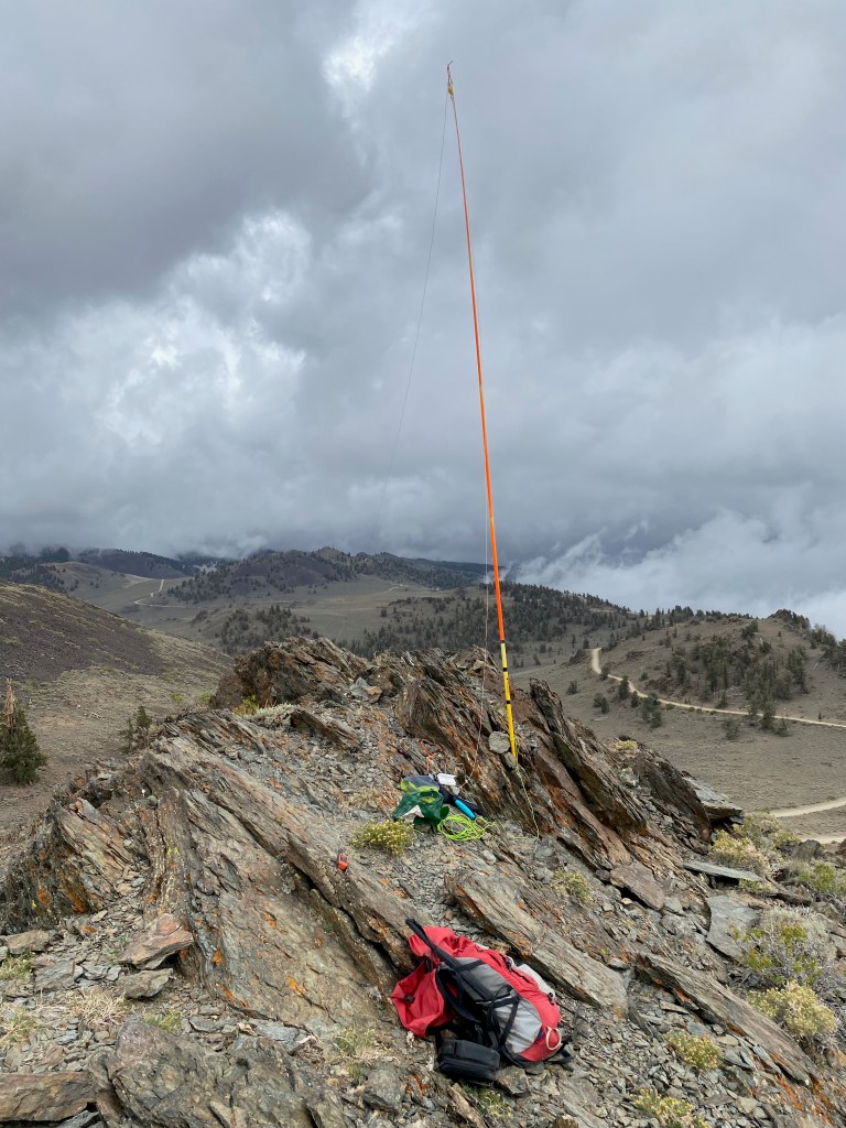
After my frenzied activation of W6/WH-009 I drove on past the Bristlecone Pine Monument entrance on White Mountain Road thinking I might try County Line Peak. Soon the road turns to a well scraped dirt road, but I kept in mind that it could get wet this stormy day with Tropical Storm Kay in the area. …oh boy, could it as I was to find out later.
When I reached the high saddle next to summit 10,940′ W6/WH-008, I could see that County Line Hill was a good deal further down White Mountain Road and I decided not to chance it in the unsettled weather. The hike is a short scramble up the north side of the summit. I quickly set up the PackTenna and didn’t set up the table or chair in favor of brevity. It was starting to cloud up again. There were HUGE static crashes on 40m. I made 10 contacts and started packing up as big fat raindrops started to fall.
Once back at Whitedog it really opened up and started raining in earnest. As I carefully made my way down White Mountain Road a drowing downpour ensued. Rocks, sand, mud, and pine cones washed all over the road. What an adventure!
I gave this summit one star and I would recommend it. It would probably get two stars if the view of the Sierra crest was clear.
The hasty stationLooking south as the weather moves inLooking back to the roadhead. County Line Hill on the left.
Looking north toward White Mountain Peak on an unsettled weather day as Tropical Storm Kay slowly enters the region. That’s Clem Nelson Peak on the right just in the clouds a bit.
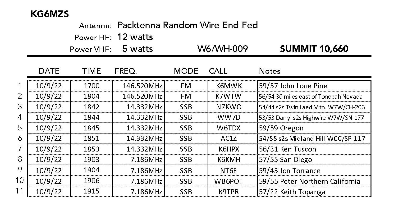
10 SEPTEMBER 2022 W6/WH-009
One star – Nothing special but I’d do it again.
Elevation:
10,660′
Route:
Old mining road and cross country
Hike Distance:
1 miles round trip
Elevation Gain:
550′
Navigation:
Easy
Steepness:
Moderate
Vehicle:
Passenger car
Road:
Good paved road
Cell Coverage:
Poor/None (Verizon), APRS Excellent
Hike basics
This crazy activation ended up being one of my most discombobulated summit to date. I woke up very early in Topanga Canyon after two very unusual days of rain in September thanks to Tropical Storm Kay off the coast. I was driving up to meet my old climbing buddies Bill Smith and Steve Tennant to do the section of the John Muir Trail between Tuolumme Meadows and Mammoth starting on the 12th, two days hence.
It rained off and on on my way up 14 and 395 but the Owens Valley seemed to be in a rain shadow so I filled up with gas in Big Pine and headed up 168 to Westgard Pass. I was considering several peaks in the area but started with summit 10,660′ W6/WH-009. At first I actually got that summit confused with WH-008 but parked a quarter mile or so down from the entrance to the Bristlecone Pines.
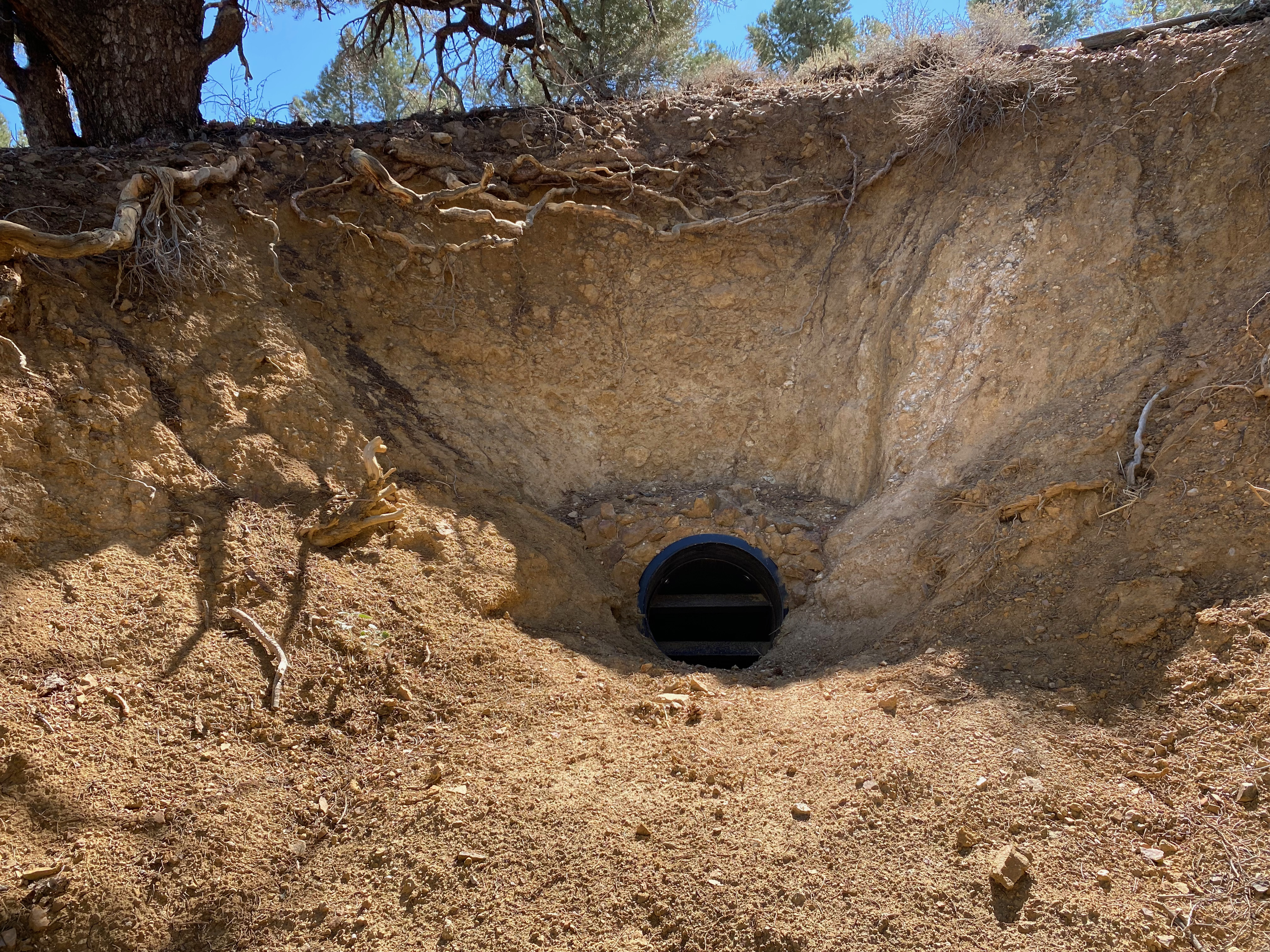
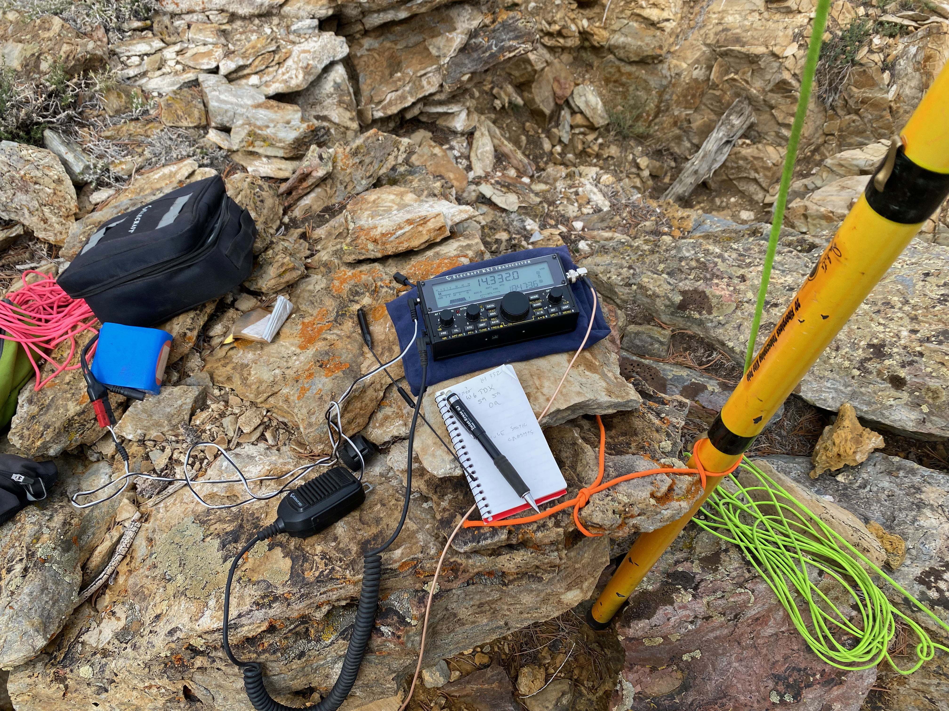
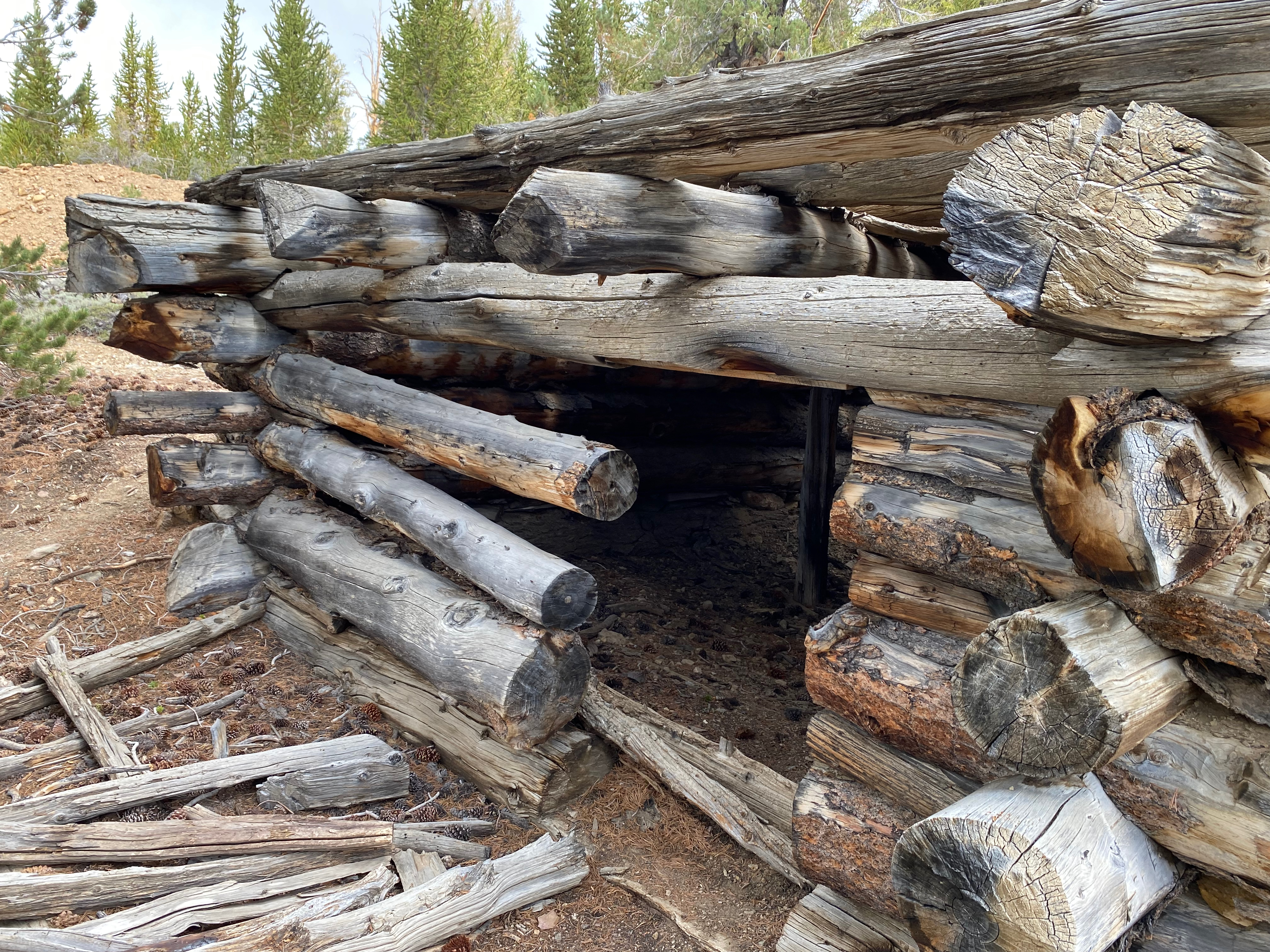
The hike is a short, moderately steep jaunt up a forested hillside. The route starts on an old mining road and goes past some ruins (see photo below). Once on the summit I quickly set up the station only to have the skies over the Owens Valley to the west get darker and darker. When the thunder got louder and closer, I quickly tore the station down and packed up. By the time I was ready to retreat down the mountain, the weather lightened up, so I got everything out and set it all up a second time!
I made a quick 11 contacts including three summit-to-summits and packed it all up again. there wasn’t much of a view due to the storminess, but It was still an interesting, if not somewhat crazy activation.
I gave this summit one star. It would probably garner two stars on a clear day with a solid view of the Sierra crest.
I went on to do W6/WH-008 next
The hastily set up station with no table or chair.The PackTenna deployedOld miner’s cabin.
Chester takes a snap of the station looking north out toward Mt Williamson and the Antelope Valley
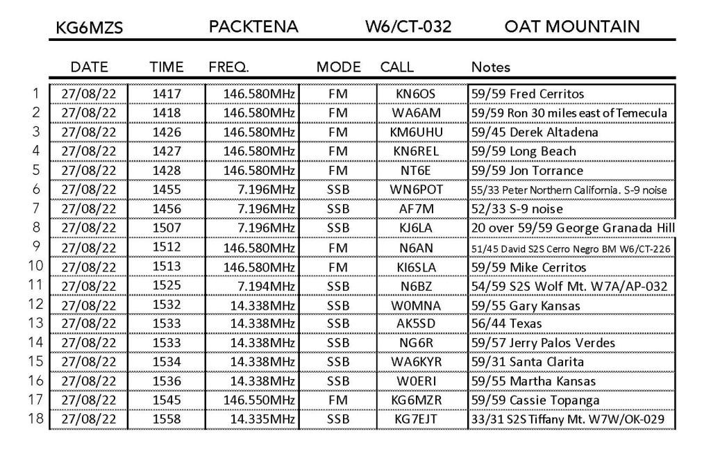
3 SEPTEMBER 2022 W6/CT-005
Three stars – Highly recommended.
Elevation:
9,138′
Route:
Forest service trail and use trail
Hike Distance:
3.6 miles round trip
Elevation Gain:
1,000′
Navigation:
Easy
Steepness:
Gentle with a moderate section at the end
Vehicle:
Passenger car
Road:
Paved Highway 2
Cell Coverage:
Poor (Verizon), APRS Excellent
Hike basics
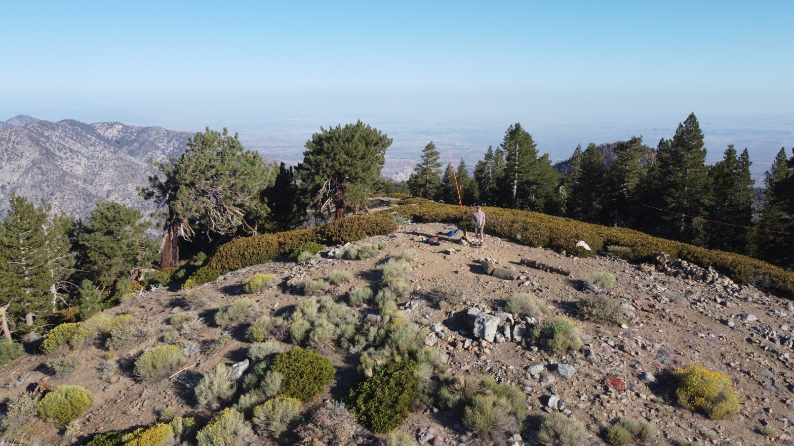
Chester the Drone flies over Throop Peak.
With a planned trip to do a 35 mile section of the John Muir Trail in a few weeks, I wanted to do a conditioning hike at a decent elevation to prepare. A third SOTA trip to Throop and a second trip to Lewis fit the bill. I got to Dawson Saddle just as the sun was rising.
The Santa Monica Mountain to the southwest at sunrise with Chatsworth and Rocky Peaks in the foreground across fields of wild oats that give Oat Mountain her name.
Looking east toward the highest point in Arizona, Mount Humphries. That’s Dogtown Reservoir in between.
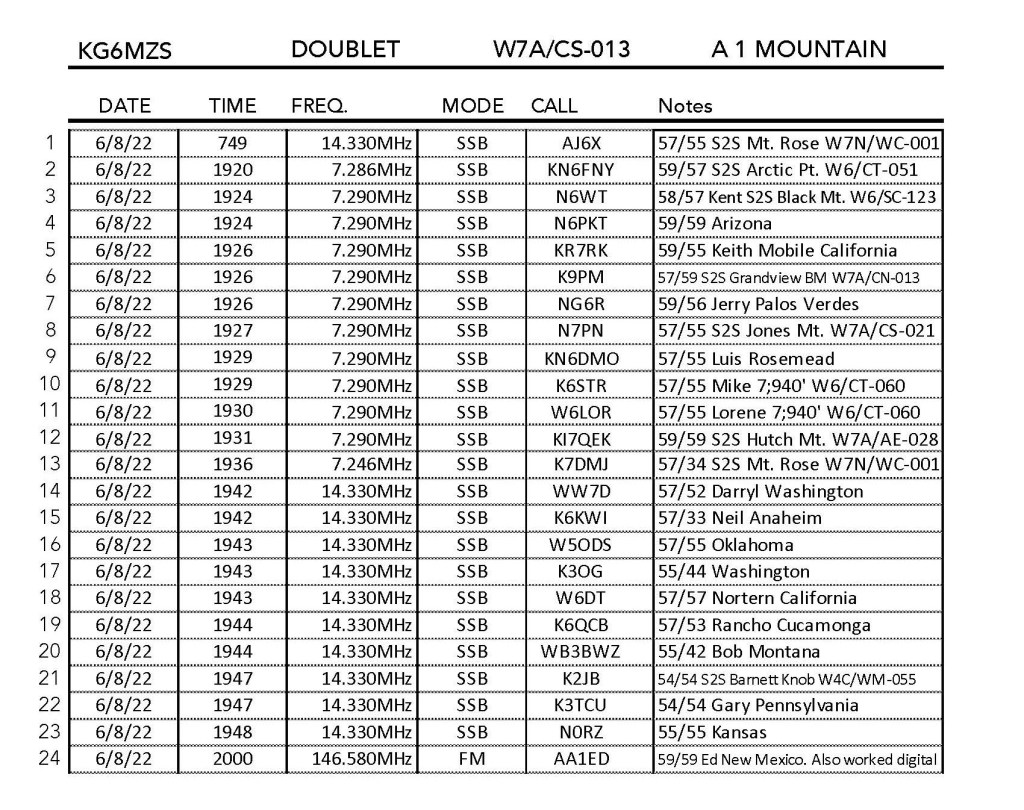
6 AUG 2022 W7A/AE-018
Elevation:
9,255′
Route:
Drive-up
Hike Distance:
n/a
Elevation Gain:
n/a
Navigation:
Easy
Steepness:
n/a
Vehicle:
High clearance SUV recommended
Road:
Dirt
Cell Coverage:
Good (Verizon)
Hike basics
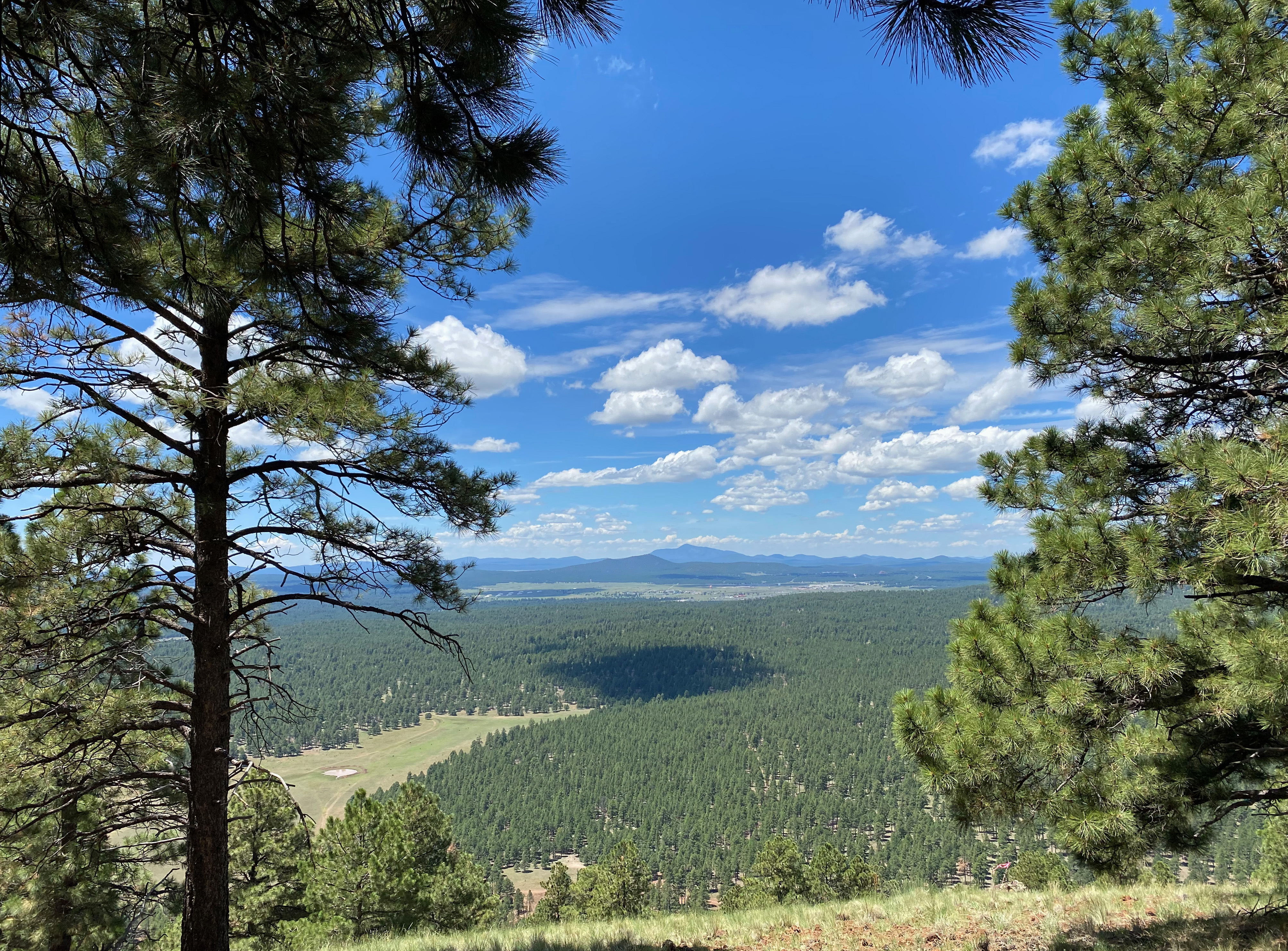
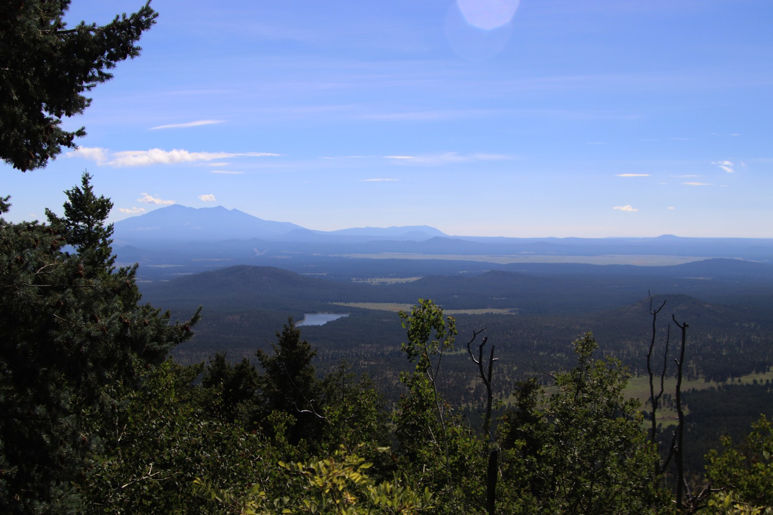
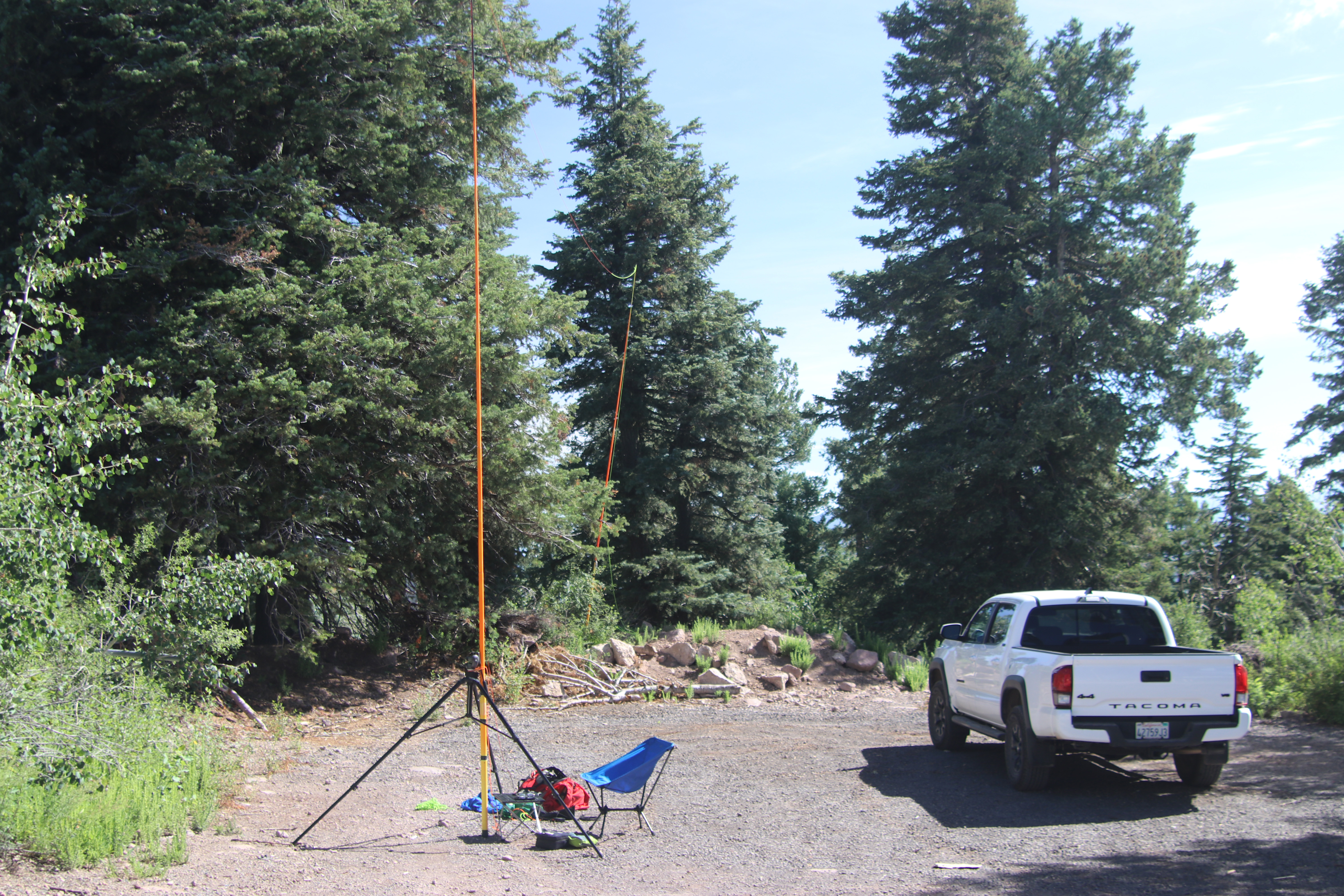
Cassie and I planned a layover in Flagstaff on Saturday on our way back from North-Central New Mexico to Topanga Canyon. I couldn’t decide on Bill Williams Mountain or A 1 Mountain, so I ended up doing both fairly easily. Cassie and I had attempted this drive-up last year in her VW Jetta and about 3/4 of the way up she vetoed that idea. If anything, the road was even worse after the winter rains this last season. I met SOTA Goat Ray W7USA on the summit in a totally random encounter and he said he had never seen the road this bad. I was glad to have Whitedog – a Tacoma 4×4 – but any decent, high clearance SUV would be okay.
The summit is a massive cluster of microwave and repeater towers. I didn’t have any trouble with the RF saturation, but I had no contacts above HF. I declined to go up into the fire lookout tower and was amazed that it was still manned by the forest service. I’m sure the RF exposure up there exceeded safe limits.
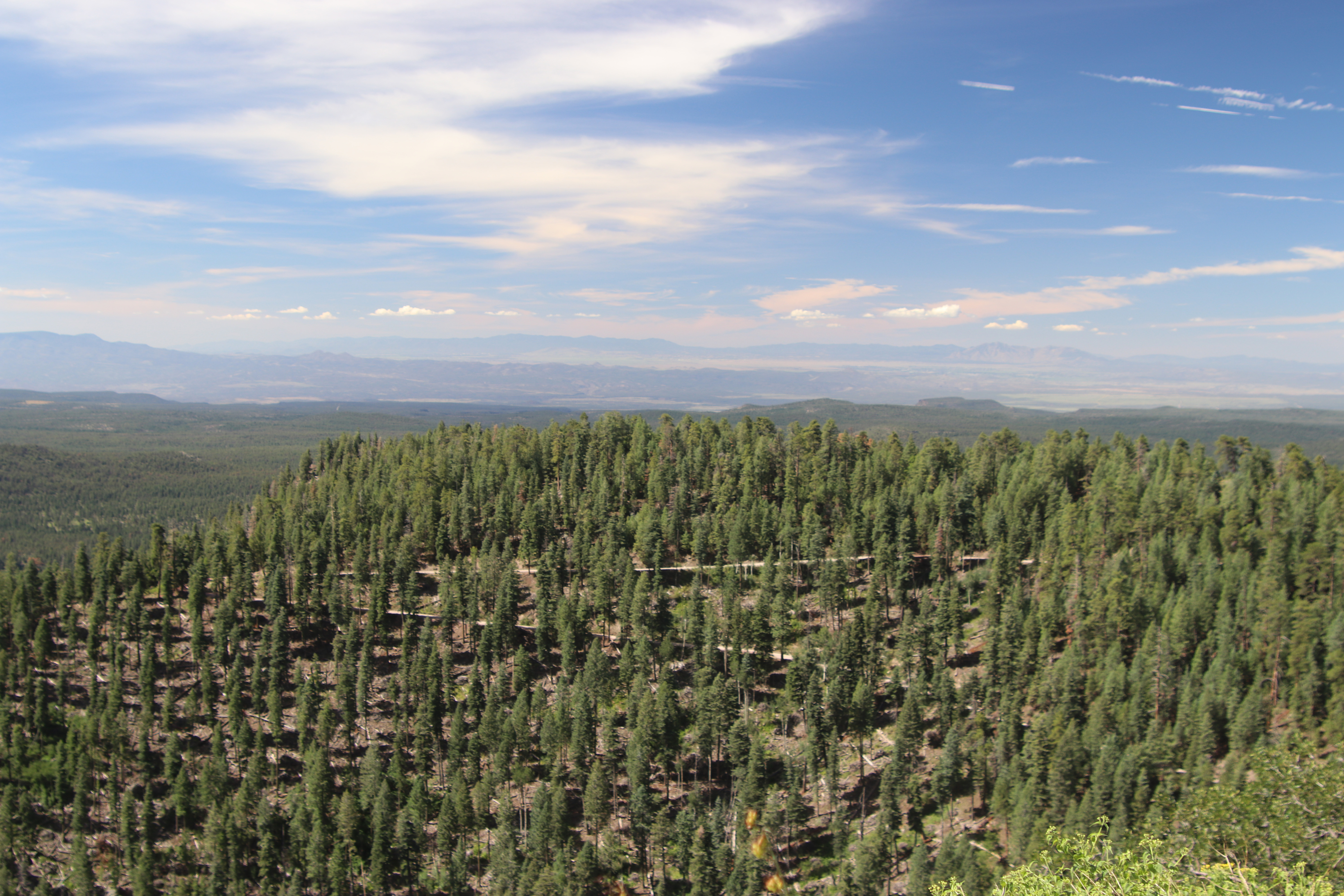
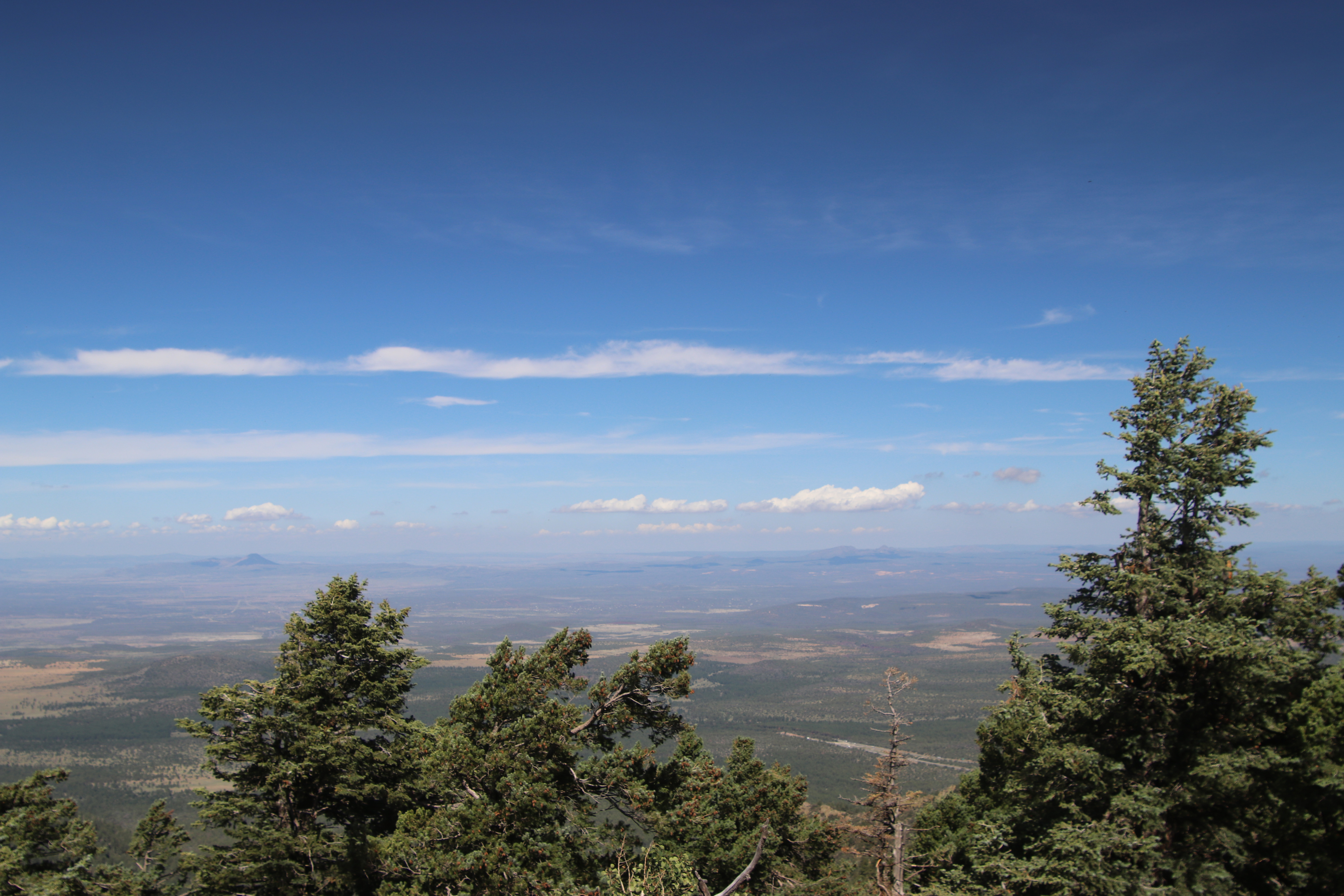
Here’s the lookout tower. I wouldn’t want to be up there in the near field of all those microwavesThe road upLooking west
Chester the Drone takes a nice shot looking west over the station to the wilds around Cobblestone Mountain. Topotopo Mountain and Hines Peak also visible.
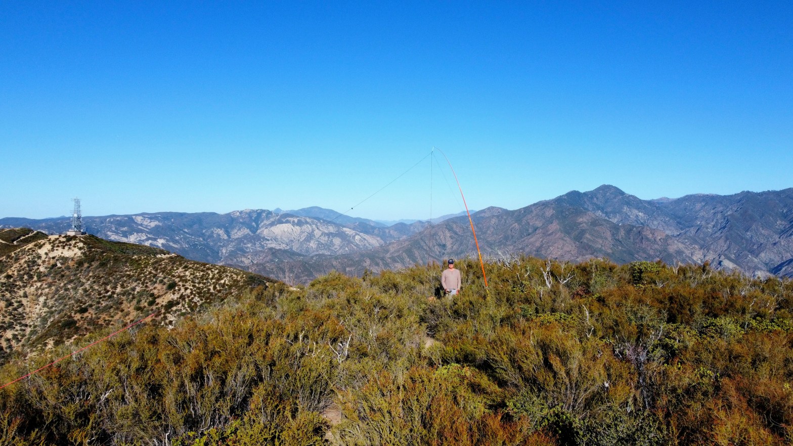
13 AUGUST 2022 W6/SC-076
Elevation:
4,174′
Route:
Mostly good road, brushy cross country last half mile
Hike Distance:
9 miles round trip
Elevation Gain:
1,250′ on the way out plus 150′ on the return
Navigation:
Easy
Steepness:
Mostly very easy with one short steep section
Vehicle:
Passenger car
Road:
Paved
Cell Coverage:
Indeterminate.
Hike basics
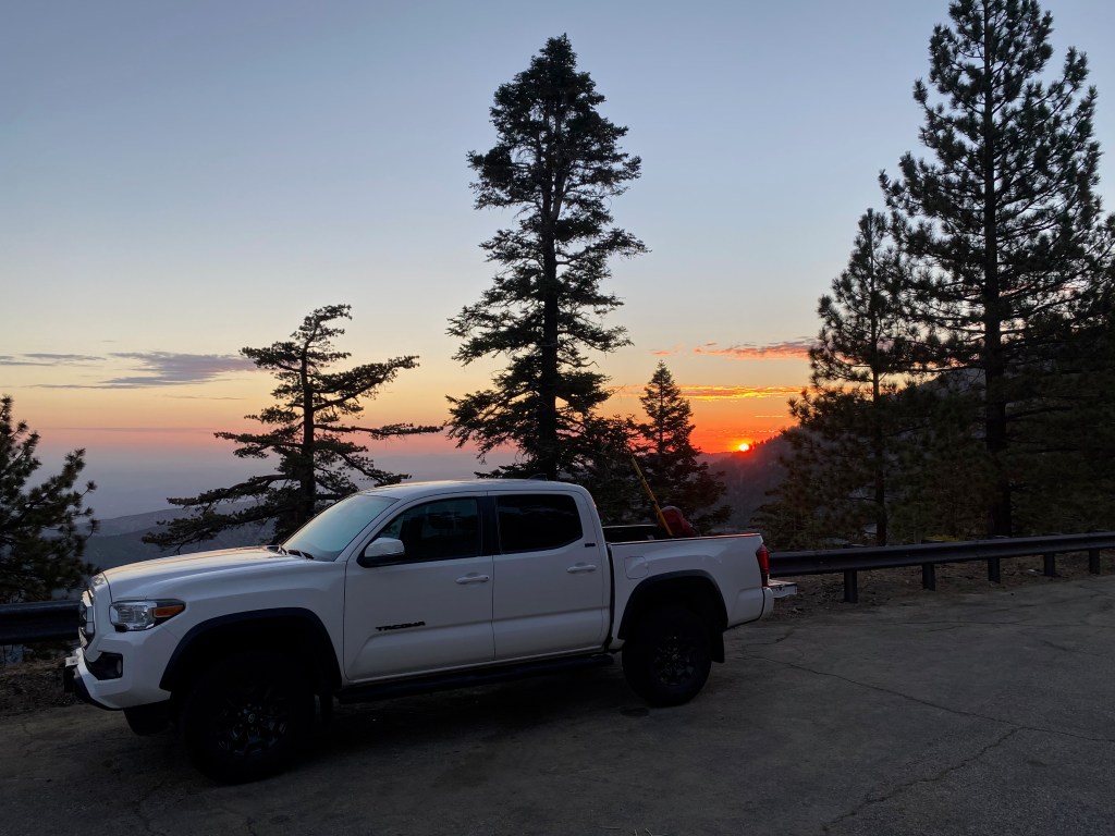
It had been 28 years since I last ascended this mountain with my brother and I only had a hazy recollection of the hike as being a short one after a long drive up a dirt road. This time around the road was closed at the old Golden State Highway up from Templin Highway. I knew it was going to be a long hike on what was going to be a hot day so it was a good thing I set out from Whitedog at 5:20 AM. A waning gibbous moon illuminated my path until the dawn twilight took over. All the bright winter stars were glittering in the east and I look forward to the cooler temperatures that the fall will bring.
The hike follows a gentle grade and a good paved road over a near ridge with a communications facility at the top. Befitting the capricious nature of road closings in the Angeles National Forest this year 6N53 has remained closed all summer for reasons who-knows-why.
In retrospect this would’ve been a very nice mountain bike ride — certainly I would’ve loved it coming back. I thought about including unnamed summit 4,020′ W6/CT-263 in this trip and a mountain bike probably would’ve made that possible for me. Why Whitaker is a SC and 4,020 is a CT is yet another of the vagaries of the SOTA brain trust.
The second communications facility on the road is not on the actual summit of Whitaker and is not in the activation zone. You must leave the trail before that point and scramble up an extremely steep and loose embankment to make the ridge. From here it is a very bushy walk back east to the summit. If I had bothered to read my own notes from my 1995 ascent, I might’ve brought a pair of clippers to cut through the worst of it.
Once on the summit I found my iPhone did not connect to the network. I suspect it just needed to be rebooted as this is a problem I had been having with my old version of iOS (PS I HATE iOS). Added to that my Yaesu FT-5D had to go back to the mothership in Cyprus for warranty repair of a cracked case that has been plaguing this particular model. Added to that is the fact that since I got my new iPhone I have neglected to load the Garmin InReach app to make texting via the Iridium Satellite Network actually usable and all this added up to no ability to self spot.
Fortunately faithful chaser Mike KI6SLA posted some spots for me so I was able to work a lot of the usual suspects.
A couple of really nice surprises: I had 152 mile summit-to-summit with 11 year old Levi KN6UIB and his dad Jacob W6RWS along with Chris N1CLC on Iron Mountain way down San Diego County way. That was really cool. I had worked Levi and Jacob on a similar VHF DX of Denk Mountain earlier this year.
Second: just tuning around on 20m because I had no spots available to me, I came across AE7AP totally randomly on Stonewall Mountain in Montana for a fortuitous summit-to-summit.
It was also great to catch Keith K9TPR back home in Topanga and a bunch of other faithful chasers.
On the way down I made a fateful mistake. I thought I’d seen a use trail coming up from the last saddle on the road, so I decided to try an do a short cut directly down the north ridge. I cannot state emphatically enough: DO NOT ATTEMPT THIS! What started out as a nice use/game trail along the ridge quickly became a very steep bushwacking nightmare. I had to remove my pack and fiberglass poles and crawl through the underbrush throwing my trekking poles and the fiberglass poles over the thick brush ahead. By this time it had gotten really hot and the work of even going 20 feet was exhausting. Even though I had a liter of water, it was not enough. When I got home I saw in AA6XA’s fine video that he was also thinking about this route, so I know I am not the only one to consider this. He was smart to go back the longer way we both came I repeat: DO NOT DO IT!
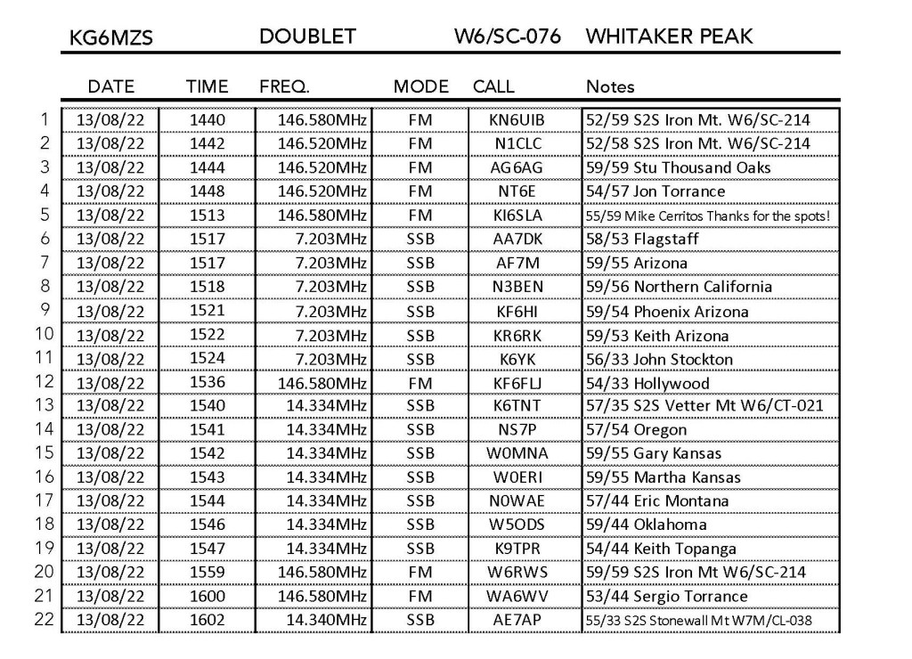
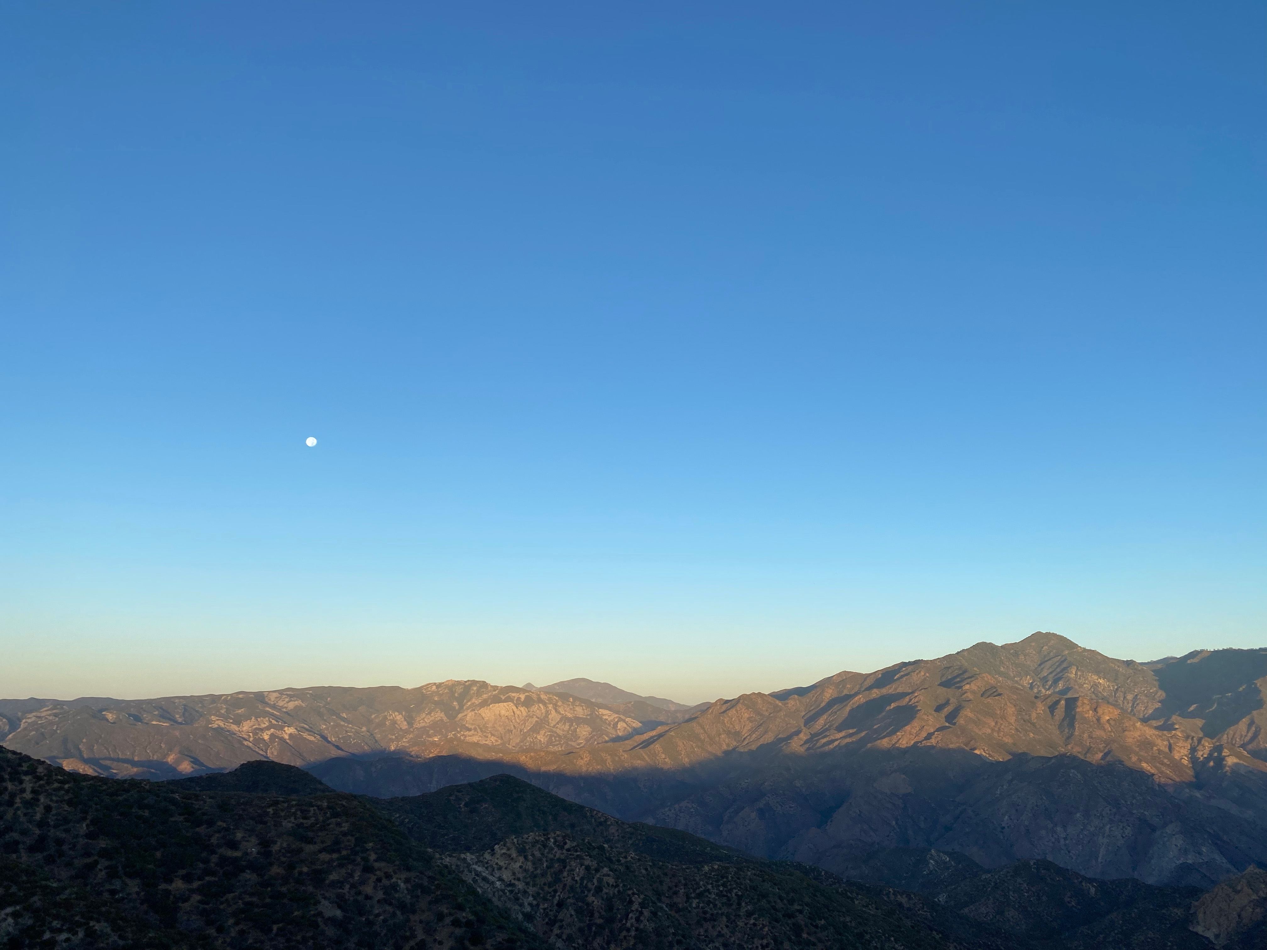
Nice Chester shot looking north at Slide Mountain (center), Frazier Mountain and Alamo Mountain to the left.Looking west at sunrise to Hines, Topotopo and CobblestoneLooking northeast over the summit to Libre Mountain