
Summit 4,054′ is a fine looking summit at the end of a steep hike. 15 APRIL 2023 W6/CT-156 Elevation: 4,054′ Route: Cross country and steep training trail Hike Distance: 4 miles round trip Elevation Gain: 2,000′ including 200′ on the return Navigation: A bit tricky to start, then easy Steepness: Steep Vehicle: Passenger car Road:Continue reading “Summit 4,054′”
Tag Archives: San Gabriel Mountains
Frankish Peak

Looking south across the basin to Santiago Peak and the Santa Ana Mountains 1 APRIL 2023 W6/CT-151 Elevation: 4,198′ Route: Use trail and fire road Hike Distance: 4.2 miles round trip Elevation Gain: 1800′ Navigation: Easy Steepness: Steep Vehicle: Passenger car Road: Paved Cell Coverage: Poor (Verizon) Hike basics This April Fools Day dawned clearContinue reading “Frankish Peak”
Summit 3,788
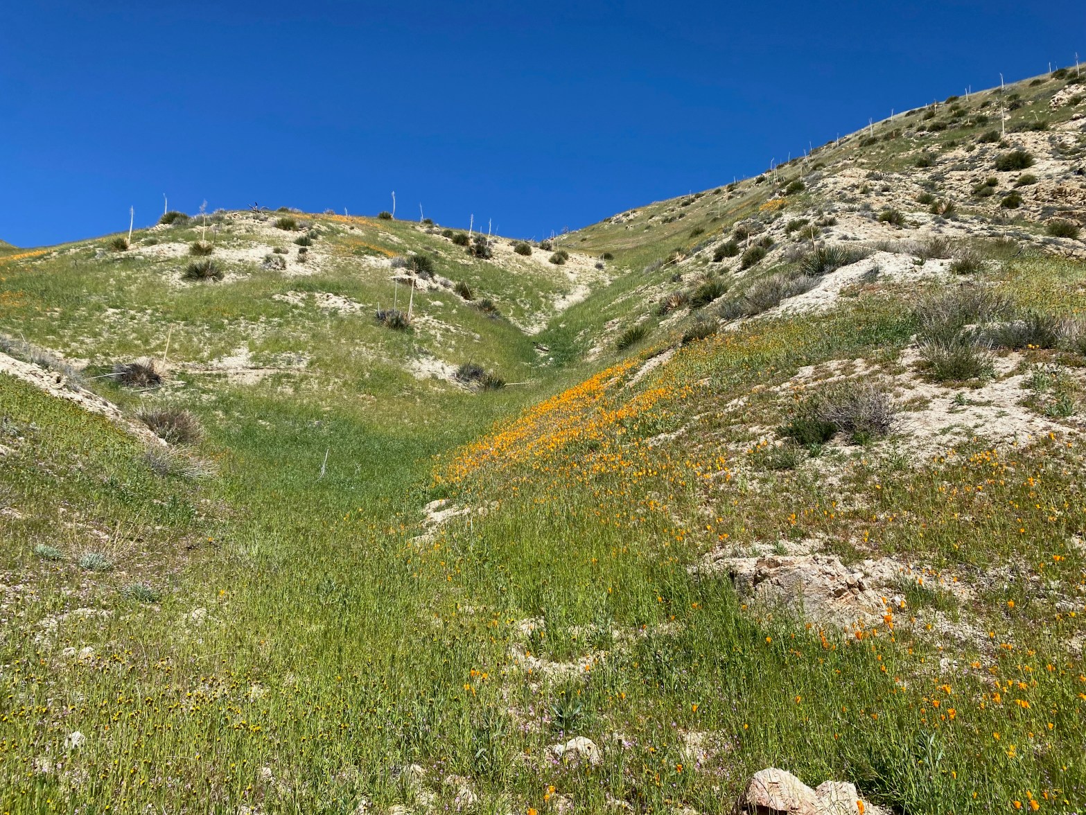
A very pleasant spring hike through flower fields. 18 MARCH 2023 W6/CT-167 Elevation: 3,788′ Route: Motorcycle track Hike Distance: 2.5 miles round trip Elevation Gain: 635′ Navigation: Easy Steepness: Steep in places Vehicle: Passenger car Road: Paved Cell Coverage: Excellent (Verizon), APRS Excellent Hike basics I hadn’t been out for a SOTA activation in weeksContinue reading “Summit 3,788”
Summit 4,460′

On the Edison road to the summit. 26 NOVEMBER 2022 W6/CT-144 Elevation: 4,460′ Route: Short cross country Hike Distance: .6 miles round trip Elevation Gain: 250′ Navigation: Easy Steepness: gentle Vehicle: SUV High clearance recommended Road: Edison dirt road Cell Coverage: Good (Verizon), APRS Excellent Hike basics This activation didn’t exactly go smoothy but endedContinue reading “Summit 4,460′”
Snow Benchmark

Looking southeast toward “Little” Iron Mountain. Monsoon clouds abound this autumn. 8 OCTOBER 2022 W6/CT-121 Elevation: 4,948′ Route: Very short cross country Hike Distance: 500′ Elevation Gain: 70′ Navigation: Easy Steepness: Easy Vehicle: Passenger car Road: Paved & dirt road with potholes Cell Coverage: Excellent (Verizon), APRS Excellent Hike basics Post to follow. Stay tuned…
Magic Mountain
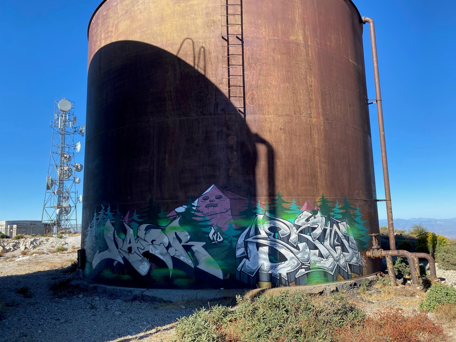
Elaborate street art on a water tank on Magic Mountain 8 OCTOBER 2022 W6/CT-255 Elevation: 4,859′ Route: Drive-up Hike Distance: 500′ Elevation Gain: n/a Navigation: Easy Steepness: Easy Vehicle: Passenger car Road: Paved road with potholes Cell Coverage: Excellent (Verizon), APRS Excellent Hike basics Post to follow – Stay tuned…
East Twin Peaks

“Look up at the mountain I have to climb” Cat Stevens. Twin Peaks from the high point on the Mt Waterman Trail. Not visible is the very bottom of the daunting saddle that must be traversed to reach the summit. That’s Santiago Peak off to the left. 24 SEPTEMBER 2022 W6/CT-064 Elevation: 7,761′ Route: ForestContinue reading “East Twin Peaks”
Mount Lewis x2

Chester takes a shot of the station on the charred summit of Mount Lewis Elevation: 8,396′ Route: Use trail Hike Distance: 1 miles round trip Elevation Gain: 450′ Navigation: Easy Steepness: Very steep! Vehicle: Passenger car Road: Highway 2 paved Cell Coverage: Poor/None (Verizon), APRS Excellent Hike basics post and drone shots to follow
Throop Peak x3
Chester takes a snap of the station looking north out toward Mt Williamson and the Antelope Valley 3 SEPTEMBER 2022 W6/CT-005 Elevation: 9,138′ Route: Forest service trail and use trail Hike Distance: 3.6 miles round trip Elevation Gain: 1,000′ Navigation: Easy Steepness: Gentle with a moderate section at the end Vehicle: Passenger car Road: PavedContinue reading “Throop Peak x3”
Mount Baden-Powell

Snow Flower at dawn on the way up the many switchbacks from Vincent Gulch Divide 11 JUN 2022 W6/CT-004
