Start of the Phantom Trail off Mulholland Highway at Malibu Creek State Park
Early on Tuesday morning I made my way through a dense marine layer to Malibu Canyon. The drizzle was enough to need the windshield wipers. There was nobody at the Cistern/Phantom trail head a few miles west of Las Virigines/Malibu Canyon road on Mulholland Highway.
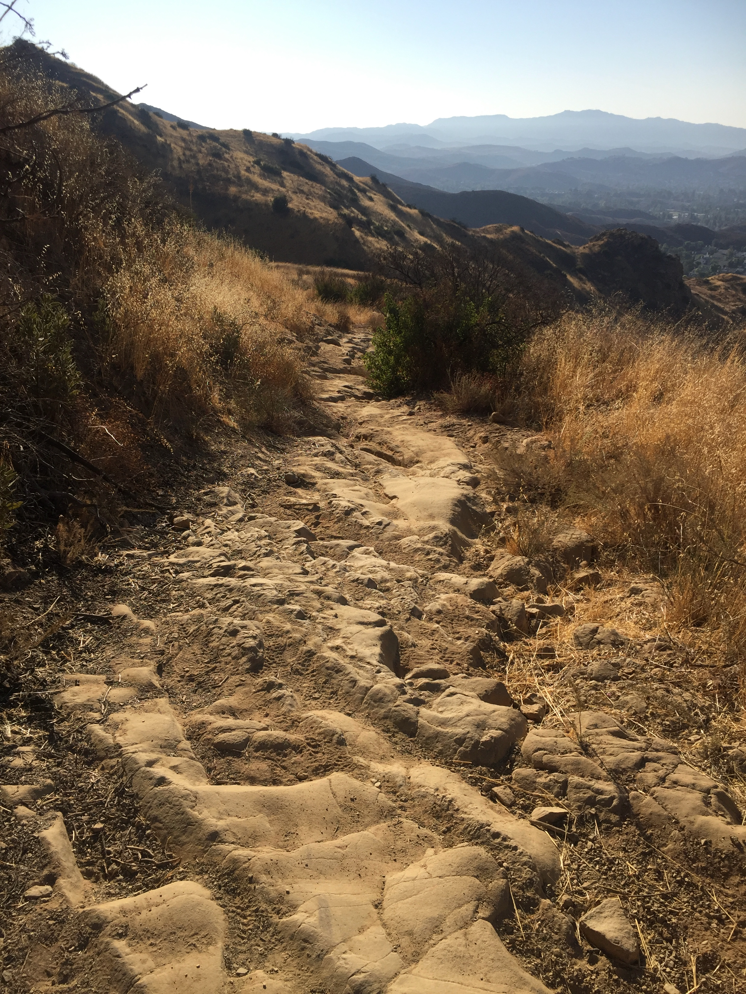
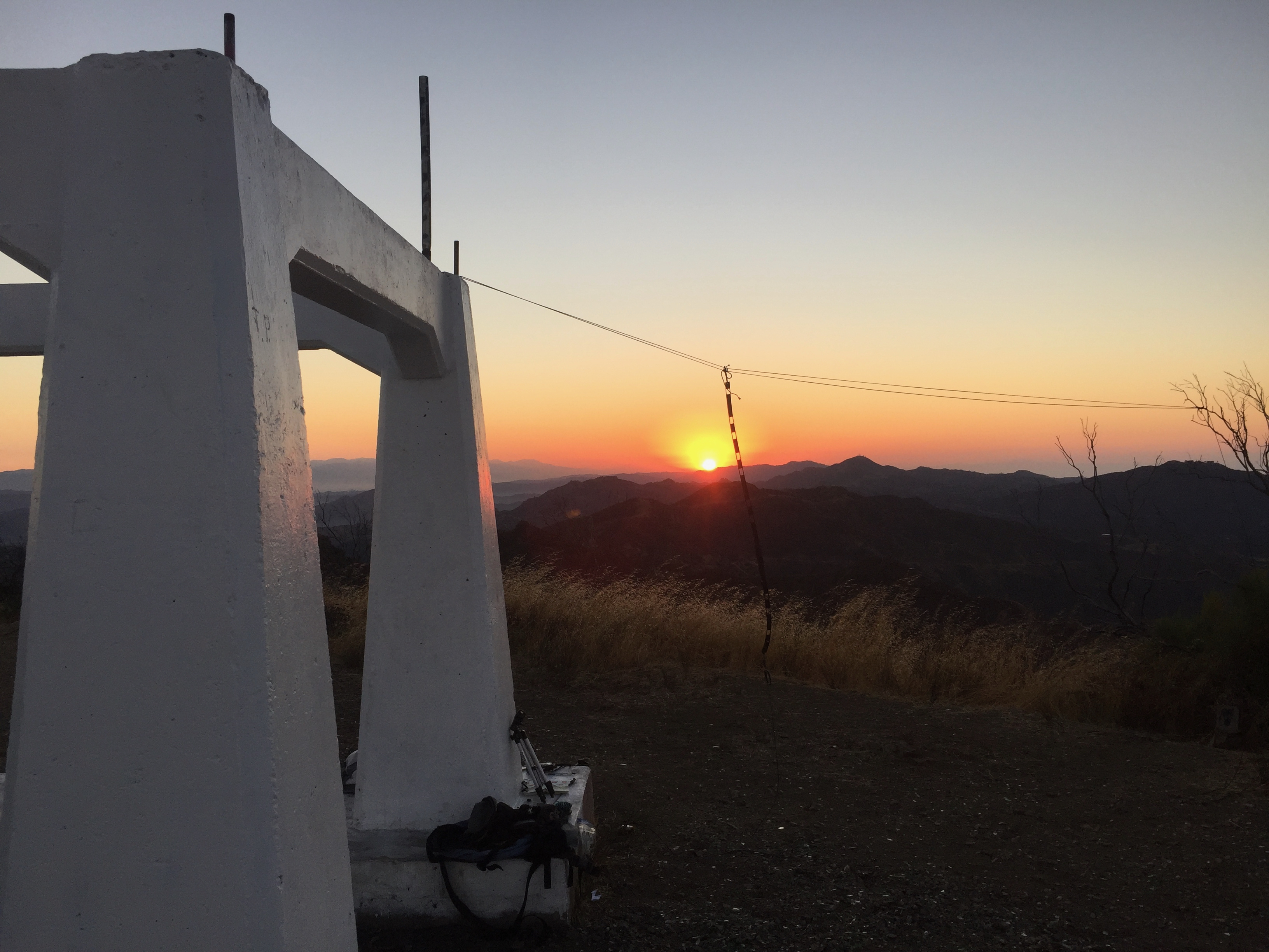
The hike is short and easy – about .9 miles and 600′ of elevation gain. The summit is the second bump passed the benchmark. A small rock cairn marks the actual summit
This summit does not have good UHF/VHF coverage into the more populated areas of Los Angeles. I had trouble scaring up 5 contacts on 2 meters early on a Tuesday morning. I probably should’ve waited until I can manage to by some HF gear before attempting this one. I heard several stations that could not hear me. One highlight was working my friend Steve WA6FGW who was mobile on Pacific Coast Highway. We barely eked out a QSO, but that was pretty amazing clear over the Santa Monica Mountains like that. Brian WA6JFK said my signal was “horrible” in Glassell Park. I did work three 59 signals: WB2WIK Steve in Winnetka, WA9STI Scott in Granada Hills and WB6MIO Charles in Simi Valley.
Deep drizzle and fog on the summitThis benchmark is two bumps short of the summit
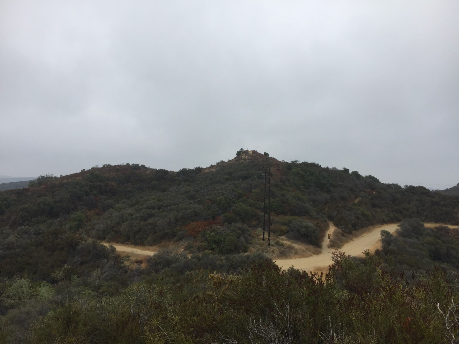
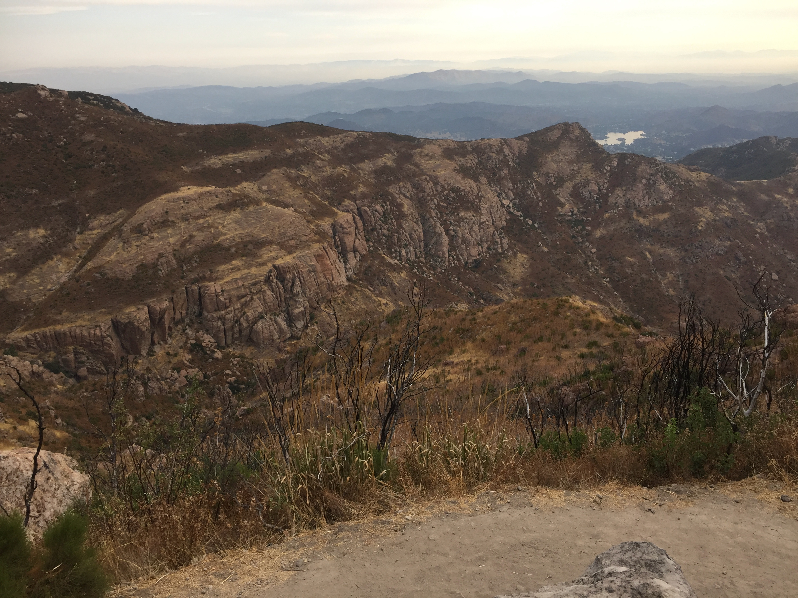
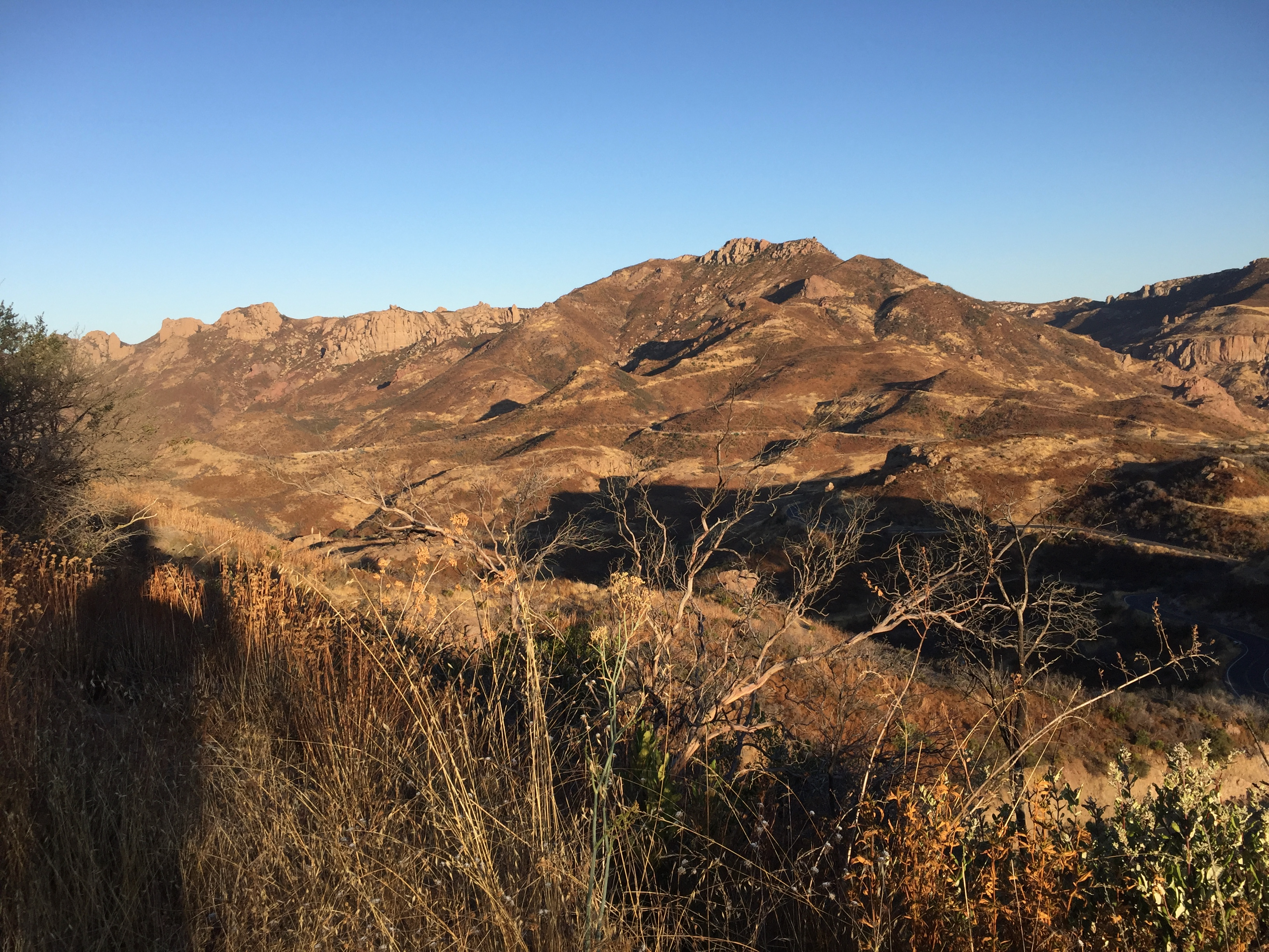
You can see why they call it Timber Mountain. About a quarter mile from the summit
Brian (WA6JFK) and I were planning another pair of tandem activations. Sunset Peak was a good choice for a moderate hike, but what other juicy peak was nearby? I had climbed Timber Mountain twice before – once in 1981 and once in the winter of 1999. At 10 miles round trip and over 3,300′ of elevation gain, it poses a challenge to my current level of conditioning. I decided that’s a good thing!
Since I haven’t been up Icehouse Canyon this century, I was shocked to find a packed roadhead parking lot at 5am with many groups getting ready to hike. This is a heavily traveled area. Starting up the trail in the dark, a flashlight is absolutely essential. The trail is very rocky and, in places, narrow with steep drop-offs. I managed to pass a few slow parties and be passed by some faster ones. I only needed to don the Covid 19 mask at these few times on the way up. This is good because the trail climbs steeply in the thin air and the mask is uncomfortable.
Getting close
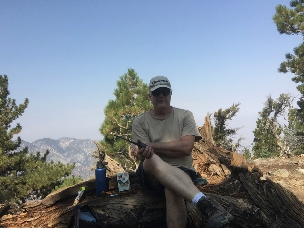
On the summit there were three guys who spent the night. They had the banda music playing merrily away while I got set up. This is not a wilderness experience. Soon several other large parties joined us. When I say “parties” I mean that more ways than one. Soon “Happy Birthday” banners were hung and tequila shots were poured. I explained to the revelers what Summits on the Air was all about and got several “cool!”s out of it. One guy said he was studying for the Technician license.
Just before the crowds arrived
The activation was a success with 18 contacts all on 2m, including 3 summit to summit contacts with Brian (WA6JFK) over on Sunset Peak, W5EAL at The Pinnacles over in the San Bernardino Mountains and with W6MDE who was acting as fire lookout on Morton Peak.
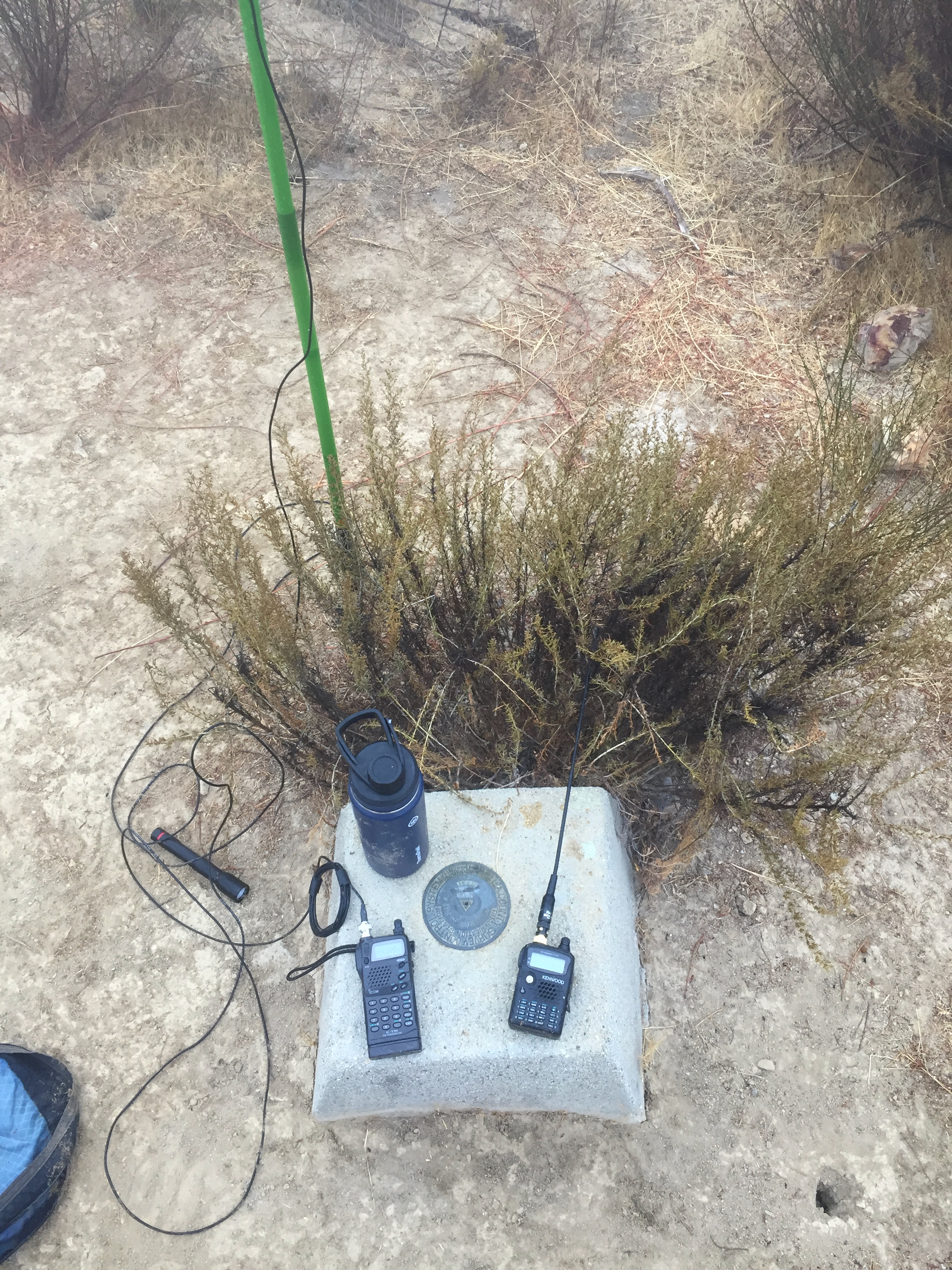
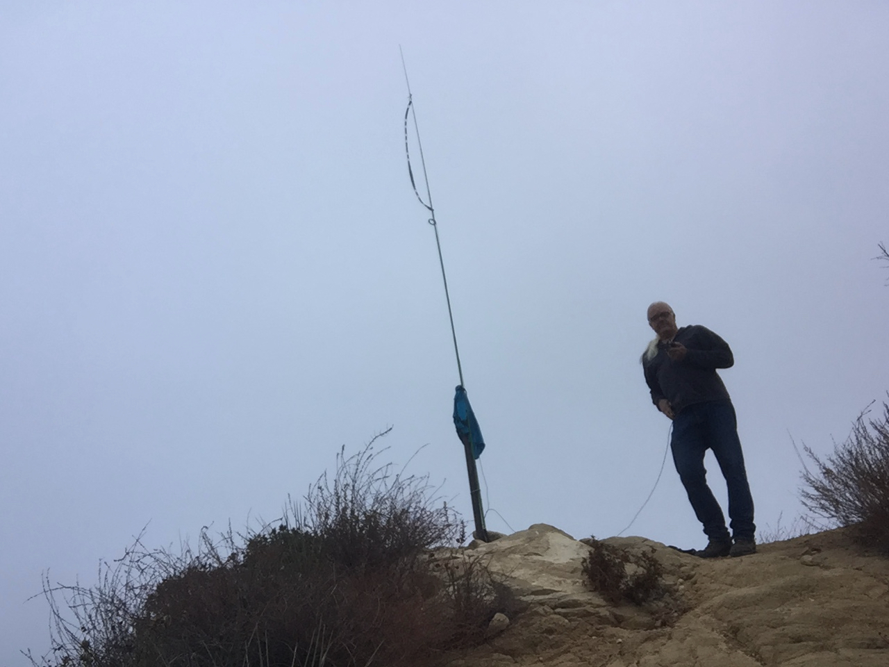
Home brew roll-up J-pole on a 20′ carbon fiber fishing pole
The hike down was actually harder with many rock and wood stairs to step down. I have to work the muscles hard to protect my 65 year old knees. I had to wear the mask almost all the way down as numerous groups where ascending the trail. I got back to the car exactly at noon.
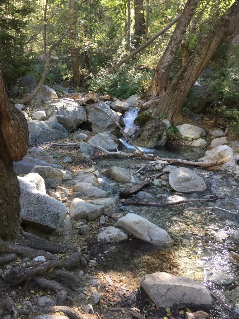
The water that comes out of the springs in Icehouse Canyon has percolated through thousands of feet of granite. It is so clear the sun seems to shine directly on the rock and sandThis Incense Cedar has seen over a hundred years of fire, rain and snowA surprising amount of water in Icehouse Canyon for October
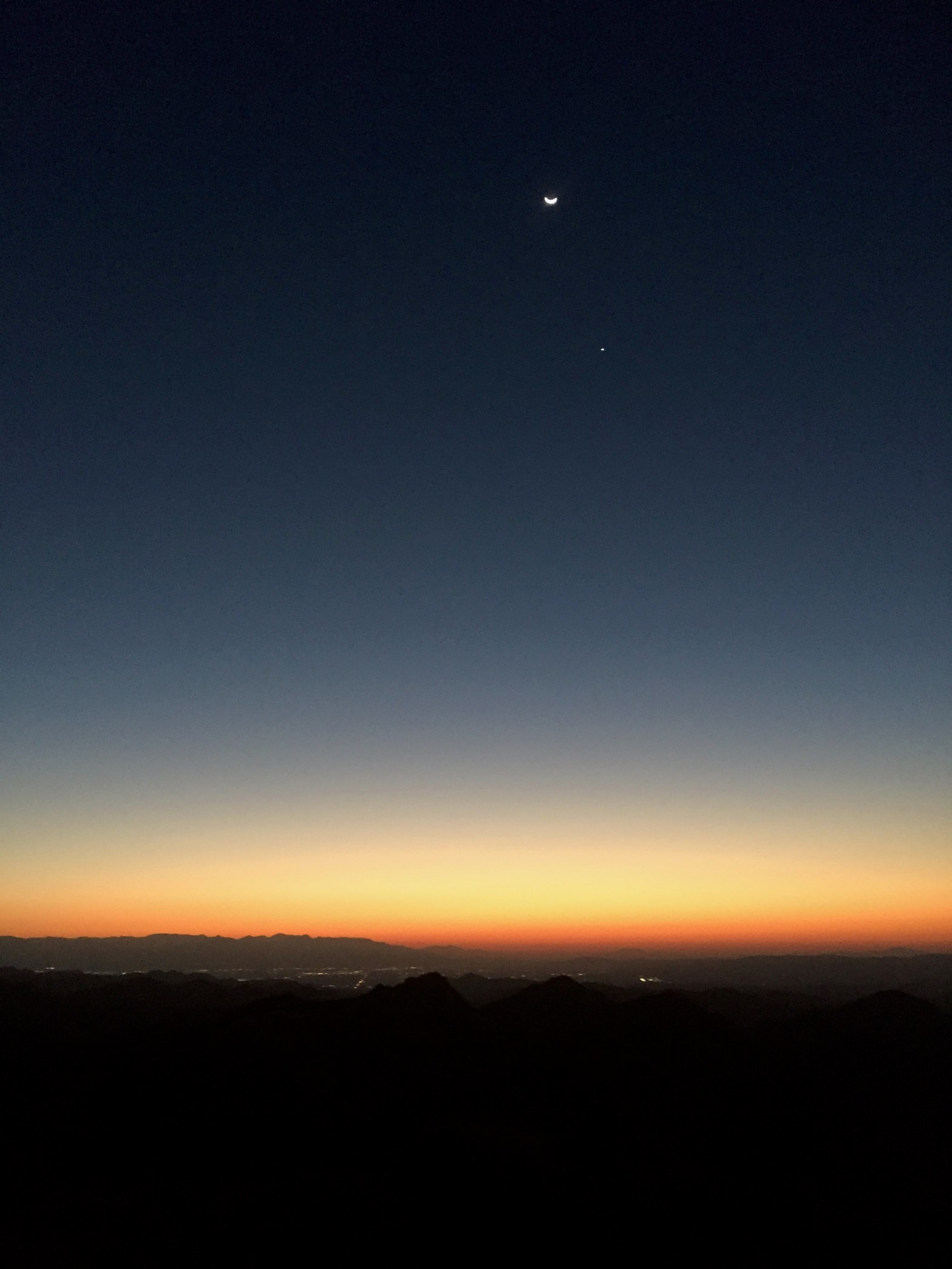
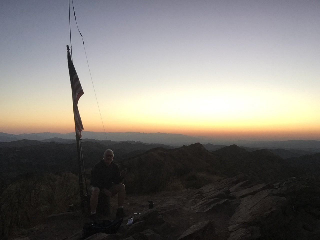
Venus and the waning crescent Moon before dawn on Simi Peak with the San Gabriel Mountains.
13 OCTOBER 2020 W6/CT-207
Two Stars – a nice summit. I’d do it again. Recommended.
Elevation:
4,580′
Route:
Good trail
Hike Distance:
5.2 miles round trip
Elevation Gain:
1,260′
Navigation:
Easy
Steepness:
Gentle
Vehicle:
Passenger car
Road:
Paved roads
Cell Coverage:
Good Verizon
Hike basics
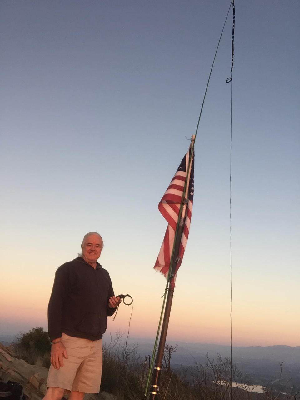
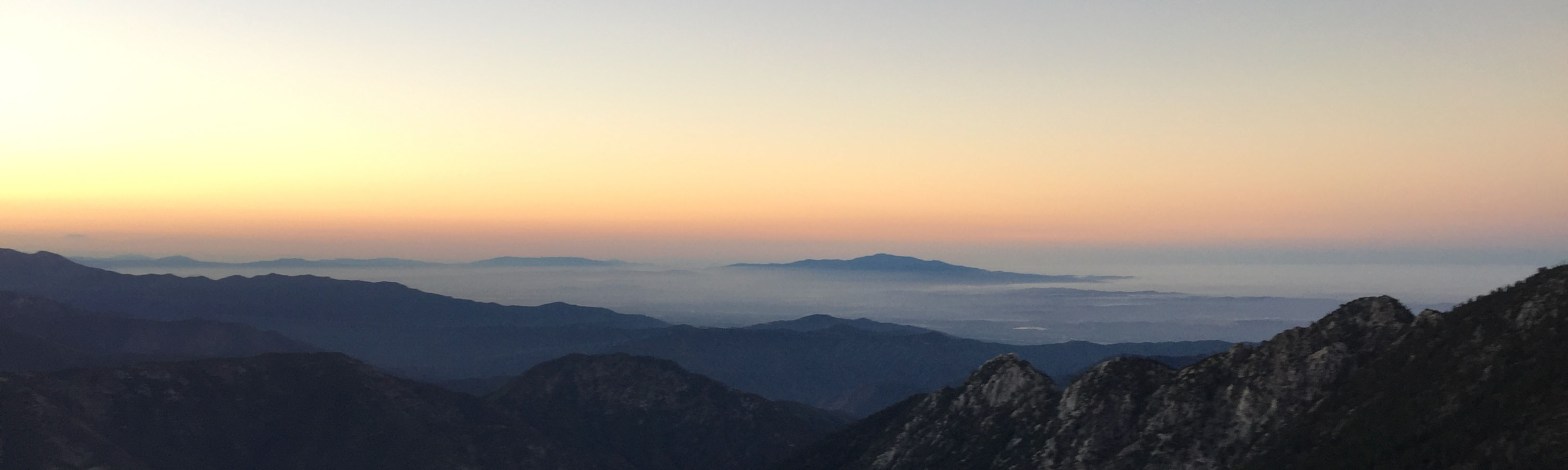
Once again my friend Brian (WA6JFK) and I were scheming about doing tandem activations early Tuesday morning to beat the heat that was forecast to be near triple digits. I picked Simi Peak and Brian decided to try Kagel Mountain over in the San Gabriels. I started hiking about 5:30 AM from the top of King James Place in Oak Park. The trail follows an old fire road that is deeply eroded. Waking in the ambient light is usually no problem, but the uneven footing made a flashlight necessary. Along the trail I saw dozens of Kangaroo Mice scurrying around feeding in the cool, pre-dawn air. The winter stars glittered overhead, Orion, Canis Major, Taurus. In the west, Mars shone brightly as it is at opposition to Earth and very close. In the east Venus and the waning crescent Moon dominated the sunrise. As I made the ridge, I even spotted Canopus – the second brightest star in the sky. Canopus is normally a Southern Hemisphere star. It can only be seen in these northern latitudes for a few hours a night in the fall and winter very low in the southern sky.
The hike is 5 miles round trip with 1,250′ of elevation gain. There is 250′ of gain on the return. The trail is heavily traveled most days and while I saw no one going up or on the summit at dawn, there were quite a few people starting out as I descended:
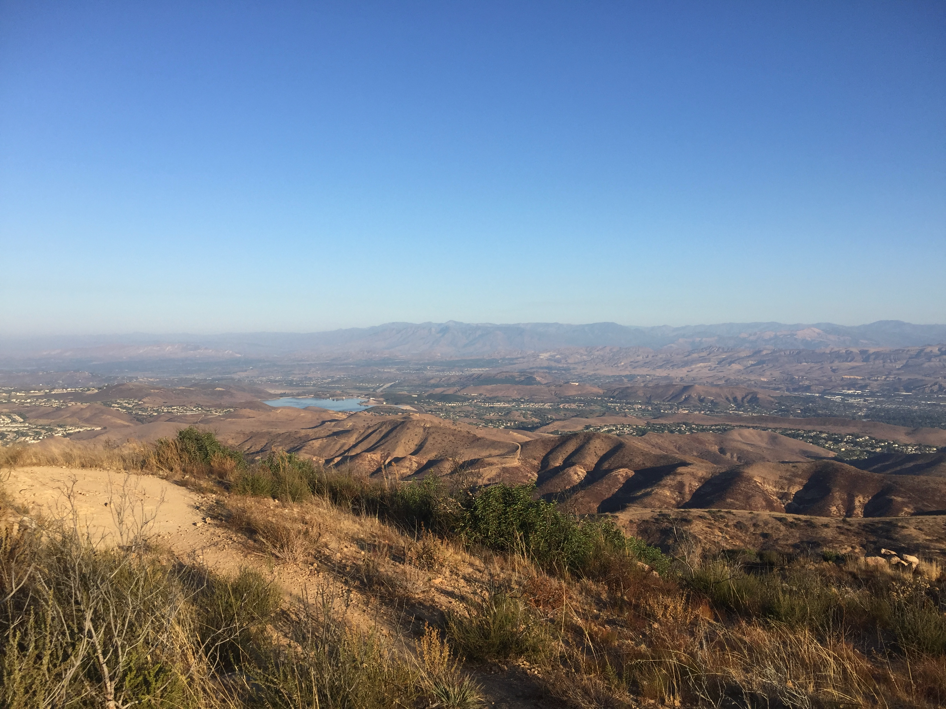
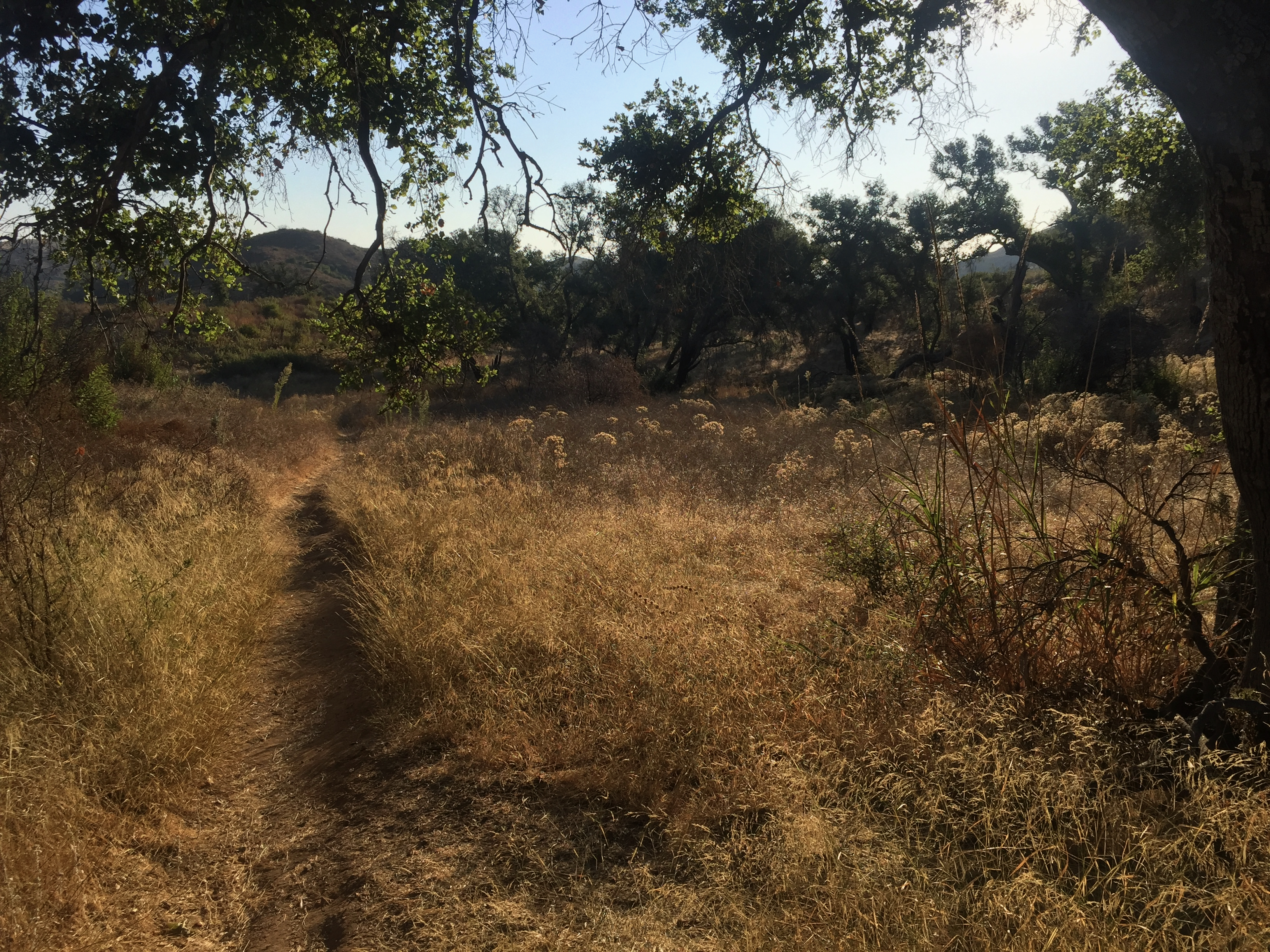
Unlike the part of the Santa Monica Mountains just to the south, Simi Peak is all sedimentary rock. The trail takes the hiker through China Flat – a lovely live oak grove set in meadows behind the steep south scarp. This is where Little House on the Prairie was filmed.
Looking east before sunrise
I made 9 contacts on 2m. Brian made it up to Kagel Mountain about 7AM and we got our summit-to-summit in. We also made contact with our friend Steve (WA6FGW) who was on his way to work in Santa Monica. I first heard him as he came out of the MacClure Tunnel over the crest of the Santa Monica Mountain. By the time he got to Cloverfield he was 59. I also heard from faithful chasers Derek (KM6UHU) in Altadena, Steve (WB2WIK) in Winnetka, Ira (KI6TPX) in Glendale among others.
Sunrise over the San Gabriel MountainsLooking northwest past Moorpark up to Hines Peak in the Sespe/Topotopo wildernessThe trail through China FlatChina Flat – where they filmed LIttle House on the Prairie and othersDeeply eroded trail up. Saddle Peak in the background.
Two Stars – a nice summit. I’d do it again. Recommended.
Elevation:
2,126′
Route:
Cross country
Hike Distance:
7.6 miles round trip
Elevation Gain:
1,250’*
Navigation:
Moderate
Steepness:
Gentle
Vehicle:
Passenger car
Road:
Paved road
Cell Coverage:
n/a
*230 feet gain on the return
The first time I hiked up Temescal Peak I was about 12 years old. My buddy Allan Gardner and I had seen the enticingly-named Eagle Springs on the topographical quad and it beckoned. Having no idea how long it would take, we left the quiet streets of Pacific Palisades at 2:30 AM. Our canvas Yucca Packs were ridiculously heavy — packed with all kinds of outlandish gear found in our suburban garages.
It was a long, strange odyssey. Using Al’s dad’s humongous SCUBA diving light, we saw a weasel raiding a large bird’s aerie for eggs in Temescal Canyon. As we made our way up to Temescal ridge in the dark, we kept hearing something strange whistling through the air over our heads. Much later we heard the report of a rifle and then the whistling sound, so we started yelling our heads off. A guy appeared over the edge of the firebreak above us on horseback brandishing a rifle. He told us “Don’t worry about it.” Yeah, right.
A little while later we came around a corner and in front of us was a large pack of wild dogs. They were mostly pretty scraggly looking, but the leader was a large shepherd mix. Al grabbed a machete out of his Yucca Pack and I picked up a huge stick with a large burl on the end. We stared the dogs down and they eventually ran off down into upper Santa Ynez Canyon.
When we arrived on 2,126′ (it wasn’t called Temescal Peak back then) I stuck the “dog bonker” stick in the pole that still graces the summit. For years after that you could see that stick for miles around. We called the summit Dog Bonker Peak for years.
In our pre-teen minds we were like Lewis and Clark in the wild west.
There are a lot of ways to hike up to Temescal Peak. I’ve done most of them. But for old time’s sake I left Trippet Ranch in Topanga State Park well before dawn. It was a nostalgic hike for me. The marine layer was in at about 2,500′ blocking out the waning moonlight, but the light LA and the San Fernando Valley provided enough illumination on the underside of the stratus to see well enough, once my eyes adapted to the dark.
The hike from Trippet Ranch is 3.7 miles, one way, with 1200 feet of elevation gain on well-graded fireroads. The turn-off is where the Backbone Trail leaves the Temescal Fireroad. You can see it in the photo above. The trail contours around the south side of the peak and you make your way to the summit via a small use trail on the east side.
My first contact was with Brian (WA6JFK) over on Cerro Negro Benchmark (CT-226) for a nice summit-to-summit contact. Unlike last week, Brian heard me loud and clear. He was 59 armchair copy. I made 19 contacts – 17 on 2 meters and 2 on 70cm. Cassie (KG6MZR) called me from home.
The pole that once held the Dog Bonker is still there and repurposed here for my carbon fiber fishing pole supporting my home brewed roll-up J-pole
The hike from Topanga State Park takes you by Eagle Springs and right under the strangly sculpted Eagle Rock.
Eagle RockEagle Rock with Chaparral Buckwheat in the foreground.
At 3,111 feet, Sandstone Peak is the highest of the Santa Monica Mountains. I first hiked to the summit on December 12, 1974. Back then all of Boney Mountain was part of the Boy Scouts’ Circle X Ranch and it was jealously guarded by the cantankerous caretaker, Max Jones. Over the years my friends and I had many run-ins with Mr. Jones as we would sneak in to enjoy this lovely area. Now the entire area is overseen by the Conservancy. In many ways I miss those old days, dodging Max. We seldom saw anybody up there. Now, I’m afraid we are loving this place to death. In the last few years it must’ve made some online “Best Hikes” list because it is packed most days.
Because of the crowds, I left my car at 5:30 AM and made my way up the trail by the cloud-shrouded moonlight. The hike is 1.57 miles and about 1,000 feet of elevation gain. The trail is deeply eroded from so much foot traffic and the Woolsey fire.
The plan was for my friend Brian (WA6JFK) to hike up Flint Peak (CT-225) so we could do a little summit-to-summit. I set up my roll-up J-pole at the end of my new telescoping carbon fiber fishing pole. I could hear Brian clearly but he could not hear me at all. I did make contact with John (W6FE) in Chula Vista. I also had a QSO with Mike (KN6HTX) in San Marcos. Mike was only running 7 watts. I had several QSOs from the Ventura/Point Hueneme area, including a nice, armchair QSO with Bruce (KM6ZJK) in Ventura. As usual, I heard from Derek (KM6UHU) in Altadena and Jon (K6LDQ) in Torrance.
The new carbon fiber mast supporting my home-brew roll-up J-pole
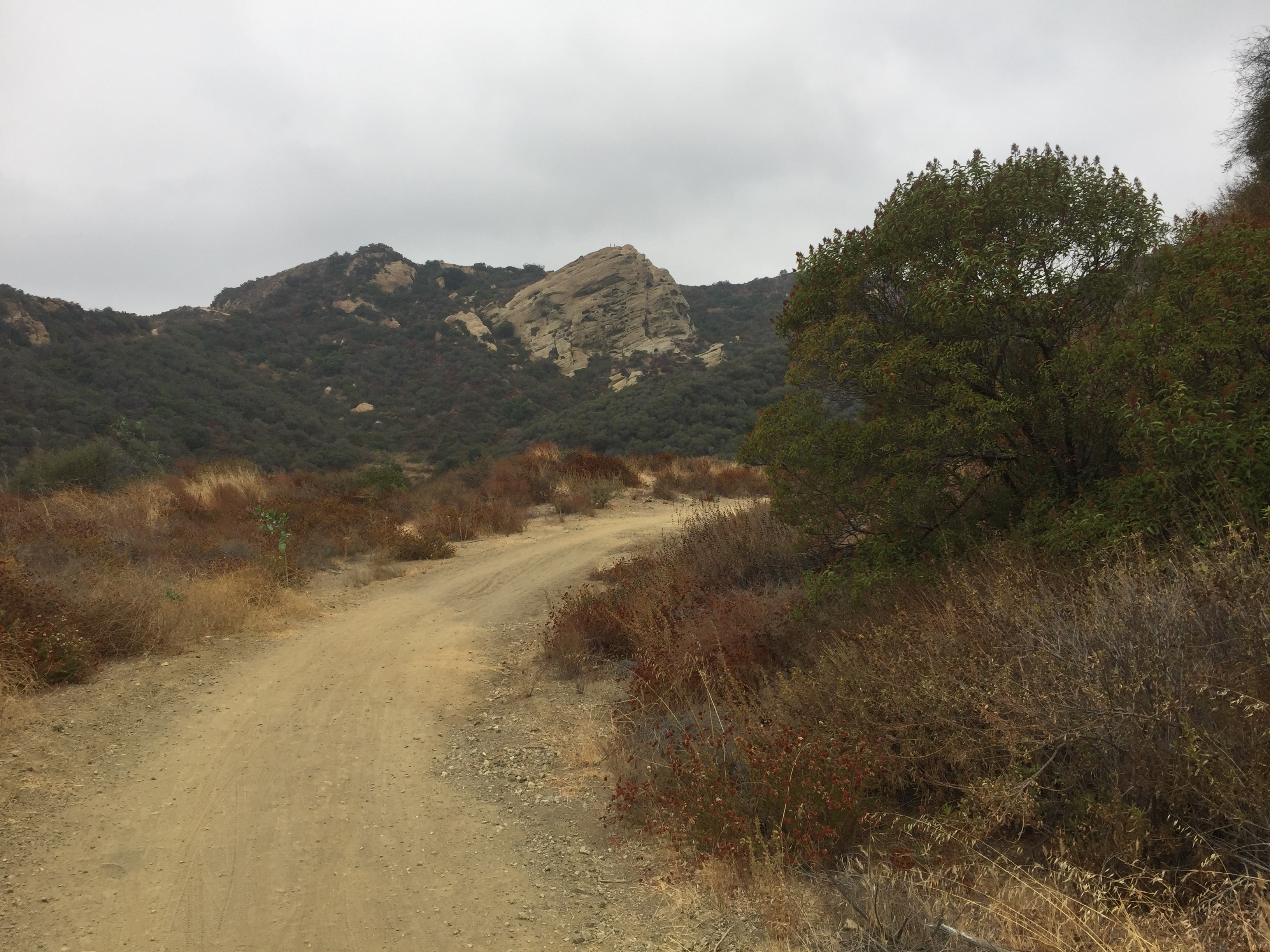
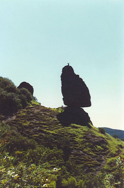
The Echo Rock rock climbing area with Lake Sherwood in the background.
I’ve been rock climbing in this area for many years – long before it became very popular. In fact, I believe my friends and I were the first to climb Balance Rock back in the ’80’s
Fun fact: Sandstone Peak is a misnomer. The peak composed of igneous rock – mostly breccia.
After helping my friend Brian (WA6JFK) activate his first summit a week ago, we decided to try doing separate summits, Brian on 4020′ in the San Gabriel Mountains and me on Triunfo Lookout. I had not been on Triunfo since February 12, 1974 when I first hiked it with my old friend, Allan Gardner back when we were in high school.
The hike follows an old access road that is grown over with mountain lilac (ceanothus) and redshanks. The first half of the trail escaped the Woolsey fire and the lilac grows overhead and makes a nice canopy. The trail is .77 miles to the summit with a modest 500′ of elevation gain.
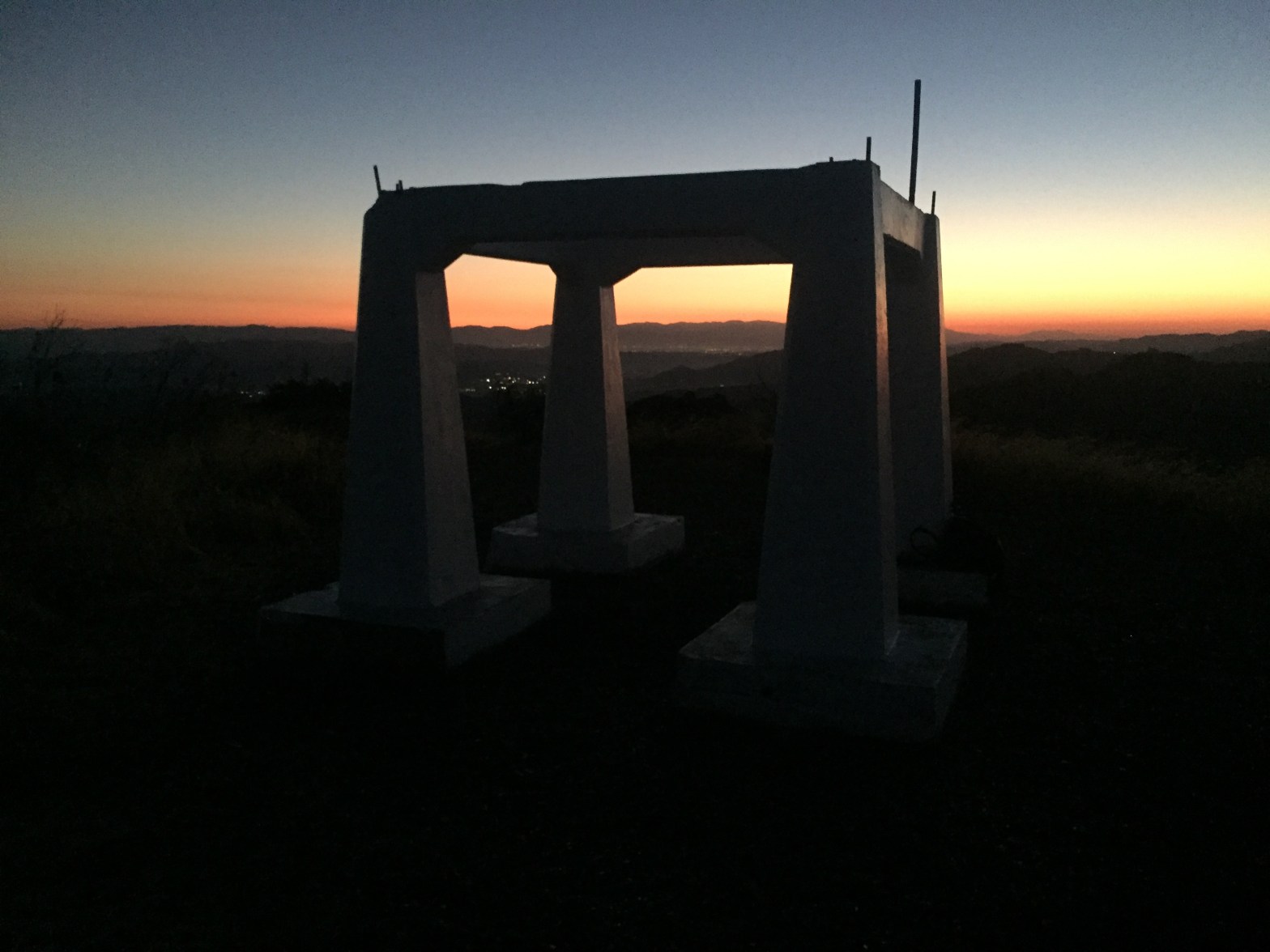
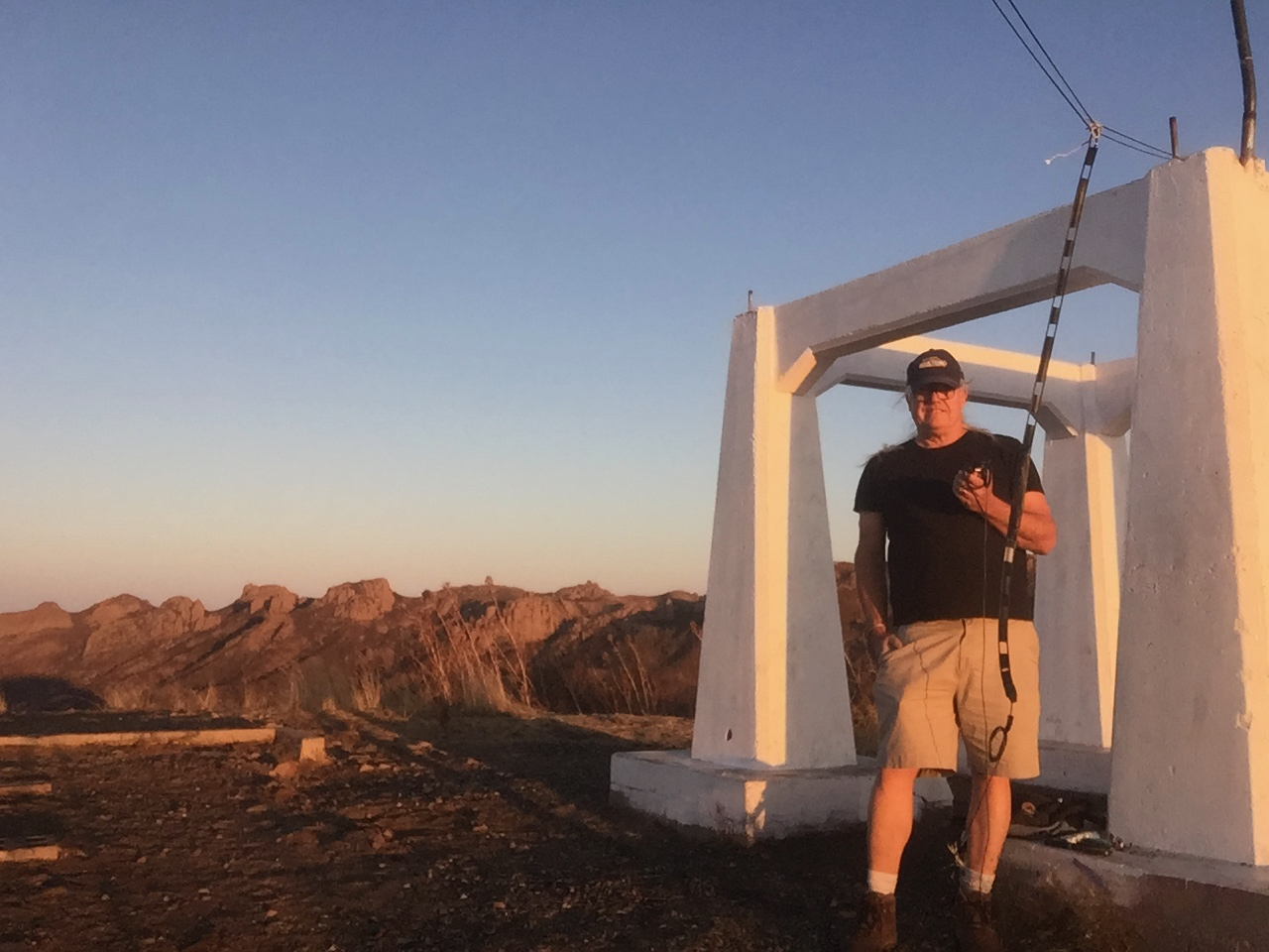
The summit affords a nice view of Sandstone Peak and Boney Ridge with Santa Cruz Island off the left side. Hines Peak and the Sespe/Topotopo mountains are off the right side and a view of Balance Rock and the Sandstone Peak rock climbing areas are plainly visible. Santa Catalina and Palos Verdes are visible to the south. The concrete foundation of the old lookout tower remain and look like some kind of ancient Greek cabana.
Santa Cruz Island is visible just behind the ladder line of my fold-able J-pole.
I immediately made contact with Brian, summit-to-summit and both my signal and reception was improved by using the roll-up J-pole I made. He was 59, full quieting. We both proceeded to make and share contacts all over the LA basin. Our furthest contact was with John, W6FE in Chula Vista. John joked that I should homestead the location because it was such a great radio site. He was armchair copy.
Sunrise over the San Gabriel Mountains from the trail up to Chatsworth Peak
2 SEPTEMBER 2020 W6/CT-036
No stars – This is a one-off summit. I am unlikely to return. Not recommended..
Elevation:
2,313′
Route:
Dirt road and use trail
Hike Distance:
1 miles round trip
Elevation Gain:
500′
Navigation:
Easy
Steepness:
Moderately steep
Vehicle:
Passenger car
Road:
Good dirt road
Cell Coverage:
n/a
Hike basics
For my ninth activation I set my sights on a peak I had never been to. I’ve looked at Chatsworth Peak for years but have never hiked it. Following the advice of Ron, K6RIN, I made my way up Lilac Lane to the private road, Mesa Drive. Unlike Ron, however, I found Mesa Drive in good condition up to the turn off on the right. I parked my sedan under a large power pole at the 4-way intersection in front of Sedona West.
The hike is short and steep, .46 miles and 400′ of elevation gain. After I passed the large water tank the road turns to a single-track trail that goes through fragrant Yerba Santa and California Buckwheat. I recommend a walking stick or trekking poles to let any potential rattlesnakes know that you are coming in the places where you can’t see your feet. This area has large sandstone boulders everywhere and it perfect snake habitat.
Just before the top the use trail takes you past two 150′ towers that suspend a large 1 megawatt shortwave antenna for radio station KVOH – The Voice of Hope. The antenna was erected in 1985.
The summit itself is a large sedimentary boulder with a large white X painted on the top that is plainly visible in Google Earth’s satellite imagery. The peak has fantastic views of the San Gabriel Mountains, the Santa Monica Mountains, the Santa Susanna Mountains and the Sespe/Topo Topo mountains to the northwest. Unlike K6RIN, I only saw a few bees.
I started calling CQ and was immediately met with a response from KI6UCN, Hart in Yucaipa Valley almost 100 miles away. Not bad for 5 watts and the glorified rubber duck. I did not detect any intermod or desensitization from the radio facility.
I also made contact with Cassie (KG6MZR) at home in Topanga. Brian (WA6JFK) in Glassell Park was next to respond. Brian was thinking about joining me, but after reading K6RIN’s report he said “No bees.” 🙂 I also had a nice QSO with Mountain Goat Scott (WA9STI) in Granada Hills among others. Another friend, Steve (WA6FGW), was over in Santa Monica and while I heard him briefly, we didn’t make contact over the Santa Monica Mountains on 2m.
Sunrise on Chatsworth Peak with Hines Peak above the bay laurel in the background
One thing to consider if you plan on activating this summit is that it lies on private property once you enter Mesa Drive. I suggest leaving early in the morning and keeping a low profile. I usually pick up a large bag of trash I find on the trail as a way to mollify any irate landowners I might come across. This tactic has worked wonders in the past. I didn’t see anybody on this early morning trip.
Just before sunrise on the trail to Waterman Mountain
29 AUGUST 2020 W6/CT-012
Three stars – Highly recommended.
Elevation:
7,982′
Route:
Good trail
Hike Distance:
6 miles round trip
Elevation Gain:
1,530′
Navigation:
Easy
Steepness:
Gentle
Vehicle:
Passenger car
Road:
Paved highway
Cell Coverage:
n/a
Hike basics
It’s been almost a month now since my first activation and my happy discovery of the joys of Summits on the Air. I’d activated 7 summits and was aiming for 8.
One thing this brief experience has taught me: getting an HF rig will be an imperative. However, in this uncertain time of the corona virus pandemic, such an expenditure probably isn’t in this household’s immediate future.
So how best to use the 2m FM equipment I do have?
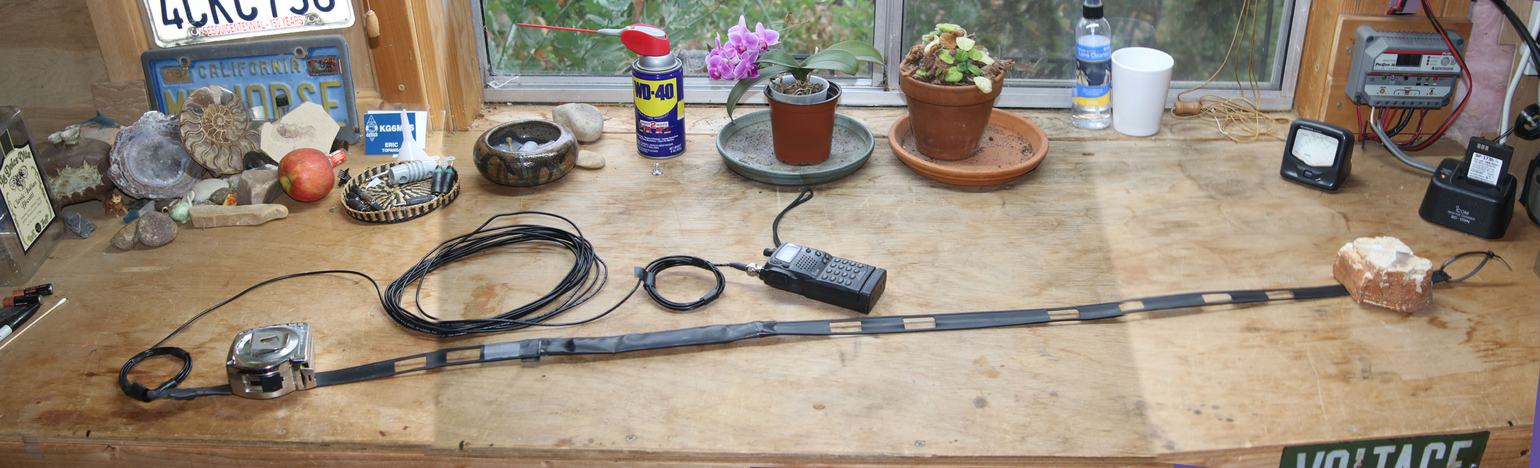
I had some 450Ω window line lying around that I had trimmed off my multi-band doublet, so it was relatively easy to make a roll-up J-pole to go with my Icom IC-T7H. The feedline might be a little long and I suspect the RG174 might be a bit lossy on 2 meters, but I wanted to test it out.
The finished roll-up J-pole on my workbench
Now what peak to test it on? There was a VHF sprint planned by the Conejo Valley Amateur Radio Club for the upcoming weekend and they were talking about activating the local peaks, so a peak high above the entire area seemed like a good match for the new J-pole test.
This is about 3 miles to the summit and 1,200′ up. It is a beautiful, shady, well graded trail with several nice views along the way. There are several gigantic incense cedars on the trail up that bear deep scars from long-ago fires, but they have completely recovered into well-shaped, mature trees. I did most of the trip up before sunrise and didn’t see another soul. I had the summit to myself for an hour or so.
The roll-up J-pole was quickly deployed in a pine tree near the summit and immediately produced the needed four contacts, including one full-scale with my friend Brian WA6JFK in Glassel Park and one with W6FE in Chula Vista near the Mexican border. In a side-by-side comparison with the rubber duck on my Kenwood TH-F6A, the J-pole clearly out-performed on receive. Perhaps the best advantage is the ability to find a more comfortable operating position enabled by the feed line. The HT itself does not need to be held high.
The roll-up J-pole is deployed behind me.
The wisdom of choosing a weekend of the Camarillo ARC VHF sprint, though, was doubtful. There were a lot of green operators on the air that probably could not hear all the traffic on 146.520 MHz. Even all the usual simplex frequencies were busy. Early on it was not hard to get my 4 contacts on 146.580 MHz, but later trying to make summit-to-summit contacts on the national calling frequency was extremely trying. I only made 6 S2S contacts with three different 1 point mountain tops. All in all, 20 2m FM contacts were made.
Trail sign at the junction of the Waterman Mountain trail and the Twin Peaks turn-off.
Soon many people were enjoying the park-like pines surrounding the summit boulders. There was enough room for good social distancing.
As a kid growing up in the Santa Monica Mountains I visited Castro Peak many times. When I first hiked up the summit on May 27, 1973 it was a beautiful summit with a stand of pine trees and an abandoned fire lookout tower. The tower was open and still contained some rainfall records from the final years of operation.
Over the years a communications site was established and expanded. There was even a local FM radio station, KBU (‘BU as in MaliBU) as I recall. It all burned in the Dayton Canyon Fire on October 9, 1982 – a fire that nearly destroyed my family’s home. I listened to KBU go off the air that day as we fought the fire.
I know that the Los Angeles County Sheriffs Department has a facility there now.
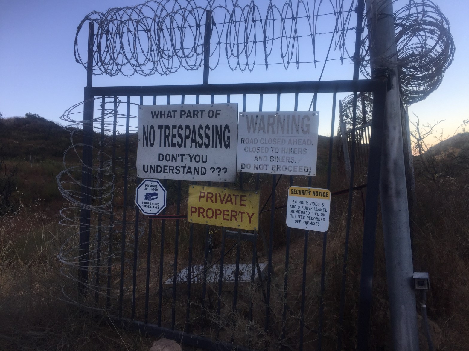
I was surprised to see that Castro Peak has never been activated. This morning I explored a few different possible routes and was met with resounding failure. Everywhere I looked I found a lot of NO TRESPASSING/PRIVATE PROPERTY signs.
Mystery of why Castro Peak has never been activated solved.
I might ask a few friends who work with the Lost Hills Sheriff’s Department if permission might be granted, but I’m not holding out a lot of hope.
Ah for the good old days!
The gate on Castro Mountain Motorway was open, but I heeded the signs. As Don Henley said “This ain’t no Shangri-La.”
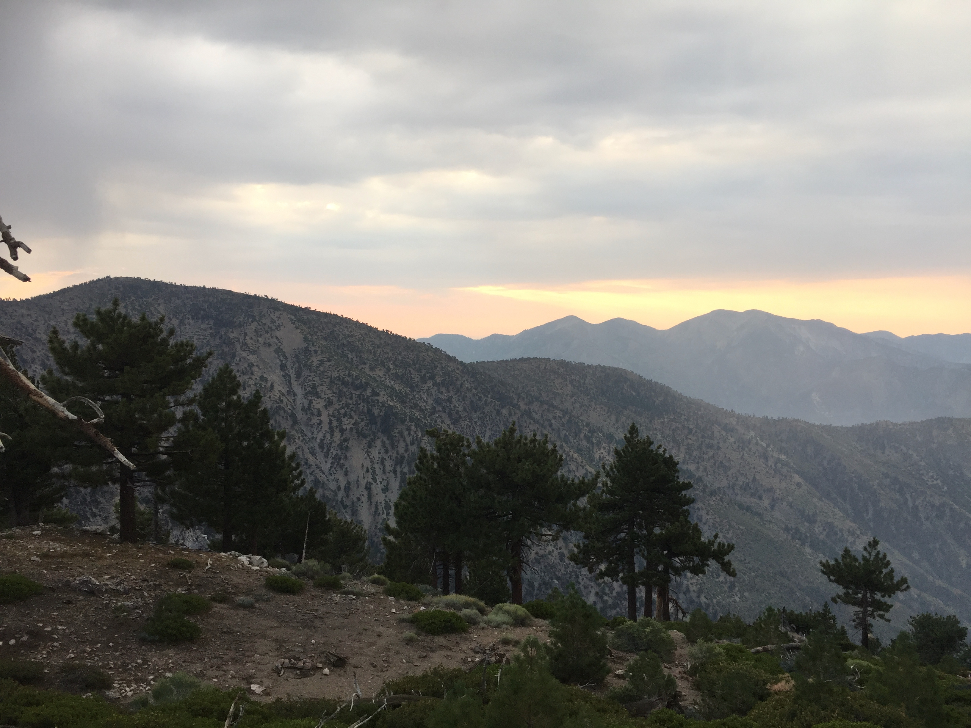
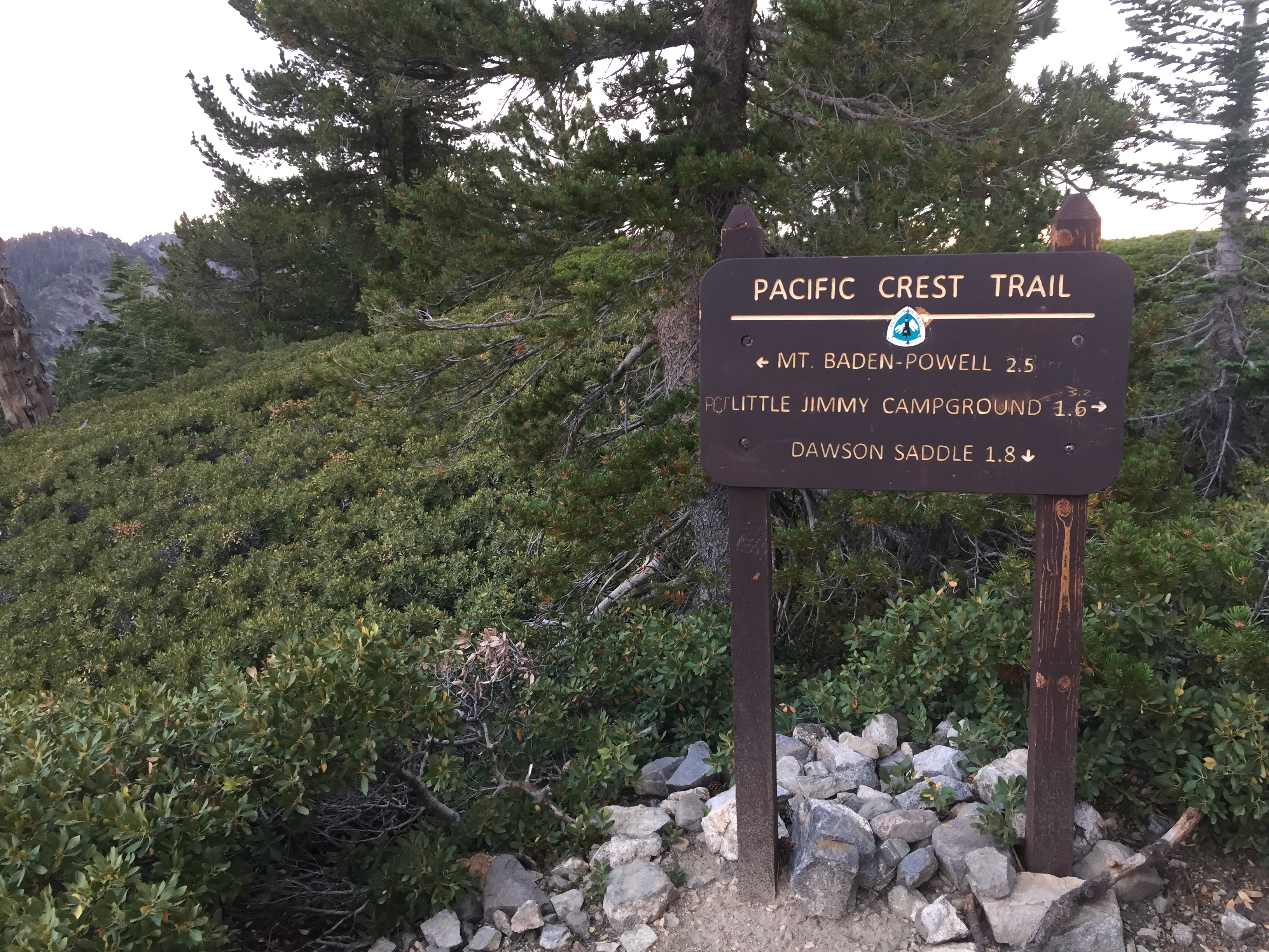
Another 4 am start from Topanga in an effort to beat wearing a mask on the way up the mountain due to the Covid-19 pandemic. I arrived at Dawson Saddle about 6am and there was only one other hiker getting ready. The smoke from the Apple fire was somewhat abated but the air was heavy with monsoon moisture. The hike is a beautiful, easy stroll up a forested, well-graded trail. It’s about 2 miles and 1200′ to the summit from Dawson Saddle. I was met with a brief rain shower on the trip up – just enough to wet the ground and cool me off.
Check out the Hundred Peaks Section guide to Throop Peak.
On the summit several people stopped by and I explained what the Summits on the Air program was all about. Jacob, originally from Texas, had spent the night on Baden-Powell and was headed back to Dawson Saddle. Catherine was a beautiful young woman from San Diego who was headed up to Baden-Powell on her own. Good for her! These young soloists had a palpable love of the mountains that did my heart well to see their knowledge and enthusiasm in these strange days.
Baden-Powell and San Antonio from intersection of the Pacific Crest Trail and the Dawson Saddle Trail
I made 11 contacts on 2m FM including 6 summit-to-summit!
Happy Activator
MT LEWIS 22 AUGUST 2020 W6/CT-246
One star – Nothing special but I’d do it again.
Elevation:
8,353′
Route:
Good use trail
Hike Distance:
1 mile round trip
Elevation Gain:
450′
Navigation:
Easy
Steepness:
Steep
Vehicle:
Passenger car
Road:
Paved highway
Cell Coverage:
n/a
Hike basics
I wasn’t really sure where I was going to go from Throop. I had been thinking about Mount Baden-Powell, but I was already starting to see a lot of people. The thought of hiking uphill with a mask on in the muggy, monsoon air was not appealing, but I wasn’t feeling done for the day so I decided on the short steep trip up Mount Lewis. I figured I would see fewer people there.
As easy the grade is on the Throop trail, the Mt. Lewis trail is as steep. It is only about a third of a mile and 500′ up. Jeffery Pines provided the shade for my stops to catch my 64-year-old breath. The top is pleasantly forested as well and would make a fun overnight camp spot.
Check out the Hundred Peaks Section guide to Mount Lewis.
Got it made in the shade on the summit of Mount Lewis. Will Thrall Peak and Pallatt Mountain in the background.
I made 6 contacts including 2 summit-to-summits with K6TNT and KK6USY booming in from over on Kratka Ridge. All-in-all a very successful day with 16 activator points and 21 S2S points.


Leave a comment