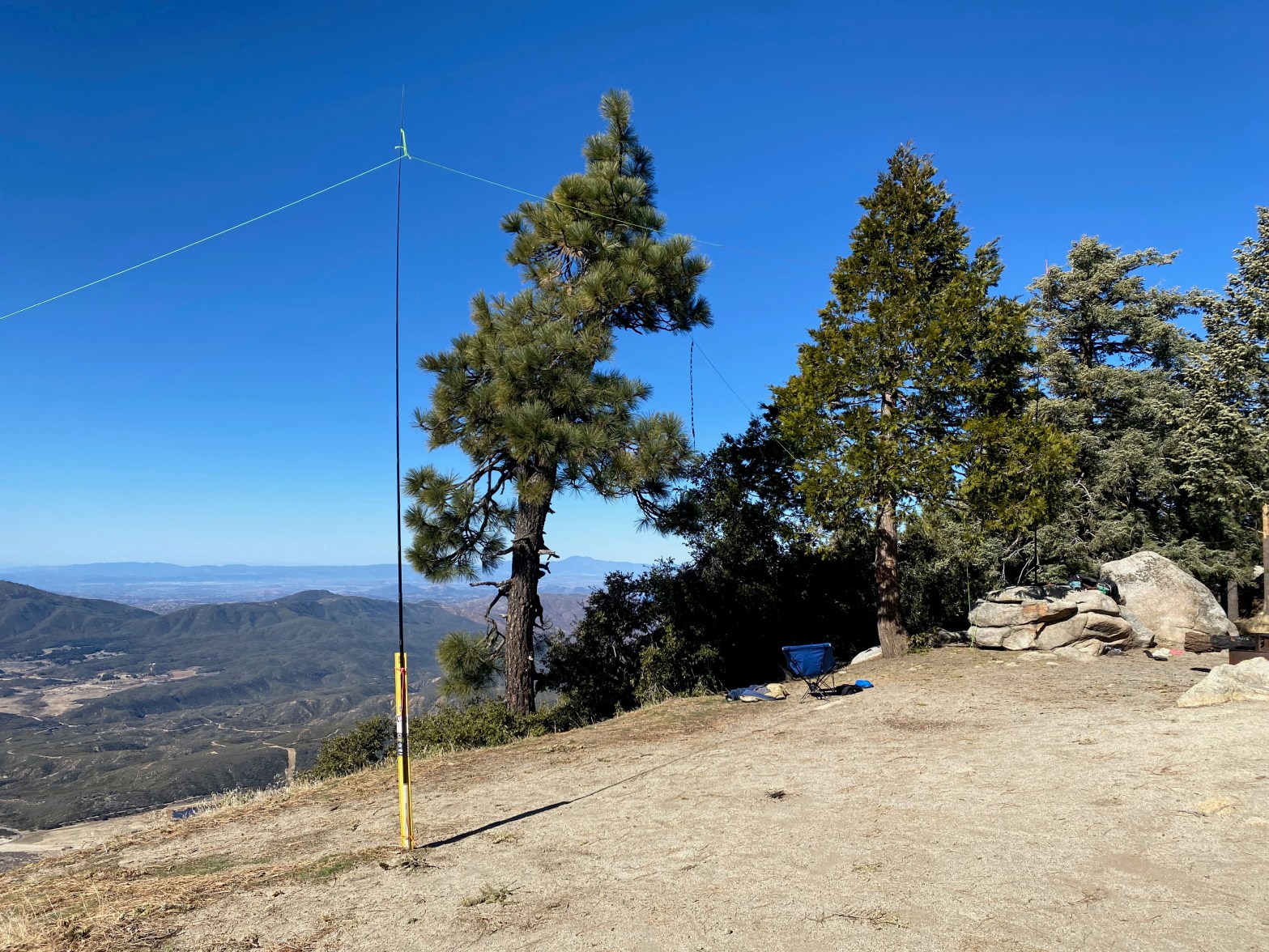
Here is one leg of the doublet and the roll-up slim jim antenna for 2m. 23 FEBRUARY 2025 W6/CT-016 Elevation: 6,825′ Route: Drive up Hike Distance: n/a Elevation Gain: n/a Navigation: n/a Steepness: n/a Vehicle: High clearance 4wd suggested Road: As of this trip pretty rutted Cell Coverage: Good Verizon Hike basics When I firstContinue reading “Thomas Mountain”
Tag Archives: San Bernardino Mountains
7,940′ “Strip Mine” Summit
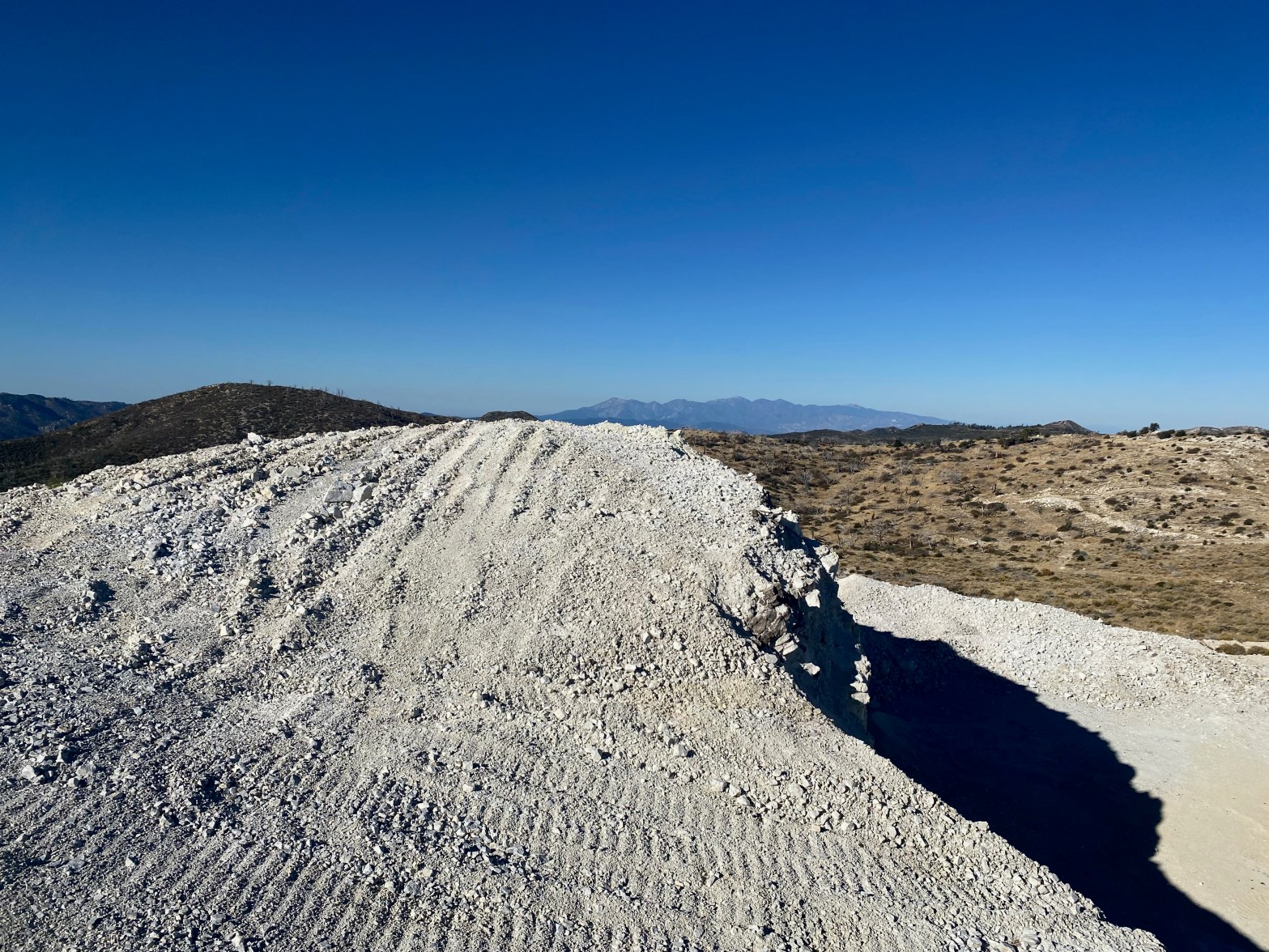
Looking west toward the San Gabriel Mountains over what is left of summit 7,940′ 21 OCTOBER 2023 W6/CT-060 Elevation: Something less than 7,940′ Route: Mining road Hike Distance: 2.2 miles round trip. Elevation Gain: 350′ Navigation: Tricky because of the changing topography Steepness: Gentle on the route below Vehicle: Passenger car Road: Good dirt roadContinue reading “7,940′ “Strip Mine” Summit”
Mountain Home Peak
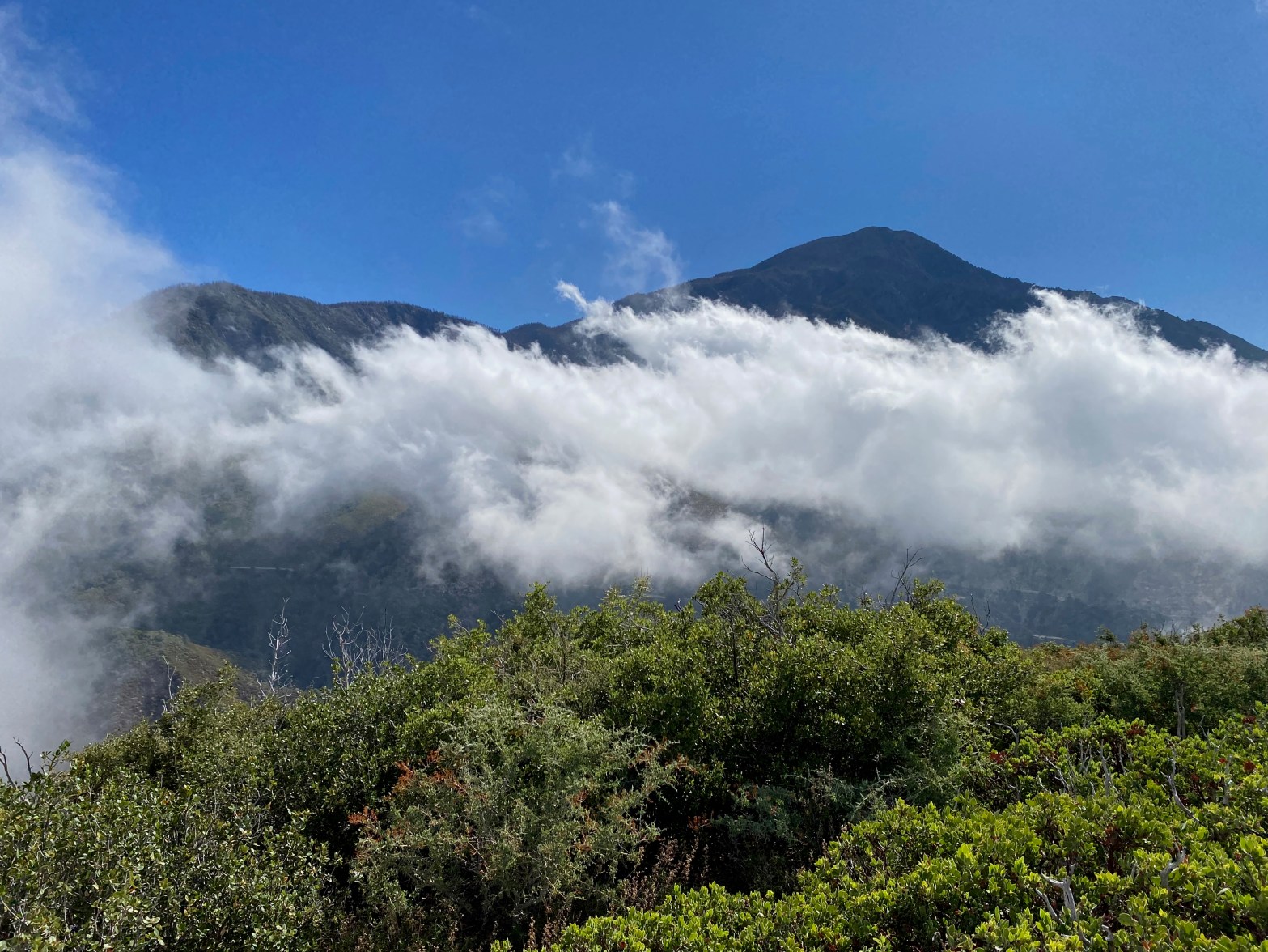
A cloud dance in front of San Bernardino Mt. morning after a very unusual winter-type storm in Southern California 3 SEPTEMBER 2023 W6/CT-090 Elevation: 7,470′ Route: Cross country Hike Distance: 1 mile round trip Elevation Gain: 500′ Navigation: Easy Steepness: Moderate to steep at the end Vehicle: Passenger car with decent clearance Road: Dirt roadContinue reading “Mountain Home Peak”
Silver Peak
David Hodge N6AN on the summit 29 APRIL 2023 W6/CT-073 Elevation: 6,756′ Route: Dirt road and use trail Hike Distance: 4 miles round trip Elevation Gain: 1000′ Navigation: A bit tricky Steepness: Very steep Vehicle: Passenger car Road: Forest service dirt Cell Coverage: Excellent (Verizon), APRS Excellent Hike basics David N6AN and I had beenContinue reading “Silver Peak”
Bailey Peak

Looking east toward all the big San Bernardinos and Mount San Jacinto 1 OCTOBER 2022 W6/CT-099 Elevation: 5,699′ Route: Use trail Hike Distance: .3 miles round trip Elevation Gain: 140′ Navigation: Easy Steepness: Easy Vehicle: High clearance 4 wheel drive recommended Road: Steep, rocky forest service road Cell Coverage: Excellent (Verizon), APRS Excellent Hike basicsContinue reading “Bailey Peak”
Cleghorn Mountain

The San Andreas Fault Zone northwest of Cleghorn Mountain at sunrise. 1 OCTOBER 2022 W6/CT-112 Elevation: 5,333′ Route: Firebreak Hike Distance: .2 mile roundtrip Elevation Gain: 80′ Navigation: Easy Steepness: Gentle Vehicle: High clearance SUV recommended Road: Forest service dirt Cell Coverage: Good (Verizon), APRS Excellent Hike basics Post to follow…. Stay tuned….
Onyx Peak

Fantastic fun was had on this winter ascent during the wildly successful Winter SOTAfest.
