With the local National Forests still closed I decided to repeat this old favorite. I’d first done this mountain in 1978 by going up the northeast ridge. Now there is a pretty well established trail going up the east ridge. There is a fun little 3rd class section that can be avoided by a bypass trail on the left, or south side. I opted for the third class route going up and the bypass going down – opposite of my last trip.
Another pre-dawn start got me to the summit of Simi Peak just as the sun rose. It was forecast to be triple digits in the Valley and I wanted to be back at the car before the temperature broke 100.
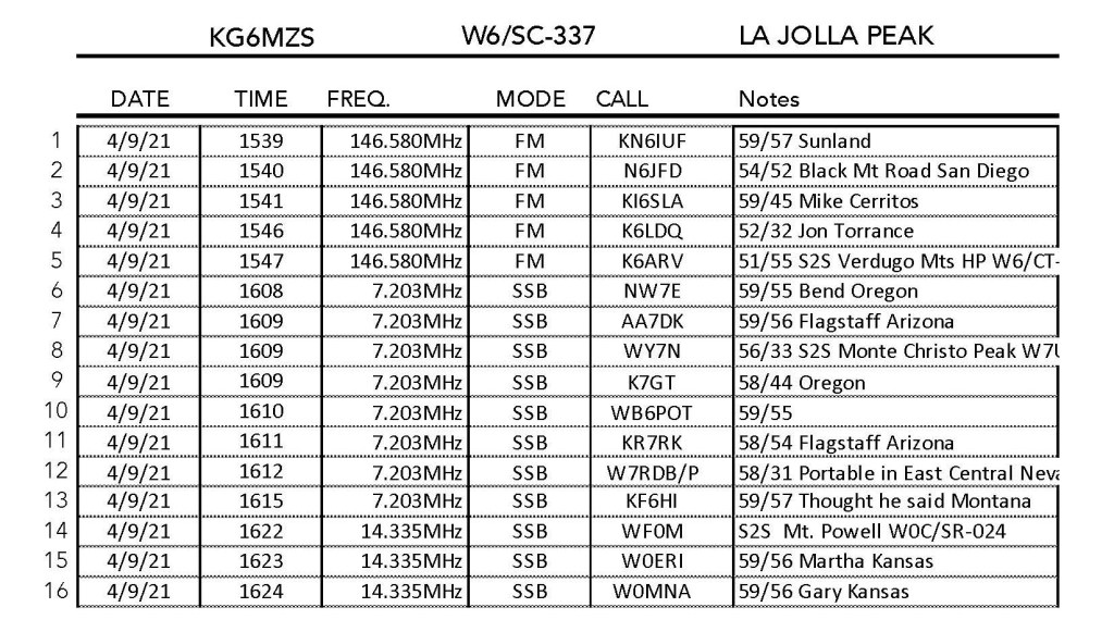
Perhaps the best part of this activation was that I got to work Martha W0ERI and Gary W0MNA on our first summit-to-summit. Martha and Gary have been such faithful chasers that it was a thrill to finally get them on a summit – and a S2S no less! They were on Rich Mountain in Arkansas. I could hear them quite well on the QSB peaks on 20 meters. They had a little trouble pulling me out, but we made contact!
The hike was the same one I did on my last activation on October 13, 2020
This time the 2.5 mile hike with over 1,000 feet of gain took me a little over an hour. Plenty of parking at the end of King James Court.
Hines Peak W6/SC-010 and the Sespe/Topotopo wilderness over Bard Lake at dawn.Here’s the friendly hiking group that came up to the summit shortly after dawn. The woman in the center in the white skirt is their leader. They were were very forgiving of my SOTA activity.
Massive high tension power lines produce a charge in my 40 meter doublet
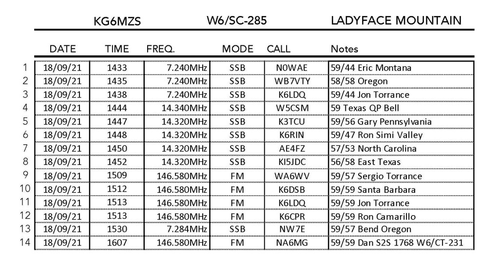
9 SEPTEMBER 2021 W6/CT-244
An interesting thing happened on this sunrise activation. As I was setting up my 40 meter doublet to start calling out on that band, I received a not-insubstantial shock off the leads to my antenna. I suspect that the harmonics from the 60 Hz AC in the overhead lines were strong enough to generate this charge. I decided not to risk the circuitry in my precious KX2, so only operated on 2m and 70cm for this one.
Brian WA6JFK tells me that William H. Workman was a mayor of Los Angeles in the 1800’s and married into the Boyle family – as in Boyle Heights.
The hike is very short – about a third of a mile and up only 200 feet or so. There is parking on Turnbull Canyon Road. Decent cell coverage from Verizon.
I caught Dan NA6MG on 70cm mobile. He said that when he was on Workman Hill the grass was very high and there were a lot of red ants. He got bitten twice. Sure enough, after the sun came up, red ants started coming out of their holes. I managed to get bitten once on the next summit – 1,416.
Sunrise over the San Gabriel and San Bernardino MountainsThe sun just peeking over San Gergonio Mountain
Peak 1,416′
9 SEPTEMBER 2021 W6/CT-242
I decided I had enough time to activate this close-by summit to Workman Hill. There is plenty of parking at the end of Gotera Drive. This hike is also pretty short — about three-quarters of a mile and up 300 feet.
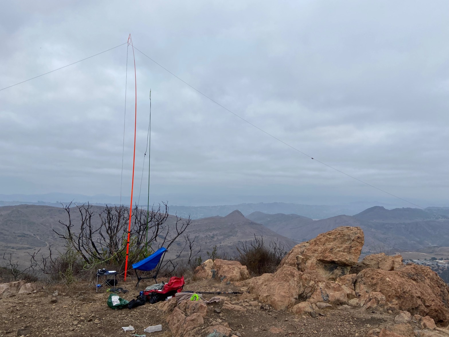
Sunrise over Boney Mountain and Sandstone Peak (W6/CC-056)
4 SEPTEMBER 2021 W6/SC-337
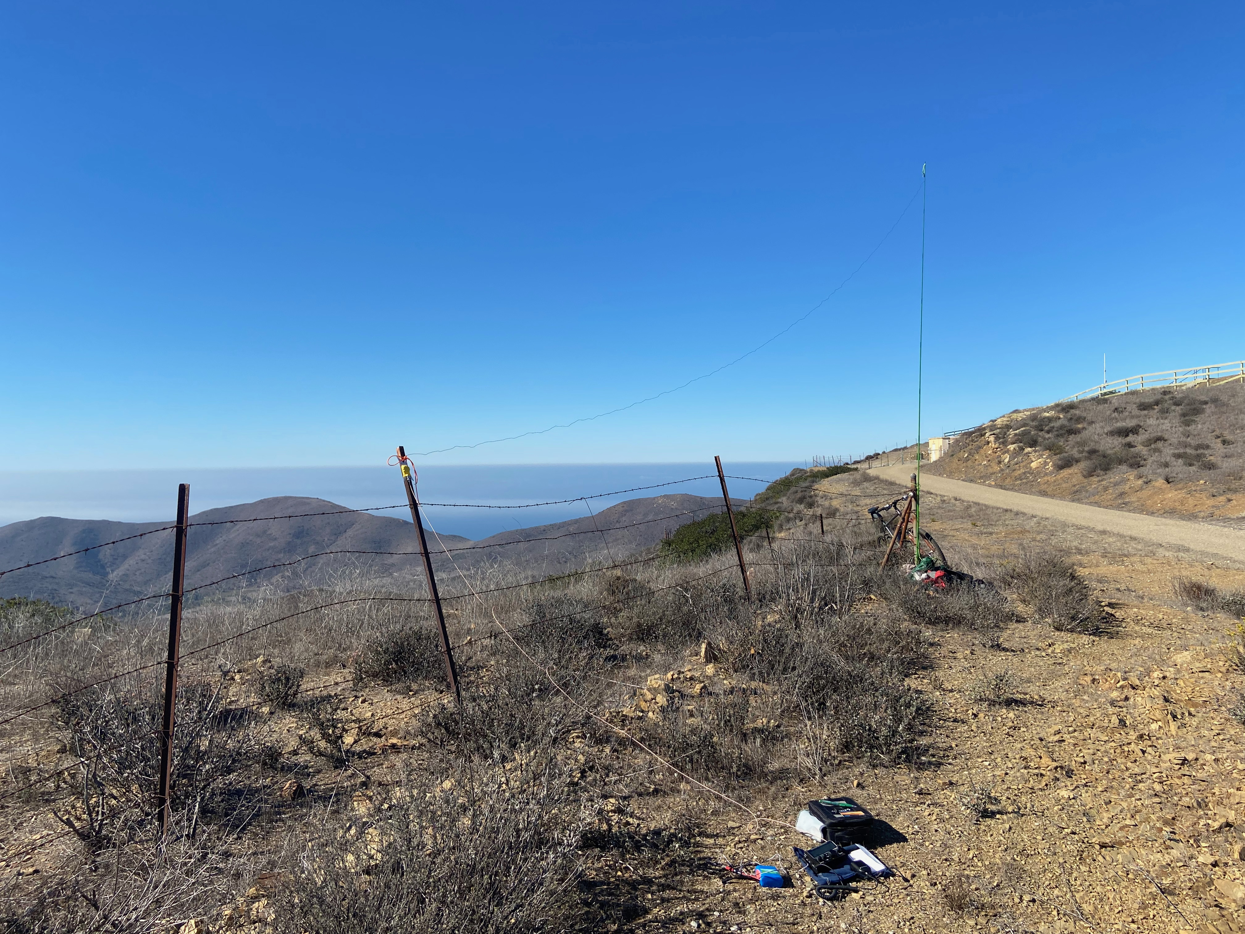
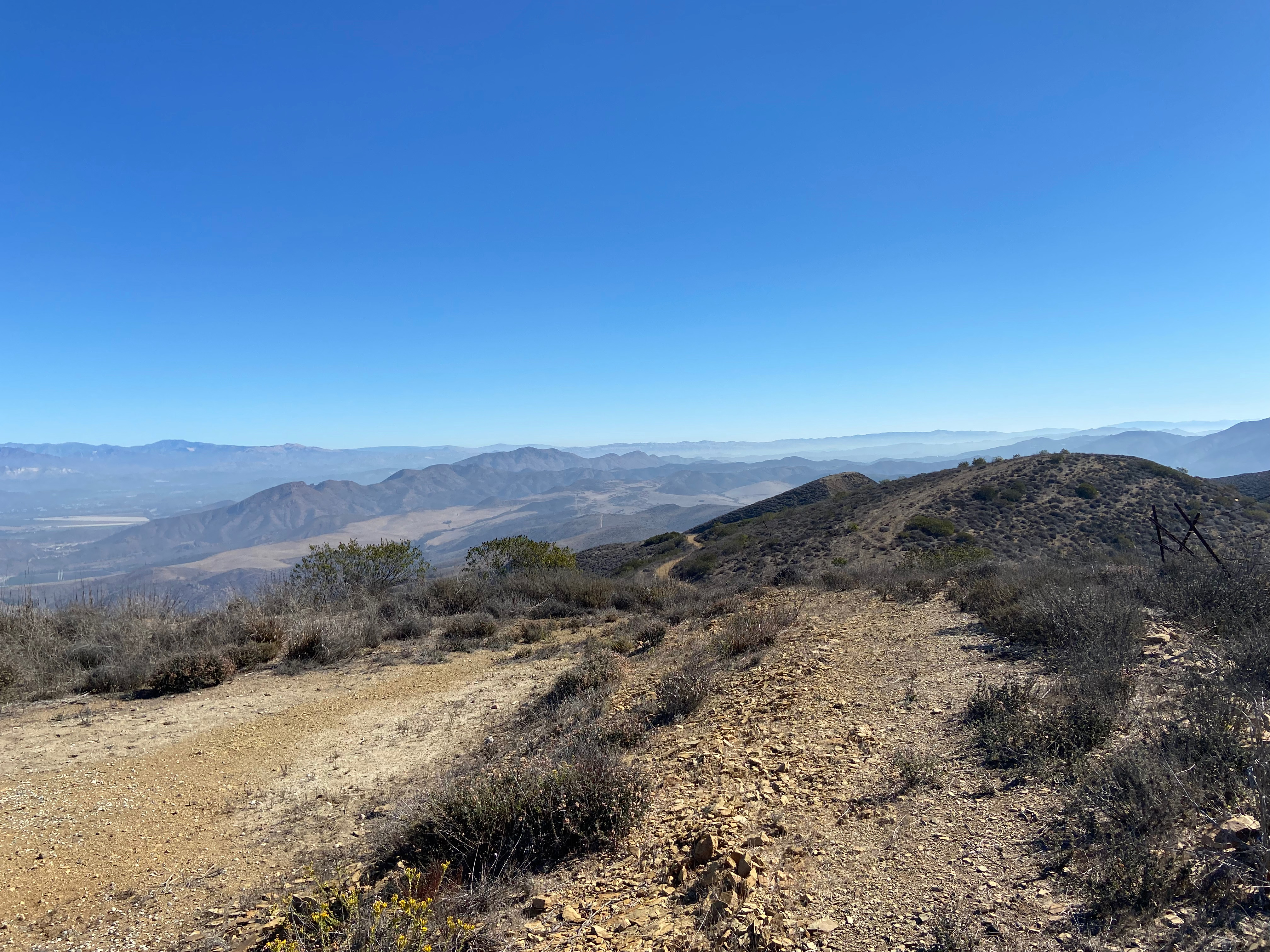
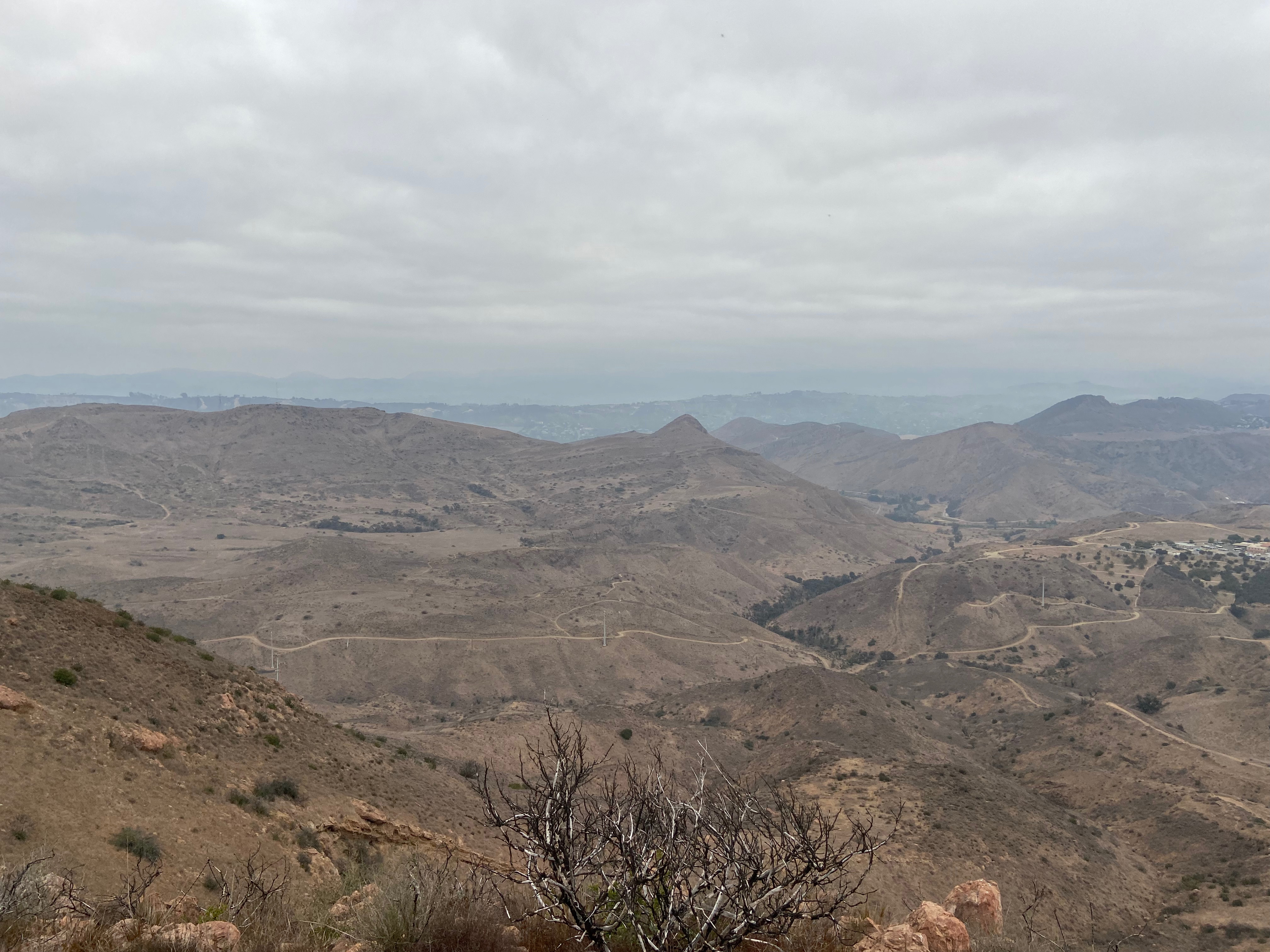
This was a strange and wonderful trip — it was my first mountain bike summit in many years — it was a trip to a summit that I am sure I have done sometime before in the last 40 years, but I mysteriously have no record of it — It was hard to find any summits to activate that are not affected by the statewide closure of national forests due to the lack of firefighting personal already engaged in fighting other fires — this ascent marked my final SOTA summit in the Santa Monica Mountain and the adjacent areas to activate — …and finally this ascent was both easy and hard.
My neighbor Chris generously gave me his mountain bike when he heard I was interested in activating summits via the pedals. This was this amazing gift’s maiden voyage and she performed excellently.
I got to Sycamore Canyon Campground at about 5:30 AM. The State Parks website said that the park was open for day use from 8AM to sunset. I didn’t figure that the parking lot gates would be locked until 8AM. It turns out you can park from 5AM to 10PM along the coast just around the point to the west by the big sand dune. From there it is a short trip back to the mouth of Sycamore Canyon.
When I said the trip was both easy and hard, I meant that the ride from the start to the junction of Guadalasca Trail and Wood Canyon fire road is a breeze. One of those rides that feels like downhill both ways. You actually go up about 450 feet in that 4.75 miles but it is all good, wide fireroad. The Guadalasca Trail is another story. I am not a mountain biker with a lot of skill. I generally don’t like single-track. Your skill level is most likely better than mine and this trail is probably no big deal. I saw a lot of guys and gals riding it. If I were to do this again, I would probably continue up the Wood Canyon fire road and follow Sierra Vista fire road to Rosewood fire road on to the summit. Longer by quite a bit and I’m not sure how well-used that route is.
At any rate the Guadalasca Trail never actually joins the Rosewood fire road and the two trails that bridge that gap are pretty overgrown and disused trails. I did one on the way up and the other on the way down. These segments are unmaintained and brushy. No fun.
The fire road gets pretty steep above where the jump-over trail joins up. I walked both up and down that section. Also – I was attacked by a swarm of mosquitos at this point. Very weird for the Santa Monica Mountains – especially in such a dry year. They abated on the summit where a nice breeze was blowing.
There is good cell coverage from Verizon.
I had a great day on the radio making 16 QSOs on 40m, 20m and 2m including 3 summit-to-summits with California, Utah and Colorado. Thank you all for chasing – especially good to get so many regulars.
There is a aircraft locator on the actual summit. I set up off to the east. No table and chair to keep the pack lightCobblestone, Conejo and Oat Mountains, to name a fewMy new bike on the way up.Nice view of Round Mountain (W6/SC-381) down in the midground. Hines Peak and others in the Sespe/Topotopo area.
I saw a roadrunner on the way down. First one in a long, long time in the Santa Monica Mountains. Also saw a lot of quail and rabbits.
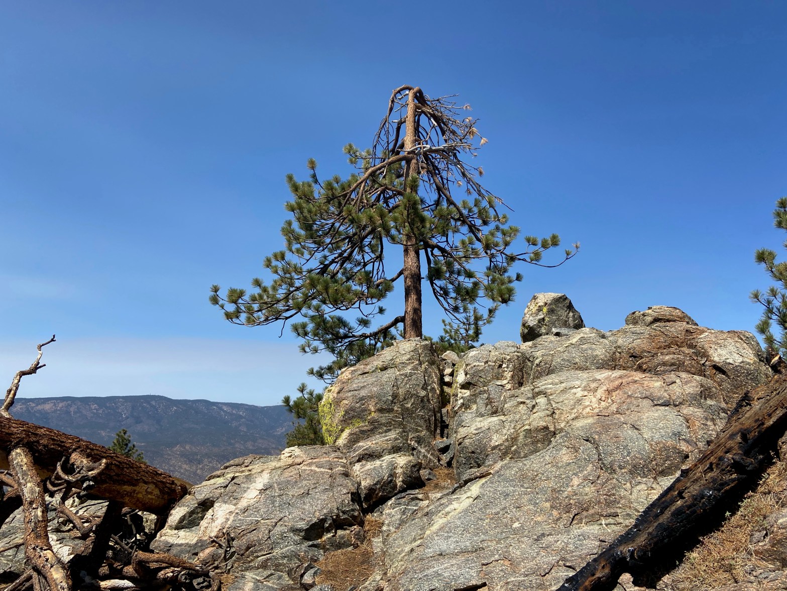
We got the news yesterday that essentially all national forests in California are closed for two weeks due to fire-fighting resources being spread too thin on existing fires. This has most of us scrambling to find summits that are still open. Since I’m trying to do all the local peaks here in the Santa Monica Mountains and areas adjacent, I picked this little local unnamed peak for a cloudy Wednesday morning hike.
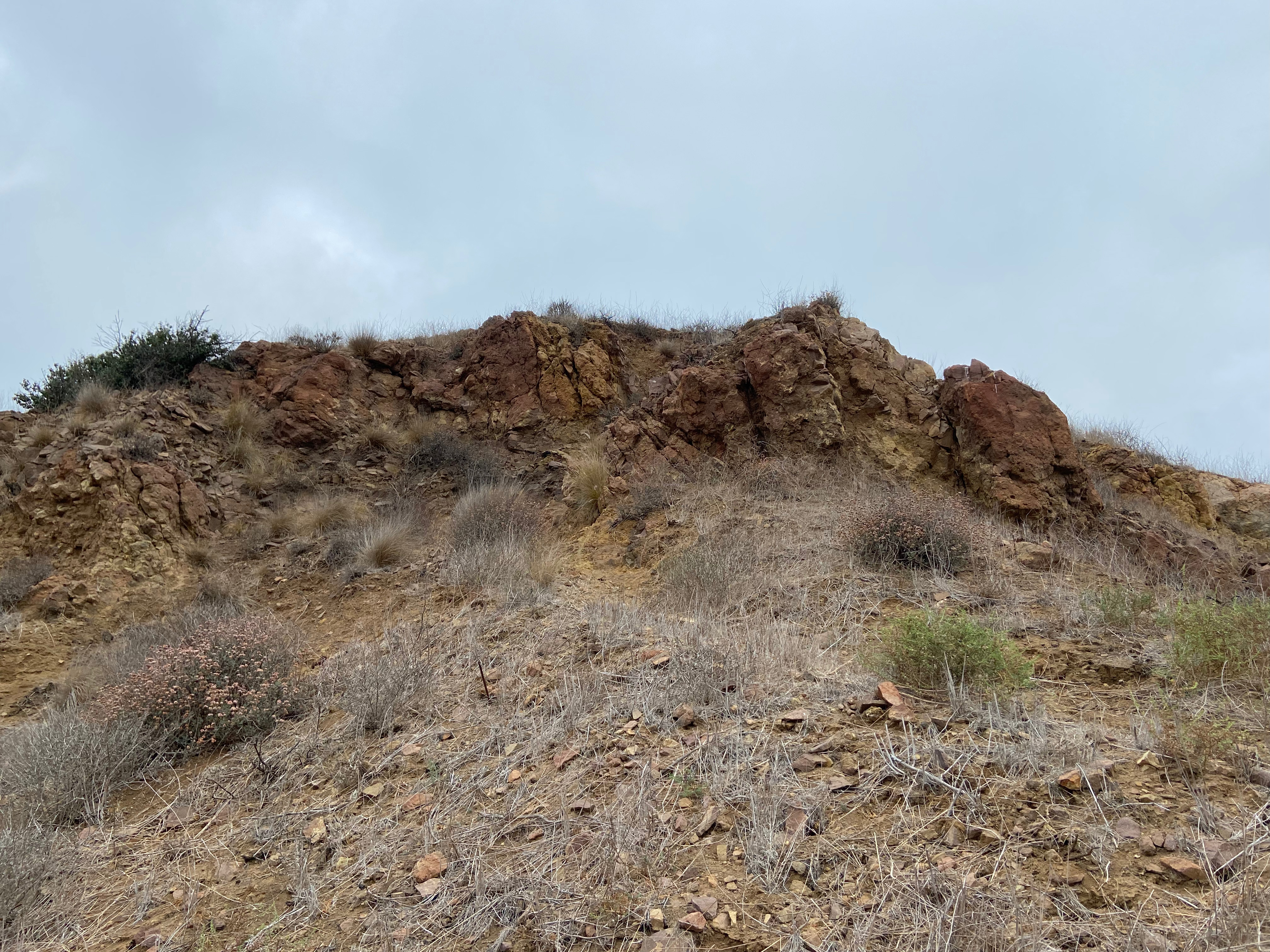
This hike is short and pretty steep. In fact there is a third-class section right below the summit. There is a trail that circumvents this outcropping of igneous breccia, but I decided to climb up it on the way up. I went around on the way down.
The hike is about a third of a mile and climbs up 500 feet.
Cell coverage from Verizon is excellent, as one might expect being so close to the Ventura Freeway.
I made 9 contacts on 40m, 20m and 2m including one summit-to-summit with David N6AN over on Flint Peak on 20m. Thanks David for getting up as early as I do! It was also good to hear from Gary W0MNA in Kansas and Eric N0WAE in Montana among other faithful chasers. Thank you all who chase.
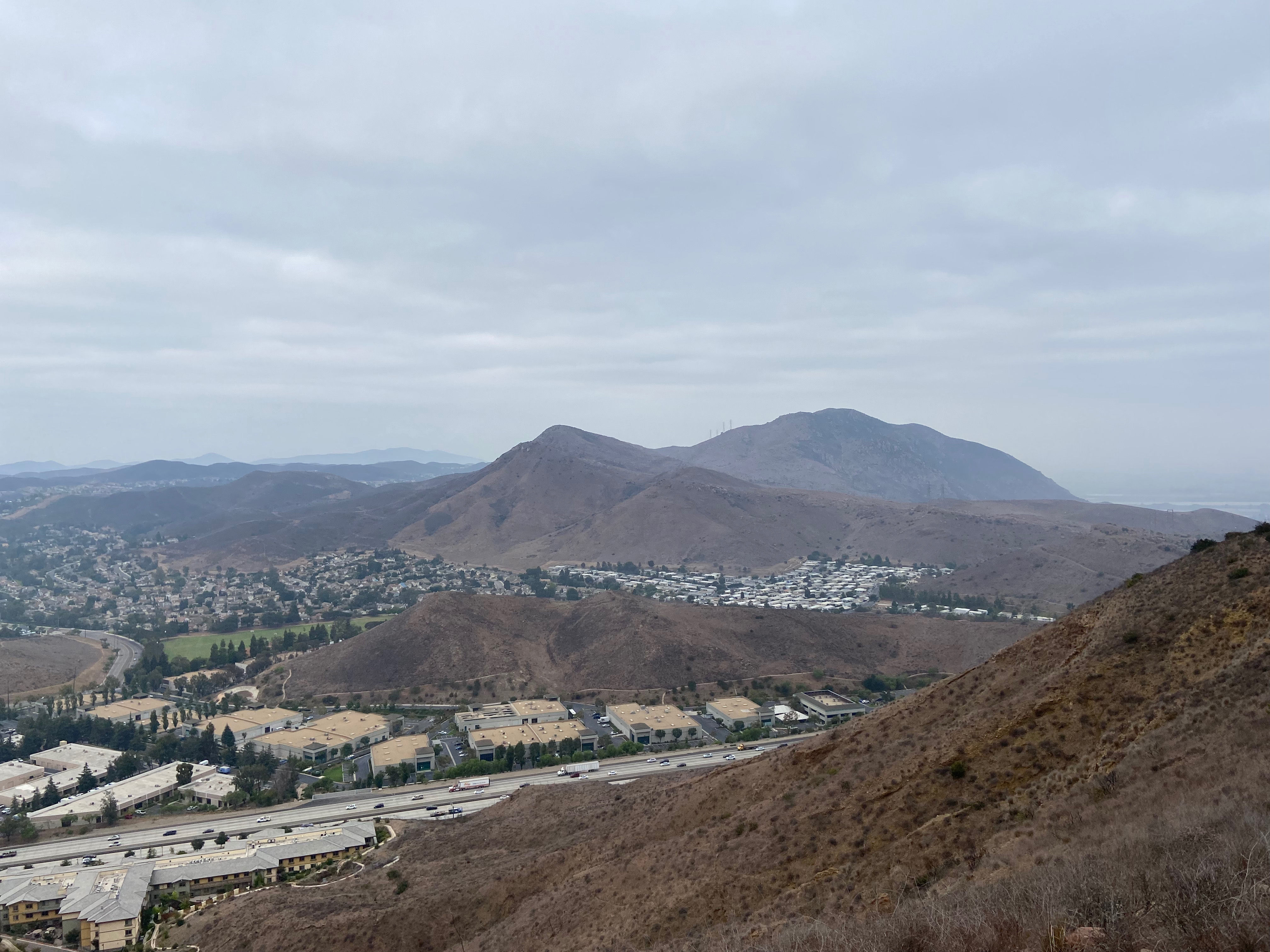
The third class section goes right up the center of this photo. It’s steeper that it looks hereSandstone Peak (W6/CC-056) over Newberry Park. You can see my white Audi parked in the lower right.Conejo Mountain (W6/SC-318)Looking north. I like to see all this open space.
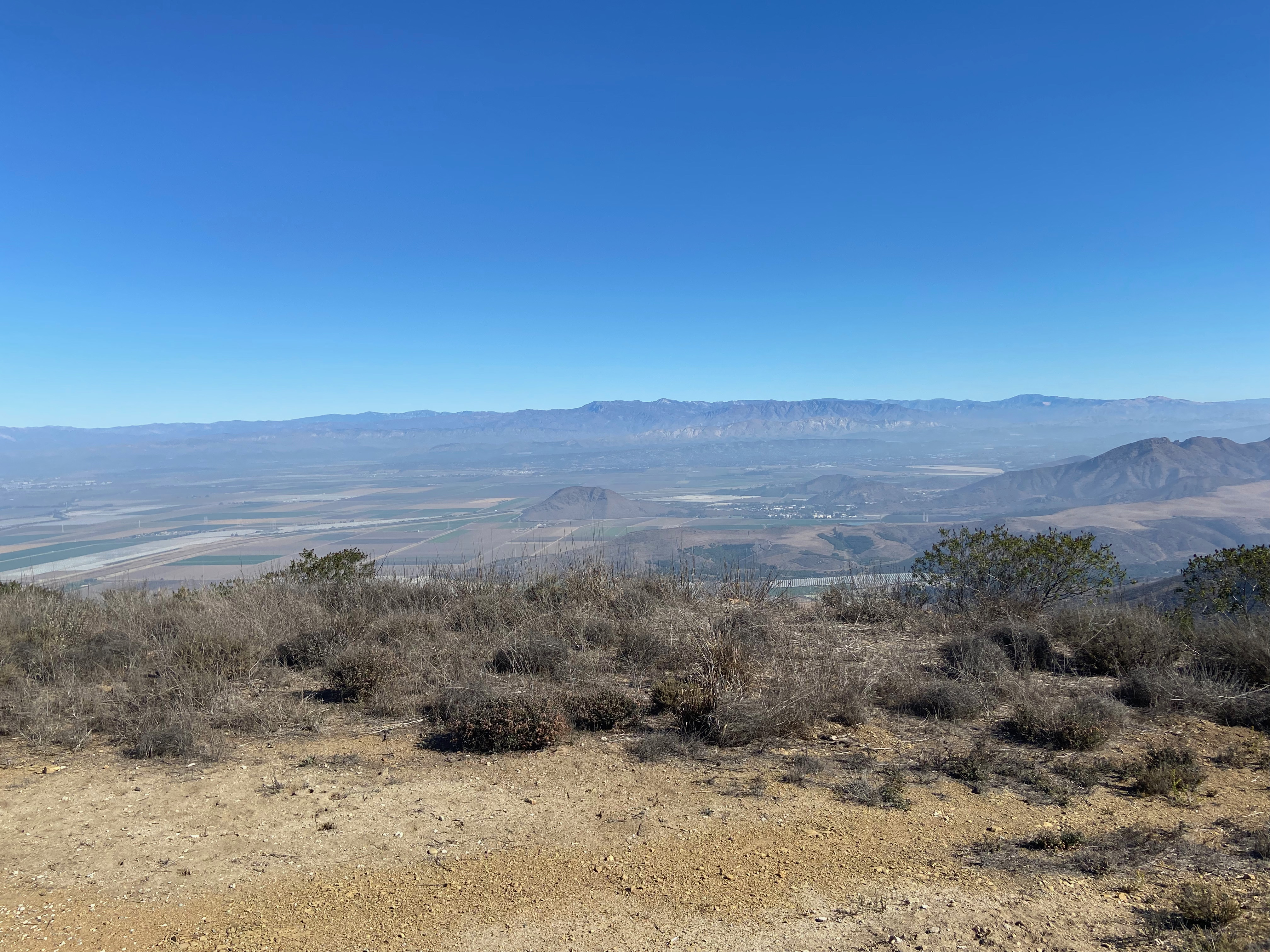
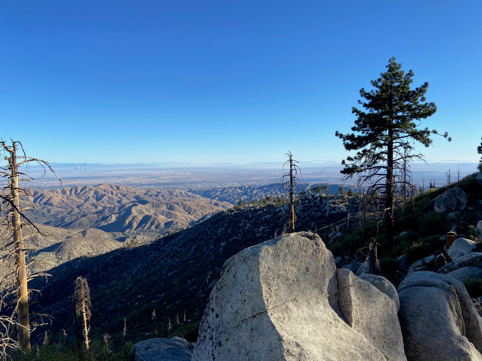
Looking northeast across the Antelope Valley. Telescope Peak (W6/CD-003) was visible on this clear day.
28 AUGUST 2021 W6/CT-015
My last trip to Pacifico Mountain was on June 29, 1980 – over 40 years ago! My friend Jon Fredland drove his 1960 Chevy Impala and as I recall the 6 mile road up from Mill Creek Summit was pretty good and the Impala had no trouble. After last weekend’s discovery that the Alamo Mountain road had deteriorated over the intervening years, I was glad that Brian WA6JFK offered to drive in his Honda Element. The road was a bit rough in places and I was happy not to be in the Audi.
Our SOTA day was wildly successful. I had my biggest day ever with 34 contacts, including 16 summit-to-summits! Thank you Brian for driving. We had a blast on the radios and a nice picnic to boot!
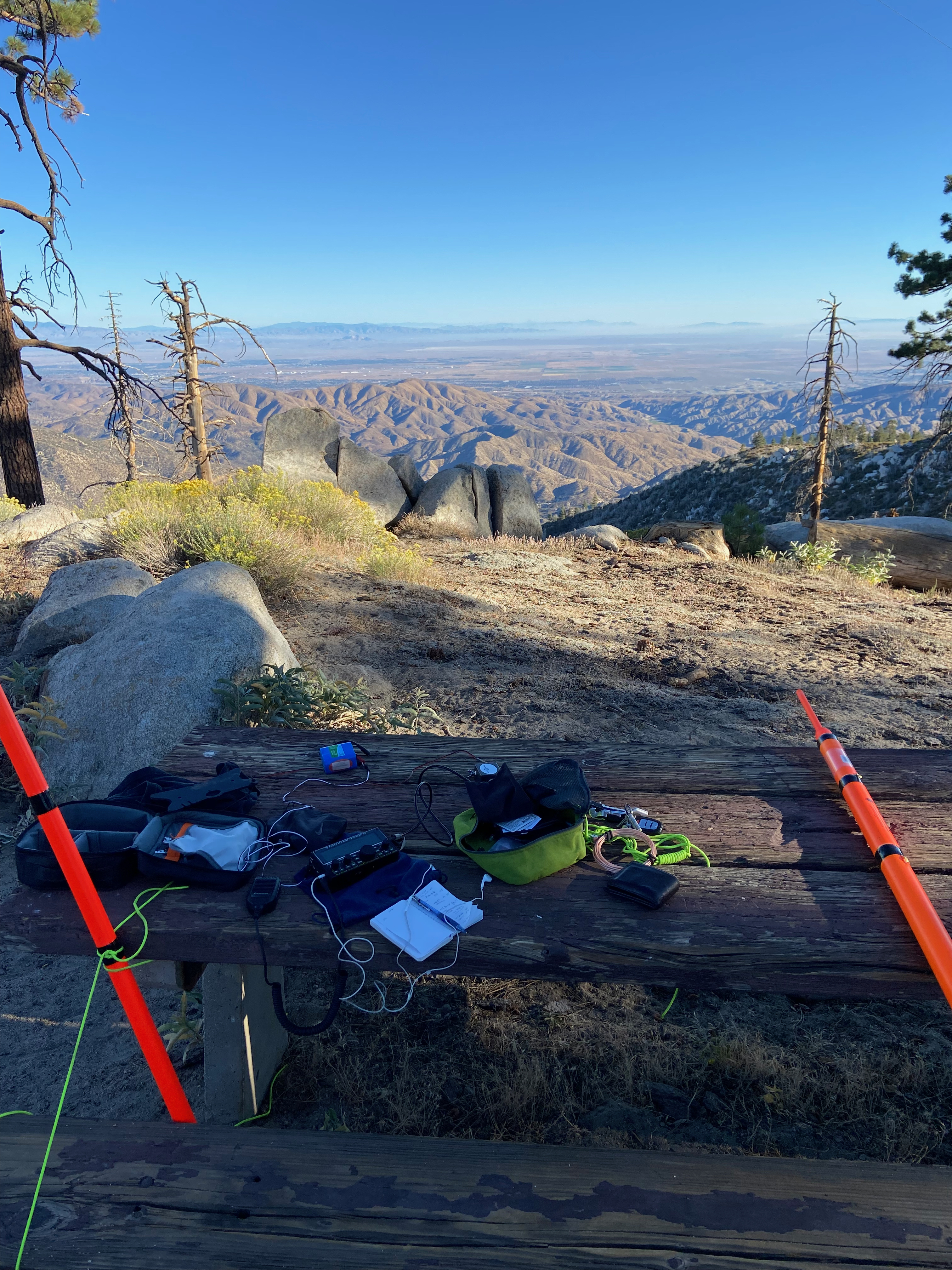
View from the station. Nice to have a built-in picnic table
Sunrise over Conejo Mountain (W6/SC-318), Peak 1,370′ (W6/SC-452) and Sandstone Peak (W6/CC-056) just off to the right
26 AUGUST 2021 W6/SC-381
This wasn’t a really well thought-out activation. Round Mountain rises above Channel Islands College — or what used to be the state mental hospital in Camarillo. I first hiked up Round Mountain on January 3, 1993 with Cassie, my late sister and her future husband, Don Crenshaw. I’d heard that the college is opening a trail to the summit but I wasn’t sure if it was actually open.
I parked just a little way down Portrero Road and just hiked up the hillside. I immediately came across some evidence of a prehistoric Chumash midden – shells and bones all over the ground. This area was once heavily populated by the Chumash for thousands of years.
I was distressed to find a lot of trash on the summit which I bagged up and carried down.
I only had my Kenwood TH-F6A with me and only made two contacts – Dave W3DRE mobile up in Santa Barbara and Doug K6DSB at his home in Santa Barbara. There is good cell coverage from Verizon.
The hike is a half mile long and goes up 500 feet. It starts up some deer trails to the notch between Round Mountain and a little bump to the west. From there it joins the trail that switchbacks up the mountain.
The summit block on Alamo Mountain with Frazier Peak in the background
21 AUGUST 2021 W6/CC-008
On September 28, 1997 I drove my old Volvo sedan up the Alamo Mountain road to the south side of the mountain. I remember the road as being a pretty good road and the hike being an easy stroll though the pine trees to the summit, so it seemed like a perfect fit for my brother. He is down for a week or so visiting from his home in Alaska.
The road is in considerably worse shape than it was 24 years ago and we only managed to make it half way up the mountain with my old Audi A4. Given that the summit has only been activated 4 times previously – and the last time was in 2014 – I should’ve guessed that the road was in bad shape. It is still not difficult for a high clearance, 4 wheel drive vehicle.
Because of the limitations of the Audi – and we probably drove it further than we should’ve – the easy half mile jaunt of a couple hundred feet became a four and a half mile hike up 2,200 feet of elevation gain!
To top it off, my brother’s hiking boot failed and we had to tie it together with some paracord. To shorten the trip to the summit I did a steep cross-country section from the road junction on the north side of the mountain. This proved to be too much for Mark and he waited there for me to ascend and activate the summit.
I made 10 quick QSOs on 2 meters and descended to rejoin my brother. I didn’t bother with HF, the KX2, the table and chair, just lofting the carbon fiber fishing pole with the roll-up slimjim. I used the cool summit block as table and chair. Just 5 watts with my aging Kenwood TH-F6A.
I didn’t actually use the phone, but I believe cell coverage by Verizon is good up the mountain.
Mark on the long hike up with Frazier Mountain and the Tehacapi Range behind him.My brother’s fancy footware.
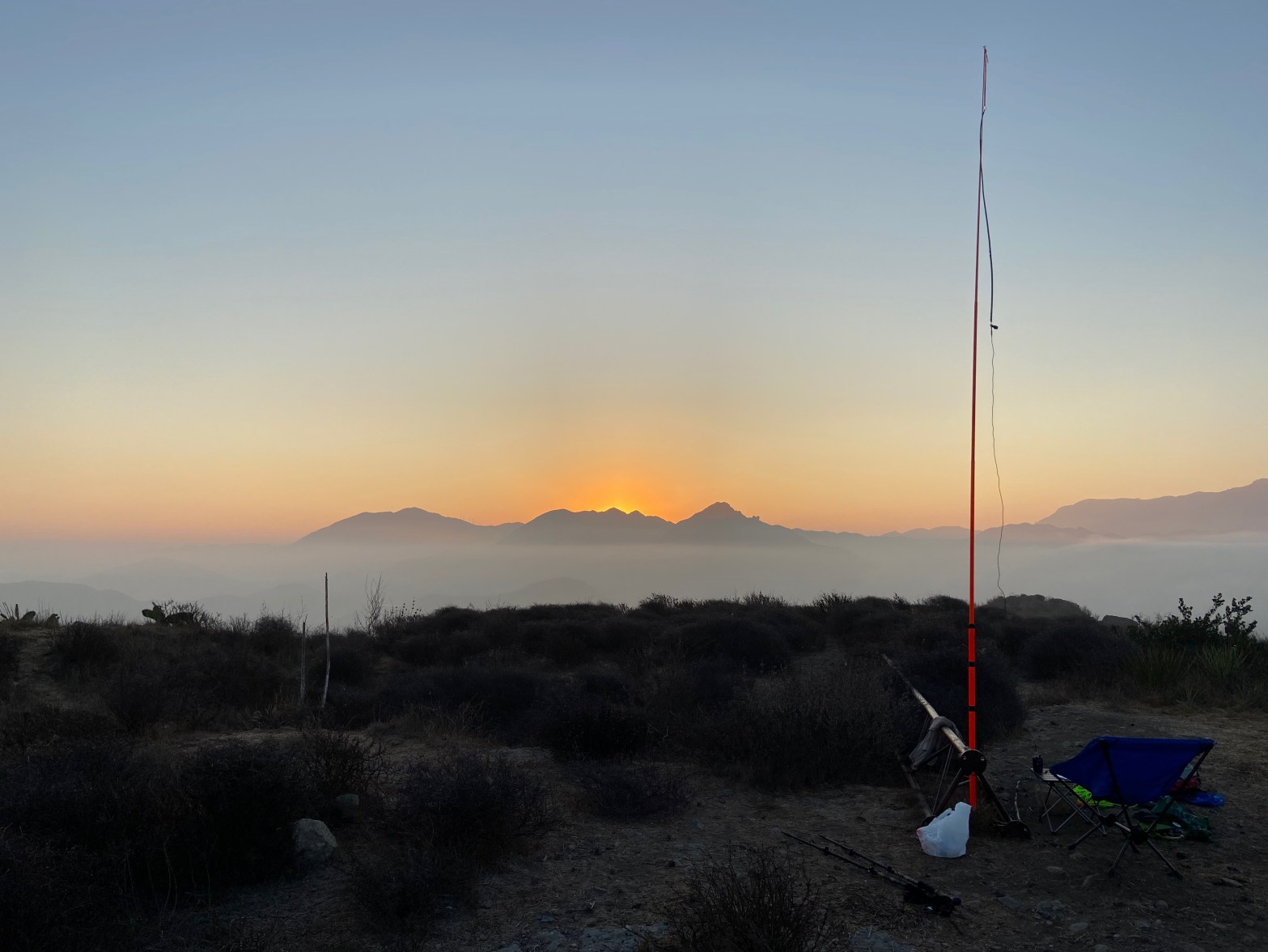
Sunrise over the San Gabriel Mountains an a monsoon sky. The bright spot below is Malibu Lake.
11 AUGUST 2021 W6/CC-057
After being discouraged by all the threatening private property signs last year, I decided to call the number listed on the signs and ask permission to activate the summit. After explaining the SOTA program, permission was readily granted.
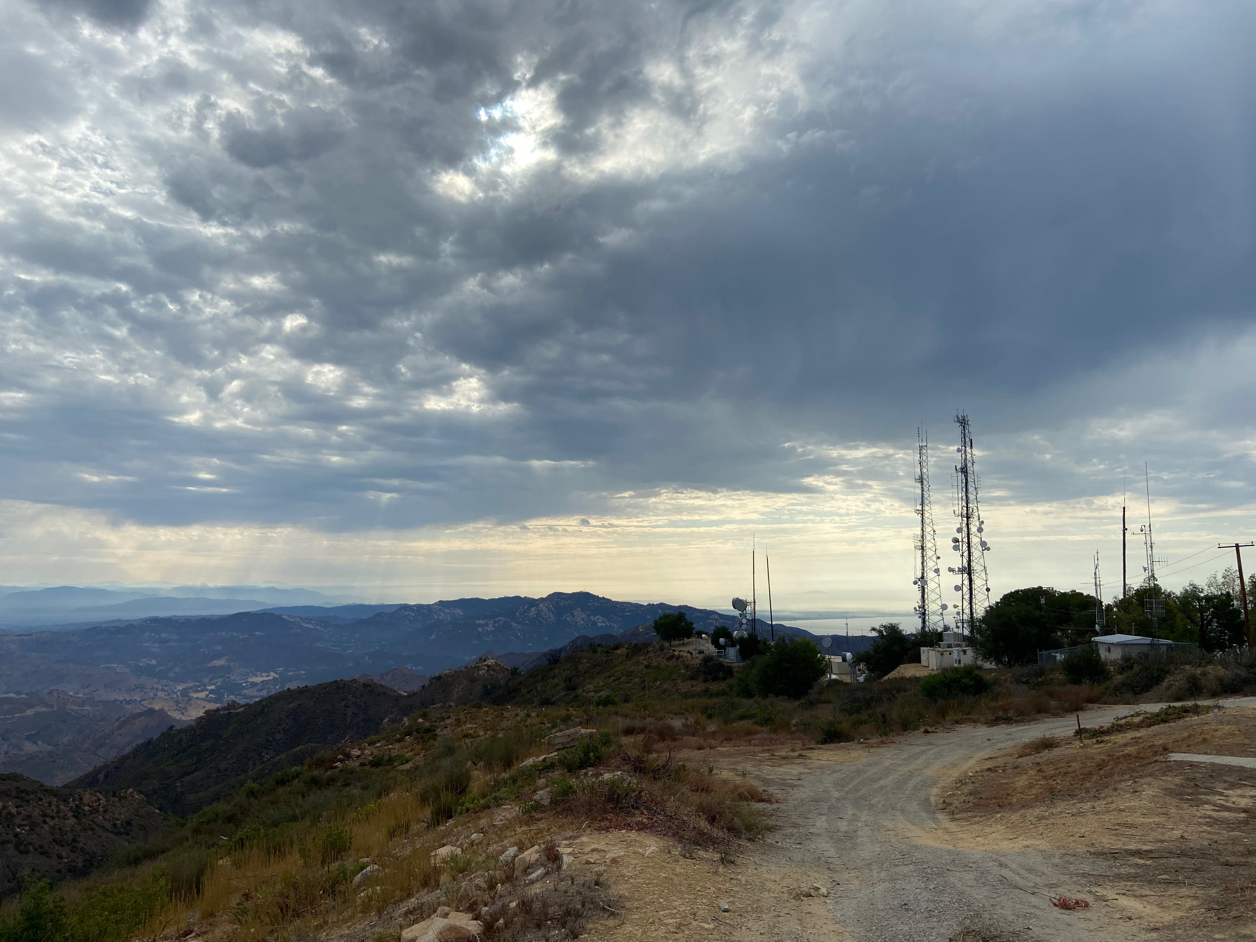
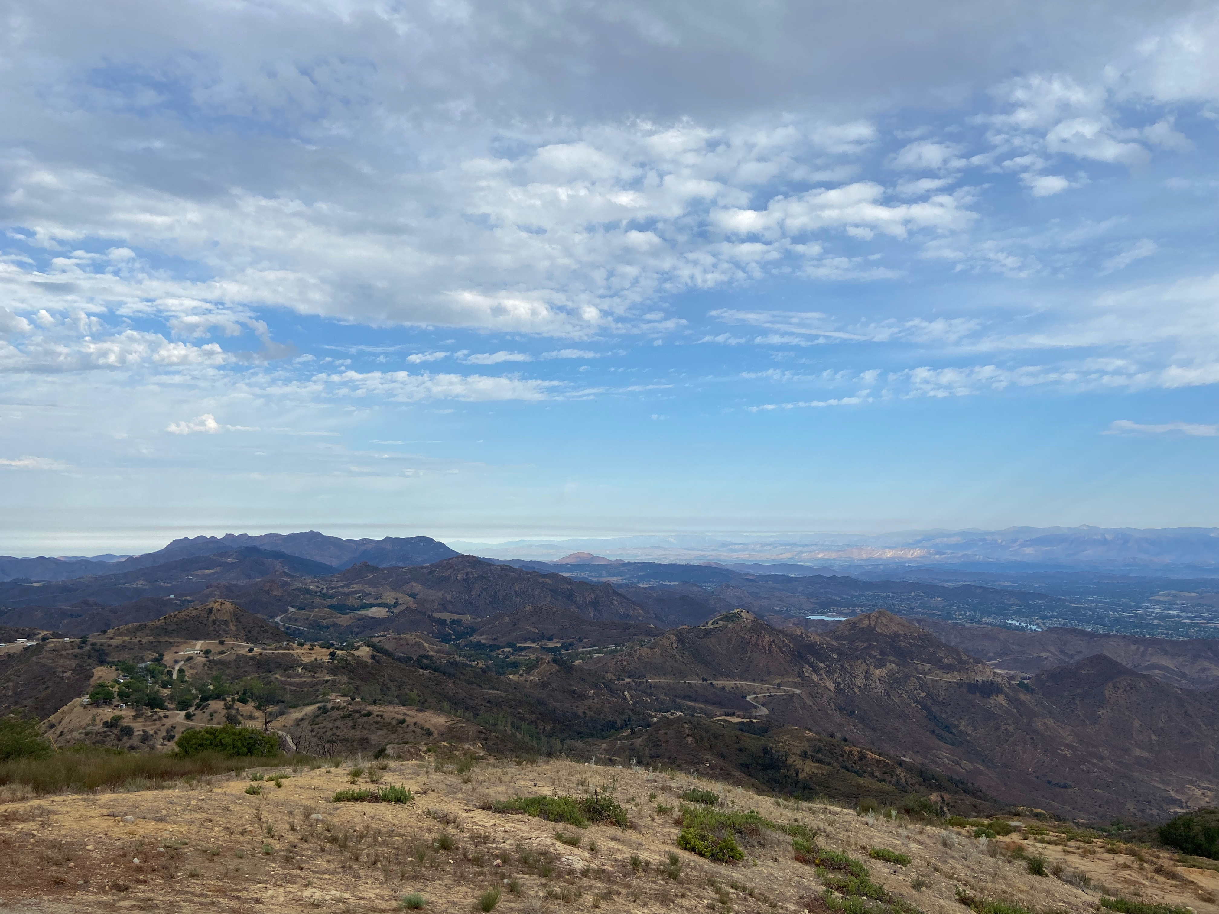
I first ascended Castro Peak May 27, 1973, when I was 17 years old. It was a charming summit with a stand of pine trees and an abandoned fire lookout tower. I did this hike a dozen or so times back in the ’70’s and watched as the summit was slowly developed into the massive communications site it is today. Now there is quite a bit of trash and other detritus from the various fires that have swept over the summit. Most notably the Dayton Canyon Fire in 1982 and, more recently, the Woolsey Fire in 2018. Now the summit is rather unlovely. A lot of fences, cameras and razor wire.
Although I could’ve driven to the summit, I decided to park my car at the lower gate and hike up in the spirit of SOTA and for the exercise. From the lower gate the hike is less than a mile with about 600′ of gain.
Band conditions weren’t great – my furthest contact was Gary W0MNA in Kansas. I did manage a summit-to-summit with Hal N6JZT and Dan NA6MG over on Mount Islip.
Cell coverage by Verizon is excellent.
Buzzard’s Roost (W6/SC-229) center with the trees on top above Newton Canyon. Sandstone Peak (W6/CC-056) peeking out on the right.The San Gabriel Mountains left with Saddle Peak (W6/CT-274) center and the Santa Monica Bay behind the microwave and radio towers.Sandstone Peak and points west near Santa Barbara and Ventura. Conejo Mountain (W6/SC-318) in the sun next to Sandstone.
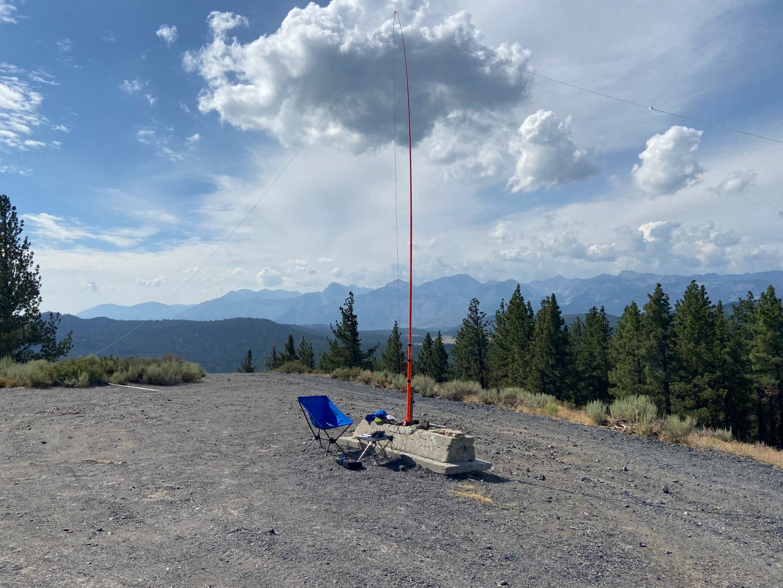
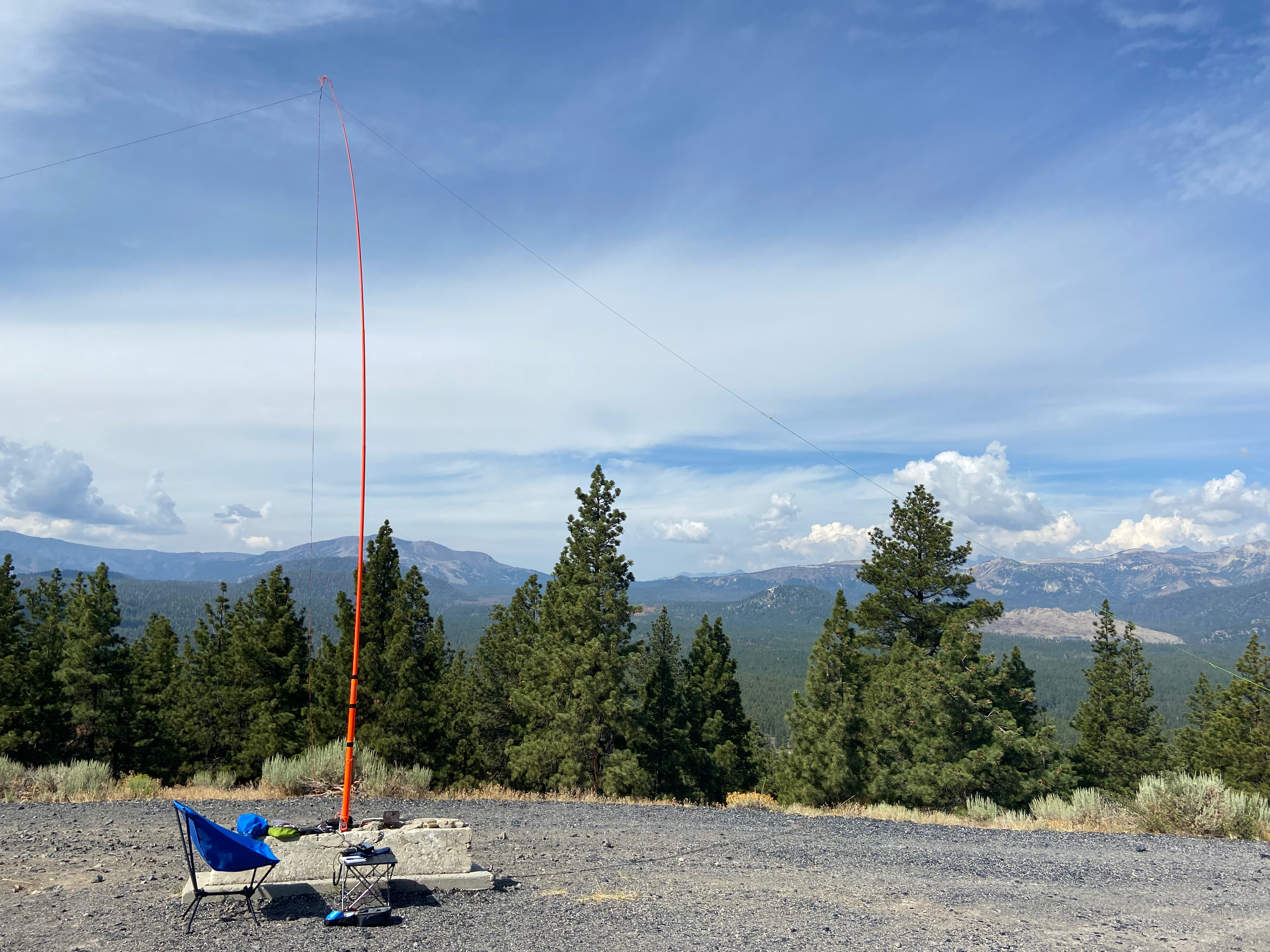
It was kind of a last minute thing, this activation. I realized a had a leisurely day driving from the El Rancho Motel in Bishop to Tuolumme Meadows campground. So I looked around and, sure enough, there was an easy one just off of Highway 395 around Deadman Summit. The only hitch was that other activators warned of volcanic glass — obsidian — on the dirt road up to the summit. My poor, battered Audi had suffered a great deal on the rough road to Lake Edison on the first segment of the John Muir Trail, but I decided to go for it. With only one of those goofy, undersized spare tires in the trunk, I slowly made my way up the dirt road.
As advertised there was obsidian everywhere and some pretty deep ruts and rocks. I drove pretty slowly and tried to stay in the tracks where others had gone before and the glass was well crushed. The approach road takes off of 395 opposite the Mammoth Scenic Route road. The drive is about 3 miles and goes up 800 feet.
I walked a few hundred feet to an old concrete foundation presumably from the former lookout that gives this mountain its name. This made a nice place to set up the station. Cumulus clouds were starting to build over the Sierra Crest in typical summer monsoon fashion.
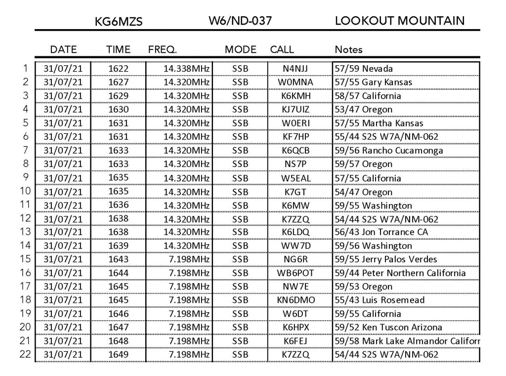
I made 22 contacts including 2 summit-to-summit contacts with KF6HP and K7ZZQ on Yellowstone Mesa in Arizona. Thanks guys! Little did I realize at the time but Lookout Mountain is considered a desert summit and, as such, awarded me summer desert bonus points. Easiest bonus points yet.
Cell coverage by Verizon is excellent.
I also discovered later that two other activations of this summit occurred later on the same day. Apparently all three of us were unaware of the others!
Close up of the stationPoor Pfeffernusse the Audi suffered the sharp obsidian road.The Station with Mammoth Mountain in the backgroundLooking north