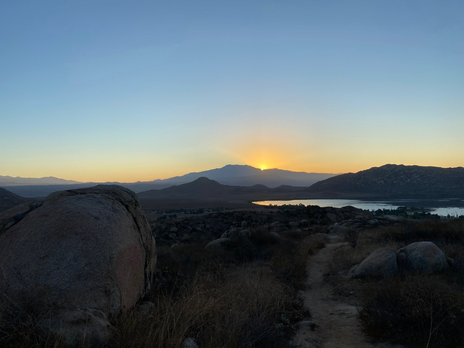
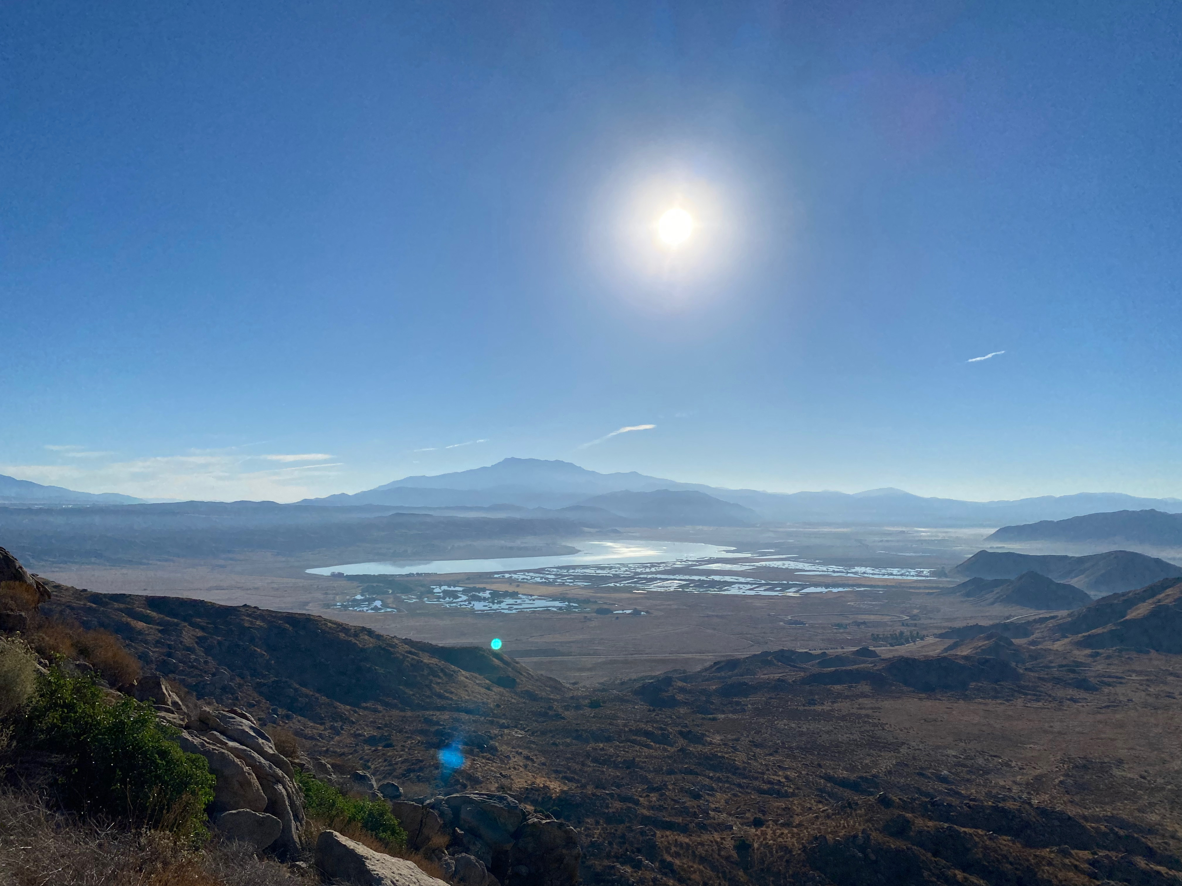
Sunrise over San Jacinto Peak from the trail up Teri’s Peak.
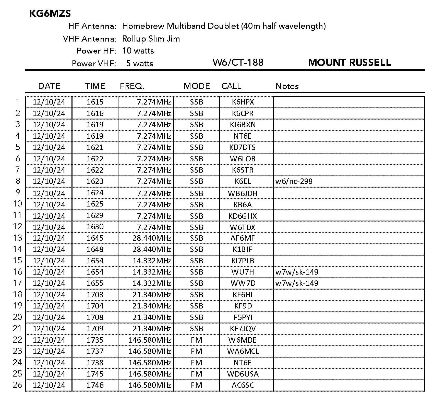
20 OCTOBER 2024 W6/CT-195
One star – Nothing special but I’d do it again.
Elevation:
2,569′
Route:
Good trail
Hike Distance:
2.25 miles round trip
Elevation Gain:
800′
Navigation:
Easy
Steepness:
Moderate
Vehicle:
Passenger car
Road:
Good dirt road to Horse Camp
Cell Coverage:
Good Verizon
Hike basics
Another 5AM start from Topanga Canyon found me back in the Bernasconi Hills after last weekend’s enjoyable hike up Mount Russell (W6/CT-188). There is a $10 day use fee ($3bfor seniors) and the recreation area opens at 6AM. I got to the Horse Camp trailhead before the sun came.
There were a few early-risers hiking down the trail before sunrise and a dozen or so people visited this summit during my activation. This summit is much more heavily traveled than the neighboring Mount Russell. The granite boulders the punctuate the trail are scarred with graffiti and there was quite a bit of trash. All this led me to only give this summit one star. I did see a couple with a trash bag and a trash picker cleaning up some of the mess on the way down. Good for them!
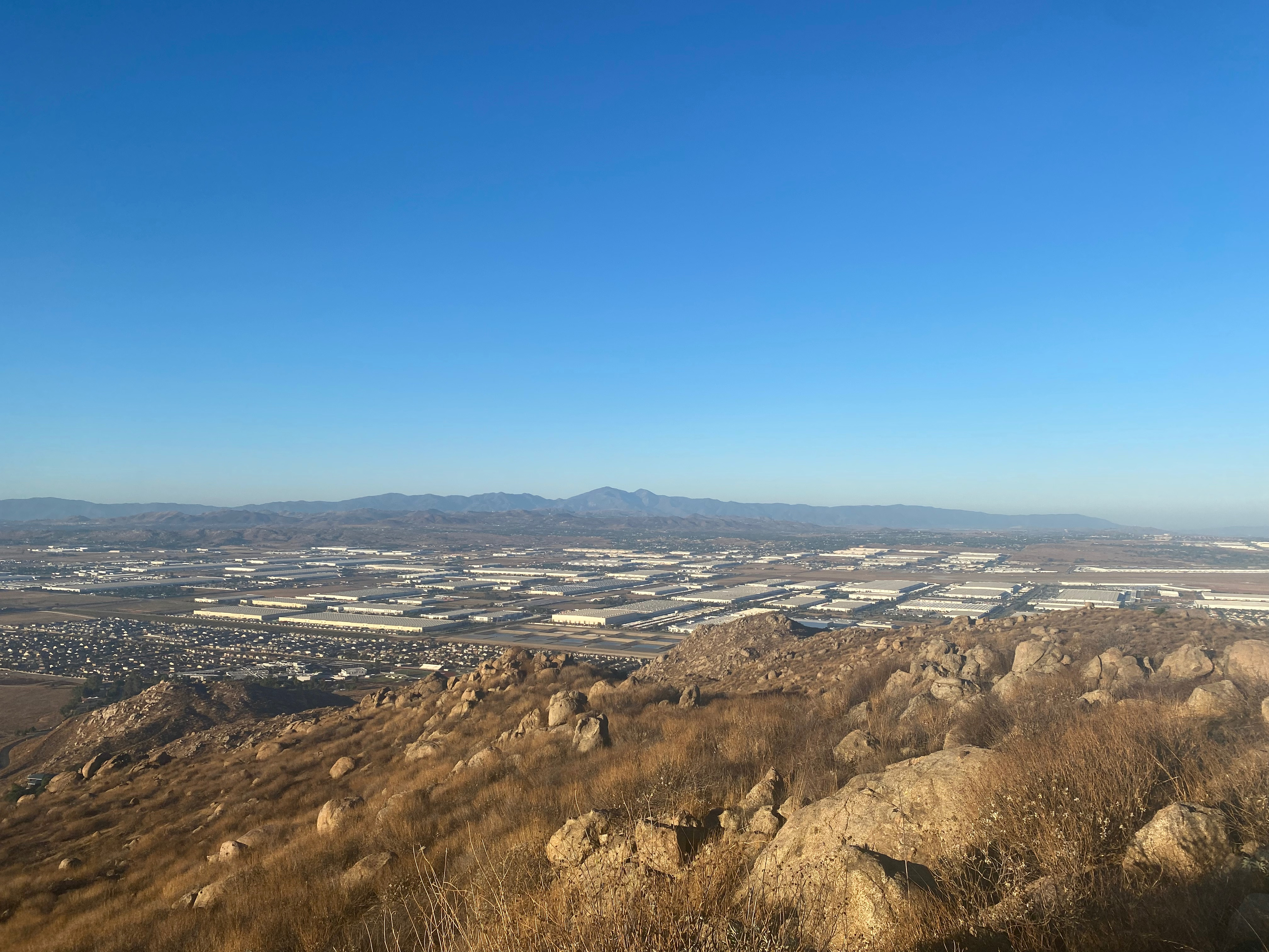
Here’s the station looking northeast to Mount San Gorgonio.I used one of the graffiti-scarred boulders as one antenna support for my doublet. Huge warehouses to the west and Santiago and Modjeska Peaks.Plenty of room in the activation zone to set up my big antenna. March Air Force Base visible here.
This summit turned out to be a very pleasant surprise. The only Mount Russell I’d ever heard of was the spectacular 14,000 footer near Mount Whitney. I’d done this magnificent summit in July of 1986 and it remains one of my favorite all-time summits, so I wasn’t expecting much on this little Mount Russell. KG6LI had warned that Perris Lake State Recreation area can be quite crowded on weekend, so I was also expecting a lot of hikers.
I left Topanga Canyon right at 5AM and got to the Hunter’s Trailhead parking lot at 7AM and was not surprised to find a dozen or so cars already parked there. I figured I’d see a lot of hikers. Wrong. Not only did I not see a single hiker all day, strangely there were no cars in the lot when I got back at about 1pm! This is contrary to my usual experience.
KG6LI mentioned that there are a variety of ways up this mountain, so I followed his track up the ridge. There is a considerable of elevation loss after the last false summit. I did find a slightly more direct route on the way down that is a little shorter and avoids this loss. The trail was very well maintained by the state but, surprisingly not on any map!
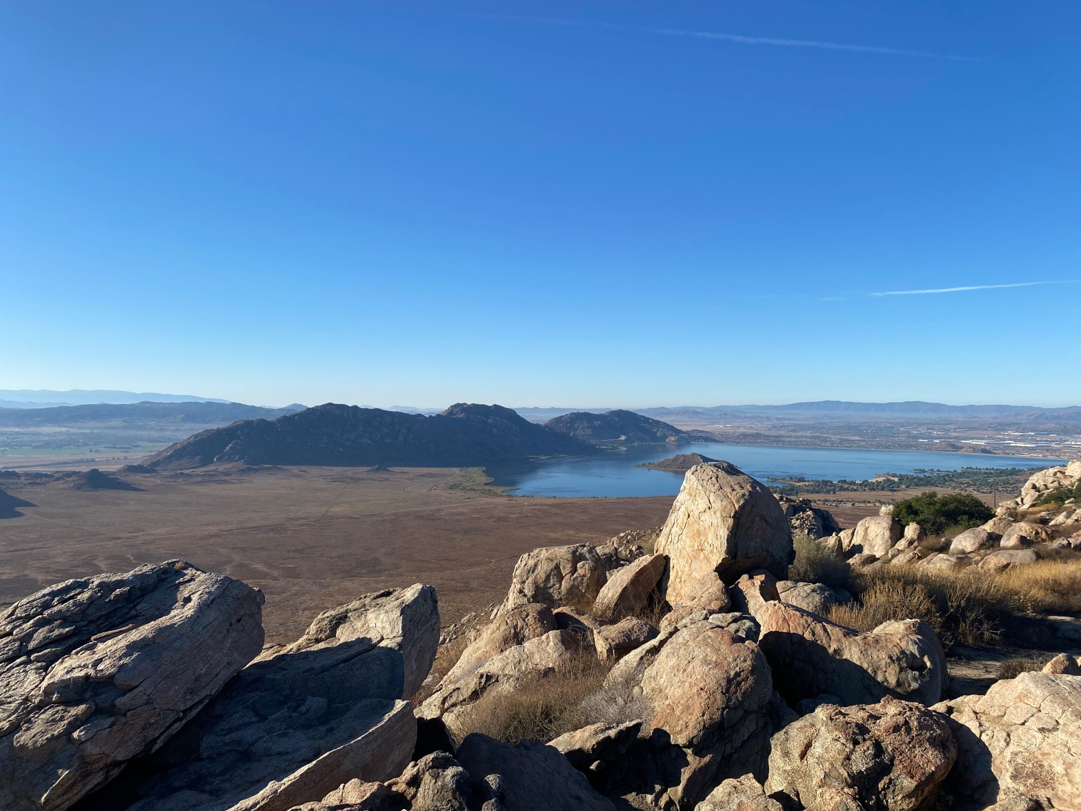
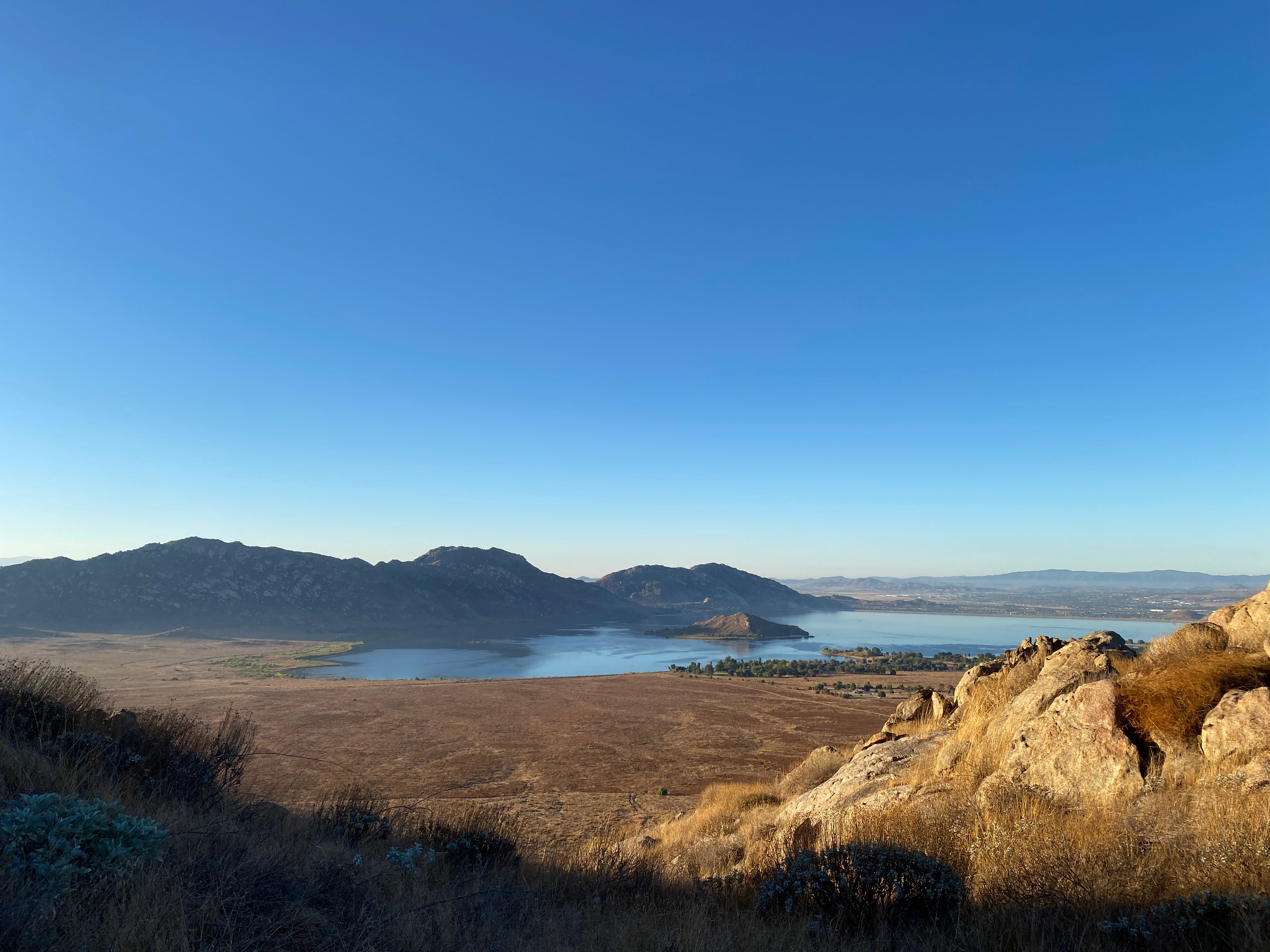
The summit looks like it is going to be a cramped summit block on the way up, but once on the top a wide set-up area appears within the activation zone. On a clear day like this one the view is spectacular. All the bigs: San Antonio, San Gorgonio San Jacinto and Santiago dominate the horizon. Lake Perris and the very cool named Mystic Lake surround.
I loved this summit!
Radio conditions were okay and I did manage to pull F5PYI out on 15m as well as three s2s contacts. A lot of photos to follow – more than I usually post because this was a very photogenic activation.
The open set-up area on the summit.One leg of the doublet looking west to the Cucamonga/Baldy massif and the Los Angeles basin.Looking north to the highest summit in Southern California: Mount San Gorgonio.Looking east over Mystic Lake and Mount San Jacinto.Perris Lake in the mellow light of early morning on the way up.Mount Russel from Hunter’s Trailhead.
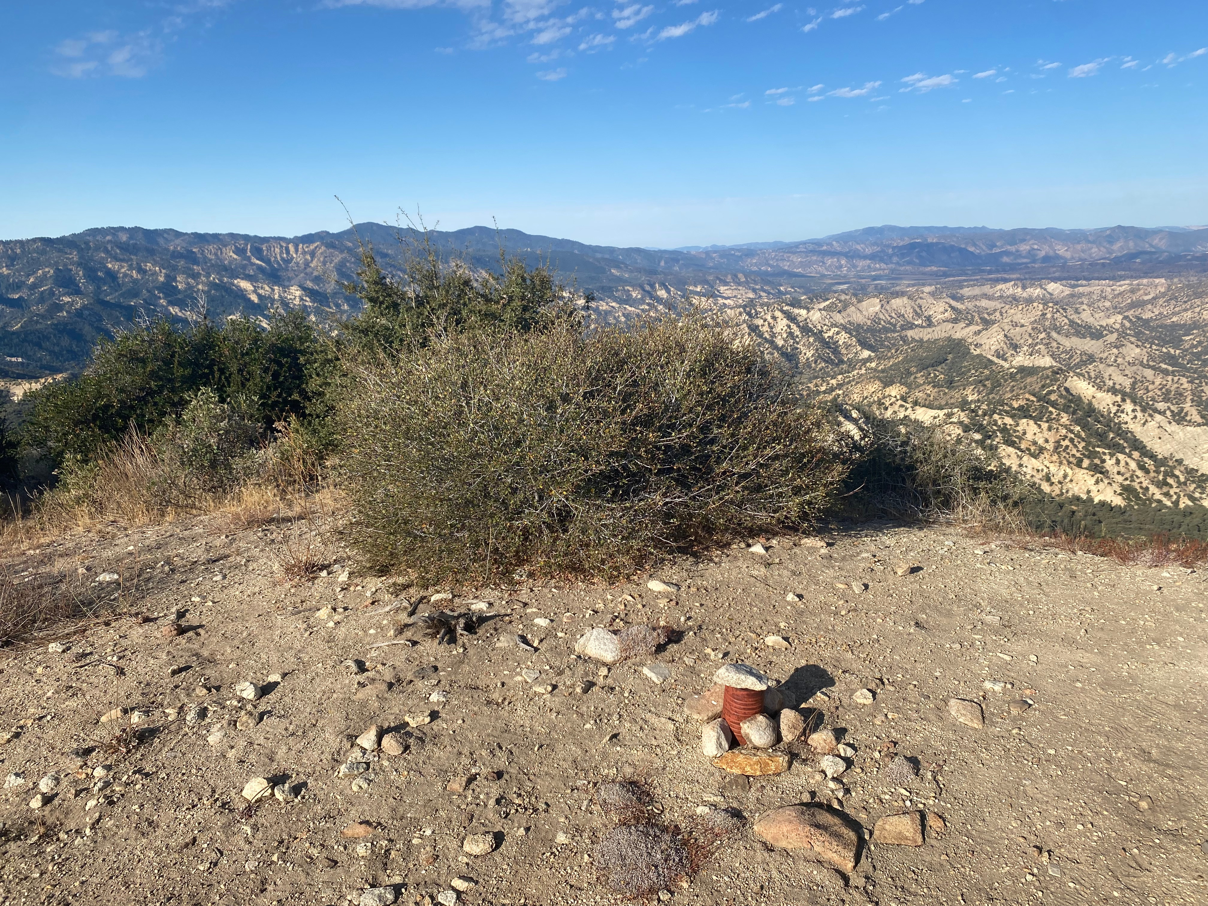
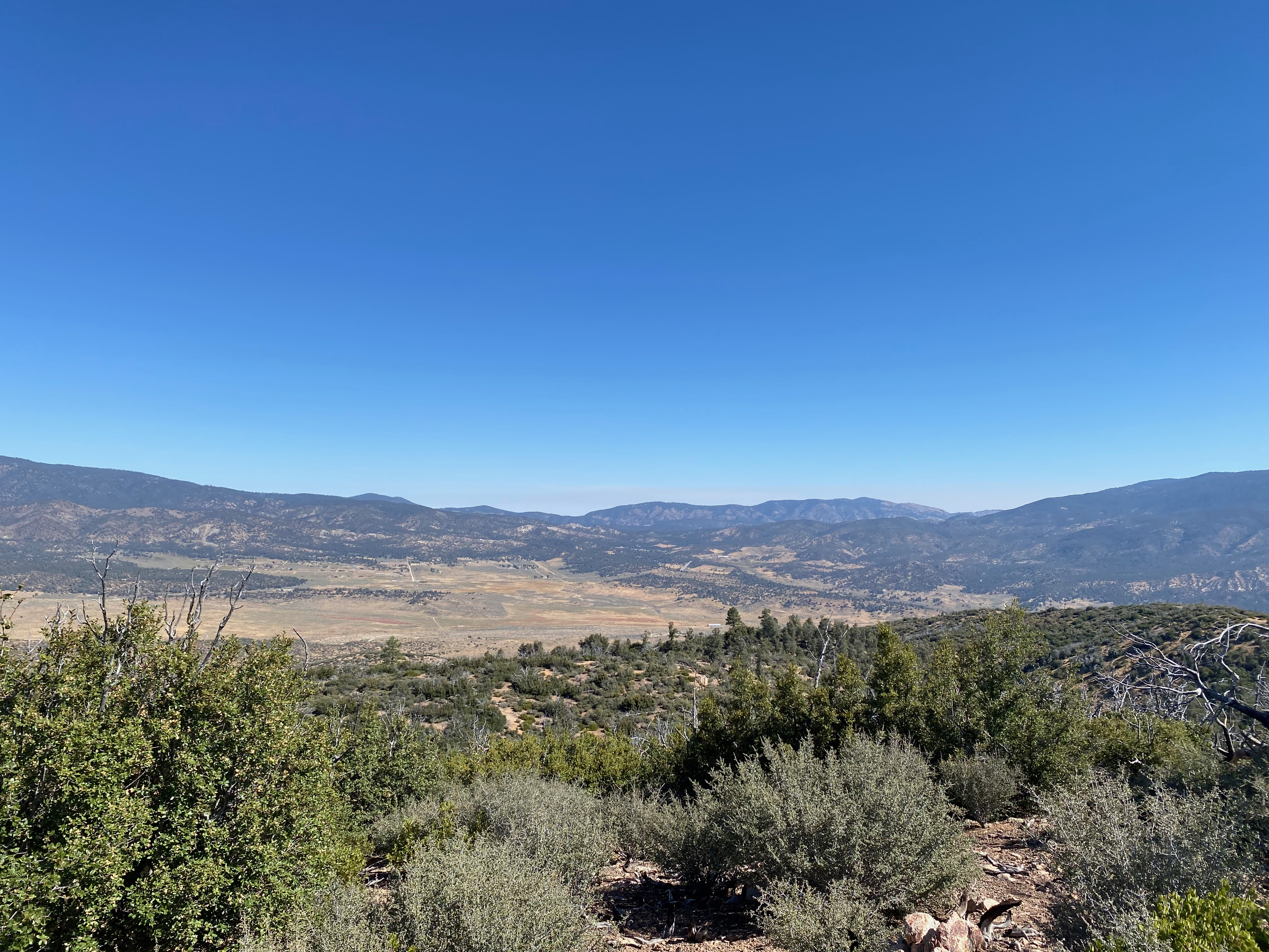
Here’s my comfy little station looking east toward Lockwood Valley and Frazier Mountain.
5 October 2024 W6/SC-012
Two Stars – a nice summit. I’d do it again. Recommended.
Elevation:
6,585′
Route:
Cross country
Hike Distance:
3.8 miles round trip from gate
Elevation Gain:
875′
Navigation:
A bit tricky to start/end
Steepness:
Moderate
Vehicle:
Passenger car
Road:
Good dirt road
Cell Coverage:
Good Verizon
Hike basics
This is a pleasant cross-country hike in a less-traveled corner of Southern California. I first hiked this mountain on September 18, 2003 when I was doing the HPS list. This time I found Pine Springs Campground closed and was obliged to park Whitedog at the gate about 3/4 of a mile short of the usual parking spot. So that added a mile and a half to my trip that I did not mind on this nice day.
Navigation on this hike is a bit tricky at the start and at the end as noted above. The trick is to find the correct ridge to ascend after going through the wash to the southwest of the campground. Once you are on the ridge, there is a fairly well established use trail that follows an ancient firebreak the was once bulldozed. If you miss this cross-wash transition on the way back it could lead to trouble, so make careful note of the route going out and look back to establish your landmarks for the return trip.
I got a bit off-route going up so here is my descent track that, as usual, provides a better route to follow.
Band conditions were spectacular for a change and I had a lot of fun working station in Europe as well as most of my usual favorites on 7 bands. I got my first 10m activation in quite a while after a summer of slim pickings on that band.
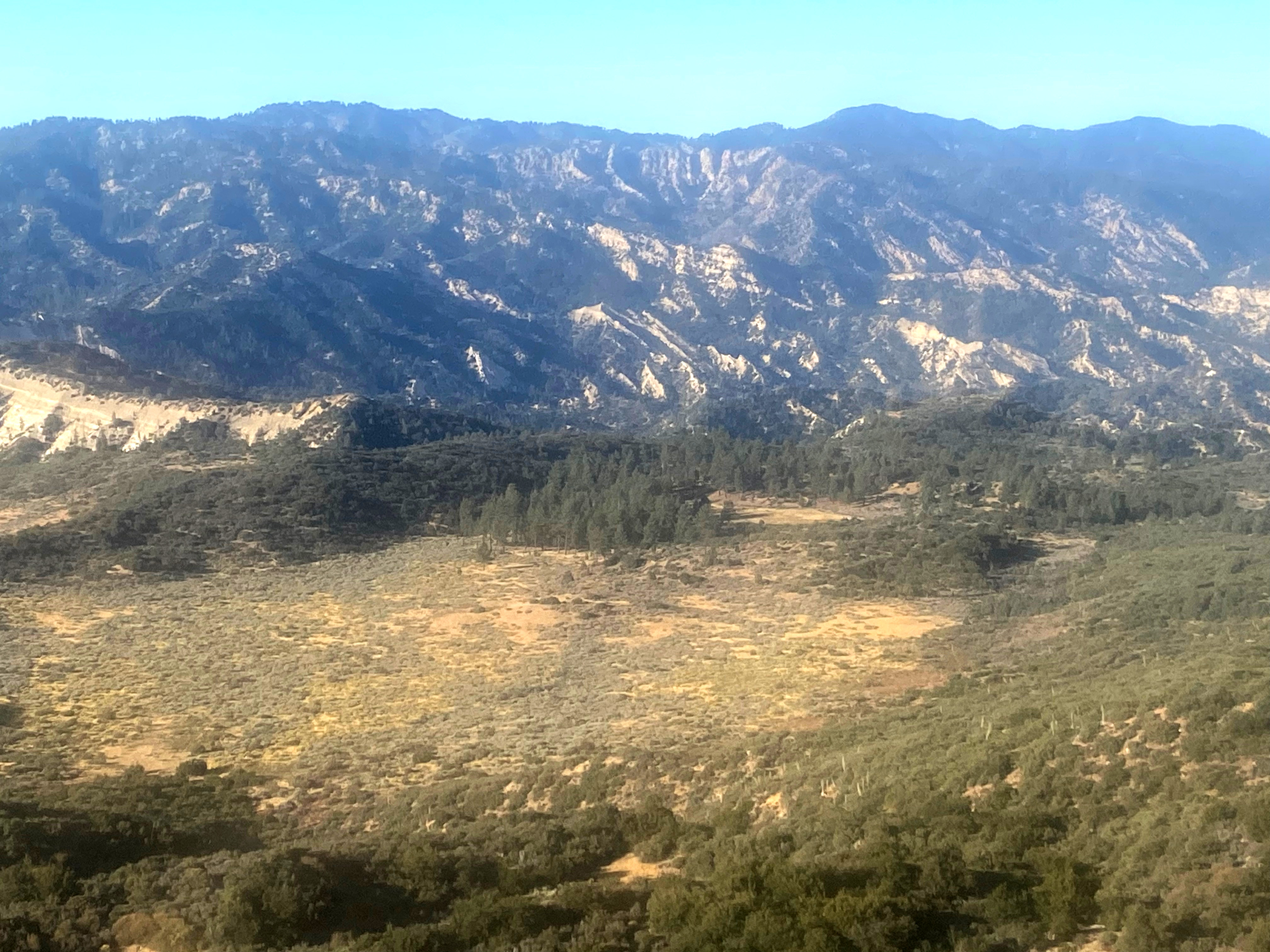
The summit looking west to Reyes Peak and Big Pine Mountain across several wilderness areas.A lovely fall day on the way up. Looking north at the summit.A cool meadow off the west flank of Guillermo. Not sure why the iPhone photo was so fuzzy.On the way up looking westLooking northwest.
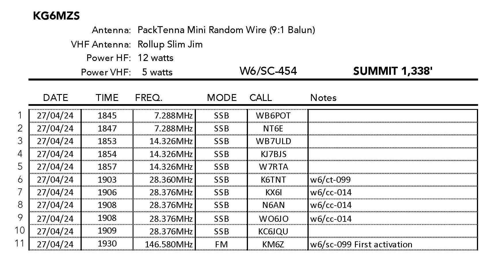
Two Stars – a nice summit. I’d do it again. Recommended.
Elevation:
1,906′
Route:
Trail
Hike Distance:
1.5 miles round trip
Elevation Gain:
375′
Navigation:
Easy
Steepness:
Gentle
Vehicle:
Passenger car
Road:
Paved
Cell Coverage:
Excellent Verizon
Hike basics
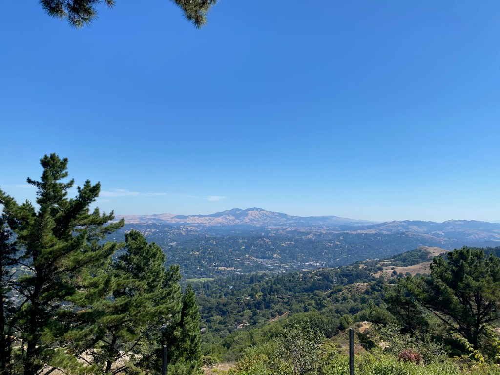
If Flint Peak in Southern California is owned by David N6AN, then Vollmer Peak should be renamed Mount Pisor for K6EL’s myriad summit-to-summit contacts from this pleasant hike in the suburban hills of Berkeley. Many times I have been gratified to hear “Two dollars and ninety eight cents” from El.
I left Topanga Canyon at 4AM and braved the semis up I-5 on a trip that was to take my to my old climbing buddy Bill Smith’s house. We were going to take in the last few games that the Oakland A’s were going to play at the Oakland Coliseum. I could not resist adding a SOTA activation into the fun mix.
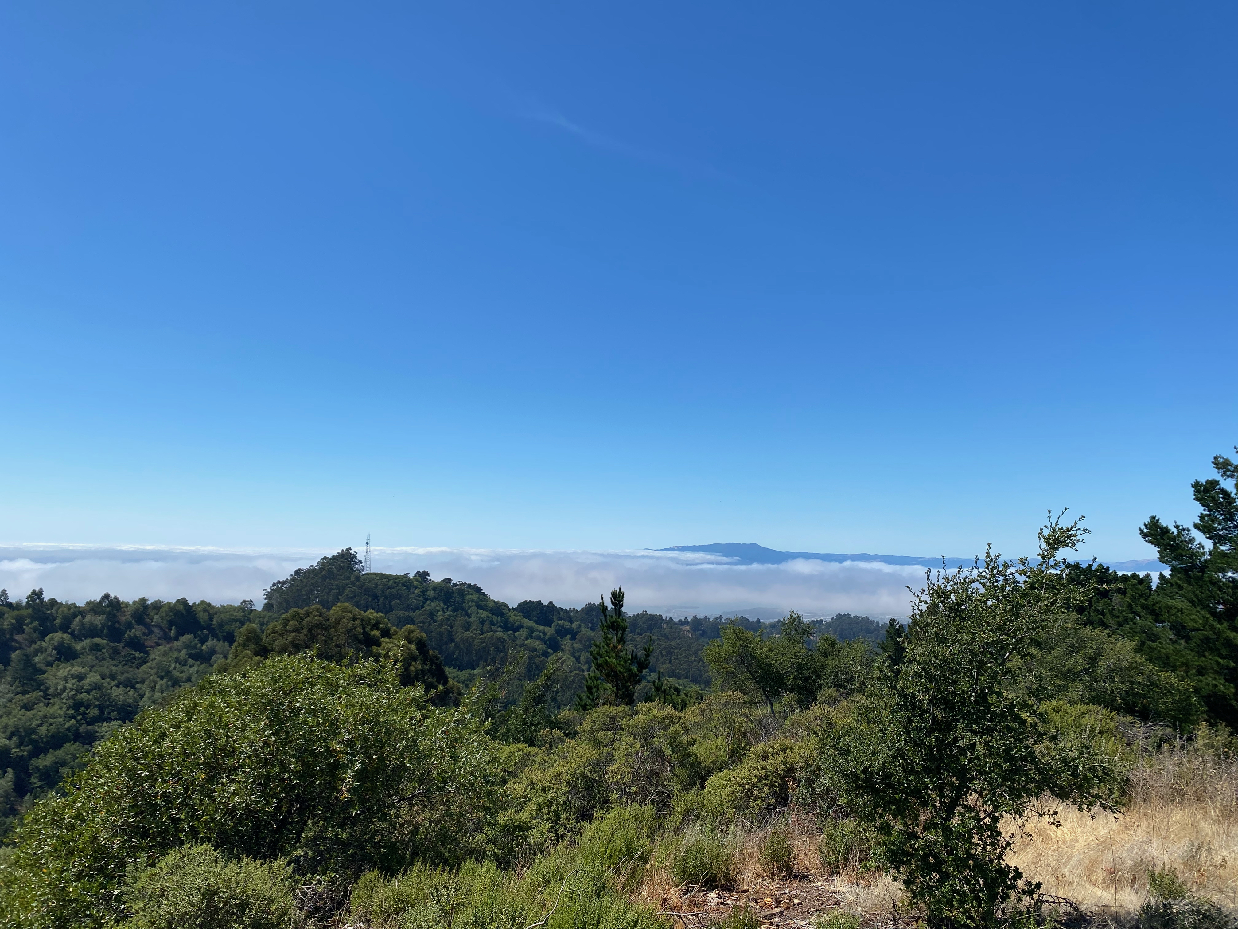
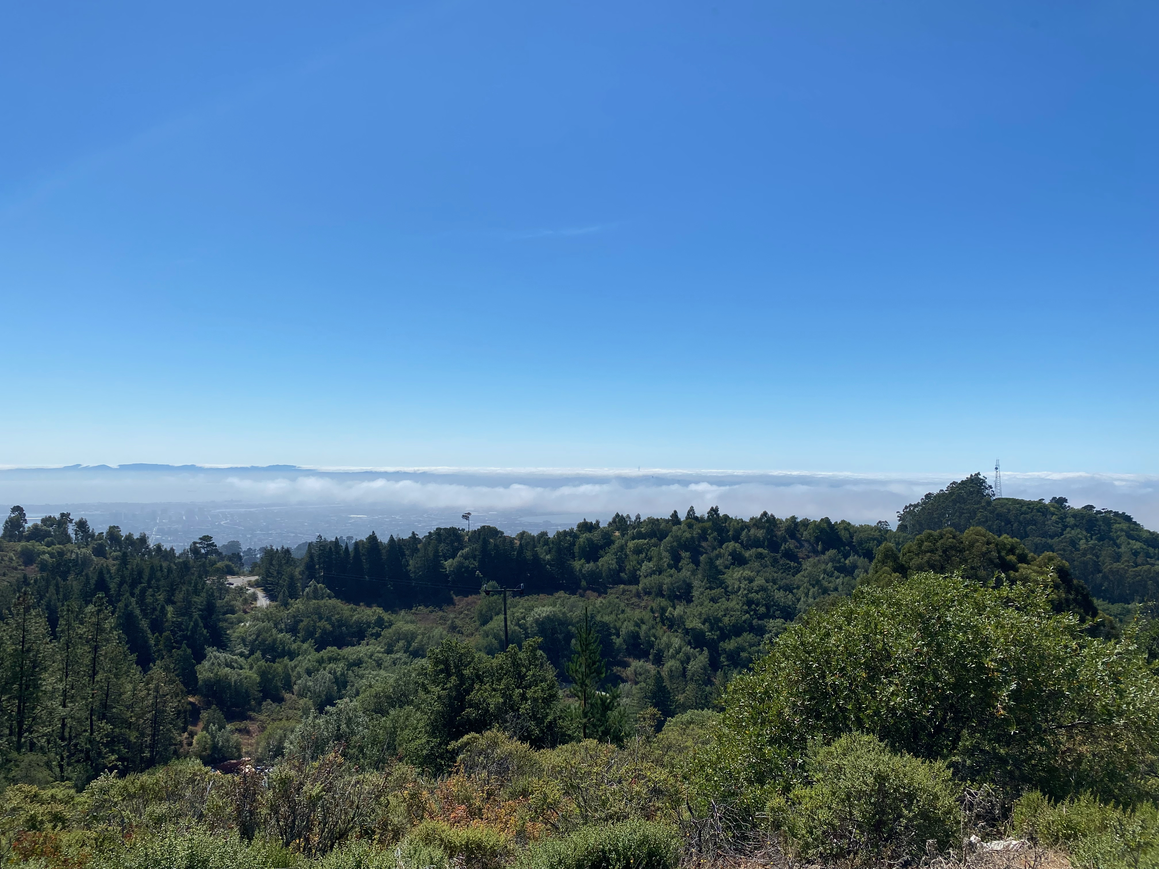
The trail to the summit is easy to follow but the circuitous drive up into the Berkeley Hills is a bit more challenging. Since I was a boy I have always loved the Bay Area. Compared to Southern California is was always cooler, greener and more beautiful to my eye. This lovely hike is a perfect example. The marine layer streamed in the Golden Gate and played cat-and-mouse with the bridges while Mount Tamalpias and Mount Diablo lorded over the green and gold of the autumnal equinox in the heart of California. The trail was lush with ferns and raspberry (and a lot of poison oak!) muddy from the copious fog-drip precipitation slakes the thirsty redwoods.
This was a work day for me and as I was on call, I made the activation shorter than I otherwise might’ve. Band conditions were poor, but I still had no trouble getting the requisite 4.
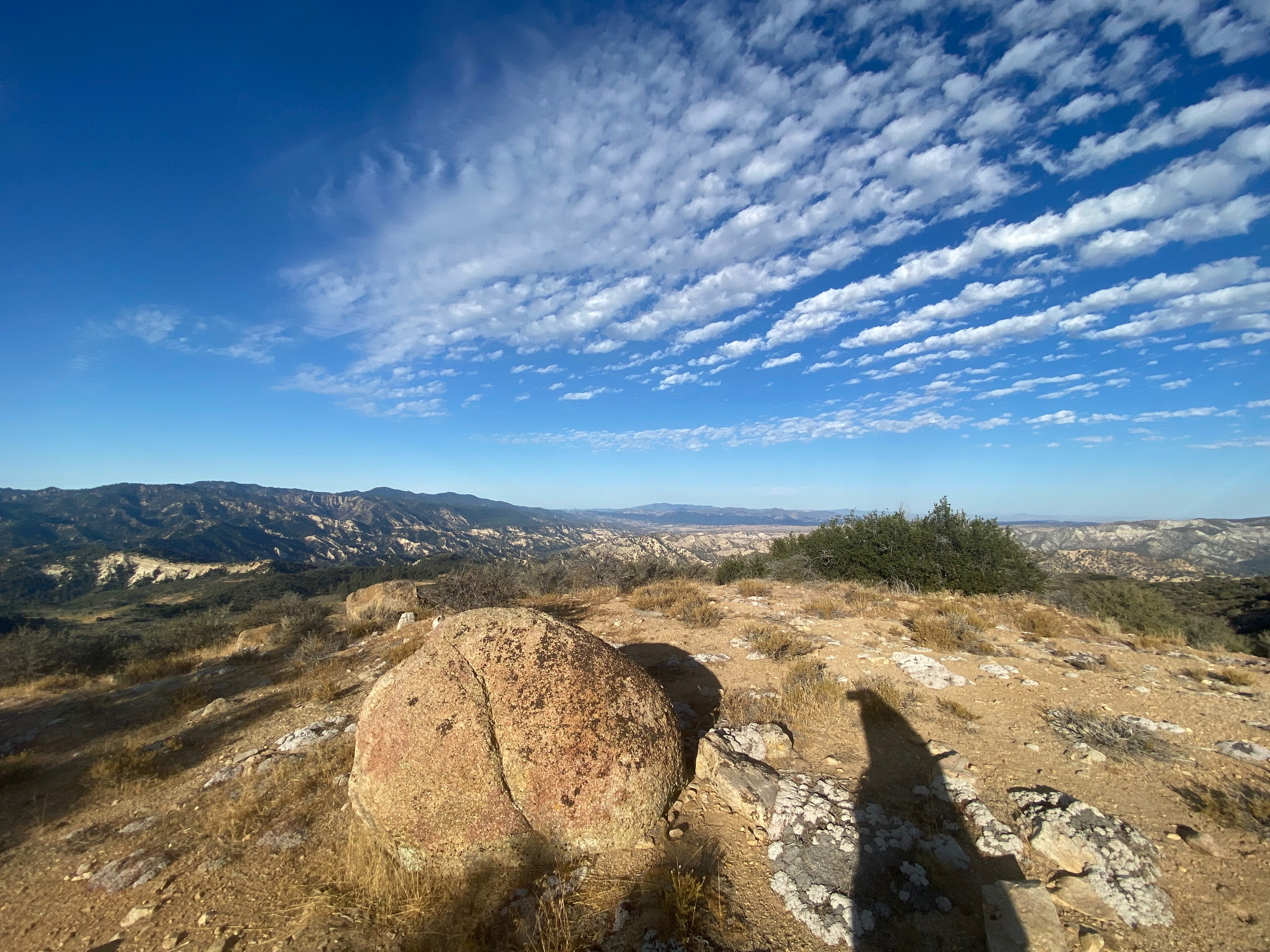
Looking east toward Mount Diablo.Mount Tamalpias and a bit of the bay to the Northwest.Sutro Tower in San Francisco is just visible poking out of the trademark fog here looking west.
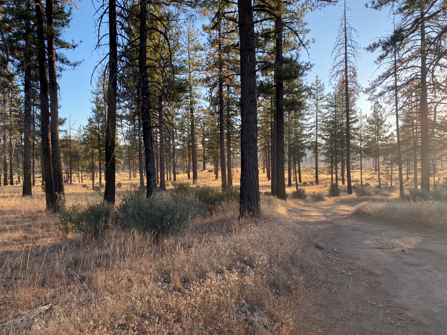
Sunrise near the trailhead. Didn’t see another soul all day
14 September 2024 W6/SC-016
One star – Nothing special but I’d do it again.
Elevation:
6,261′
Route:
Forest service trail and cross country
Hike Distance:
5.5 miles round trip
Elevation Gain:
1,200′
Navigation:
Easy
Steepness:
Steep cross country
Vehicle:
High clearance suggested
Road:
Good dirt road
Cell Coverage:
Good Verizon
Hike basics
I last hiked this mountain on May 28, 1996 before it had burned in the Day Fire of 2006. While the area has rebounded fairly well in the intervening 18 years, there was noticeably more deadfall in the cross-country gully than there was back in the last century. Lorene (W6LOR) and Mike (K6STR) had done this mountain a few weeks before and suggested that the standard route up the gully used by The Hundred Peaks Section might be a bit shorter and less brushy, if not more fallen trees to contend with than the ridge route.
I found the hike to be very enjoyable. Others have mentioned finding water along the route, but in September there was none to be seen on this trip. There is no shade on the summit so bring plenty of water.
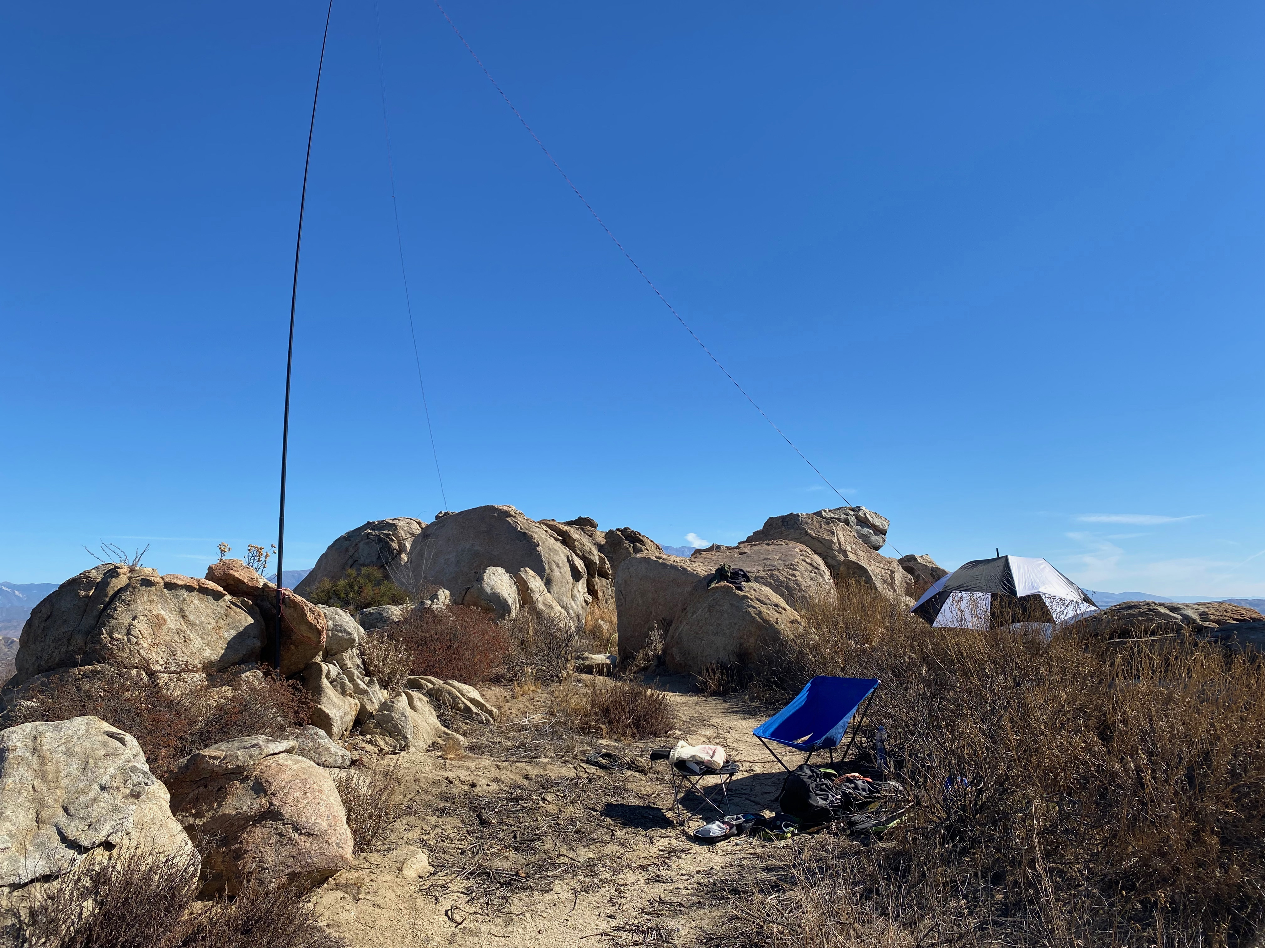
I was surprised to find a Jeep Rubicon parked at the spot where the route leaves Yellowjacket trail and ascends the gully. On the summit I found a full camp with a tent, sleeping bags, chairs and a mobile phone charging via a solar panel in the sun. No people, though. A few empty water bottles. I hope they are okay.
I made no 2m contacts which is unusual for Southern California. I suggest HG gear is a must for this activation. Even with a class C solar flare I had 3 s2s contacts and several back east.
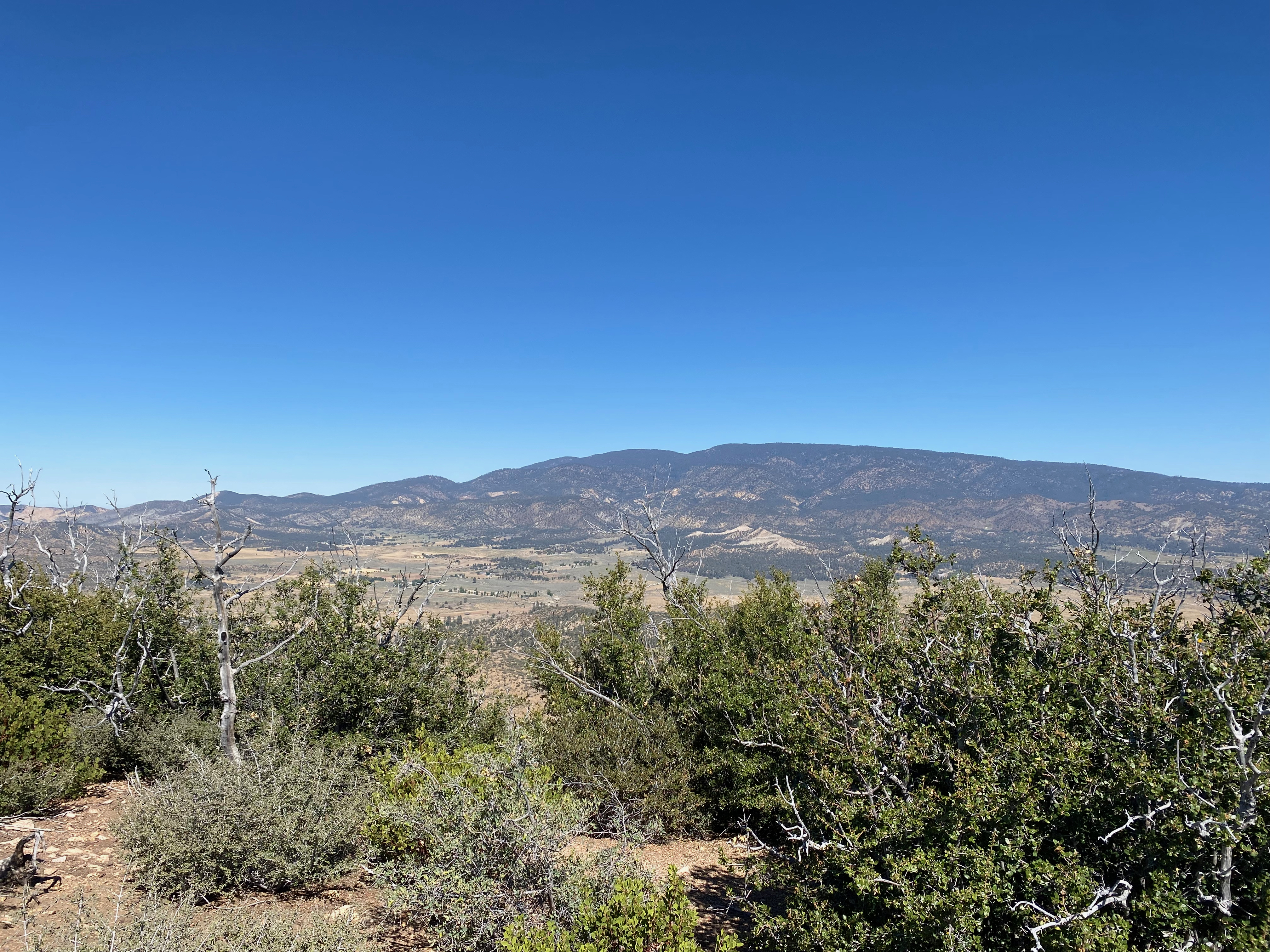
The station looking south to Hines PeakThe “ghost camp” I found on the summit.Looking northeast to Frazier Peak and Lockwood Valley.Mount Pinos dominates the north view.The station.
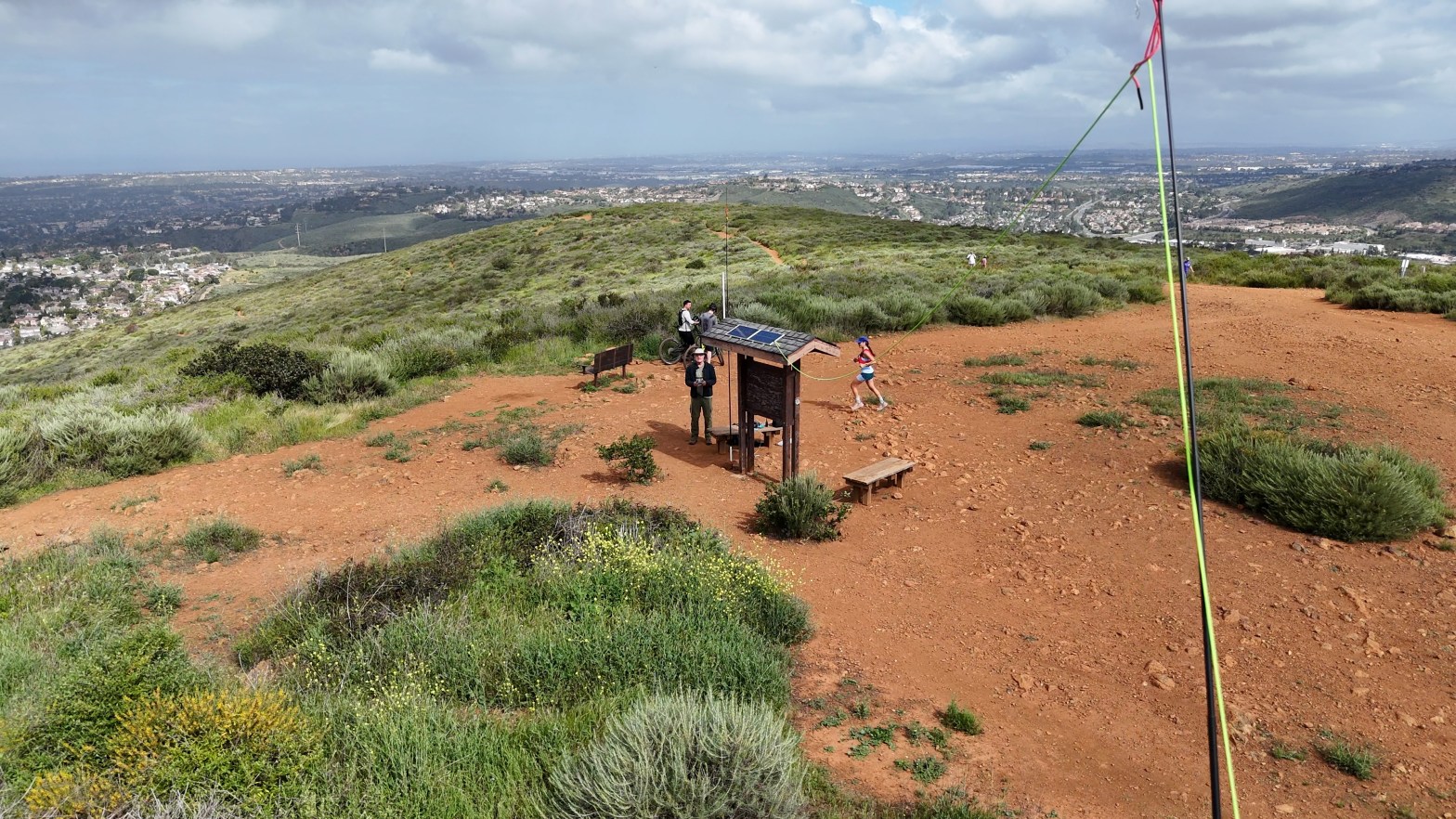
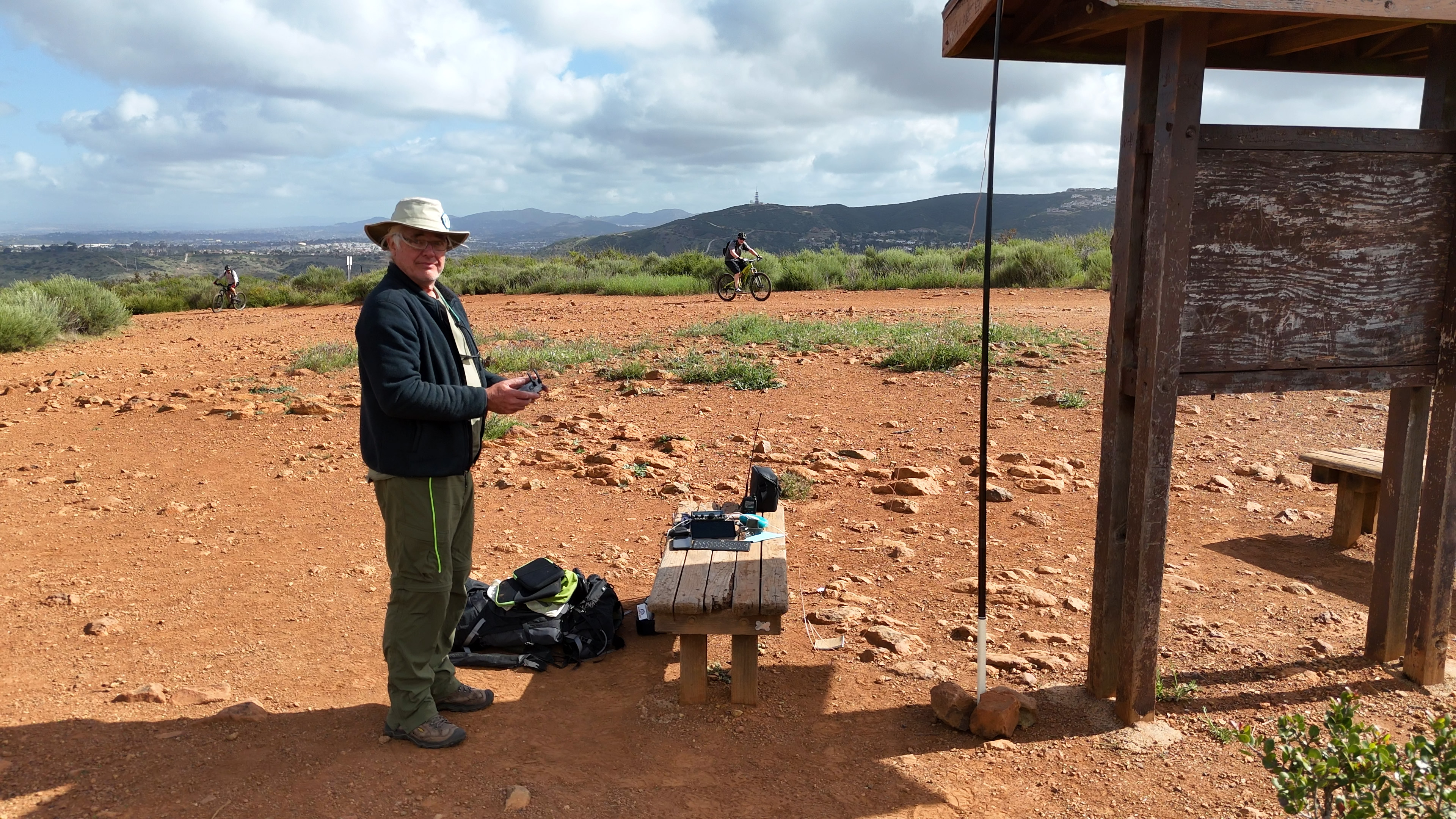
The station on the uneven ground of the summit. Looking south with Cuymaca Peak in the background.
SPECIAL ACCESS NOTE: This summit is on the Santa Rosa Band of Cahuilla Indians reservation. A day-use permit is required to visit this summit. Permits are $40 per person and must be obtained in advance. A liability waiver is also required.
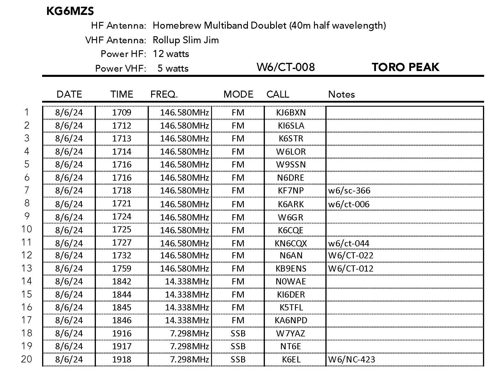
Two Stars – a nice summit. I’d do it again. Recommended.
Elevation:
8,694′
Route:
Dirt Road
Hike Distance:
1 mile round trip
Elevation Gain:
450′
Navigation:
Easy
Steepness:
Moderate
Vehicle:
High clearance suggested
Road:
Long dirt road
Cell Coverage:
Spotty Verizon
Hike basics
Toro Peak is a summit that has eluded me. It is the highest of the Santa Rosa Mountains one of the HPS summits that I have never done, so this was an extra special summit for me. I left Topanga about 5 AM and had a relatively fast trip to the Ramona Expressway. Once here however I was stopped by a seemingly endless procession of signals. Back in the days when I was rock climbing Suicide and Taquitz Rocks we often went this way. I was amazed to see the number of bedroom communities that have sprung up since that time.
Santa Rosa Road leaves Highway 74 — the so-called “Pines to Palms Highway” at
33° 34.0662′ N, 116° 30.7052′ W
From here is is 12.5 miles of pretty bad road. It’s the kind of road I have driven passenger cars on but I was glad to have Whitedog’s high clearance and 4 wheel drive. There was a Tesla and a Lexus parked about half way up before a rutted, muddy section.
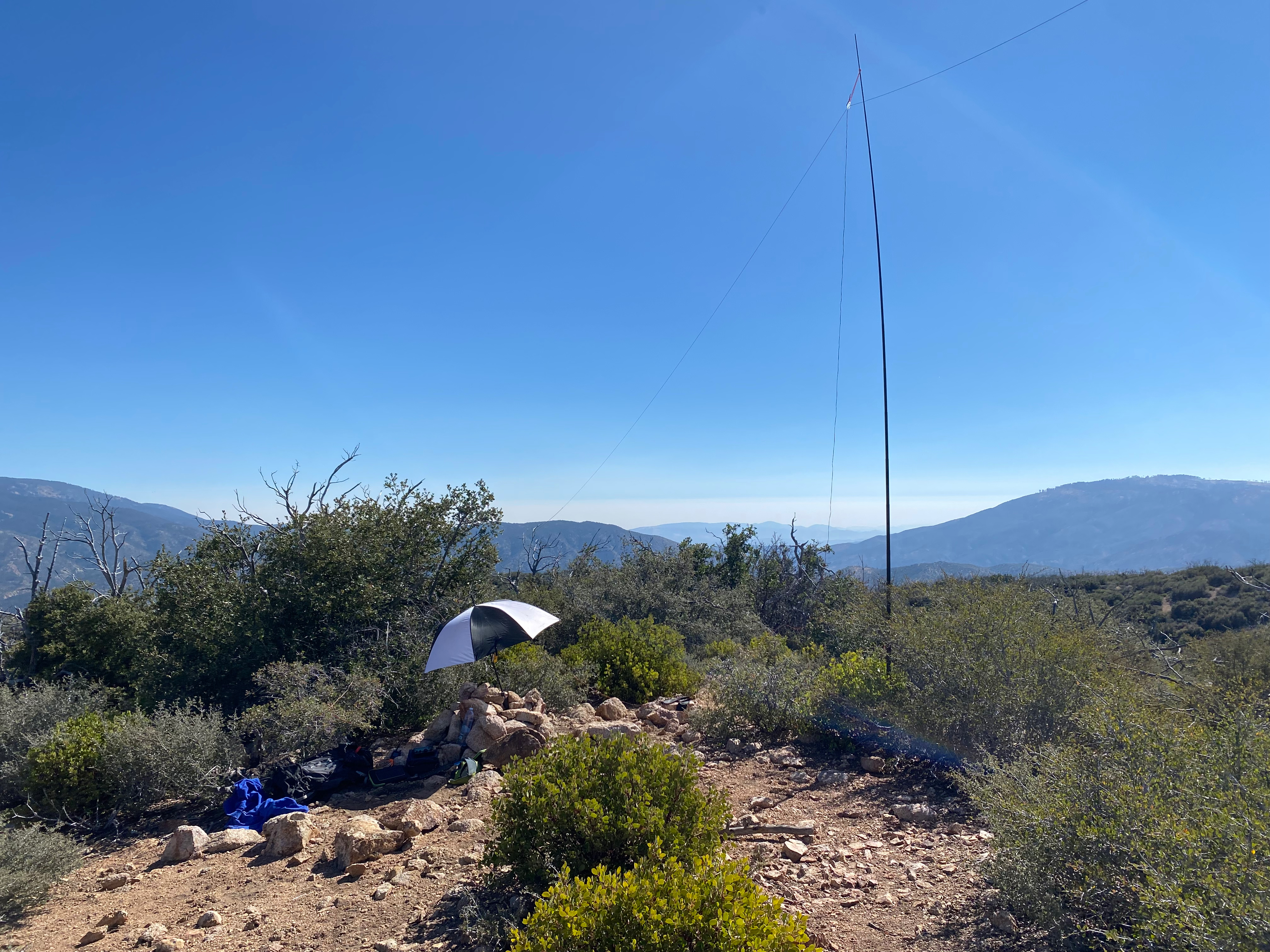
The hike itself is short – about half a mile up 450′ – to a large communications facility. I continued past that to the west side where I found a place to set up away from the microwave dishes and repeaters. the ground here was pretty uneven and it took me much longer to set up than usual as my wires and ropes kept getting tangled and jammed in the rocks and buck brush.
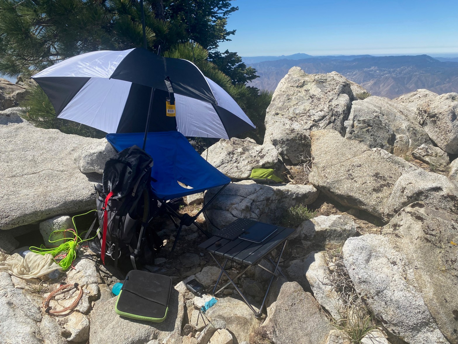
It was pretty hot in the sun and I brought an umbrella. This was fortunate because my electronics rapidly overheated in the direct sun.
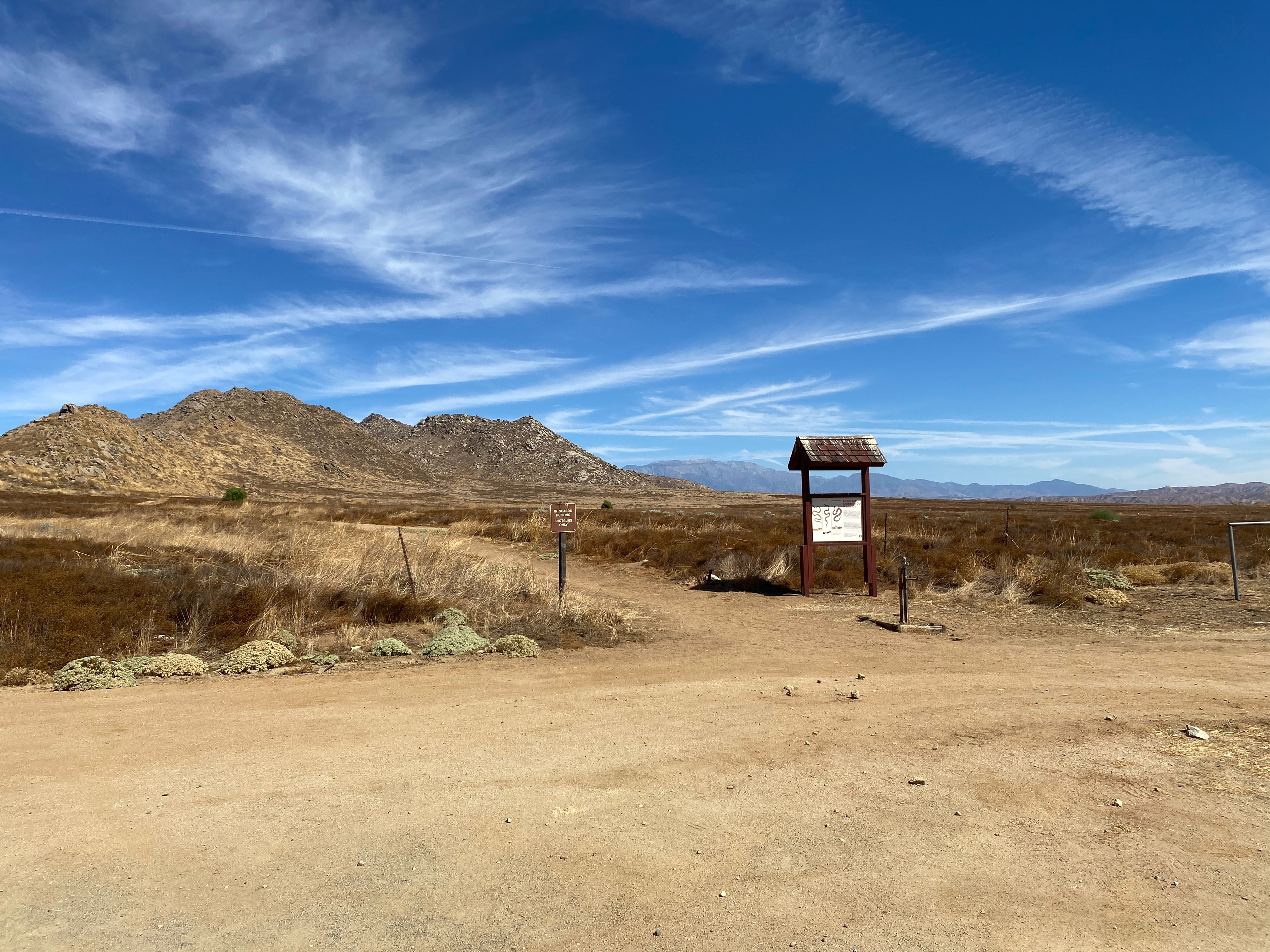
Looking south to Palomar and Cuyamaca Peak.Sign at the trailhead.Looking north to Mount San Jacinto, Mount San Gorgonio and Mount San Antonio — all the bigs.Looking west to Santiago and Modjeska Peaks and the fog laden Los Angeles Basin
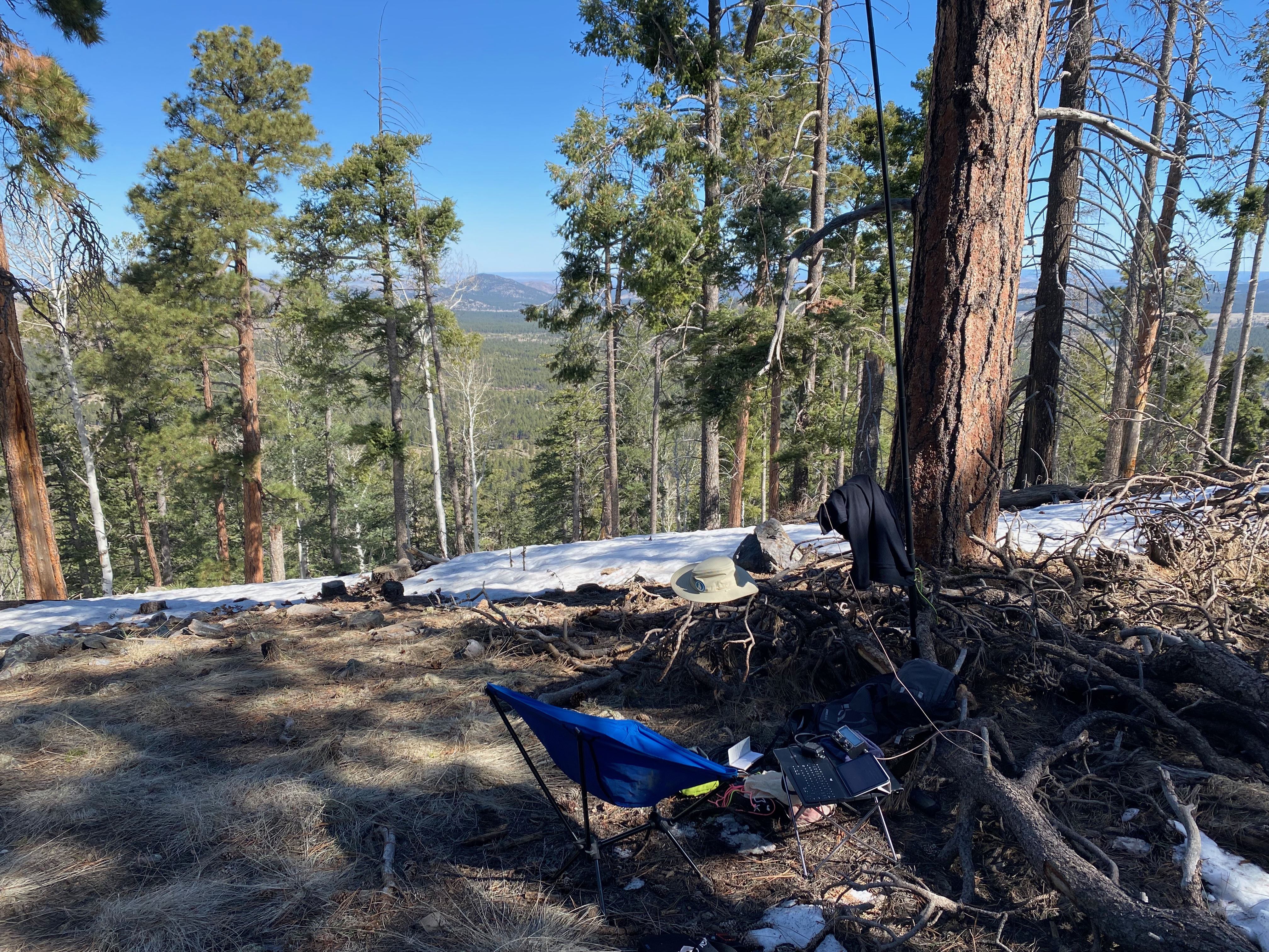
On my way back to Southern California from our total solar eclipse adventure I like to break up the trip from Taos to Topanga with a layover in Flagstaff. The cinder cones on the Coconino Plateau are easy and fun activation. This time I set my sights on two juicy 10-pointers for uniques and completes: Goverment Hill & Mountain.
Strangely Government Hill is higher than Government Mountain by about 100′. The dirt road is a little bumpy but otherwise good. The hike is pretty straightforward — just head up the steep slope up and around a false summit to the right east. The false summit is just discontinuous from the activation zone – I checked.


Leave a comment