
Blue Mountain from the gate off Highway 80 4 FEBRUARY 2023 W5N/PL-008 Elevation: 5,774′ Route: Cross country Hike Distance: 2.3 miles round trip Elevation Gain: 950′ Navigation: Easy Steepness: Moderate Vehicle: High clearance suggested Road: Dirt Cell Coverage: Good (Verizon), APRS Excellent Hike basics On my way to Cassie’s little adobe casita in north-central NewContinue reading “Blue Mountain”
Tag Archives: Hiking
Sandstone Peak x3
Two days before Christmas I return for a glorious third activation of the misnamed Sandstone Peak. Santa Catalina Island in this view looking from Chester the Drone. 23 DECEMBER 2022 W6/CC-056 This is a classic hike that I give four stars to with one very important caveat: it is an incredibly popular hike. I usuallyContinue reading “Sandstone Peak x3”
Harold Beacon Benchmark

★★☆☆ I love this area. Unlikely to see anybody in the early morning.
Summit 4,300′
★★☆☆ Pleasant seldom-visited walk. Approach road subject to closure.
Summit 4,460′

On the Edison road to the summit. 26 NOVEMBER 2022 W6/CT-144 Elevation: 4,460′ Route: Short cross country Hike Distance: .6 miles round trip Elevation Gain: 250′ Navigation: Easy Steepness: gentle Vehicle: SUV High clearance recommended Road: Edison dirt road Cell Coverage: Good (Verizon), APRS Excellent Hike basics This activation didn’t exactly go smoothy but endedContinue reading “Summit 4,460′”
Bald Mountain

★☆☆☆ Pleasant drive-up summit.
Trabuco Peak

Looking southwest to Lake Elsinor with Mount San Jacinto in the background 28 OCTOBER 2022 W6/CT-031 Elevation: 4,603′ Route: Short very steep bushwack Hike Distance: .25 miles round trip Elevation Gain: 150′ Navigation: Easy Steepness: Very steep Vehicle: SUV High clearance recommended Road: Forest Service dirt Cell Coverage: None (Verizon), APRS Excellent Hike basics MyContinue reading “Trabuco Peak”
Los Pinos Peak
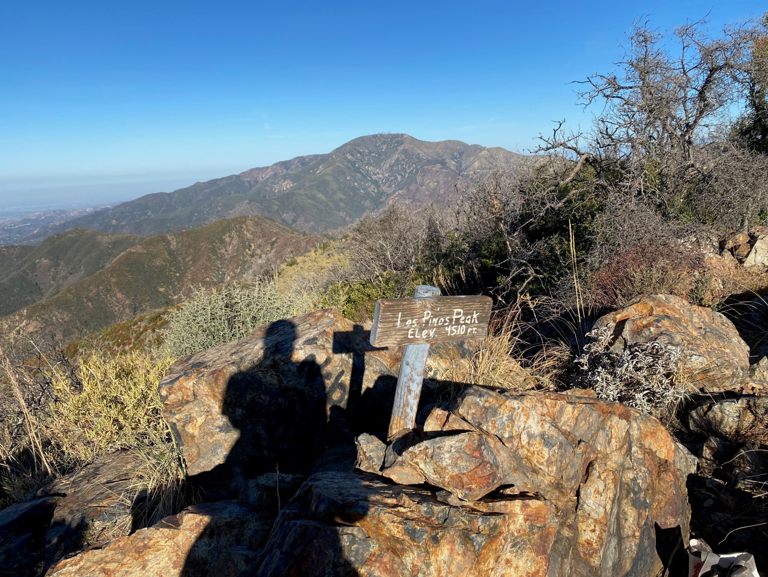
Looking northwest to Santiago Peak 29 OCTOBER 2022 W6/CT-138 Elevation: 4,541′ Route: Trail Hike Distance: 2 miles round trip Elevation Gain: 500′ Navigation: Easy Steepness: Mostly gentle Vehicle: SUV High clearance recommended Road: Forest Service dirt Cell Coverage: Good (Verizon), APRS Excellent Hike basics I’d stayed up late (for me) the night before watching theContinue reading “Los Pinos Peak”
Townsend Peak

A blustery day on Townsend 22 OCTOBER 2022 W6/SC-161 Elevation: 3,182′ Route: Firebreak/use trail Hike Distance: 500′ Elevation Gain: 100′ Navigation: Easy Steepness: Gentle Vehicle: High clearance SUV recommended* Road: Dirt Cell Coverage: Good (Verizon), APRS Excellent Hike basics I was going to activate Bald Mountain for a complete after Burn Benchmark, but Lake ElizabethContinue reading “Townsend Peak”
Burn Benchmark
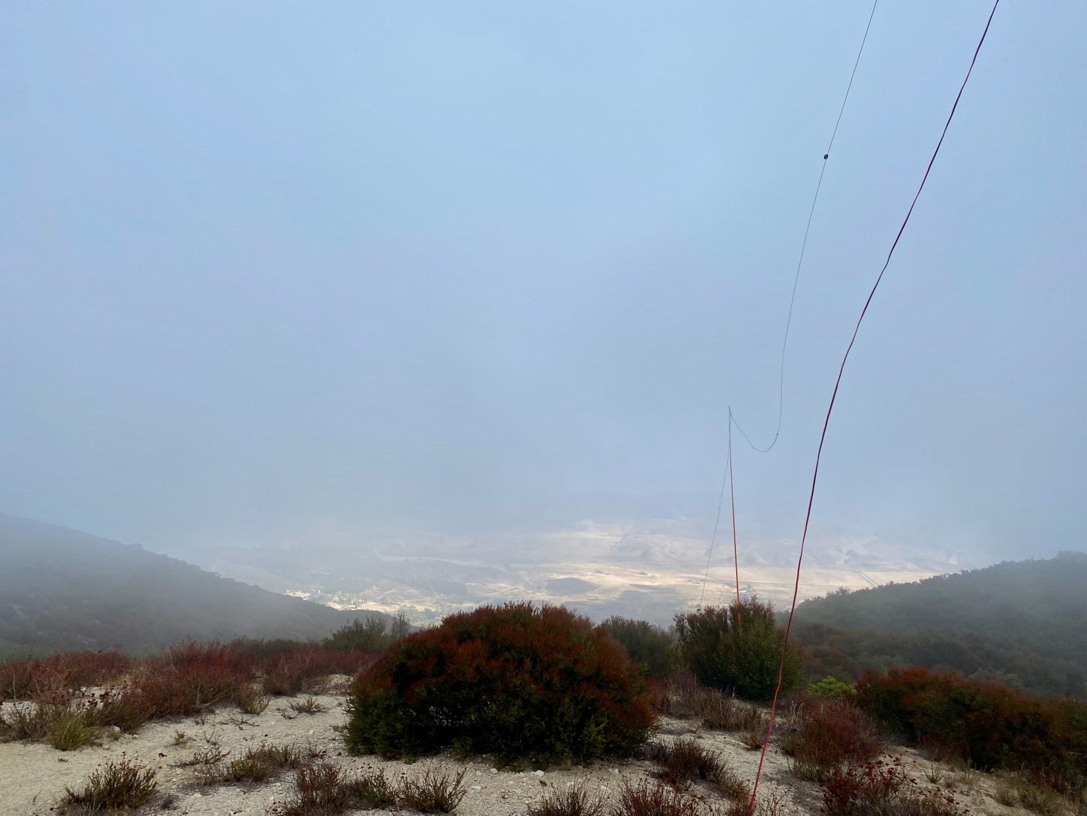
A cold, cloudy and windy morning. The San Andreas Fault Zone and the Leona Valley to the north just under the clouds. 22 OCTOBER 2022 W6/CT-136 Elevation: 4,541′ Route: Short dirt bike trail Hike Distance: .2 miles Elevation Gain: 100′ Navigation: Easy Steepness: Gentle Vehicle: Passenger car* (See below) Road: Forest Service dirt Cell Coverage:Continue reading “Burn Benchmark”
