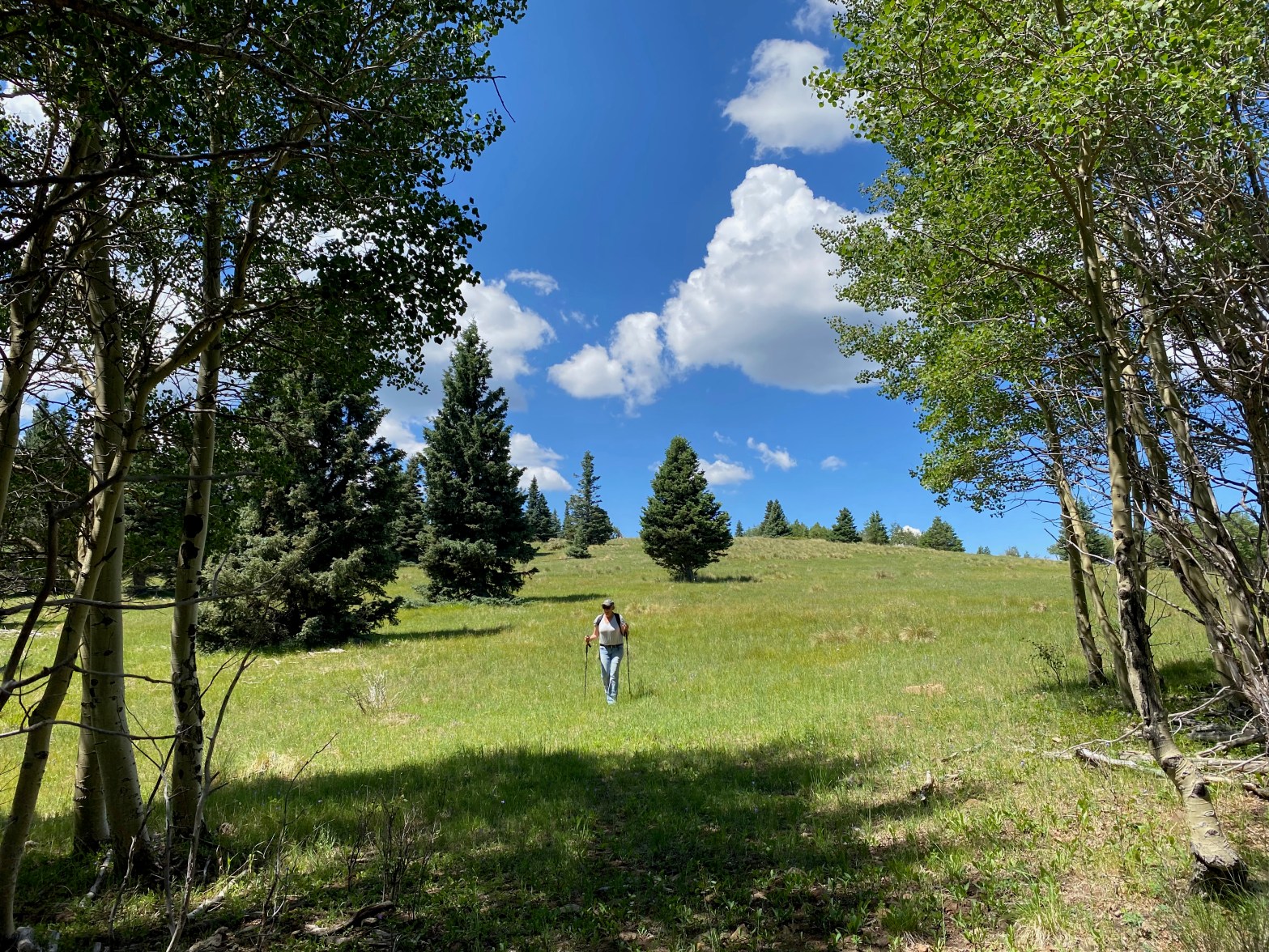
Cassie (KG6MZR) makes her way down through an alpine meadow near the top of Sierra de Don Fernando. 17 JULY 2022 W5N/SS-024 Route: Forest service road & cross country on use and game trails Hike Distance: 3 miles round trip Elevation Gain: 300′ Navigation: Moderate Steepness: Easy Vehicle: Passenger car Road: Rough dirt road Coverage:Continue reading “Sierra de Don Fernando”
Category Archives: Uncategorized
Cerro de los Taoses

Looking south at dawn toward Tres Orejas (W5N/OT-026) and Santa Fe Baldy. 14 JULY 2022 W5N/OT-025 Route: Wide open cross country Hike Distance: 1.2 miles round trip Elevation Gain: 400′ Navigation: Easy Steepness: Easy Vehicle: High clearance passenger vehicle Road: Seasonal, very rocky at the end. Cell Coverage: Fair (Verizon) Hike basics For this reallyContinue reading “Cerro de los Taoses”
Tres Orejas
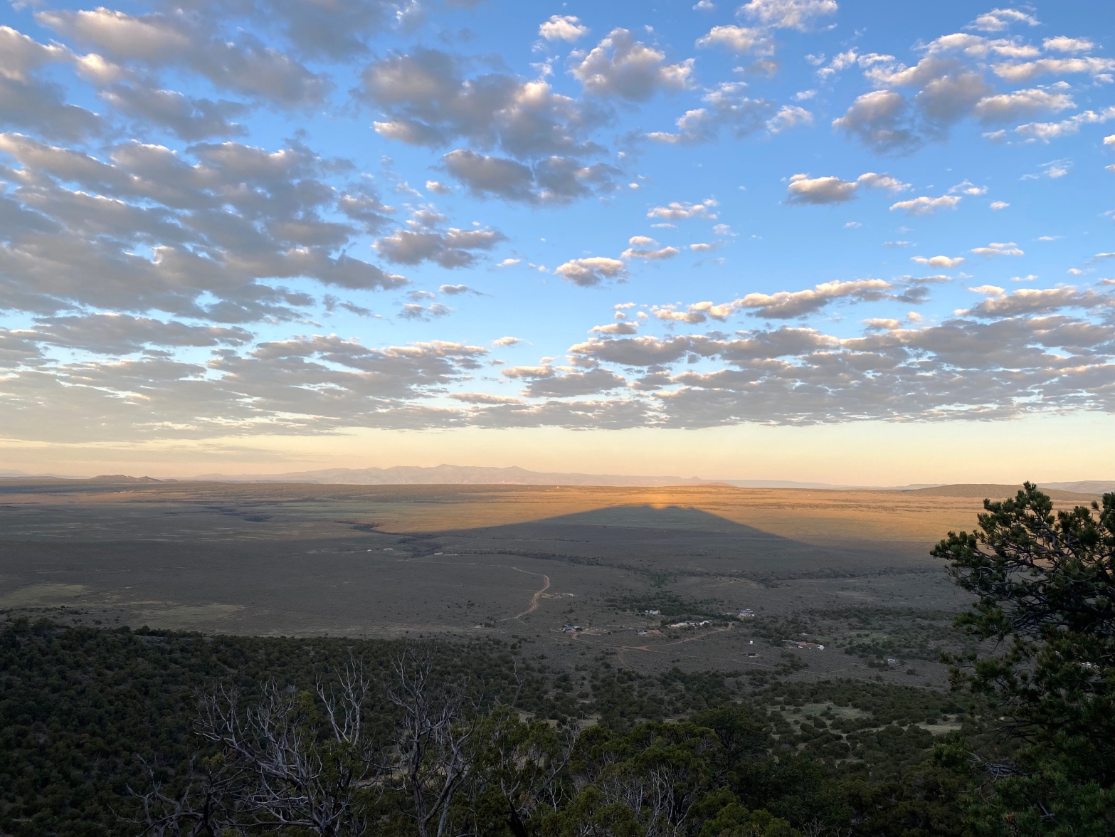
Sunrise on the way up 8 JULY 2022 W5N/OT-026 Route: Cross-country Hike Distance: .8 miles round trip Elevation Gain: 530′ Navigation: Easy Steepness: Steep Vehicle: Passenger car Road: 9 miles dirt (dry weather only!) Cell Coverage: Indeterminate. My phone had to be reset after this trip. Hike basics Last winter I attempted to do TresContinue reading “Tres Orejas”
Navajo Point

Sunrise on the Cedar Breaks the day before on the way to Brian Head. 2 JULY 2022 W7U/IR-002 Route: Jeep track and coss-country Hike Distance: .3 miles round trip Elevation Gain: 250′ Navigation: Easy Steepness: Moderate Vehicle: Passenger car Road: One mile good dirt road Cell Coverage: Unknown – forgot my cell! Hike basics PerhapsContinue reading “Navajo Point”
Brian Head

Brian Head, Utah 1 JULY 2022 W7U/SU-017 Full write-up to follow. Stay tuned… Route: Drive-up Hike Distance: 200′ Elevation Gain: 0′ Navigation: Easy Steepness: Easy Vehicle: Passenger car Road: 3 miles good dirt Cell Coverage: Good (Verizon) Hike basics
Ranger Peak

California green and gold. Looking east toward San Rafael Mountain W6/SC-013 18 JUNE 2022 W6/SC-056
Cachuma Peak

Selfie looking west down the Santa Ynez Valley. 19 JUNE 2022. W6/SC-054 Elevation: 4,623′ Route: Fire road and use trail Hike Distance: 8 miles round trip Elevation Gain: 1400′ Navigation: Easy Steepness: Moderately steep use trail Vehicle: Passenger car Road: Good dirt road Cell Coverage: n/a Hike basics While I adore the San Rafael Mountains,Continue reading “Cachuma Peak”
Mount Baden-Powell

Snow Flower at dawn on the way up the many switchbacks from Vincent Gulch Divide 11 JUN 2022 W6/CT-004
Escapula Peak x2

Fantastic view of San Emigdio Moutain, Antimony Peak and Eagle’s Rest Peak. 4 JUN 2022 W6/SC-005
San Emigdio Mountain

Chester the Drone shot this shot of San Emigdio Mountain from the east. That’s Big Pine Mountain in Santa Barbara County. 6 JUNE 2022 W6/SC-002
