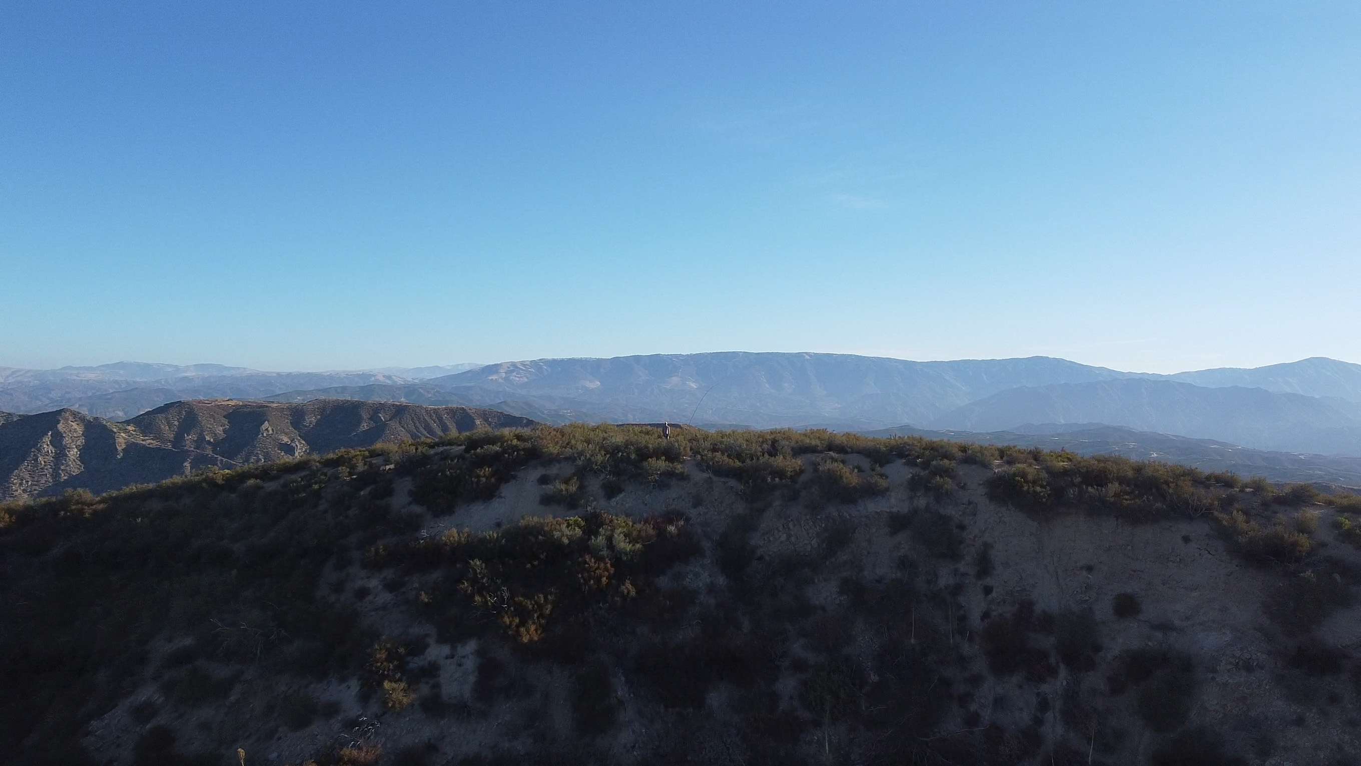
Chester takes a snap of the station looking north out toward Mt Williamson and the Antelope Valley
3 SEPTEMBER 2022 W6/CT-005
Three stars – Highly recommended.
Elevation:
9,138′
Route:
Forest service trail and use trail
Hike Distance:
3.6 miles round trip
Elevation Gain:
1,000′
Navigation:
Easy
Steepness:
Gentle with a moderate section at the end
Vehicle:
Passenger car
Road:
Paved Highway 2
Cell Coverage:
Poor (Verizon), APRS Excellent
Hike basics
Chester the Drone flies over Throop Peak.
With a planned trip to do a 35 mile section of the John Muir Trail in a few weeks, I wanted to do a conditioning hike at a decent elevation to prepare. A third SOTA trip to Throop and a second trip to Lewis fit the bill. I got to Dawson Saddle just as the sun was rising.
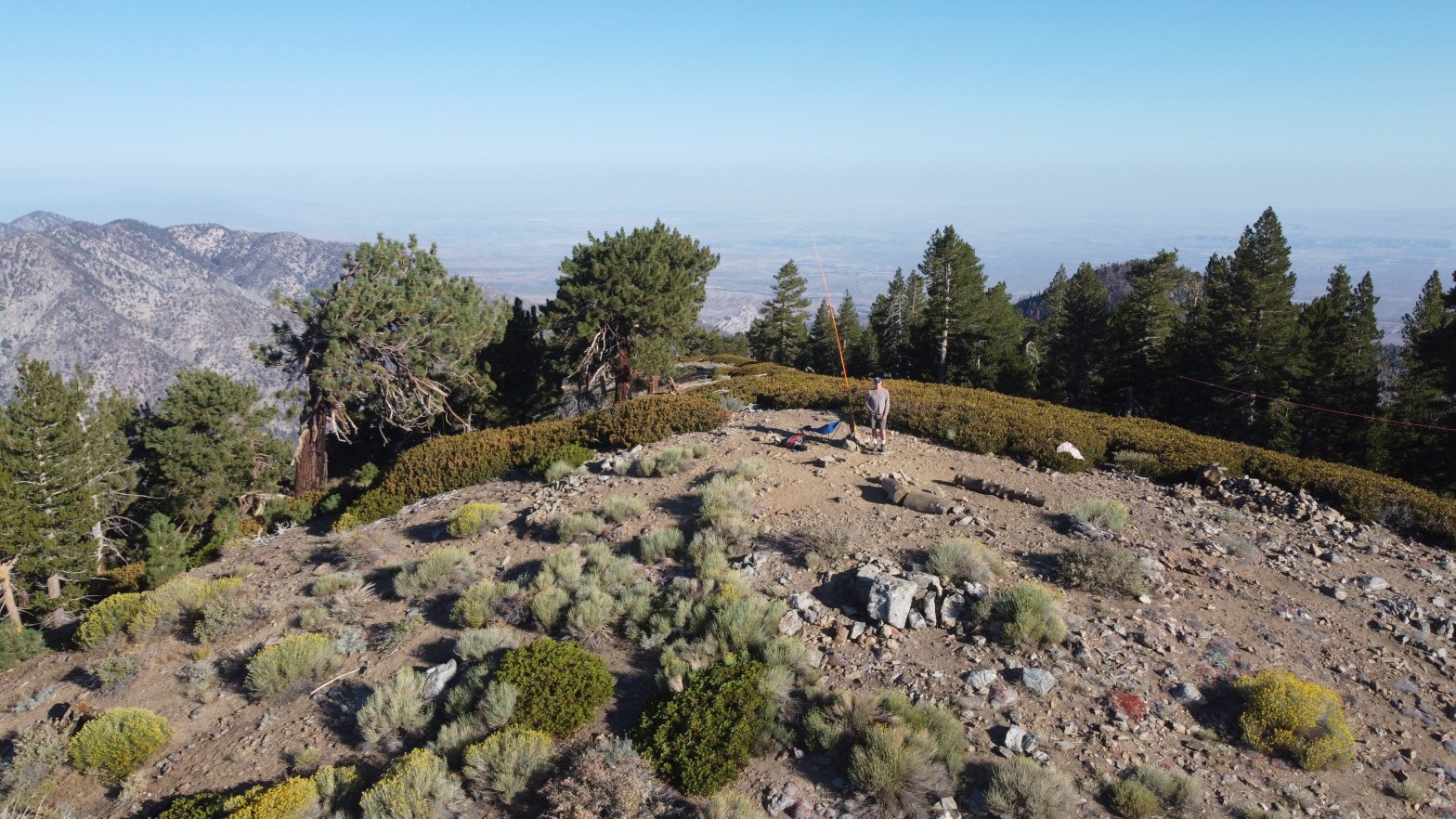
The Santa Monica Mountain to the southwest at sunrise with Chatsworth and Rocky Peaks in the foreground across fields of wild oats that give Oat Mountain her name.
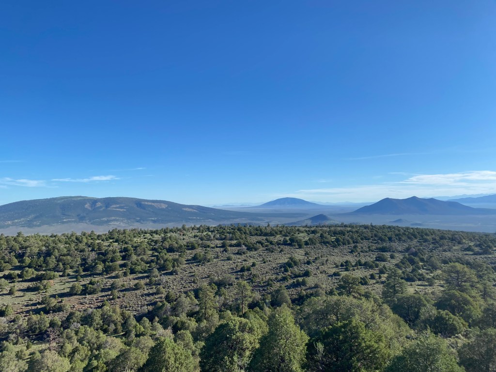
Looking east toward the highest point in Arizona, Mount Humphries. That’s Dogtown Reservoir in between.
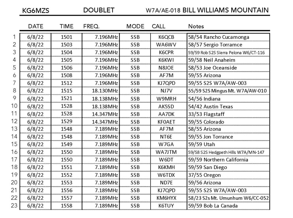
6 AUG 2022 W7A/AE-018
Elevation:
9,255′
Route:
Drive-up
Hike Distance:
n/a
Elevation Gain:
n/a
Navigation:
Easy
Steepness:
n/a
Vehicle:
High clearance SUV recommended
Road:
Dirt
Cell Coverage:
Good (Verizon)
Hike basics
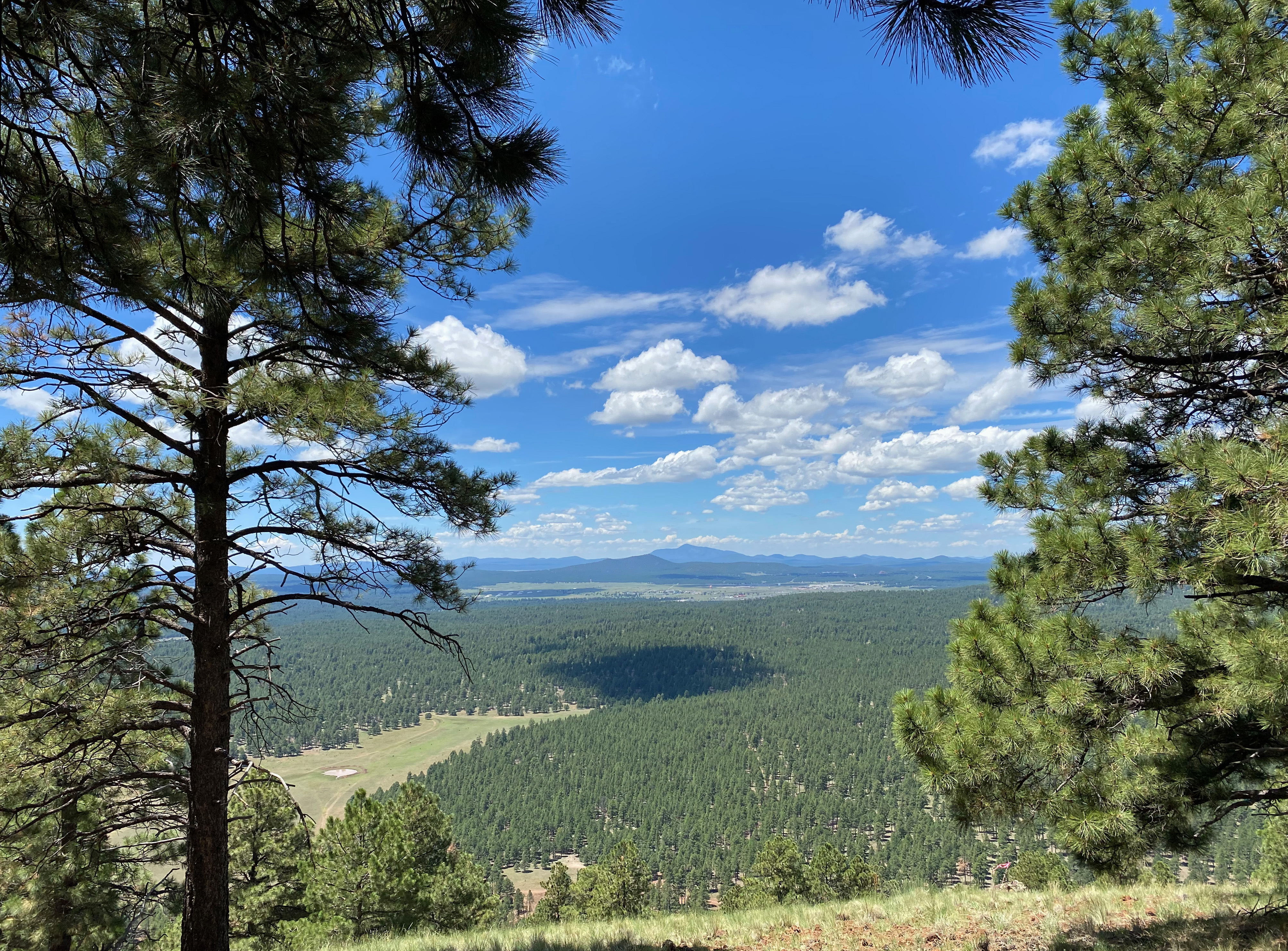
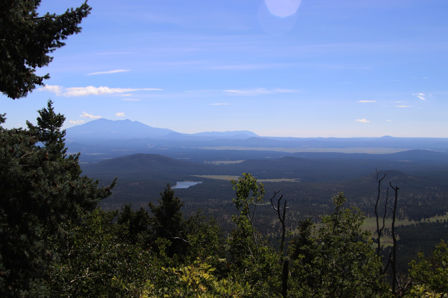
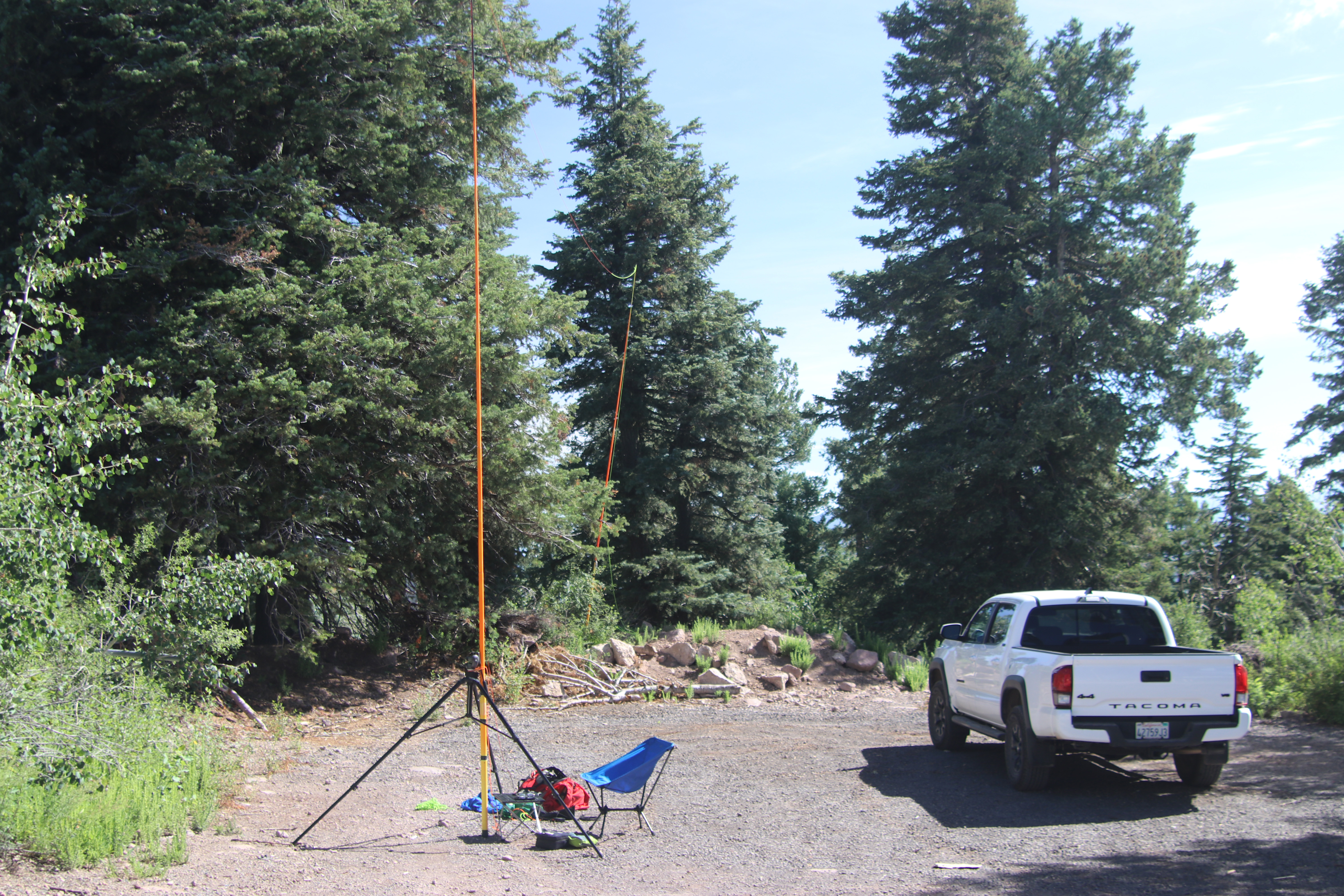
Cassie and I planned a layover in Flagstaff on Saturday on our way back from North-Central New Mexico to Topanga Canyon. I couldn’t decide on Bill Williams Mountain or A 1 Mountain, so I ended up doing both fairly easily. Cassie and I had attempted this drive-up last year in her VW Jetta and about 3/4 of the way up she vetoed that idea. If anything, the road was even worse after the winter rains this last season. I met SOTA Goat Ray W7USA on the summit in a totally random encounter and he said he had never seen the road this bad. I was glad to have Whitedog – a Tacoma 4×4 – but any decent, high clearance SUV would be okay.
The summit is a massive cluster of microwave and repeater towers. I didn’t have any trouble with the RF saturation, but I had no contacts above HF. I declined to go up into the fire lookout tower and was amazed that it was still manned by the forest service. I’m sure the RF exposure up there exceeded safe limits.
Here’s the lookout tower. I wouldn’t want to be up there in the near field of all those microwavesThe road upLooking west
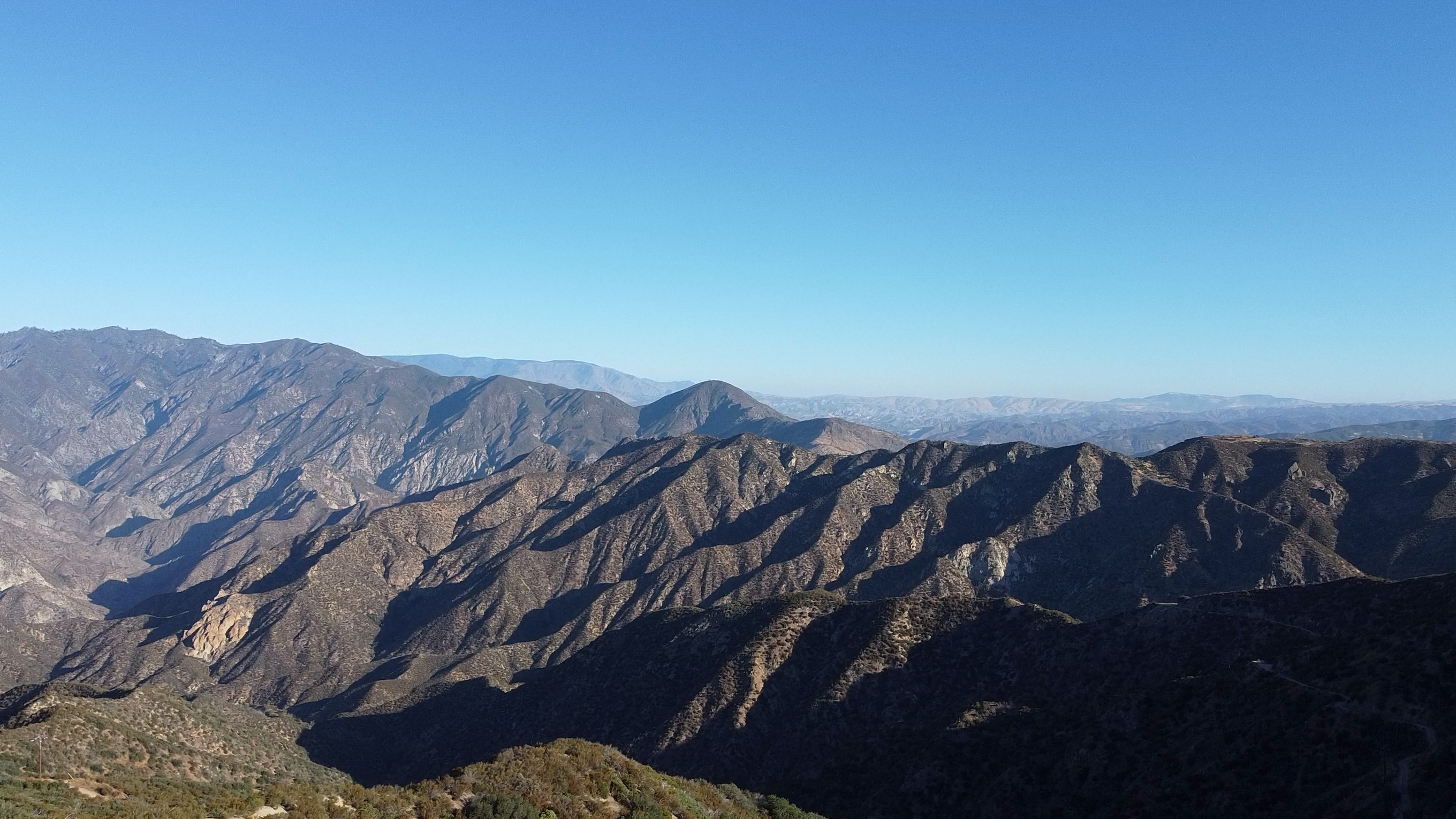
Chester the Drone takes a nice shot looking west over the station to the wilds around Cobblestone Mountain. Topotopo Mountain and Hines Peak also visible.
13 AUGUST 2022 W6/SC-076
Elevation:
4,174′
Route:
Mostly good road, brushy cross country last half mile
Hike Distance:
9 miles round trip
Elevation Gain:
1,250′ on the way out plus 150′ on the return
Navigation:
Easy
Steepness:
Mostly very easy with one short steep section
Vehicle:
Passenger car
Road:
Paved
Cell Coverage:
Indeterminate.
Hike basics
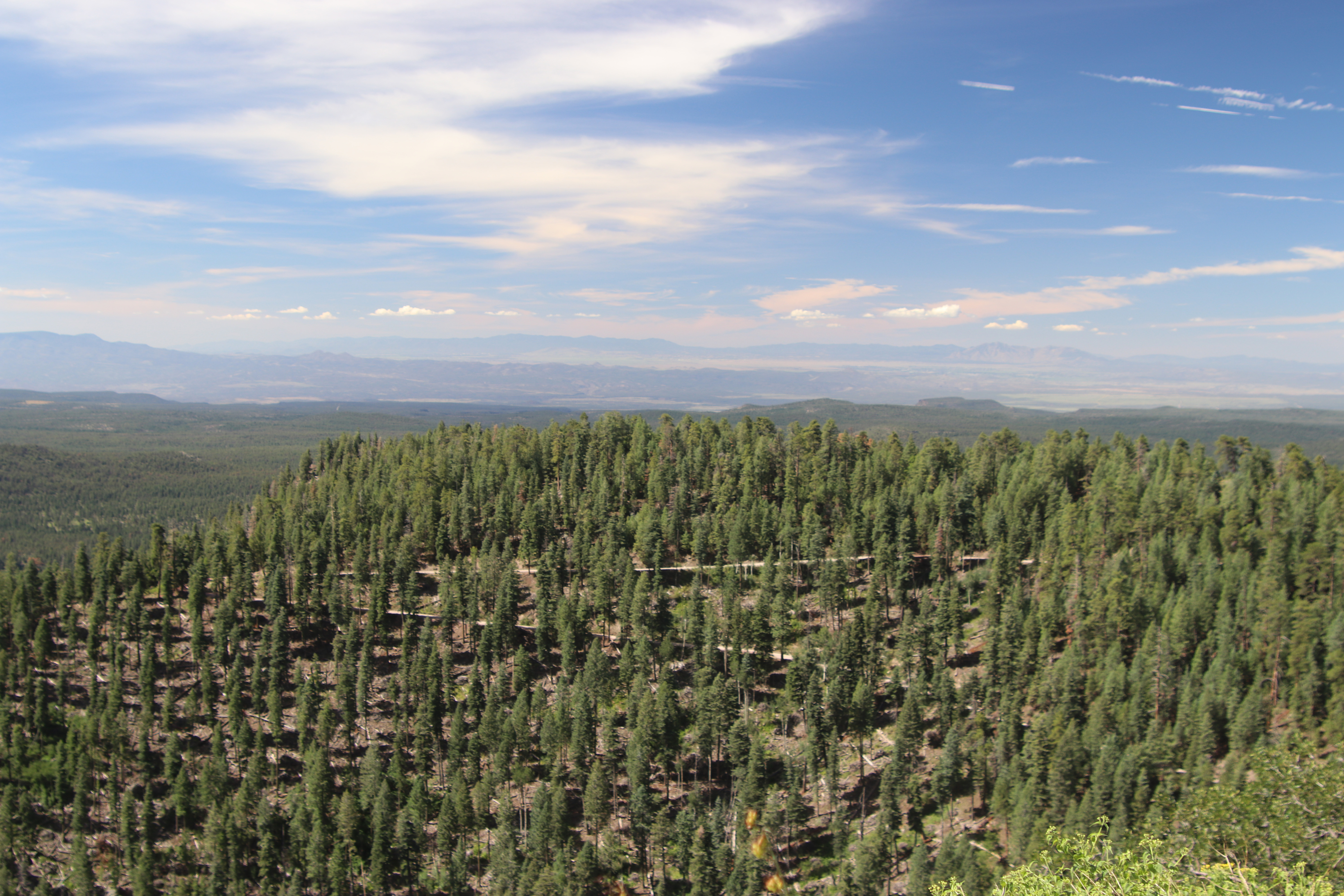
It had been 28 years since I last ascended this mountain with my brother and I only had a hazy recollection of the hike as being a short one after a long drive up a dirt road. This time around the road was closed at the old Golden State Highway up from Templin Highway. I knew it was going to be a long hike on what was going to be a hot day so it was a good thing I set out from Whitedog at 5:20 AM. A waning gibbous moon illuminated my path until the dawn twilight took over. All the bright winter stars were glittering in the east and I look forward to the cooler temperatures that the fall will bring.
The hike follows a gentle grade and a good paved road over a near ridge with a communications facility at the top. Befitting the capricious nature of road closings in the Angeles National Forest this year 6N53 has remained closed all summer for reasons who-knows-why.
In retrospect this would’ve been a very nice mountain bike ride — certainly I would’ve loved it coming back. I thought about including unnamed summit 4,020′ W6/CT-263 in this trip and a mountain bike probably would’ve made that possible for me. Why Whitaker is a SC and 4,020 is a CT is yet another of the vagaries of the SOTA brain trust.
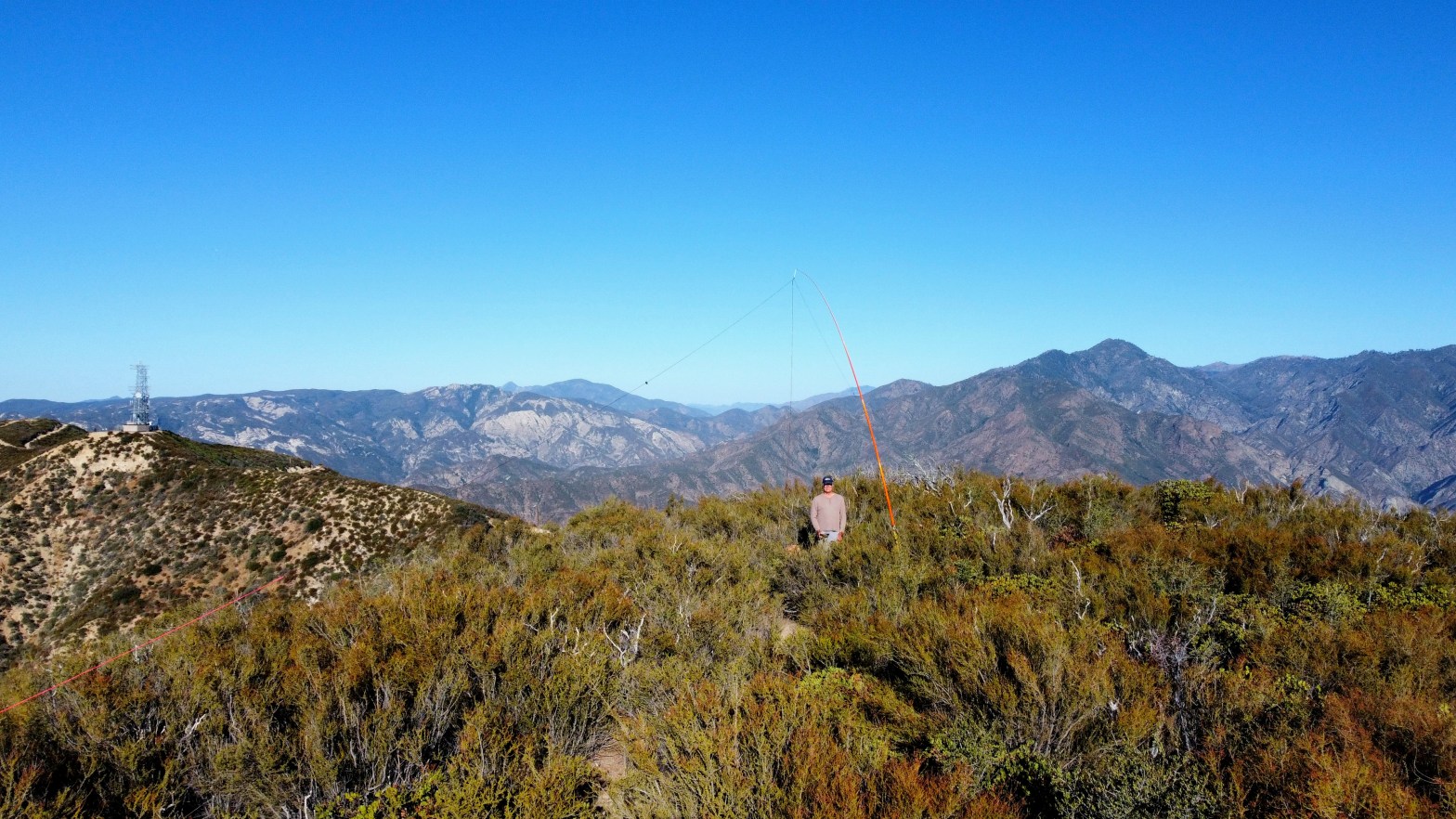
The second communications facility on the road is not on the actual summit of Whitaker and is not in the activation zone. You must leave the trail before that point and scramble up an extremely steep and loose embankment to make the ridge. From here it is a very bushy walk back east to the summit. If I had bothered to read my own notes from my 1995 ascent, I might’ve brought a pair of clippers to cut through the worst of it.
Once on the summit I found my iPhone did not connect to the network. I suspect it just needed to be rebooted as this is a problem I had been having with my old version of iOS (PS I HATE iOS). Added to that my Yaesu FT-5D had to go back to the mothership in Cyprus for warranty repair of a cracked case that has been plaguing this particular model. Added to that is the fact that since I got my new iPhone I have neglected to load the Garmin InReach app to make texting via the Iridium Satellite Network actually usable and all this added up to no ability to self spot.
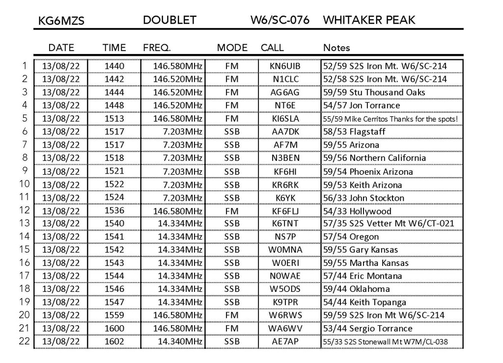
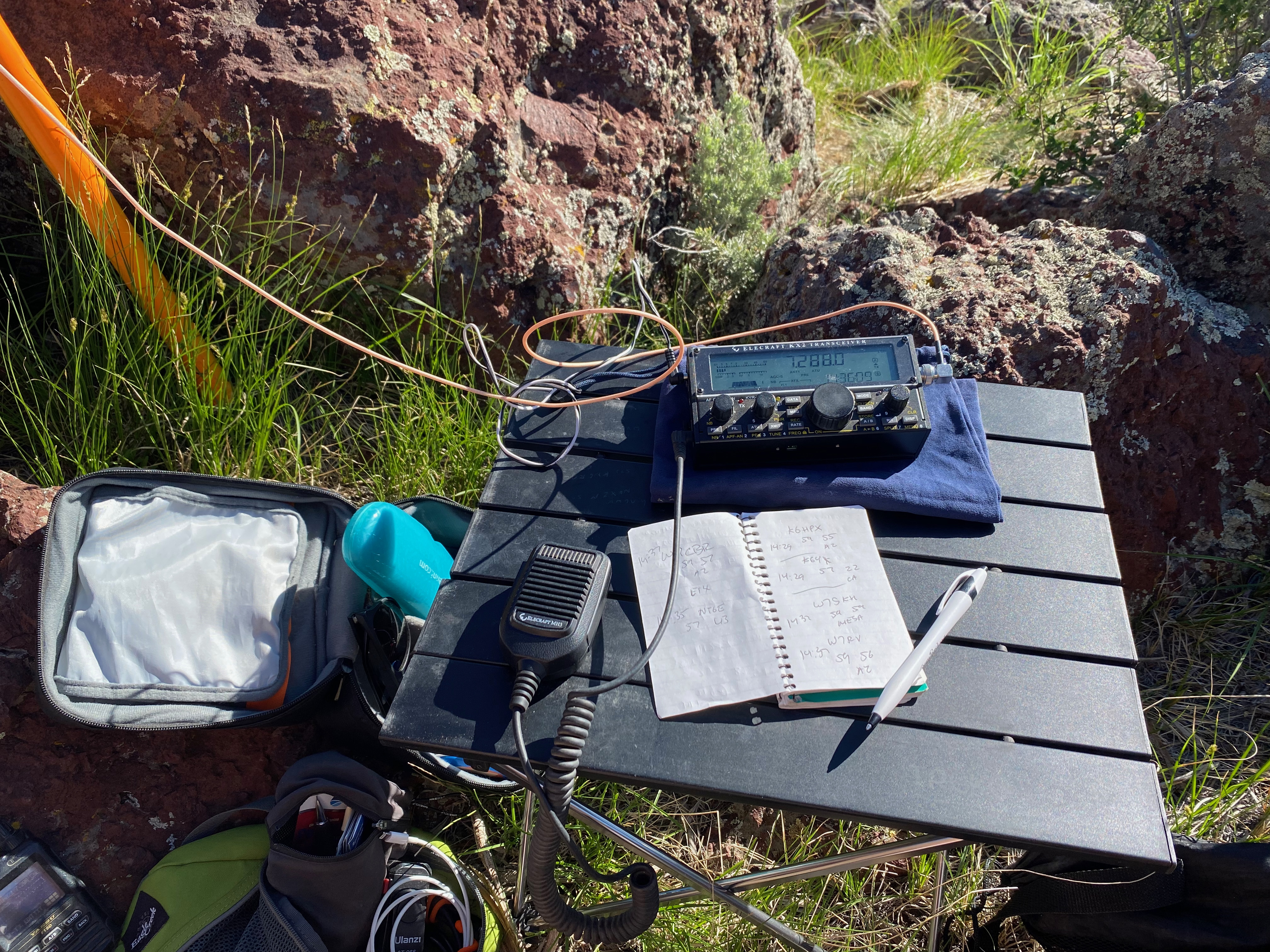
Fortunately faithful chaser Mike KI6SLA posted some spots for me so I was able to work a lot of the usual suspects.
A couple of really nice surprises: I had 152 mile summit-to-summit with 11 year old Levi KN6UIB and his dad Jacob W6RWS along with Chris N1CLC on Iron Mountain way down San Diego County way. That was really cool. I had worked Levi and Jacob on a similar VHF DX of Denk Mountain earlier this year.
Second: just tuning around on 20m because I had no spots available to me, I came across AE7AP totally randomly on Stonewall Mountain in Montana for a fortuitous summit-to-summit.
It was also great to catch Keith K9TPR back home in Topanga and a bunch of other faithful chasers.
On the way down I made a fateful mistake. I thought I’d seen a use trail coming up from the last saddle on the road, so I decided to try an do a short cut directly down the north ridge. I cannot state emphatically enough: DO NOT ATTEMPT THIS! What started out as a nice use/game trail along the ridge quickly became a very steep bushwacking nightmare. I had to remove my pack and fiberglass poles and crawl through the underbrush throwing my trekking poles and the fiberglass poles over the thick brush ahead. By this time it had gotten really hot and the work of even going 20 feet was exhausting. Even though I had a liter of water, it was not enough. When I got home I saw in AA6XA’s fine video that he was also thinking about this route, so I know I am not the only one to consider this. He was smart to go back the longer way we both came I repeat: DO NOT DO IT!
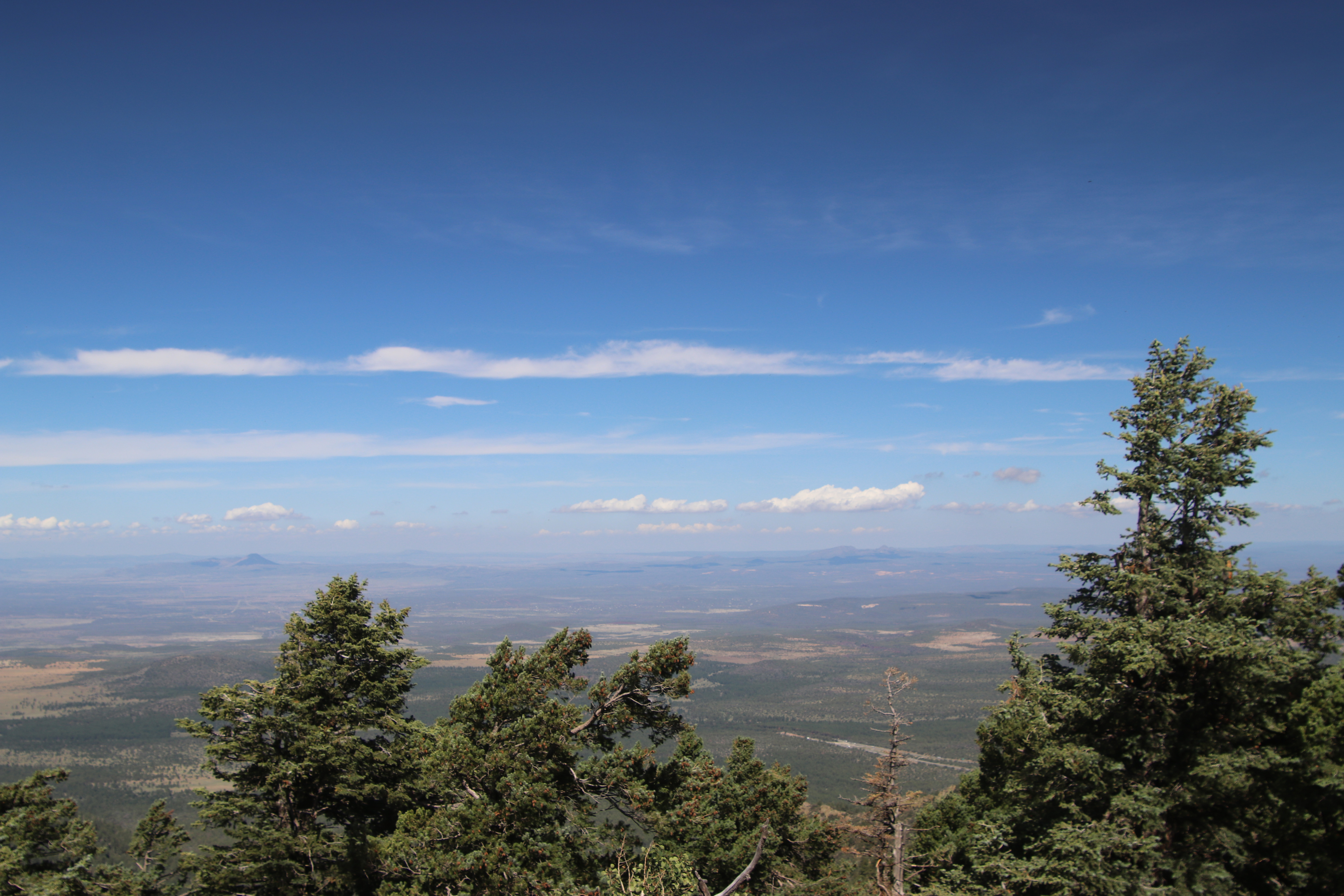
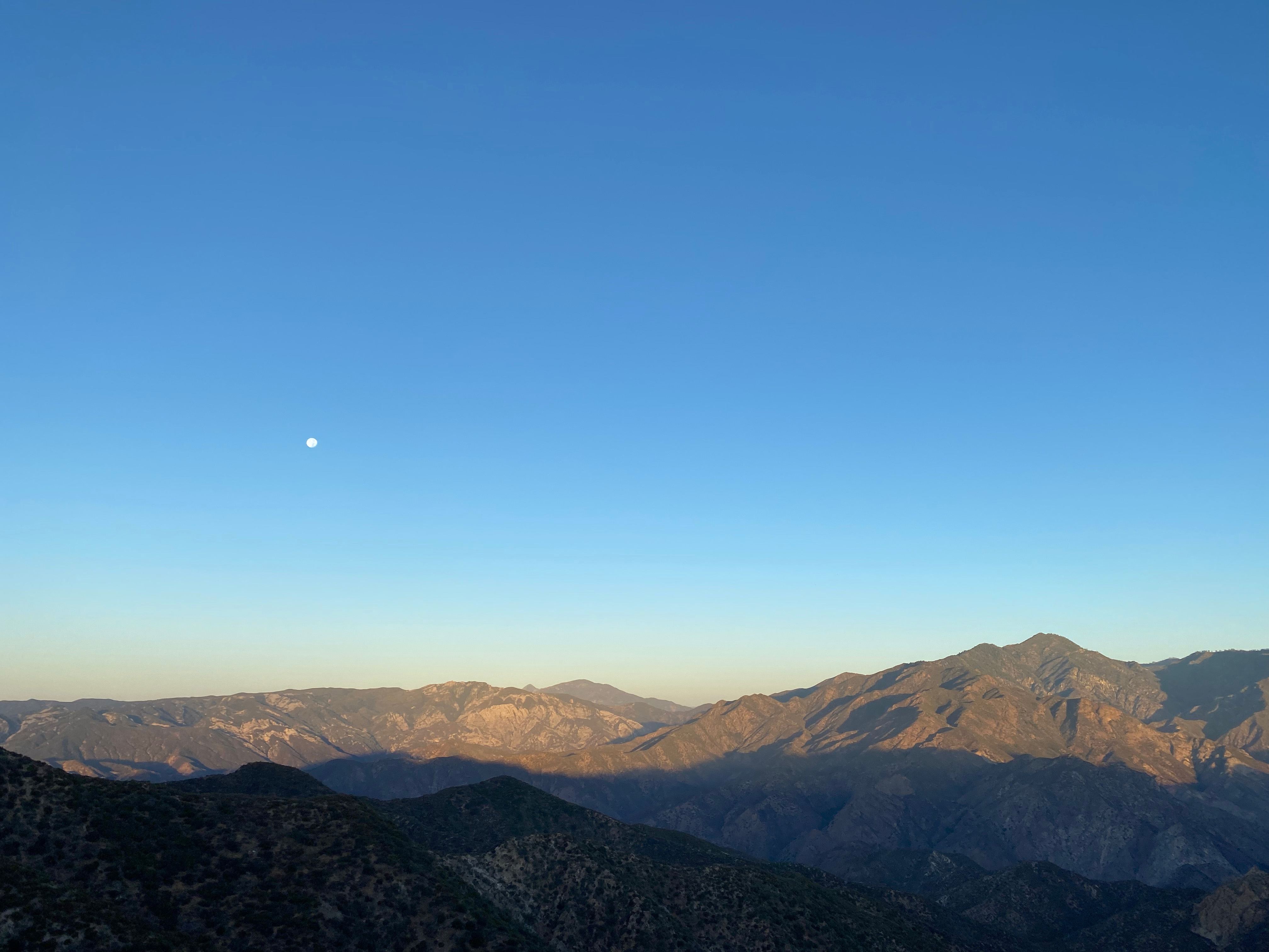
Nice Chester shot looking north at Slide Mountain (center), Frazier Mountain and Alamo Mountain to the left.Looking west at sunrise to Hines, Topotopo and CobblestoneLooking northeast over the summit to Libre Mountain
Cassie (KG6MZR) and I tried this summit on the previous weekend by taking the Angel Fire “Chile” ski lift to the summit. The lift is now $21.00 and rather a noisy affair. We wandered around in the maze of roads on the summit and never did actually make it into the activation zone. The threat afternoon monsoonal thundershowers caused us to abandon hunting for the summit.
So the following weekend I decided to try again, this time avoiding the cacophonous crowd of mountain bikers on the pricey lift and the late 9am lift start time and drove beyond the top of the “Chilie” lift. Not being bound by the late 9am lift start time, I was able to get up there much earlier in the morning to hopefully beat the afternoon rain that was in the forecast. It is possible to drive up following El Camino Real up from the bottom of the lift through a neighborhood of ski cabins. I parked by a large water tank at 36° 22.0598′ N, 105° 13.6843′ W on a good, well drained dirt road that only got a little rough at the very end.
A word of caution on this peak. Obviously the area was set out to be a neighborhood on paper. There is a rabbit’s warren of cleared “roads” through the dense forest – none of witch lead directly to this rolling summit. Route finding in the forest and the fog can be challenging with most landmarks obscured. Make a careful note of your route — it is pretty easy to get turned around. I ended up walking an extra half mile in a circle when I came down. At the end of the closest track to the actual summit I found a route marked with DayGlo orange tape that led to the summit clearing.
Another warning: most of the roads listed on most maps are so-called “paper streets” — neighborhoods that have been laid out but do not actually exist.
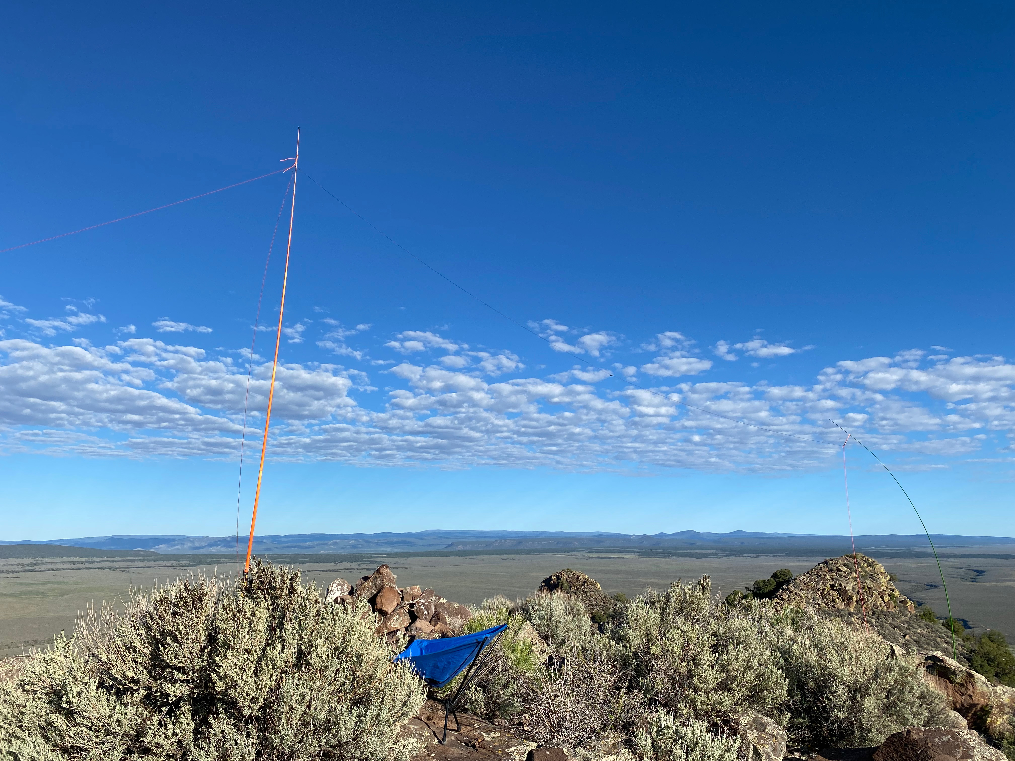
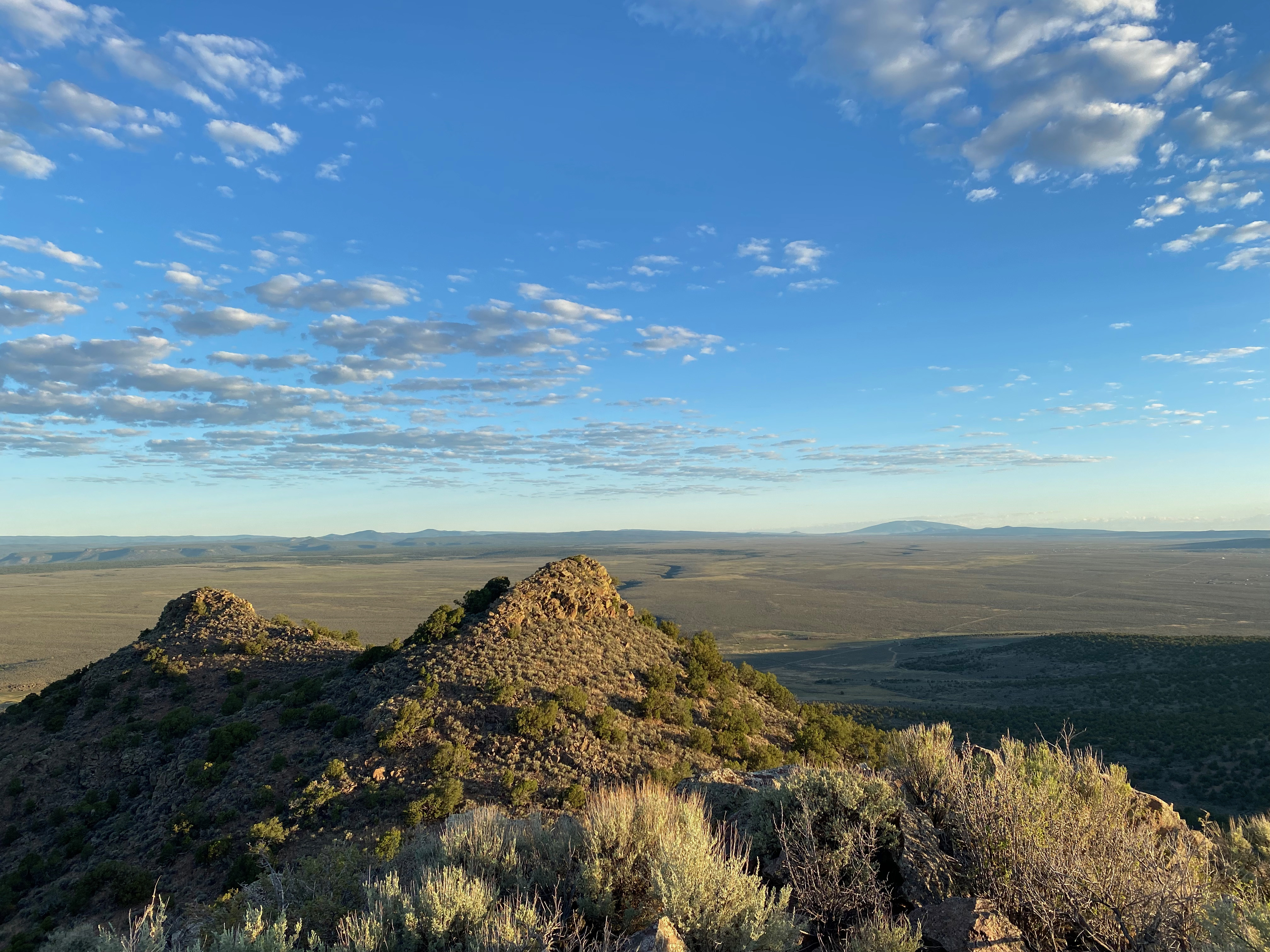
On this morning the entire summit was wreathed in low clouds an everything was dripping wet from yesterday’s rain. Mushrooms and wildflowers were everywhere. the summit itself is just up from a wide alpine glade to the south that makes a pleasant spot to set up on numerous trees. The activation zone on this rolling summit is huge.
I quickly set up the station and made 14 contacts. I had no idea when the rain would start as there was not good visibility, so I wrapped things up sooner than I otherwise might’ve. I kept feeling drops but I wasn’t sure if that was rain starting or just moisture blowing off the trees.
Sunrise from El Prado on the drive up.The station on a cloudy morningLooking south on the way down once I got under the cloudsMore mushrooms. All this needs is a caterpillar and a hookah.
Chester the Drone shoots the summit looking south across the Taos Plateau.
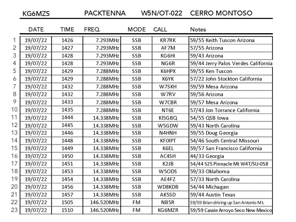
19 JULY 2022 W5N/OT-022
Route:
4×4 track and cross-country
Hike Distance:
4 miles round trip
Elevation Gain:
728′
Navigation:
Moderate to difficult on the way down
Steepness:
Gentle
Vehicle:
High clearance vehicle
Road:
Mostly good dirt. DRY WX only
Cell Coverage:
None (Verizon) Good APRS
Hike basics
Looking for another early morning, before-work activation I set my sights on the unnamed summit 8,090′ (W5N/OT-023). I left Cassie’s casita around 5AM and struck out across the Rio Grande Gorge Bridge. This is now necessary because the John Dunn Bridge has been closed for a while now. I was following Fred KT5X’s directions but when I got to the point when you branch off to the left of Camino de Lavato I found a locked gate with “No Tresspassing” and “Private Property” signs.
Okay, so I always have a plan B when I go out — and plan B was Cerro Montoso. I had the foresight to enter all the waypoints from Tom K6TAA’s route description and this is strongly advised for anybody attempting to hike this mountain this way. The route is circuitous with a lot of turns amidst a labyrinth of dirt roads that dodge a checkerboard of private property. The road is mostly good with the caveat that this is only true in DRY weather. I could see a lot of what would be bogs in wet weather with numerous roads that threaded around them. Like the roads to other peaks I’ve activated on the Taos Plateau, deep ruts were cemented into these roads from vehicle is wet weather.
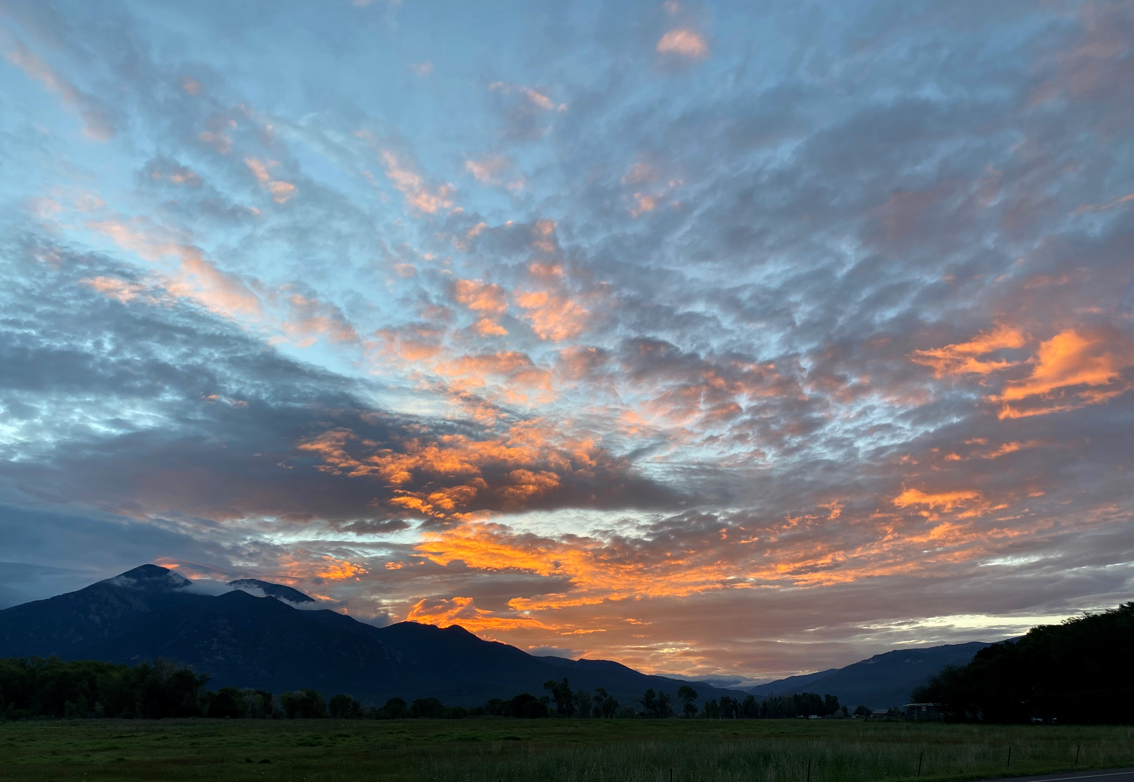
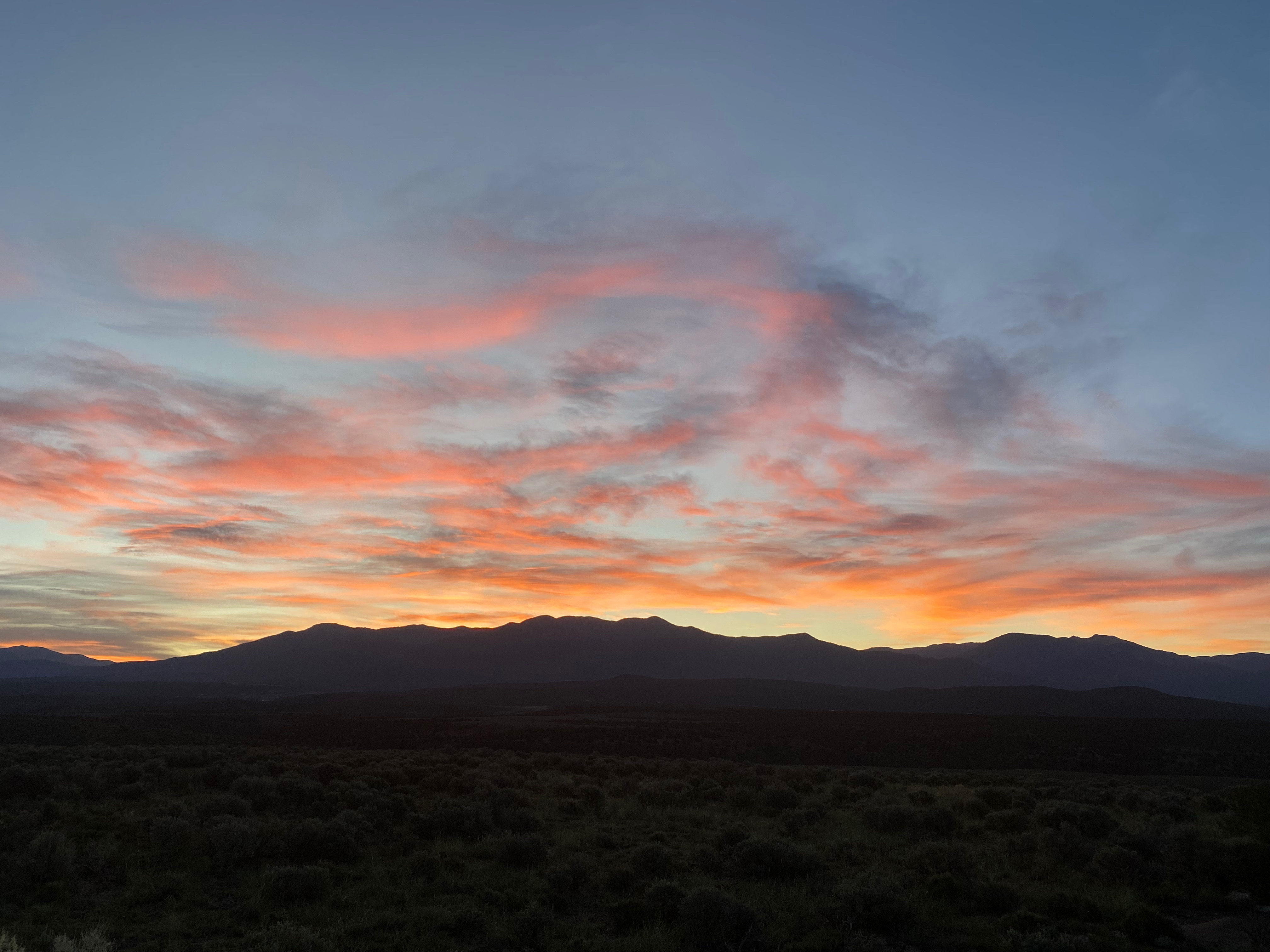
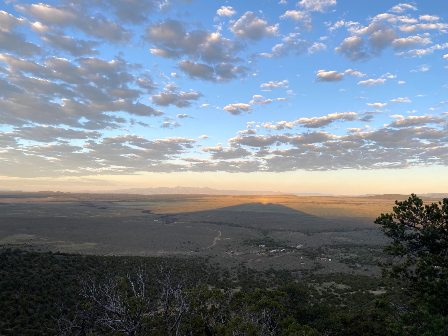
Tom must be a more adventurous 4×4 driver than I because I stopped short of where he indicated the road head. Two elk galloped along side Whitedog for a while before crossing in front of me. The sunrise over the Sangre de Christo Mountains lived up to its name.
The hike goes up through a sparsely wooded hillside but there are enough trees to obscure landmarks. Care should be taken in observing your route for the descent.
Radio conditions were markedly better than they were over the weekend. 20m was open into the south and east. I even got chased by a station on Pinnacle Mountain for a summit-to-summit. I originally planned to make a few contacts and bail to get back in time for work, but I was having so much fun I hung out for a while. I heard from Brian NB5R, a radio tech going up San Antonio Mountain on 2m long with my wife, Cassie KG6MZR back at her casita.
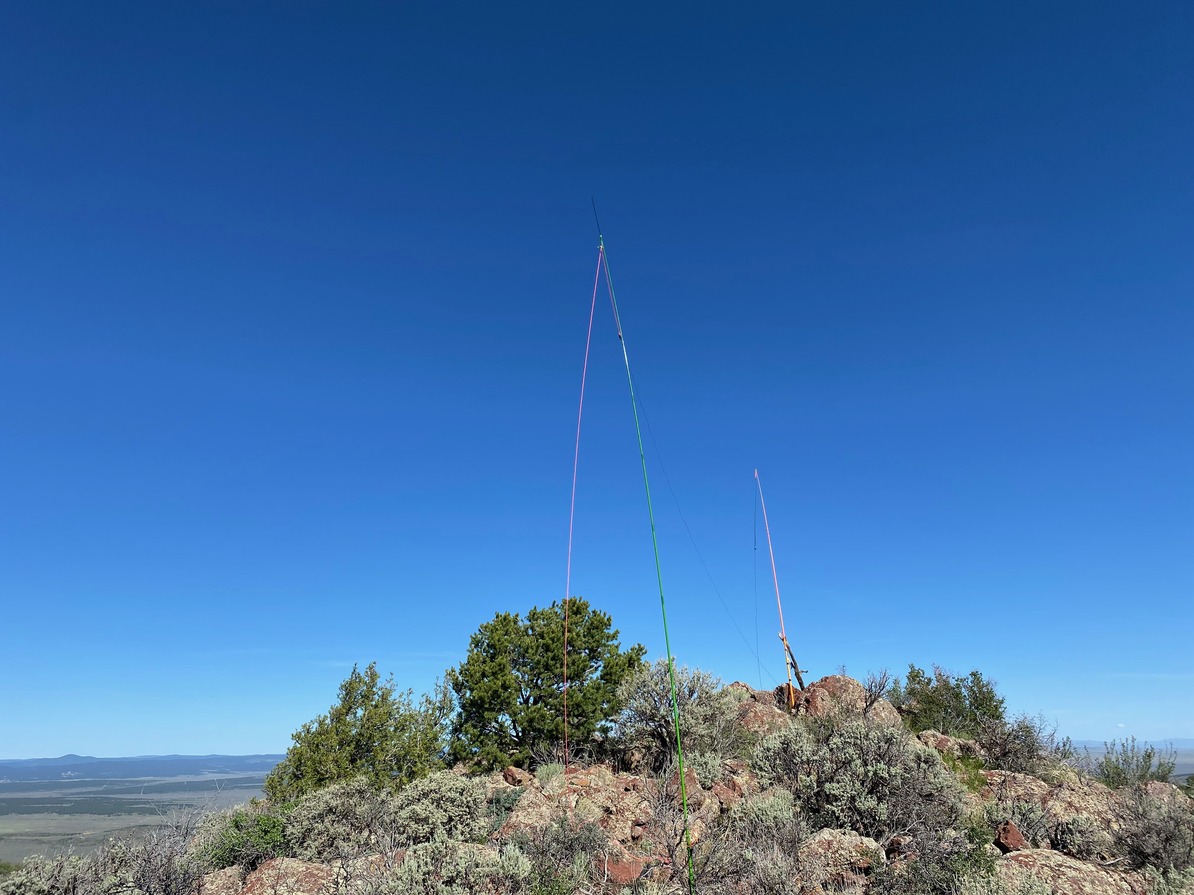
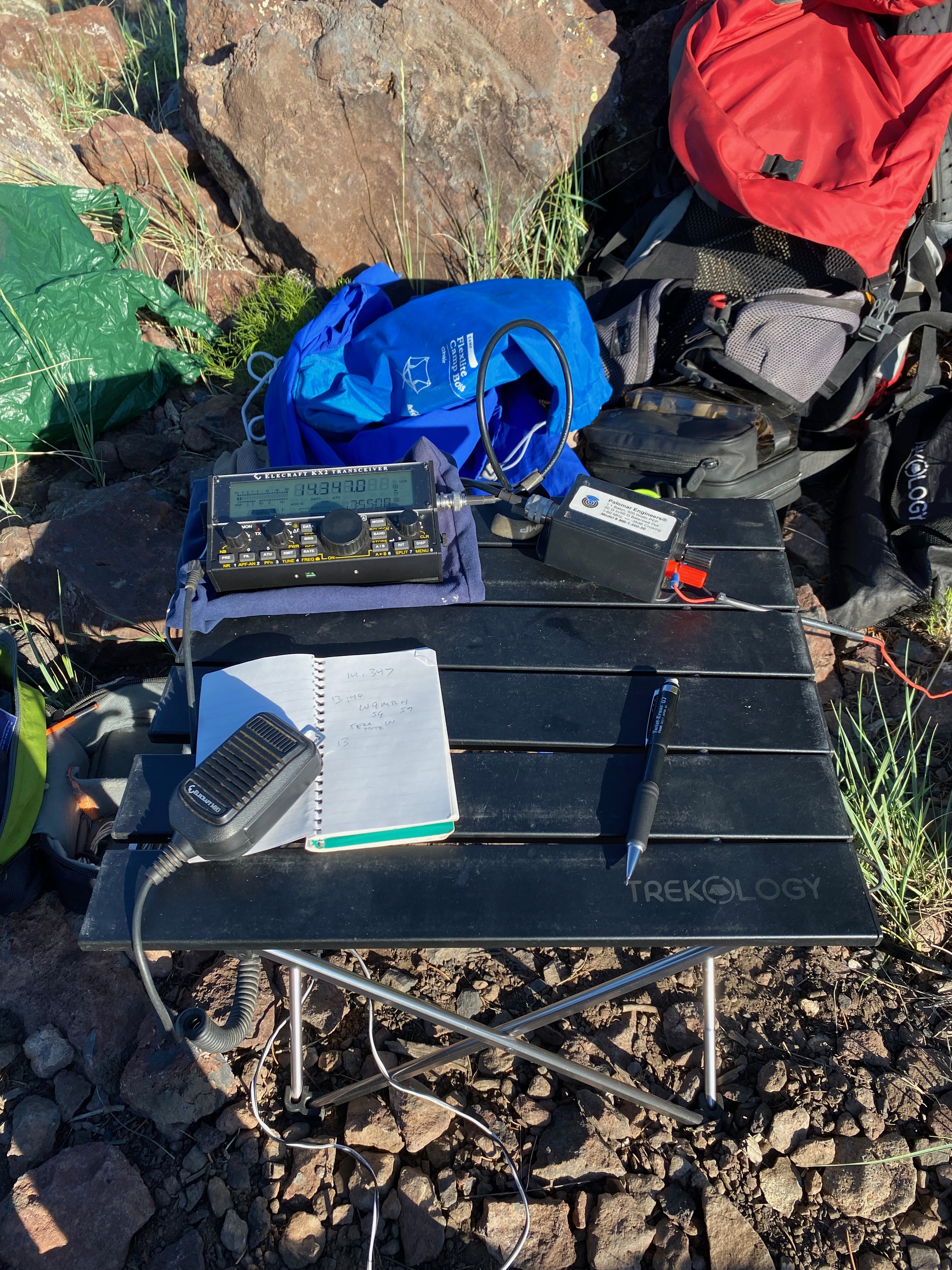
Sunrise on the drive out.The station.Close up of the operating position.Looking northwest to Cerro de la Olla, Ute Mounain and the Guadelupe PeaksLooking northwest to Mount San Antonio. I spoke with Brian NB5R on 2m, a radio technician driving to the summit to work.Love the lichen on the igneous summit rock in this shot.This guy never made it to the summit
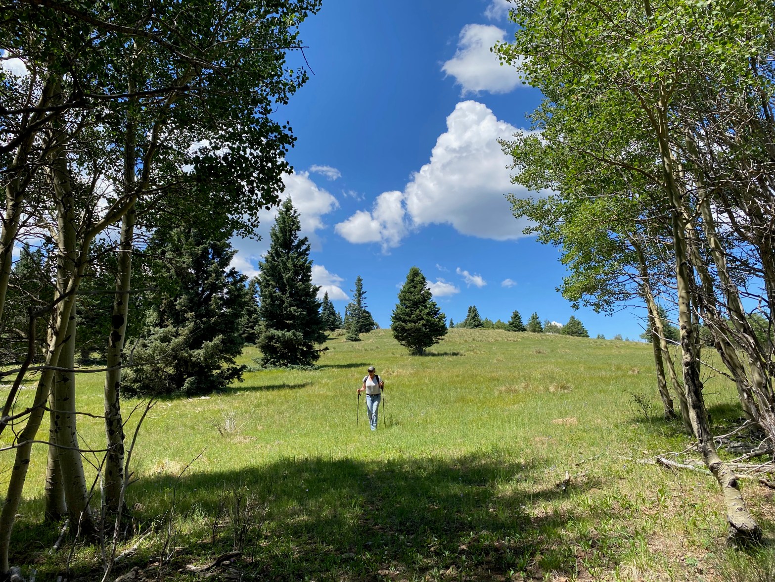
Cassie (KG6MZR) makes her way down through an alpine meadow near the top of Sierra de Don Fernando.
17 JULY 2022 W5N/SS-024
Route:
Forest service road & cross country on use and game trails
Hike Distance:
3 miles round trip
Elevation Gain:
300′
Navigation:
Moderate
Steepness:
Easy
Vehicle:
Passenger car
Road:
Rough dirt road
Coverage:
Good data (Verizon) & excellent APRS
Hike basics
I can now see why this summit is so popular: it is a very pleasant, near level walk through beautiful aspens and pines and firs to a wide open summit with great support trees. Cassie (KG6MZR) and I were looking for an easy Sunday stroll near Taos so we took a look at Sierra de Don Fernando on the advice of Fred KT5X. We wanted a hike that we could be down off of before the afternoon monsoon rolled in and the lightning bolts started flying. As it turned out this was an all-too-valid concern. We got a late start (for me) leaving Cassie’s casita about 7AM.
The hike follows the closed forest road 445 but at some point you need to strike out to the south to gain the summit. We left FS road at about the one mile mark and found our way among the old woodcutter tracks, use trails and elk track. We came down a more defined road.
There is broad alpine meadow on the gentle north slope of the summit with wonderdul views to the north of Wheeler, Pueblo and the surrounding peaks.
Radio conditions were poor and the building cumulus clouds curtailed my activation. On the trip back we decided to do the so-called “”Enchanted Circle” and go back through Angel Fire, Eagle’s Nest and Red River. As we climbed Bobcat Pass a tremendous thundershower struck with lightning everywhere and a drowning rain. The windshield wipers could not keep up even on the fastest speed. There were visible lightning strikes very close by. We were wise to get off the mountain as soon as we did,
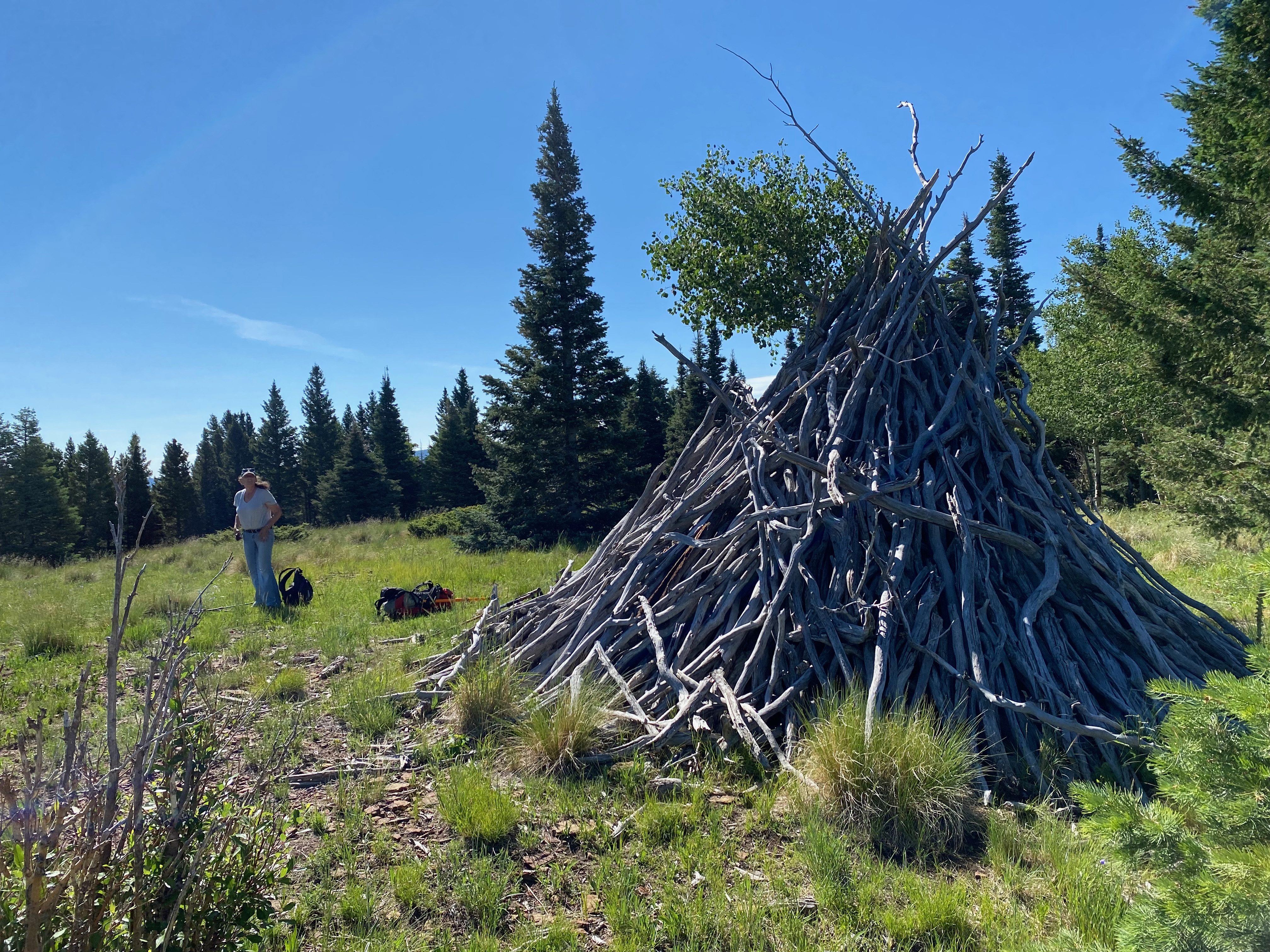
Looking north toward Wheeler and Pueblo Peaks.Deadwood shelter we found on the summit.
For this really fun activation I got up around 5AM and the full moon was hanging low over the Taos Mesa. My work schedule had subsided the day before and I felt I could reasonably take off and get in an early activation before clients started calling me again.
I followed Tom K6TAA’s directions and found the approach to be pretty rocky toward the end. I was glad to have a high clearance truck and I certainly would not want to try these deeply rutted roads in wet conditions.
The hike is pretty short and straightforward. The little community I passed through is pretty, uh, different. I was a little nervous parking past the abandoned trailer, but the early hour seemed to be in my favor. On my way back I talked with Joshua, a resident in the last house I passed and he was curious as to what brought me out his way. Once I told him I was hiking he was quite friendly. He did say that I woke him up at 6:00 when I drove by, but that he was fine with me hiking up Cerro de los Taoses. he said not many people came down his road.
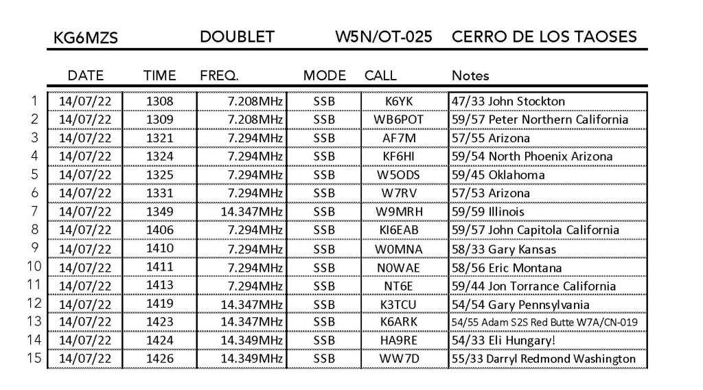
After I did Tres Orejas (W5N/OT-026) last week I was contacted by Eli HA9RE in Hungary. Eli is a dedicated US county hunter and he expressed a desire to add Taos County to his log. I figured that I might be be able to work him from the portal of my wife’s little adobe near Arroyo Seco using my K3/100 at 100 watts and a large doublet.
I was shocked when Eli called me on 20m toward the end of my activation! He was a solid 54 to me and he gave my little 12 watt signal a 33. This made both of our days!
I also worked Adam K6ARK on Red Butte in Arizona for a summit-to-summit and a lot of my favorite chasers, including Jon NT6E back home. This turned out to be a really fun activation!
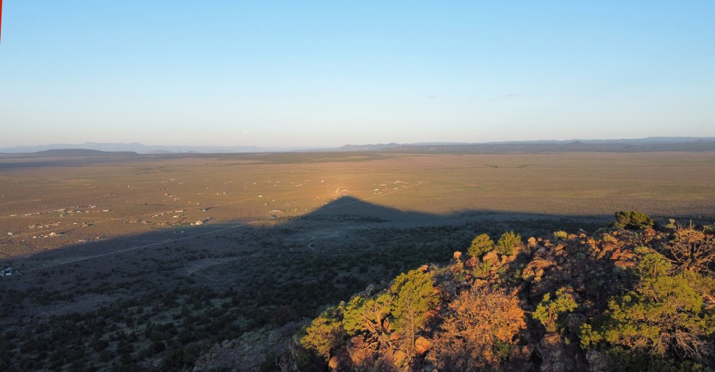
Whitedog at the trailhead at dawn.Chester shot of the shadow of Cerro de los Taoses. Chicoma Peak and the Valles Caldera out across the Taos Mesa.The stationHappy activator.
Indeterminate. My phone had to be reset after this trip.
Hike basics
Last winter I attempted to do Tres Orejas but turned around about half way down Star Road. The muddy ruts were simply too deep and I kept slipping into them. I did not want to get stuck. This time the roads were mostly dry but the deep ruts were still there, like they were set in concrete. Such is the nature of the volcanic mud on the Taos Mesa. I followed Tom K6TAA’s instructions and was able to take Whitedog, my Tacoma 4×4, up the side road a ways to a nice, secluded parking area in the Carson National Forest.
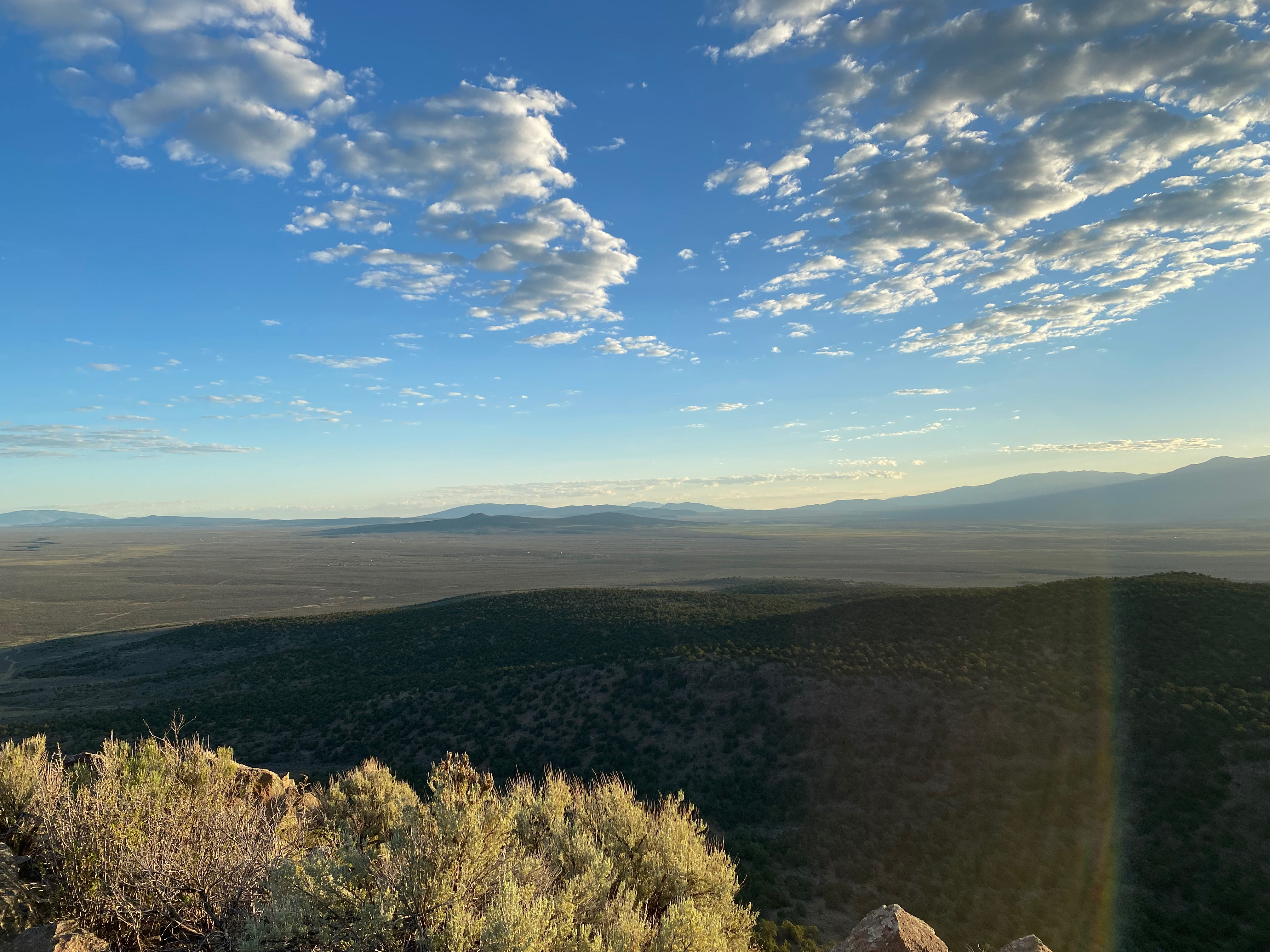
The hike is short and steep with even a short 3rd class section. The view of the Taos Mesa and Sangre de Christo Mountains at sunrise was breathtaking. It was a little too windy to fly Chester the drone.
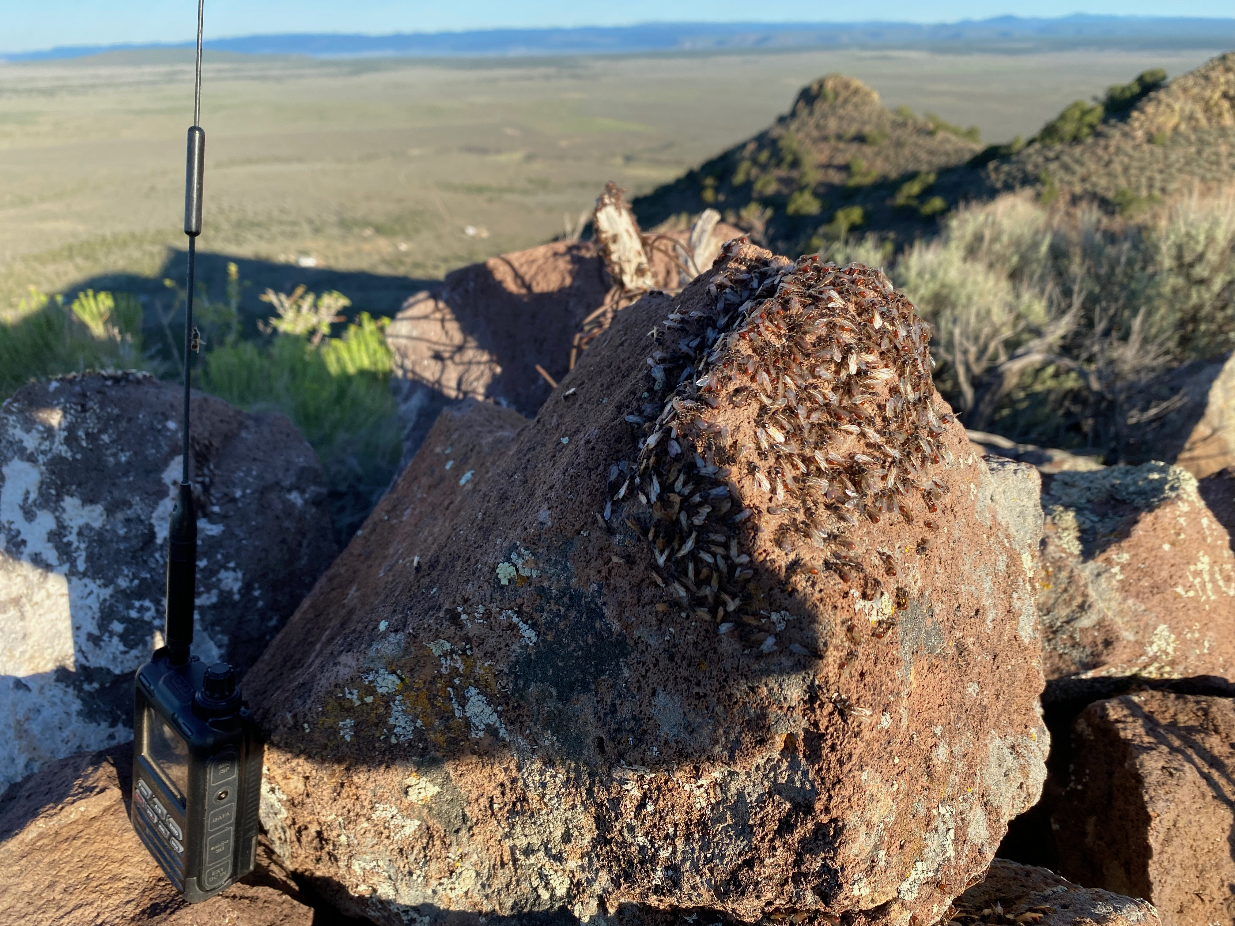
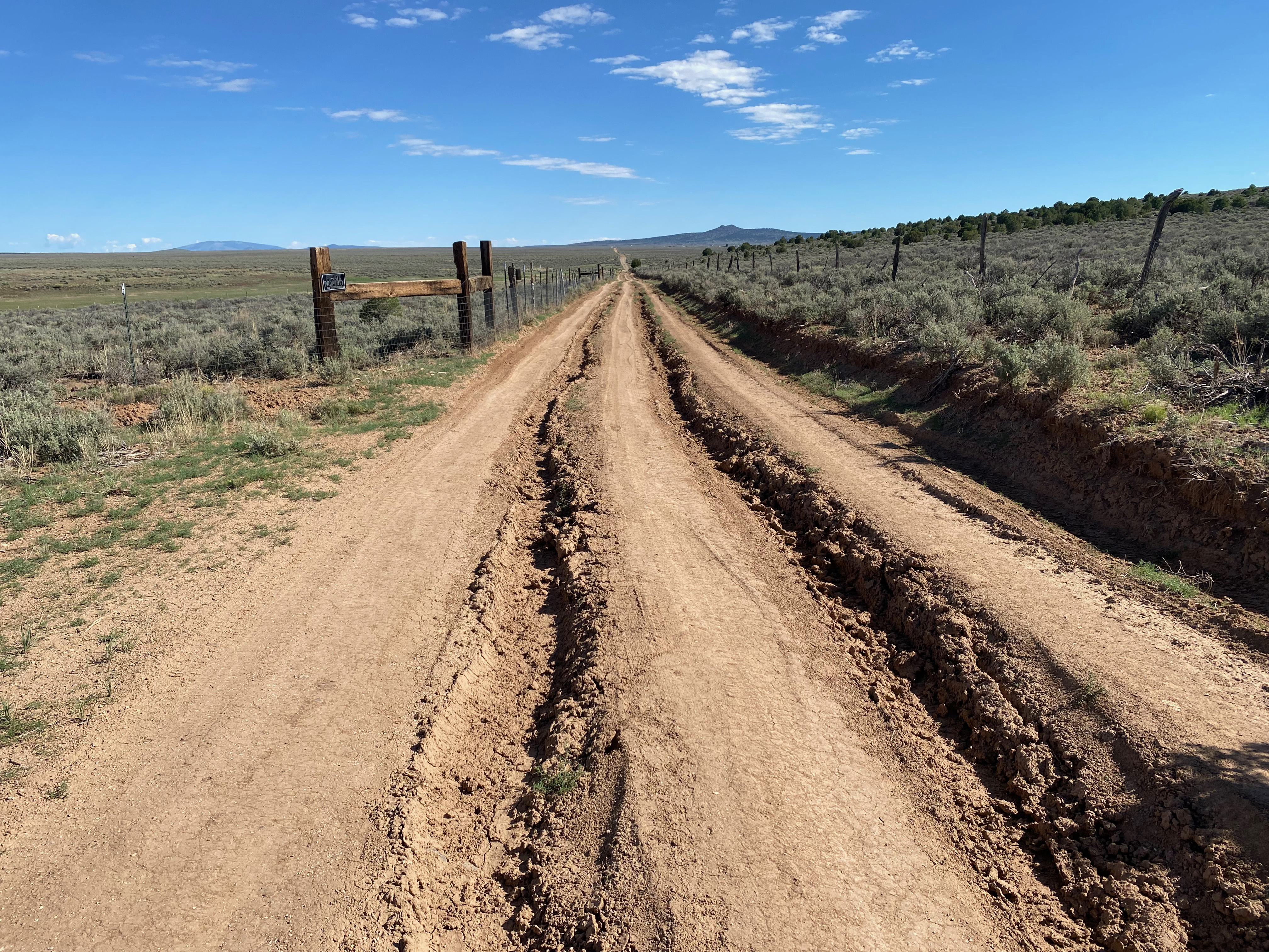
The station looking northDos Orejos and Mount San Antonio looking northwestThe stationFlying antsNorthYou can see why this is a dry weather road only.