South Guadalupe Mountain

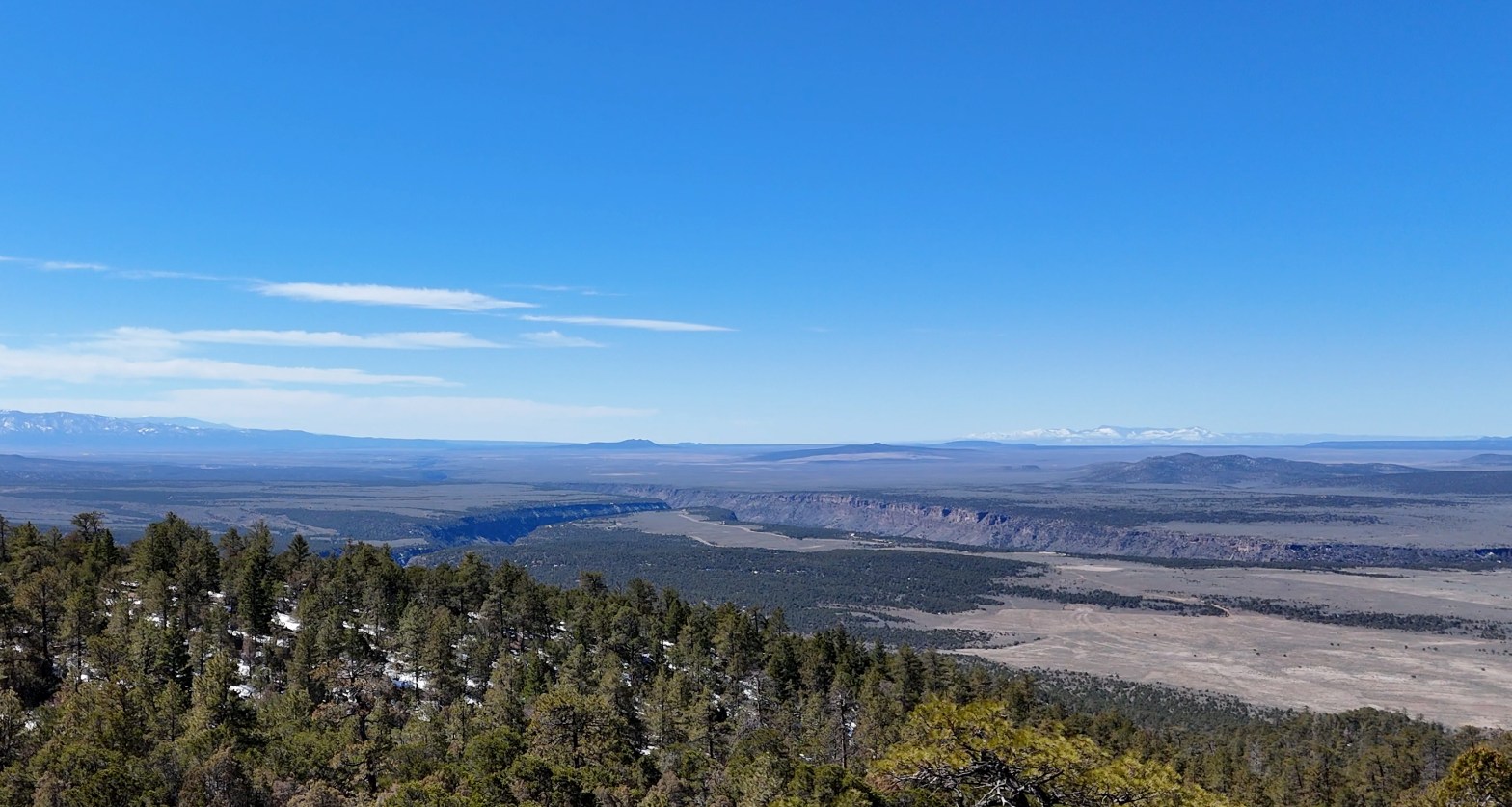
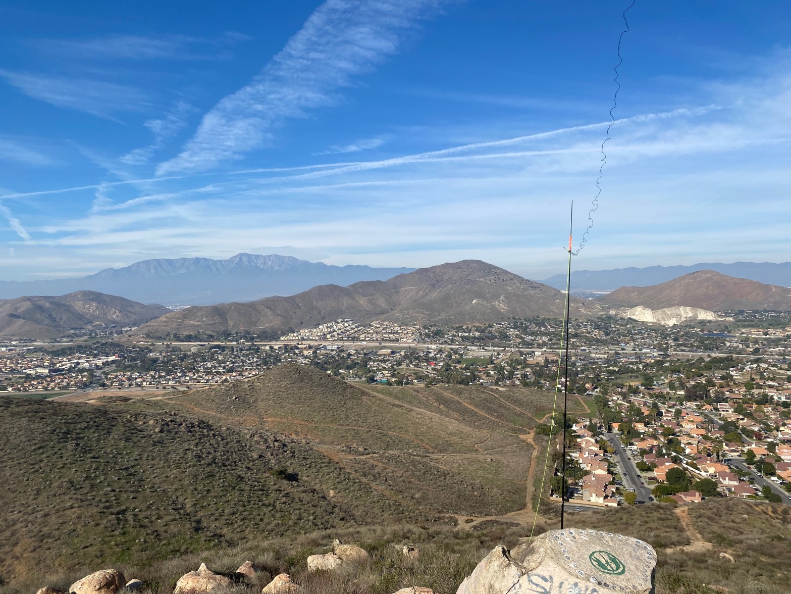
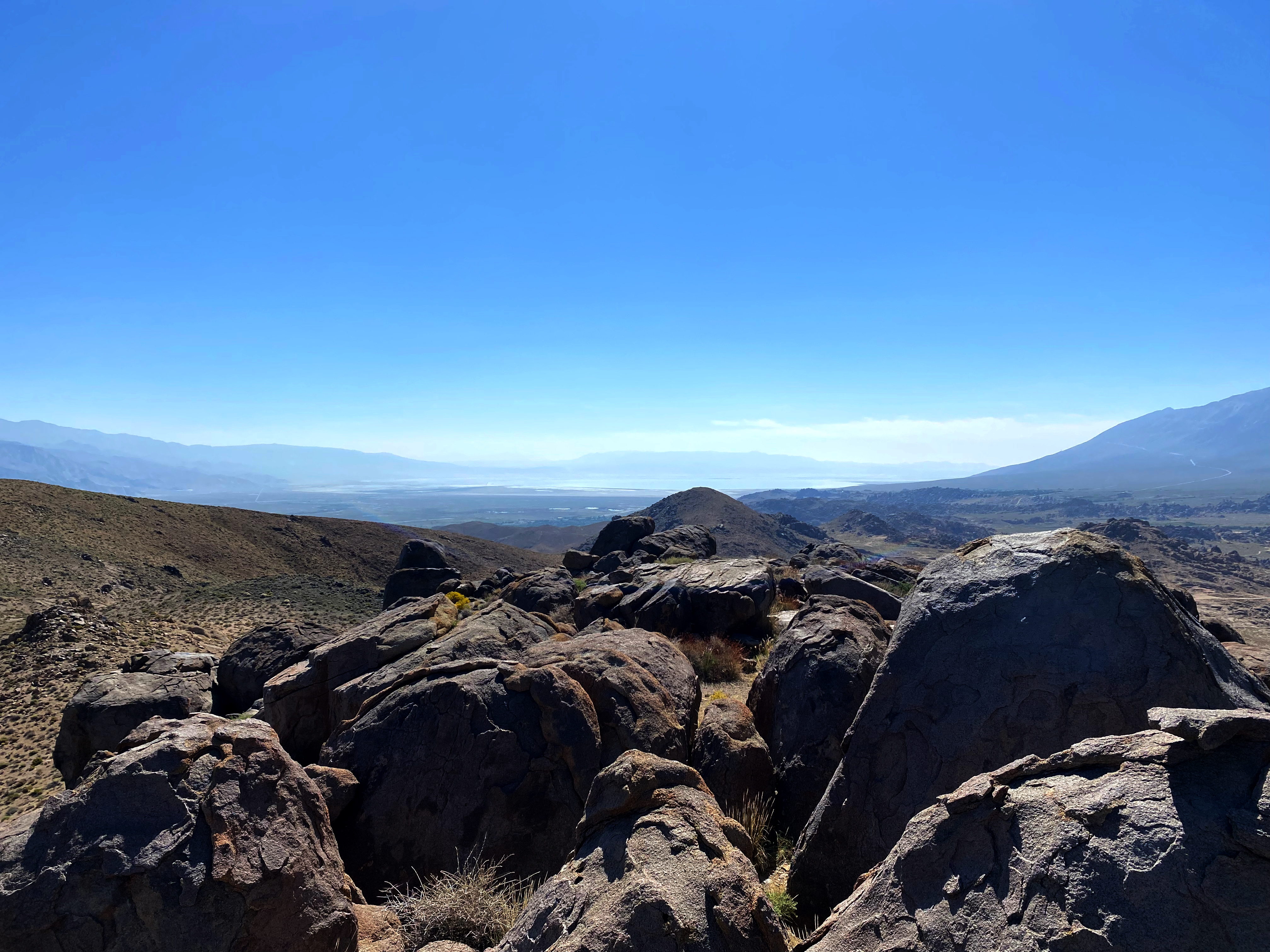
Looking south across the Taos Plateau and the Rio Grande Gorge.

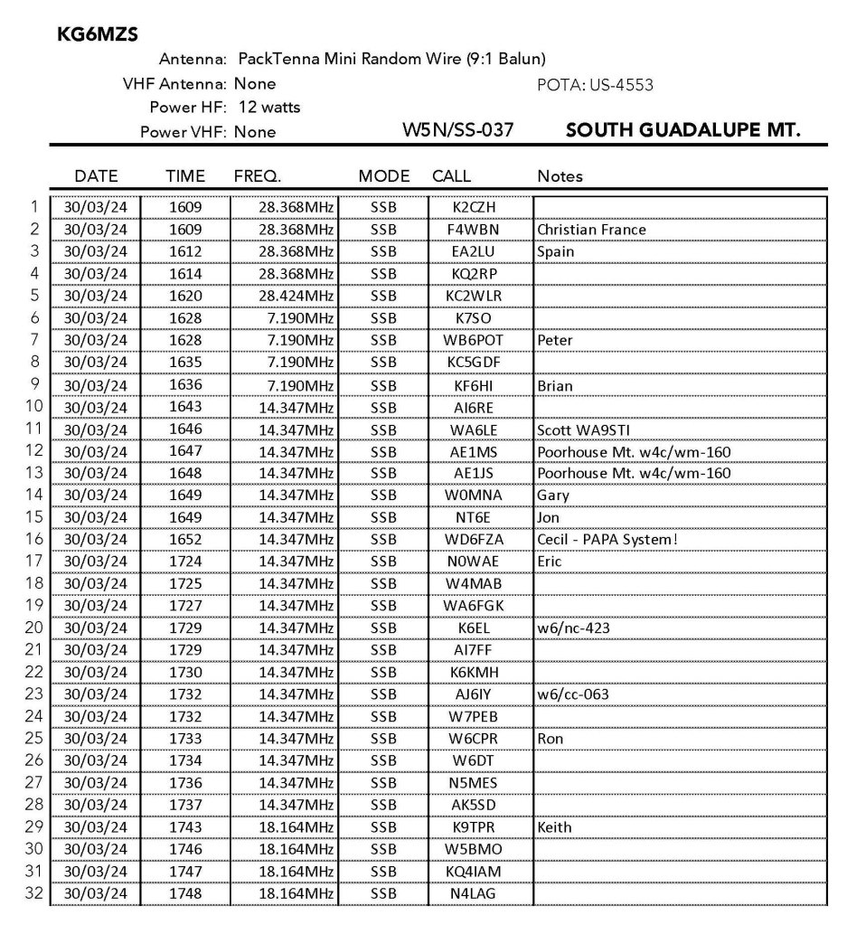
30 MARCH 2024 W5N/SS-037

Two Stars – a nice summit. I’d do it again. Recommended.
Elevation:8,720′
Route: Trail and cross country
Hike Distance: 3.5 miles round trip
Elevation Gain: 780′
Navigation: Easy
Steepness: A little steep
Vehicle: Passenger car
Road: Good dirt road
Cell Coverage: Verizon was in and out
Hike basics

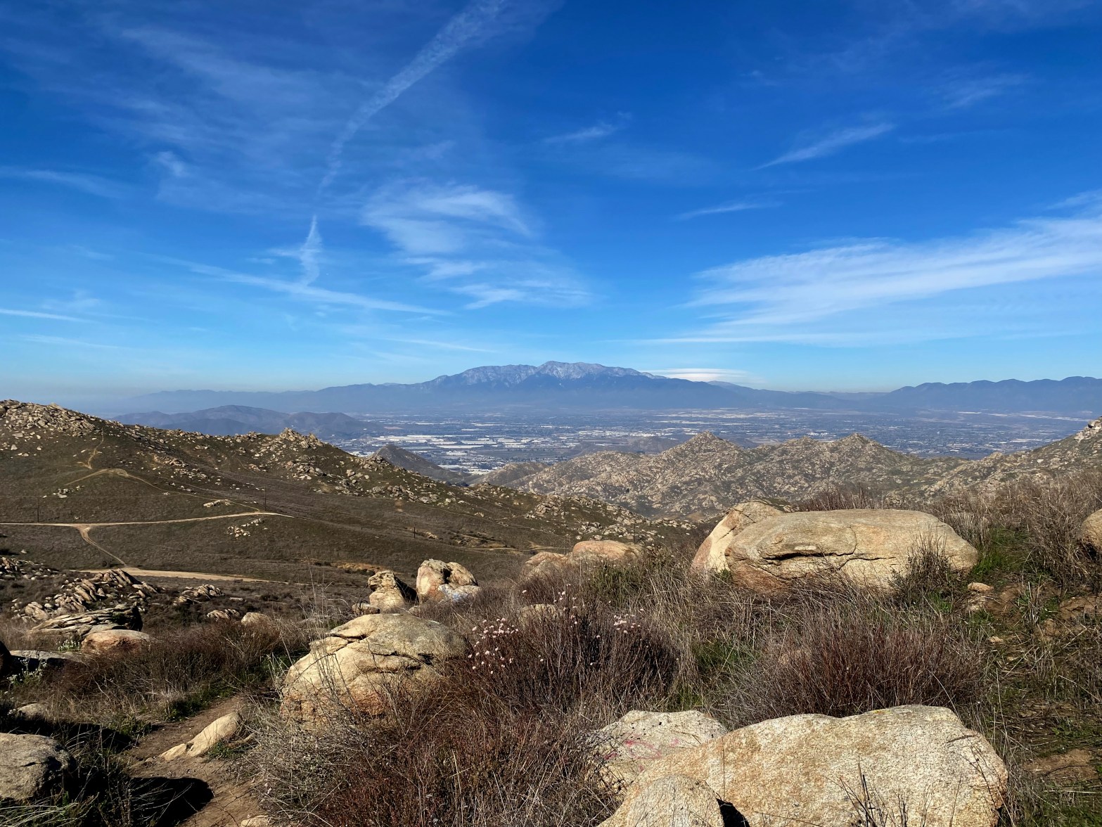
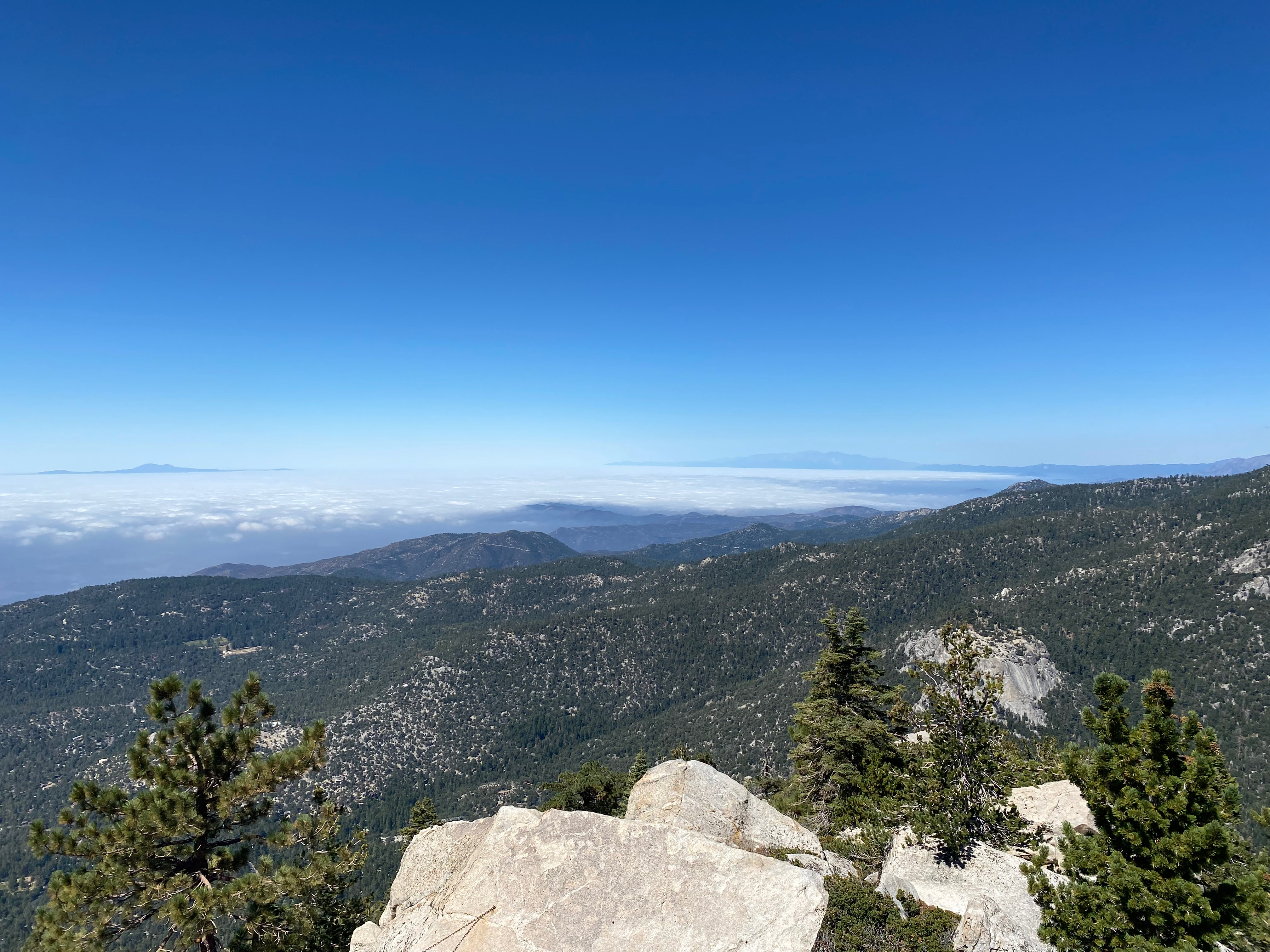
It had snowed a lot the previous week at Cassie’s little adobe so I was looking for a summit that was doable amidst all the mud and snow in the Land of in Enchantment. The Taos Plateau is a remarkable geologic feature – a high altitude volcanic deposit that was laid down about 4 million years ago. The Rio Grande River has cut through this impediment to its relentless path to the Gulf of Mexico and has formed a tremendous gorge.

Two National Monuments were established in 2013 at the north and south ends of this gorge. South Guadalupe Mountain lies in the beautiful Rio Grande del Norte National Monument.

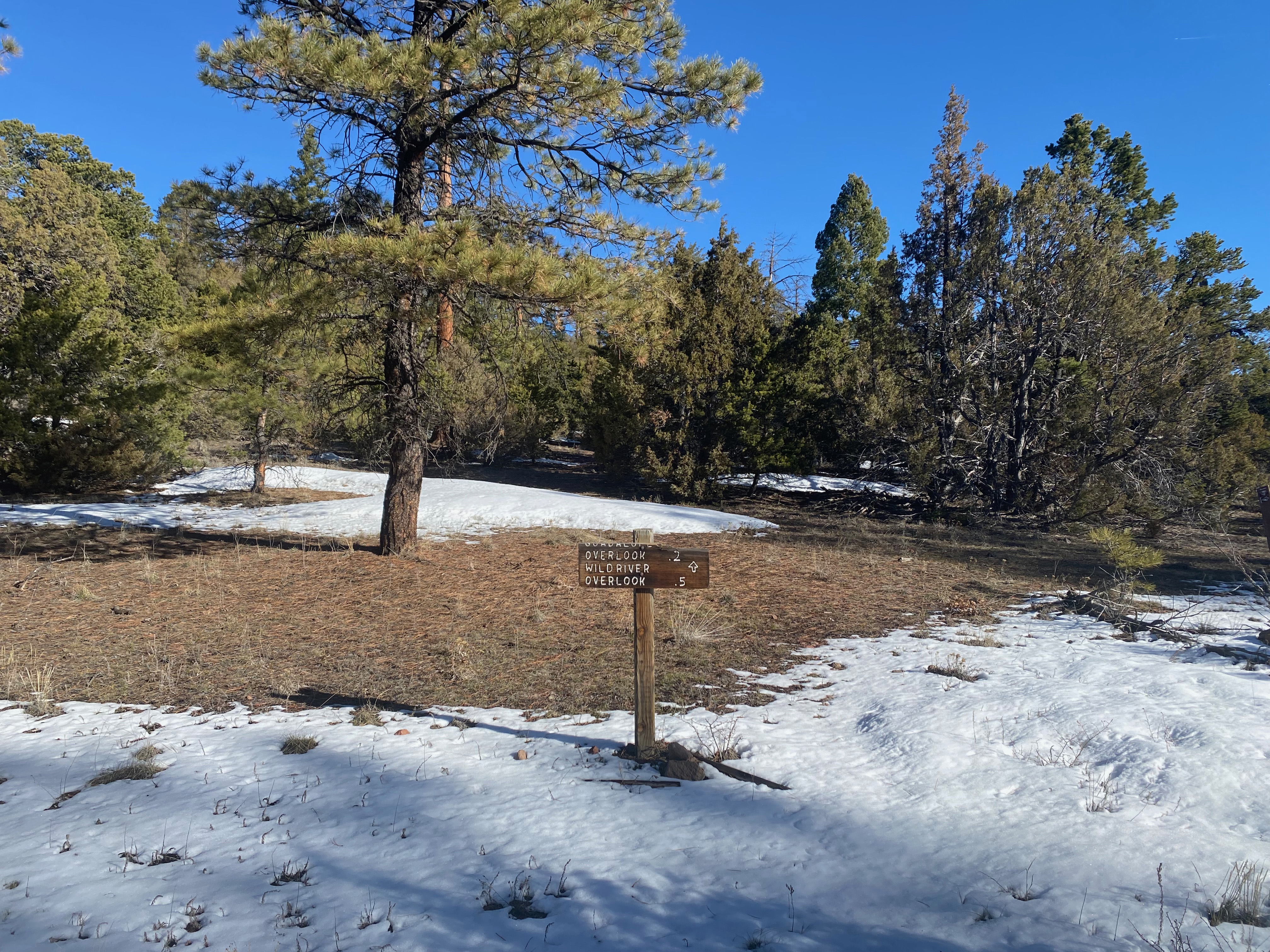
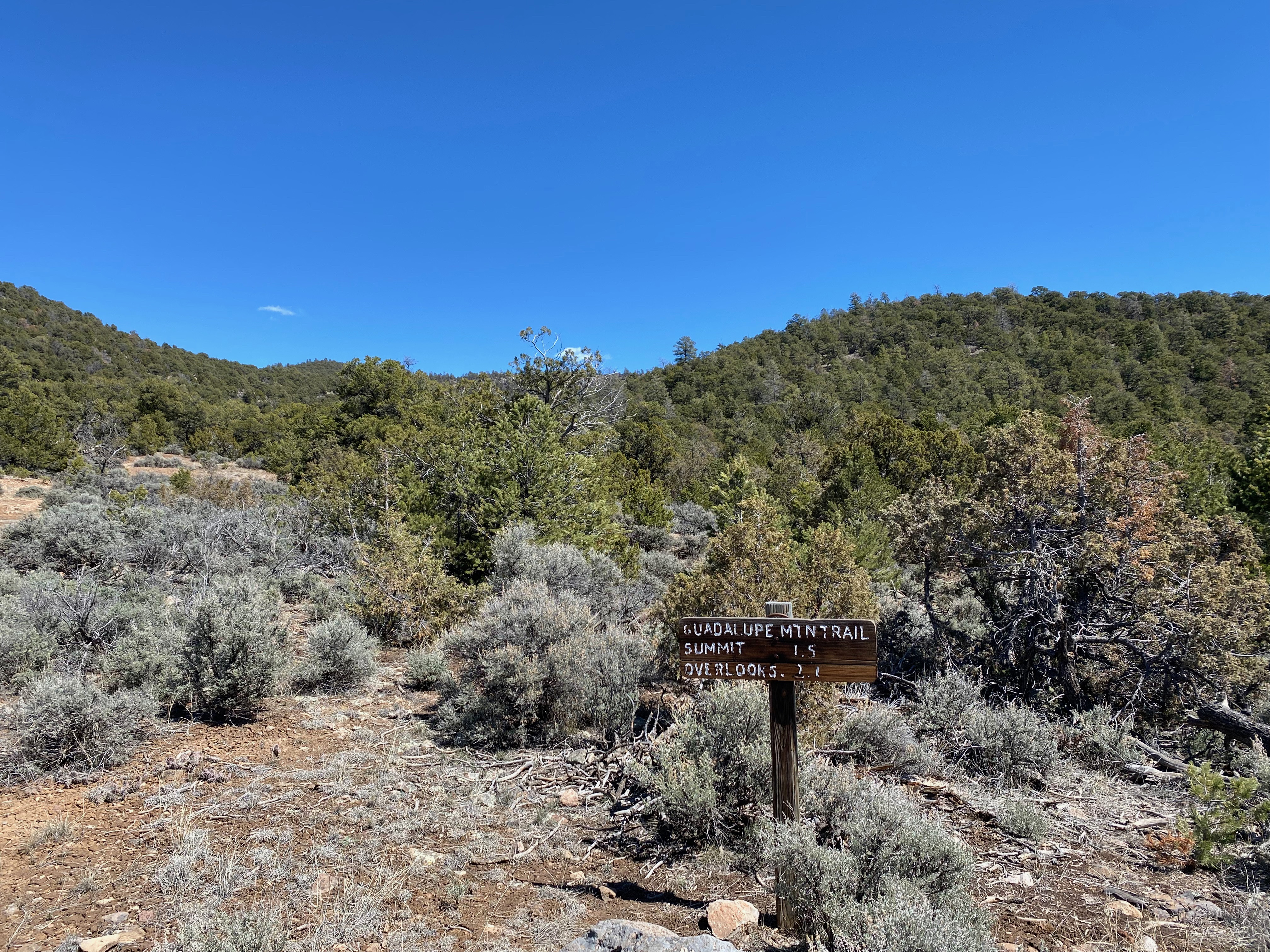
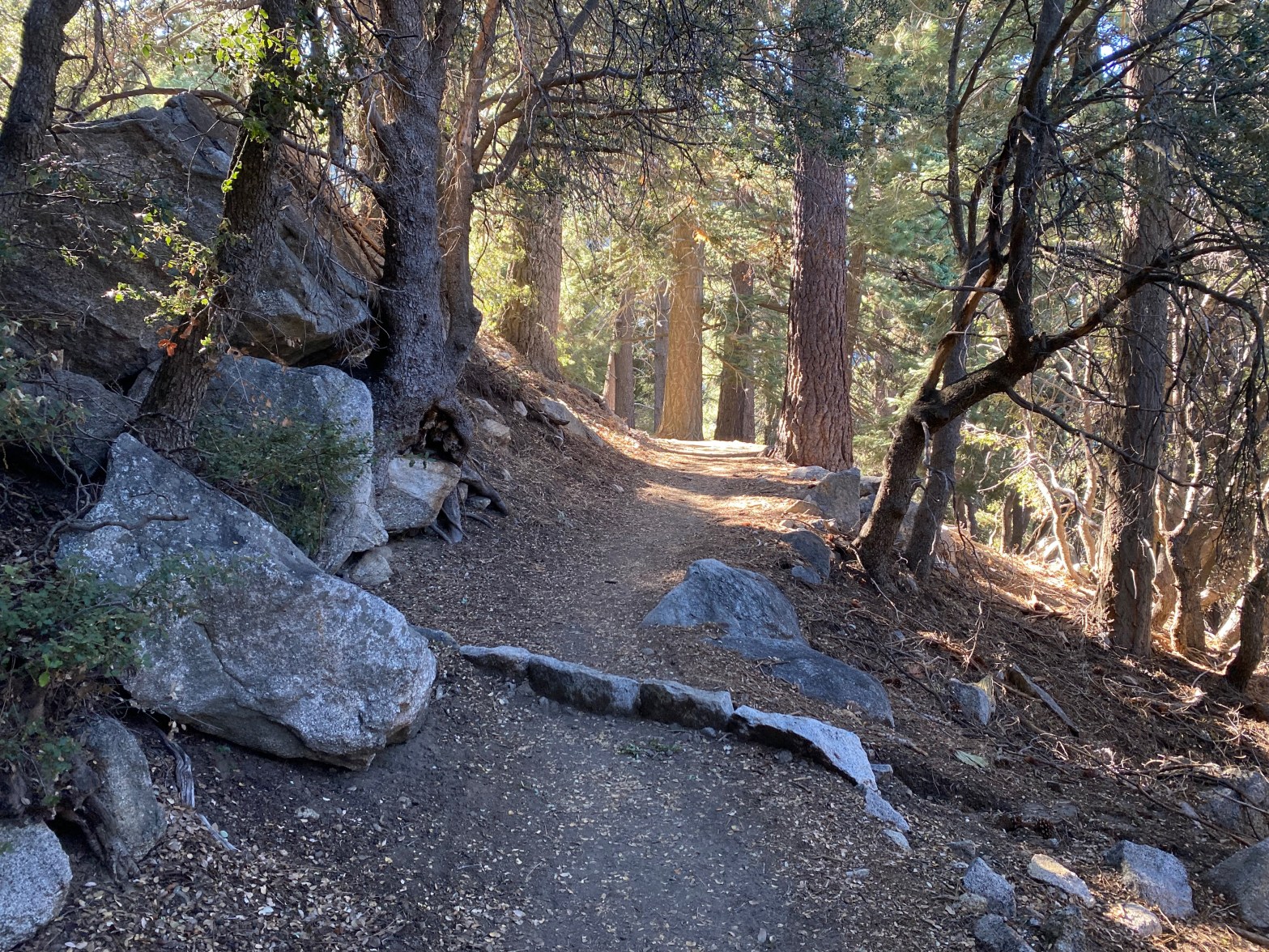
The trailhead is at the end of a very well-maintained dirt road. It was 29ºF when I left Whitedog about 7AM and what mud was there was nicely frozen. The trail follows an old roadcut up to a saddle along the north side of the mountain. As I climbed up the moderate grade the patches of snow became more frequent. These drifts were mostly frozen but every now and then I would break through up to my hips. Snowshoes probably would have been more hindrance than help given all the deadfall and exposed rock and frozen mud. Going was very slow. It took me over 2 hours to do 1.8 miles!

When I got to the saddle I left the trail and contoured around to the east side a bit further than I otherwise would’ve done and found a relatively snow-free route. On the descent I left the trail at the saddle and stayed on the south side of the slope. This tactic avoided most of the snow that had now become very soft and treacherous in the afternoon. This strategy really paid off as this cross country route was relatively brush-free and free from deadfall.

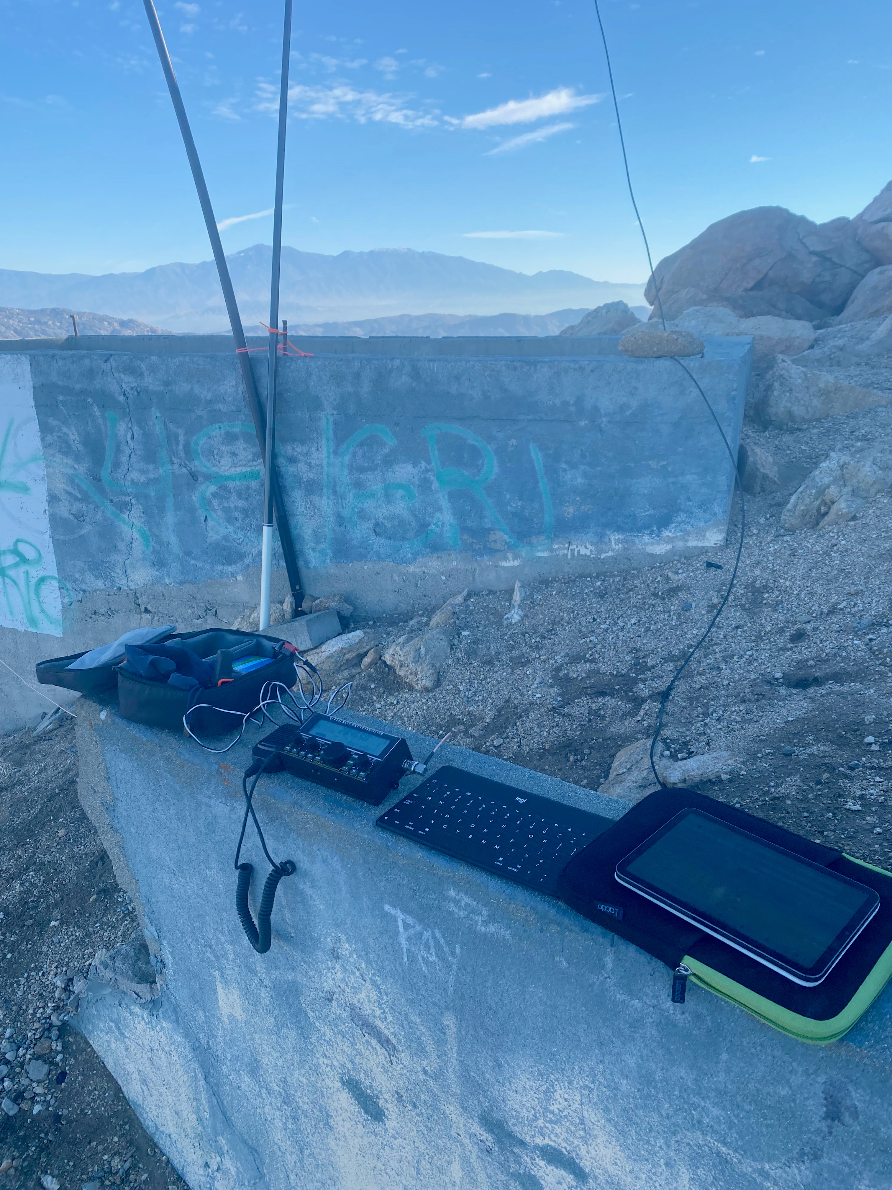
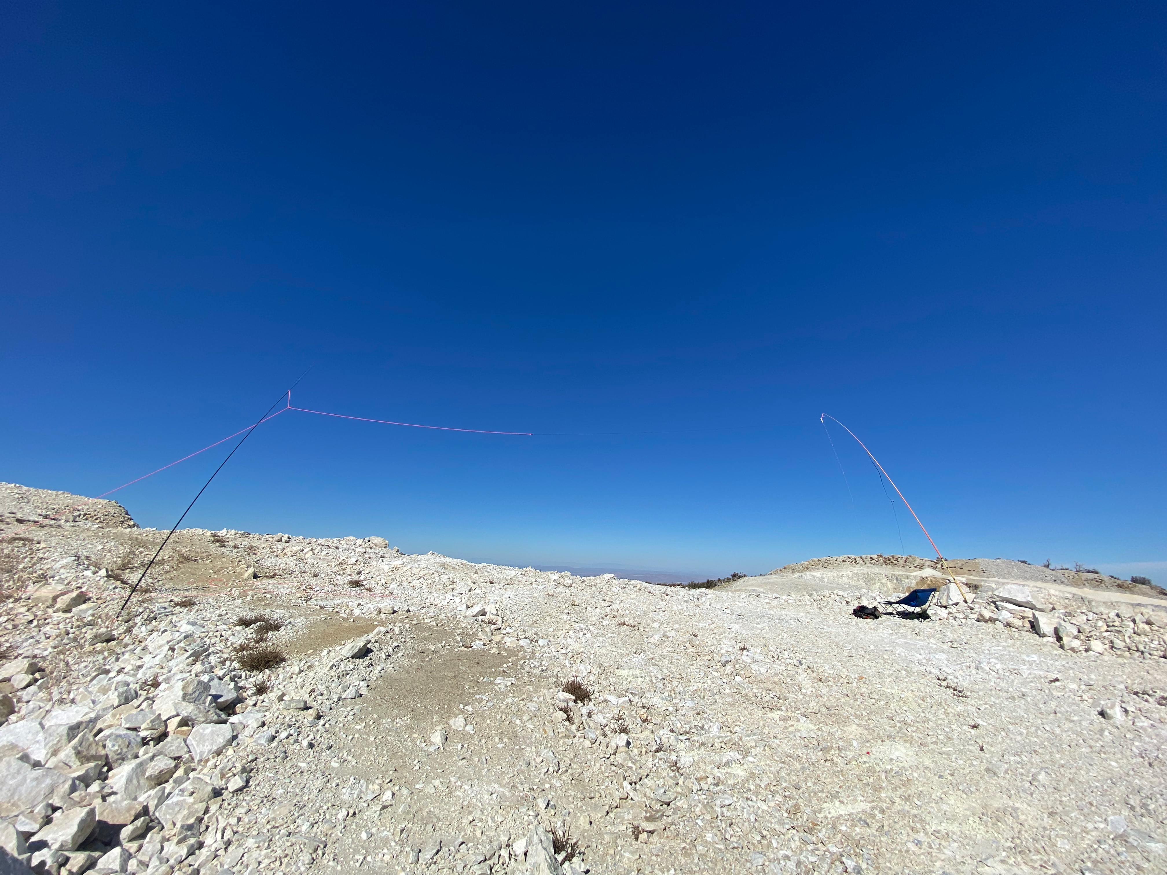
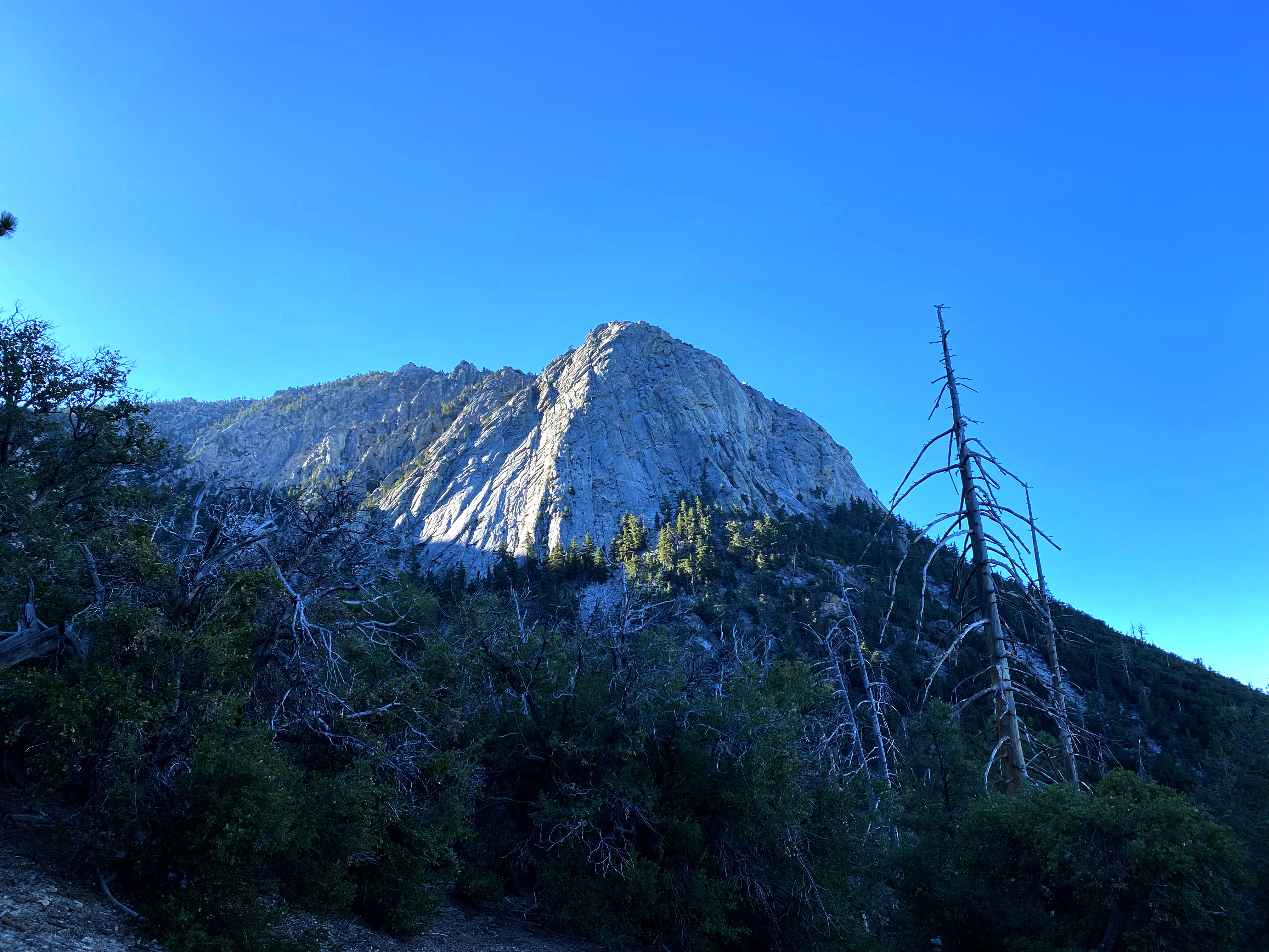
As Tom K6TAA mentioned there is a nice open spot on the summit to set up and some trees for antenna supports.

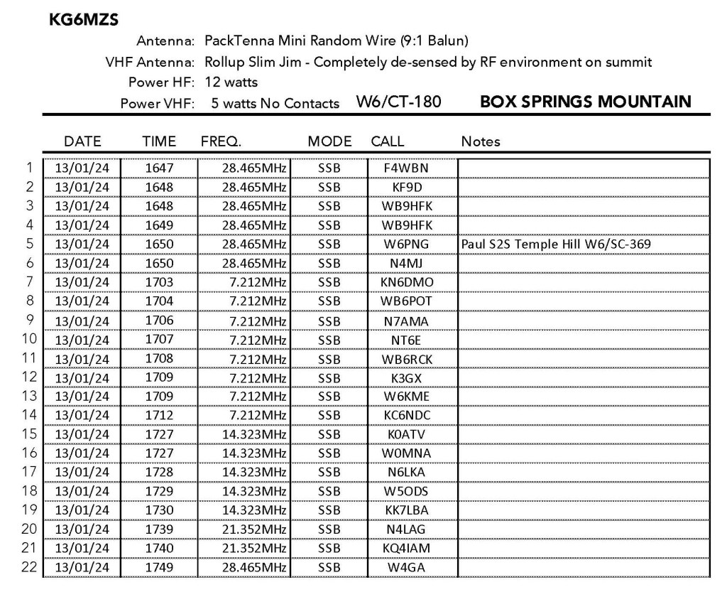
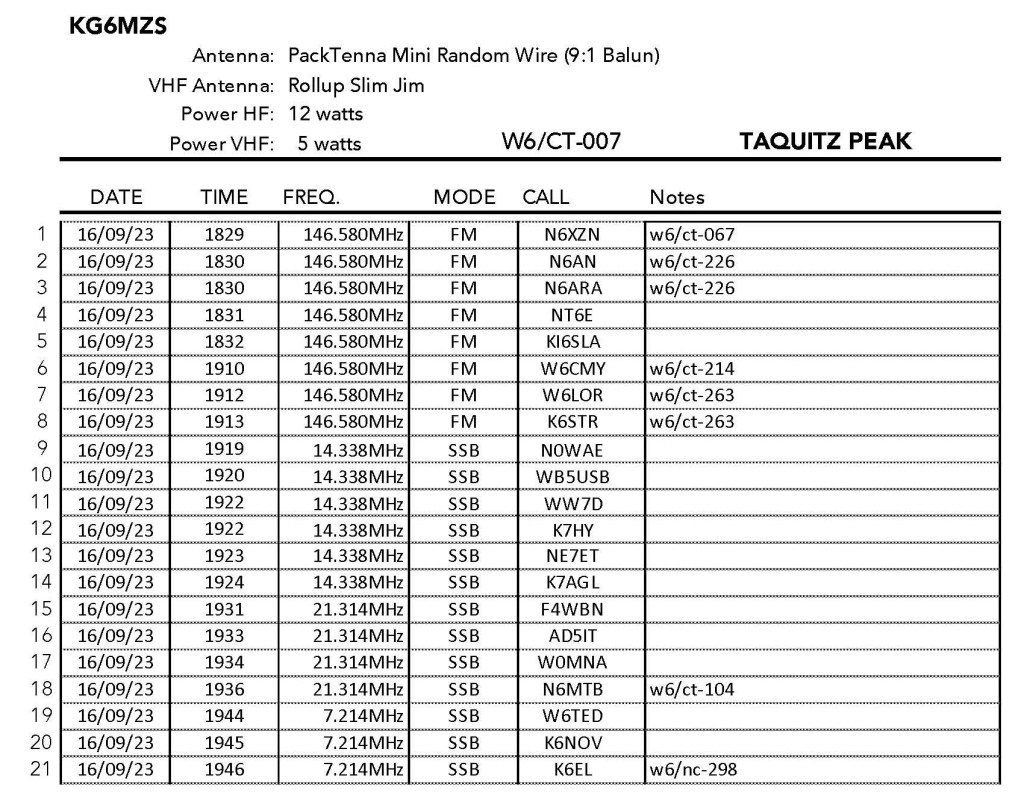
Band conditions on the non-WARC bands were pretty chaotic with the CQ WPX Contest raging.

I had a lot of fun on the summit with DX contacts to France (thanks Chris!) and Spain, S2S contacts to North Carolina (thanks Jean and Mark) and California (thanks Herb and El). I got a lot of the usual suspects and a surprise visit from Cecil WD6FZA – grand poobah of the PAPA System. That was a first! Thanks Scott WA9STI (using club call WA6LE) for spotting me on the PAPA system. Thank you everybody for chasing!

Chester shoots north from about 30 feet above. Ute Mountain (left) and Blanco Peak in Colorado (right)
A sign in the relatively snow-free saddle on the way up
Looking south across the relatively open summit area to the Rio Grande Gorge and the Taos Plateau.
The station looking northeast toward Questa and Red River.
The snow and mud free trailhead made this a smart pick for an Easter weekend attempt.
Looking north from the Sheep Crossing turnout at the beginning of the gorge. Ute Mountain and Blanco Peak just peeking over the rim.

Leave a comment

Spitz Hill

Looking northeast to Humphreys Mountain – the highest point in Arizona at 12,635′ – and Kendrick Peak 10,420.

22 MARCH 2024 W7A/CS-032

Two Stars – a nice summit. I’d do it again. Recommended.
Route: Cross-country
Hike Distance: 1 mile round trip
Elevation Gain: 635′
Navigation: Easy
Steepness: Moderate
Vehicle: Passenger car
Road: Good forest service dirt
Cell Coverage: Good (Verizon)
Hike basics

On a Friday morning I set out from our house in Topanga at 4:30am on my way to meet Cassie in Santa Fe. We are getting ready to set out for Arkansas and the total solar eclipse on April 8th. I got to William about 11am and decided that was about enough battling the big rigs on I-40 for one day.

I had my eye on Spitz Hill as an easy hike with a short approach drive. I was not disappointed. There are apparently several ways to walk through the forest to reach this summit and I chose the west slope. There is no particular route beyond the numerous elk trails the crisscross the deadfall. It’s pretty easy to find the summit through the trees – just go up!

Here is my track up Spitz Hill. I will say that it was a bit harder to find my way down than it was to find the summit going up. I didn’t worry about it too much because I knew I’d hit County Road 76 if I just went down.

The weather was pretty much perfect; mild and a light breeze now and again. I managed to get Chester the Drone in the air to shoot a little video:

I made 25 contacts – no big DX but a lot of familiar callsigns. Thank you all for helping to make this a very enjoyable day. I was down and in Flagstaff by check-in time at my motel.

Chester the Drone takes a shot of me on the summit.

Leave a comment

Pedley Hills

Looking north to the San Gabriel Mountains.

13 JANUARY 2024 W6/CT-241

One star – Nothing special but I’d do it again.
Route: Trail/road
Hike Distance: .5 miles round trip
Elevation Gain: 150′
Navigation: Easy
Steepness: Moderate
Vehicle: Passenger car
Road: Paved
Cell Coverage: Good (Verizon) APRS Good
Hike basics

After doing Box Springs Mountain (W6/CT-180), I wanted to do another Complete, so I meandered through the neighborhoods of Jurupa Valley and drove to the end of Lakeshore Drive.

This is a short hike to a trashy summit with a decent view on a clear day. I picked up a little trash but it is pretty much a lost cause. Easy to set up a HF station among the graffiti stained granite boulders.

I had fun on the radio working some Winterfest folks: Lorene W6LOR & Mike K6STR up on Mt. Ord, David N6AN on his Flint Peak and Mark KD7DTS on Pacifico Mountain.

The Station with San Gorgonio and even Box Springs Mountain in the background.

Leave a comment

Box Springs Mountain

Terrific view of the big San Gabriel Mountains over their namesake valley. Baldy or Mount San Antonio is in the background.

13 JANUARY 2024 W6/CT-180

Two Stars – a nice summit. I’d do it again. Recommended.
Elevation:3,045′
Route: Good trail and access road
Hike Distance: 4 miles round trip
Elevation Gain: 700′
Navigation: Tricky
Steepness: Extremely steep
Vehicle: Passenger car
Road: Paved
Cell Coverage: Just below the summit Verizon
Hike basics

Despite the heavy RF environment due to a massive, unlovely communications complex, I give this one two stars due to the interesting hike up and unusual view. You can do it from a trailhead off Hidden Springs Drive that is a bit longer with more elevation gain, or you can do what I did and go from the Box Springs Mountain Reserve trailhead at the end of Pigeon Pass Road.

The park opens at 7am I got there just at 7 and was the first car there. As I drove up Pigeon Pass Road I spotted a warning sign that had the picture of a donkey on it. Weird, I thought.

As I started hiking the sun came up and started to warm the hillsides after a chilly winter night, I head the sound of braying! Sure enough herds of wild donkeys were everywhere. Cassie KG6MZR had a saddle mule – Kentucky Darla – for years and would’ve loved this. I took the Springs Trail shortcut and I got pretty close to three of these creatures. I suggest if you want to seem them you plan on being there early as I saw very few on the way down.

This summit has an interesting location that sports fine views of not only San Jacinto and San Gorgonio, but novel views of Palomar, Santiago and the San Gabriel Mountains.

Stations reported hearing me on 2m but I heard nobody due to my FT-5D’s receiver getting totally de-sensed by the RF environment. Others have suggested setting up on the south side to avoid this problem. I tried several spots down the mountain with no joy. Likewise with cell reception. I had to use my Garmin InReach Mini’s Iridium satellite network to put up spots. HF was not a problem.

The station with San Gorgonio in the background.
Park greeter
Locals near Box Spring.
Santiago and Modjeska Peaks to the west.
The summit with Palomar Mountain in the background.

Leave a comment

The Pinnacles

The tall skinny rock on the left is called The Bong (aka 2001) by rock climbers.

15 DECEMBER 2023 W6/CT-097

Three stars – Highly recommended.
Elevation:5,738′
Route: Trail
Hike Distance: 3.7 miles round trip
Elevation Gain: 875′
Navigation: Easy to lose the trail over rocks
Steepness: Steep
Vehicle: Passenger car
Road: Paved road
Cell Coverage: Good (Verizon)
Hike basics

My last trip up to The Pinnacles was on May 5th, 1995. It snowed lightly that day and there was an earthquake the next day in Yucca Valley. This turns out to be a very nice hike to a very interesting summit. The trail is steep in places and can be tough to follow where it dodges the boulders strewn across the route. The trail is threaded through these areas and while most roads lead to Rome, some are easier than others. A few venture off into easy third class climbing.

Here is our descent route that, as usual, is a better way to the summit.

This time my brother Mark and I had a chamber-of-commerce day for our hike. Cool, clear and calm. We got a late start due to the long drive from Topanga Canyon, but still made it to the summit in time to have some fun with the radio and fly Chester the Drone. Here is a short video that includes a 360º panorama from 100m above the summit:

I gave this summit three stars because I found it it an interesting and surprisingly enjoyable hike. It was a long day door-to-door from home, so it might be better as a weekend hike with Mount Marie Louise and others.

Leave a comment

Burn Benchmark #2

This sign isn’t kidding. The last half mile of this route is steep!

4 NOVEMBER 2023 W6/CT-271

Two Stars – a nice summit. I’d do it again. Recommended.
Elevation:3,094′
Route: Fire road and motorcycle track
Hike Distance: 3.5 miles round trip
Elevation Gain: 550′ in and 100′ on the return
Navigation: Easy
Steepness: Extremely steep at the end
Vehicle: Passenger car
Road: Good dirt road
Cell Coverage: Good (Verizon) APRS Excellent
Hike basics

It continually amazes me that considering all the time I have spent in my life traipsing across the mountains Southern California, I still manage to stumble upon obscure corners of this state that I have never seen. My brother Mark and I set out on this pleasant Saturday morning to try our hand at what I call Burn Benchmark #2. I think of the higher, more oft visited W6/CT-136 Burn Benchmark as Burn BM #1.

We took Rush Canyon Road (5N13.1 ) off Sierra Highway and headed up toward Rowher Flats OHV area. The parking area is about a mile and a half up this road where the Vasquez Truck Trail (locked gate) joins Rush Canyon Road. This is the trailhead for the popular Texas Canyon rock climbing area. There is ample parking.

This route follows the Vasquez Truck Trail for a little more than a half mild before taking off to the left up the “Hell of a Hill” motorcycle trail. Take careful note of that name.

The hike takes you past a great view of Elephant Rock in the Texas Canyon rock climbing area. We saw several groups of climbers on belay.

The hike is a very enjoyable, seldom traveled route right up until the last quarter mile or so. At this point the route ascends the aforementioned “Hell of a Hill.” My older brother and I grew up hiking steep firebreaks in the Santa Monica Mountains, so this hill didn’t particularly phase us. Be forewarned that your mileage may vary. I found that my trekking poles came in handy, especially on the descent on my 67-year-old-knees.

Radio conditions weren’t great but I did have a lot of fun working 5 bands.

Looking east at the station and the San Gabriel Mountains. Photo by Mark Fitzgerald.
My brother Mark and the Packtenna.
Looking west on the way up at Elephant Rock in the Texas Canyon rock climbing area.
We passed this ominous warning at the bottom of the last hill.
Mark heading down “Hell of a Hill.”
Looking southwest over Santa Clarita, Newhall Pass and Saddle Peak in the Santa Monica Mountain faintly visible through the pass.

Leave a comment

7,940′ “Strip Mine” Summit

Looking west toward the San Gabriel Mountains over what is left of summit 7,940′

21 OCTOBER 2023 W6/CT-060

No stars – This is a one-off summit. I am unlikely to return. Not recommended..
Elevation:Something less than 7,940′
Route: Mining road
Hike Distance: 2.2 miles round trip.
Elevation Gain: 350′
Navigation: Tricky because of the changing topography
Steepness: Gentle on the route below
Vehicle: Passenger car
Road: Good dirt road
Cell Coverage: Good (Verizon) APRS Excellent
Hike basics

There is very little to recommend this summit in my opinion. The OMYA Sentinel Quarry has decimated the summit to the point that it probably no longer meets the SOTA criteria for prominence. It looks like the north side of the quarry is now higher. About the only thing I can say is get this one now in case it gets de-certified later.

I followed the track posted on SOTLas by KX6I and the “short climb up a rockpile” is now a treacherous scramble up very loose powdered quartz. I spent 15 minutes or so carving out semi-stable steps to make the ridge. I don’t recommend this.

My route down follows a road that is a much better route. Who knows how long this will last given all the earth-moving up there.

I did have an enjoyable time on the radio despite all this and had my first-ever chase from down under!

The unlovely landscape of “Strip Mine” Summit
The Station
Looking North across the OMYA Sentinel Quarry to what I suspect is now the higher “summit.” The old route comes up the cliff in the foreground.

Leave a comment

Burnt Peak

A partial eclipse of the sun is projected through a pinhole in my logbook’s cover. The spiral spine also creates a series of suns.

14 OCTOBER 2023 W6/CT-093

One star – Nothing special but I’d do it again.
Elevation:5,778′
Route: Drive-up if the gates are open
Hike Distance: 5.5 miles round trip if the gates are closed
Elevation Gain: 1,500′ – 1,000′ in and 500′ on the return
Navigation: Easy
Steepness: Well graded forest service road
Vehicle: Passenger car
Road: Good dirt road
Cell Coverage: Good (Verizon) APRS Excellent
Hike basics

This activation proved to be more of a drive and much less of a hike than I expected. I left my home on Topanga at 5 AM expecting to get to the gate at 34° 41.4986′ N, 118° 33.2767′ W on forest service road 7N23 early. The suggested route for this is taking Lake Hughes Road out of Castaic. As I made my way up this road in the dark, I encountered a ROAD CLOSED sign in the middle of the road. I drove past it for a few miles and found no obstructions but decided I didn’t want to get turned around 20 miles up the road so I headed back down to Castaic.

From there I headed into Santa Clarita and wheeled up San Francisquito Canyon Road. I actually could’ve saved myself a lot of time, miles and gas but jumping over on forest service road 5N04. I could’ve saved even more time, miles and gas if I had just continued as it turns out I discovered on the way back that Lake Hughes Road was, in fact, OPEN!

At this point I had no idea if Pine Canyon Road would be open to Bushnell Summit and forest service road 7N23 or if the gate would be open when I got there. I was already forming backup plans in my mind.

It turns out not only was the gate open at Bushnell Summit, but the gate at 7N23A was also open, so this was a drive up.

There we a lot of deer hunters parked along the road but I heard very few reports from any firearms. The early morning guys all tend to be “one shot” kind of guys. The afternoon crowd is a little more trigger happy.

On the summit is a large FAA radar facility. I remembered from my last time on this summit on August 15, 1985 that there was a spot on the north side that was below a rock berm shielded from the radar. Since this was still in the activation zone, I set up there.

When the moon was at maximum coverage of the sun (about 70%) it became noticeably much cooler and dimmer. I thought I might be wearing my sunglasses at one point and was surprised to find that they were my normal reading glasses!

Radio conditions were excellent – especially on 10m where I worked Aleksander in Slovenia, Mike in Germany and, of course, Chris in France. I had 5 summit-to-summit contacts and even got Lorene W6LOR and Mike K6STR in Wyoming.

The station
the sun at maxima. It was noticeably dimmer and much cooler. Not the interesting diffraction spikes.
Lovely shot west on this nice eclipse morning to Cobblestone Mountain.
Looking east toward the San Gabriel Mountains.
Looking southwest across the Santa Monica Mountains.

Leave a comment

Tahquitz Peak

Devil’s Slide Trail up from Humber Park is a lot of up, but it is cool and mostly shaded in the early morning.

16 SEPTEMBER 2023 W6/CT-007

Three stars – Highly recommended.
Elevation:8,770′
Route: Trail
Hike Distance: 9 miles round trip
Elevation Gain: 2,350′
Navigation: Easy
Steepness: Well graded trail
Vehicle: Passenger car
Road: Paved road
Cell Coverage: In and out (Verizon) APRS Excellent
Hike basics

As I approached Mountain Goat status I started picking summits that are nostalgic for me – summits that I had done in my high school years. In the case of Tahquitz Lookout three of my friends had loaded up Gary Ottenger’s white ’55 Bel Aire with lo-tech, high weight backpacking gear and driven up to Idyllwild late one full moon night in August 1972.

We camped up in Taquitz Meadow and climbed both Tahquitz Peak and Red Tahquitz. The fire lookout on Tahquitz was manned by very cool ranger. We spent most of the day up there with the clouds dancing around the lookout tower. He served us wine and cheese and played classical music on a FM radio. Can you imagine that happening today? The poor guy would be in jail.

He issued us all “Squirrel Cards” – cards handed out proclaiming that we had successfully climbed an official forest service fire loookout.

On this trip I was delayed on the 90 at 4:30am by a police closure of the entire freeway for almost an hour. I still managed to get to the Idyllwild Ranger Station just off SR 243 at 54270 Pine Crest Road just before it opened. There I filled out my wilderness permit at the after-hours kiosk.

Important note: a wilderness permit is required for this hike and the quota is filled up fast on summer weekends. There were rangers checking for permits a mile or so up the trail.

The hike up Devil’s Slide Trail is a lovely walk that affords tremendous views of Lily (Tahquitz) Rock and Suicide Rock across Fern Valley. These are highly traveled rock climbing destinations. I’ve done dozens of routes on these excellent hunks of granite back in my rock climbing days. I could spot climbers on some of the more exposed routes on this trip.

I played leap-frog with an energetic young couple all the way up and when I met them on the summit I asked them if they had gotten their Squirrel Cards. They hadn’t, so I escorted the pair up into the lookout tower and asked Ranger B. May if they still bestowed Squirrel Cards on fire lookout ascenders. He was somewhat bemused that anybody over the age of 12 would request them, but dutifully issued us entrance into “The Ancient and Honorable Order of the Squirrel. :-). The young couple were tickled by the experience.

50 one years later I am issued my second Squirrel Card from the Taquitz fire lookout.

Even with the permit requirement there was a steady stream of hikers visiting the lookout. I fielded a lot of questions and handed out a lot of my SOTA cards to interested hikers.

Conditions weren’t the best but I made 21 contacts with 8 summit-to-summit QSOs

The lookout
No table and chair on this pared-down hike. So “rock-butt” it was from the summit shack.
Suicide Rock with Santiago Peak just peeking out in the distance.
The formidable “Lily” or Tahquitz Rock’s north side
The tremendous view west to Santiago and the San Gabriel Mountains.
Looking south
Suicide Rock with a route I did several times back in the day on The Weeping Wall. Santiago Peak in the distance.

Leave a comment

Alabama Hills

A spectacular view of the Whitney Crest from the high point of the Alabama Hills

22 SEPTEMBER 2023 W6/SS-636

Two Stars – a nice summit. I’d do it again. Recommended.
Elevation:5,413′
Route: Cross country
Hike Distance: .8 miles round trip
Elevation Gain: 500′
Navigation: A bit tricky
Steepness: Moderate
Vehicle: Passenger car
Road: Good dirt road
Cell Coverage: Spotty (Verizon) Didn’t check APRS
Hike basics

I got into Lone Pine a day early to get ready for the big Mountain Goat backpack out of the Cottonwood Lakes trailhead. With 995 points racked up, I could afford to do a 4 pointer and still save the big day for the big mountains. In all my 60+ years of coming up Highway 395 I had never explored the Alabama Hills.

Many of the roads in the area were closed due to damage inflicted by tropical storm Hilary last month. This included Whitney Portal Road through the Alabama Hills. I took a very circuitous route around south on Tuttle Creek Road back to Whitney Portal road only to discover that Movie Road was closed at the Mobius Trailhead.

Not being in any hurry I drove up and around on Hogback Road to the other end of Movie Road only to find it closed there too.

Not being in any real hurry and not really minding a longer hike I parked there and walked several miles to the spot where I otherwise would’ve parked Whitedog. It turns out people were driving around the “Road Closed” signs, but the added miles didn’t really bother me. The way I did it was 4 miles round trip and 650 feet of elevation gain. I had time to kill before my 3pm check in time in Lone Pine.

Going up from Movie Road I took a fairly direct route from the saddle to the north of the summit. This got me into some genuine 3rd class bouldering. Not the easiest thing with trekking poles and a 25 pound pack. I found an easier way down around the east side that I would suggest for those not wishing to tangle with the boulders.

Here is my unduly lengthy track up all the way from Hogback Road and here is my track down just to Movie Road that I would suggest for those seeking the easiest way up and down.

As you can see from the photograph above, the view of the biggest part of the Sierra Crest is worth the price of admission alone. If the hike was a bit more interesting I’d give this one three stars.

The activation was short and sweet with 4 summit-to-summit contacts and the usual suspects 😉

The Station looking south toward the revitalized Owens Lake
Looking a little north of east across a lush section of the Owens Valley to New York Butte and the Inyo Mountains.
South to Owens Lake

Leave a comment