Looking west past the summit cairn over the San Luis Valley to the San Juan Mountains.
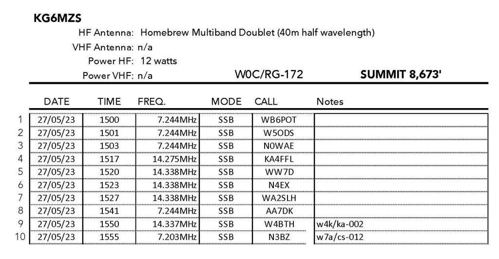
27 MAY 2023 W0C/RG-172
Two Stars – a nice summit. I’d do it again. Recommended.
Elevation:
8,673′
Route:
Cross country
Hike Distance:
1 mile round trip
Elevation Gain:
400′
Navigation:
Easy
Steepness:
Moderate
Vehicle:
High clearance suggested
Road:
Good BLM dirt
Cell Coverage:
Excellent (Verizon), excellent APRS
Hike basics
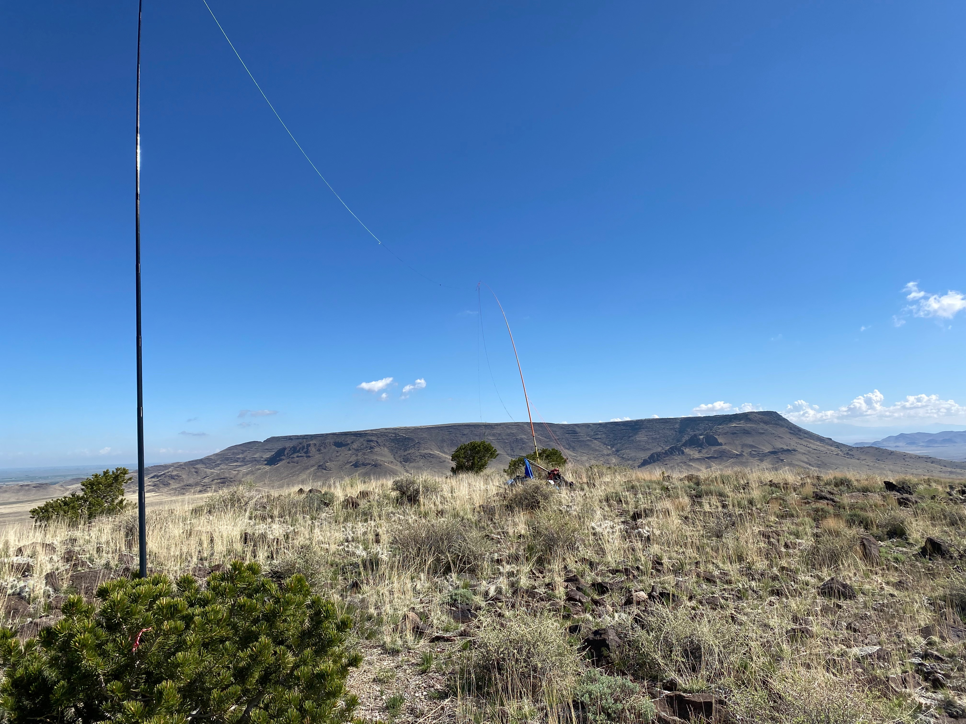
Last year’s first time activation of the Piñon Hills High Point prompted me to try this other nearby first timer. I really like this seldom-visited area. Expansive vistas of the San Luis Valley dotted with ancient volcanoes that formed the Taos Plateau are bordered on the east by the Sange de Christo Mountains and on the west by the San Juan Mountains. It is a beautiful area imbued with a peaceful solitude that suits me just fine.
The dirt road that leaves Colorado State Highway 142 is quite good. It’s the kind of road that I would do in a passenger car but the ruts and rocks made me glad to have Whitedog the Tacoma. Coming from the east, as I did this time, take a right at 142 at 37° 10.6106′ N, 105° 46.6673′ W. Coming from the west, as I did last year, the right is at 37° 10.5272′ N, 105° 51.6166′ W. There is a little spur road at 37° 9.4525′ N, 105° 48.6472′ W that gets you to within a half mile of the summit. Reminder: leave all gates as you find them – open or closed.
The hike is short and sweet with a brief moderately steep section that is easy to negotiate. I saw two separate heard of wild horses – one band was migrating through the pass between this summit and Flattop to the north – and one heard of elk springing along at a lope. There is a cairn on the summit but no other sign of humans.
Conditions weren’t great on HF but I did eke out a S2S with Kentucky. I kept it short because I had my eye on activating North Guadalupe in New Mexico on my way back.
Maidenhead grid DN12 is very sparsely populated. Here is a lonely stretch Highway 95 looking south.
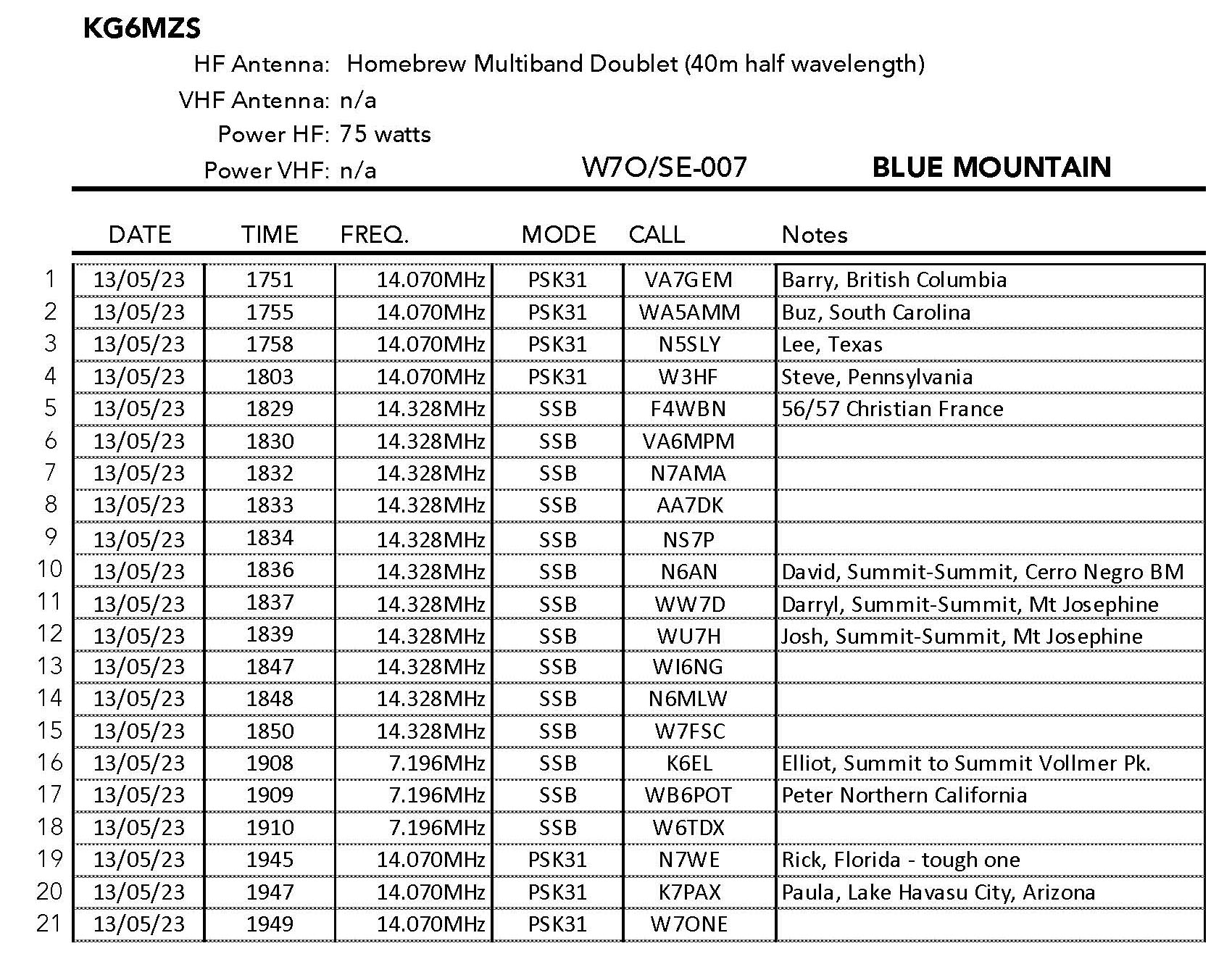
13 MAY 2023 W7O/SE-007
Two Stars – a nice summit. I’d do it again. Recommended.
Elevation:
7,435′
Route:
Drive up
Hike Distance:
n/a
Elevation Gain:
n/a
Navigation:
Easy
Steepness:
n/a
Vehicle:
4×4 high clearance suggested
Road:
Steep dirt
Cell Coverage:
Excellent (Verizon), No APRS
Hike basics
The main reason I selected this summit on my wanderings to New Mexico is that grid square DN12 is seldom activated – especially in the PSK31 mode. So I was looking for a drive-up that I might reasonably set up a 100 watt digital station and hand out as many endosements to the PODXS 070 club members as I could.
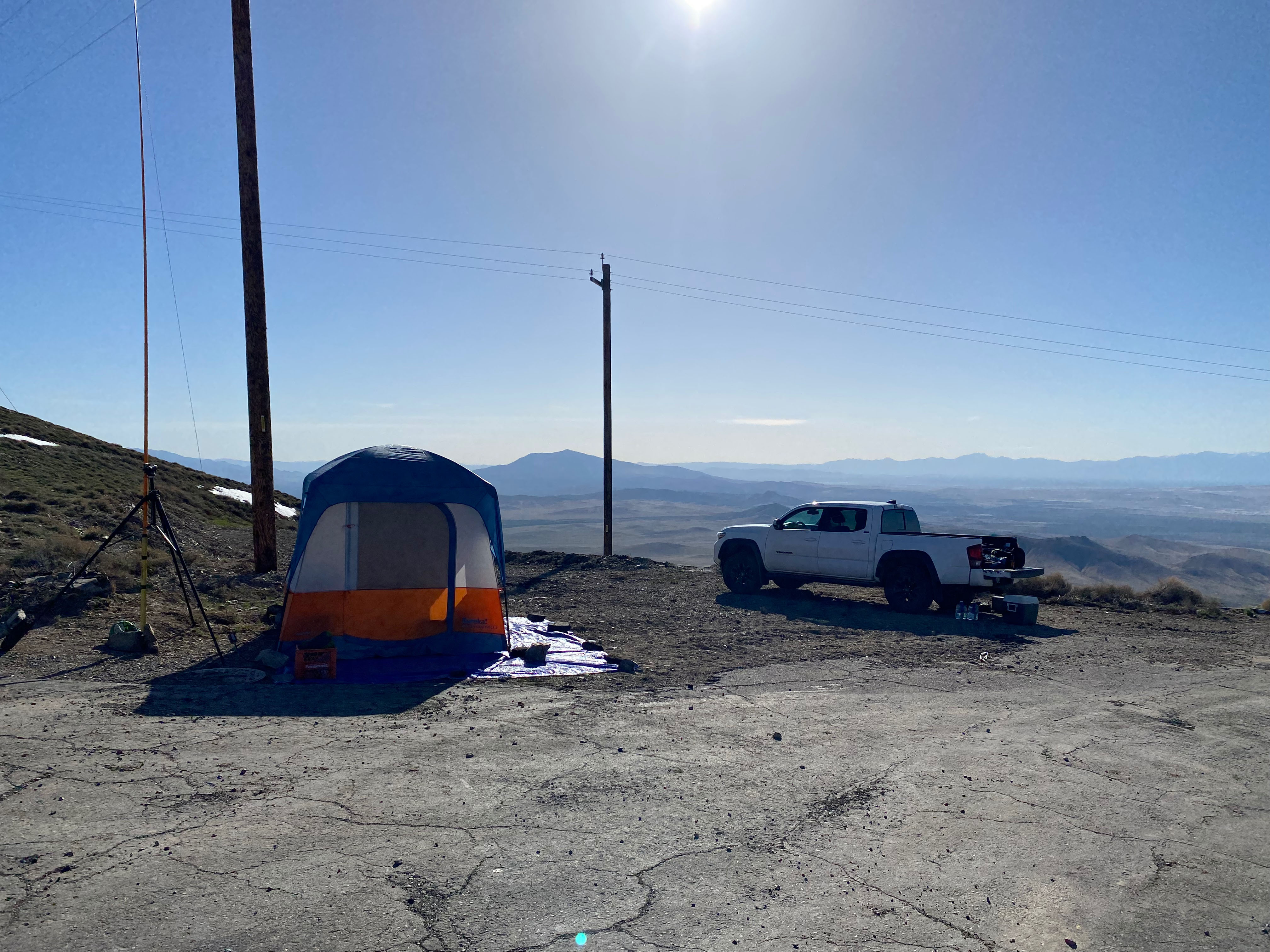
My original plans called for setting up a camp and spending the night, however after shattering a tent pole the night before on Winnemucca Mountain in high winds, I scratched that idea as the winds persisted and it looked like rain might move in. Apologies to the 070 folks who were unable to reach me on this one.
W7IMC suggested from his 2014 activation that 4 wheel drive was required. I found the route I took to be in reasonably good shape. It’s the kind of road I used to drive with my rear wheel drive passenger cars. I don’t suggest that, but — and this is a big but — if this road is not muddy, snowy or icy, it’s actually a pretty good road that accesses the communications facility. Just remember you are in the middle of nowhere, but with good cell coverage.
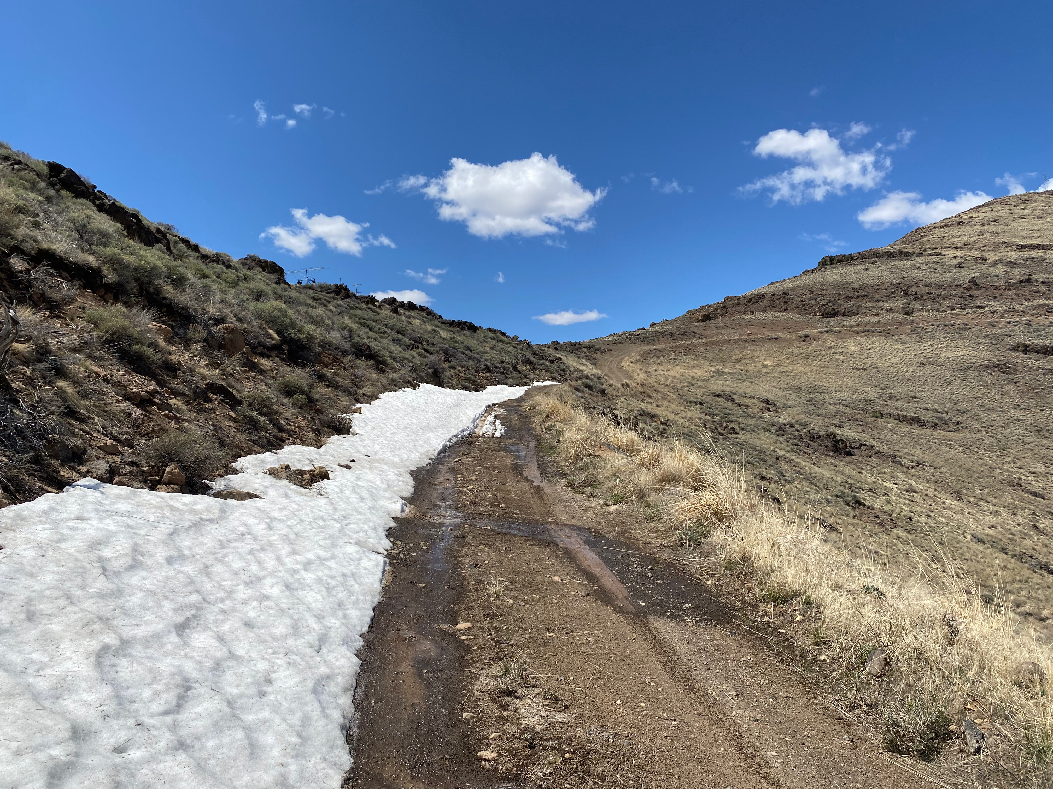
I did encounter a stretch of snow on a section with a bit of a drop off on the right. It took a few tries to safely pass by. the photo below is on the way down after it had melted quite a bit. There was also a stock tank crossing that was pretty muddy. I was glad to have Whitedog the 4×4.
The snow had melted off quite a bit by the time I went down.
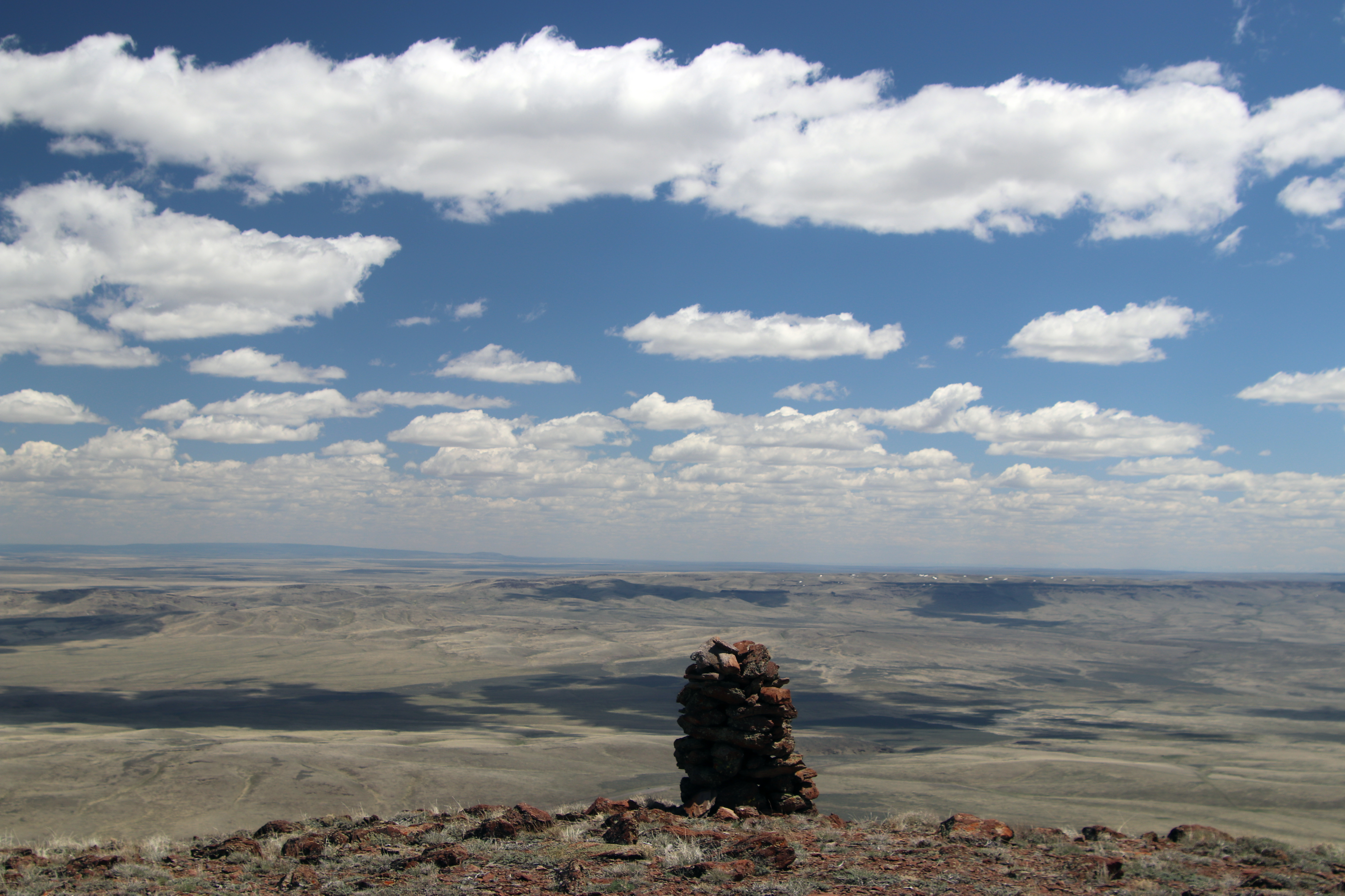
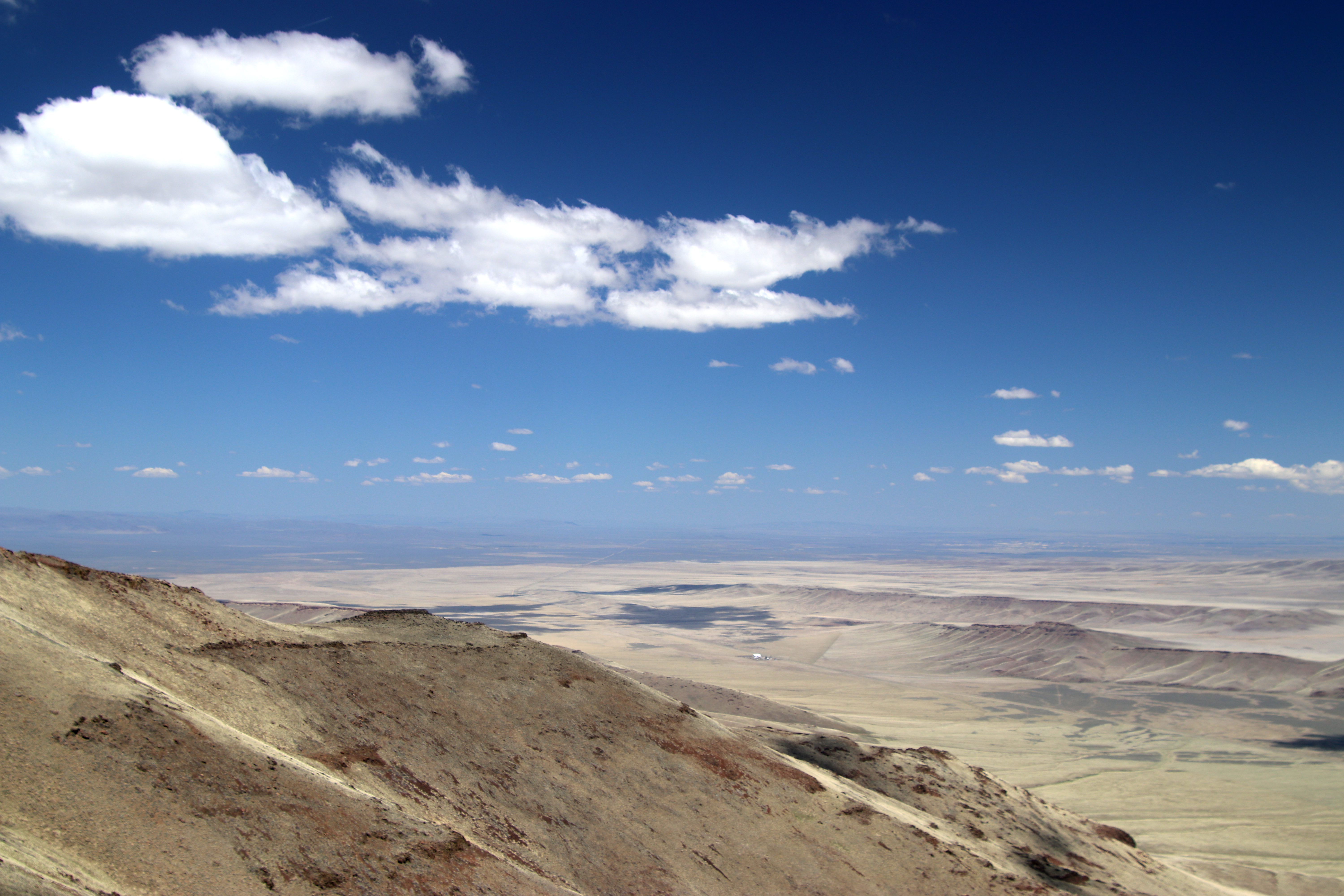
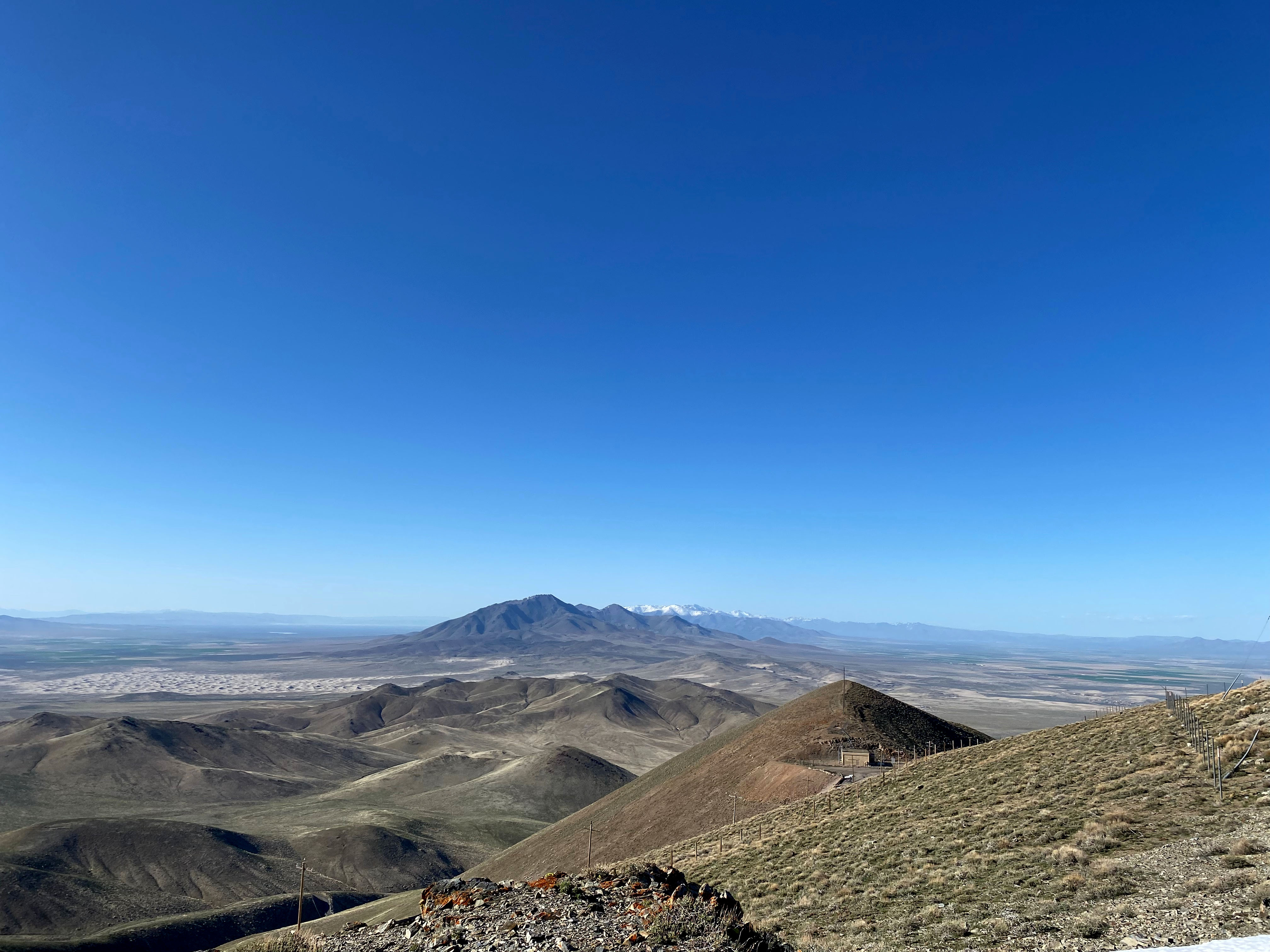
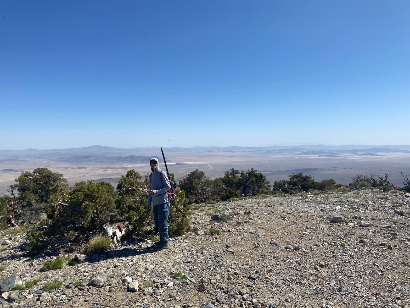
The view at the top is spectacular. Steens Mountain (9,733′) dominates the northwest. The plains of Idaho go on seemingly forever to the entire east. The Oregon Canyon Mountains command the southwest. This is beautiful country in a very austere way.
Weather was perfect as I set up. Rick N7WE in Florida and Barry VA7GEM in British Columbia coordinated with the PODXS 070 Club as they did on my “GridPedition” to DM17 two years ago. Thanks guys! Strangely cell coverage was excellent but APRS was nonexistent.
As I worked the bands the wind began to pick up again and cumulus clouds started moving in from the east. I didn’t get to stay as long as I had hoped because I just didn’t want to risk driving down a muddy road. This turned out to be wise because it poured after I got back on pavement. I had 4 summit-to-summit contacts kicked off with my SOTA partner-in-crime David N6AN on Cerro Negro Benchmark back home in the Los Angeles Basin. Christian F4WBN in France got the DX award and I was very happy that Rick N7WE managed to pull me out of the waterfall gibberish. He was a respectable 459 on my end.
All in all this grid/SOTA activation was a blast! Thanks to all who participated. I heartily recommend getting out and doing whatever kind of activation you might be comfortable with.
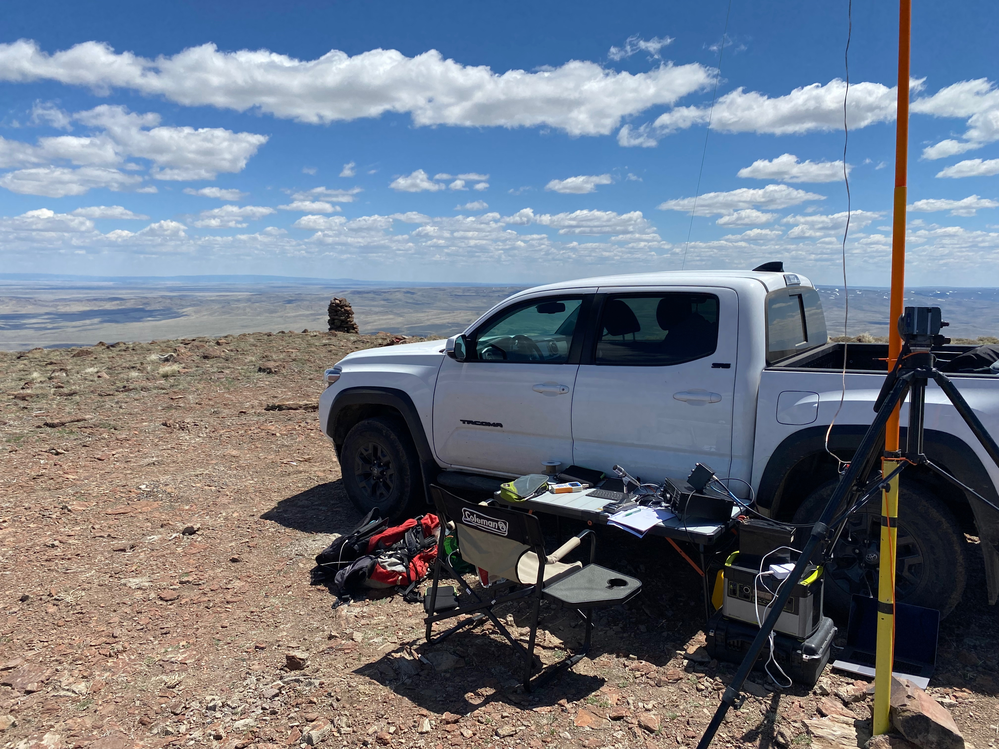
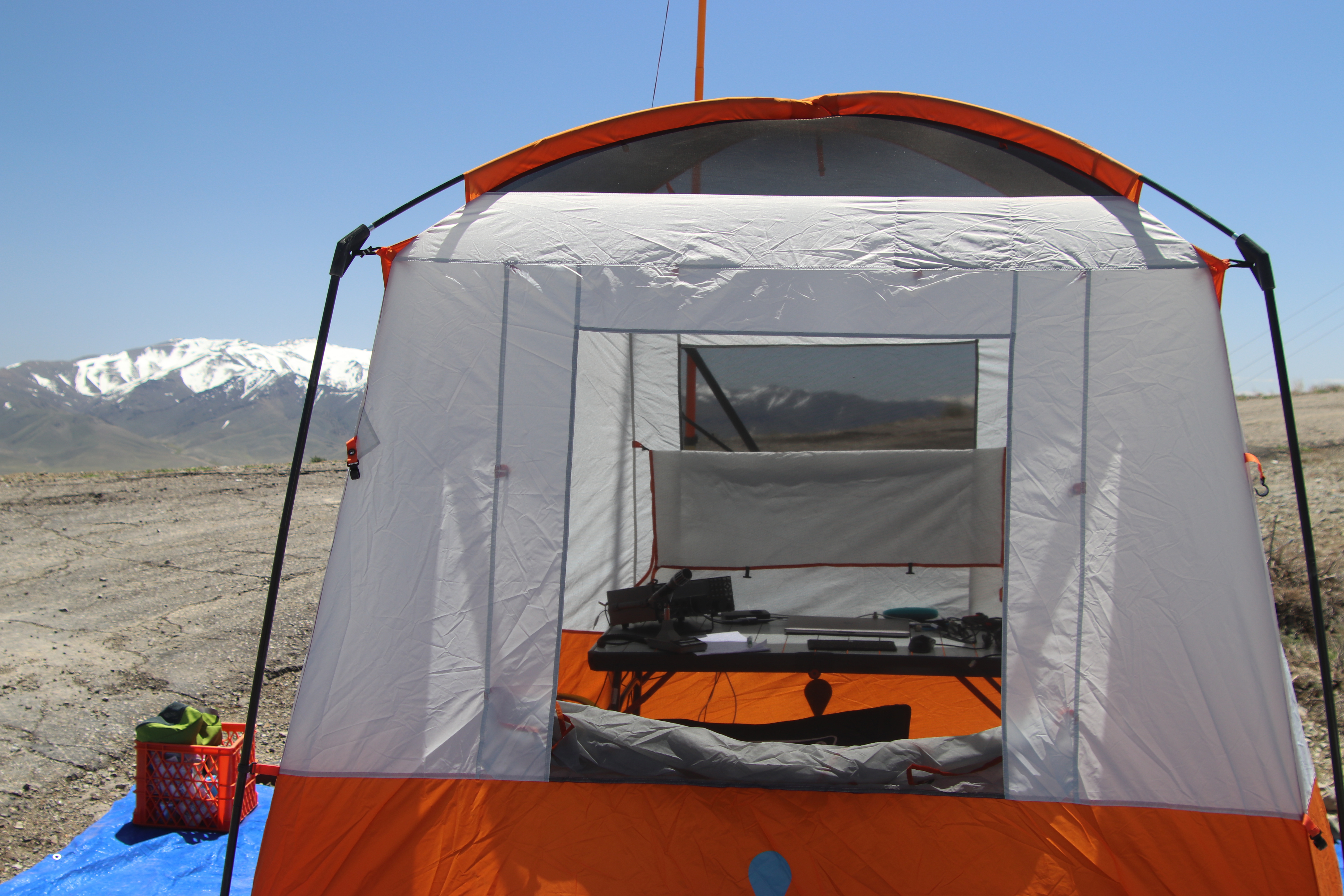
Here’s the station. To meet the SOTA requirement I carried all the gear to this spot and then drove Whitedog back for a wind/sun break.Looking east into Idaho past the summit cairn.Looking northLooking northwst up to Steens MountainLooking southwest over Blue Mountain Draw to Oregon Creek MountainsClouds move in and the wind begins to blow.Pano looking south showing the entire dirt road up.
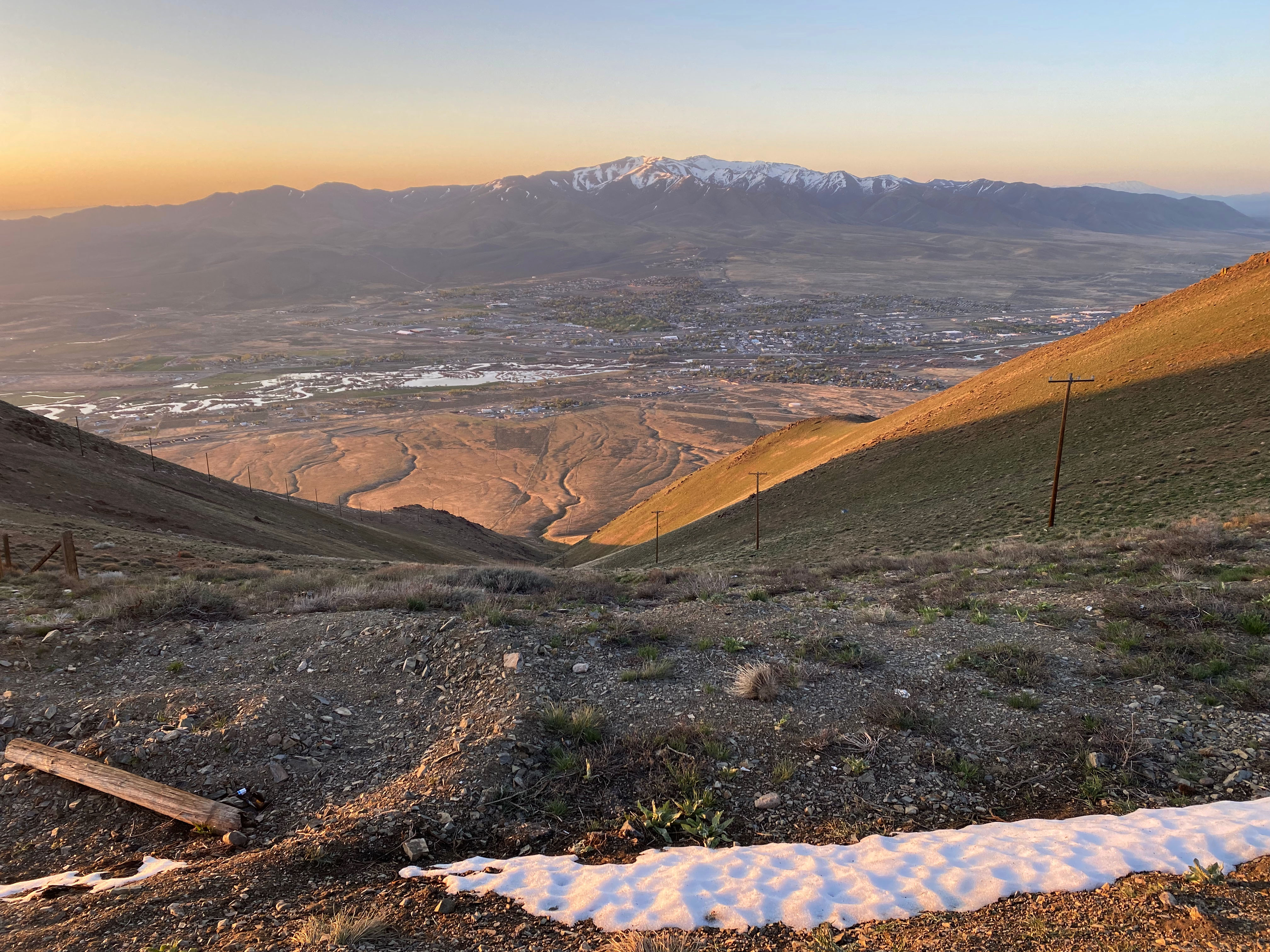
Sunrise on my way up to Winnemucca Mountain. Good road all the way to the top.
12-13 MAY 2023 W7N/HU-089
Elevation:
6,742′
Route:
Drive up
Hike Distance:
n/a
Elevation Gain:
n/a
Navigation:
Easy
Steepness:
n/a
Vehicle:
Passenger car
Road:
Paved
Cell Coverage:
Excellent (Verizon), No APRS
Hike basics
This was to be a weekend of new experiences for me. On this rather circuitous trip to meet up with Cassie KG6MZR at her adobe little casita in New Mexico, I wanted to go on a route that covered as much new ground for me in the west as possible. No small trick given that I have toured the west pretty extensively in my entire life. My PSK-31 club, the PODXS 070 Club offers a cool endorsement for working as many Maidenhead grid squares as possible. Grid squares DN11 and DN12 are sparsely populated and seldom, if ever, activated, let alone by the PSK-31 mode.
Grids DN11 and DN12 bottom to top. The topmost pin is Blue Mountain, the lowest is Winnemucca Mountain
So I looked for two mountains in those two grid squares that I could drive up with the rather voluminous amount of equipment that the digital modes require.
I left home at 3AM on a Thursday to give me plenty of time to drive up to Winnemucca, Nevada. While I had no jobs at work active, I am basically on call and can work with a laptop in a pinch anywhere with an internet connection. However, work cooperated and I got no panic rush calls.
I made my way up beautiful, austere Highway 395 along the dramatic eastern scarp of the Sierra Nevada just after sunrise. This incredible water year has left the Sierra with a impressive snow pack and runoff. All my life Owens Lake has been a dry dust bowl largely due to the Los Angeles Aqueduct’s construction in 1913. Before then this fossil sea in Basin and Range country was over 100 square miles large.
Owens Lake somewhat revived from this year’s heavy precipitation.
This was to be the theme for the day’s drive: a desert flourishing with the boisterous creeks and rivers pouring out of the snow-capped mountains. Once past Carson City I was in new territory — new dots on the map.
Winnemucca Mountain dominates the northern skyline from this pleasant town along the overflowing Humbolt River. The original transcontinental railroad came through this city. The Sundance Kid held up the local bank for $32,000 in 1900.
Getting all the way to Winnemucca in one day moved my plans up by a day. If I was to find cell service on the summit, I could camp out up there on Friday night. As the sun came up Friday morning I drove up the good paved road all the way past the local landfill and a public shooting range to the summit.
Weather was perfect as I made camp. This was my first SOTA summit using the digital modes. I was hoping for a lot of activity but HF conditions did not cooperate. There had been some solar disturbances and conditions were not that great. I made 54 contacts over the two Zulu days. Even though I was running my Elecraft K3/100 I only used 15 watts because I had up my QRP doublet. In retrospect I would’ve felt safer loading up a heavier gauge wire with more power. Here is my log:
That afternoon and night the wind came up enough to keep Chester the Drone grounded and, later, enough to keep me awake most of the night. As I broke camp in the morning, one of my tent poles shattered in the wind. This was going to change things for Saturday night on Blue Mountain
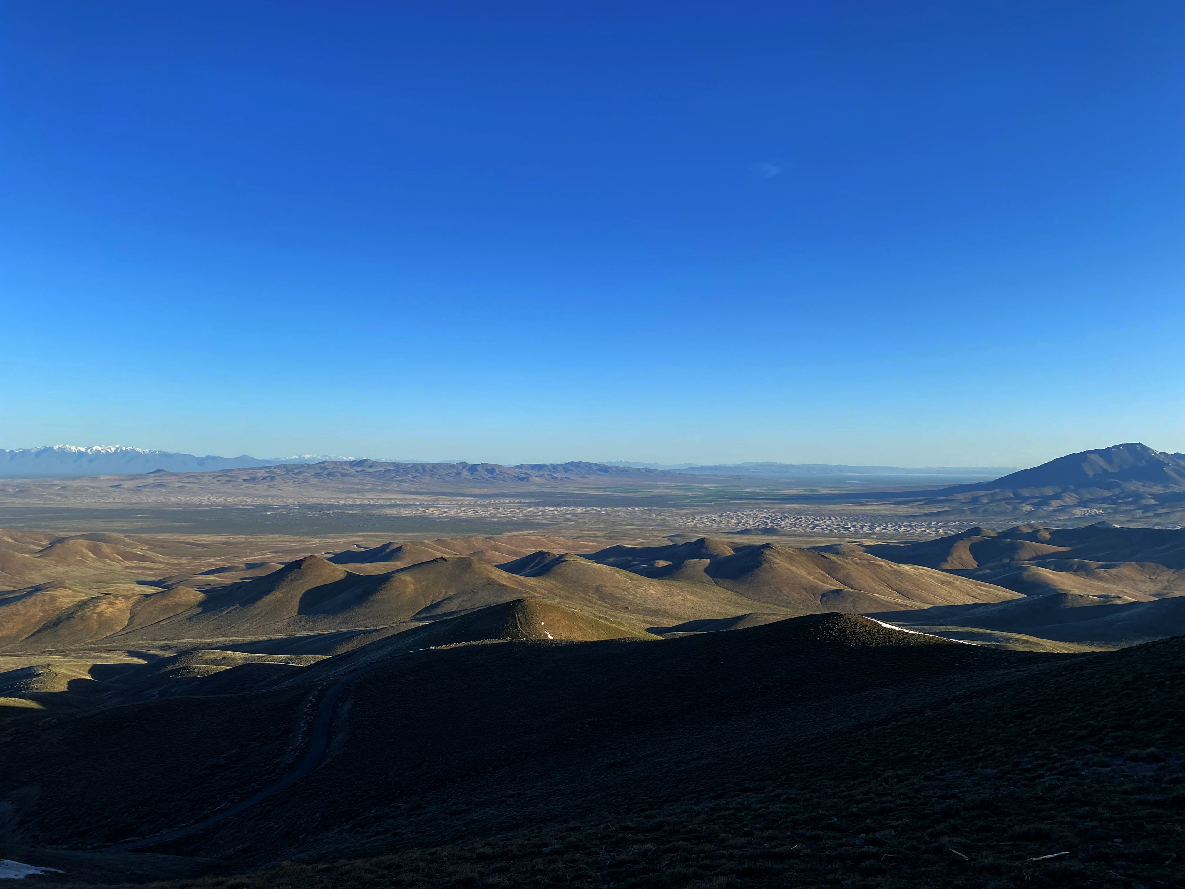
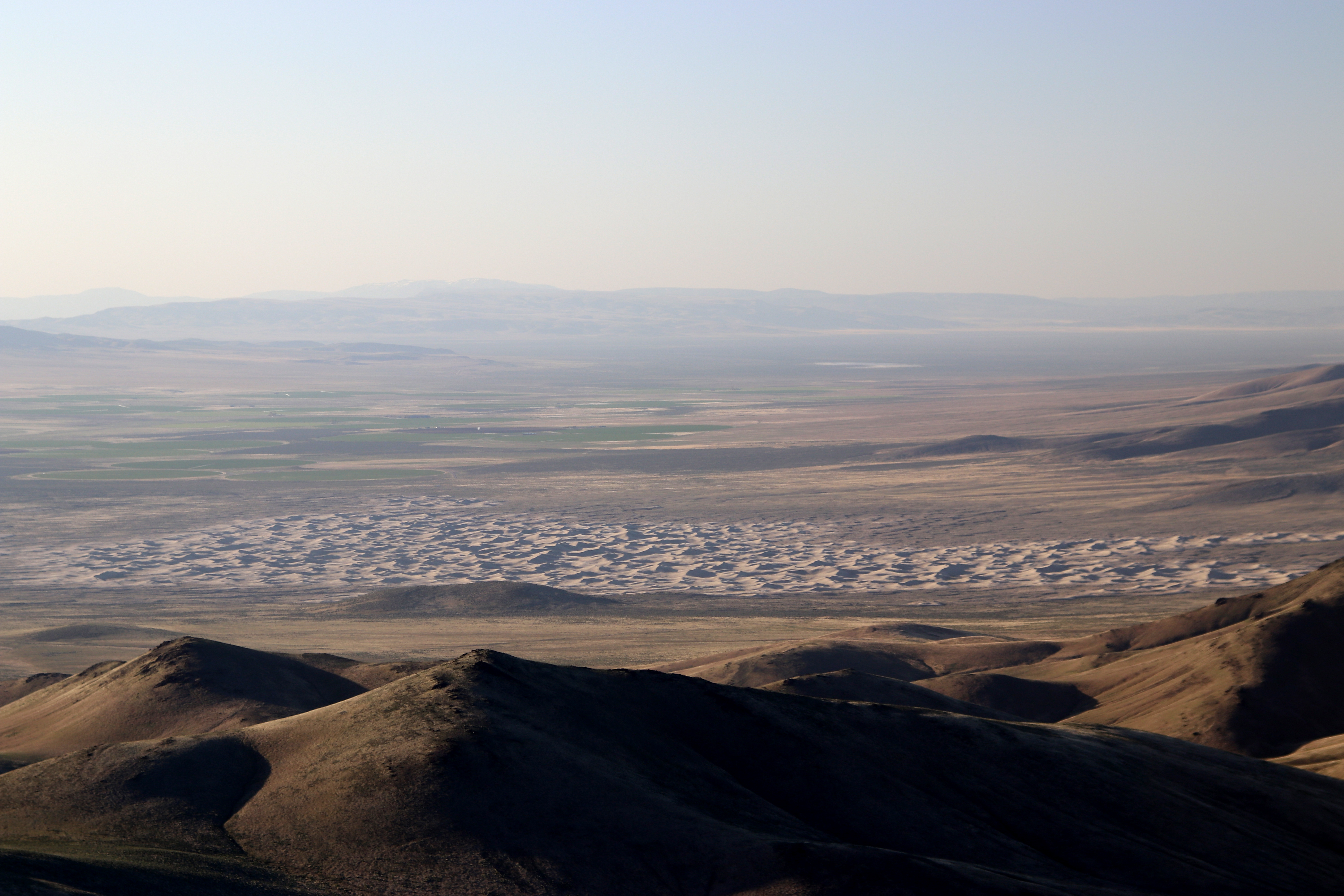
The station.Looking north across a phalanx of sand dunes.My camp on the summit. Wind blew all night shattering a tent pole.Looking south at the town of Winnemucca at sunrise the next day.Looking east at the magnificent flooded Humbolt River.Just after getting there after dawn looking northwest. Again the dunes.
Two Stars – a nice summit. I’d do it again. Recommended.
Elevation:
6,756′
Route:
Dirt road and use trail
Hike Distance:
4 miles round trip
Elevation Gain:
1000′
Navigation:
A bit tricky
Steepness:
Very steep
Vehicle:
Passenger car
Road:
Forest service dirt
Cell Coverage:
Excellent (Verizon), APRS Excellent
Hike basics
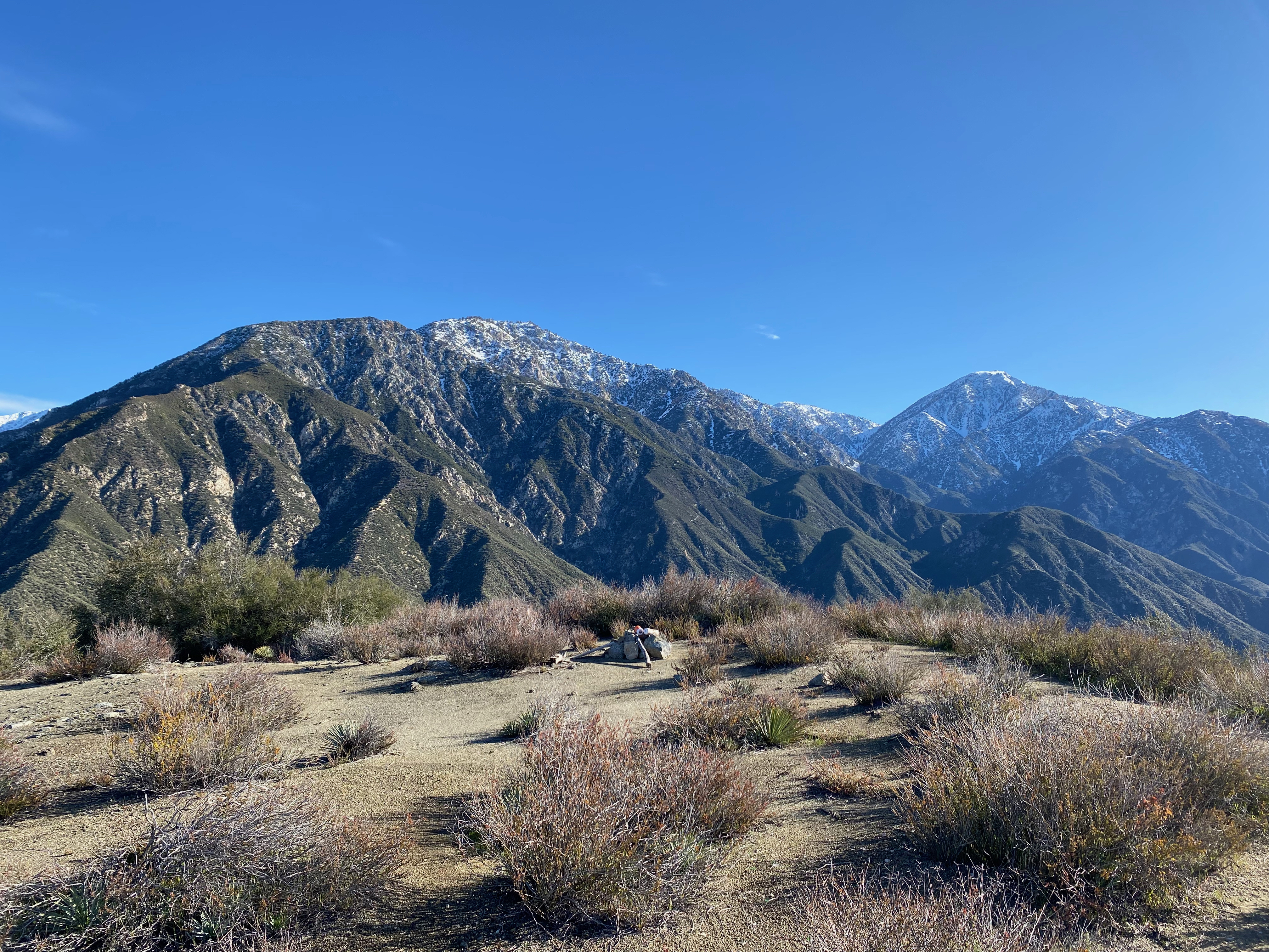
David N6AN and I had been talking about doing another activation together for a while and we finally settled on a early Saturday morning rendezvous in Pasadena at 6:00 AM. The day promised to be fair and mild as we headed east for the San Bernardino Mountains. Originally we were thinking about Bertha Peak, but David had suggested Silver Peak. This held a certain allure for me because this was an HPS summit that I had never done and it would be a unique for David as well.
We drove up Poligue Canyon Road far enough to determine that it was open before we decided to forsake Bertha and venture on out to Silver.
Silver Peak is named after the long history of mining in the area. Silver was first discovered on the south slope of this peak (1873). This resulted in the short-lived Arlington Mining District and its many colorful characters, such as “Cactus Jim” Johnson, who carved out a wagon road on nearby “Johnson’s Grade”. It is believed that Cactus Jim is buried on this summit. Wreckage from the mining operation is scattered along the trail up.
Legend has it that this peak was once known to the Cahuilla Indians as Makaveat.
The hike up to Silver starts from a parking area just off Highway 18 that was in remarkably good shape when we did it. I would have driven it in a passenger car. Route finding is a bit tricky in that with wanders through a maze of old mining roads and cross country routes that shorten the route.
It took us two hours to reach the summit travelling a relaxed pace. There is one fairly steep section after leaving the first visible mineshaft that requires caution.
Band conditions were fairly unsettled with only 40m and 20 really working. I did manage a summit-to-summit with W4BTH in Kentucky along with 6 other s2s contacts. All in all it was a great hike with good company.
Truck cab c1940’sScarlet Hedgehog (Echinocereus coccineus)A mine shaft on the summit. Cactus Jim Johnson is fabled to be buried here.
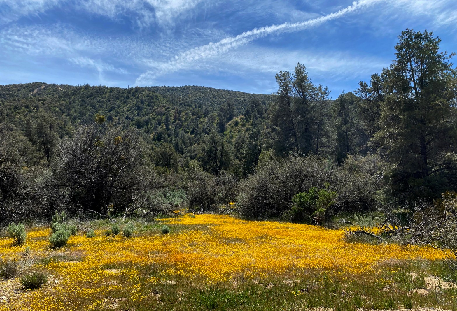
Apache Canyon was carpeted for miles with these little daisies.
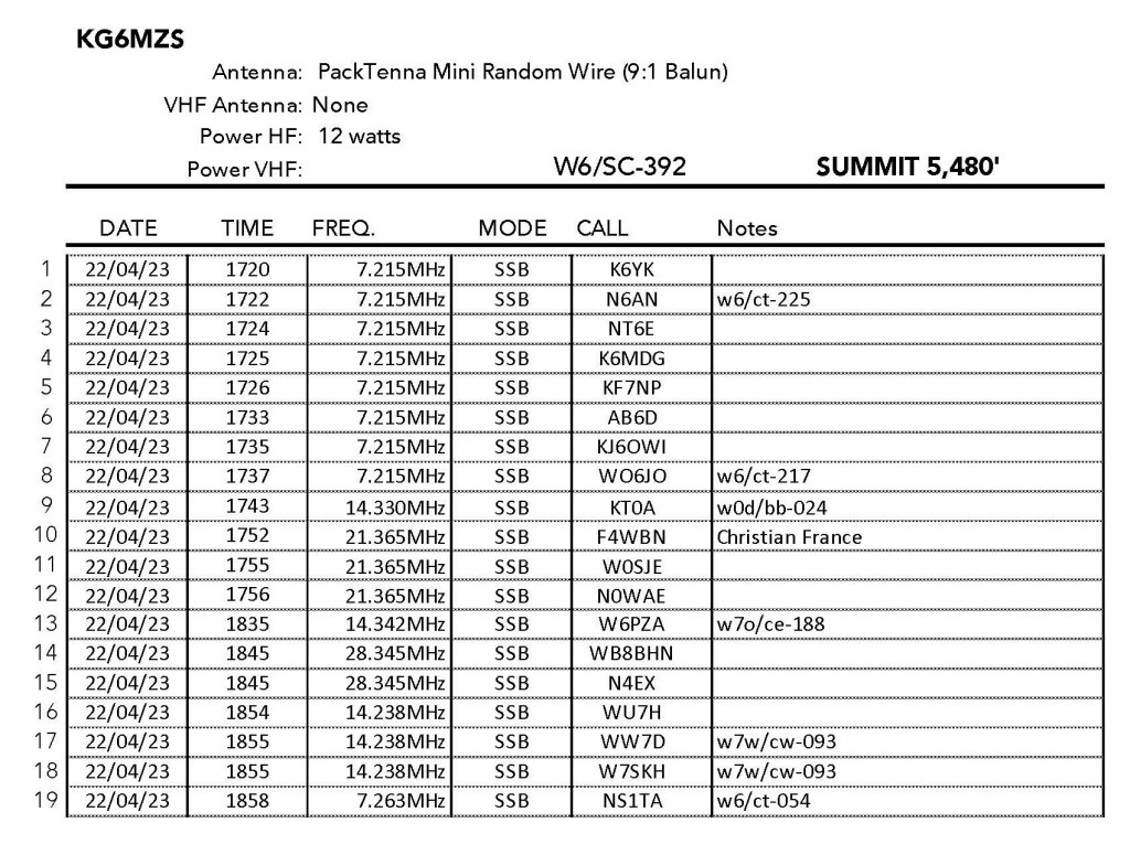
22 APRIL 2023 W6/SC-392
Two Stars – a nice summit. I’d do it again. Recommended.
Elevation:
4,580′
Route:
Cross country
Hike Distance:
2.2 miles round trip
Elevation Gain:
800′
Navigation:
Tricky
Steepness:
Extremely steep
Vehicle:
Passenger car
Road:
Good dirt road
Cell Coverage:
n/a
Hike basics
I loved this adventure! Great time of the year with comfortable mild weather. I would give this one 3 stars except this is really not a summit for everyone.
I left my home in Topanga at 4:15 AM and was surprised to see a freeway sign in Oxnard warning the Highway 33 was closed! Fortunately I was able to jump on to the 126 and head to Castaic up the Santa Clara River Valley. All the big creeks – Sespe, Piru and Santa Clara were still very full from all the rain we’d had this season. I was hoping the the Lockwood Valley route was open to the Cuyama Valley along with Apache Canyon.
Traffic at that hour was light so I was still able to get to the parking spot by 8:00 am. Good thing I left early. Both the Lockwood Valley Road and Apache Canyon Road were luckily open as the gates were closed on all the other forest service roads I passed. Forest service road 24W06 is a pretty easy off-highyway route labelled trail 103 at the junction with Apache Canyon. There were a lot of dispersed campers in this beautiful area as I made my way up. I parked probably sooner than I needed to out of abundant caution. The road was surprisingly good.
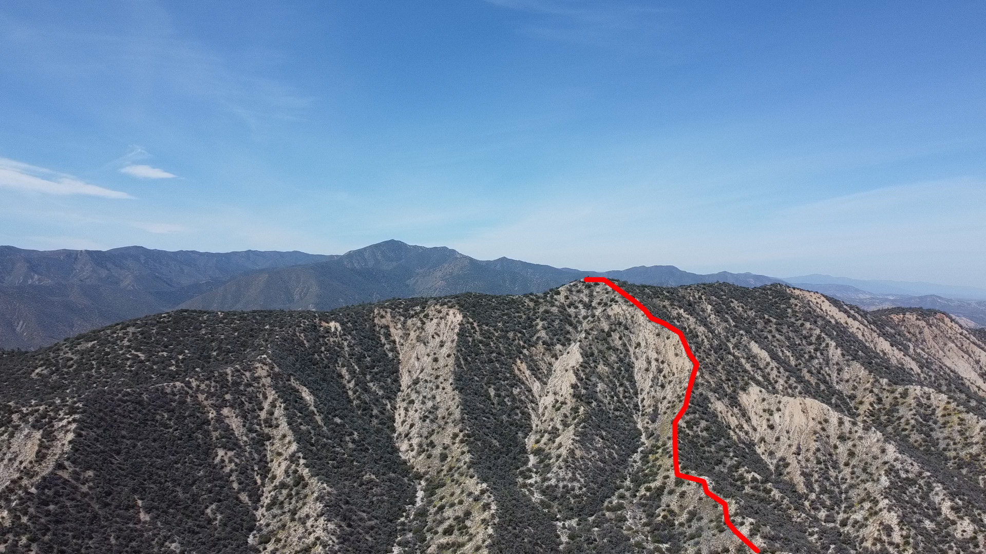
Here is a Chester the Drone shot of my route up the east side.
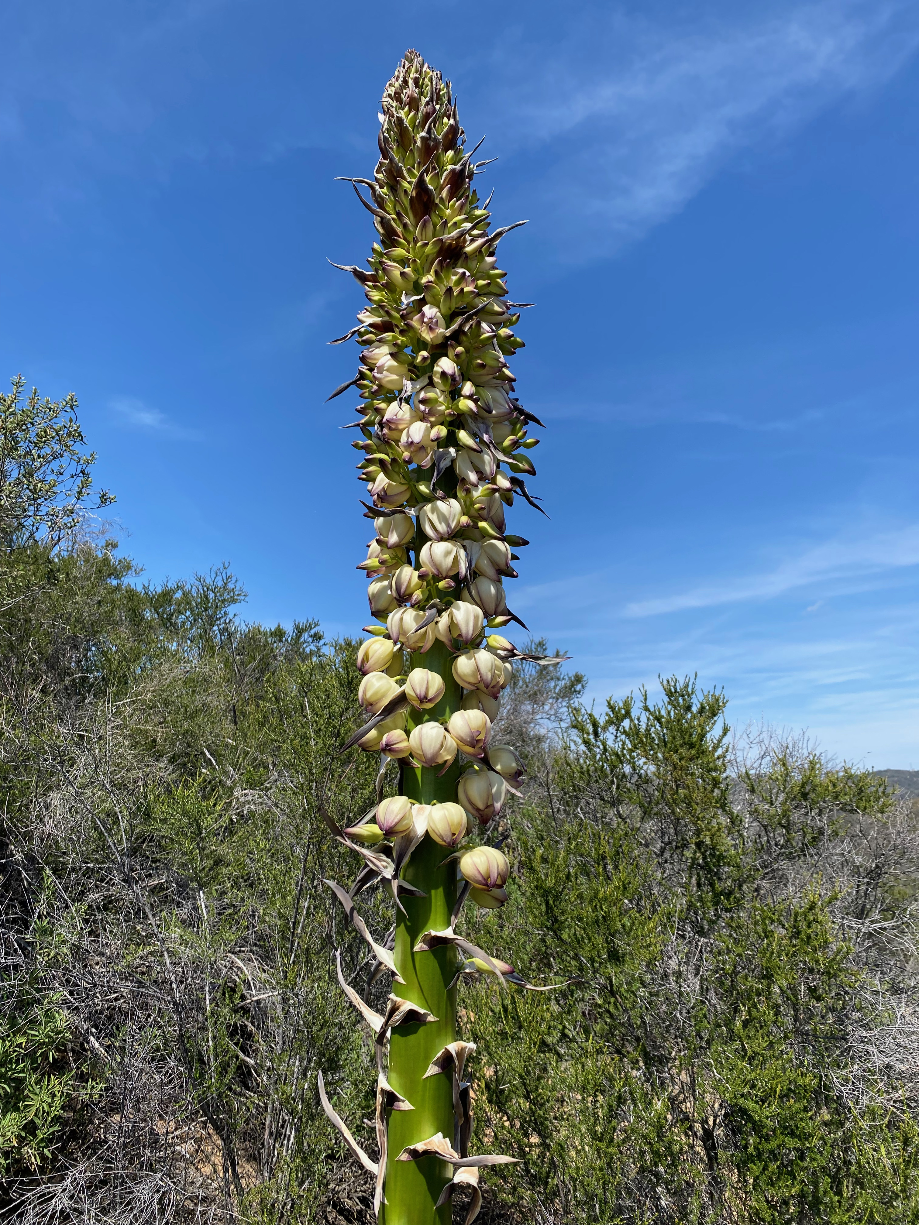
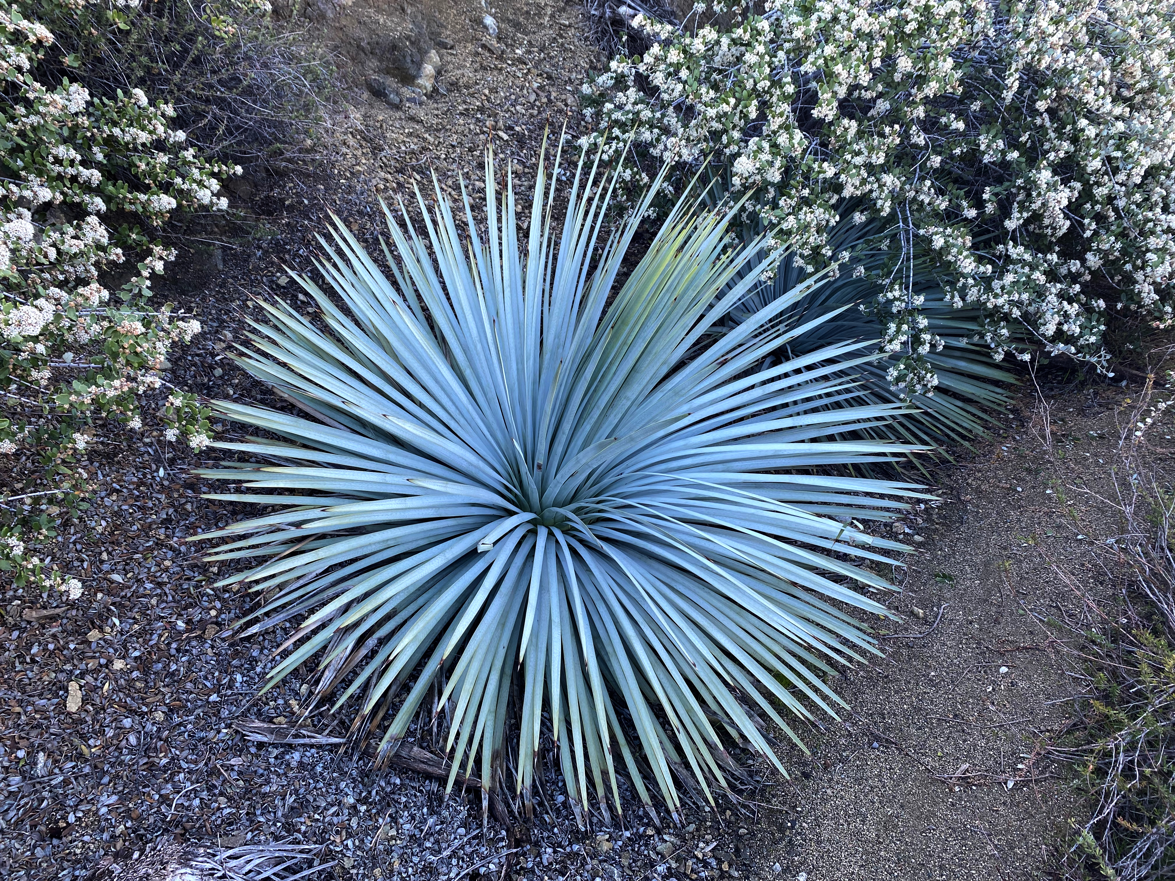
The route is completely cross country following faint deer tracks. In my case, literally following some fresh tracks. This route is very steep in places with some exposure that, while not deadly, is enough to warrant caution — especially for 67 year-old solo hikers. The brush is fairly easy to avoid, although I did get punctured by one of the numerous Yucca along the route. I also spotted some not-very-fresh mountain lion tracks.
It had been 38ºF in Lockwood Valley as I came in and the morning was delightfully cool. Cool enough to minimize the rattlesnake threat on the way up.
The activation was a real kick — 19 QSOs including 7 summit-to-summits. The longest QSO of the day was, who else, Christian F4WBN a strong 56 from France.
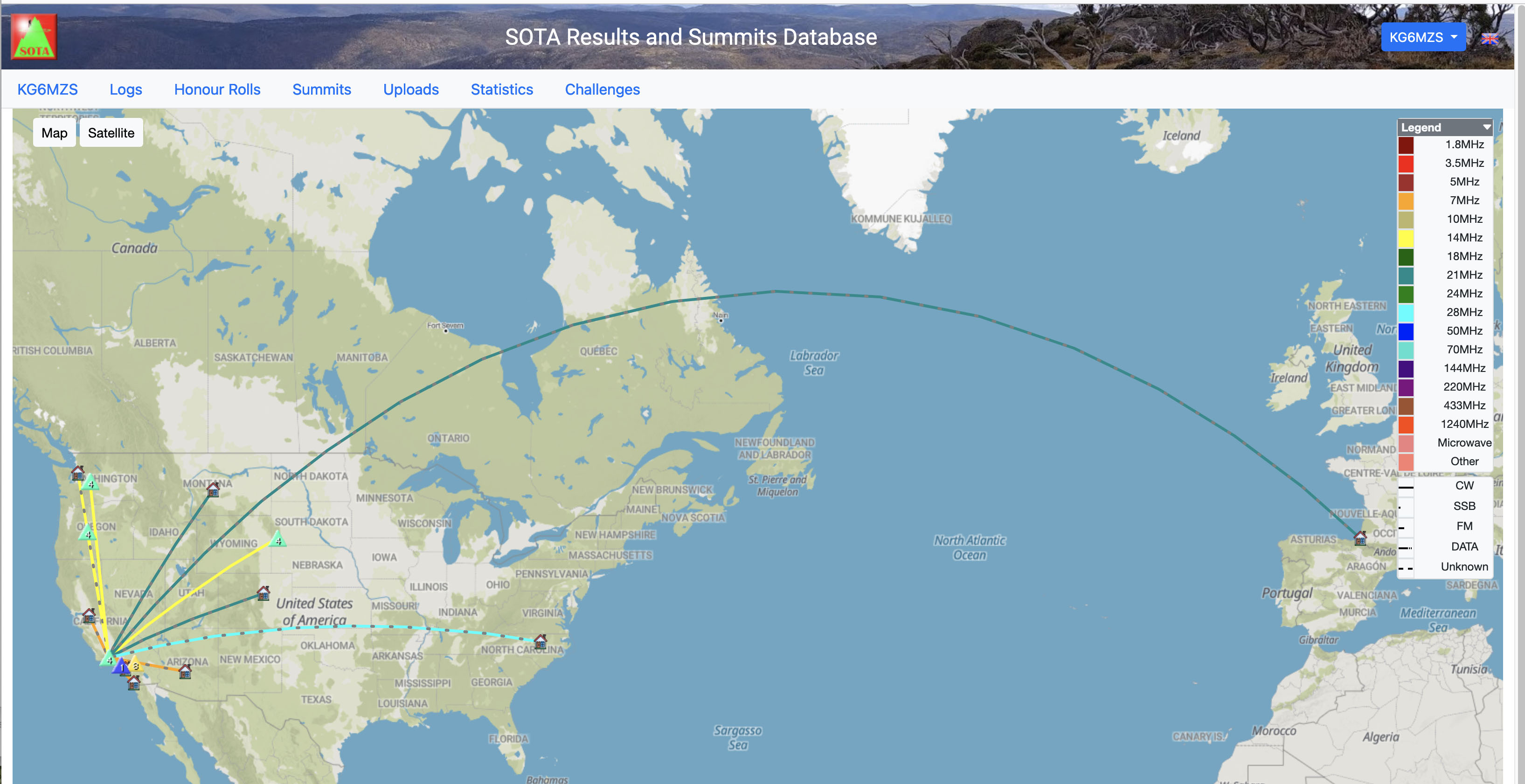
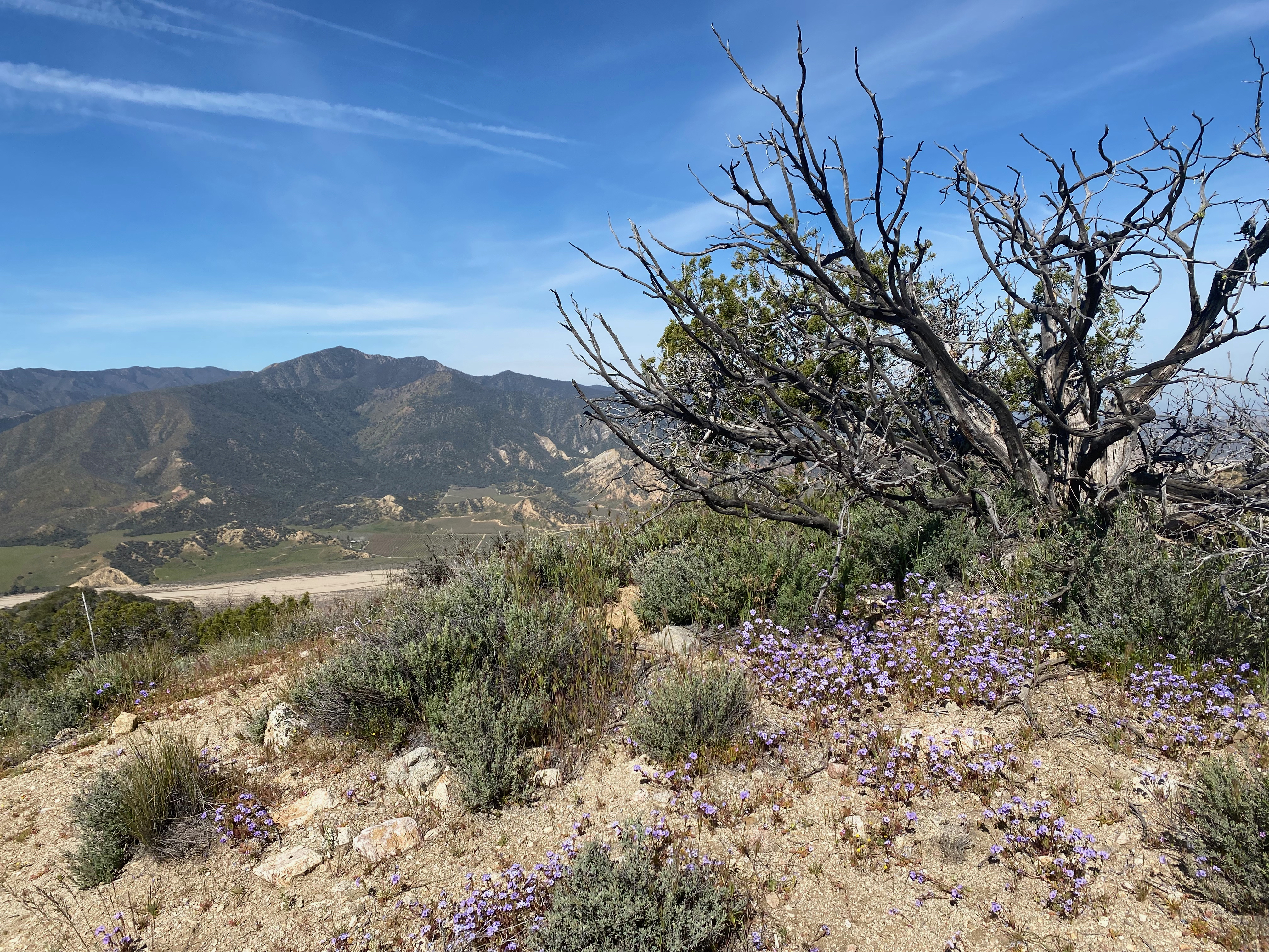
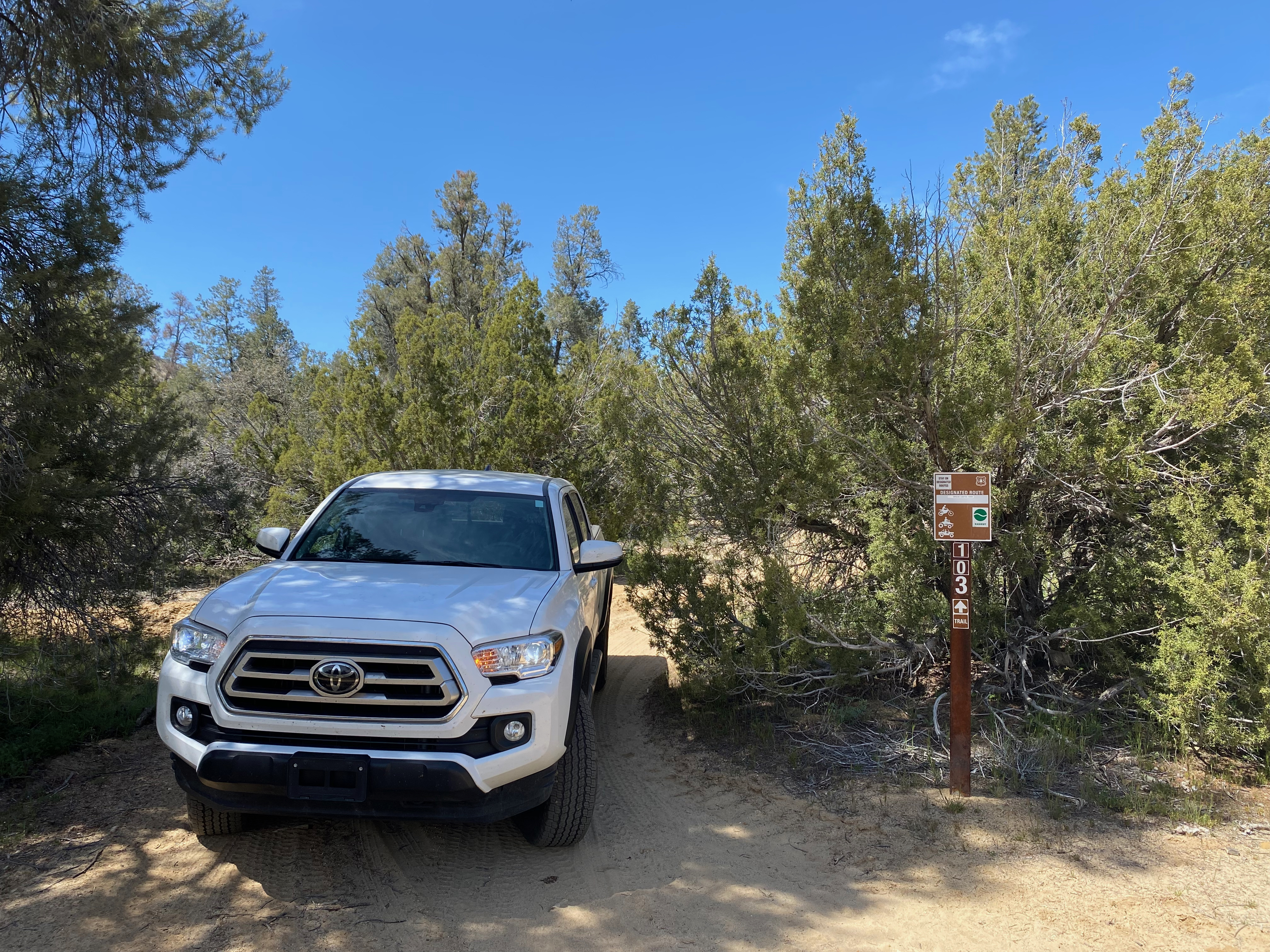
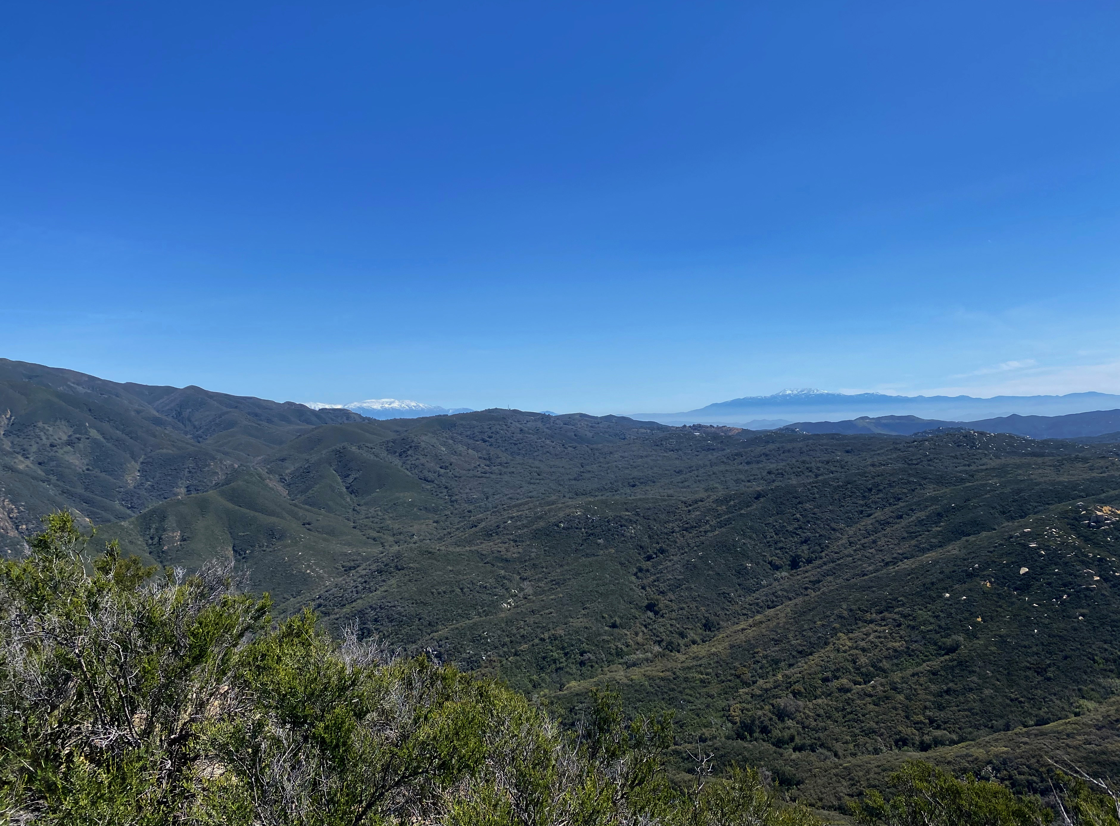
And the groovy new QSO mao from the SOTA Databas3.The summit looking west with Cuyamaca Peak in the background.Looking east at Cerro Noroestre and Mount PinosWatch out for these guys going up. There are a lot of them and they gave me a pretty deep puncture wound.Whitedog at the beginning of forest service road 24W06 – Trail 103I left a brand new summit register for other activators,
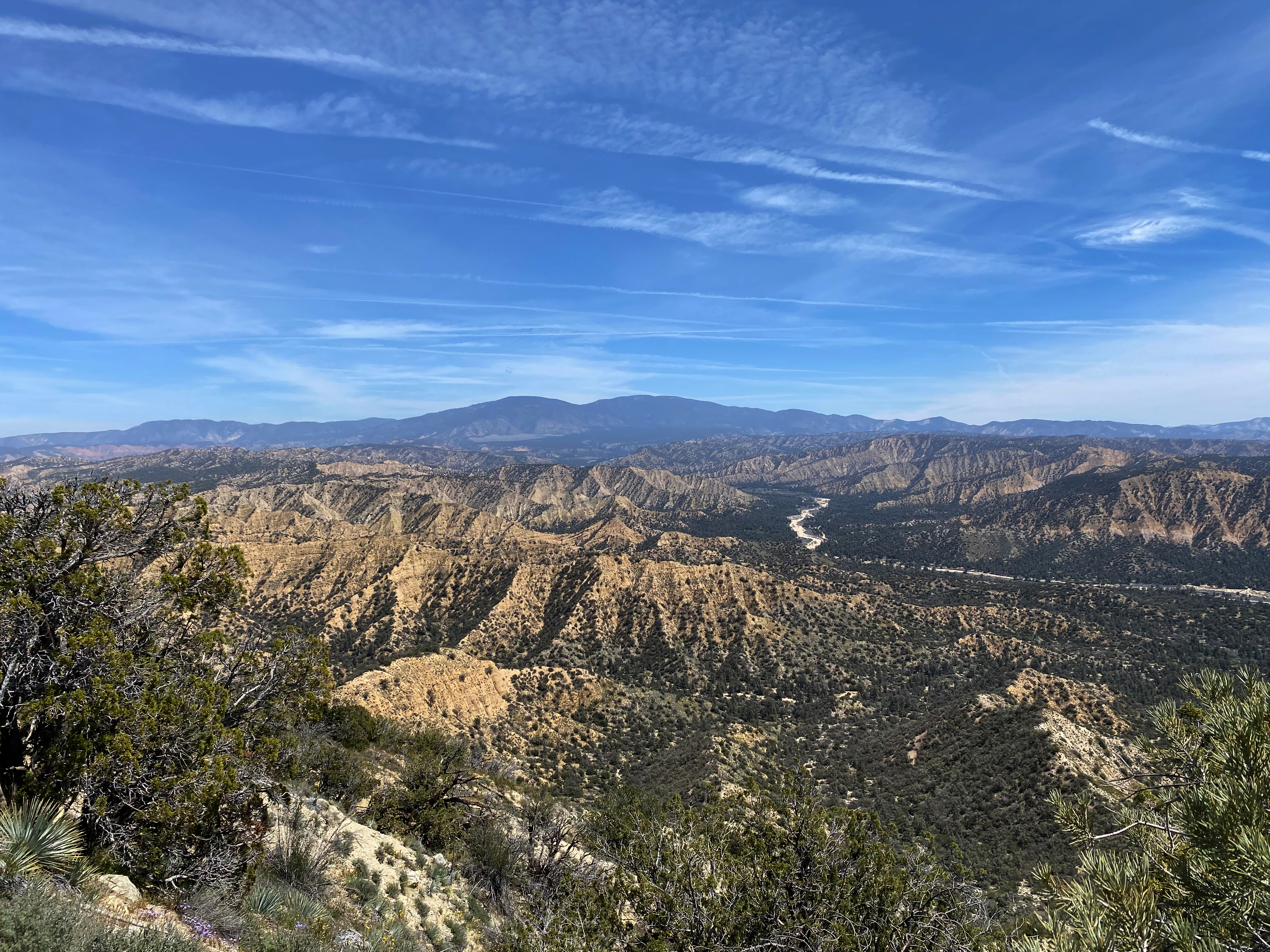
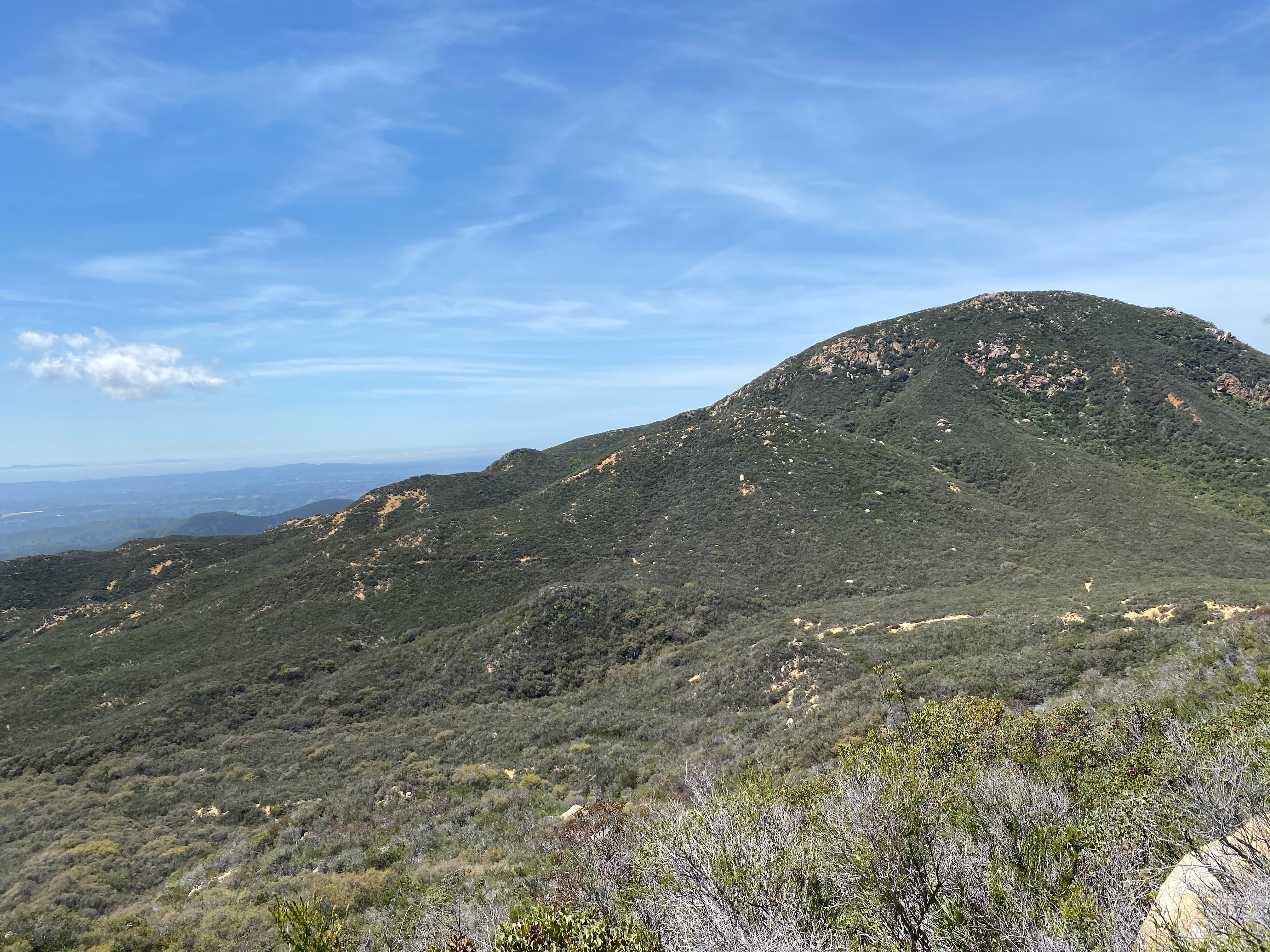
Summit 4,054′ is a fine looking summit at the end of a steep hike.
15 APRIL 2023 W6/CT-156
Three stars – Highly recommended with the caveat that this is a hike that is not for everybody.
Elevation:
4,054′
Route:
Cross country and steep training trail
Hike Distance:
4 miles round trip
Elevation Gain:
2,000′ including 200′ on the return
Navigation:
A bit tricky to start, then easy
Steepness:
Steep
Vehicle:
Passenger car
Road:
Paved
Cell Coverage:
Excellent (Verizon), APRS Excellent
Hike basics
I love this hike and I highly recommend it, but it is not a hike for everybody. At a little over two miles to the summit it is very steep. In fact, it appears that this hike is a training route for fire crews out of the Conservation Camp at the junction of Soledad Canyon and Maher Canyon just east of the trailhead. They call it “No Fear.”
The sign for the fire crew training hike “No Fear.” You can see the route zig-zagging up to the right.
I started the hike right at sunrise and mistakenly went up the hillside to the left of the little ravine where I parked Whitedog the Tacoma. It is actually better to climb up the short waterfall at the start of the ravine and head up to the saddle where it joins the “No Fear” route.
Here is my track up CT-156. I’ve posted this so you an see how long it took me. Normally I do 1 mile in 30 minutes or less. As you can see this hike 1 mile took me 72 minutes to ascend.
I suggest getting an early start if you plan on doing this hike on a warm day. The hike up will be cooler and the rattlesnake danger is less. You can mostly see where you are putting your feet, but, even so, I was glad to have my trekking poles for balance and to fend off any potential snake strikes on the much warmer descent.
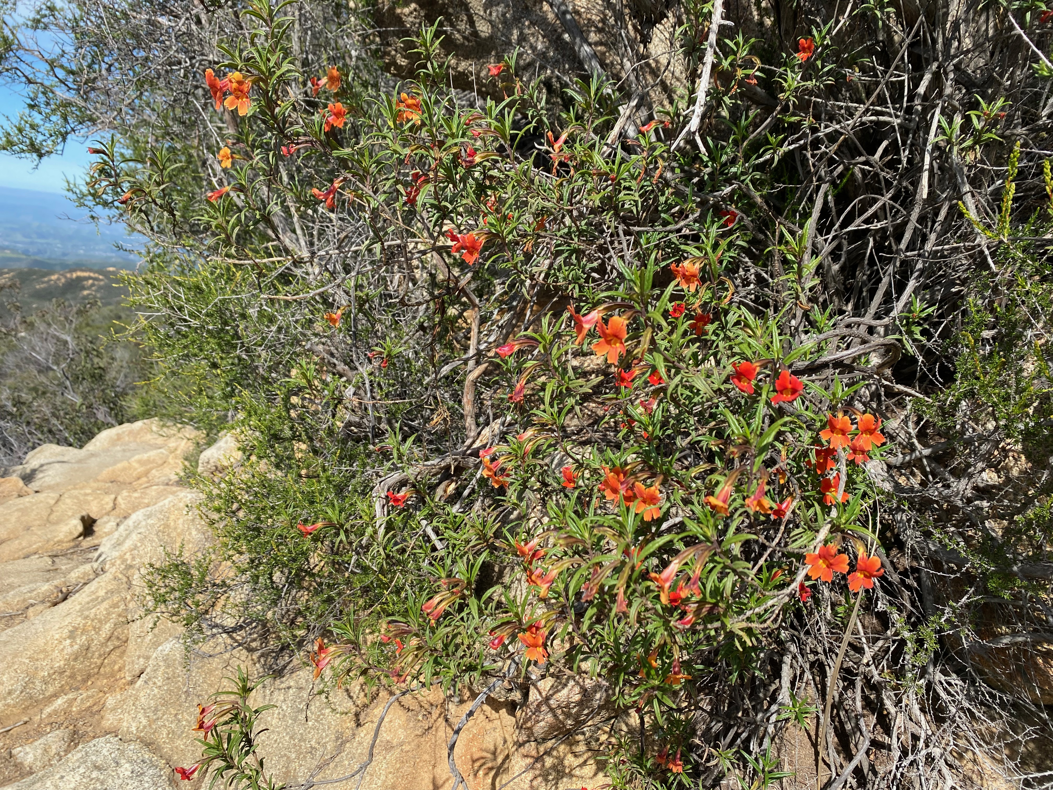
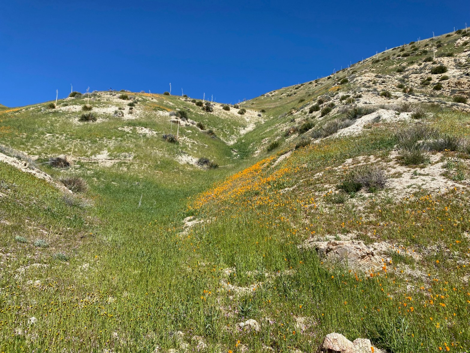
It was nice and cool as I rapidly climbed the steep slopes covered in bright yellow Tree Poppies (Dendromecon rigida). The golden state flower, the California Poppy gets all the superbloom buzz in the media, but other wild flowers adorned this hike.
Tree Poppy (Dendromecon rigida) adored this spring day hike
I was serenaded by the plaintive, single note cry of the Mountain Quail (Oreortyx pictus) as I hiked upward. It is a familiar sound to mountaineers in California and evokes a lazy nostalgia for me of dreamy afternoons in the clean, high air.
One thing that really appeals to me about the summits on the backside of the San Gabriel Mountains is how little-travelled they are. I didn’t see another hiker the entire day. All the “big name” peaks on the crest would be packed on such a beautiful Saturday as this.
It took me two hours and twenty minutes to reach the summit. While I make frequent stops to catch my breath, I don’t usually sit down. I follow the old hiker’s maxim that this expends more energy that it is worth. I usually start to move slowly in a rest step after a minute or two.
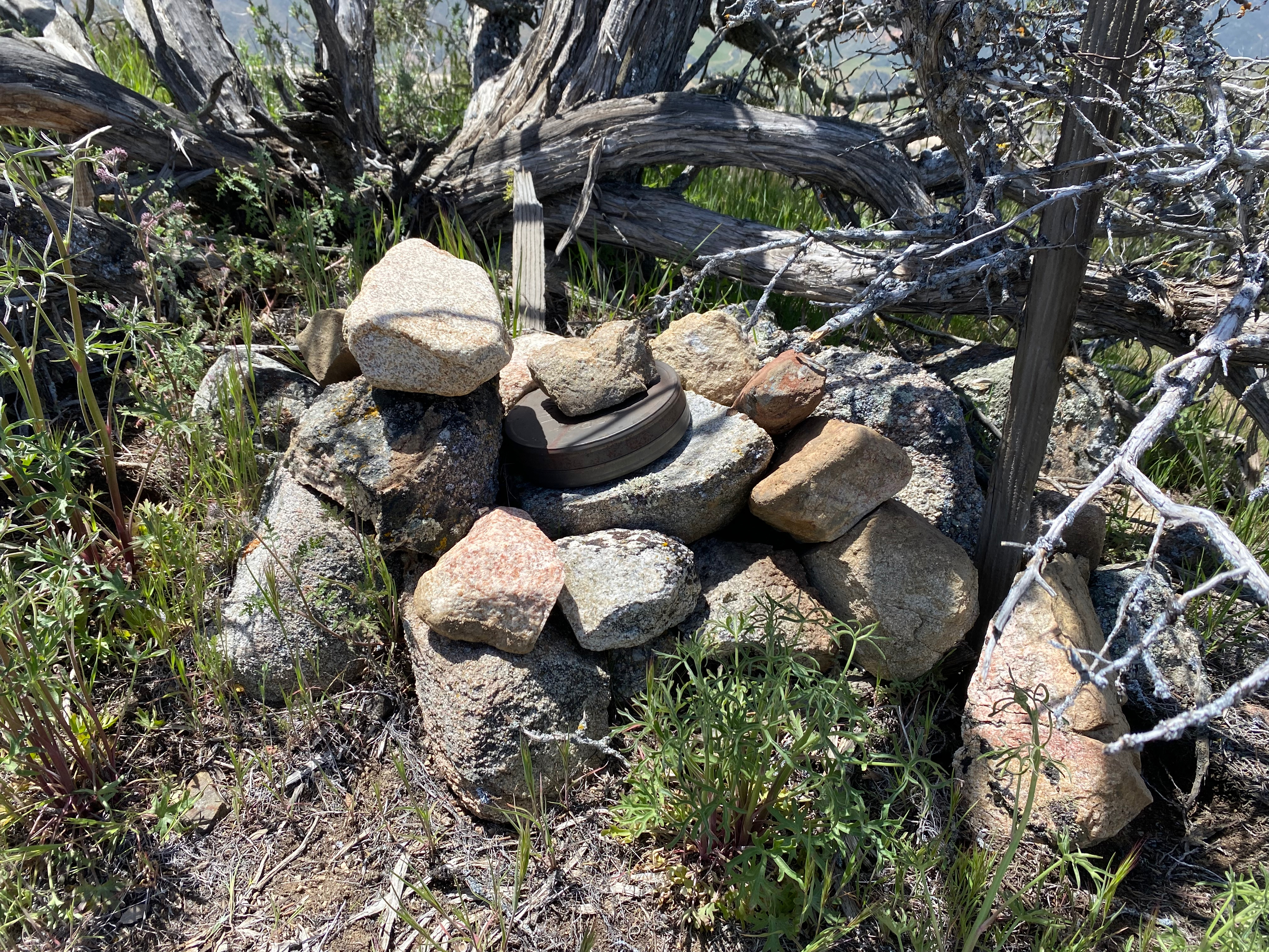
Cassie (KG6MZR) and I were fortunate enough to catch Kevin (W6KCO) on this summit when he did it last winter. We were on Grass Mountain at the time so this was a really sweet complete made even better when Kevin was my first caller from his home in Canyon Country. Thank you Kevin.
Kevin had left a very well-made register on the summit and the only signatures in the little book were all SOTA activators!
It was somewhat breezy on the way up, but I managed to get Chester the Drone up in the air for a short video of the summit:
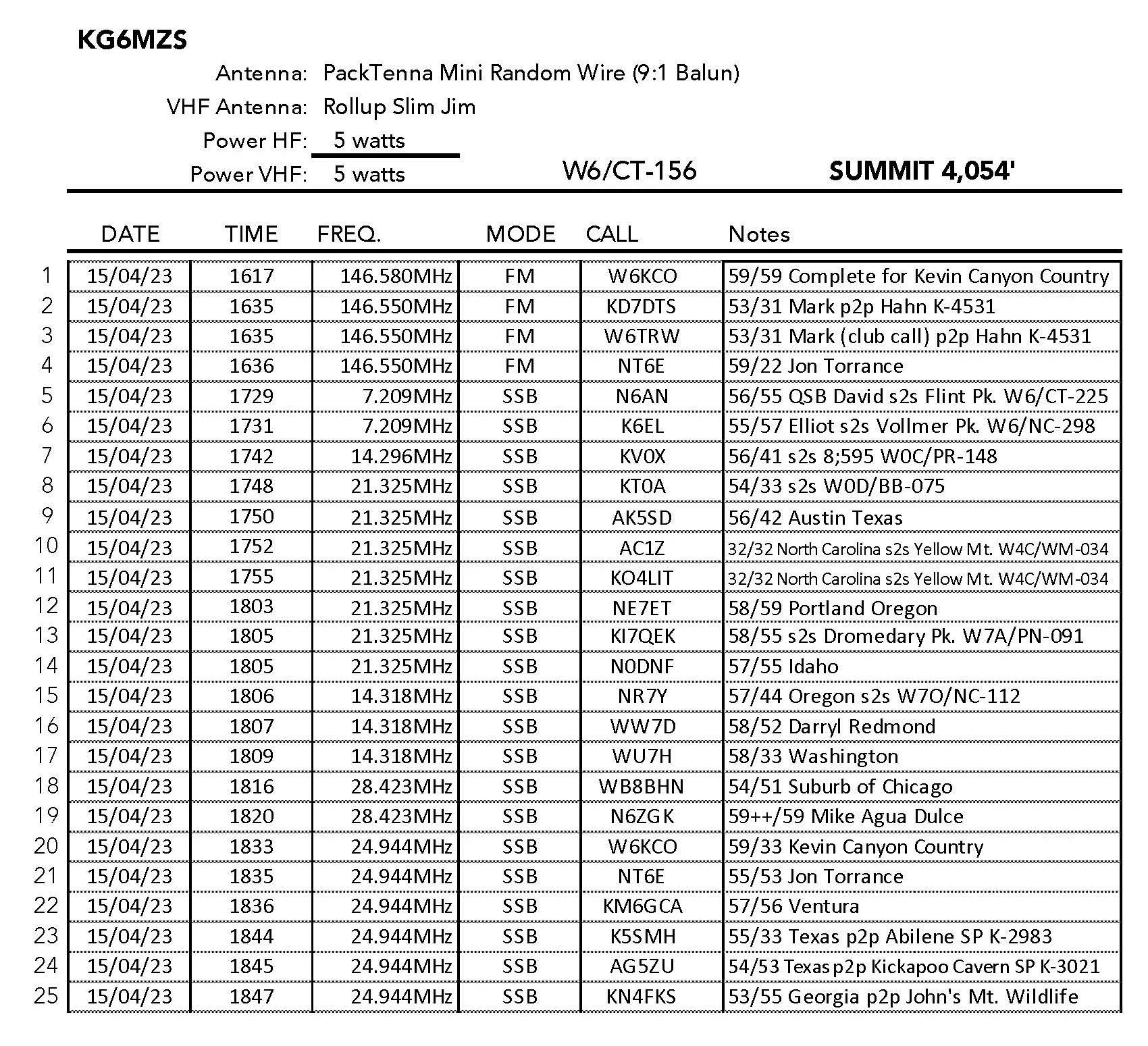
I had great fun making 25 contacts including 8 summit-to-summit contacts and 4 park-to-park contacts. This summit is in the Angeles National Forest and in the San Gabriel Mountains National Monument.
About noon the nice morning breeze died and the insects became noticeable. Small biting gnats attacked my elbows and it was time to pack up and hike down. It was pretty warm at this point and I consumed all of my litre and a half of water. Bring lots of water!
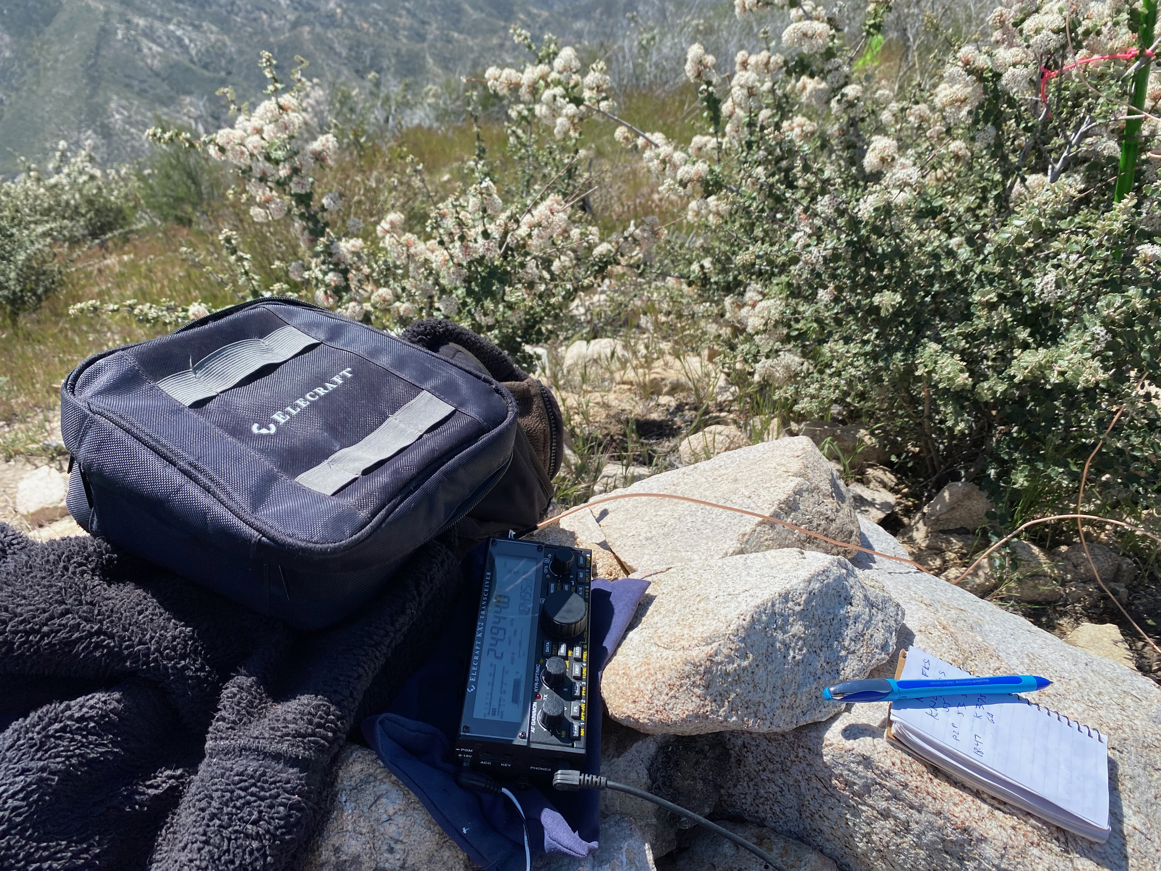
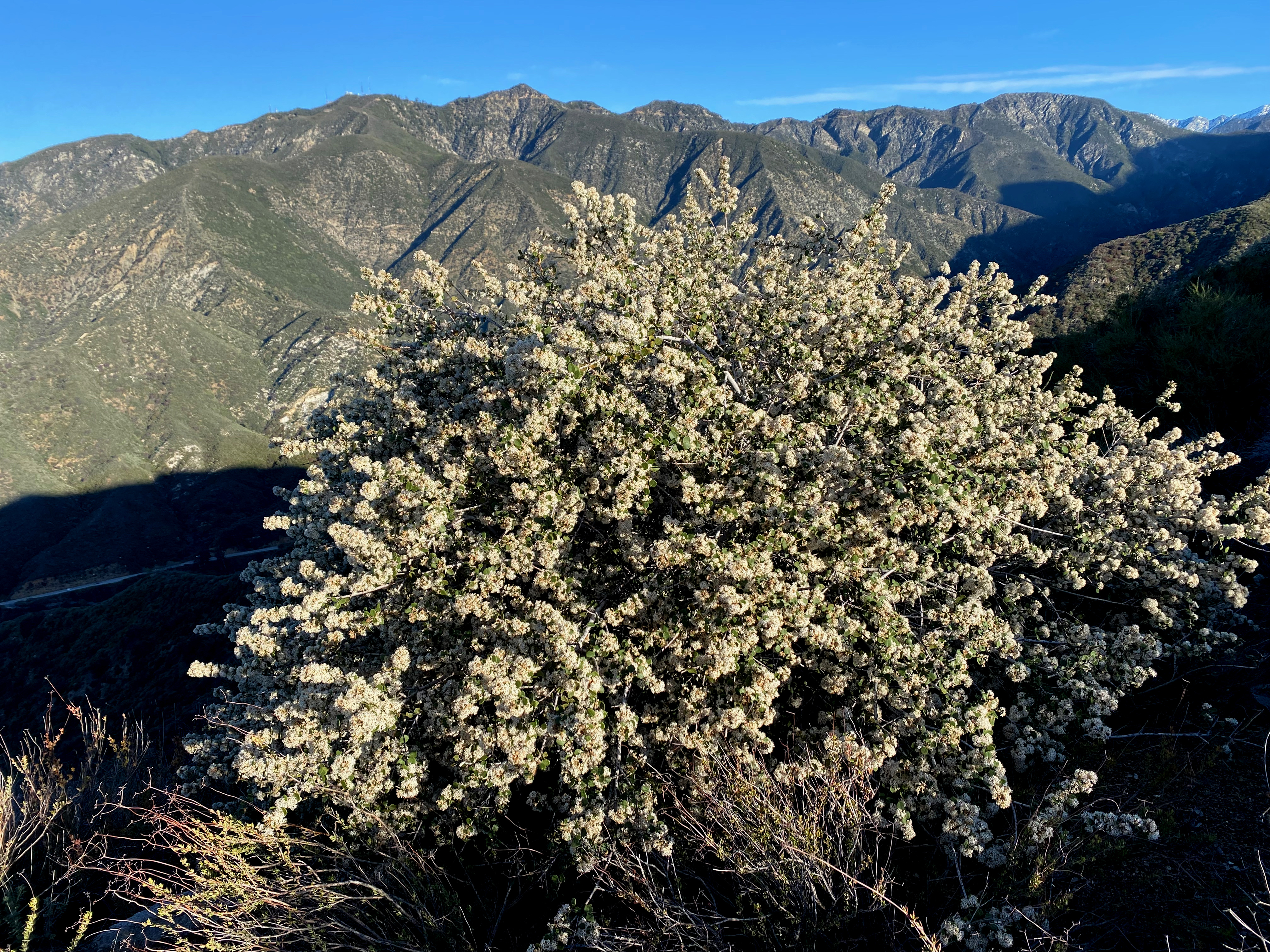
The station closeup with snowbrush (Ceanothus) flowersThe antennaLooking west at some of my favorite peaks.
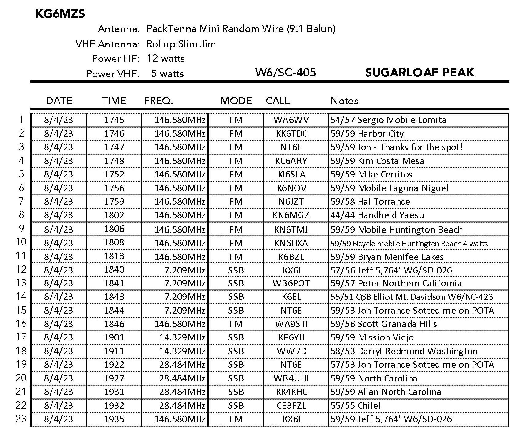
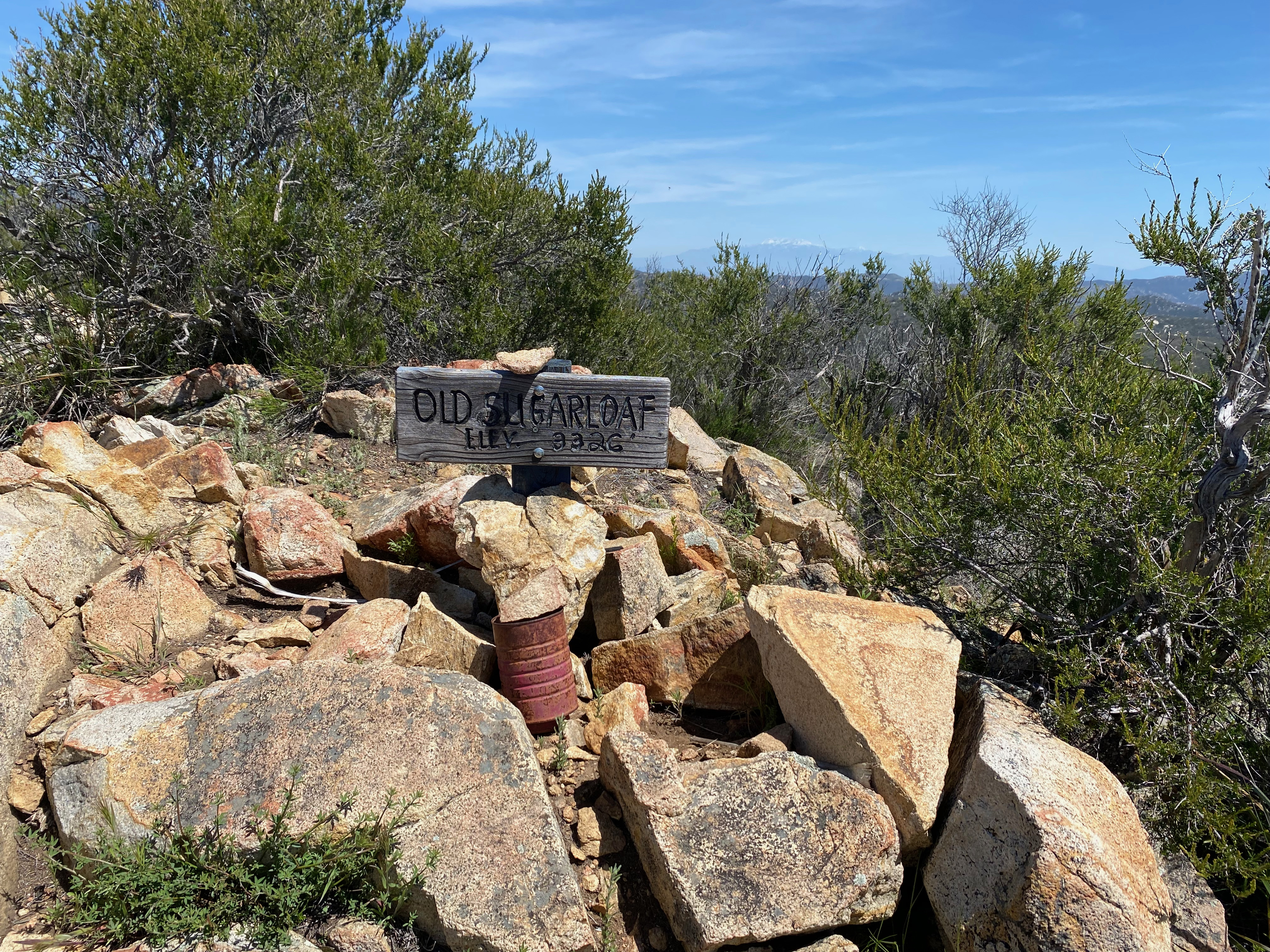
Here”s the trail leading an up and down roller-coaster pointing right at the summit itself. This was a surprisingly enjoyable 2 pointer. I was rewarded with a terrific activation that included 4 summit-to-summit contacts and my first chase from Chile!
“Sugarloaf” is one of the most ubiquitous names for a mountain, so much so that when you enter “it “sugarloaf”into the SOTA database you get the “Too many results” dialogue box. There is one in the San Gabriel Mountain and one in the San Bernardino Mountains too. However, this humble little 2 point 3,326 foot summit proves to hold it’s own as a lovely hike and summit. Despite it being a little longer hike for me than I am strictly comfortable with at near 9 miles with over 2,000 feet of gain — 1,100 feet on the return (!) — I heartily recommend it.
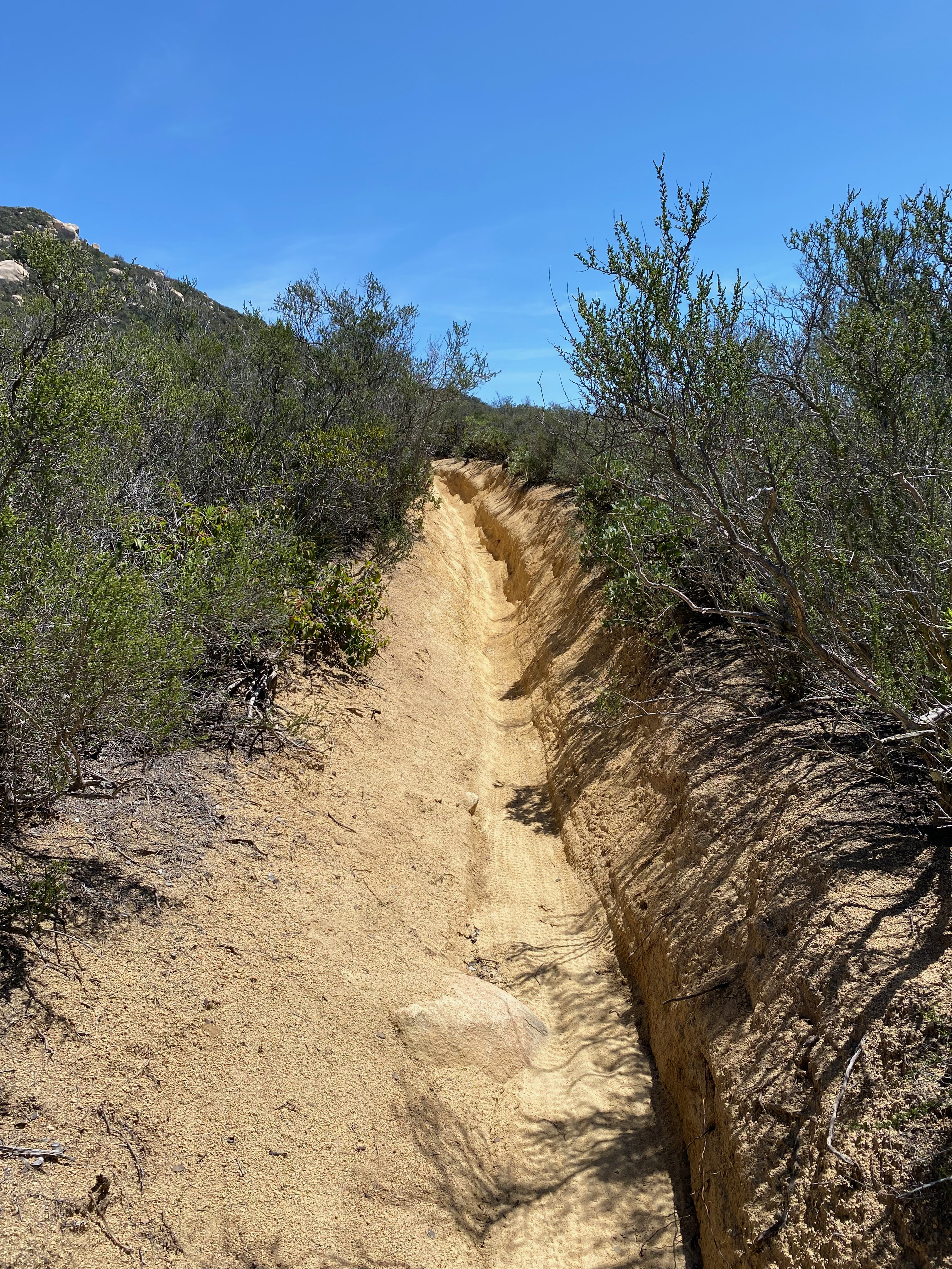
I initially figured I would ride my mountain bike on this one, but after a third of a mile or so it quickly became apparent that this single track was above my skill level given the loose rock and deep, deep ruts. I’m good with a mountain bike on fire roads and not a whole lot else.
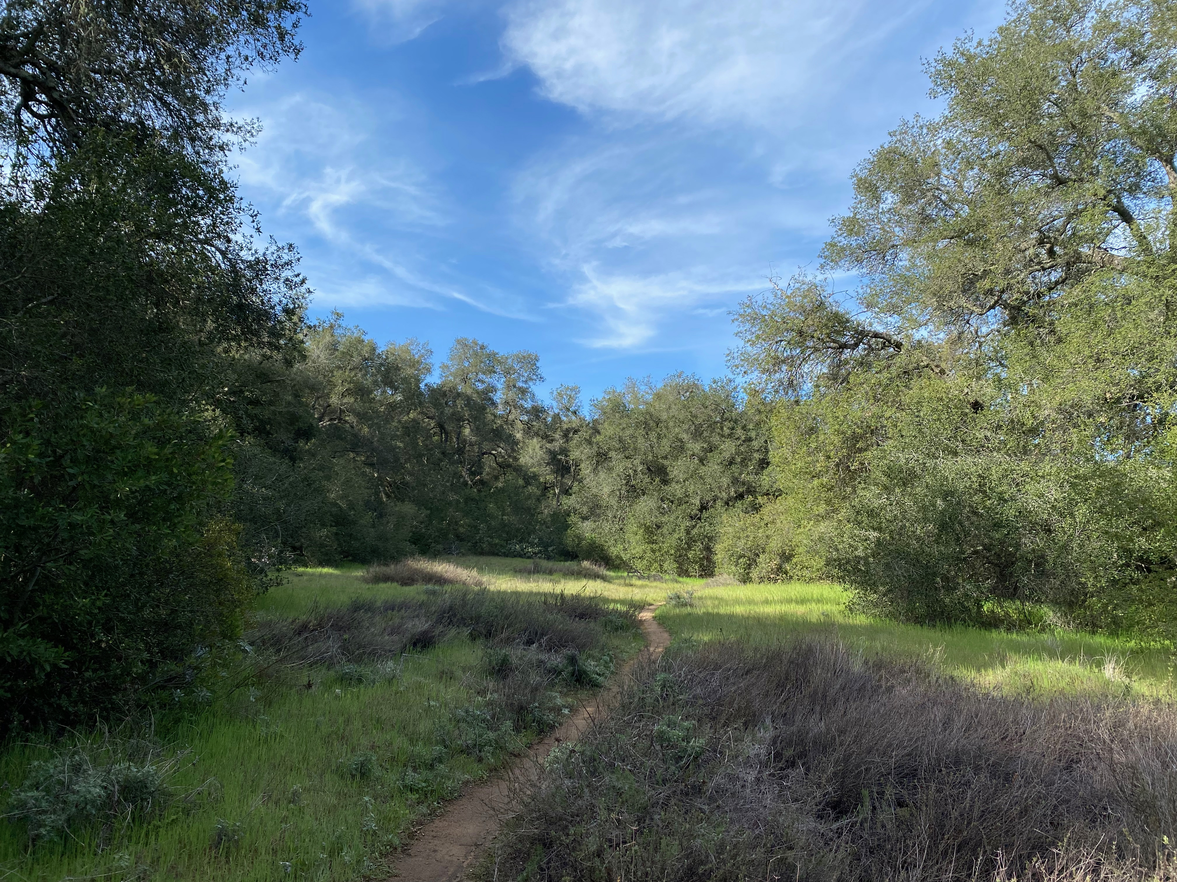
So I stashed the bike and continued on foot. Punting like this left me a little short on gear – especially water. Fortunately is was a relatively cool day. I imagine the in the dog days of summer this can be a hot trek in places. There are also a lot of beautiful shady meadows along the way.
Lucious meadows near Chiquito Springs. Next time I’ll bring the water filter.
At about the 4 mile mark there is a well established use trail that leaves the San Juan Trail and ascends very steeply up the south side of Sugarloaf. While not as steep as the trail up Frankish Peak that I did the weekend prior, it’s still pretty steep.
The summit register went back a few years and didn’t show a whole lot of activity. While a lot of people do the San Juan Trail, it seems that not a lot of them take the side trip to the summit. This beautiful Saturday afternoon I had the top to myself even while the San Juan Trail was pretty busy.
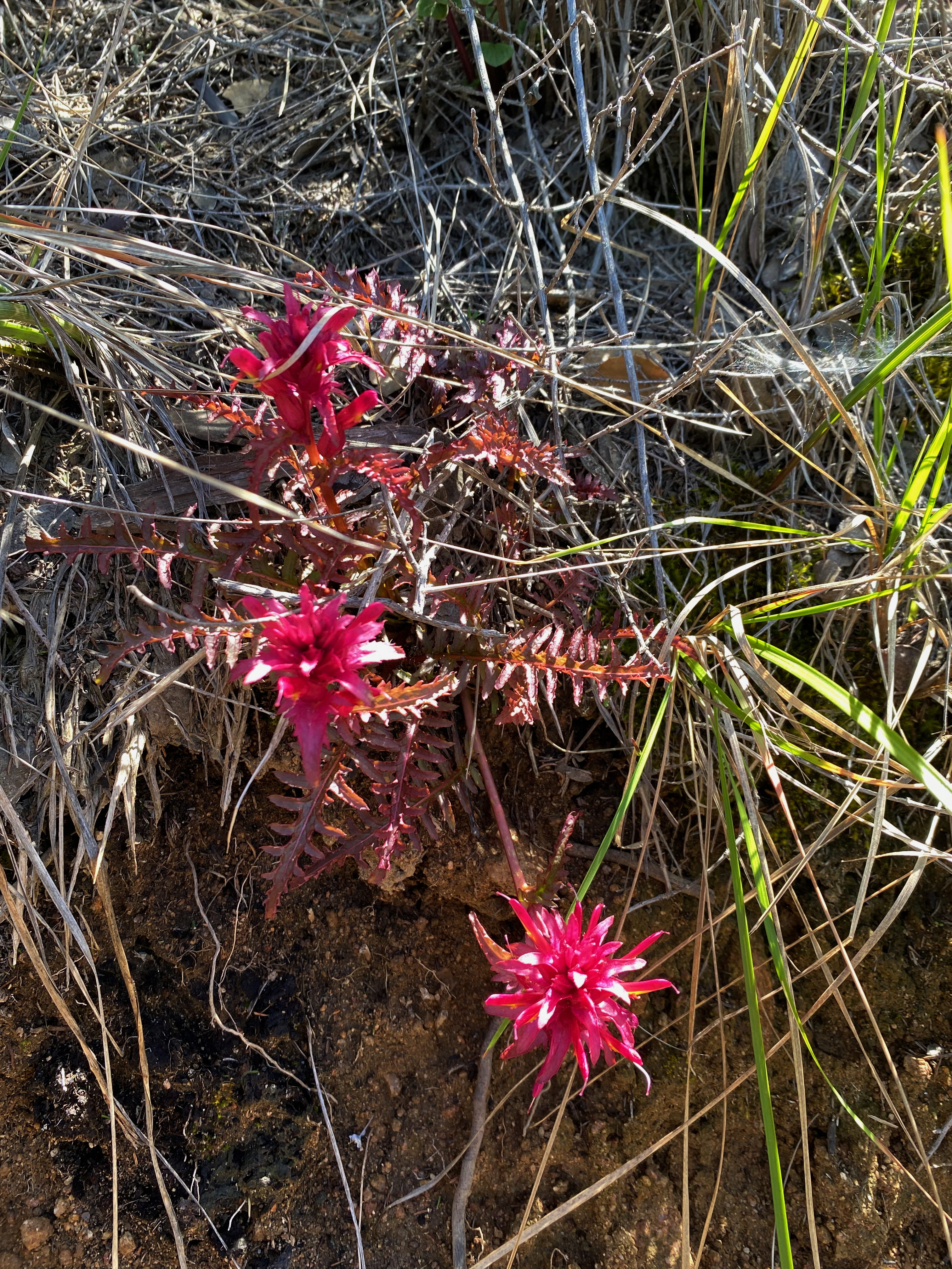
Indian WarriorYucca about ready to popBlue CanothusRed Monkeyflower
As you can see, wildflowers abounded. I think spring is an excellent time to do this summit
I spent about two hours on the summit and made 23 contacts including 4 summit-to-summit QSOs and a surprise contact with Hector CE3FZL in Chile! This was the result of Jon NT6E spotting me on POTA. Thank you Jon – my #1 chaser!
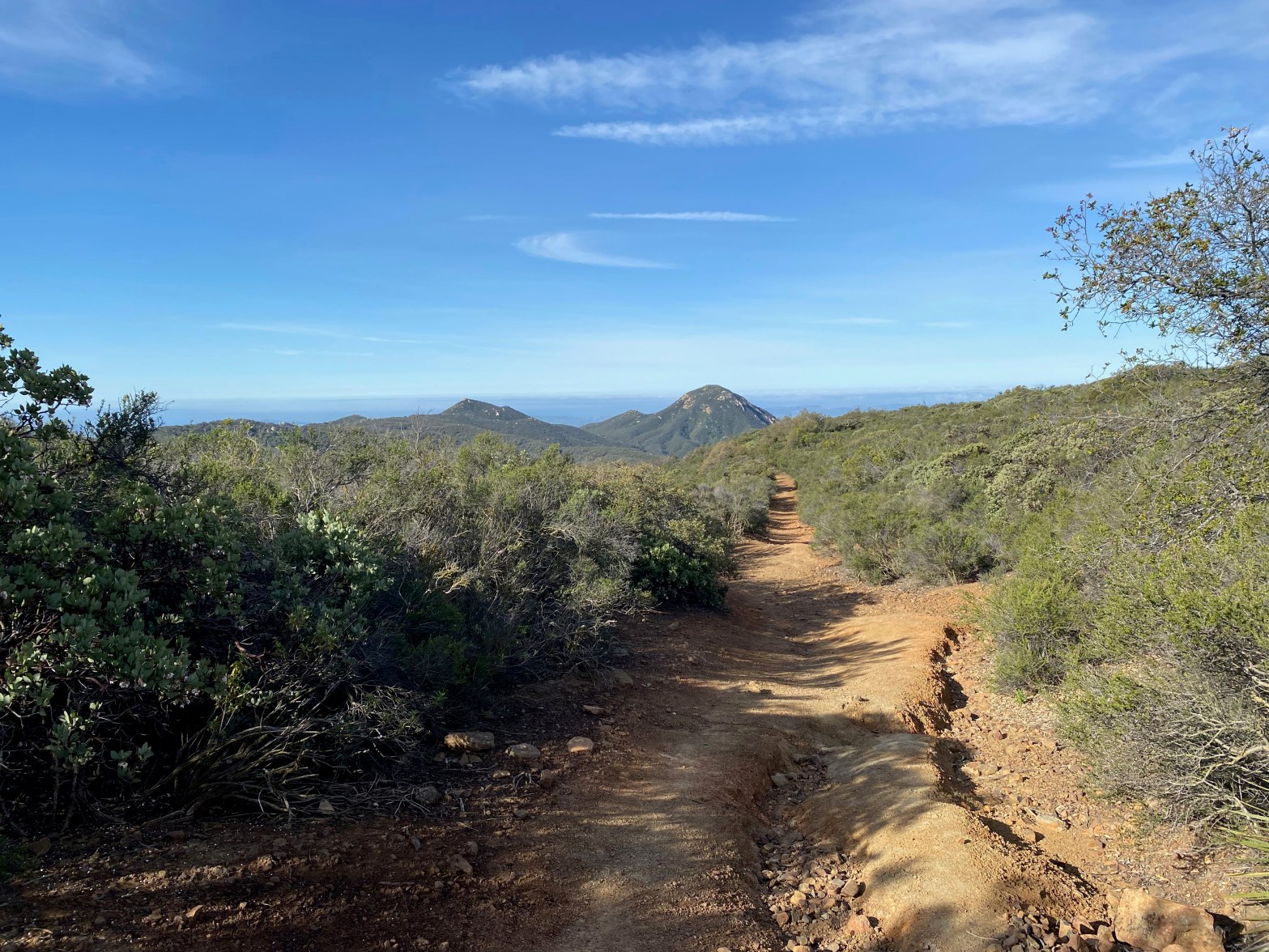
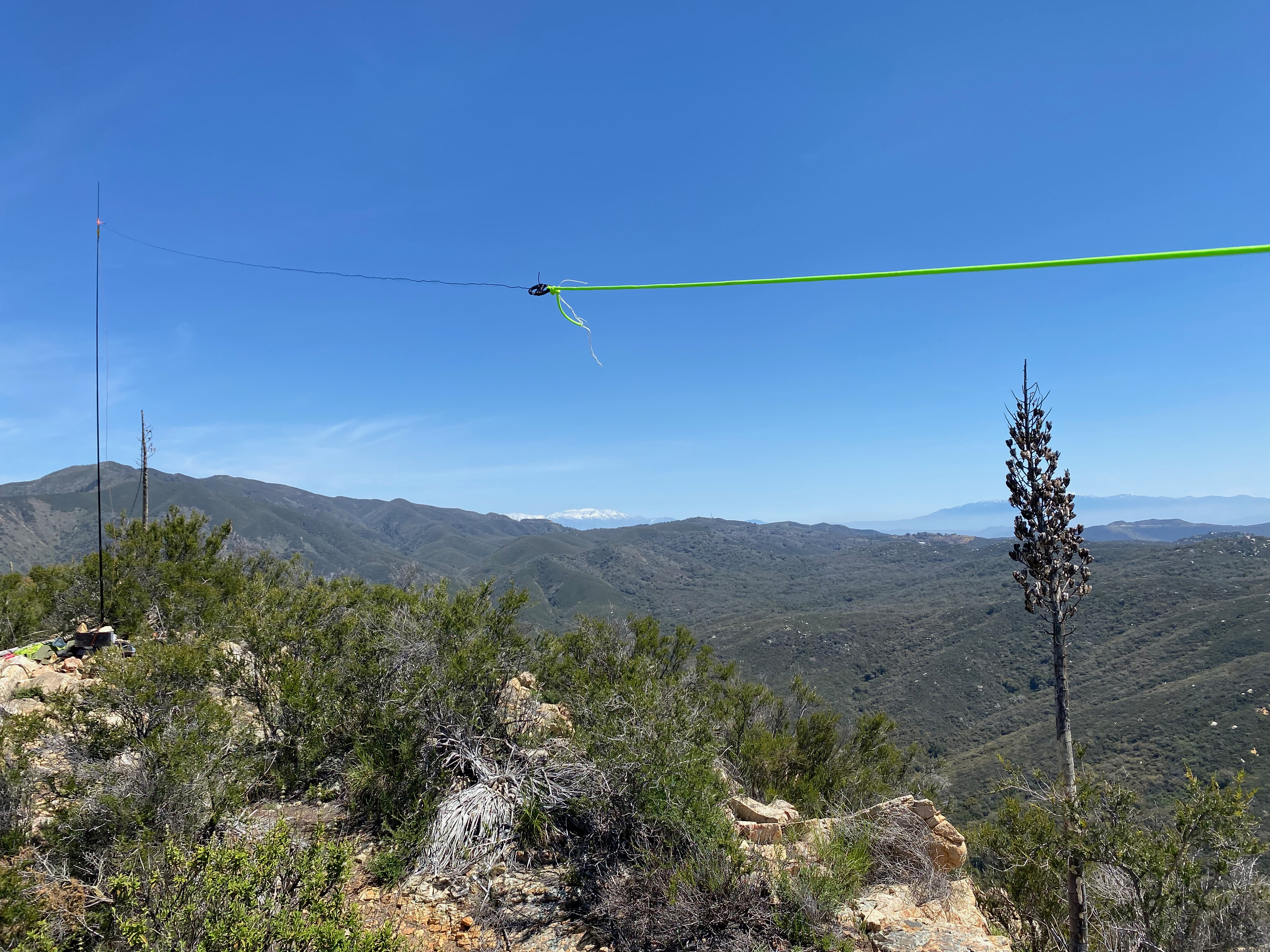
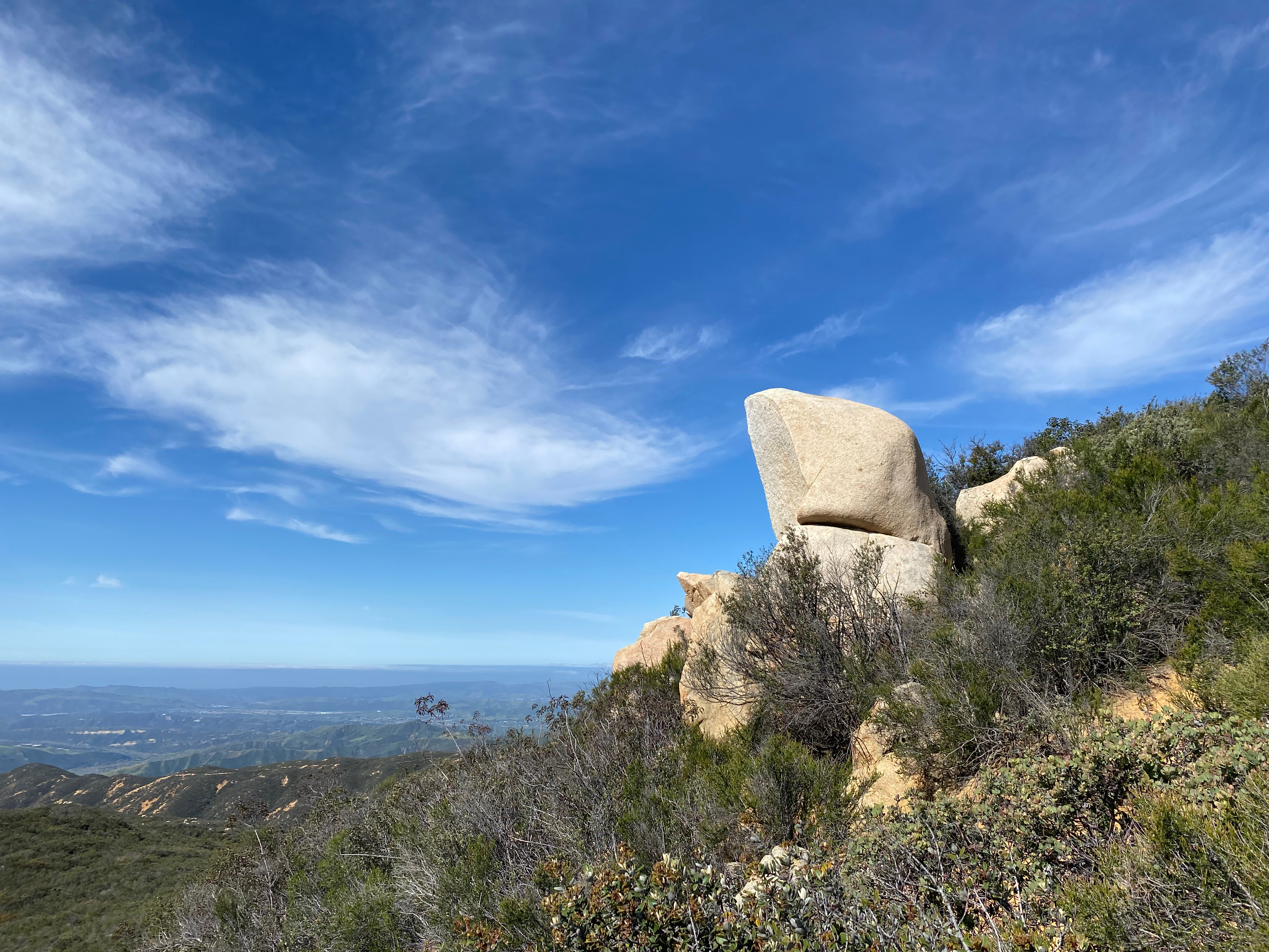
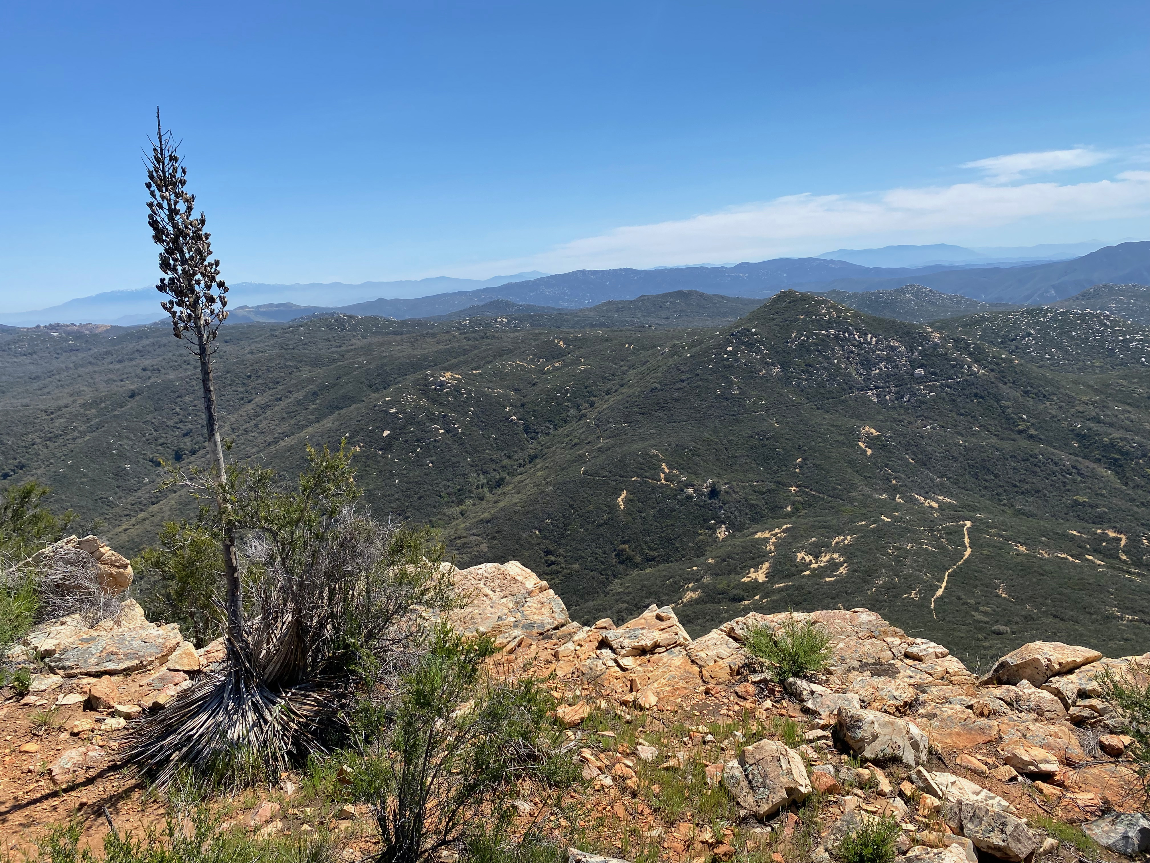
Here’s a close up of the abbreviated stationThe Packtenna looking northeast back to San Gorgonio PeakThe summit with Mount San Jacinto in the backgroundDeep ruts in places made this one a non-starter for this 67 year old mountain biker.Looking southeast back along pretty much the entire route along the San Juan TrailMount San Gorgonio and San Jacinto looking eastLooking north to Santiago PeakLooking at Sugarloaf from the trail back up what is called “Old Sugarloaf” on some maps. That is Santa Catalina Island in the distance on the left.
Looking south across the basin to Santiago Peak and the Santa Ana Mountains
1 APRIL 2023 W6/CT-151
Two Stars – a nice summit. I’d do it again. Recommended.
Elevation:
4,198′
Route:
Use trail and fire road
Hike Distance:
4.2 miles round trip
Elevation Gain:
1800′
Navigation:
Easy
Steepness:
Steep
Vehicle:
Passenger car
Road:
Paved
Cell Coverage:
Poor (Verizon)
Hike basics
This April Fools Day dawned clear and mild — perfect for a SOTA adventure. I got to the trailhead just off Mountain Avenue before sunrise and started up the very steep, very rutted old fire road/trail. Others have mentioned the steepness of this hike and given that it goes straight up the mountain front in the highest section of the San Gabriel Mountains, this did not surprise me. The hike is very much like a longer version of a hike I’ve done hundreds of times growing up in Pacific Palisades — High Peak.
At it’s steepest the hike borders on 3rd class in that I used my hands to climb. There is no serious exposure. I found this bush tunnel through the profusely blooming snowbrush (ceanothus) to be enchanting. I didn’t see anyone up or back. I would advise caution on a hot day as this is a south facing slope and I’m sure it bakes in the summer. Bring lots of water as it goes up mercilessly.
Snowbrush (ceanothus) on the way up.
The last time I did this summit my brother and I approached it from the fire roads that come in from the north via Stoddard Flat. This is a very long hike but a much more gentle incline. That was over 13 years ago so I can’t speak to the condition of that road today.
Interesting note for Parks on the Air: Frankish Peak straddles the boundry between the Angeles National Forest and the San Bernardino National Forest. Not sure if you can claim both parks with one activation.
Even though the HF band conditions were not great on 20m – 10m, I still had a lot of fun working many loyal chasers. I had three summit-to-summit contacts in California, Arizona and New Mexico.
Perhaps the biggest surprise of the day was randomly finding Carol K5TFL on Capilla Peak in New Mexico on 20m. After having okay cell service early it went out altogether just before noon, so I was unable to check SOTAWatch 3 for spots. I was just tuning up and down 20m when I found Carol calling CQ SOTA. My YL Cassie KG6MZR and I bumped into Carol on Ortiz Mountain in New Mexico earlier this year and enjoyed talking with this fascinating lady. How cool was it to get a completely rando s2s?!
Here’s a cool, short video shot with Chester the Drone. He gets photo-bombed by some swifts that thought he might be an edible cricket:
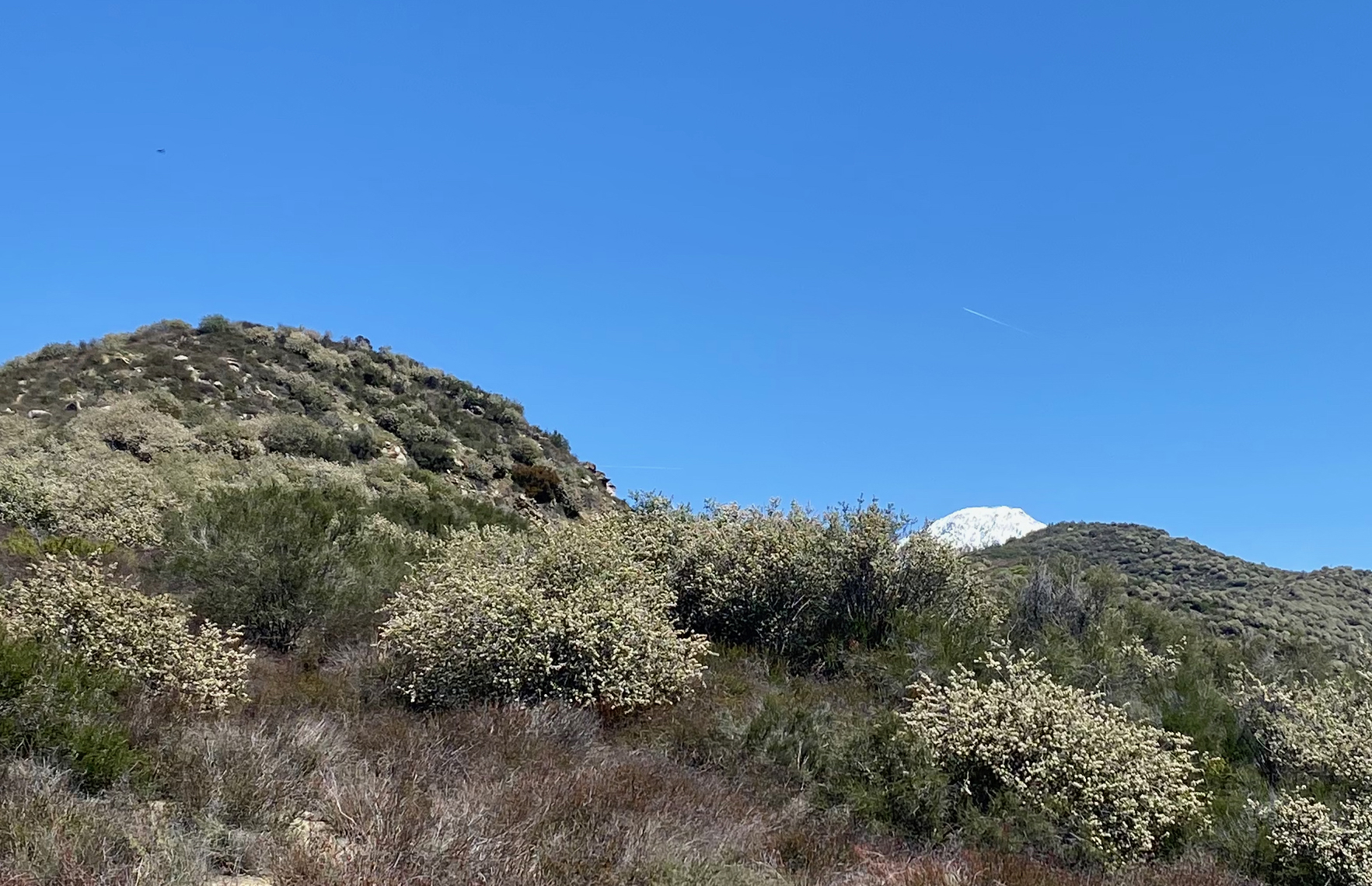
Snowy Cucamonga just peeking out from the snowbrush on the ridge up to Frankish peakSpanish Dagger and snowbrushThe summit looking north to Ontario and Cucamonga
A very pleasant spring hike through flower fields.
18 MARCH 2023 W6/CT-167
Two Stars – a nice summit. I’d do it again. Recommended.
Elevation:
3,788′
Route:
Motorcycle track
Hike Distance:
2.5 miles round trip
Elevation Gain:
635′
Navigation:
Easy
Steepness:
Steep in places
Vehicle:
Passenger car
Road:
Paved
Cell Coverage:
Excellent (Verizon), APRS Excellent
Hike basics
I hadn’t been out for a SOTA activation in weeks due to the heavy rain and snow in Southern California, so I was raring to go do a new one. There are four unnamed summits in the Crown Valley area and I really enjoy the solitude of this corner of the Santa Clara watershed. I’ve yet to see another person on these surprisingly enjoyable summits.
I got to the bottom of National Guard Road off Aliso Canyon road just before sunrise on this Saturday morning. Gentle breezes beneath clear skies foretold a nice hike. This Escondito Pass corridor can be mercilessly windy, but all was calm as I started out.
As others have noted there is a rather permanent “Road Closed” gate off Aliso Canyon at National Guard Road. The motor “sports” have made an obvious drive around but I chose to honour the “No Motor Vehicles” sign posted and left Whitedog in a large parking area.
I took a different route than the others have noted on the external links page of the SOTA database. Rather than head up the ridge immediately to the right of the fireroad and over several false summits, I followed National Guard Road up to where motorcycle tracks head up a ravine off to the right. Once up in the saddle, look for a (not obvious) track that goes around to the left of a steep hill immediately to the north at 34° 26.9613′ N, 118° 9.9294′ W.
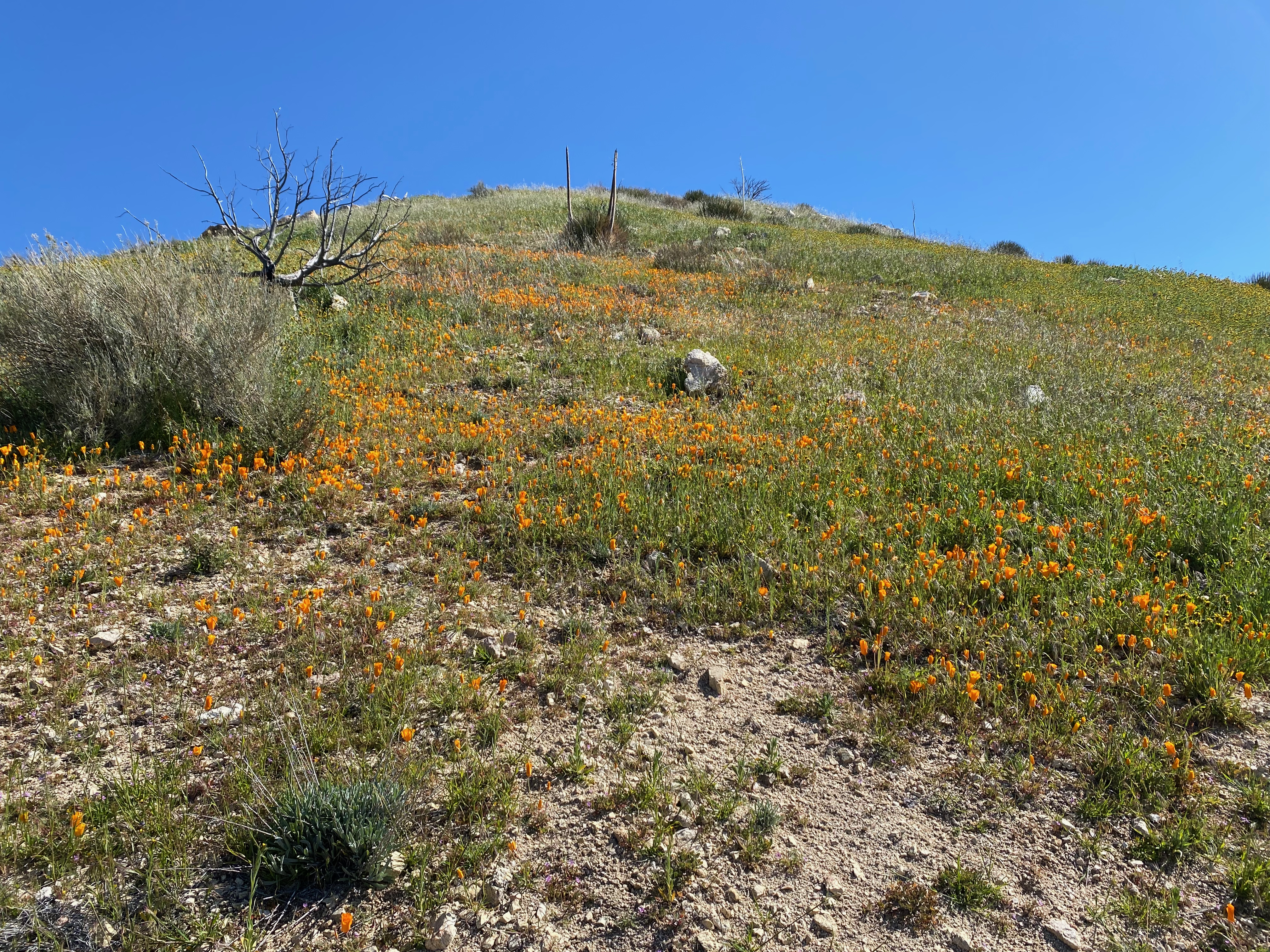
The hike up was laced with the beginnings of the California Poppy bloom and with all the moisture we’ve seen this should be a spectacular hike in a few weeks, All-in-all, I think this is a seldom visited but really nice SOTA summit. As others have noted the actual summit lies just over the boundary of the San Gabriel Mountains National Monument. It’s possible to stay on the south side of the summit off of the private property and still be in the activation zone. I didn’t worry about it given no “No Tresspassing” or “Private Property” signs and set up on the actual summit.
The activation was a lot of fun. I had 23 contacts. Christian F4WBN was a strong 58 on the KX2 and he gave me a 57 from France. I also worked first time SOTA chaser John McCarthy KE6SPO in Yorba Linda. Thank you all chasers for a fun day on the radio.
The wind was borderline for flying Chester the Drone but I did anyway with one mishap:
I passed this field of wild geraniums at Bloom Ranch on the way down.Did the famous “bush tie” to support the 10m fibreglass mast.The station looking south toward Mount Gleason.
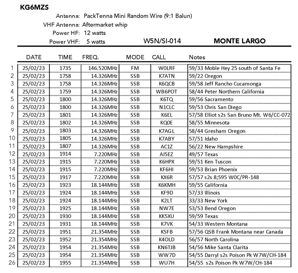
Due to heavy snowfall in New Mexico I limited my activations on this trip to some of the lower summits. Monte Largo was on my list to do as a complete and because of Fred KT5X’s glowing reports. As usual, there were a few flies in my SOTA ointment for this one. First, while I checked out the map the day before, I failed to load the detailed map into my Gaia GPS on my phone. This usually isn’t a problem if there is cell service but for some reason I had no cell service on this entire trip until I rebooted my phone in Albuquerque on the way back. I’m not sure if there actually was no cell service as reported above, or if it was just an iPhone glitch. So this meant that I had to negotiate the confusing approach through the neighbourhood from memory. This proved to be rather trying as this part of Sandia Park is a checker board maze of cul de sacs.
Then there was the matter of the hiking route itself. There is a pretty well established use trail to the summit, but I took a wrong turn (again due to not having the map downloaded) and ended up doing cross-country route.
On the way down I saw the actual use trail but didn’t take it just in case it led to some other completely different trailhead. The devil you know and all that. It was all good, however, it just made the whole thing a little more challenging. A good lesson in old-school route finding.
The activation was quite enjoyable and the wind eased enough for Chester the drone to fly. here is a short video of the summit:


Leave a comment