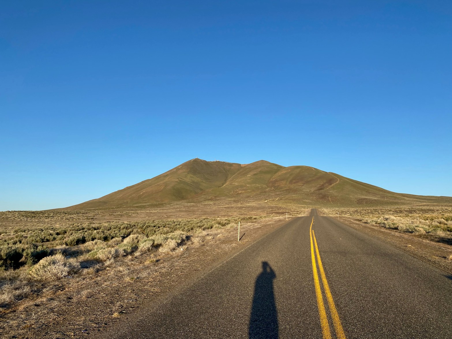
Sunrise on my way up to Winnemucca Mountain. Good road all the way to the top. 12-13 MAY 2023 W7N/HU-089 Elevation: 6,742′ Route: Drive up Hike Distance: n/a Elevation Gain: n/a Navigation: Easy Steepness: n/a Vehicle: Passenger car Road: Paved Cell Coverage: Excellent (Verizon), No APRS Hike basics So I looked for two mountains inContinue reading “Winnemucca Mountain & DN11”
Category Archives: Uncategorized
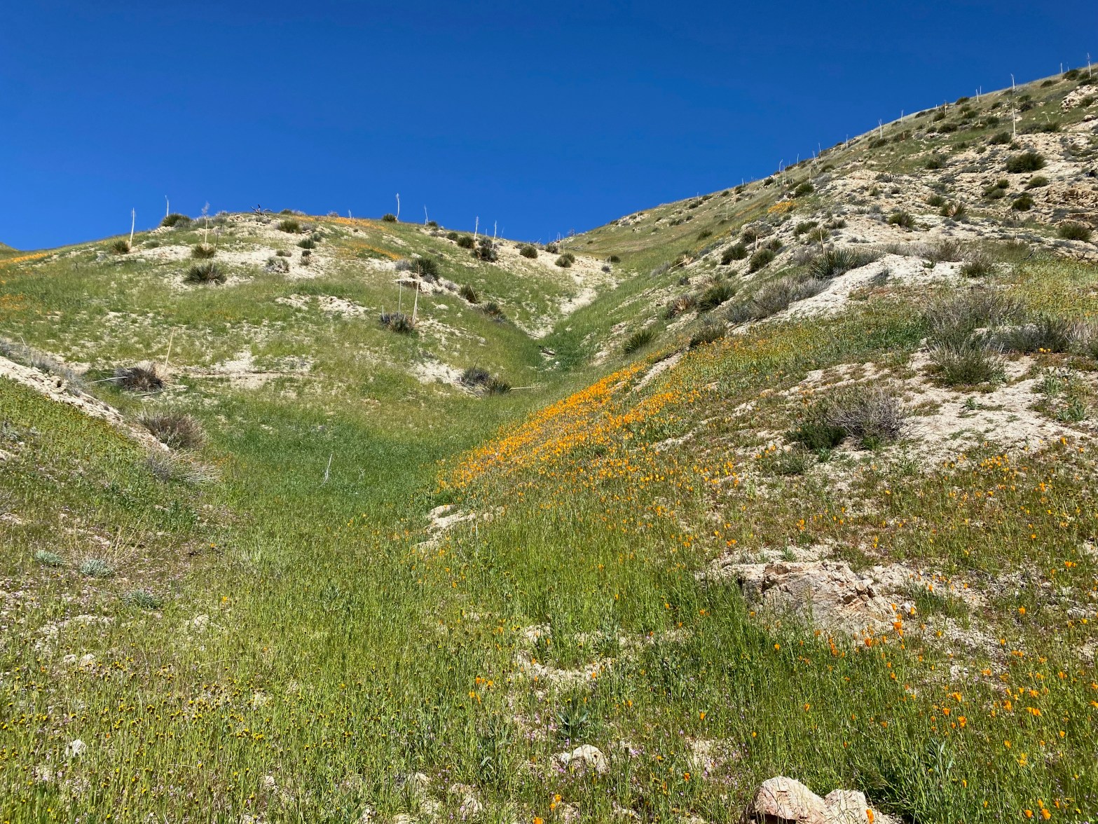
Silver Peak
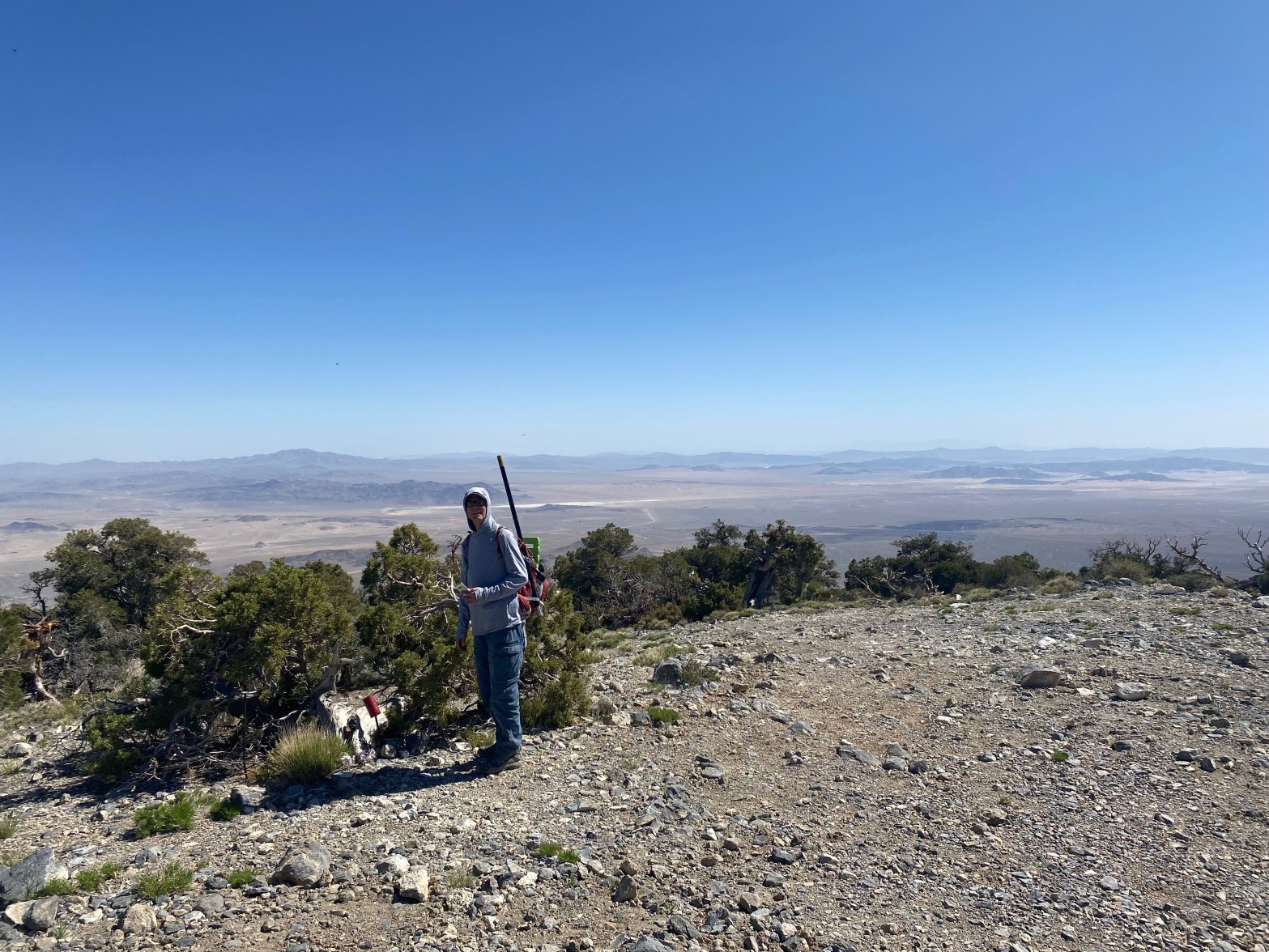
David Hodge N6AN on the summit 29 APRIL 2023 W6/CT-073 Elevation: 6,756′ Route: Dirt road and use trail Hike Distance: 4 miles round trip Elevation Gain: 1000′ Navigation: A bit tricky Steepness: Very steep Vehicle: Passenger car Road: Forest service dirt Cell Coverage: Excellent (Verizon), APRS Excellent Hike basics David N6AN and I had beenContinue reading “Silver Peak”
Summit 4,580
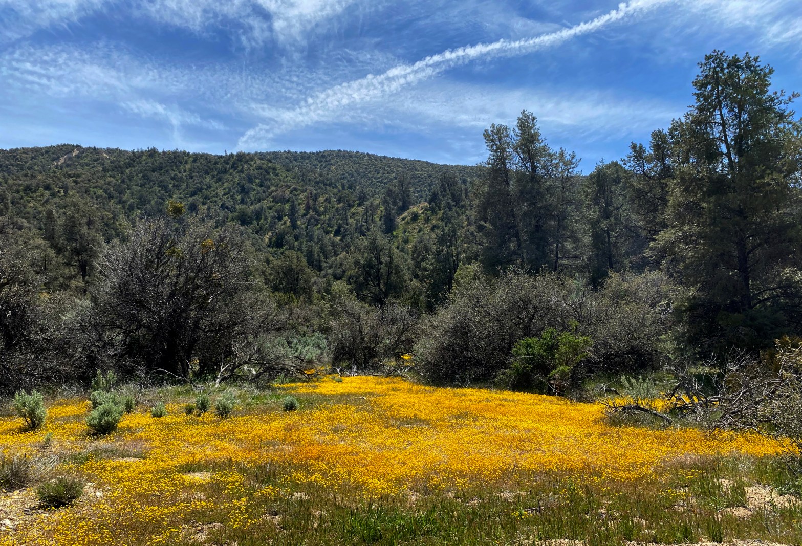
Apache Canyon was carpeted for miles with these little daisies. 22 APRIL 2023 W6/SC-392 I loved this adventure! Great time of the year with comfortable mild weather. I would give this one 3 stars except this is really not a summit for everyone. I left my home in Topanga at 4:15 AM and was surprisedContinue reading “Summit 4,580”
Summit 4,054′

Summit 4,054′ is a fine looking summit at the end of a steep hike. 15 APRIL 2023 W6/CT-156 Elevation: 4,054′ Route: Cross country and steep training trail Hike Distance: 4 miles round trip Elevation Gain: 2,000′ including 200′ on the return Navigation: A bit tricky to start, then easy Steepness: Steep Vehicle: Passenger car Road:Continue reading “Summit 4,054′”
Sugarloaf
Here”s the trail leading an up and down roller-coaster pointing right at the summit itself. This was a surprisingly enjoyable 2 pointer. I was rewarded with a terrific activation that included 4 summit-to-summit contacts and my first chase from Chile! 8 APRIL 2023 W6/SC-405 Elevation: 3,326′ Route: Deeply eroded trail and use trail Hike Distance:Continue reading “Sugarloaf”
Frankish Peak

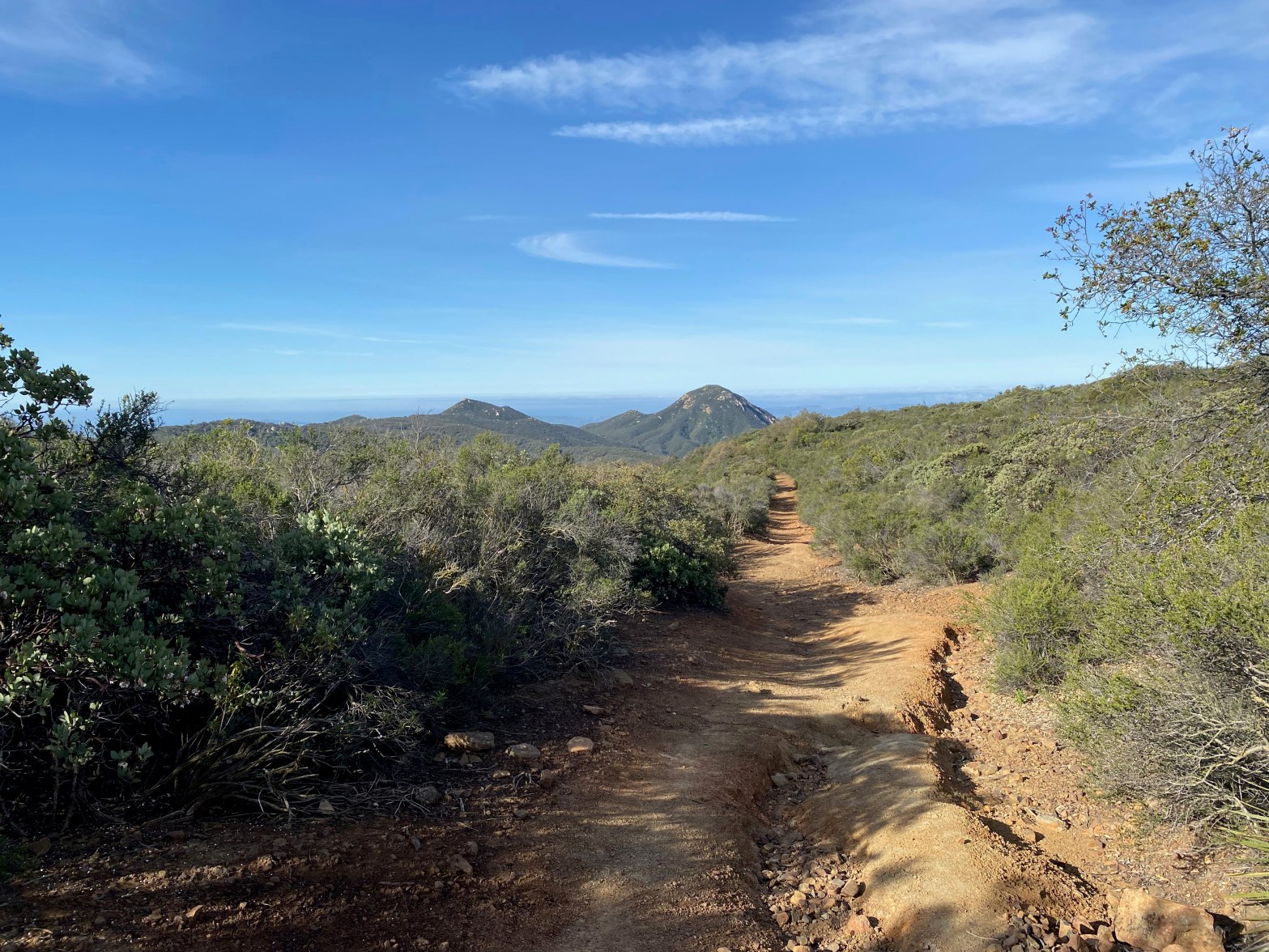
Looking south across the basin to Santiago Peak and the Santa Ana Mountains 1 APRIL 2023 W6/CT-151 Elevation: 4,198′ Route: Use trail and fire road Hike Distance: 4.2 miles round trip Elevation Gain: 1800′ Navigation: Easy Steepness: Steep Vehicle: Passenger car Road: Paved Cell Coverage: Poor (Verizon) Hike basics This April Fools Day dawned clearContinue reading “Frankish Peak”
Summit 3,788
A very pleasant spring hike through flower fields. 18 MARCH 2023 W6/CT-167 Elevation: 3,788′ Route: Motorcycle track Hike Distance: 2.5 miles round trip Elevation Gain: 635′ Navigation: Easy Steepness: Steep in places Vehicle: Passenger car Road: Paved Cell Coverage: Excellent (Verizon), APRS Excellent Hike basics I hadn’t been out for a SOTA activation in weeksContinue reading “Summit 3,788”
Monte Largo

Looking southwest at the station on the summit. 25 FEBRUARY 2023 W5N/SI-014 Elevation: 7,710′ Route: Use trail Hike Distance: 2.6 miles round trip Elevation Gain: 675′ Navigation: A bit tricky Steepness: Moderate Vehicle: Passenger car Road: Paved Cell Coverage: None (Verizon), APRS Excellent Hike basics Due to heavy snowfall in New Mexico I limited myContinue reading “Monte Largo”
Rough and Ready Hills

Here’s the station on the summit with the Organ Mountains near Las Cruces in the background. Looking east. 5 FEBRUARY 2023 W5N/RO-015 This was one of my more goofy days is pursuit of a SOTA summit. Originally I had thought to try and activate a summit in Texas. I spent the night in Las CrucesContinue reading “Rough and Ready Hills”
Blue Mountain

Blue Mountain from the gate off Highway 80 4 FEBRUARY 2023 W5N/PL-008 Elevation: 5,774′ Route: Cross country Hike Distance: 2.3 miles round trip Elevation Gain: 950′ Navigation: Easy Steepness: Moderate Vehicle: High clearance suggested Road: Dirt Cell Coverage: Good (Verizon), APRS Excellent Hike basics On my way to Cassie’s little adobe casita in north-central NewContinue reading “Blue Mountain”
