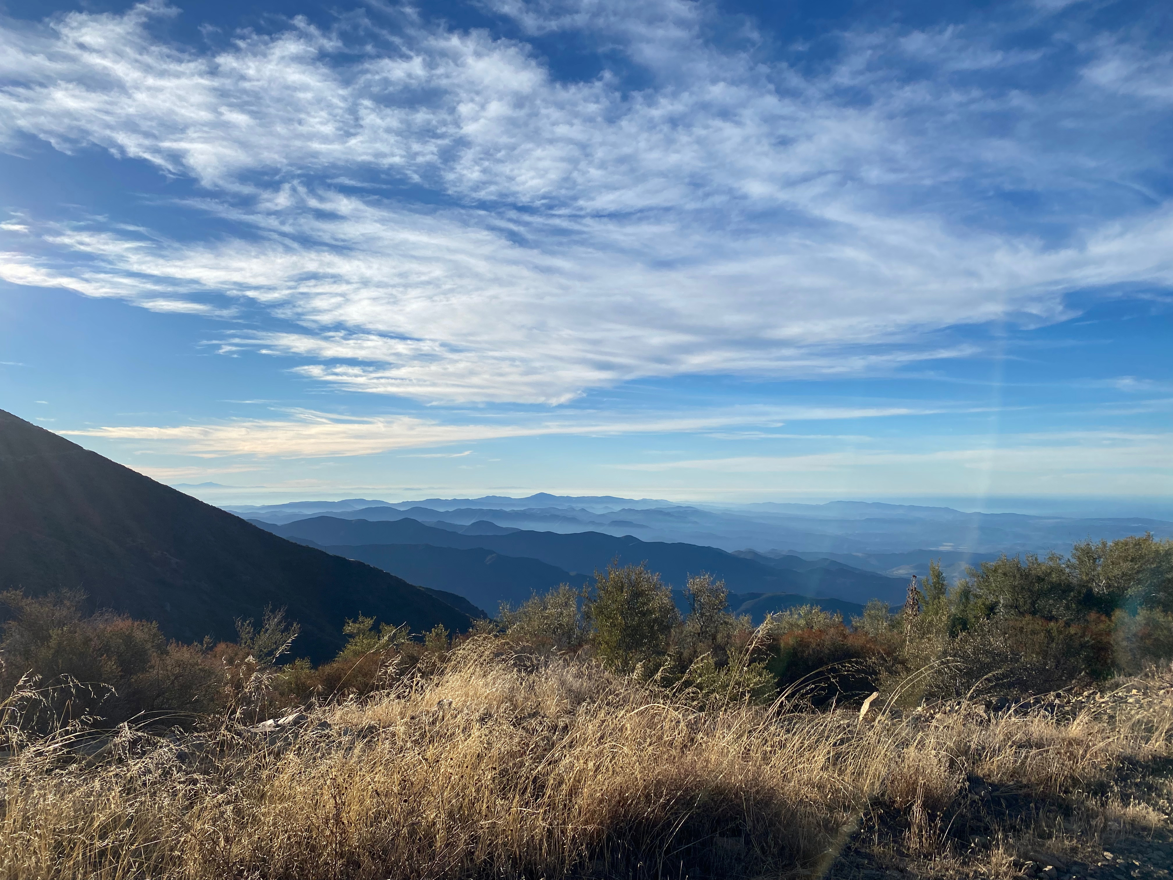
Looking west over the summit to the Sespe/Topatopa Wilderness. Hines Peak and Santa Paula Peak visible
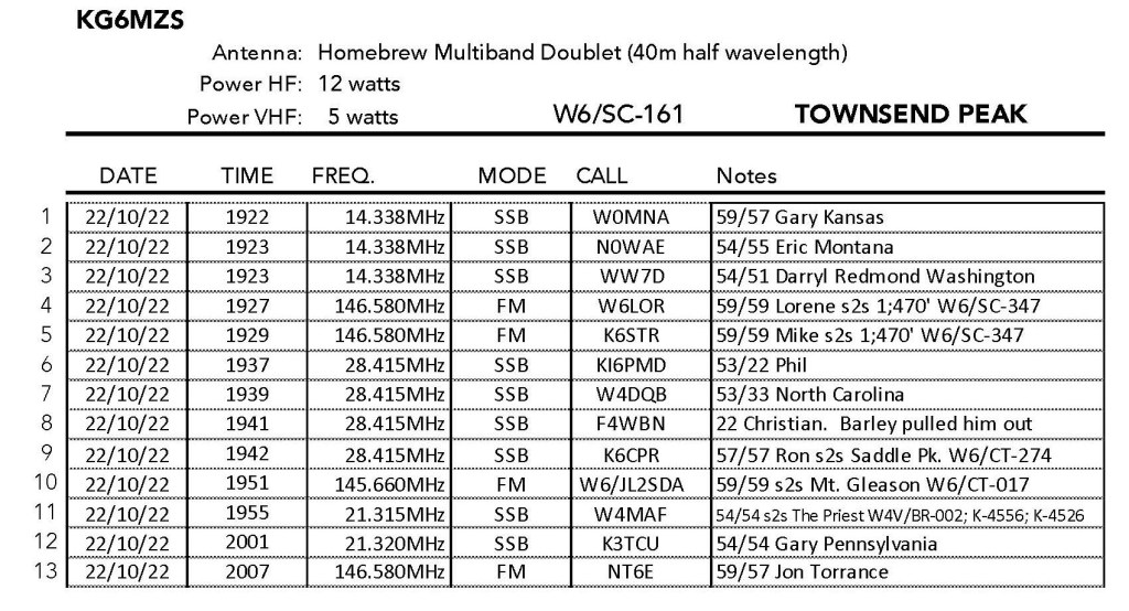
22 FEBRUARY 2025 W6/CT-104
Two Stars – a nice summit. I’d do it again. Recommended.
Elevation:
4,300′
Route:
Cross country
Hike Distance:
1.6 miles round trip*
Elevation Gain:
750′
Navigation:
Easy
Steepness:
Steep
Vehicle:
Passenger car
Road:
Good dirt road
Cell Coverage:
Good Verizon
*Locked gate adds 2 miles and 400′ gain. Mountain bikeable.
After doing Harold Beacon Benchmark I found the gate open off Aliso Canyon Road, so I drove Whitedog up the Edison Road to the saddle below Summit 4,300′. The hike is short and steep with good footing.
My efforts were rewarded with a pleasant activation. Note: this is not a good summit for 2 meters. the San Gabriel Mountains screen out the Los Angeles Basin.
Two Stars – a nice summit. I’d do it again. Recommended.
Elevation:
4,460′
Route:
Short cross country
Hike Distance:
.6 miles round trip
Elevation Gain:
250′
Navigation:
Easy
Steepness:
gentle
Vehicle:
SUV High clearance recommended
Road:
Edison dirt road
Cell Coverage:
Good (Verizon), APRS Excellent
Hike basics
This activation didn’t exactly go smoothy but ended up being surprisingly enjoyable. In preparing for this one I noticed that the formidable Mountain Goat Dan NA6MG has done this one no less than 6 times! That’s a lot even for Dan so I suspected that this was a good one.
The only thing that wasn’t clear to me was access. KB1KXL had mentioned a locked gate so I pulled up the private property map on my Gaia GPS app:
I saw that the BPL road had access points that seemed to be all within the San Gabriel Mountains National Monument so I drove off the Angeles Forest Highway to Aliso Canyon Road. I found an access point that had an open gate with a sign that warned that the road was patrolled and that damaging the powerlines was a crime with a $1,000 fine but no road closed, private property, no tresspassing or keep out signs. I suspect the road to the west was probably a little shorter and less steep, but I didn’t check it out for a gate.
Upon getting to the point of the BPL road that was the trailhead. I discovered that I had left my SOTA pack in the driveway at home. Again. New rule: car must be packed the night before any before-dawn SOTA excursions. I tend to leave stuff in the hour before my bucket of strong coffee has kicked in.
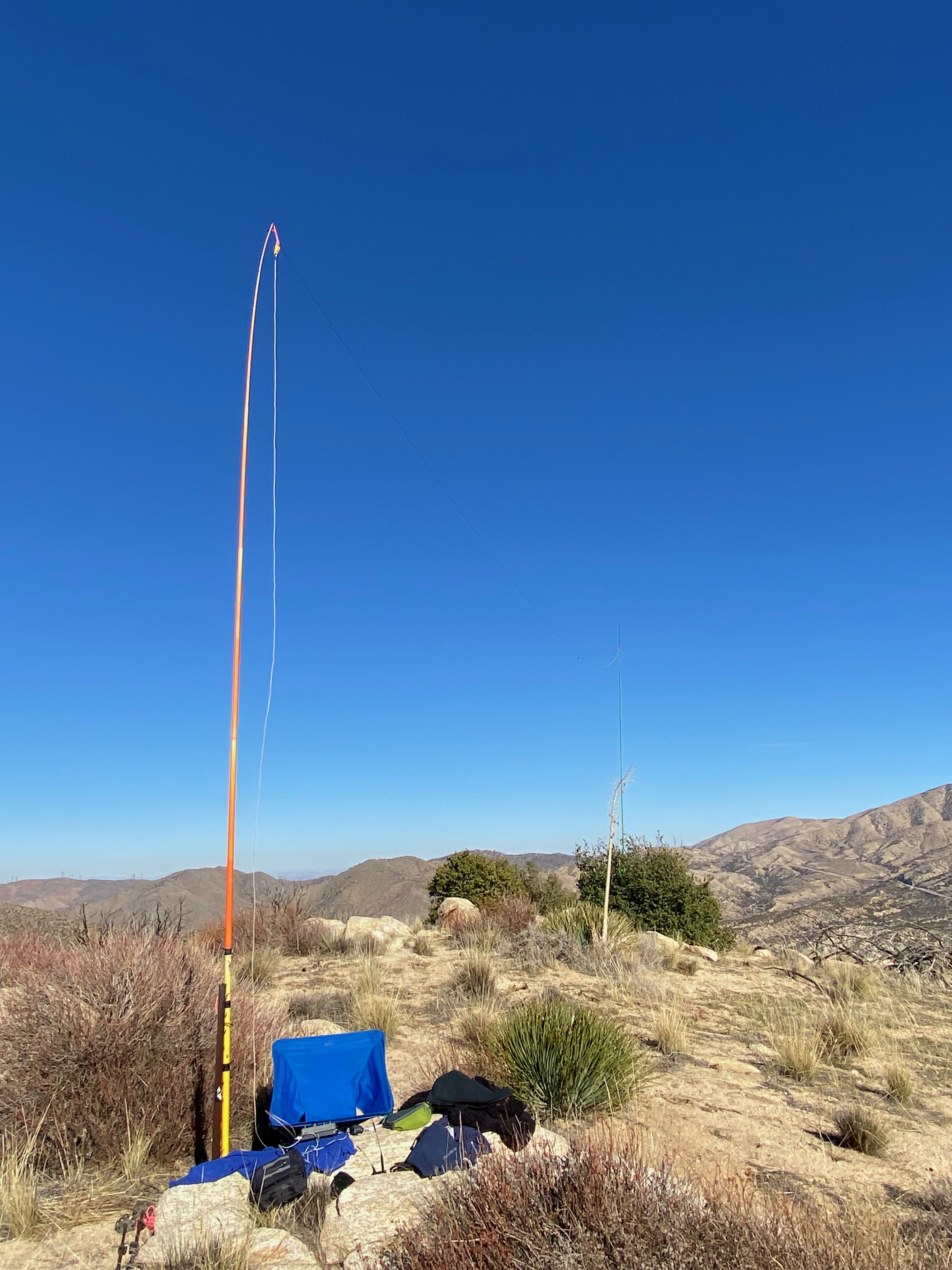
Once again, however, I did have my trusty Yaesu FT-5DR and, strangely enough, Chester the Drone. I knew that making contacts on this side of the San Gabriel Mountains with 5 watts and a glorified rubber duck antenna would be iffy, but, what the hay, I’d come this far.
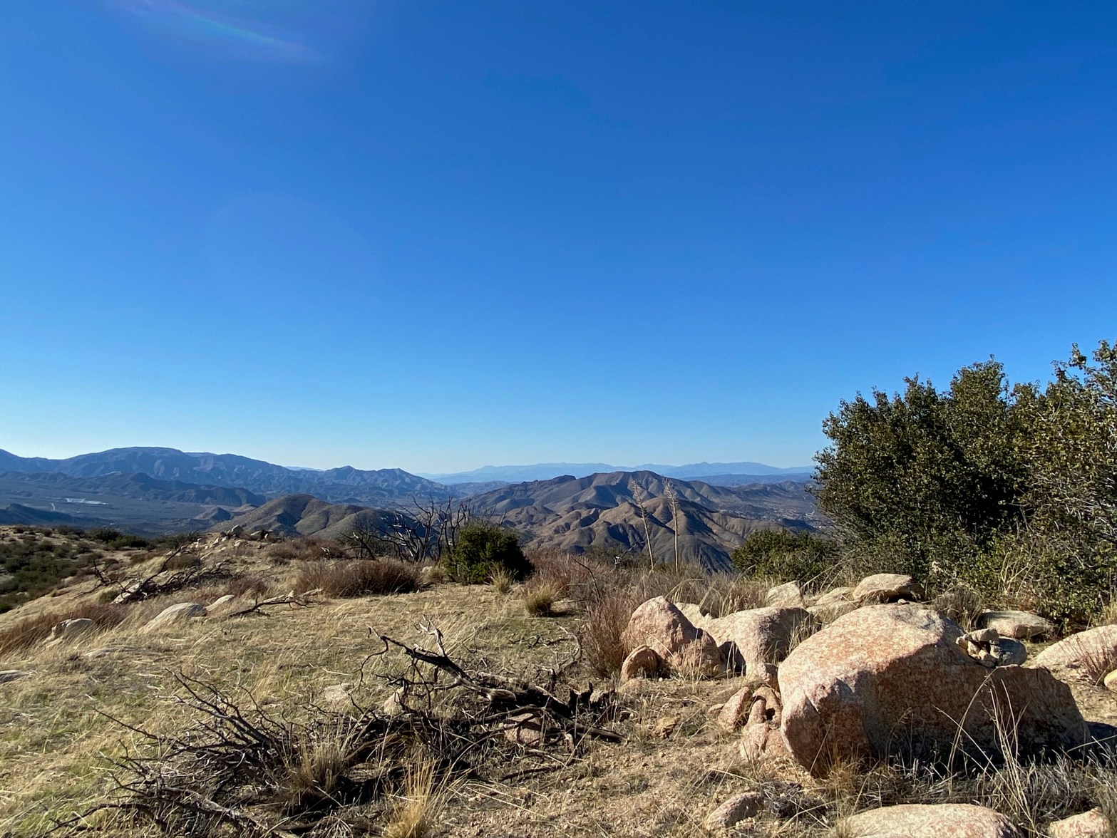
The “hike” is short – just a third of a mile and up 250 feet or so, but the summit was surprisingly nice with a good antenna support – If I had an antenna to support 😉 I started calling CQ … and calling… …and calling… Just one contact would count as an activation if not give me the points, so I kept calling. Even with a spot on SOTAWatch3 I was having no luck on 146.580, so I jumped over to the national calling frequency 146.520 in hopes of catching a total rando.
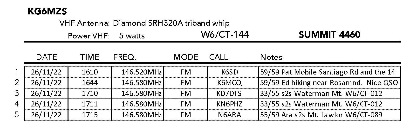
Eureka! Pat K6SD was motoring on Soledad Canyon Road and came back to me full quieting. We chatted for a bit and I was happy to at least get the activation. I flew the drone and took some photos waiting a bit because it was still pretty early.
Then I caught KD7DTS and KN6PHZ hiking on their way up Mount Waterman. Hoo hoo! only one more needed for the points. Then I caught Ed K6MCQ hiking near his home out near Rosamond. We had a long, very pleasant ragchew. Activation points secured! I hung out waiting for those guys to reach the summit of Waterman when I heard Ara N6ARA work them summit-to-summit. Score – I worked all three for more s2s points then I had managed in a month or more.
I originally had planned to activate 4,300 W6/CT-262 as well but my battery was running low on the HT so I just marked the jump-off point from the BPL road (red waypoint on the map above) for next time.
The bonus epilogue to the day was that DTS and PHZ went on to activate East Twin Peak and I worked them once I got back home for my second complete of the day. Lemonade from lemons!
Looking east toward Mount San Gorgonio and Mount San Jacinto.
5 NOVEMBER 2022 W6/CT-026
One star – Nothing special but I’d do it again.
Elevation:
5,495′
Route:
4×4 route
Hike Distance:
2 miles round trip
Elevation Gain:
500′
Navigation:
Easy
Steepness:
Gentle
Vehicle:
SUV High clearance recommended
Road:
Forest Service dirt
Cell Coverage:
Good (Verizon), APRS Excellent
Hike basics
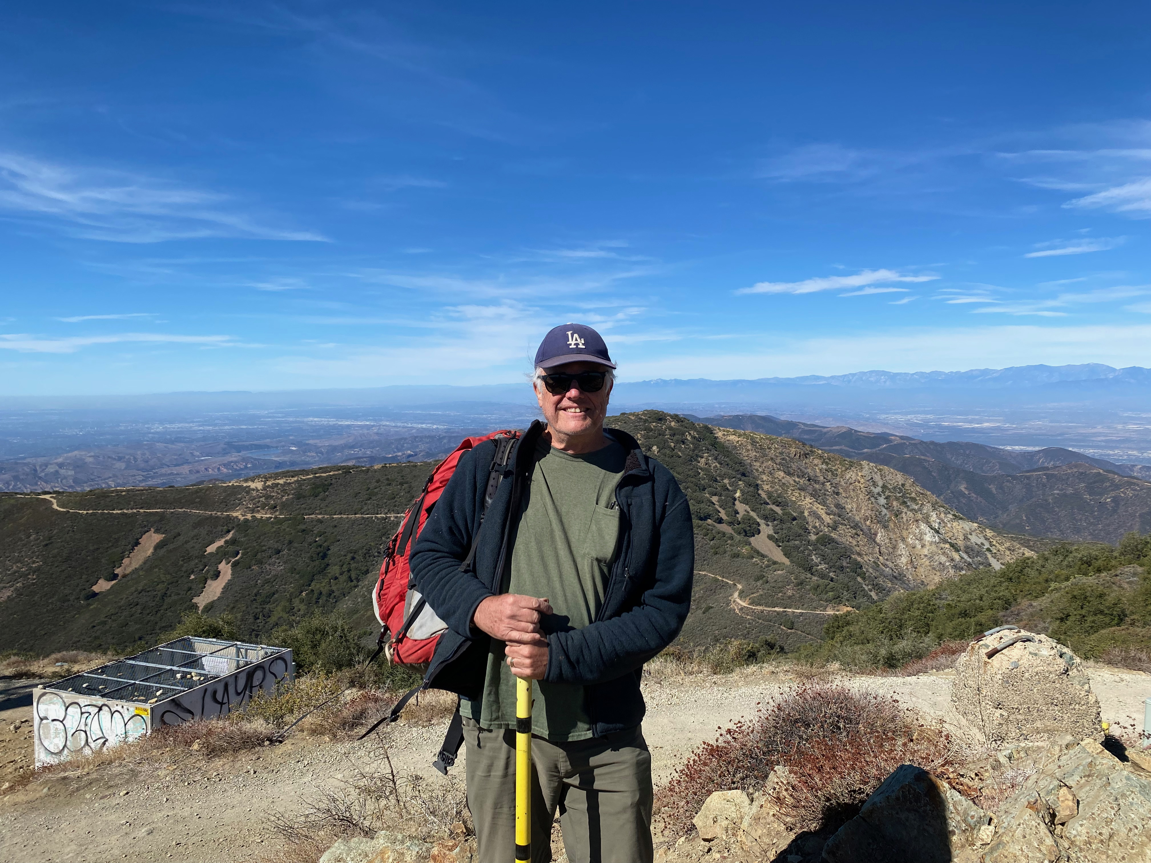
Modjeska Peak is named for the famous Polish actress Helena Modjeska who immigrated to the United States and lived in Silverado Canyon below the peak. I last ascended Modjeska Peak in the waning winter days of 1997. In my log I noted that there was a drunk guy on the summit that made the trip rather disagreeable. I suppose Santiago and Modjeska Peaks – together comprise what is popularly called “Saddleback Mountain” – are must-dos for any southern California SOTA activator, so I very grudgingly give them both one star even though I am unlikely to return to either summit.
This trip wasn’t much more agreeable than my last visit last century. For one thing, the foothills below have become wildly developed in a maze of bedroom communities and cul de sacs. The two freeways in the area are both toll roads and, not knowing the toll protocol, I ventured into the labyrinth of Orange County suburbs. It took me quite a while to finally get from the 5 freeway to Silverado Canyon. The mountain is very popular and a LOT of OHVs were around. The dust, noise, trash and general lack of regard for the right-of-way (uphill vehicles) made the long drive up to North Divide Road un-fun.
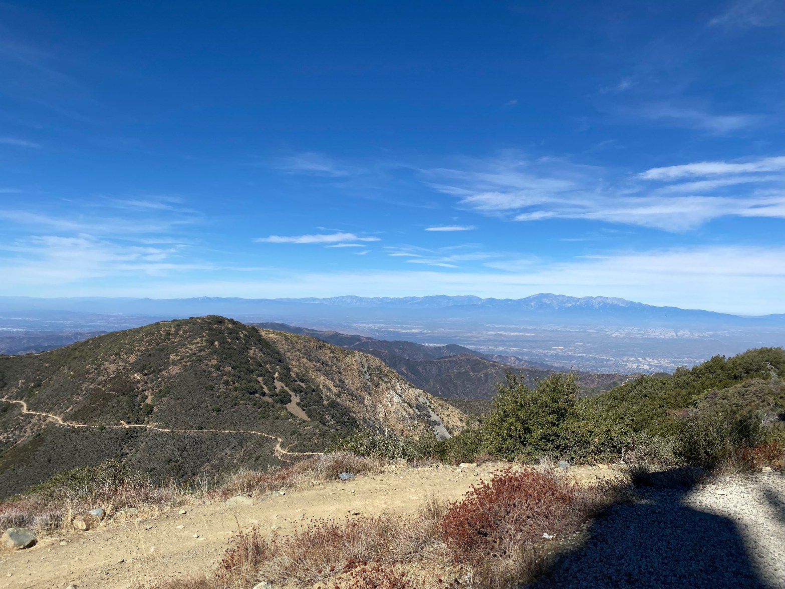
There was a lot of trash on the summit. The whole experience left a bad taste in my mouth. It is possible to 4 wheel to the actual summit but I opted to walk the mile or so from North Divide Road. The one redeeming virtue of Modjeska and Santiago is the outstanding view of the Santa Monica Mountains, The San Gabriel Mountains, The San Bernardino Mountains, San Jacinto and both Santa Catalina and San Clemente Islands.
Access at the end of Silverado Canyon is via Maple Springs. There is a gate there that is closed seasonally. Call the Trabuco ranger station of the Cleveland National Forest for the status on the gate.
The road was mostly good with one notable exception. I was glad to have the 4×4 for that, but my previous two trips up to North Divide Road in the 1990s was in a Volvo sedan. the road seems a little rougher these days due to so much use.
The stationLooking south off the shoulder of Santiago PeakLooking west toward Santa Catalina Island.Santiago Peak
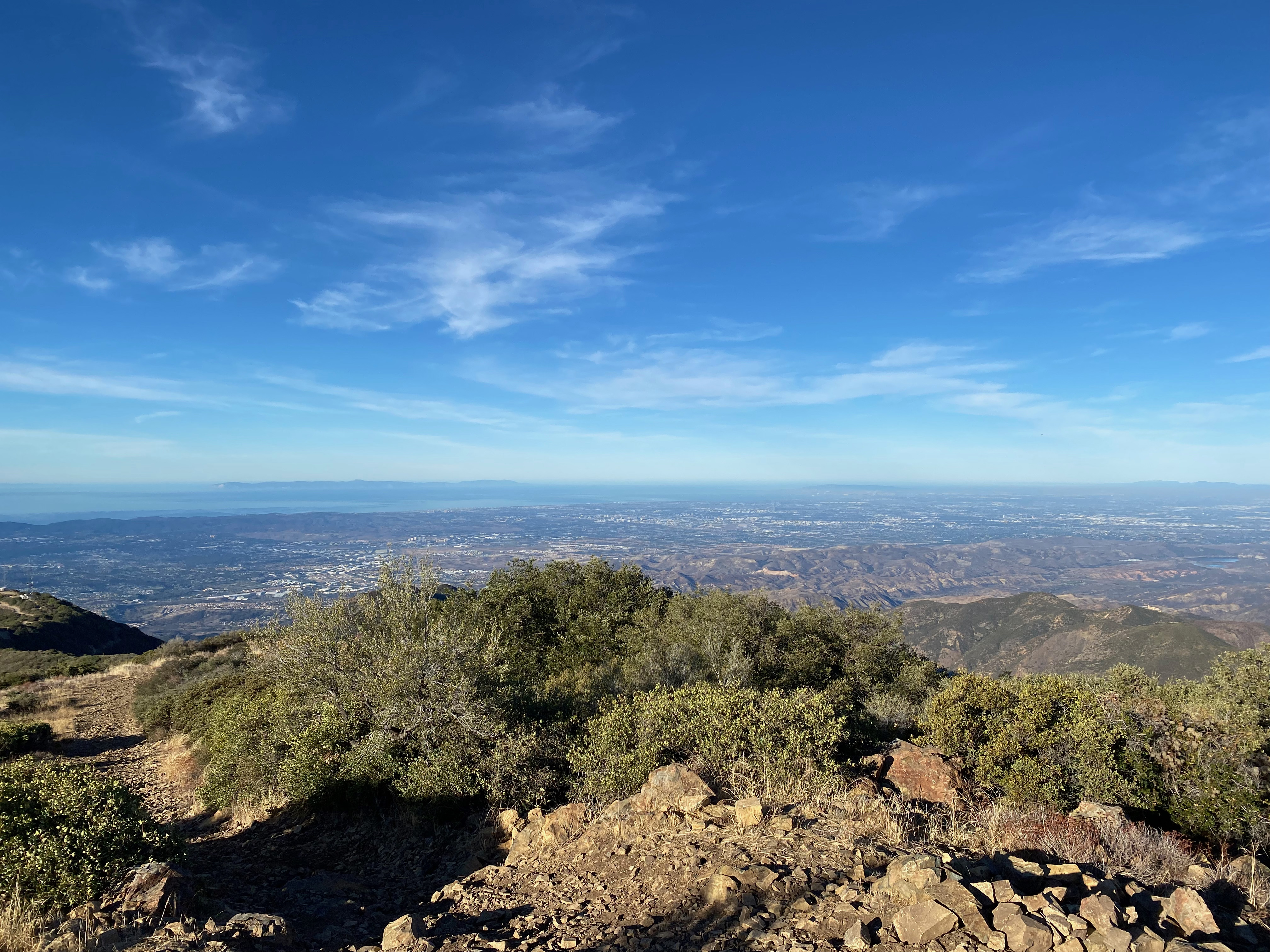
Looking northeast toward the Tehachapi Mountains and the Antelope Valley.
20 NOVEMBER 2022 W6/CT-259
One star – Nothing special but I’d do it again.
Elevation:
4,541′
Route:
n/a
Hike Distance:
n/a
Elevation Gain:
n/a
Navigation:
Easy
Steepness:
n/a
Vehicle:
Passenger car
Road:
Good dirt road
Cell Coverage:
Good Verizon
Hike basics
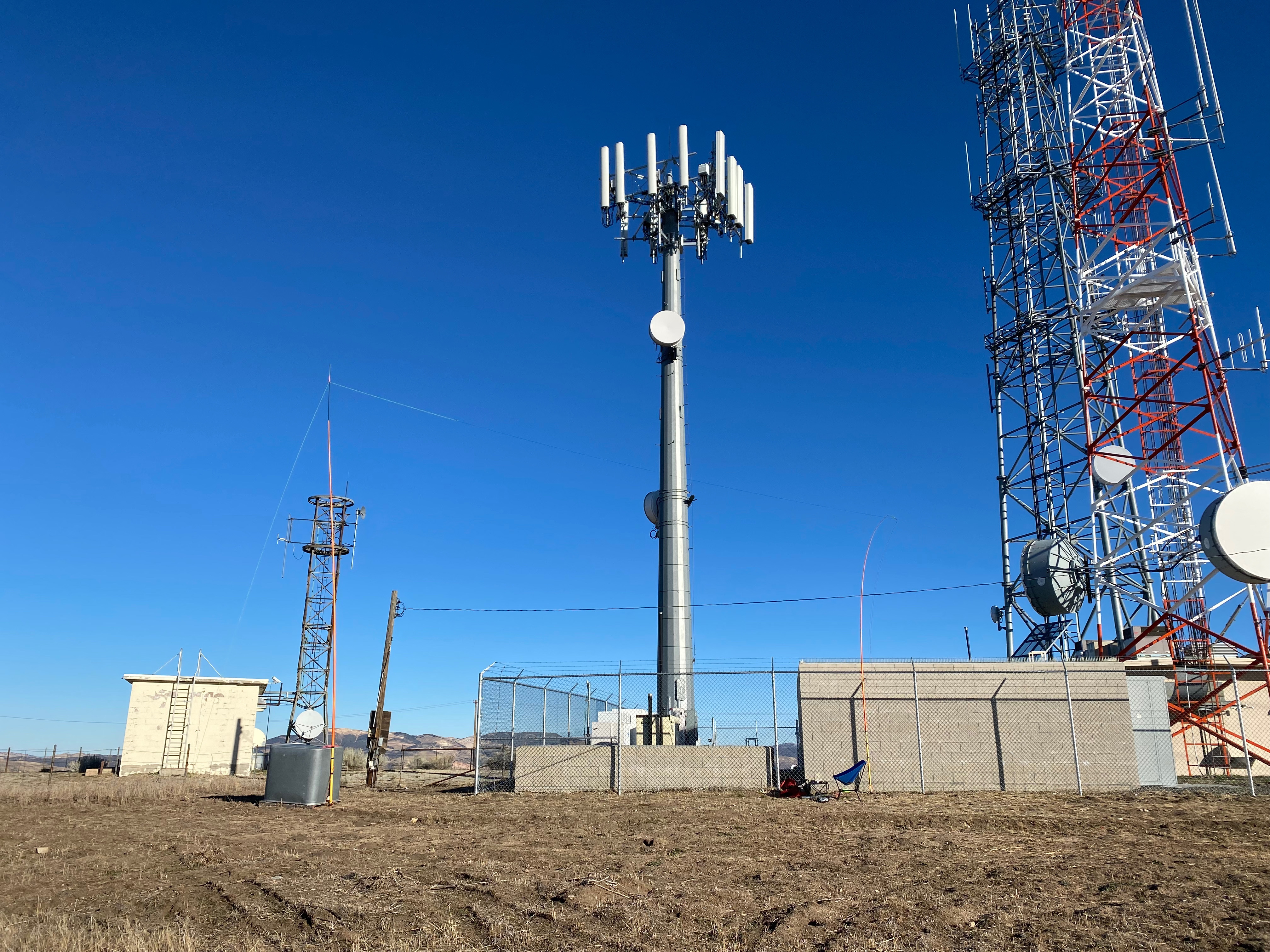
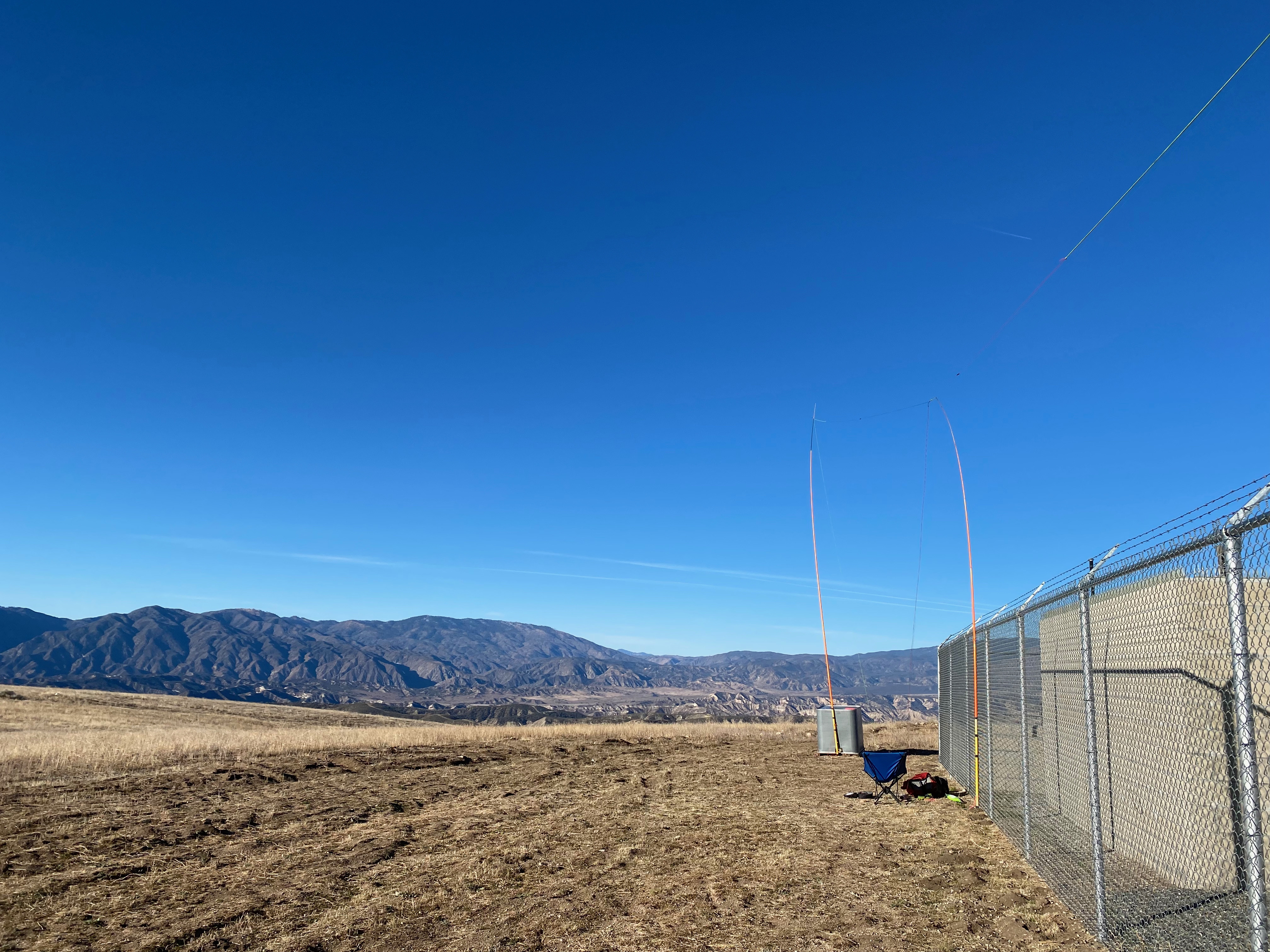
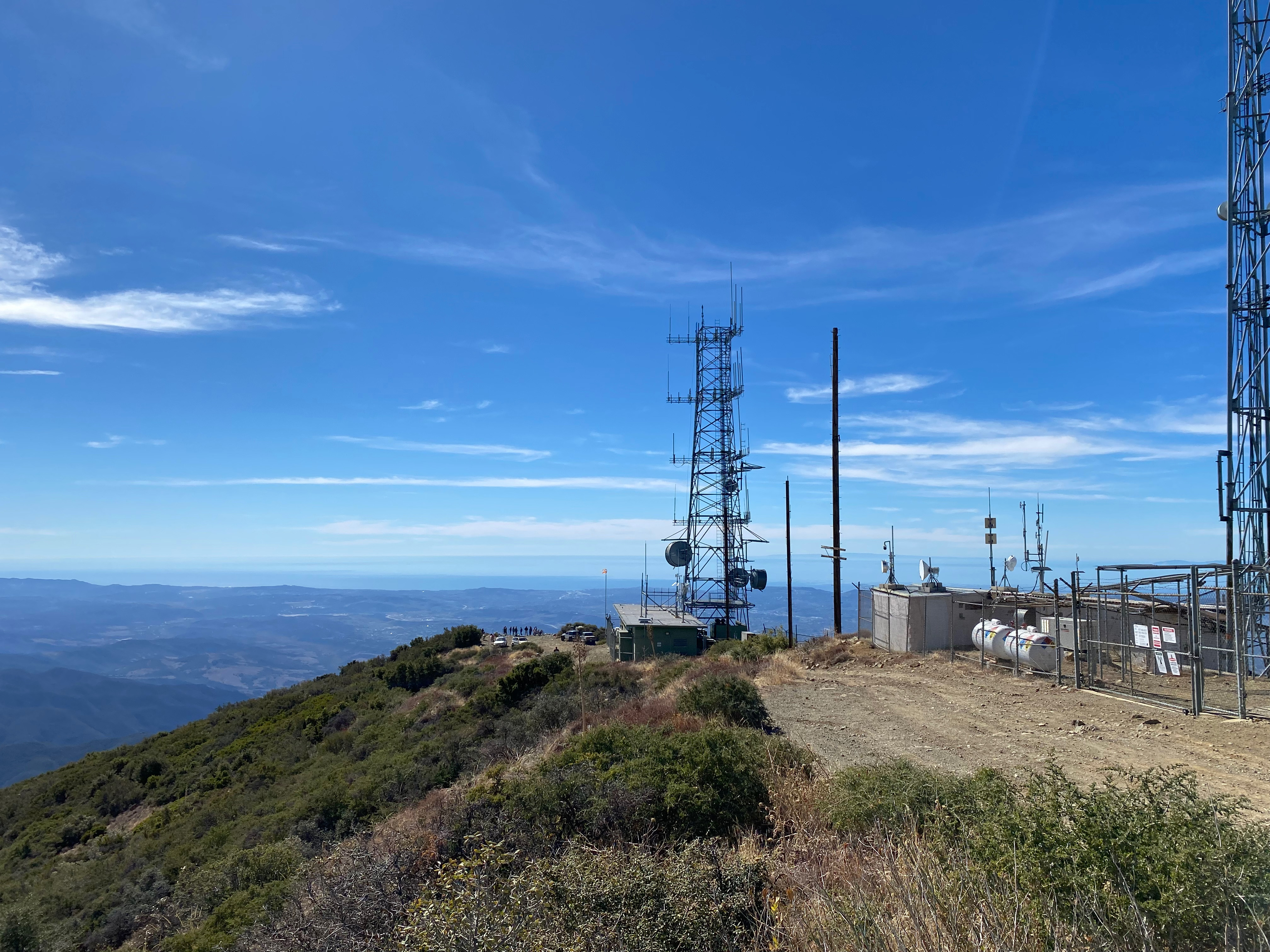
Early on this chilly morning I drove across the San Fernando Valley in the dark to activate this easy drive-up. There is a large communications facility on the summit and I tied my two large orange fiberglass masts to the fence posts.
Hard to pick out my orange masts.Looking west toward Alamo MountainLooking south to Cobblestone Peak.Happy activator selfie.
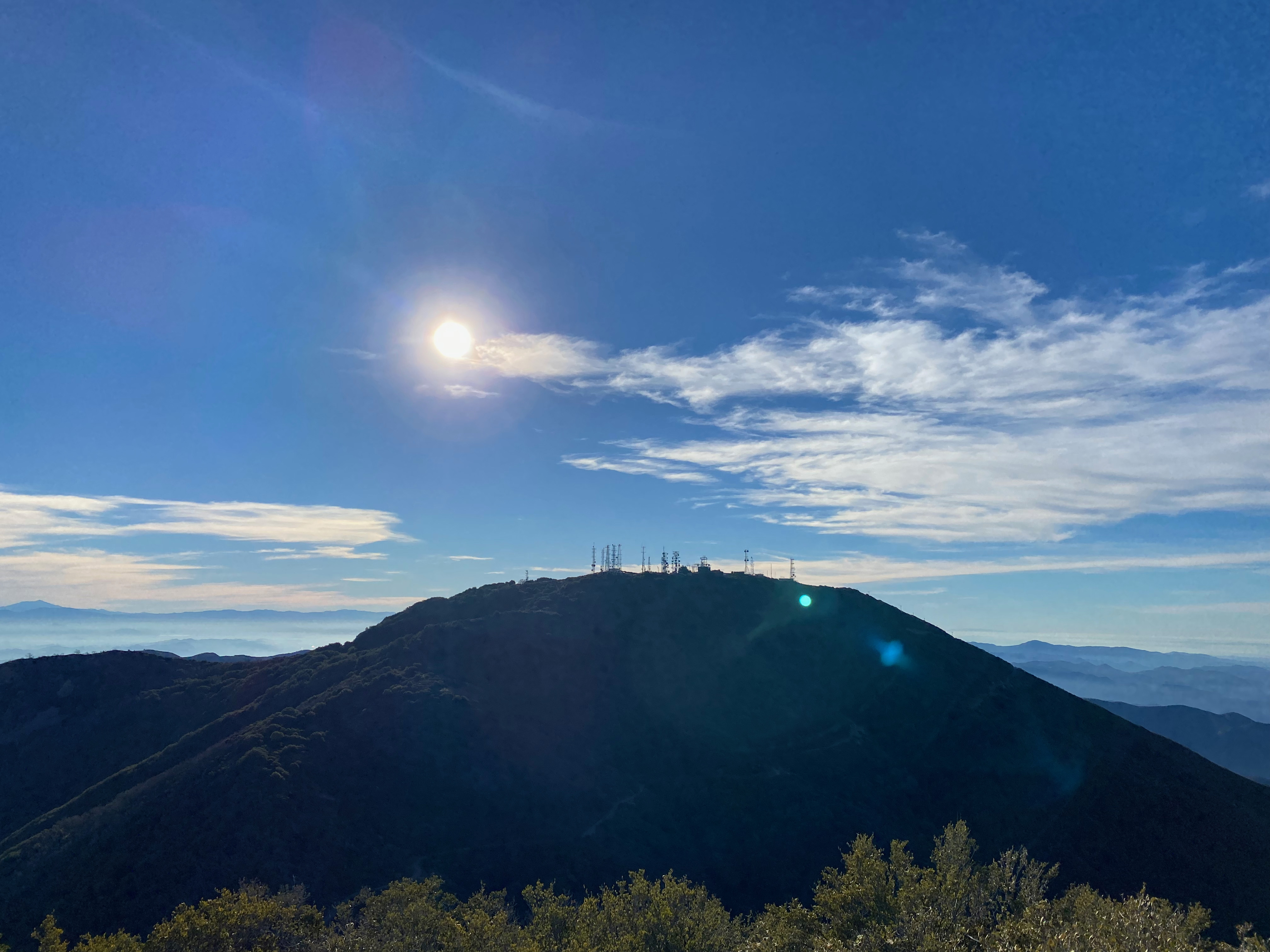
One of the few remaining active fire lookout towers – even if it is mostly just for PR.
13 NOVEMBER 2022 W6/CT-086
One star – Nothing special but I’d do it again.
Elevation:
6,152′
Route:
Drive-up
Hike Distance:
n/a
Elevation Gain:
n/a
Navigation:
Easy
Steepness:
n/a
Vehicle:
Passenger car
Road:
Paved road
Cell Coverage:
Good Verizon
Hike basics
I picked a icy, windy day to activate this drive-up. There was a fire lookout stationed in the tower and it was nice to get out of the wind and chat with this friendly ranger.
Pretty good HF radio conditions yielded some DX on 15m and 10m plus good 2m coverage into the LA Basin.
A frosty picnic table on the summit with a good view of the Santa Ana river valley and Santiago Peak.
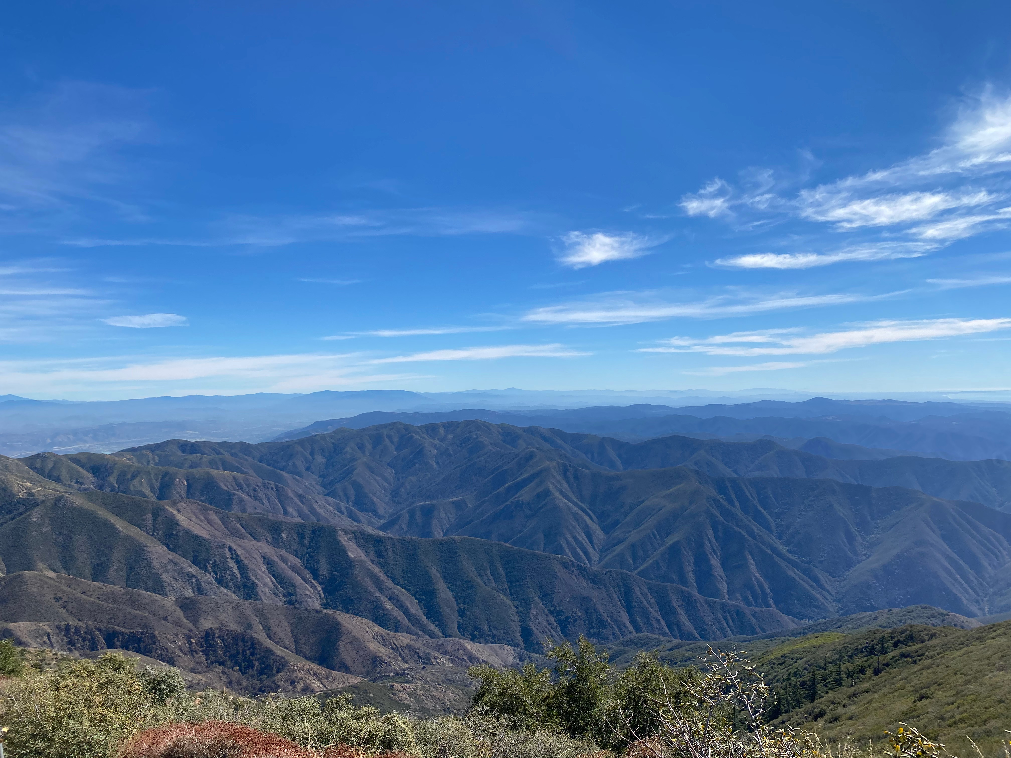
Looking north past Modjeska Peak to the San Gabriel Mountains.
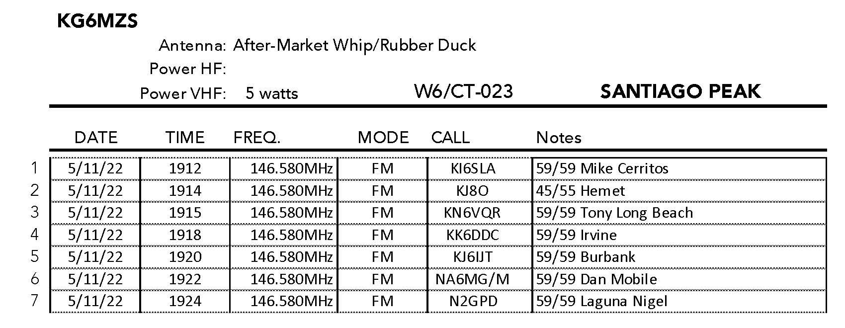
5 NOVEMBER 2022 W6/CT-023
One star – Nothing special but I’d do it again.
Elevation:
4,689′
Route:
Drive up
Hike Distance:
n/a
Elevation Gain:
n/a
Navigation:
Easy
Steepness:
n/a
Vehicle:
SUV High clearance recommended
Road:
Forest Service dirt
Cell Coverage:
Good (Verizon), APRS Excellent
Hike basics
Lots of people crowded this “techno summit” on the Saturday I decided to activate Santiago Peak. My last trip up to this summit was on December 3rd, 1994. Access to this drive-up is via Silverado Canyon Road and forest service road 5S05 at Maple Springs Trailhead. Call the Trabuco Ranger Station of the Cleveland National Forest ahead to make sure the gate at Maple Springs is open.
As noted in my previous post on Modjeska Peak (the pair make up “Saddleback Mountain” and are usually done together), I grudgingly give these two one star for the view alone. I’m not likely to return however.
The summit is RF saturated but my FT5DR was able to withstand the sheer volume of the radio assault and make five quick contacts before bailing. The drive down was very tedious with a LOT of vehicles coming up and slow vehicles going down.
Looking southwest to Lake Elsinor with Mount San Jacinto in the background
28 OCTOBER 2022 W6/CT-031
No stars – This is a one-off summit. I am unlikely to return. Not recommended..
Elevation:
4,603′
Route:
Short very steep bushwack
Hike Distance:
.25 miles round trip
Elevation Gain:
150′
Navigation:
Easy
Steepness:
Very steep
Vehicle:
SUV High clearance recommended
Road:
Forest Service dirt
Cell Coverage:
None (Verizon), APRS Excellent
Hike basics
My last trip to this mountain was 22 years ago on December 20, 1994. It is a long was down North Divide Road from the Ortega Highway. As with Los Pinos Mountain, a passenger car might make it but it is not advised. I actually was glad to have the compound low 4×4 in Whitedog for stability and traction.
A fire had swept over this peak quite a few yeas ago and you can see that it was once very brushy. Now it is covered with regrown brush and the charred bones of the old brush. Not a pleasant hike with very little room to set up the station. For this if gets no stars from me.
This is the actual summit. Not a lot of room to set up.
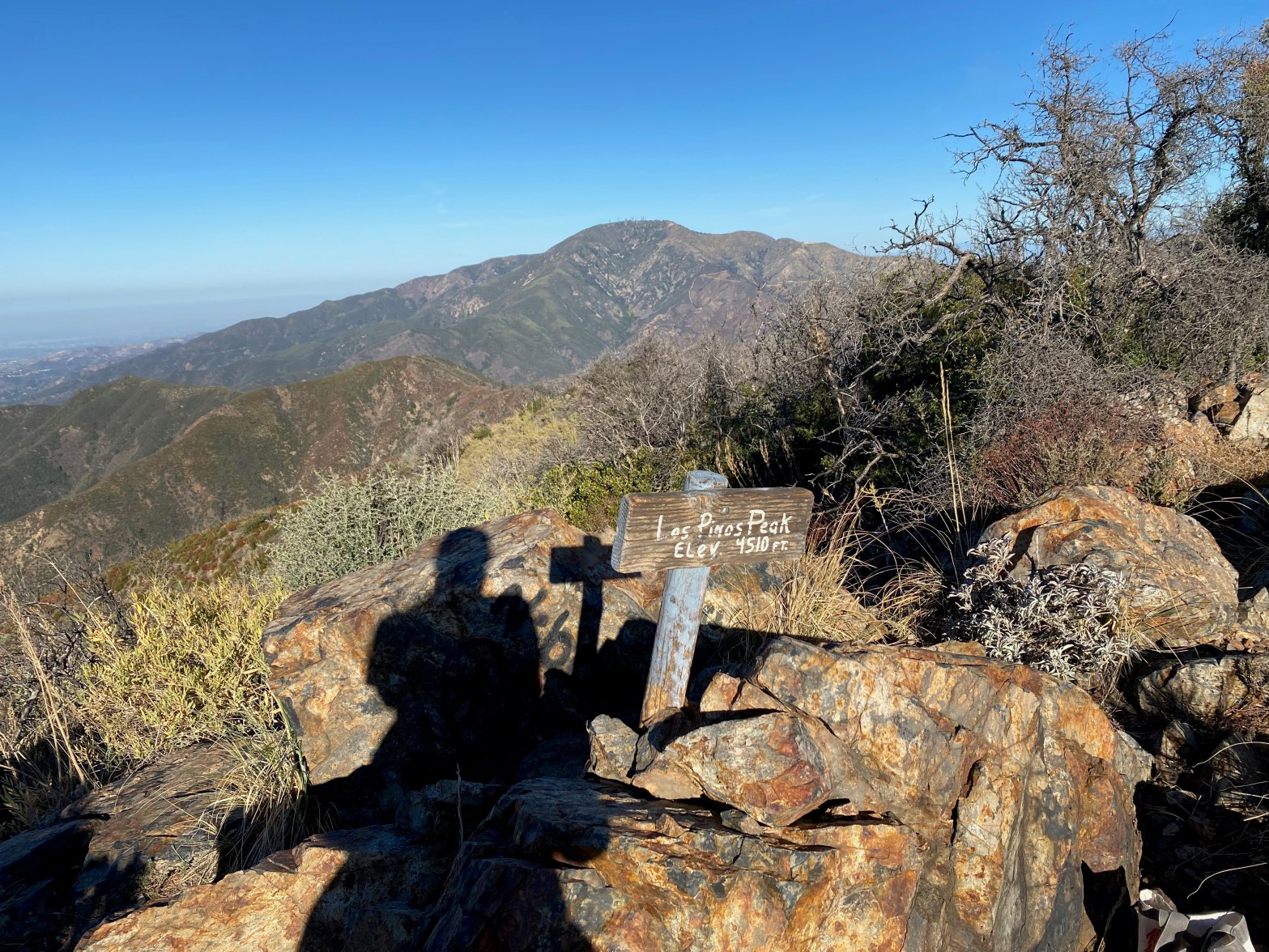
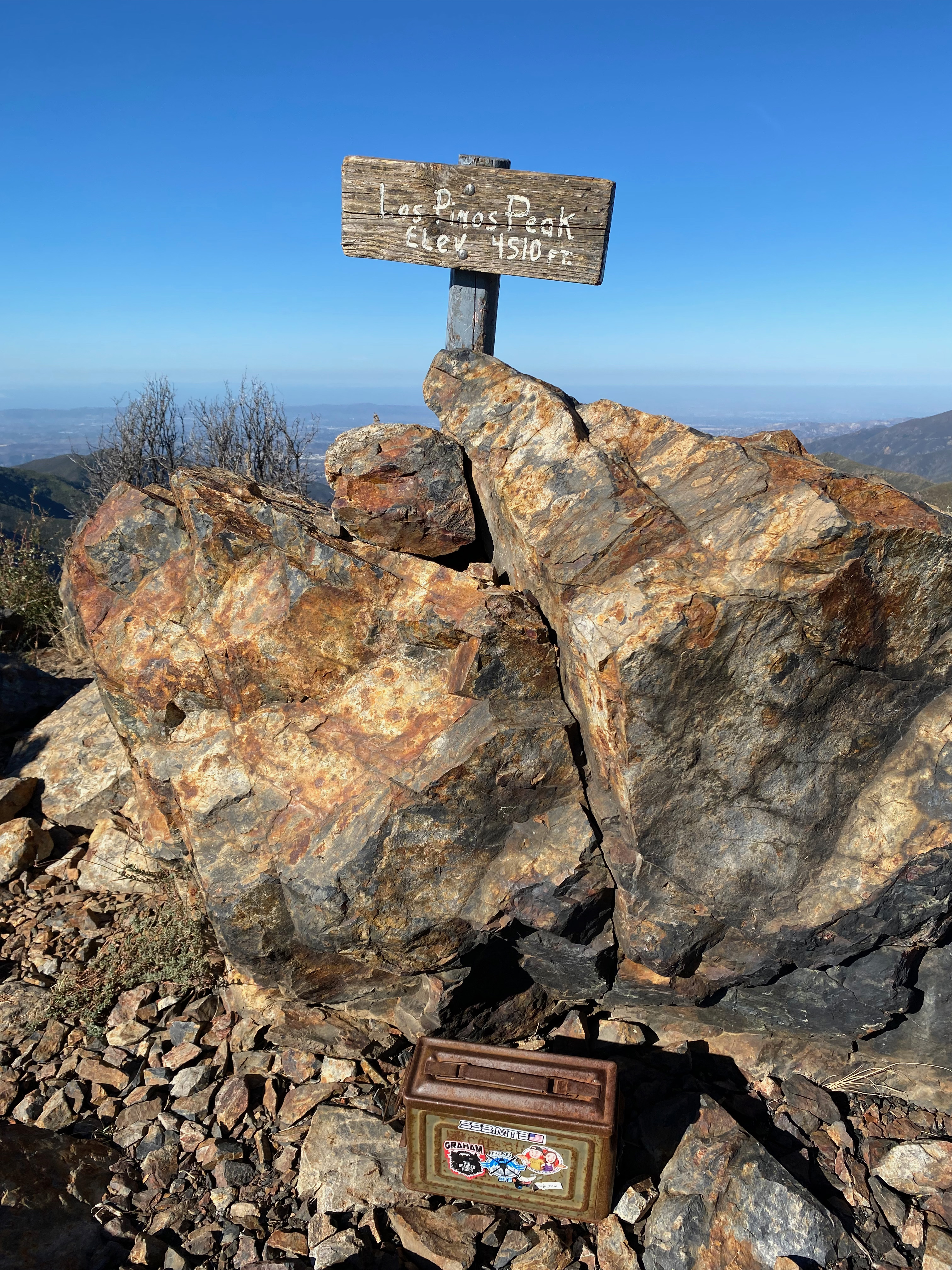
Two Stars – a nice summit. I’d do it again. Recommended.
Elevation:
4,541′
Route:
Trail
Hike Distance:
2 miles round trip
Elevation Gain:
500′
Navigation:
Easy
Steepness:
Mostly gentle
Vehicle:
SUV High clearance recommended
Road:
Forest Service dirt
Cell Coverage:
Good (Verizon), APRS Excellent
Hike basics
I’d stayed up late (for me) the night before watching the Phillies come from to beat the hated Astros in game one of the world series so this is my excuse for leaving my SOTA pack at home. With gas at $6.00 a gallon I sat stunned at the trail head and quickly devised a plan to salvage the 200 mile round trip drive.
I did have my Yaesu FT5D with me. That saved the day. I filled a reusable shopping bag with my water bottle a pencil and a few pages ripped out of my Topanga Survival Guide for a makeshift logbook.
My last trip to this mountain was 22 years ago. The drive is up the North Main Divide Ridge road (FSR 3S04). The road was in pretty good condition. It is fairly steep and the water bars are pretty high. It’s kind of road that I used to routinely take my Audi A4 on, but I was pretty glad to have the 4WD Tacoma this time.
The hike is an extremely enjoyable ridge run. I was recovering from some medical issues so I was looking for a relatively easy hike and this one certainly satisfied that criteria.
The “MacGivver” Station — pared down to what was in Whitedog.Looking southeast to Lake Elsinor. That’s San Gorgonio, San Jacinto and Toro peaks in the background.The ammo can register and the interesting looking summit rock. There was a nice table rock to operate from.
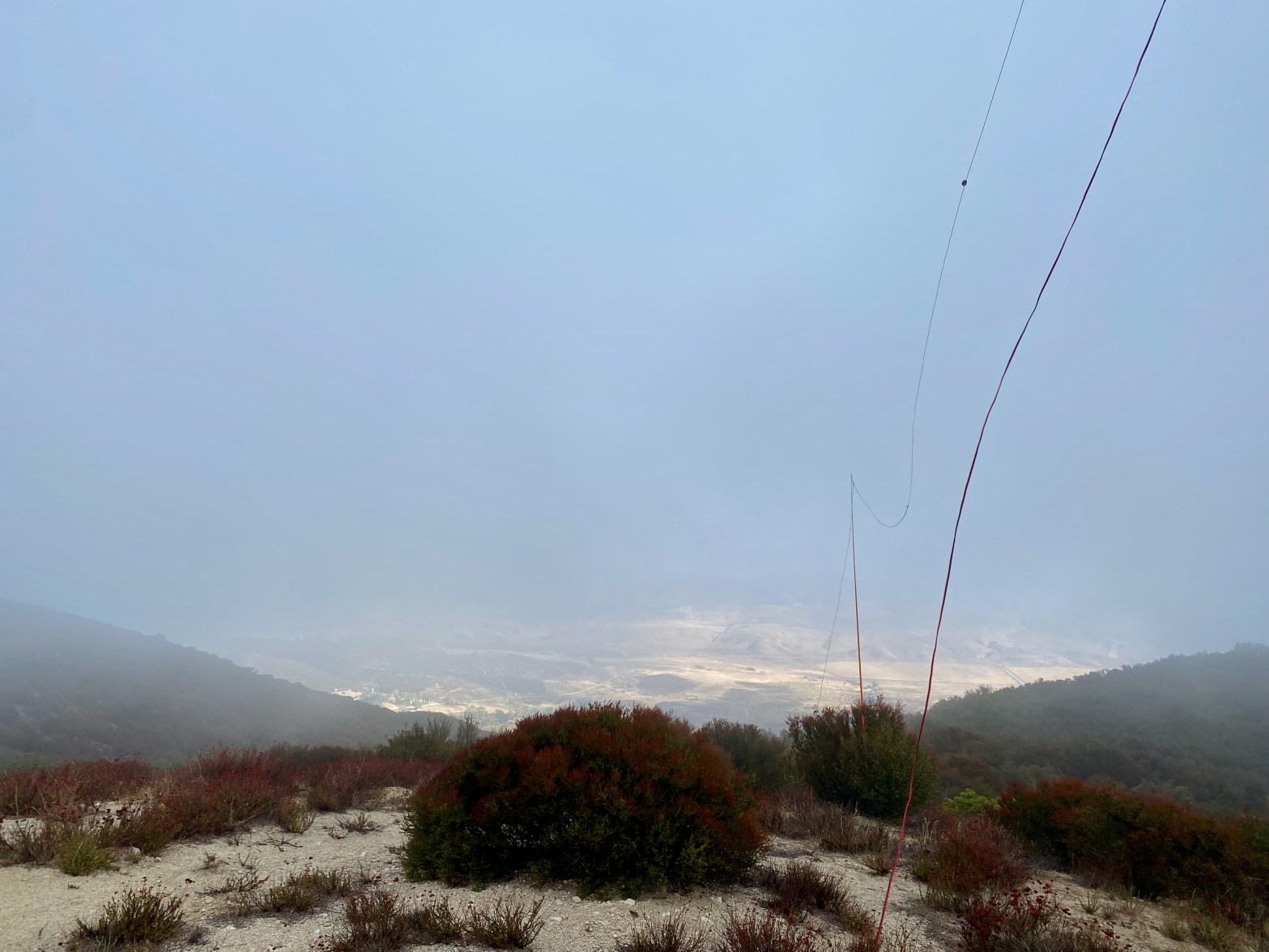
I was going to activate Bald Mountain for a complete after Burn Benchmark, but Lake Elizabeth Road was closed. The area appeared to have been hit with some debris flows. So I punted and opted for another complete: Townsend Peak.
I had scoped out forest service road 6N38 about a month ago and it looked pretty rough. This time though it had been freshly scraped and the gate about a half mile up was open. I recommend high clearance front or 4 wheel drive vehicle, but the road was in good shape and a passenger car would’ve worked when I did this trip.
The hike is very short up a fire break and the summit is nice enough. It was a cold and windy day on this occasion.
A cold, cloudy and windy morning. The San Andreas Fault Zone and the Leona Valley to the north just under the clouds.
22 OCTOBER 2022 W6/CT-136
One star – Nothing special but I’d do it again.
Elevation:
4,541′
Route:
Short dirt bike trail
Hike Distance:
.2 miles
Elevation Gain:
100′
Navigation:
Easy
Steepness:
Gentle
Vehicle:
Passenger car* (See below)
Road:
Forest Service dirt
Cell Coverage:
good (Verizon), APRS Excellent
Hike basics
There are days on summits that I just want to hang out and play radio, have a little picnic, fly Chester the Drone and just generally goof off and laze around. This day was not one of them. The weather the last week had been warm and mild but things changed this Saturday morning. There was a little drizzle as i made my way up the Leona Divide Truck Road. A passenger car could probably do it and it is the kind of road that I used to drive in my old Audi A4, but I was happy to have Whitedog, the Tacoma this time.
The parking spot is a little hard to find – especially in near-white out conditions that I was experiencing. I parked at: 34° 37.1546′ N, 118° 21.8747′ W


Leave a comment